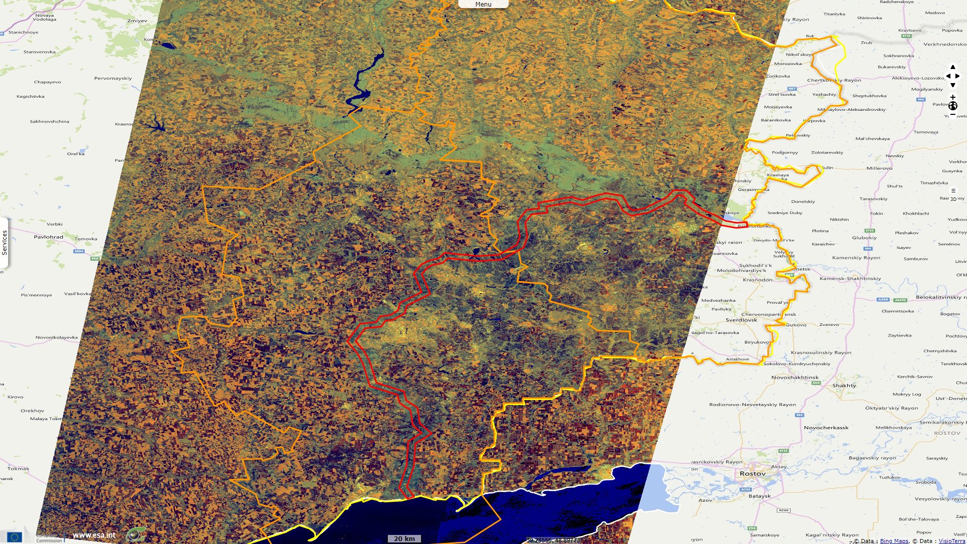
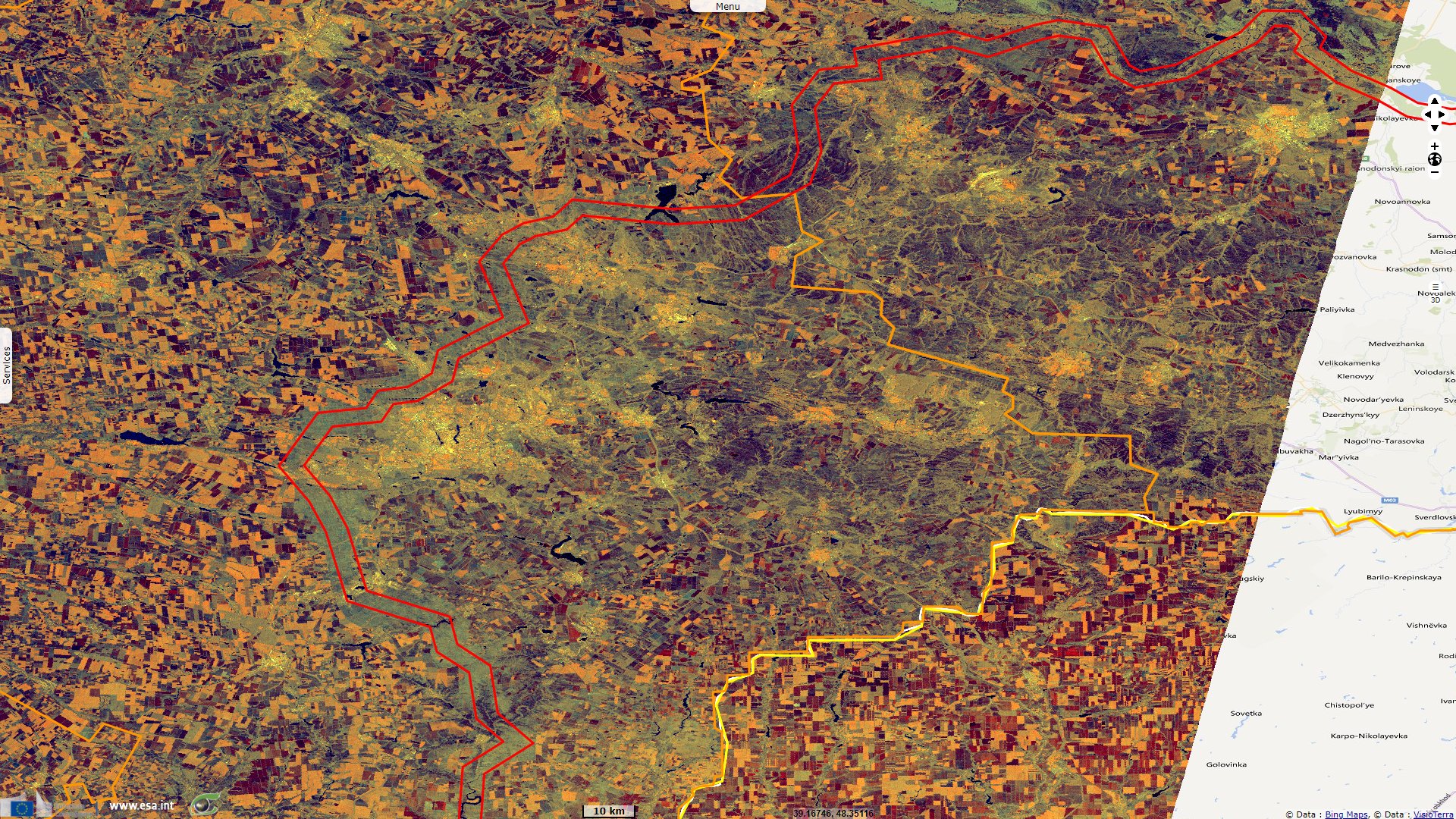
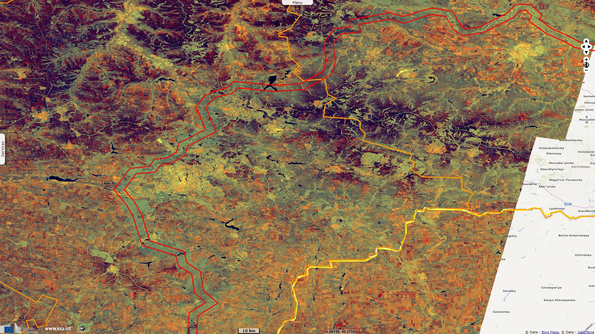
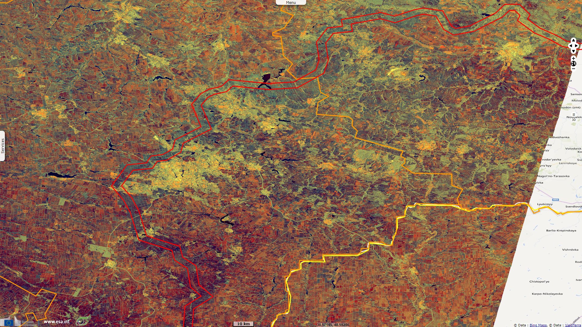
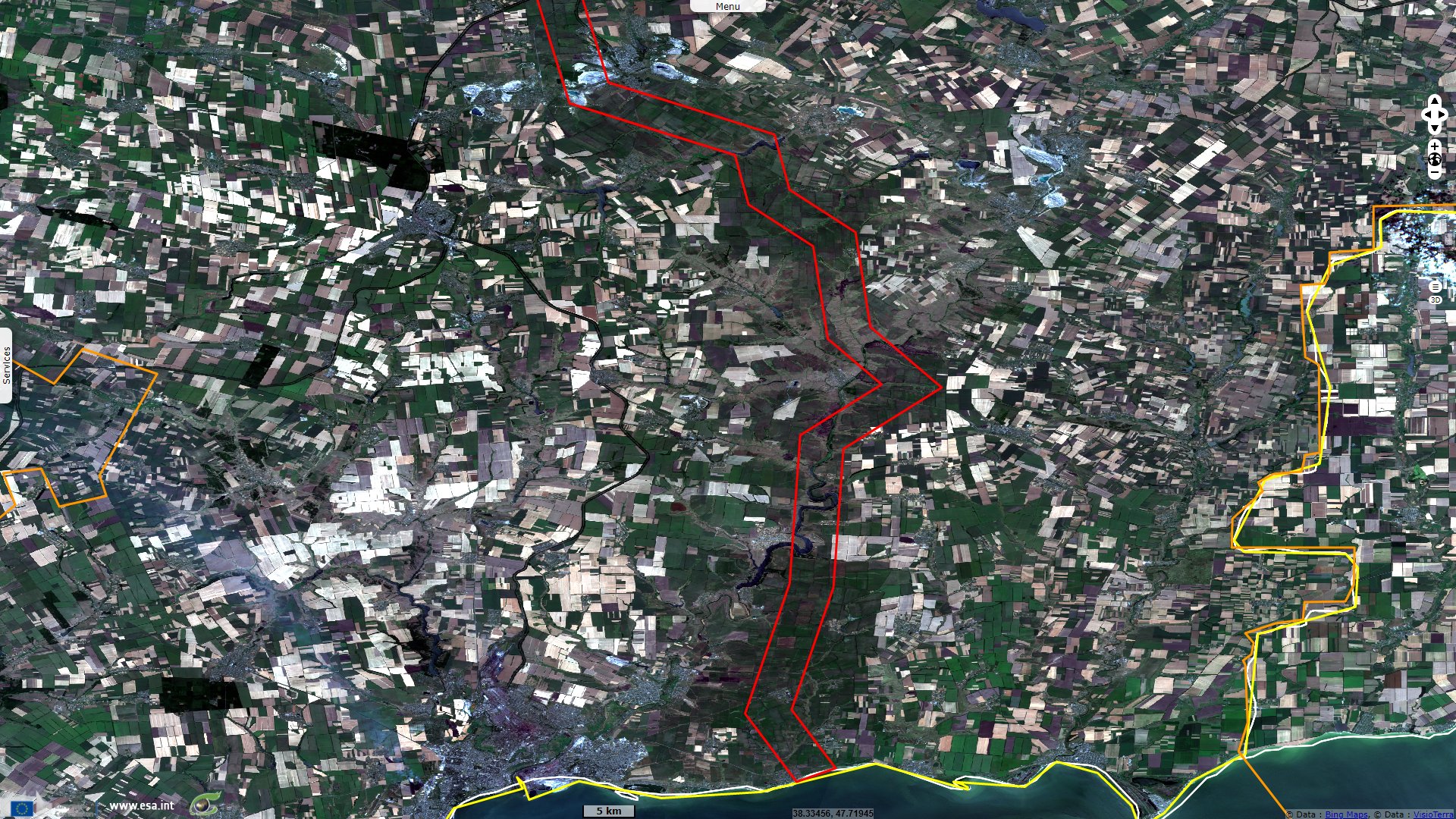
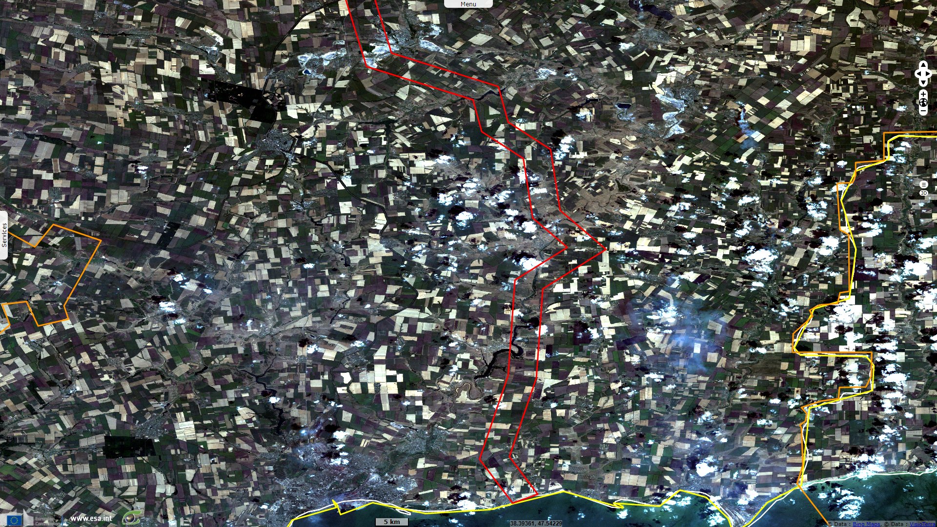
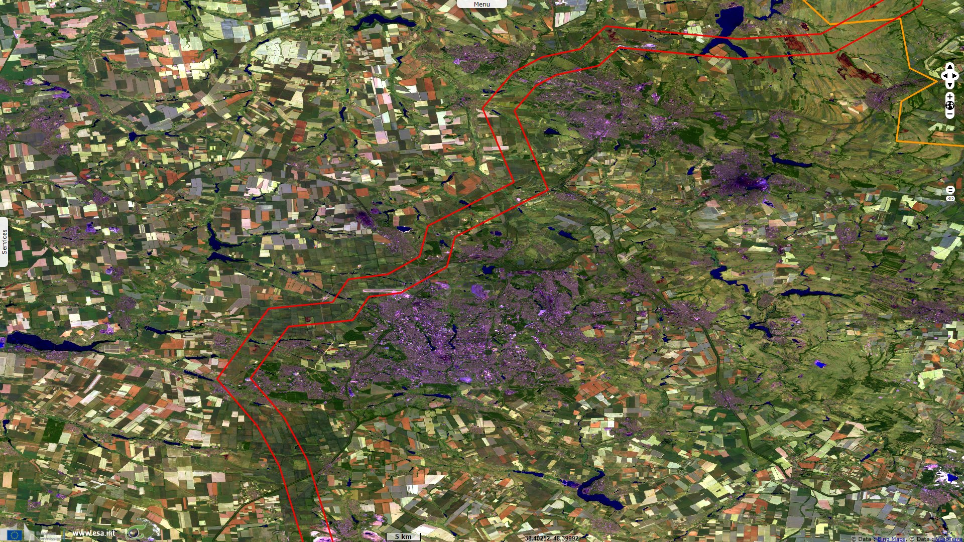
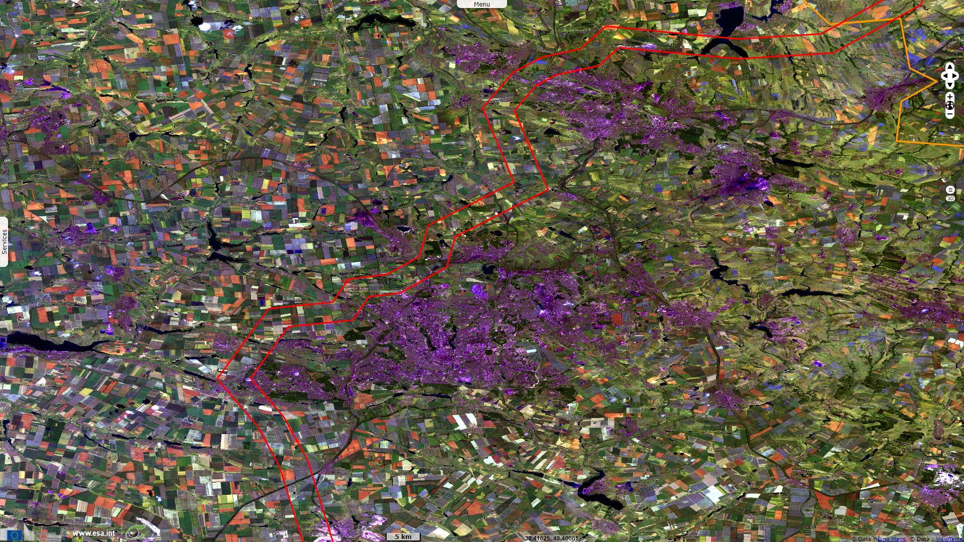
The no man's land around the 2014-2021 frontline between Ukraine and separatists viewed from space
Landsat TM acquired on 18 July 2007 from 08:12:06 to 08:12:30 UTC
Sentinel-2 MSI acquired on 18 July 2016 at 08:30:12 UTC
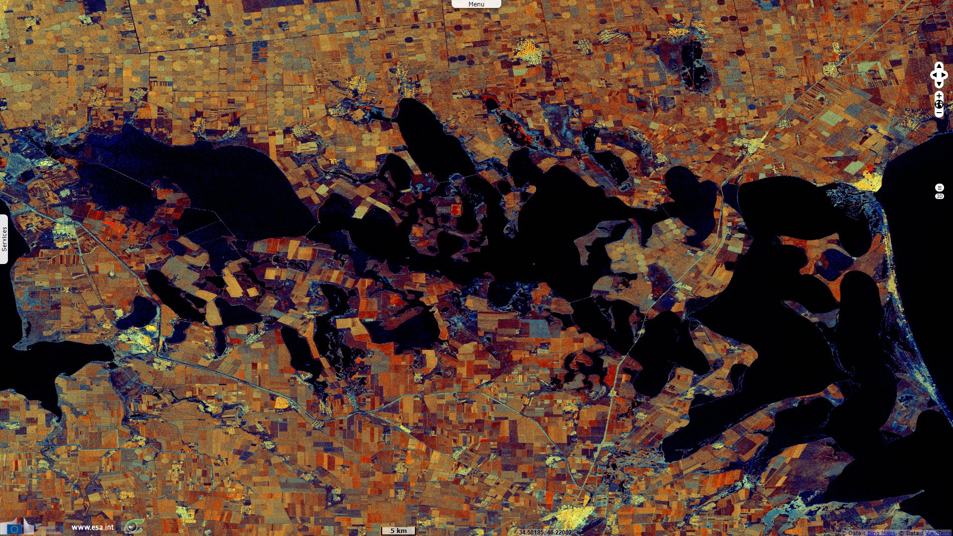
Sentinel-1 CSAR IW acquired on 20 February 2022 from 03:39:05 to 03:39:55 UTC
Sentinel-2 MSI acquired on 18 July 2016 at 08:30:12 UTC
Sentinel-1 CSAR IW acquired on 20 February 2022 from 03:39:05 to 03:39:55 UTC
Keyword(s): Land, security, agriculture, Ukraine, Russia, Belarus
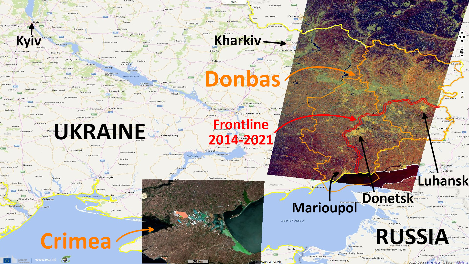
In 2015, Andrew E. Kramer wrote an article for the New-York Times explaining the frozen conflict at east of Ukraine, he described the situation as: "Governed by Russian-backed separatists, the provinces of Luhansk and Donetsk have no patron, neither the Western-leaning government in Kiev nor Moscow. Instead, they exist in a state of limbo that has proved both spiritually and economically debilitating."
"The war between the Russian-backed so-called People’s Republics of Luhansk and Donetsk and the Ukrainian government broke out in April 2014 and quickly escalated in cruelty and intensity, killing nearly 8000 people, according to the United Nations. About 1.3 million have been displaced."
"The guns went quiet in eastern Ukraine in September, wrapping up with a cease-fire but with no final settlement. This is a common arc of post-Soviet conflict, visible in the Georgian enclaves of South Ossetia and Abkhazia, Nagorno-Karabakh in Azerbaijan and in Transnistria, a strip of land on Moldova’s border with Ukraine."
"In each case, the Kremlin intervened or provided arms on the pretext of protecting ethnic Russians or local allies, then it installed pro-Russian governments that it has used to manipulate events in the host countries. The contested borders of frozen zones also effectively guard against any further expansion of NATO, since no country with an unresolved border conflict can join the alliance."
In 2014, both pro-Russian separatists territories of Donetsk People's Republic and Luhansk People's Republic tried to unite as a confederation called Novorossiya, Novorussia or New Russia. At present, the two constituent republics of the proposed confederation have only Russian diplomatic recognition, and Ukraine has classified them as terrorist organizations and refers to their territory as the Anti-Terrorist Operation Zone.
The creation of Novorossiya was declared on 22 May 2014, and one month later spokespeople of both republics declared their merger into a confederal "Union of People's Republics". Within a year, the project was suspended: on 1 January 2015, founding leadership announced the project has been put on hold, and on 20 May the constituent members announced the freezing of the political project.
"Office of the United Nations High Commissioner for Human Rights (OHCHR) estimates the total number of conflict-related casualties in Ukraine (from 14 April 2014 to 15 February 2020) to be 41 000–44 000: 13 000-13 200 killed (at least 3350 civilians, an estimated 4100 Ukrainian forces and an estimated 5650 members of armed groups); and 29 000-31 000 injured (approximately 7000–9000 civilians, 9500–10 500 Ukrainian forces and 12 500-13 500 members of armed groups)."
It can be added 1,4 million Ukrainians are internally displaced and 0.9 million who fled abroad. Things flared up again in 2021 as troups massed around the Ukrainian border and breaches of the frontline became more frequent.
Despite the ceasefire mandated by the Minsk II agreement, signed in February 2015, fire along the frontline does not seem to have ceased at all. Between 2015 and 2021, the Ukrainian army has continued to lose soldiers on a daily bases; separarists and civilians also suffered numerous casualties. A no man's land buffer region appeared since people could be fired on sight or walk on mines if they approached the frontline.
The views expressed herein can in no way be taken to reflect the official opinion of the European Space Agency or the European Union.
Contains modified Copernicus Sentinel data 2026, processed by VisioTerra.
Contains modified Copernicus Sentinel data 2026, processed by VisioTerra.
| More on European Commission space: |  |
 |
 |
||||
| More on ESA: | |
|
|
S-1 website | S-2 website | S-3 website | |
| More on Copernicus program: | |
|
|
Scihub portal | Cophub portal | Inthub portal | Colhub portal |
| More on VisioTerra: | |
|
|
Sentinel Vision Portal | Envisat+ERS portal | Swarm+GOCE portal | CryoSat portal |