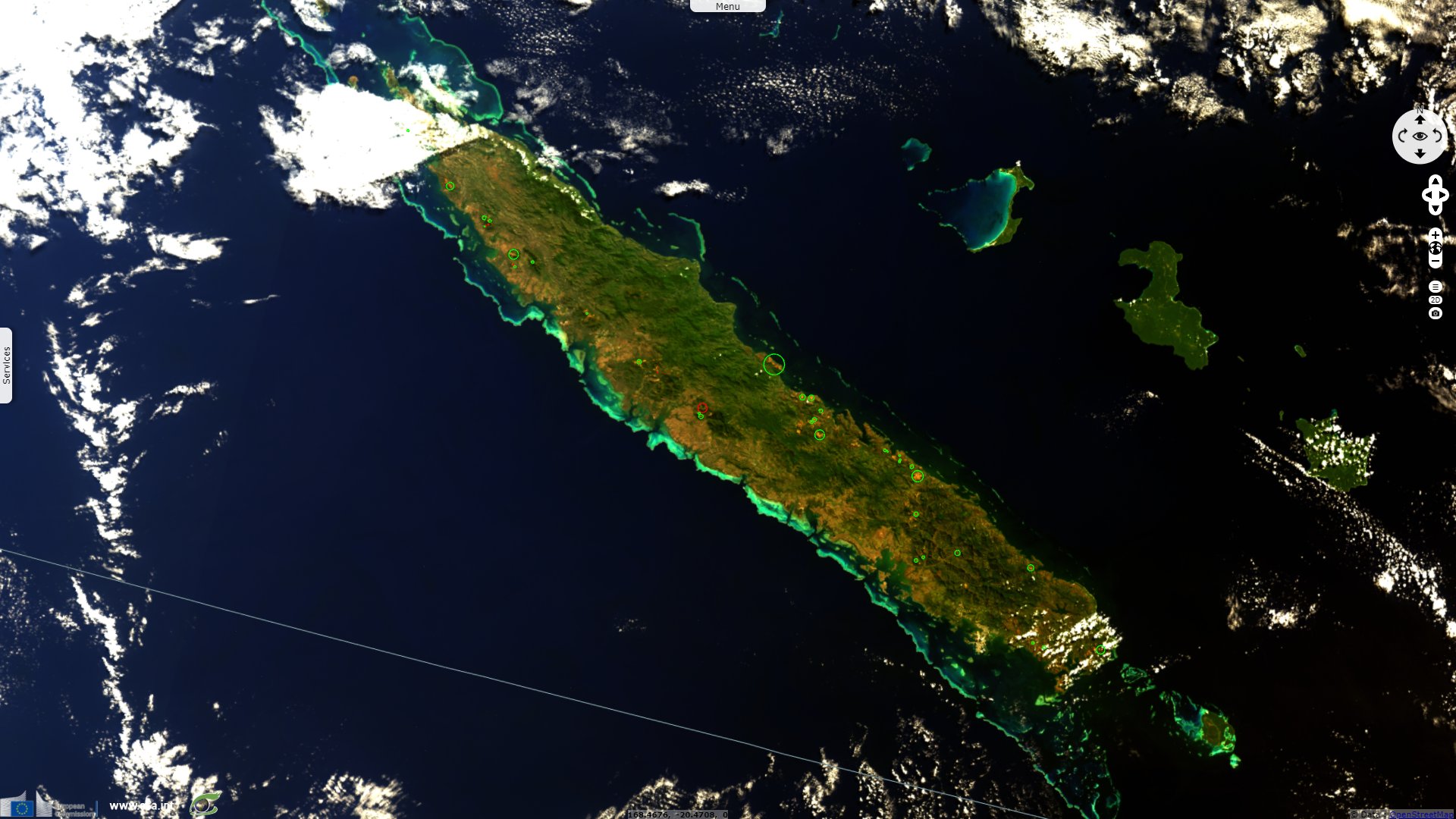
Nickel mining in New Caledonia, Poum mining site
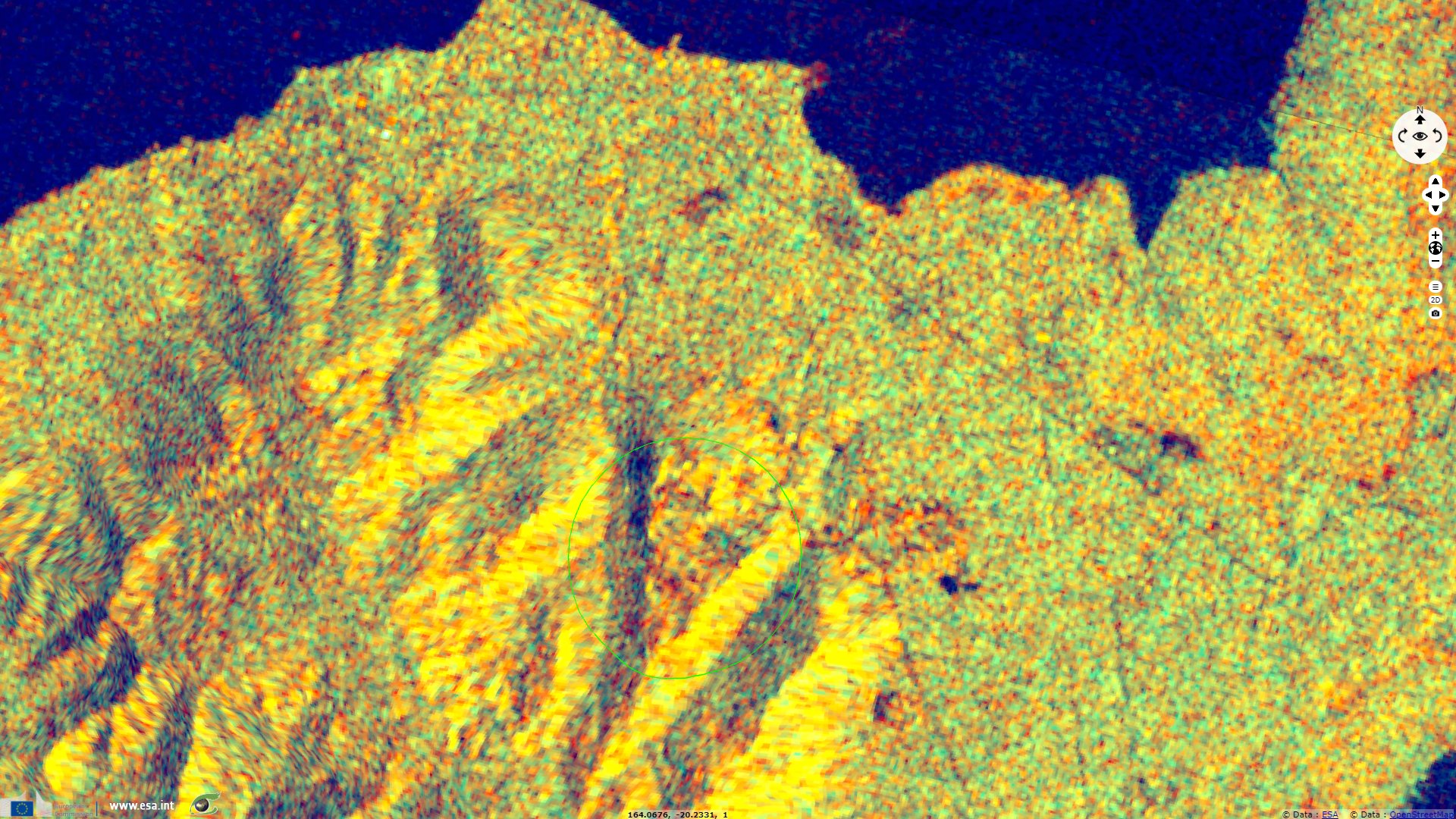
Sentinel-1 CSAR IW acquired on 01 May 2015 from 18:22:15 to 18:30:27 UTC
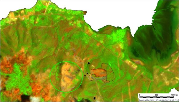
Sentinel-2 MSI acquired on 08 January 2016 at 23:18:52 UTC
Sentinel-3 OLCI FR acquired on 17 August 2018 from 22:28:34 to 22:31:34 UTC
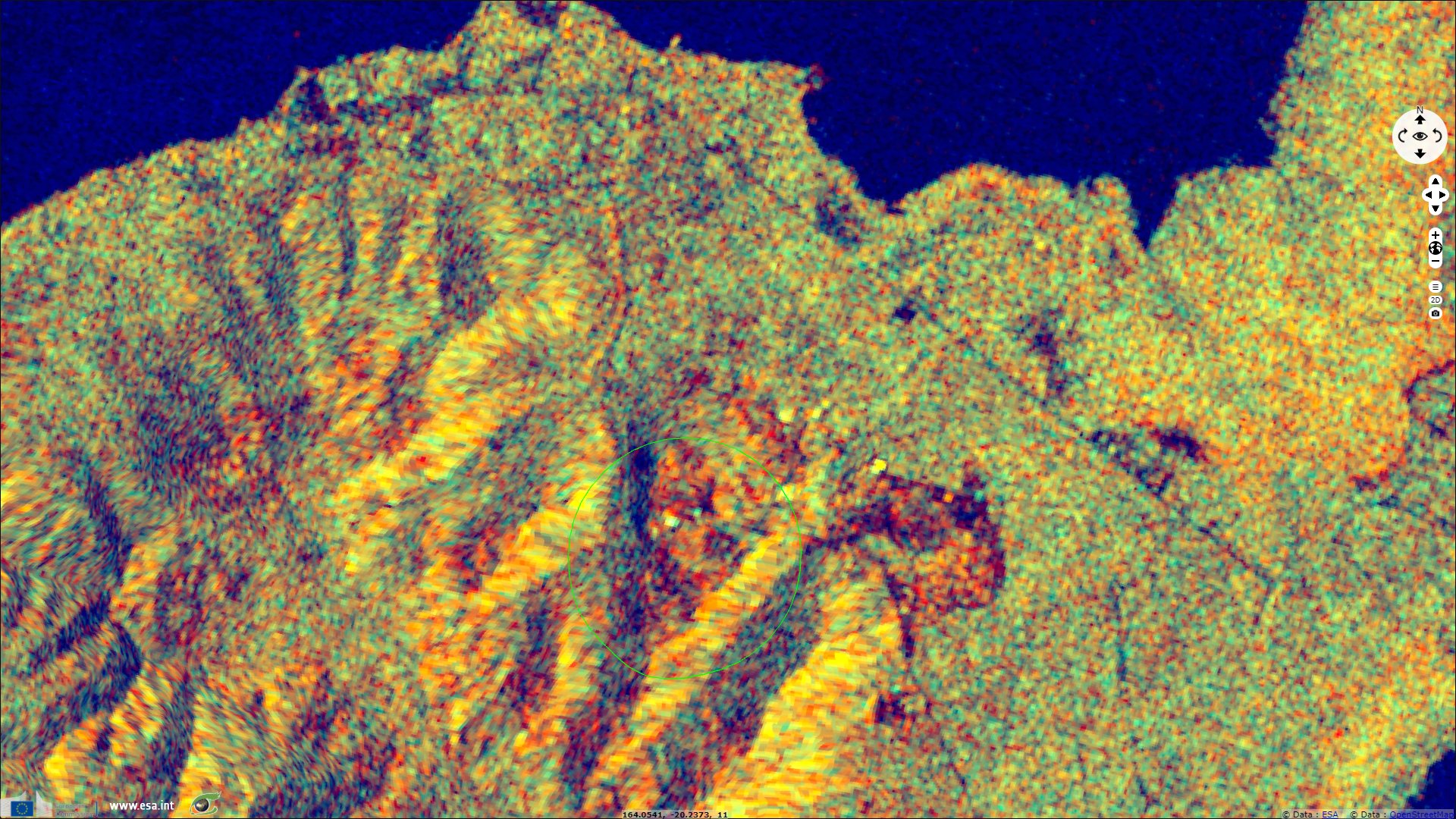
Sentinel-1 CSAR IW acquired on 29 November 2020 from 18:30:18 to 18:22:38 UTC
Sentinel-2 MSI acquired on 17 December 2020 at 23:18:49 UTC
Keyword(s): Nickel mining in New Caledonia, Poum mining site
"New Caledonia is a French territory including several islands with about 20 000 km² but is called 'Le Caillou'. The mainland is the Grande Terre with 16 000 km² and could be considered as a 'peeble' of nickel with 9% of the world production and 8% of the mining reserves. Since 1874, it became the economic backbone of this territory; in 2019, nickel production reaches 220 000 tons (equivalent to Russia, Australia and Canada national productions) extracted from 20 000 000 tons of mineral ore.", writes Doctor Christian Depraetere, researcher at French National Reseach Institute for Sustainable Development (Institut de Recherche pour le Développement, IRD) and author of "Introduction à l’hydrogéomorphométrie : études des relations entre le modelé des formes de terrain et les processus hydrologiques dans des contextes insulaires."
Part-1
Part-2
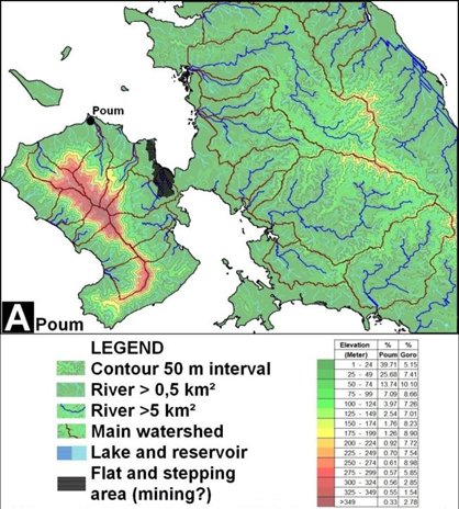
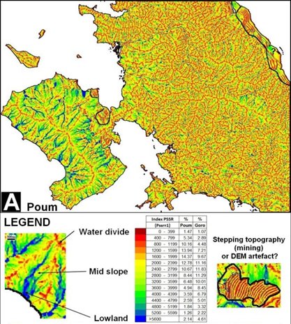
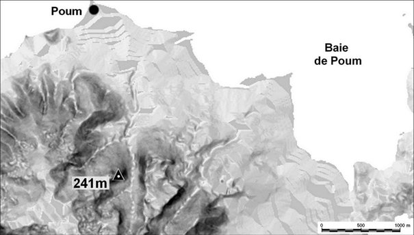
"Several open-cast strip mines operated by various companies extract nickel from ultrabasic rock outcrops covering a third of the Grande Terre. A first part of the comments of satellite images will focus on the mining sites of Poum in the North Province and Goro in the South Province in a second story. The hydro topographical contexts are given in fig-2 and fig-3 as processed from 10 meters resolution DEM covering all the territory available on line Observatoire de l'Environnement pour la Province Sud (OEIL)."
"In the Poum area, there is a sharp difference of hillshapes between the ultrabasic rock of the western peninsula and the eastern part with a different bedrock (fig-2) ; the texture of crests and talwegs is larger and less smaller and less intricated on ultrabasic outcrops."
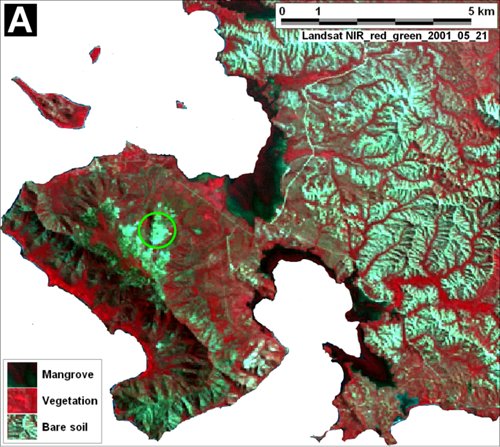
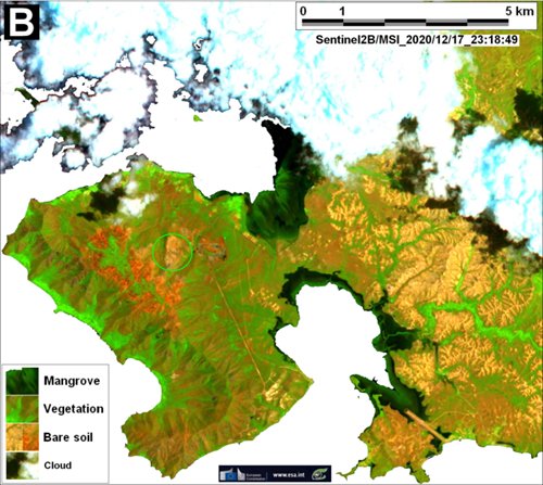
He adds "The reddish to brown color on Sentinel2/MSI images of both sites is due to excavations of rock weathering under tropical conditions so to say laterite with content of 1.5 % of nickel, 45% of iron, 4% of chrome and traces of cobalt."
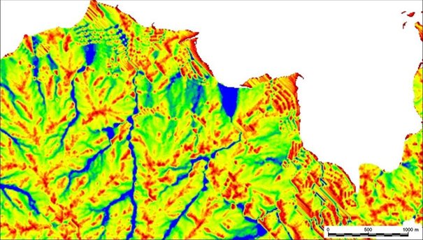
"A detailed map of PSSR derived from SRTM DEM provides insights on possible alluvial landings coming from the excavations plots flowing into the valley floors and downstream estuarine or deltaic wetlands."
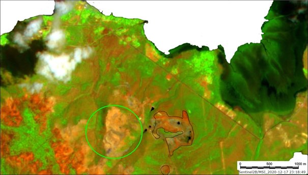
"In the northern part of the Poum peninsula, the consequences of mining on hydrogeomorphology and land covers are still limited to the the upperpart of the three main coastal catchments with possible siltation in downstream river beds including accretion on alluvial fans."
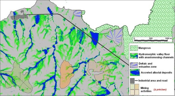
"The impact of mining activities on the Poum Peninsula is subject to environmental monitoring within the framework of an environmental management plan, in particular with regard to the coastal zone including lagoons, coral reefs and mangroves since 2017 (Cf. Province Nord, 2017).
On the entire Grande-Terre, the pristine biodiversity pay a heavy toll to mining activities with about 30 000 hectares impacted. Nevertheless, the mining companies in partnership with local authorities and the civil society try to mitigate the long term consequences by reforestation. For instance, the method of hydroseeding, which consists of spraying a mixture of seeds, fertilizer and substrate, gives a perspective of partial reconstitution of the milieu but it should take several centuries."
The views expressed herein can in no way be taken to reflect the official opinion of the European Space Agency or the European Union.
Contains modified Copernicus Sentinel data 2026, processed by VisioTerra.
Contains modified Copernicus Sentinel data 2026, processed by VisioTerra.
| More on European Commission space: |  |
 |
 |
||||
| More on ESA: | |
|
|
S-1 website | S-2 website | S-3 website | |
| More on Copernicus program: | |
|
|
Scihub portal | Cophub portal | Inthub portal | Colhub portal |
| More on VisioTerra: | |
|
|
Sentinel Vision Portal | Envisat+ERS portal | Swarm+GOCE portal | CryoSat portal |