Operational review of the record flood in Niamey, Niger
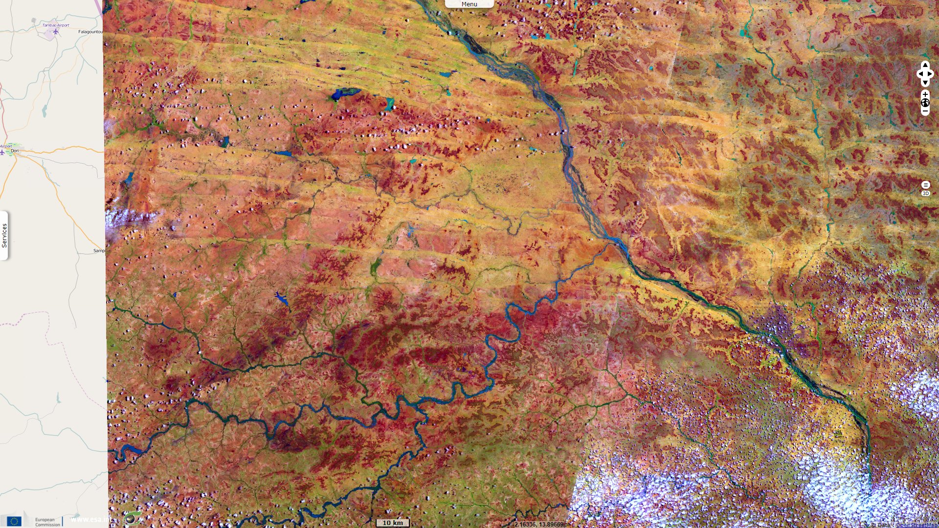
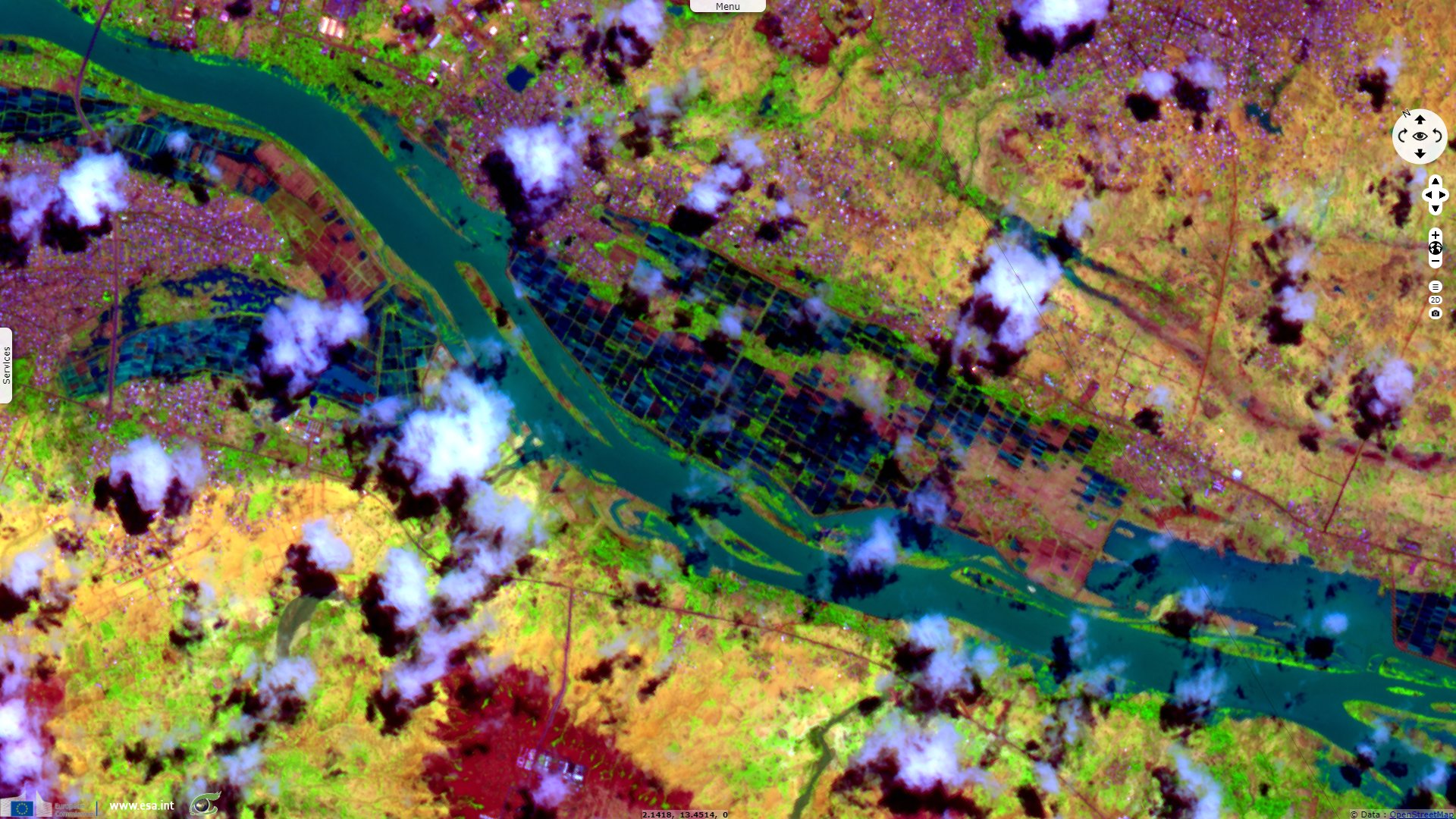
Sentinel-2 MSI acquired on 22 July 2020 at 10:05:59 UTC
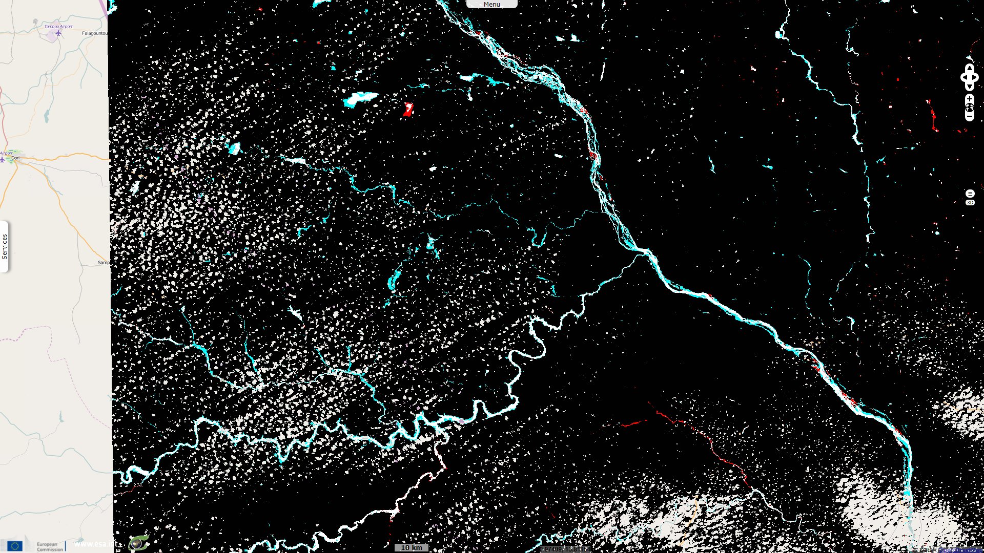
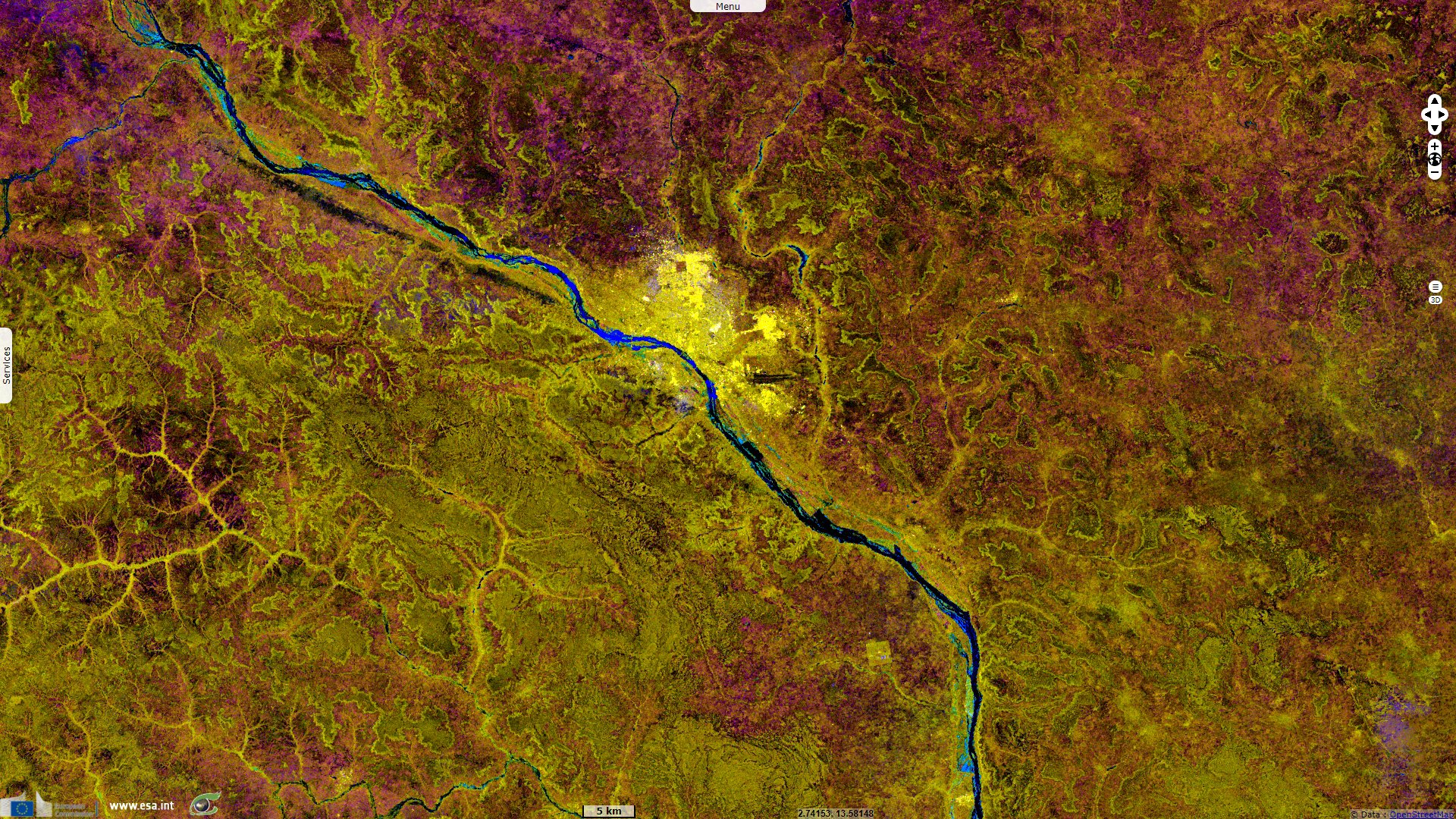
Sentinel-1 CSAR IW acquired on 29 July 2020 from 18:03:34 to 18:03:59 UTC
...
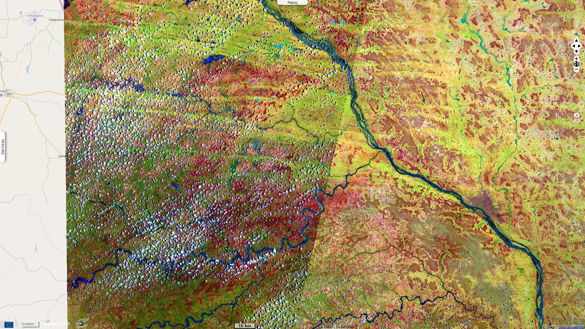
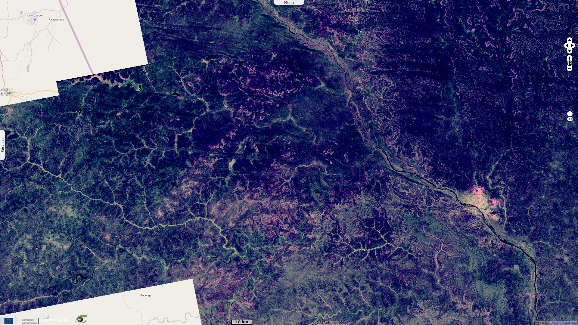
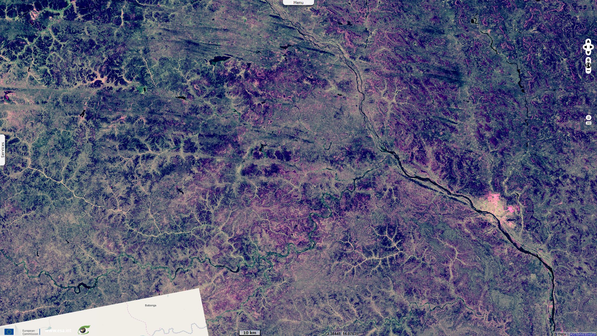
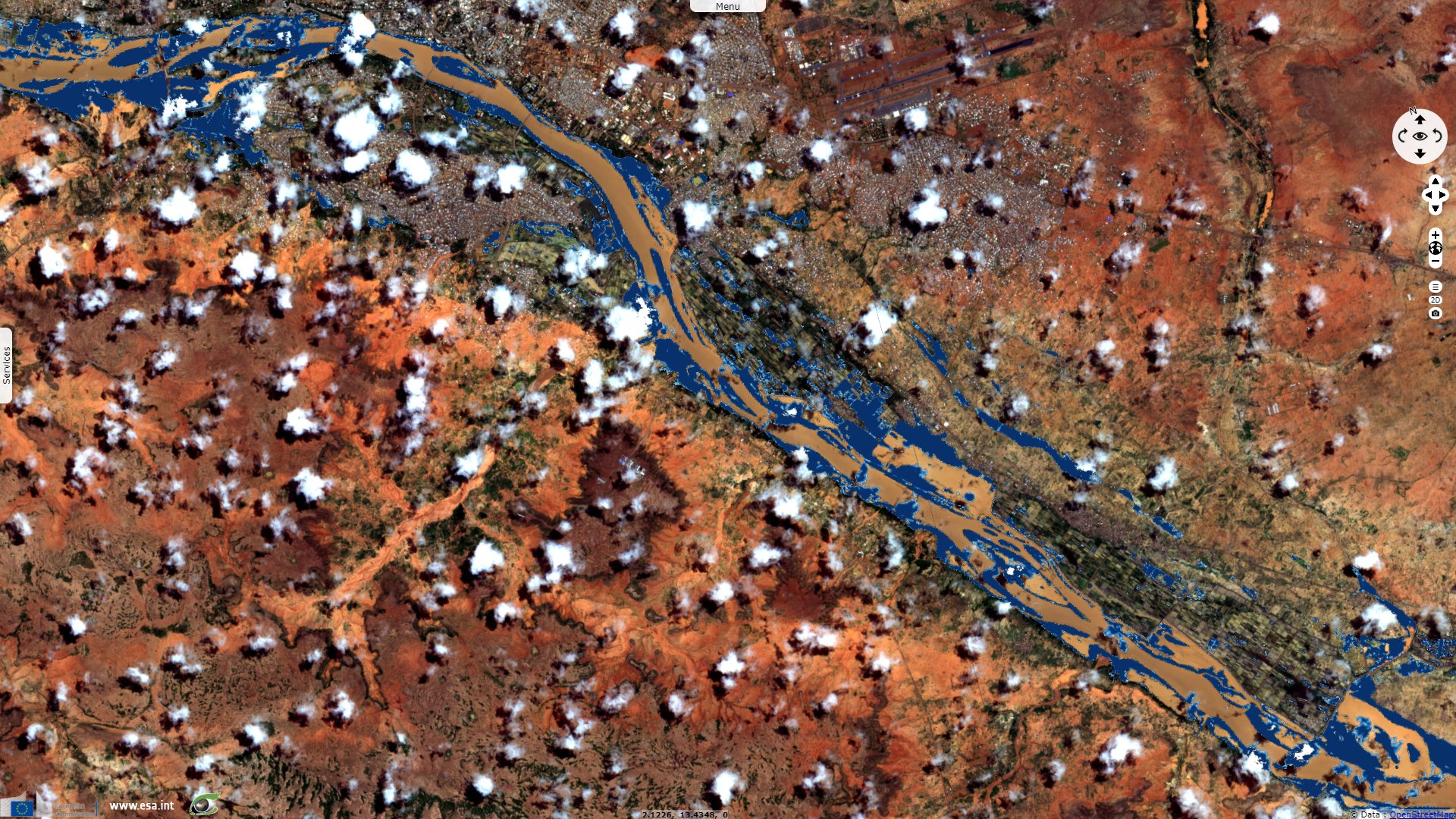
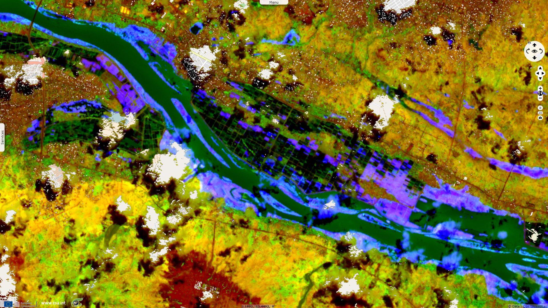
Sentinel-2 MSI acquired on 19 August 2020 at 10:20:31 UTC
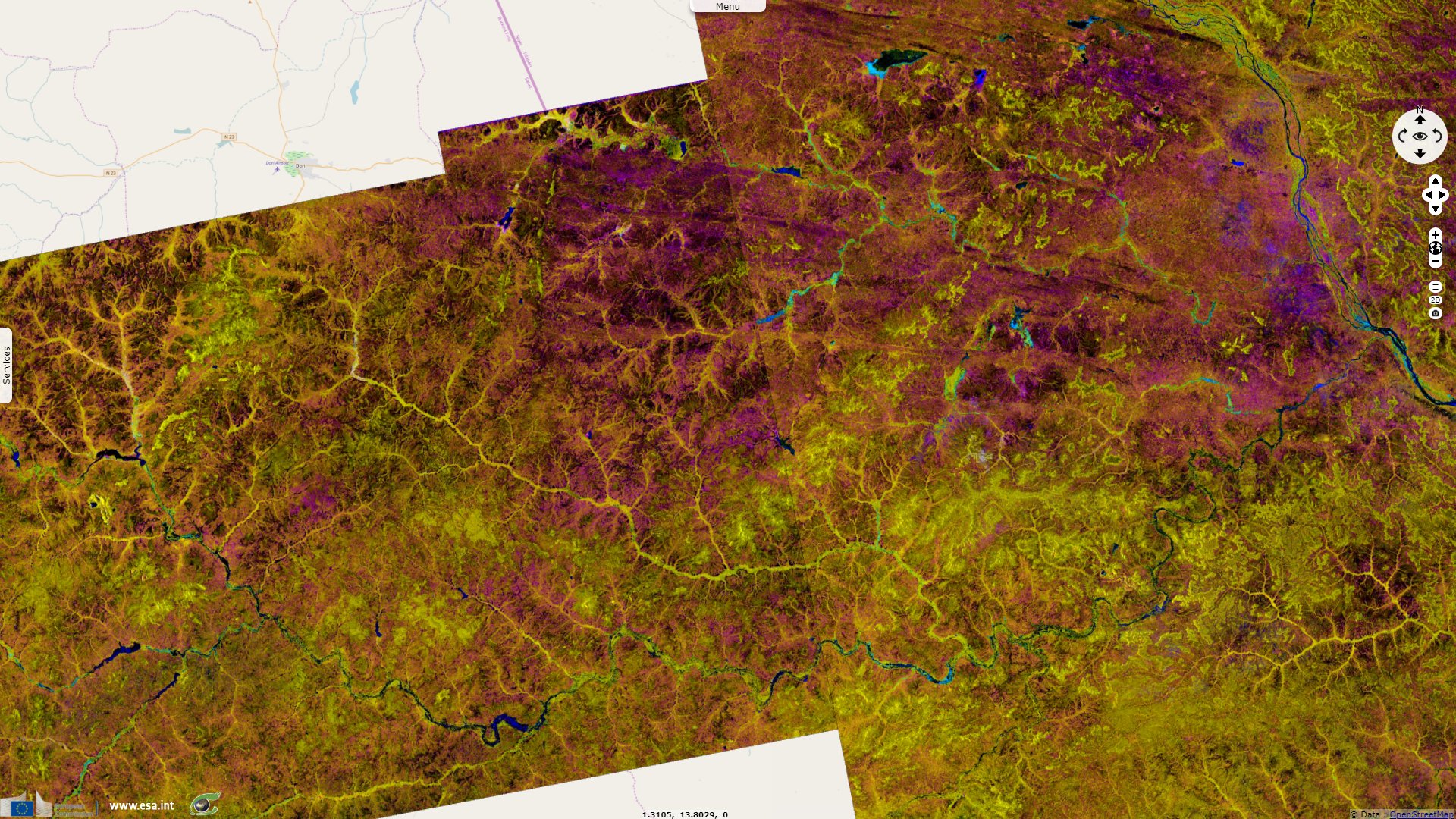
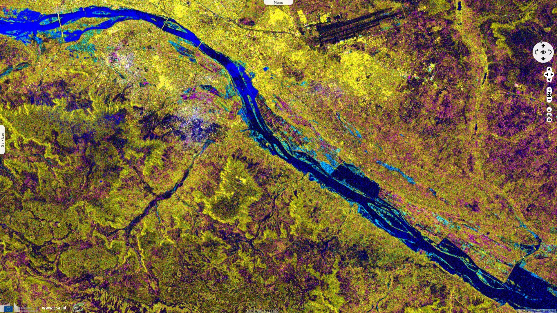
Sentinel-1 CSAR IW acquired on 22 August 2020 from 18:03:36 to 18:04:01 UTC
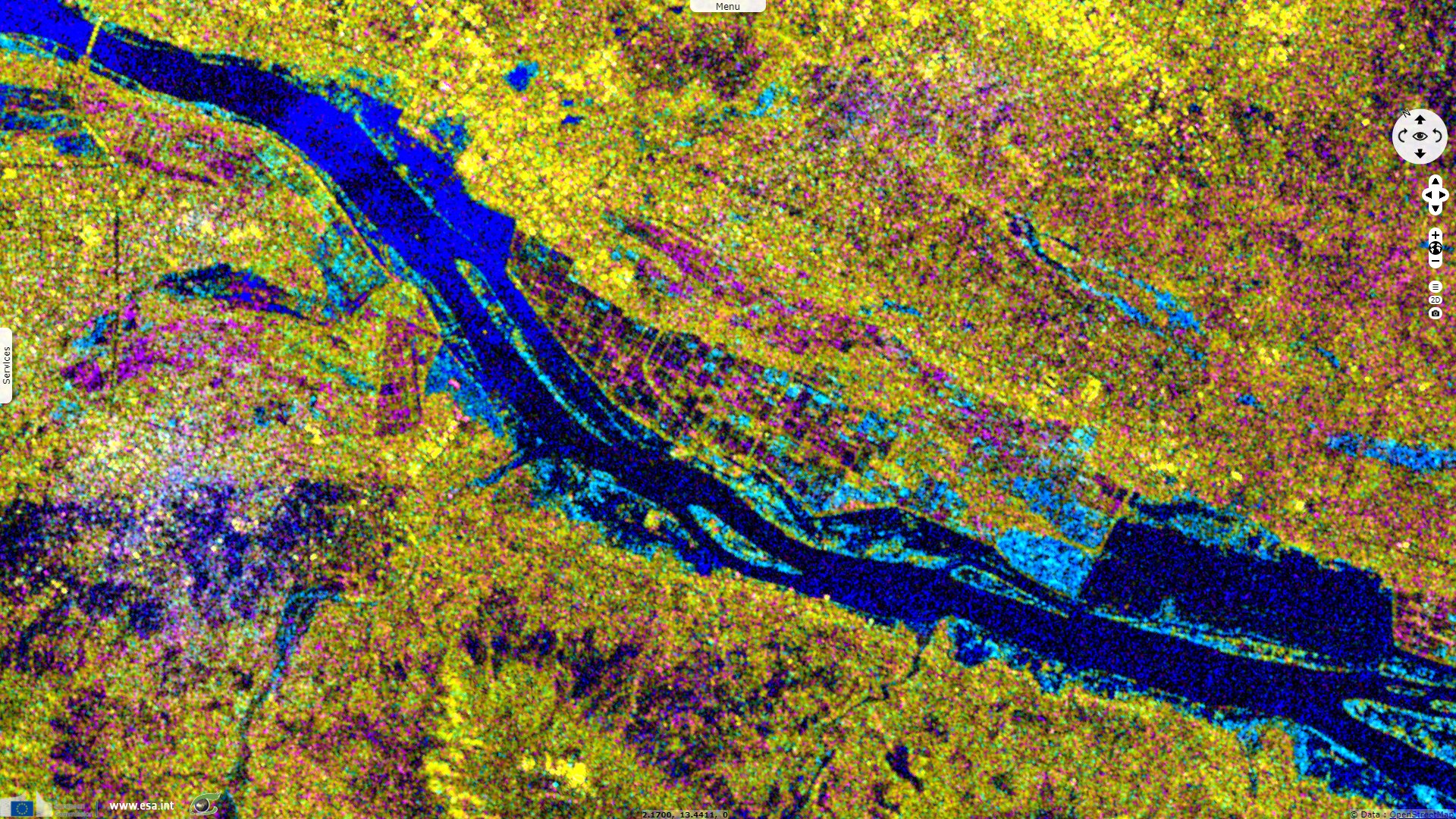
Sentinel-1 CSAR IW acquired on 29 July 2020 from 18:03:34 to 18:03:59 UTC
...
Sentinel-2 MSI acquired on 19 August 2020 at 10:20:31 UTC
Sentinel-1 CSAR IW acquired on 22 August 2020 from 18:03:36 to 18:04:01 UTC
Keyword(s): Emergency, natural disaster, flooding, rainfall, precipitations, urban planning, Niger
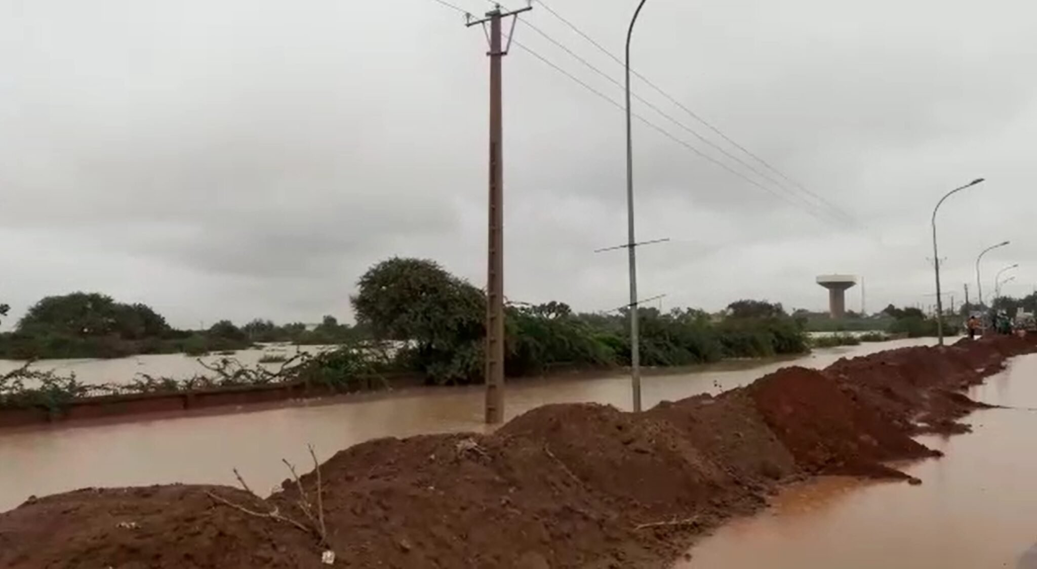
Based in Niger, the local early warning system for Sirba floods (Système Local d’Alerte Précoce pour les Inondations de la Sirba, SLAPIS) reported: In Niamey, following the rainfall received in the south-western part of Niger and Burkina Faso, the water level observed at the hydrometric station of Niamey rose to 650 cm on 18/08/2020 at 09:00. This is a water level never reached in the past. Sandbags were placed on the dyke downstream of the Kennedy Bridge to prevent the water from overflowing it.
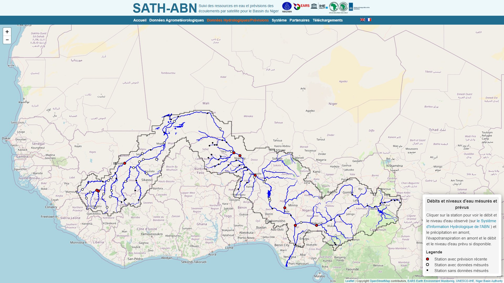
Left: Hydrological stations network of the Niger river basin - Source: Niger Basin Authority
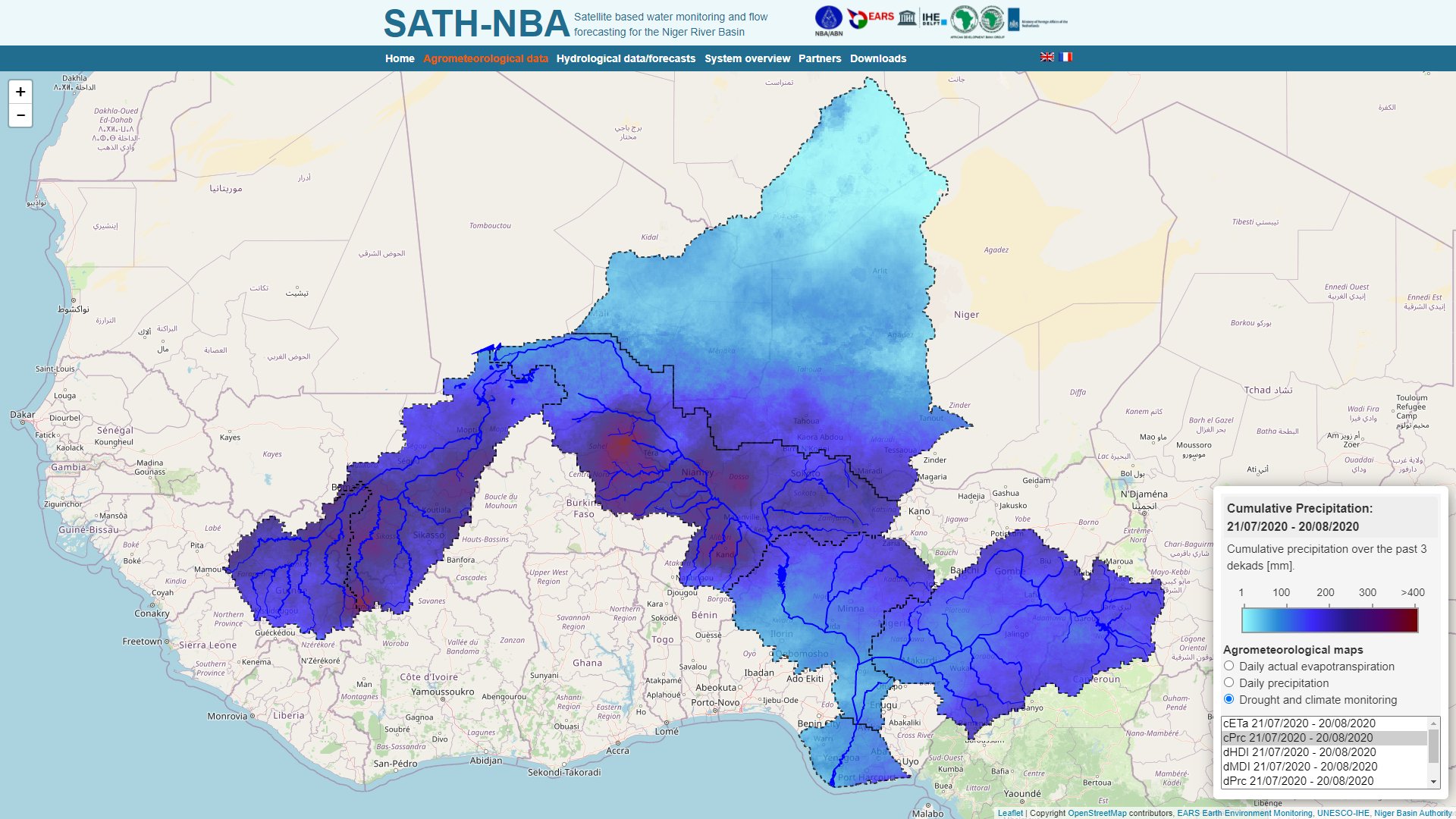
Right: Cumulative precipitation in the Niger river basin over the past 3 dekads [mm] - Source: Niger Basin Authority
On 18 August, Niamey et les 2 jours detailed the impact of the current flooding of the Niger river: "819 houses collapsed in Niamey resulting in the death of four people". According to the same source, a number of dykes begin to submerge which prompted the authorities to start repairing them.
Hervé TREBOSSEN is an expert working on floods in Niamey since 2007 in the framework of flood prevention and production of prevention maps as a part of an intellectual work convenience by AGRHYMET and the Niger Basin Authority. TREBOSSEN details in Trebossen and al., 2008: "The hydrological regime of the Niger River in Niamey is characterized on the one hand by the flows from the high Niger basin whose peak arrives in Niamey during the dry season during the period December-January and on the other hand by the flows from tributaries of the right bank during the rainy season. The hydrograph in Niamey is thus characterized by two main flood peaks. The flood associated with the tributaries from Burkina is called local flood (or black flood) because of its localized character in time and space, as opposed to the second flood called Malian flood (or white, or Sudanian, or Guinean) which is generated by distant inputs from the upper Niger Basin: Guinea, Ivory Coast and Mali. Part of the city of Niamey is located in floodplain by overflow of the river, in any case for a secular event. In particular the alluvial zone of right bank (former river bed), is protected by various embankment only for a threshold of limited flow."
"Since 2012, several major flood events have occurred in Niamey mostly due to local tributaries and land cover changes in their respective basins. The last one is the most important one ever measured in Niamey. The scientific community found that the middle Niger is potentially changing its regime."
As stated by Mr. Hervé TREBOSSEN, "In 2007, the AGRHYMET Regional Center and the Niger Basin Authority joined their efforts to warn Niamey of the risk of overflow flooding of the Niger River. The specific objectives were to:
- Characterize hydrological events with significant flood risk,
- Construct the reference water lines associated with these events,
- Mapping the corresponding flood events (right-of-way, water depths and even duration of flooding),
- Mapping the risk by confronting the hazard to the vulnerability (land use).
"The measures to be taken to prevent floods for example for the city of Niamey are:
- Dikes should be regularly inspected and maintained, including their foundations,
- Dikes should be reinforced and heightened taking into account the changes in the Middle Niger regime,
- The upstream flood expansion zones must absolutely be preserved,
- The possibility of exceptionally using Kandadji's work (by preserving a slice of capping in the bowl, possibly by preventive releases) could be examined for the Malian flood."
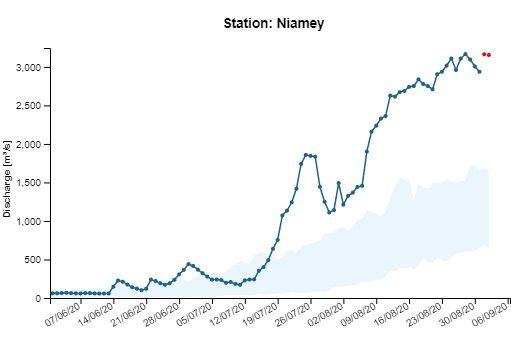
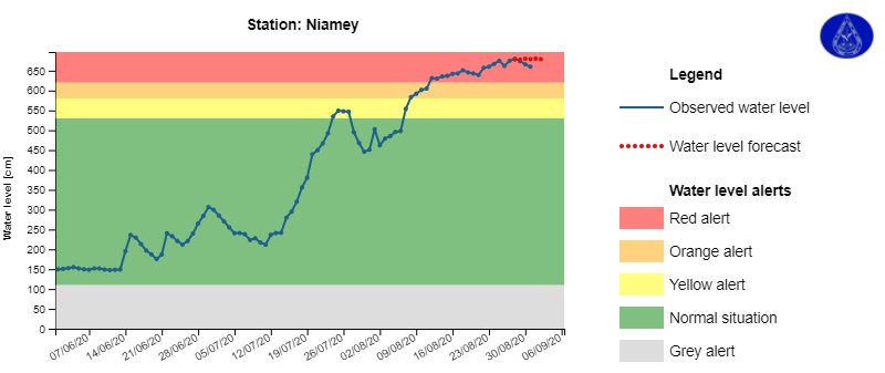
Left: Discharge of the Niger river in Niamey - Source: Niger Basin Authority
Right: Height of the Niger river in Niamey - Source: Niger Basin Authority
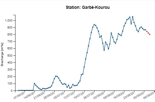
Left: Discharge of the Sirba river in Garbé Kourou, upstream of the confluence with the Niger river - Source: Niger Basin Authority
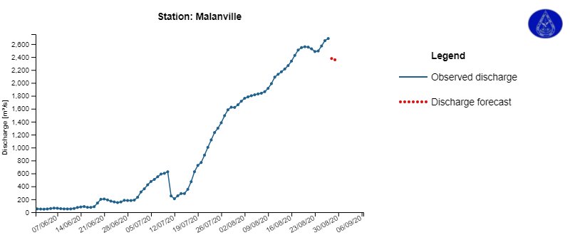
Right: Height of the Niger river in Malanville, downstream of Niamey - Source: Niger Basin Authority
The levee was finally overflowed as it was reported by the SLAPIS on 23 August 2020:
The protection system of the city of Niamey lasted for more than ten days, but today, 23 August 2020, as water reached a height of 659 cm in several places, the levee was no longer able to withstand the floodwaters of the Niger River.
The Hydrology Service of Niger added in this report:
The Hydrology Department's monitoring system has been closely and diligently monitoring the flood for weeks and had provided timely information on the rising water level. Once the level of red alert had been reached, several actions were taken to inform, alert and even protect the population against the risk of flooding:
- Before the arrival of the flood, the reinforcement and raising of several protective dikes in Kirkissoye, Saga, Lamordé, downstream Saguia (this dyke had been breached on 1st September 2019) etc,
- Several awareness-raising sessions for local populations through field visits, radio and television communications. The governor of the Niamey region has made several communications, summoned the mayors of the communes, the heads of districts and villages to sensitise them to also show them to sensitise the neighbouring populations,
- A field visit to raise awareness among the local population led by the Minister of Hydraulics accompanied by the governor of Niamey, several other agents and senior officials from other ministries, the executive management of Civil Protection, Humanitarian Action, Early Warning System, National Office of Hydro-Agricultural Developments, Rural Engineering, etc... , the directors and advisers of the prime minister,
- Raising the embankment upstream of Kennedy Bridge with sandbags to prevent water from passing through the dikes and limit damage. These works have been directed by the regional directorate of rural engineering of Niamey,
- The evacuation of very threatened populations by the executive management of Civil Protection and the Ministry of Humanitarian Action.
A later report released by the Niger Basin Authority on August 28, 2020 states: "On Sunday 23rd August 2020, the Niger River rose out of its main bed and invaded the Technical Directorate of the Niger Basin Authority and its surroundings. The riverside population is completely in the water and does not know who to turn to. Also, several material damages have been noticed: houses and training centres completely in flooded, the Niger rice husking factory submerged, rice fields immersed, household effects destroyed, etc.
Indeed, ten days ago, the Niger Basin Authority (NBA) gave the red alert that the water level would be very high, with even high risks of flooding. The water level started to rise since 11th August 2020, going from 605 cm to 629 cm on 12th August 2020. This upward trend continued rapidly and reached the level 660 cm on Sunday 23rd August 2020, thus exceeding the 620 cm red alert level in Niamey. The heavy rains recorded between 18th and 24th August, 2020 in Niamey and Tillaberi regions and in the Burkina part of the Niger Basin accentuated the rapid rise in the water levels in Niamey, going from 660 cm to 675 cm on 25th August 2020. This recorded 675 cm water level, never observed before, is 55 cm higher than the 620 cm red alert threshold, which led to the river’s overflow into flood-prone areas by submerging the protection dyke downstream of the Kennedy Bridge."
Left: The August 2020 flood broke the record level of the Niger river - Source: SLAPIS
Right: The dikes were heightened but after several days of water rising beyond record levels, they were overflowed - Source: SLAPIS
"It should be noted that the failure to continue the reinforcement of the dyke protecting the Niger River’s right bank beyond the old Kennedy Bridge, further downstream, probably favoured the submersion of the dyke on that part, thus causing the flooding of the AGRHYMET Regional Centre and the NBA Technical Directorate, as well as the road passing in front of the Technical Directorate. In addition, the river bed was filled in or silted up, which is an aggravating factor for the floods. Also, actions by riparian populations, which block the natural ways of the river’s water, have certainly helped in accentuating this flooding situation in the area."
"Within the framework of the Niger River’s hydrological monitoring, the National Directorate of Hydrology of the Republic of Niger, together with the team of the Niger Basin Observatory, conducted two gauging sessions during the month of August 2020 for the verification and validation of the rating curve in effect at the Niamey station. Thus, on Tuesday 25th August, 2020, the flow rate was 2420 m³/s and the level was 669 cm. This 2420 m³/s flood wave will propagate downstream of Niamey to reach the localities of Say, Tamou and Gaya in Niger, Alibori and Malanville in Benin, and Jiderebode and Kainji in Nigeria."
"Faced with this observed critical situation, the competent national authorities must intensify the sensitization of downstream riparian populations in order for them to take the necessary measures for evacuating the area."
The views expressed herein can in no way be taken to reflect the official opinion of the European Space Agency or the European Union.
Contains modified Copernicus Sentinel data 2026, processed by VisioTerra.
Contains modified Copernicus Sentinel data 2026, processed by VisioTerra.
| More on European Commission space: |  |
 |
 |
||||
| More on ESA: | |
|
|
S-1 website | S-2 website | S-3 website | |
| More on Copernicus program: | |
|
|
Scihub portal | Cophub portal | Inthub portal | Colhub portal |
| More on VisioTerra: | |
|
|
Sentinel Vision Portal | Envisat+ERS portal | Swarm+GOCE portal | CryoSat portal |