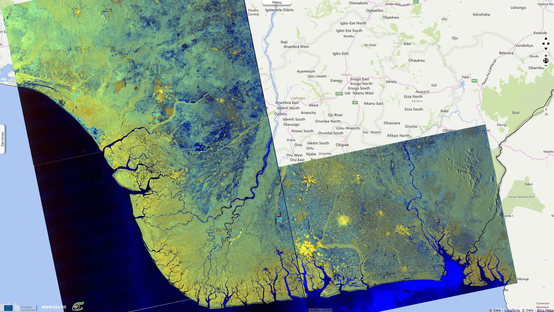
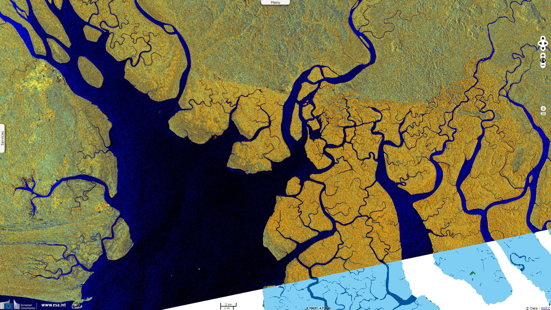
Labyrinthine mangroves forests on Nigerian East coast
Sentinel-1 CSAR IW acquired on 27 July 2015 from 17:52:38 to 17:53:07 UTC
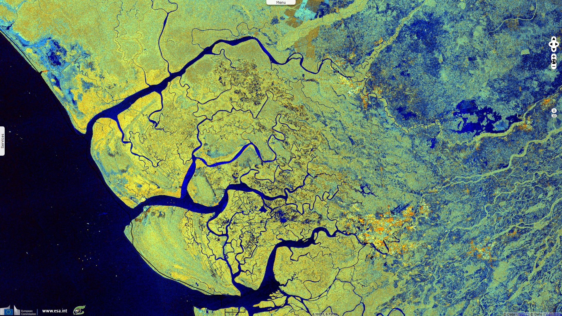
Sentinel-1 CSAR IW acquired on 22 February 2017 from 17:52:26 to 17:53:16 UTC
...
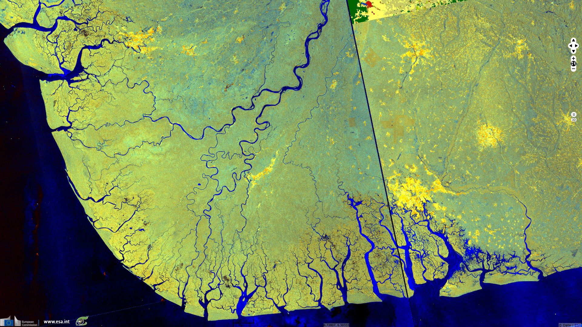
Sentinel-1 CSAR IW acquired on 16 July 2017 from 17:52:32 to 17:53:22 UTC
Sentinel-1 CSAR IW acquired on 22 February 2017 from 17:52:26 to 17:53:16 UTC
...
Sentinel-1 CSAR IW acquired on 16 July 2017 from 17:52:32 to 17:53:22 UTC
Keyword(s): coastal, land cover, forestry, hydrology, delta, mangrove, erosion, Ramsar, Niger river, Nigeria, Guinea Gulf
The views expressed herein can in no way be taken to reflect the official opinion of the European Space Agency or the European Union.
Contains modified Copernicus Sentinel data 2026, processed by VisioTerra.
Contains modified Copernicus Sentinel data 2026, processed by VisioTerra.
| More on European Commission space: |  |
 |
 |
||||
| More on ESA: | |
|
|
S-1 website | S-2 website | S-3 website | |
| More on Copernicus program: | |
|
|
Scihub portal | Cophub portal | Inthub portal | Colhub portal |
| More on VisioTerra: | |
|
|
Sentinel Vision Portal | Envisat+ERS portal | Swarm+GOCE portal | CryoSat portal |