Snowfalls in French plains
Sentinel-3 SLSTR RBT acquired on 08 February 2018 from 10:50:16 to 10:53:16 UTC
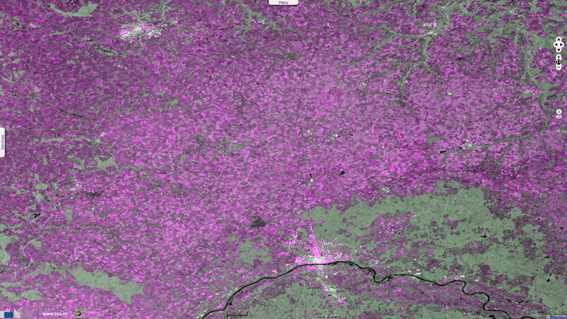
Sentinel-2 MSI acquired on 08 February 2018 at 11:02:09 UTC
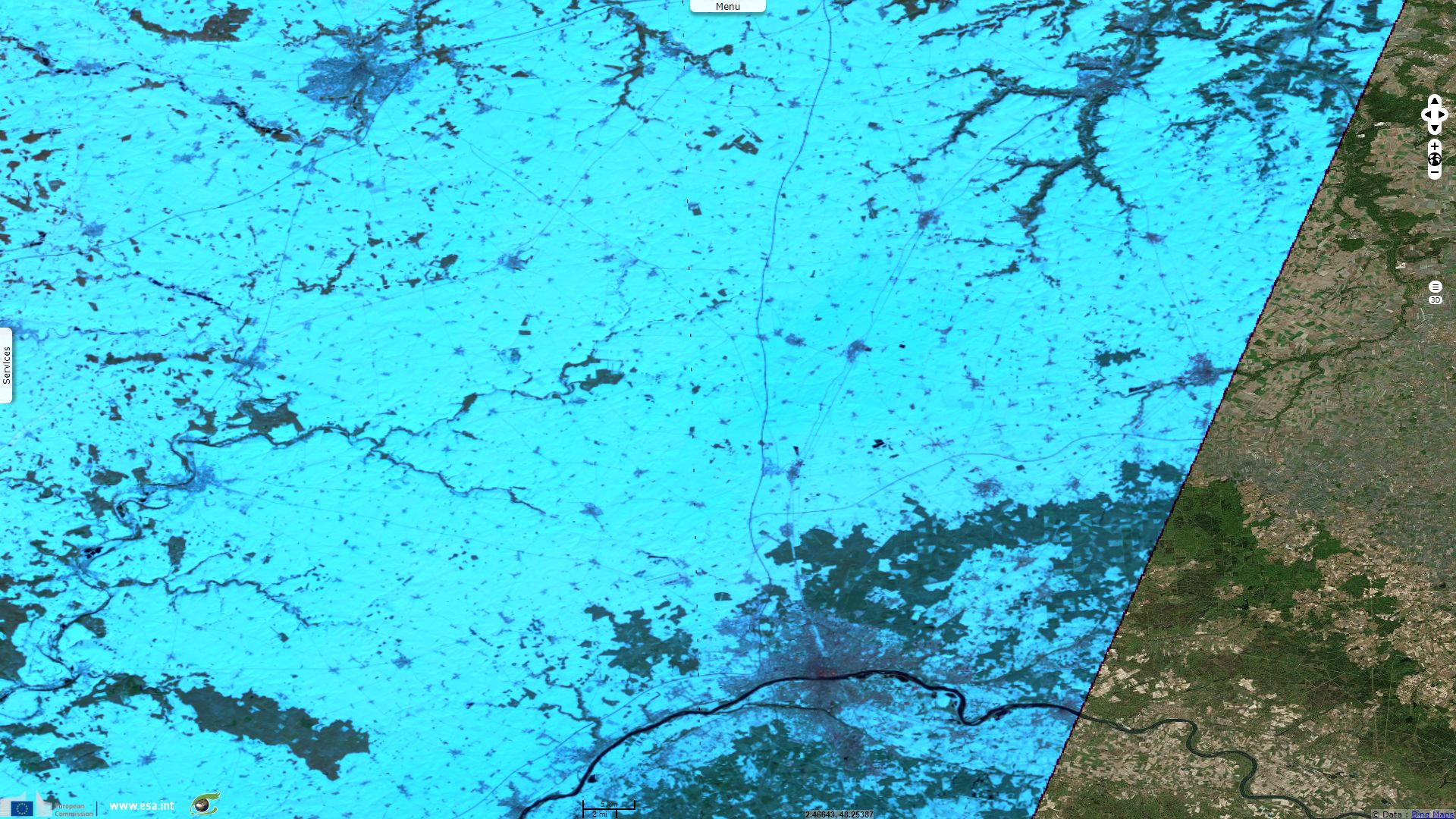
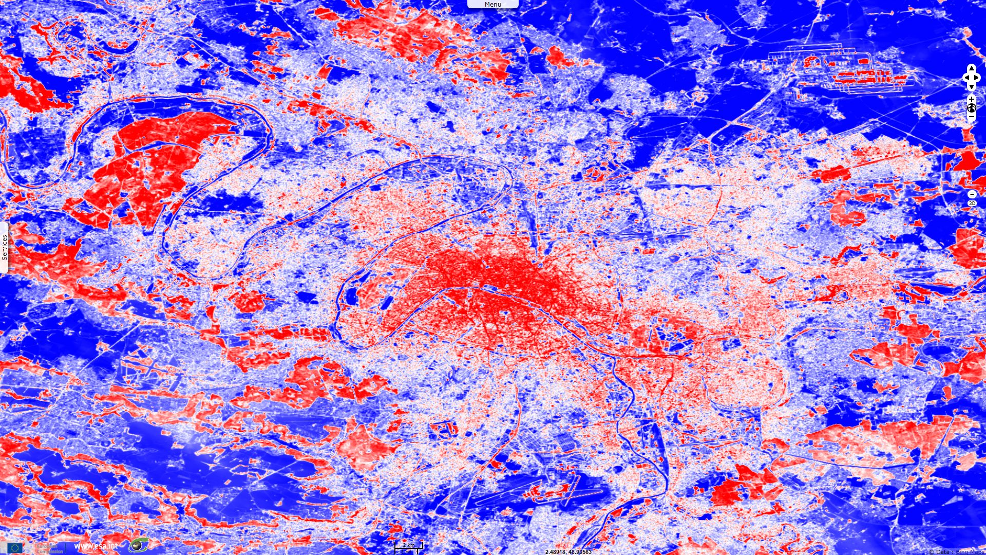
Sentinel-1 CSAR IW acquired on 08 February 2018 from 17:38:31 to 17:39:46 UTC
...
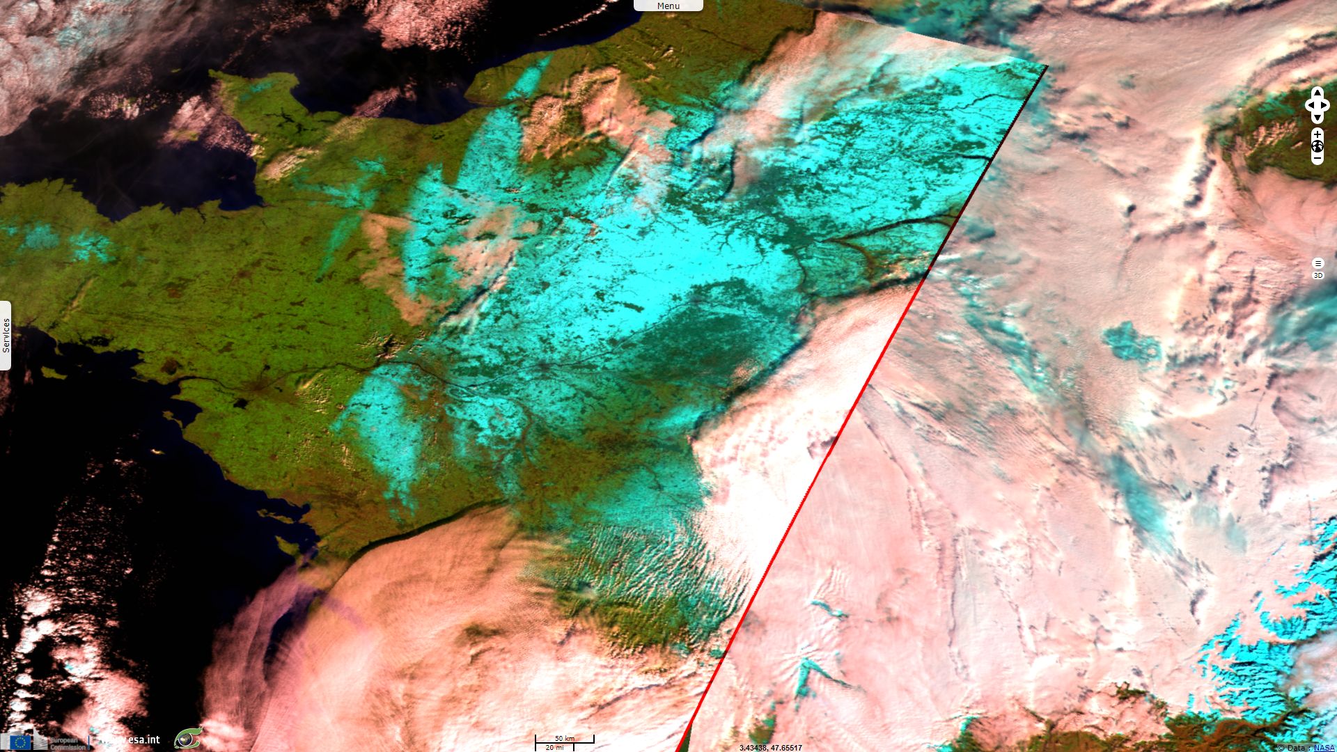
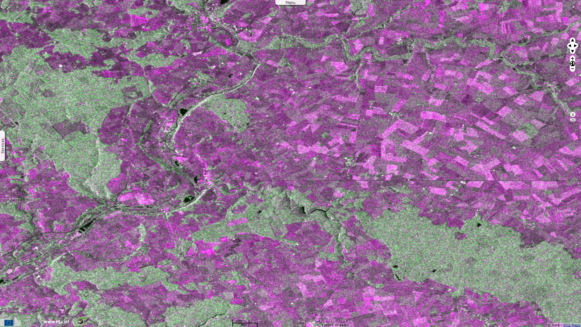
Sentinel-2 MSI acquired on 10 February 2018 at 10:52:01 UTC
Sentinel-2 MSI acquired on 08 February 2018 at 11:02:09 UTC
Sentinel-1 CSAR IW acquired on 08 February 2018 from 17:38:31 to 17:39:46 UTC
...
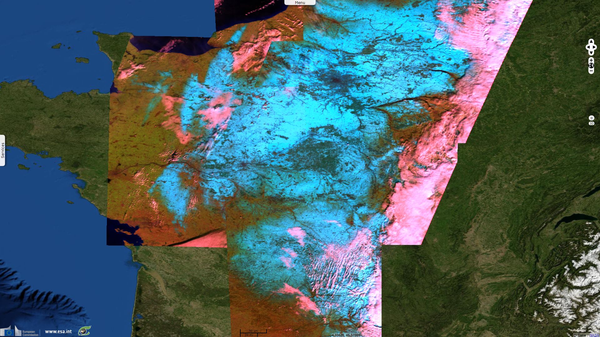
Sentinel-2 MSI acquired on 10 February 2018 at 10:52:01 UTC
Keyword(s): Land, meteorology, climate change, snowfall, ice, precipitations, vegetation, urban, France, Spain

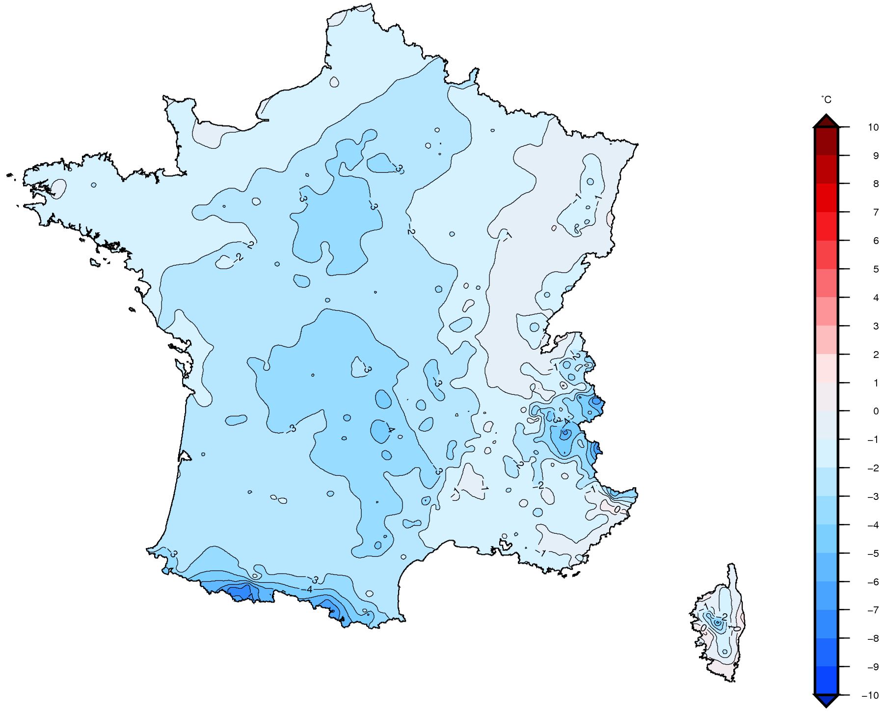
Temperature anomaly in Europe between 04.02.2018 & 10.02.2018 by NOAA - source: Meteo France
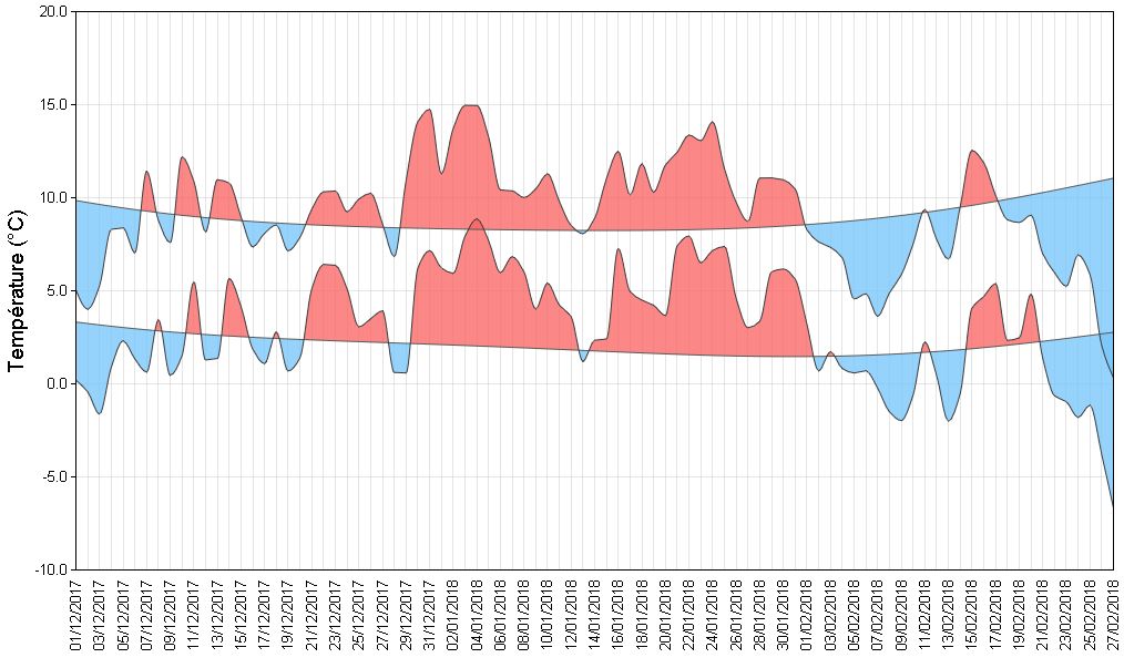
January 2018 has been marked by record highs for precipitation and temperature (melting a part of the important December snowfalls in heights), record lows in sunshine duration in North-West Europe and slow floods mostly in Seine, Rhine and Mosel bassins.
At the opposite, February 2018 has been much colder than usual for most of Europe. First a cold snap at the beginning of the month resulted in unusual snowfalls in plains, notably in France. At the end of the month, another colder and drier system nicknamed "the Beast from the East" in the UK or "Siberian bear" in the Netherlands blanketed a large part of Europe (spectacularly in parts of UK, Ireland, Italy, Spain or France) while Arctic, Eastern US and middle East faced positive temperature anomalies (up to +30°C anomaly).
The Sentinel-2 and Sentinel-3 images were acquired within a few minutes interval and the Sentinel-1 later in the afternoon. This animation shows a good correlation between these images.
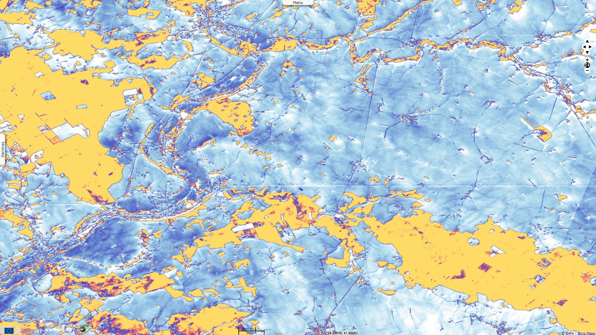
Normalized Difference Snow index (NDSI) uses Sentinel-2 bands 3 & 11 and Sentinel-3 SLSTR bands 5 & 1. It proves to be coherent with colour composites and, using threshold adapted to the selected colour map, it can be an intuitive tool to quickly estimate snow cover.
On these Sentinel-1 images, the VH polarisations is backscattered vegetated areas (green) more strongly than it is by snow-capped areas (magenta). It also agrees with the NDSI on roads retrieval but seems able to pierce the snow cover by discriminating agricultural parcels better than Sentinel-2 does in these snowy conditions.
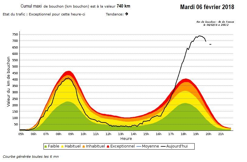
Total trafic jams in Ile de France the 06.02.2018 by Sytadin
With 12cm mean depth and up to 20cm locally, snow caused exceptional trafic jams the 06.02.2018, here 740km after 8pm around Paris. This was aggravated by the fact drivers felt confident after limited snowfalls induced no perturbation the day before.
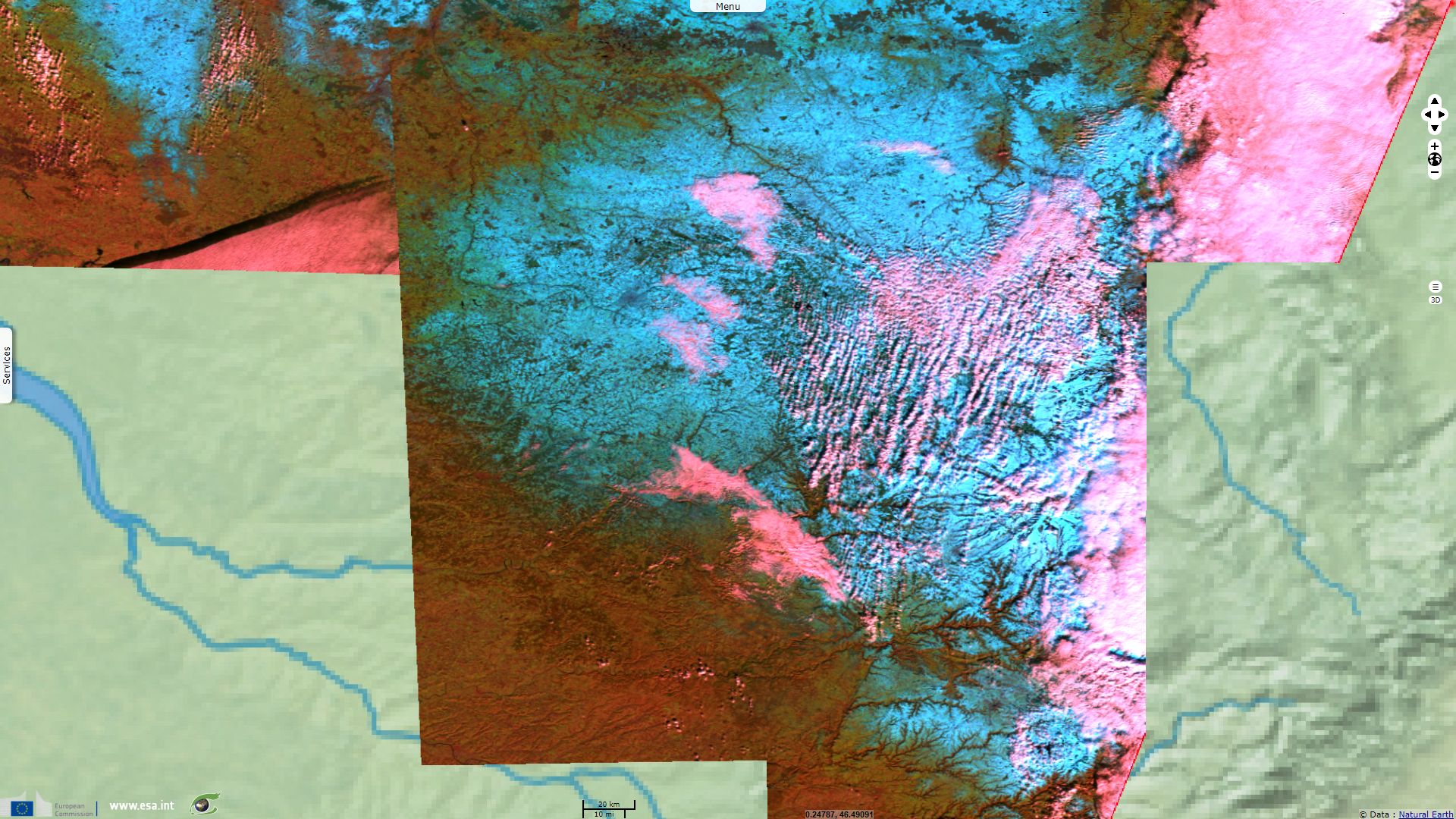
Snow also fell over the Massif Central barrier. This old massif was lifted during the Variscan or Hercynian orogeny and is now eroded, leaving no mount higher than the 1886m high Puy de Sancy extinct volcano. On the southernmost tiles, one can notice the Causses limestone plateau that is crossed by several rivers which cut deep gorges.
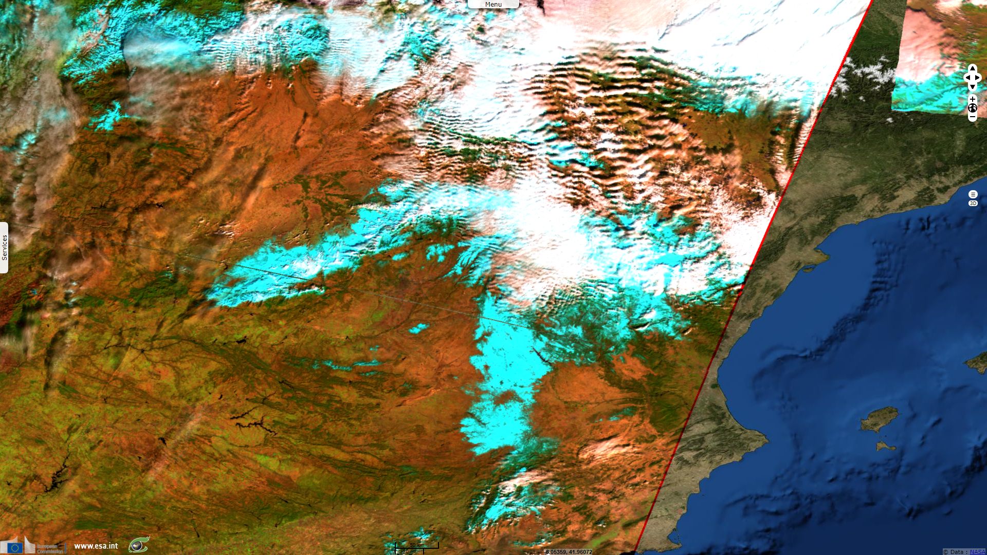
Limited cloud cover in Spain allowed Sentinel-3 to show snow covering many Spanish ranges. Not only Pyreneans but also Bordillera Cantabrica, Sistema central, Sistema Iberico and Sistema Penibetico received snowfalls. Part of La Mancha region, located on a plateau, was also covered in snow.
The views expressed herein can in no way be taken to reflect the official opinion of the European Space Agency or the European Union.
Contains modified Copernicus Sentinel data 2026, processed by VisioTerra.
Contains modified Copernicus Sentinel data 2026, processed by VisioTerra.
| More on European Commission space: |  |
 |
 |
||||
| More on ESA: | |
|
|
S-1 website | S-2 website | S-3 website | |
| More on Copernicus program: | |
|
|
Scihub portal | Cophub portal | Inthub portal | Colhub portal |
| More on VisioTerra: | |
|
|
Sentinel Vision Portal | Envisat+ERS portal | Swarm+GOCE portal | CryoSat portal |