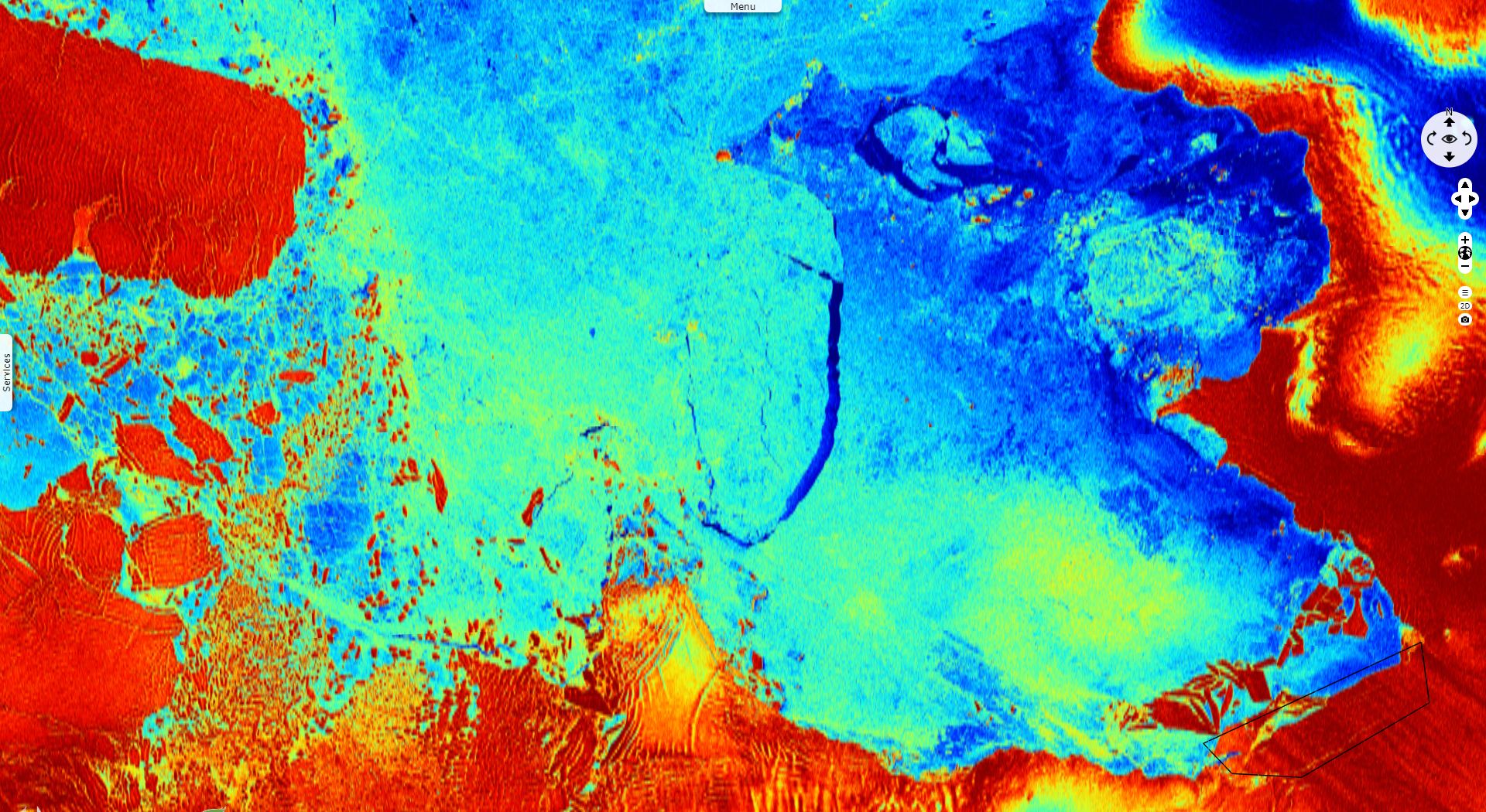
B46 Iceberg calves from Pine Island Glacier
Sentinel-1 CSAR EW acquired on 22 October 2018 at 04:11:41 UTC
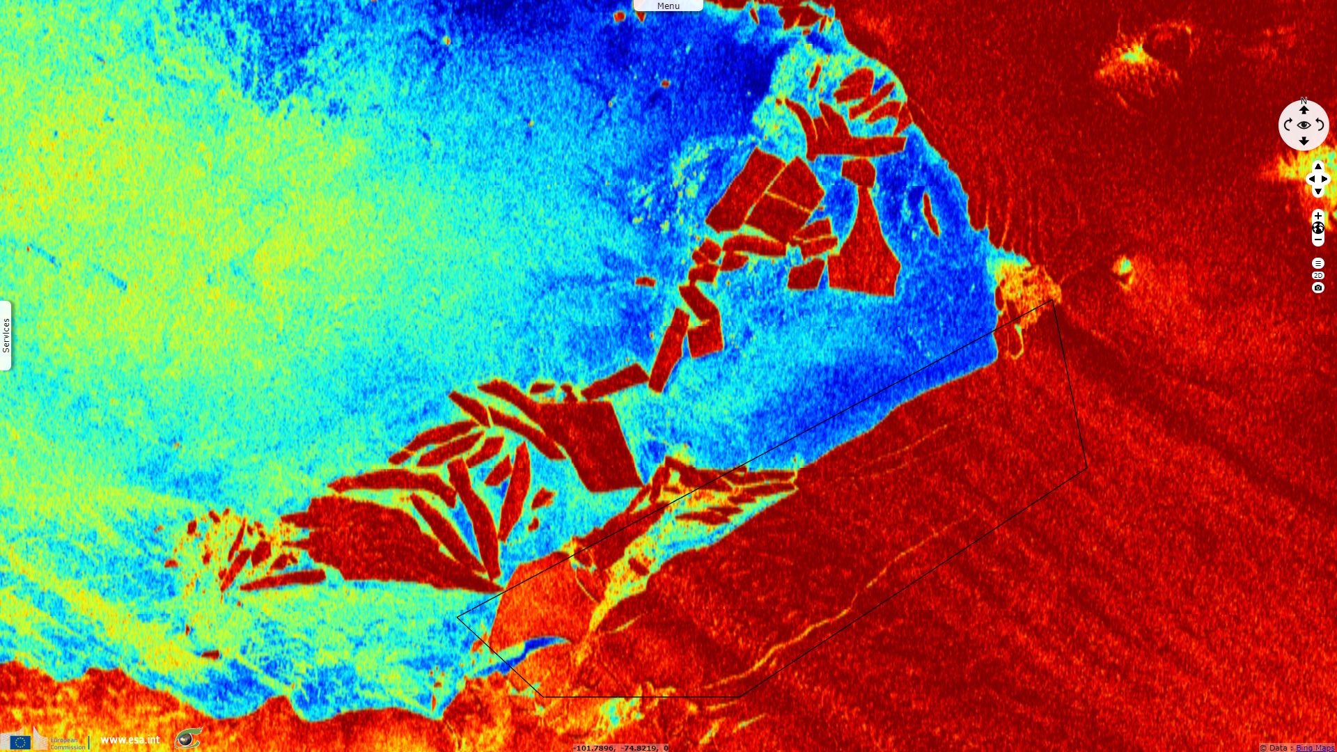
Sentinel-1 CSAR EW acquired on 28 October 2018 at 04:10:59 UTC
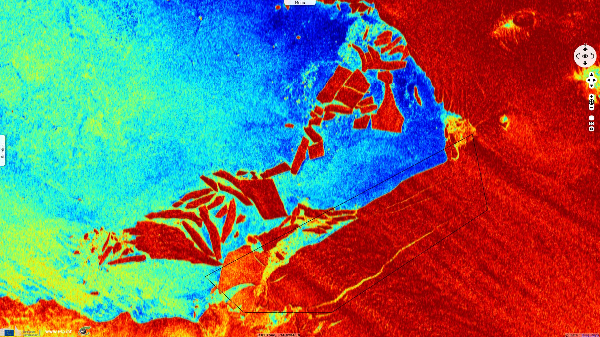
Sentinel-1 CSAR EW acquired on 03 November 2018 at 04:11:41 UTC
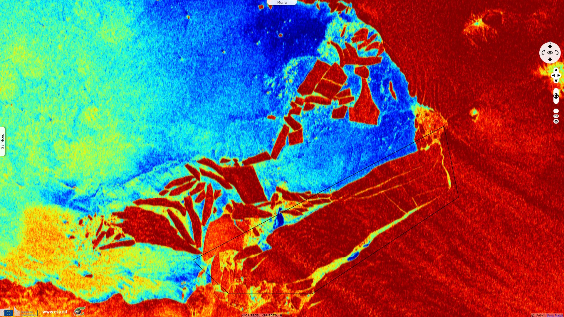
Sentinel-1 CSAR EW acquired on 09 November 2018 at 04:10:59 UTC
Sentinel-1 CSAR EW acquired on 28 October 2018 at 04:10:59 UTC
Sentinel-1 CSAR EW acquired on 03 November 2018 at 04:11:41 UTC
Sentinel-1 CSAR EW acquired on 09 November 2018 at 04:10:59 UTC
Keyword(s): Polar, climate, coastal, iceberg, cryosphere, lead, sea ice, glacier, Amundsen Sea, Antarctica, Antarctic Ocean
The views expressed herein can in no way be taken to reflect the official opinion of the European Space Agency or the European Union.
Contains modified Copernicus Sentinel data 2026, processed by VisioTerra.
Contains modified Copernicus Sentinel data 2026, processed by VisioTerra.
| More on European Commission space: |  |
 |
 |
||||
| More on ESA: | |
|
|
S-1 website | S-2 website | S-3 website | |
| More on Copernicus program: | |
|
|
Scihub portal | Cophub portal | Inthub portal | Colhub portal |
| More on VisioTerra: | |
|
|
Sentinel Vision Portal | Envisat+ERS portal | Swarm+GOCE portal | CryoSat portal |