The slow subsidence of the Mississippi river delta
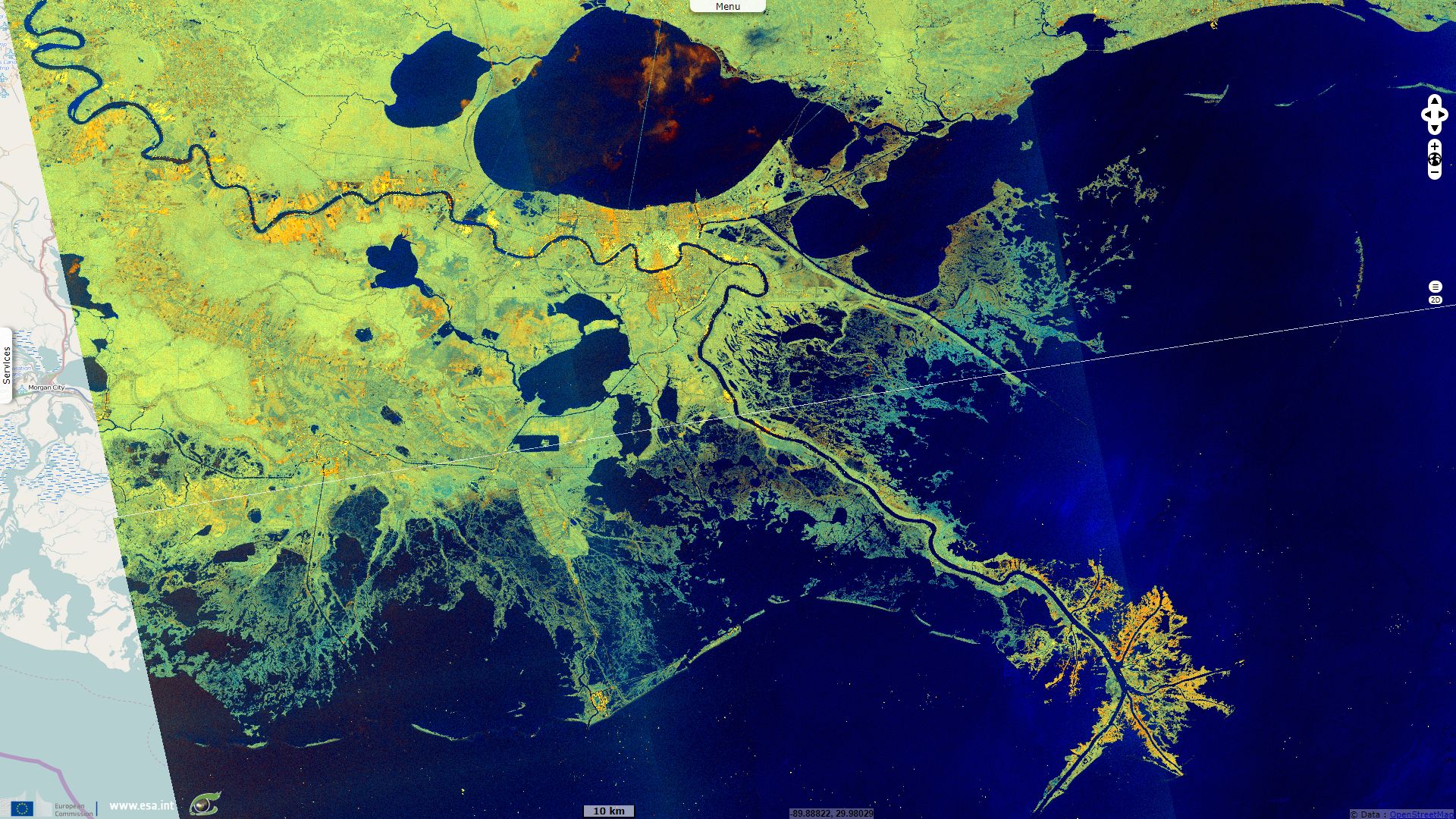
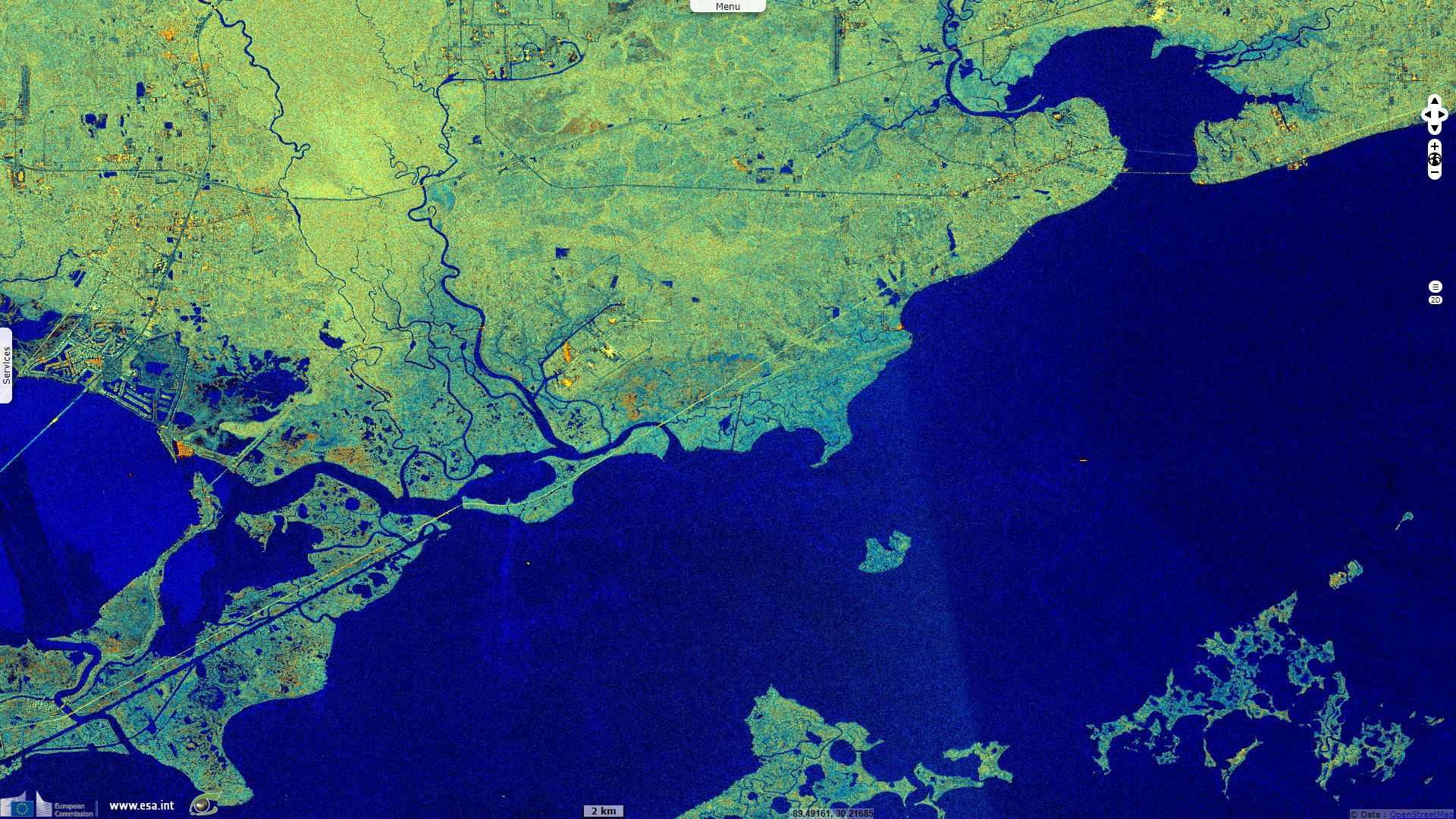
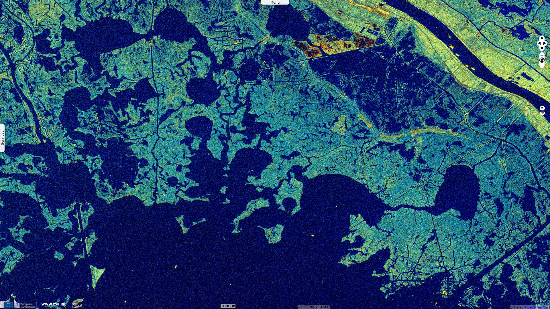
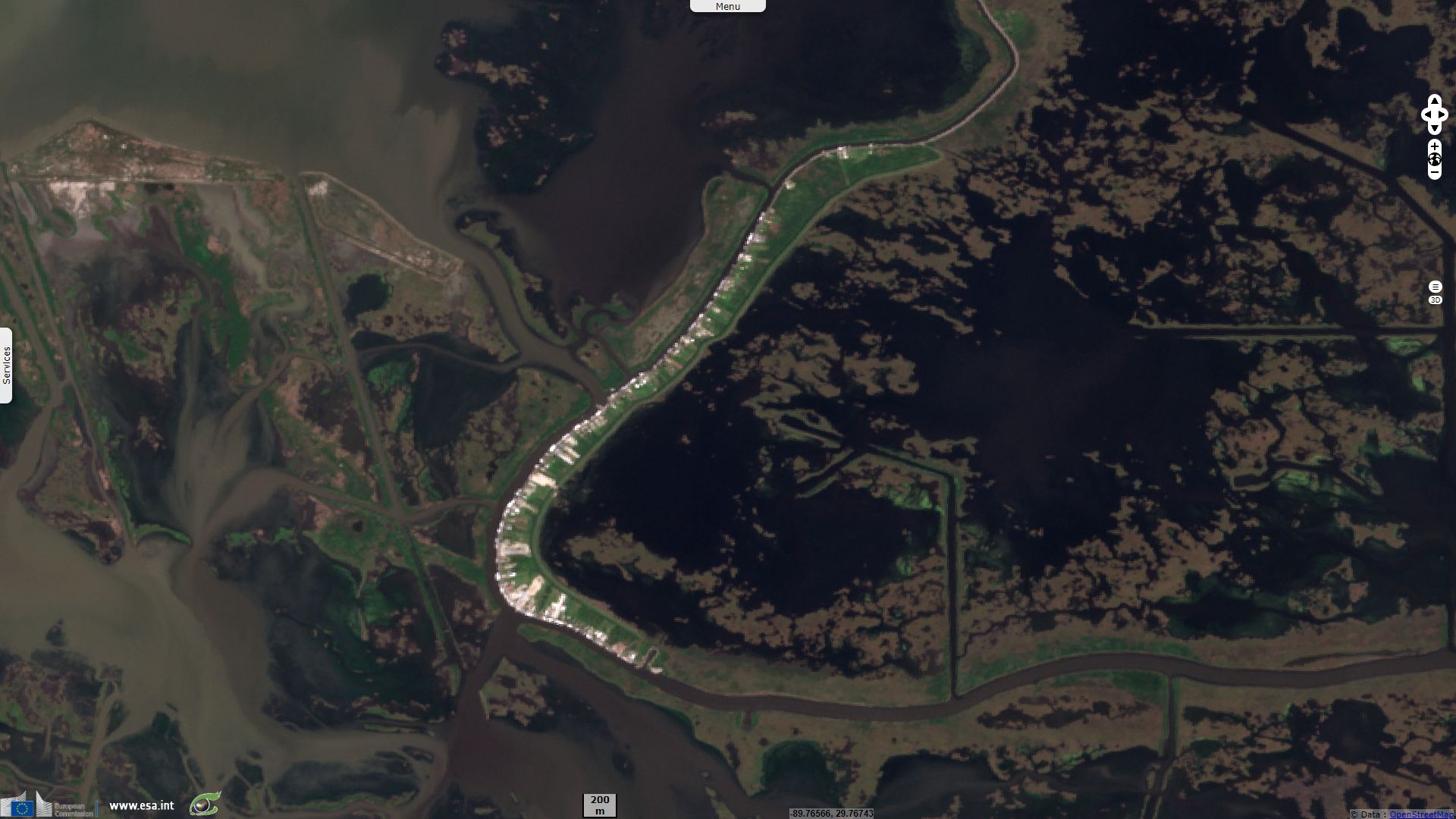
Sentinel-1 CSAR IW acquired on 22 March 2015 at 00:01:31 UTC
...
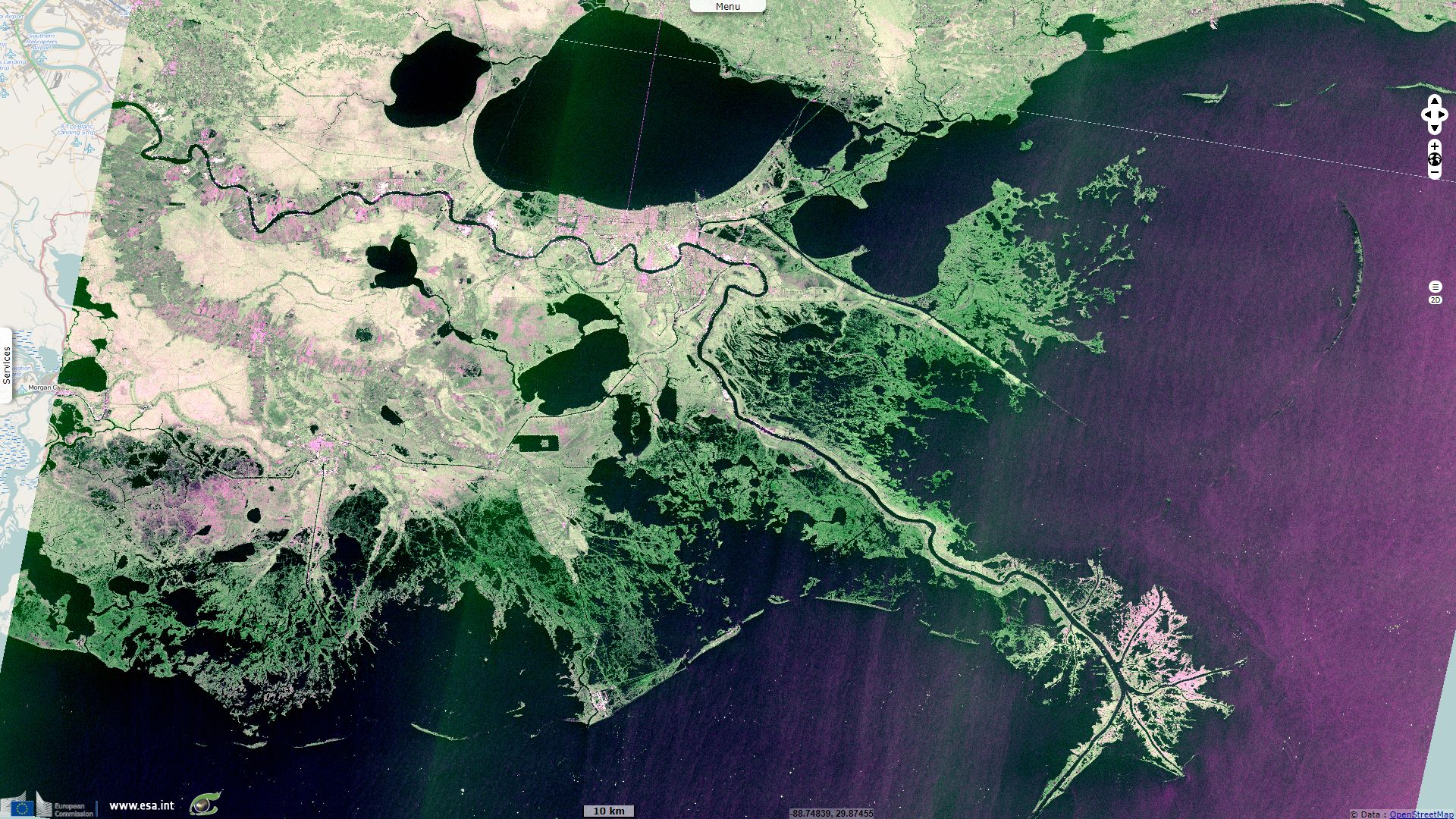
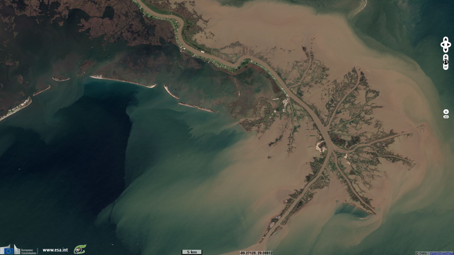
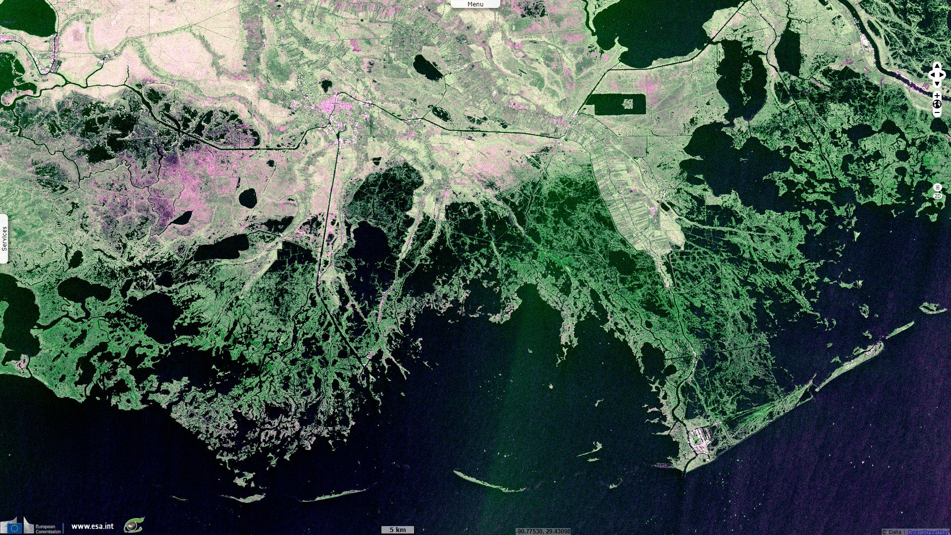
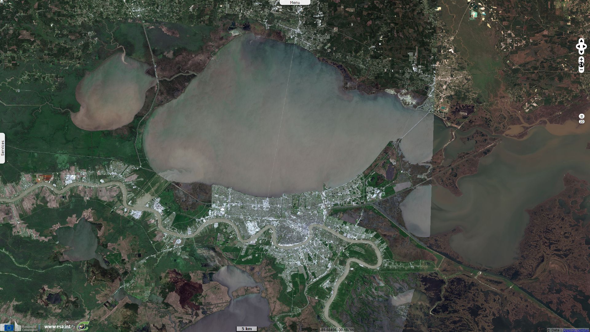
Sentinel-2 MSI acquired on 14 March 2018 at 16:30:41 UTC
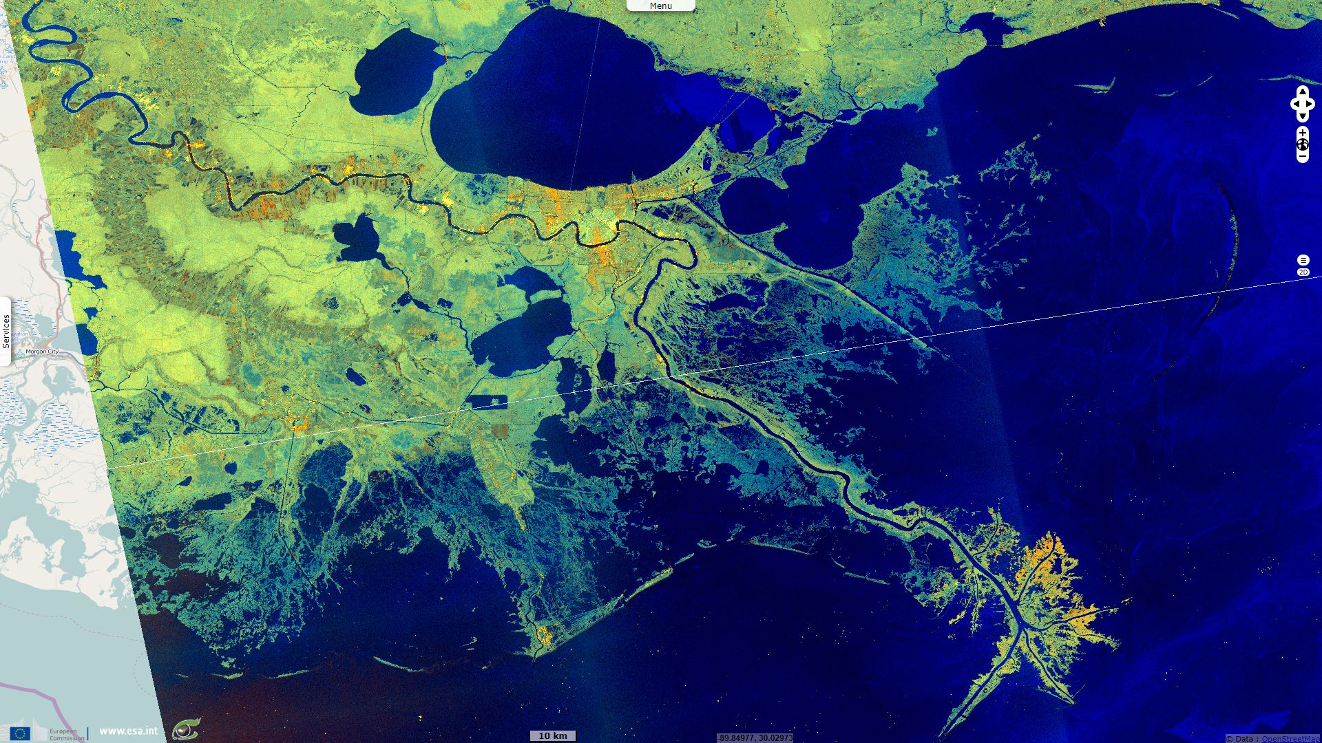
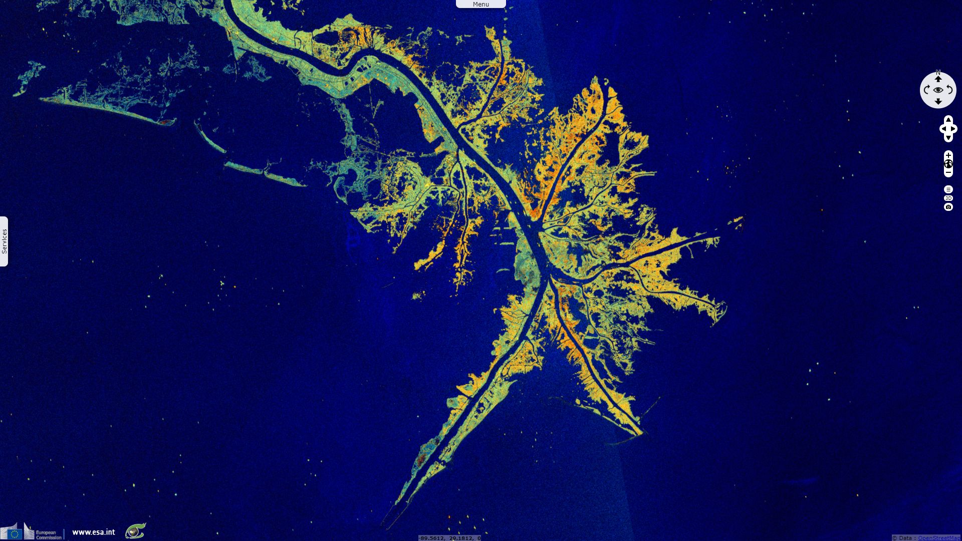
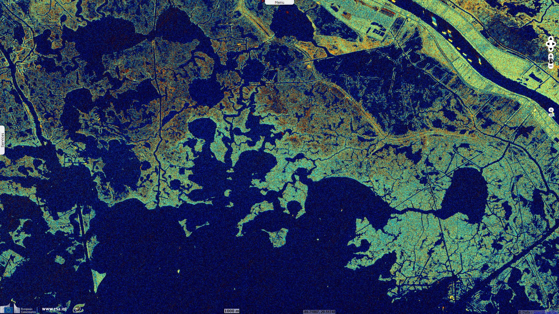
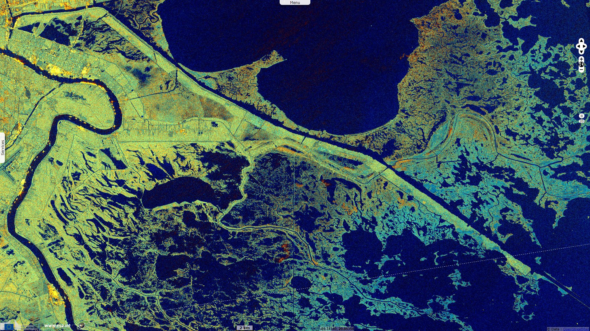
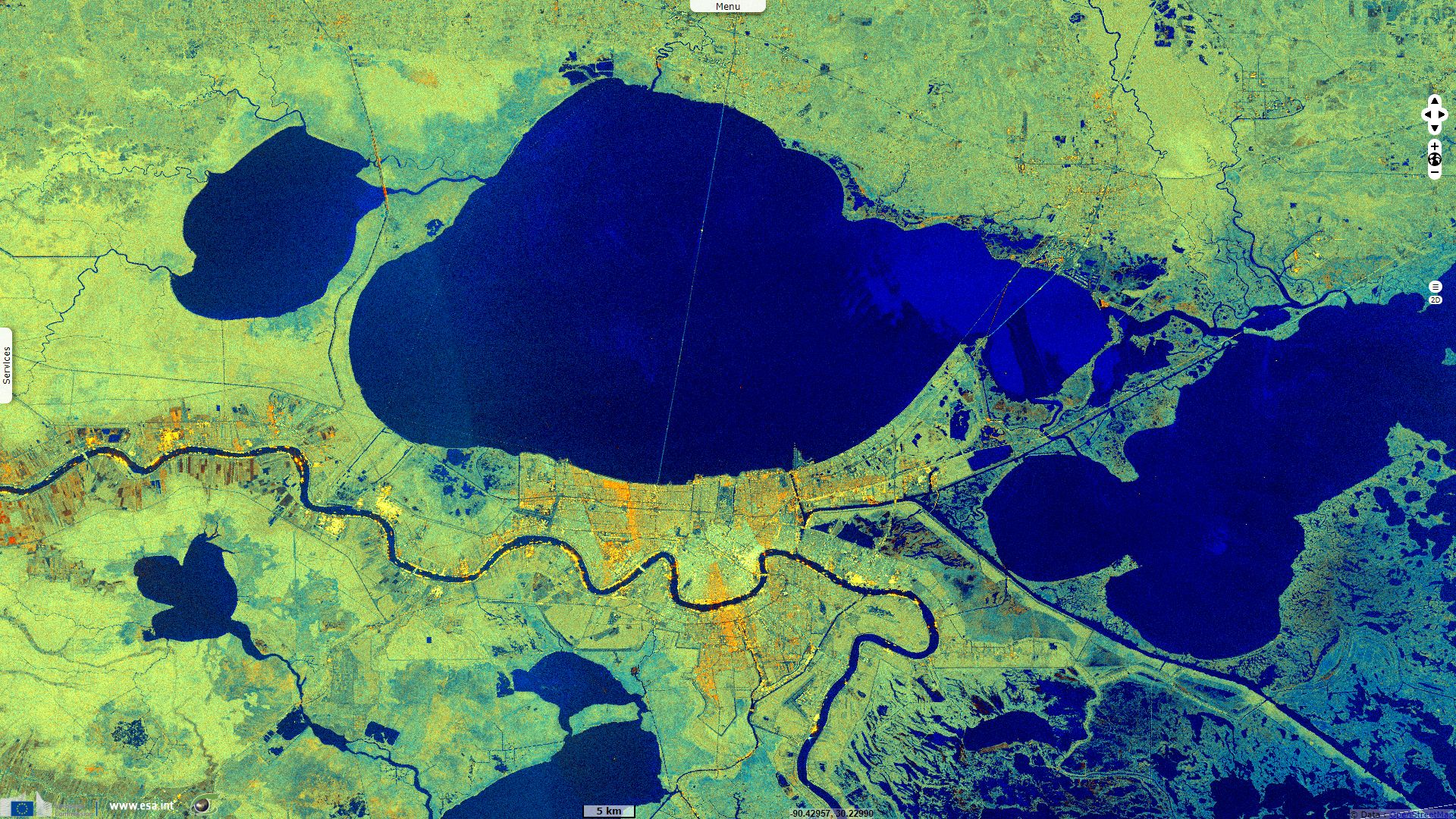
Sentinel-1 CSAR IW acquired on 12 May 2019 from 00:01:44 to 00:02:09 UTC
...
Sentinel-2 MSI acquired on 14 March 2018 at 16:30:41 UTC
Sentinel-1 CSAR IW acquired on 12 May 2019 from 00:01:44 to 00:02:09 UTC
Keyword(s): Coastal, wetland, river delta, flood control, infrastructure, urban planning, subsidence, erosion, sedimentation, alluvium, dam, oil exploration, oil spill, biodiversity, USA, Unites States.
Louisiana Coastal Wetlands Planning Protection and Restoration Act Program web site explains in details how the Mississippi delta was shaped: "The Mississippi River has had a profound effect on the landforms of coastal Louisiana. The entire area is the product of sediment deposition following the latest rise in sea level about 5 000 years ago. Each Mississippi River deltaic cycle was initiated by a gradual capture of the Mississippi River by a distributary which offered a shorter route to the Gulf of Mexico. After abandonment of an older delta lobe, which would cut off the primary supply of fresh water and sediment, an area would undergo compaction, subsidence, and erosion. The old delta lobe would begin to retreat as the gulf advanced, forming lakes, bays, and sounds. Concurrently, a new delta lobe would begin its advance gulfward. This deltaic process has, over the past 5 000 years, caused the coastline of south Louisiana to advance gulfward from [25 to 80 km], forming the present-day coastal plain."

Mississippi river basin - Source: http://mississippiriverdelta.org/
"Louisiana’s coastal wetlands were built up by Mississippi River floodwaters that deposited enormous volumes of sediment and nutrients onto the continental shelf at its mouth. These sediments were eroded from the lands of the vast Mississippi River basin in the interior of North America. For the last several thousand years, the dominance of the deltaic processes resulted in a net increase of more than [10 000 km²] of coastal wetlands."
"In addition, these deltaic processes created an extensive skeleton of higher natural levee ridges along the past and present Mississippi River channels, distributaries, and bayous in the deltaic plain and created the beach ridges of the chenier deltaic plain. The landscape that these processes produced gave rise to one of the most productive ecosystems on earth. Only the most intensively managed agricultural systems that are artificially subsidized by large inputs of energy and fertilizer could possibly rival the ability of these estuarine wetlands to convert sunlight and carbon dioxide into biomass."
"For the last 1 200 years, sediment deposition has occurred primarily at the mouth of the Mississippi River's Plaquemines-Balize delta, in the area defined as the Mississippi River Delta Basin. This delta is located on the edge of the continental shelf of the Gulf of Mexico. Its bird's foot configuration is characteristic of alluvial deposition in deep water. In this configuration large volumes of sediment are required to create land area; consequently, land is being lost in this delta more rapidly than it is being created."

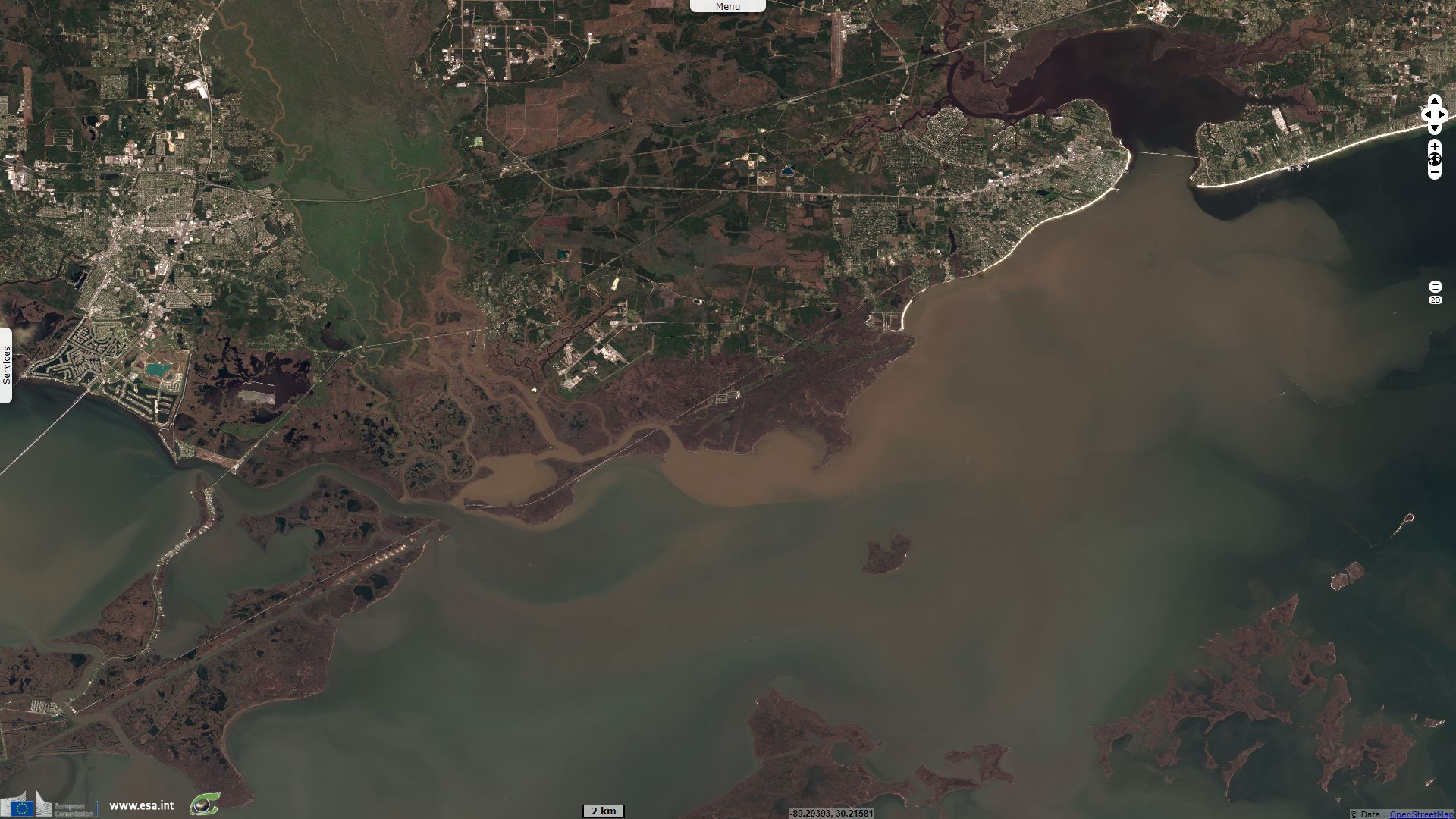
Many different fish and wildlife species are found throughout Louisiana’s estuaries. Dashed line indicates the general range of salinity and habitats where each species might be found - Source: Coalition to Restore Coastal Louisiana, LSU Coastal Sustainability Studio.
"The Mississippi River Delta Basin comprises approximately [1300 km²] of land and shallow estuarine water area in the active Mississippi River delta. Approximately 83 percent of this area, or [1000 km²] is open water. The [250 km²] of land in the basin are characterized by low relief, with the most prominent features being natural channel banks and dredged material disposal areas along the Mississippi River, its passes, and man-made channels. Coastal marshes make up approximately [150 km²] or about 61 percent of the total land area in the Mississippi River Delta Basin. Eighty-one percent of this marsh is fresh, 17 percent is intermediate, and 2 percent is brackish-saline.
The Mississippi River discharges the headwater flows from about 41 percent of the contiguous 48 states. On a long-term daily basis, discharges in the Mississippi River average [13 000 m3/s]. A peak discharge of approximately [35 000 m3/s] occurs on the average of once every 16 years downstream of New Orleans."
"Suspended sediment concentrations in the river decreased markedly between 1950 and 1966. Since that time the observed decrease in the suspended sediment load has been minimal. Long-term suspended sediment loads in the river average 436 000 tons per day; they have ranged from an average of 1 576 000 tons per day in 1951 to a still considerable average of 219 000 tons per day in 1988."
"Between 1974 and 1990 the land loss rate in the Mississippi River Delta Basin averaged [2.7 km²] per year, or 1.69 percent of existing land area (Dunbar, Britsch, and Kemp 1992). Between the mid-1950's and 1974, the estimated land loss rate for the basin was [7.15 km²] per year. This loss is the result of compaction, subsidence, hurricanes, tidal erosion, sea level rise, and human activities. The loss has been aggravated by maintenance of navigation channels and construction of canals for mineral exploration. The total land area lost in this basin over the last 60 years has been approximately [280 km²]."
"The MRGO was supposed to be a shortcut between the Gulf of Mexico and the New Orleans inner harbor. During Hurricane Katrina, the MRGO acted as a funnel for the gulf storm surge that flooded St. Bernard Parish and parts of New Orleans. 'The dynamics of this waterway has been destructive not only in terms of bringing water in, in terms of surges, but also the salt water intrusion has destroyed thousands and thousands of acres of wetlands and estuaries,' said St. Bernard Parish President Craig Taffaro."
"The primary wetlands loss problem facing the Mississippi River Delta Basin is that of subsidence and compaction. Unlike other areas of coastal Louisiana, the Mississippi River delta is blessed with a relative abundance of inflowing fresh water and sediments. Despite the availability of these resources, the overall growth of emergent delta has been truncated in recent history. In its present position the Mississippi River deposits sediments into much deeper water than has been the case historically. This is evidenced by the thick stratum of Holocene deltaic sediments found in the active river delta. These unconsolidated sediments are highly susceptible to compaction, reducing the life span of emergent wetlands. While the rapid emergence of wetlands can occur over large areas in the delta, these areas deteriorate in an equally rapid manner."
"Human activities have aggravated land loss rates in the Plaquemines-Balize delta. The stabilization of the Mississippi River's channel has cut off seasonal sediment-laden overbank flow that once nourished adjacent wetland areas. The Mississippi River levees to the north, and associated erosion control and channel stabilization measures extending to its mouth, also preclude the possibility of a naturally occurring crevasse or change in the river's course."
Regarding natural disasters, we often have to choose between fighting the disaster or adapt to live with it. To preserve cities built on the banks of Mississippi river and its tributaries, flood control was mostly managed using dams and levees. The erosion upstream of the river generates of lot of sedimentes that used to deposit in the delta; they now fill the dams instead of elevating land. Deprived of sedimentation, the delta is thus slowly sinking under the combined effect of coastal erosion, sediment compaction and subsidence caused by oil exploitation. This in return, compels to rise levees higher to protect subsiding cities from the floods.
"Many areas of the Louisiana coast suffer from a lack of the abundant fresh water and sediment found in the Mississippi River. Since the river is no longer free to alter its course and leave its banks to inundate vast coastal areas, the effects of human and natural forces which promote wetland deterioration are compounded. In this respect the relationship between the Mississippi River and the problems facing coastal wetlands is not limited to the river's delta, but extends across the entire Louisiana coast. The lack of growth in the Mississippi River delta, on a large scale, is as much a coast-wide problem as a basin problem. This source of ample fresh water and sediment, which shaped the Louisiana coast as we know it, is no longer producing a net gain in coastal wetlands, placing the entire Louisiana coast at risk."
The views expressed herein can in no way be taken to reflect the official opinion of the European Space Agency or the European Union.
Contains modified Copernicus Sentinel data 2026, processed by VisioTerra.
Contains modified Copernicus Sentinel data 2026, processed by VisioTerra.
| More on European Commission space: |  |
 |
 |
||||
| More on ESA: | |
|
|
S-1 website | S-2 website | S-3 website | |
| More on Copernicus program: | |
|
|
Scihub portal | Cophub portal | Inthub portal | Colhub portal |
| More on VisioTerra: | |
|
|
Sentinel Vision Portal | Envisat+ERS portal | Swarm+GOCE portal | CryoSat portal |