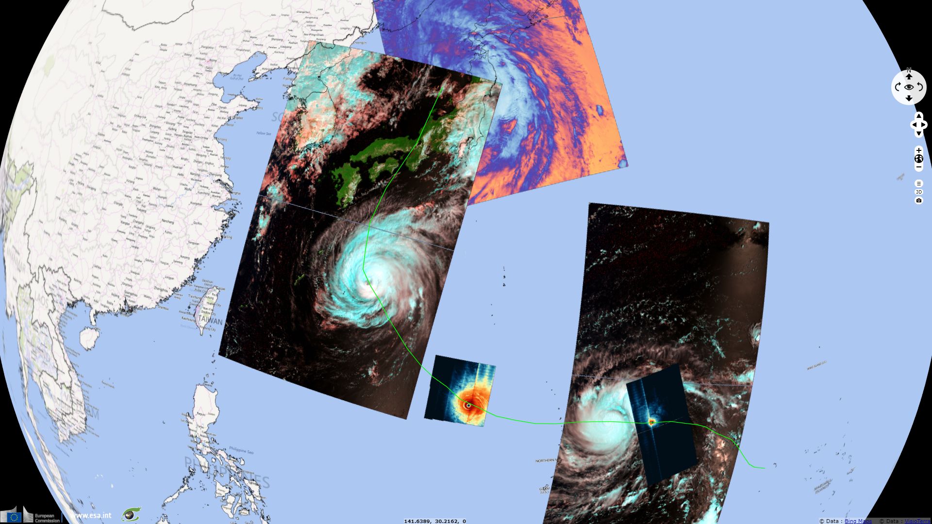
Typhoon Jebi makes landfall in Japan
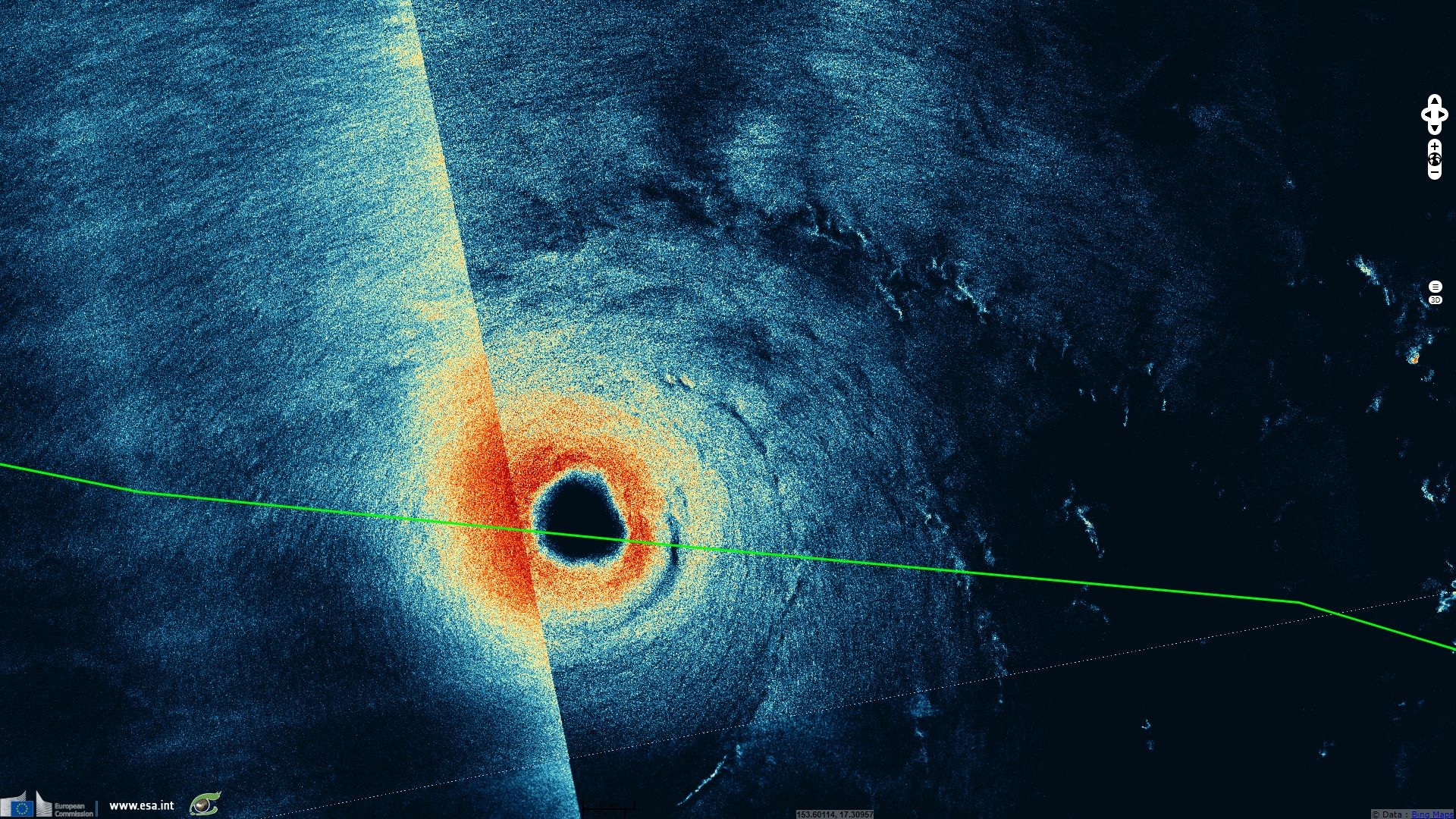
Sentinel-1 CSAR EW acquired on 29 August 2018 from 07:54:08 to 07:55:12 UTC
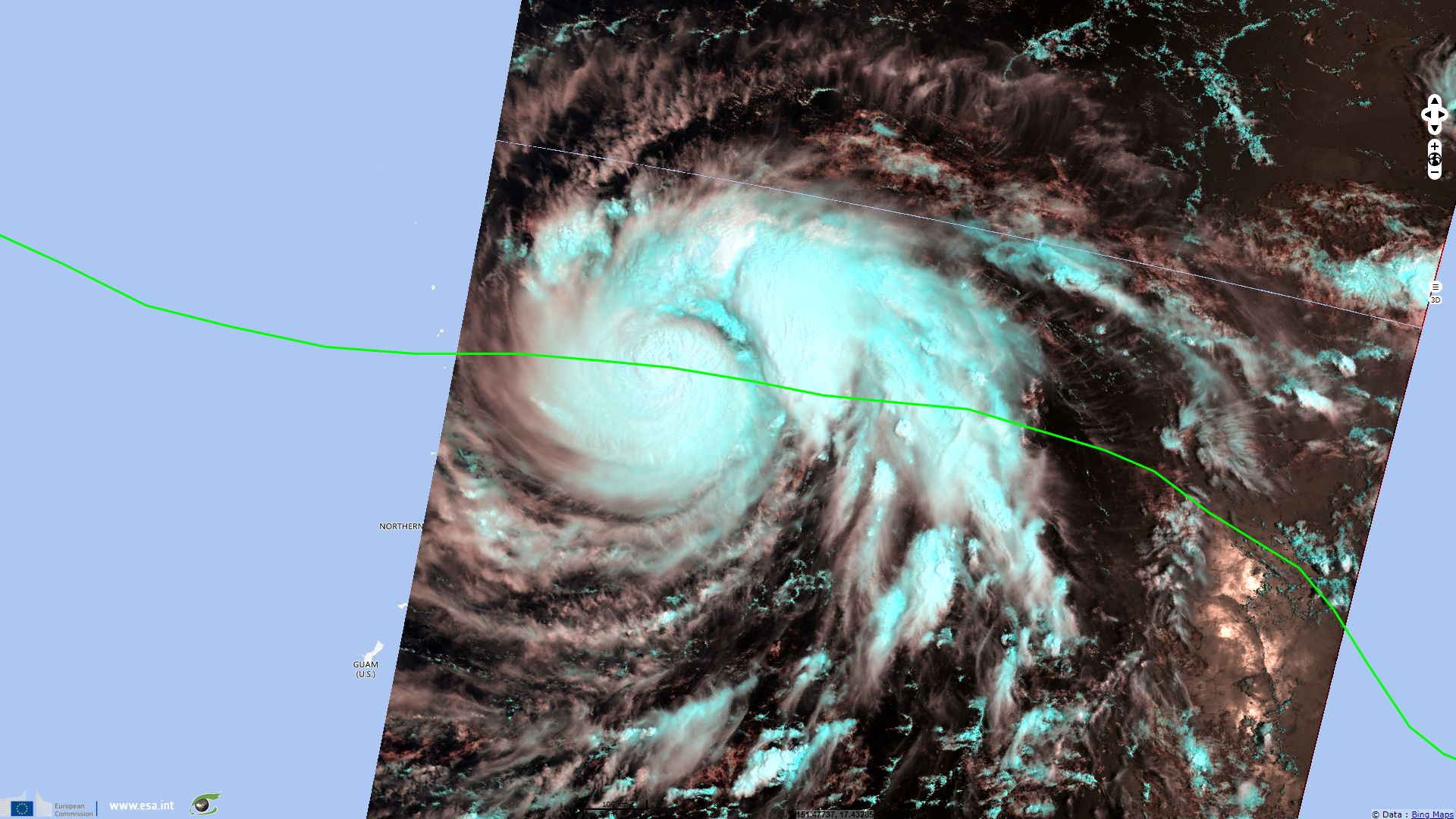
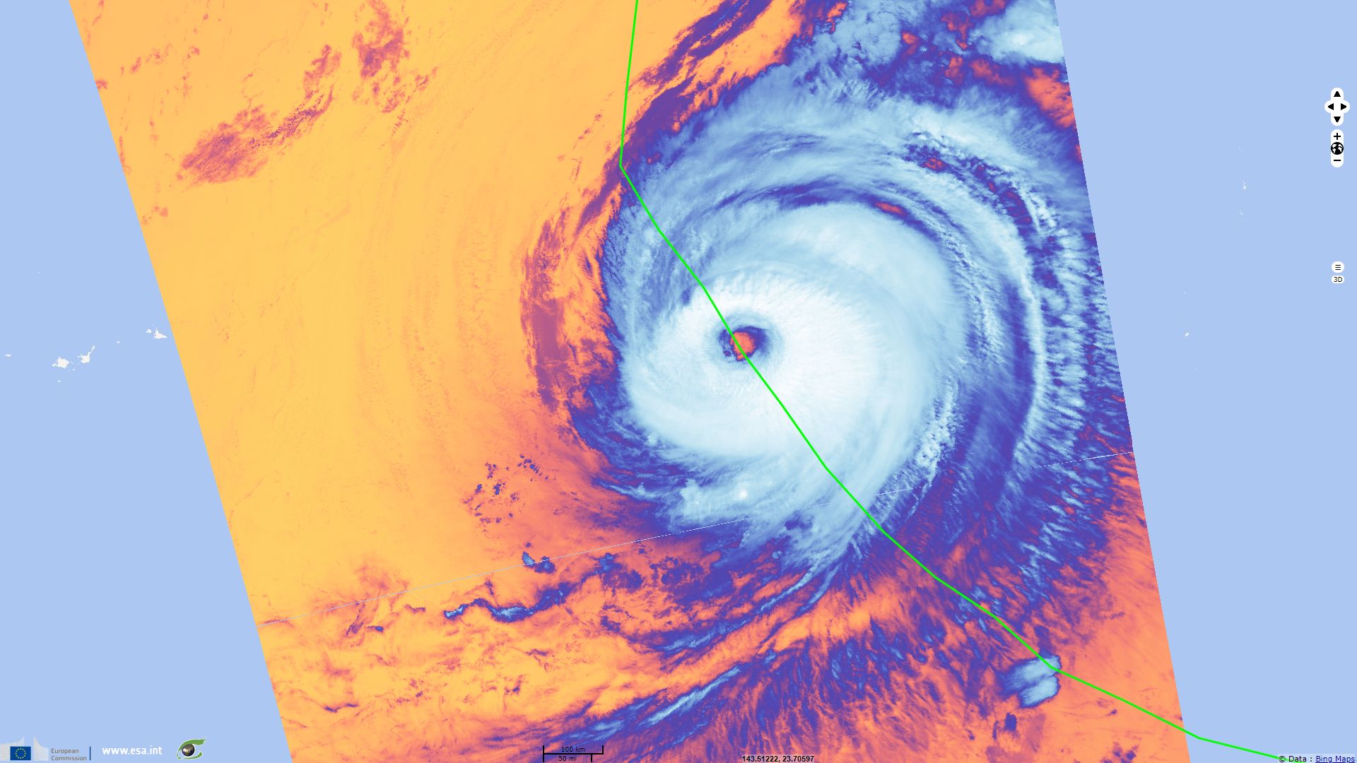
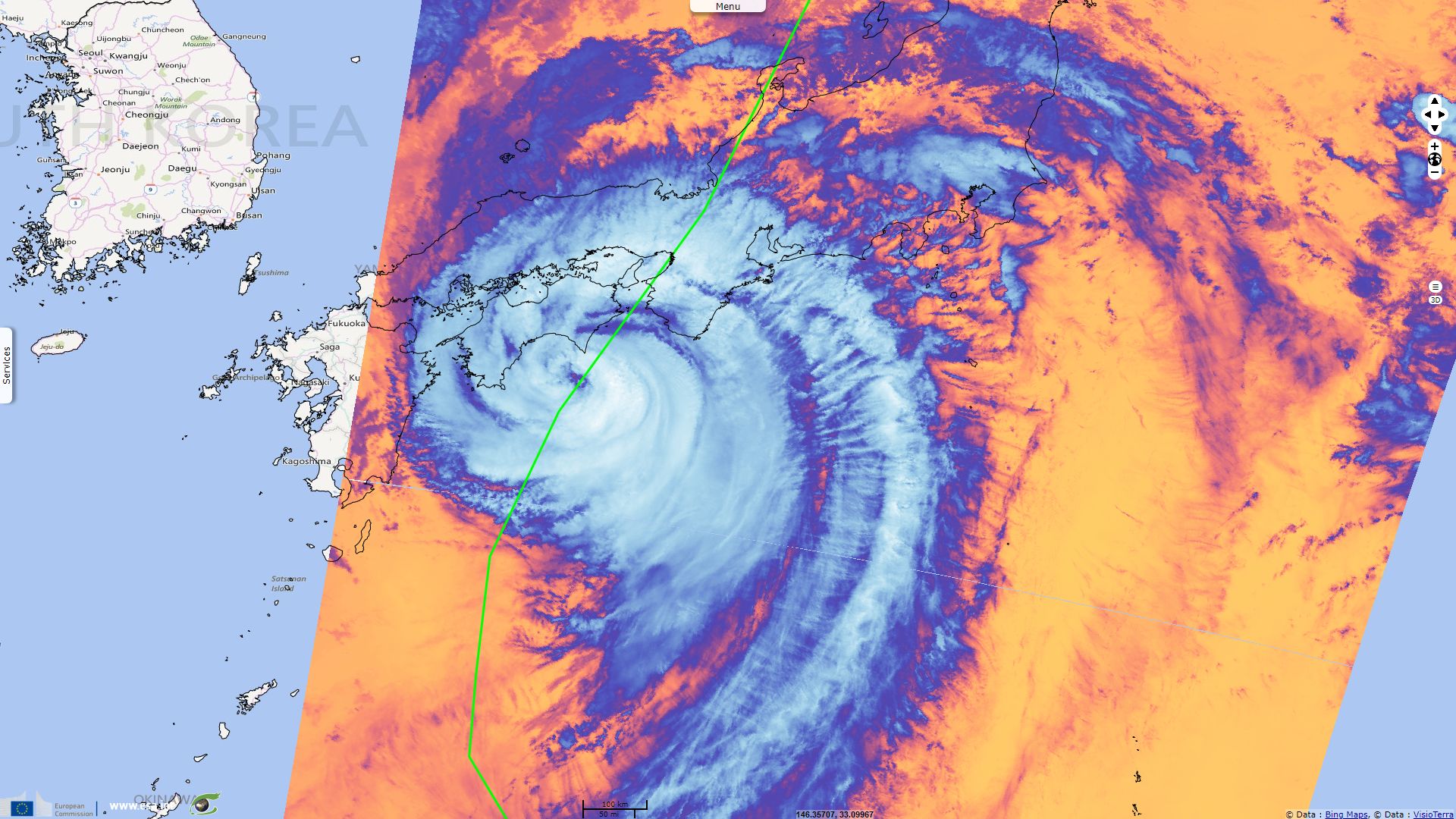
Sentinel-3 SLSTR RBT acquired on 29 August 2018 from 23:46:48 to 23:49:48 UTC
...
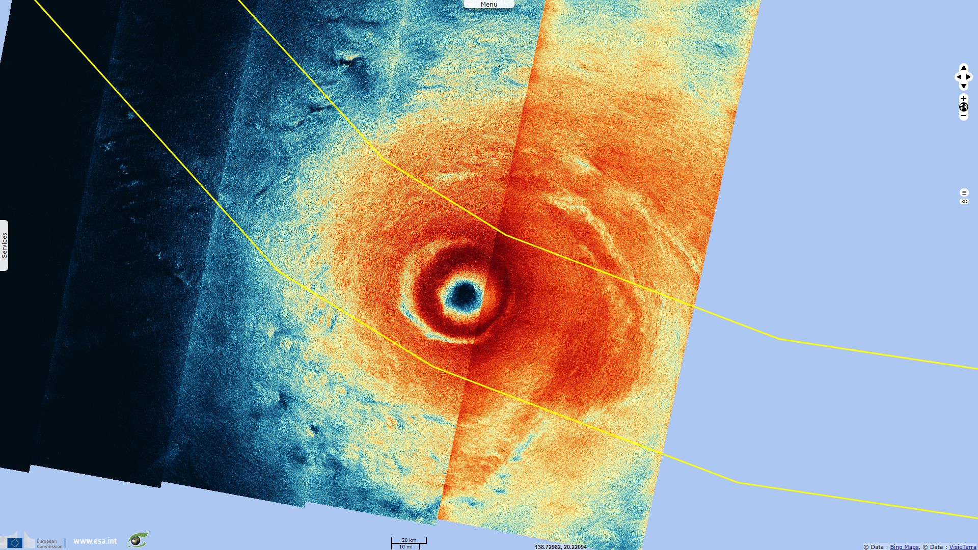
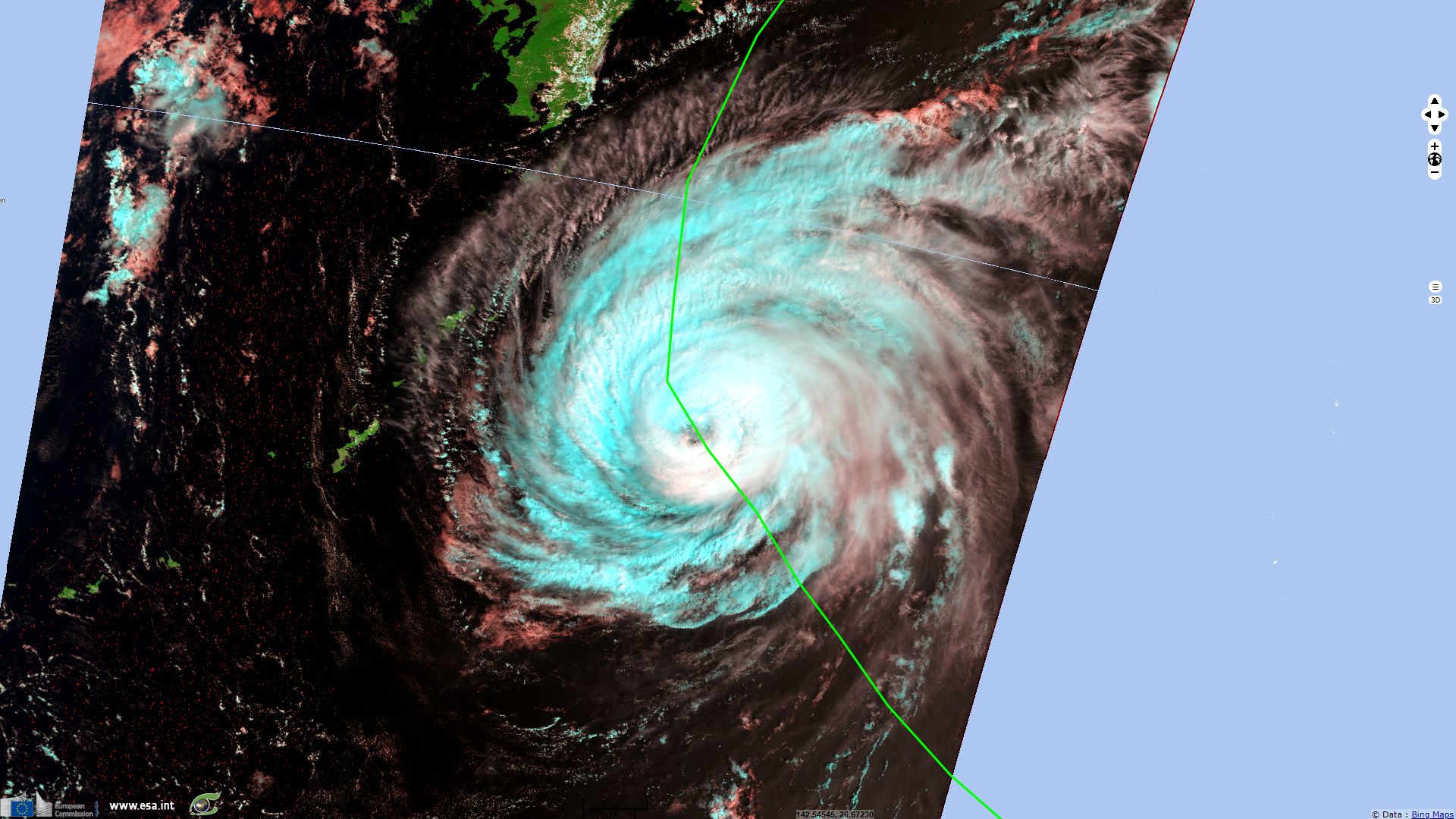
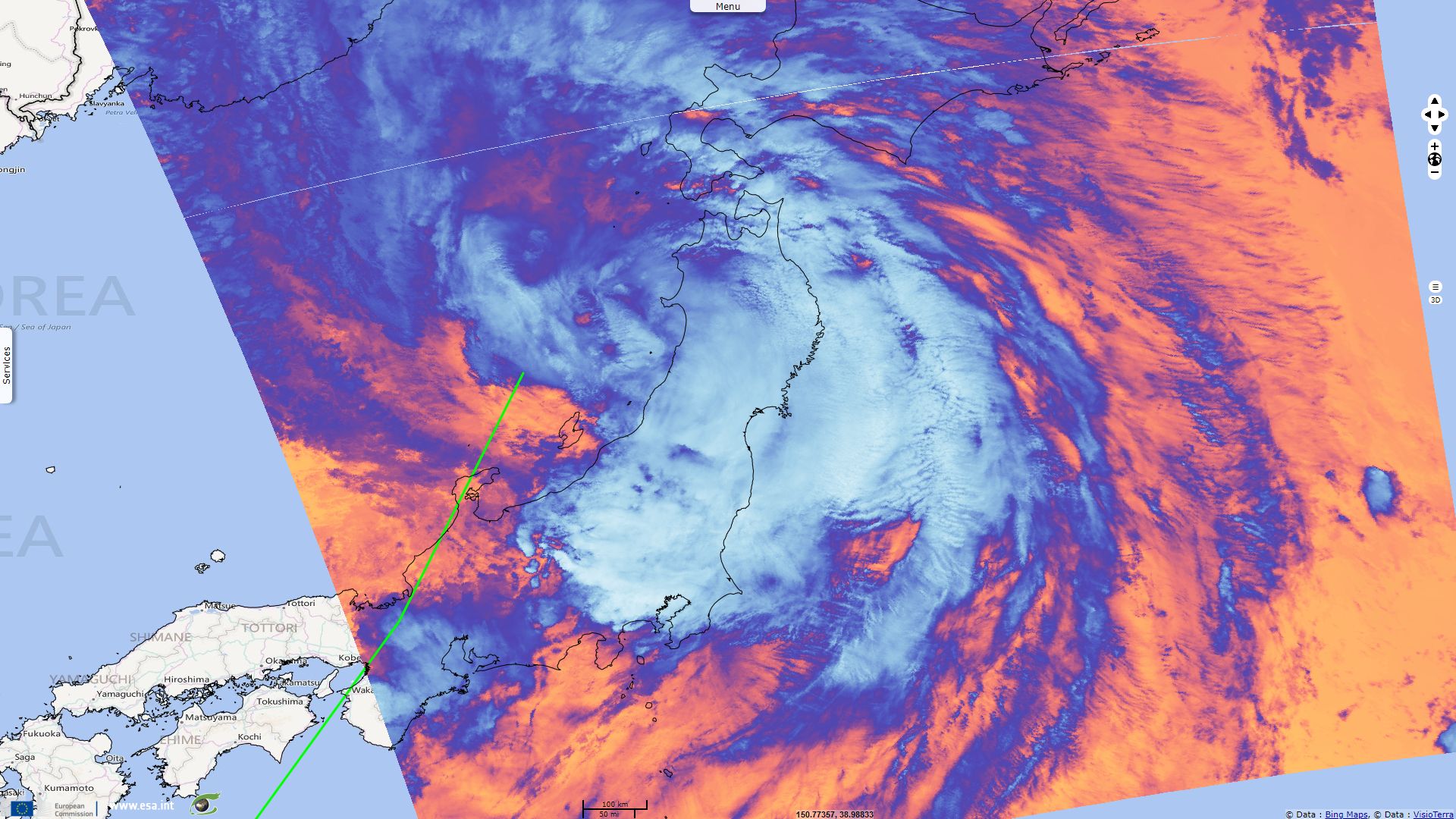
Sentinel-3 SLSTR RBT acquired on 03 September 2018 from 01:21:04 to 01:24:04 & from 12:34:59 to 12:37:59 UTC
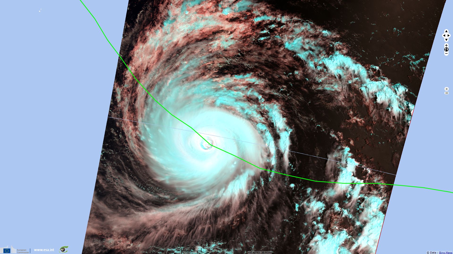
Sentinel-3 SLSTR RBT acquired on 04 September 2018 from 00:54:53 to 00:57:53 & from 12:11:48 to 12:14:48 UTC
Sentinel-3 SLSTR RBT acquired on 29 August 2018 from 23:46:48 to 23:49:48 UTC
...
Sentinel-3 SLSTR RBT acquired on 03 September 2018 from 01:21:04 to 01:24:04 & from 12:34:59 to 12:37:59 UTC
Sentinel-3 SLSTR RBT acquired on 04 September 2018 from 00:54:53 to 00:57:53 & from 12:11:48 to 12:14:48 UTC
Keyword(s): Emergency, natural disaster, atmosphere, storm, climate change, wind, rain, cyclone, hurricane, Japan
According the chart hosted by the Japanese National Institute of Informatics, Jebi reached category-5 typhoon between the 31 August 2018 00:00 and the 01 September 2018 15:00 with a surface pressure as low as 915HPa and 1-mn sustained winds up to 280km/h. In this event sheet, the typhoon track displayed has been provided by the US-run Joint Typhoon Warning Center (JTWC).
In an article released by the Washington Post the 31 August 2018, Ian Livingston wrote: "Super Typhoon Jebi, churning across the western Pacific Ocean, is the strongest storm observed on the planet so far in 2018. Although it has leveled off from its earlier explosive intensification, when its sustained winds reached nearly 180 mph [290kph], Jebi is still an intense Category 5 storm, packing winds of a little over 170 mph (150 knots).
Over the very warm waters of the tropical Pacific Ocean, Jebi is right about where we might expect to see the strongest storm on Earth. Ryan Maue, a meteorologist with Weather.us and an expert on tropical systems, said there are typically several Category 5 storms in any year, and the most likely location for them is either in the western Pacific or the southwestern Pacific, to the east of Australia. Jebi is the fourth Category 5 globally this year, Maue said."
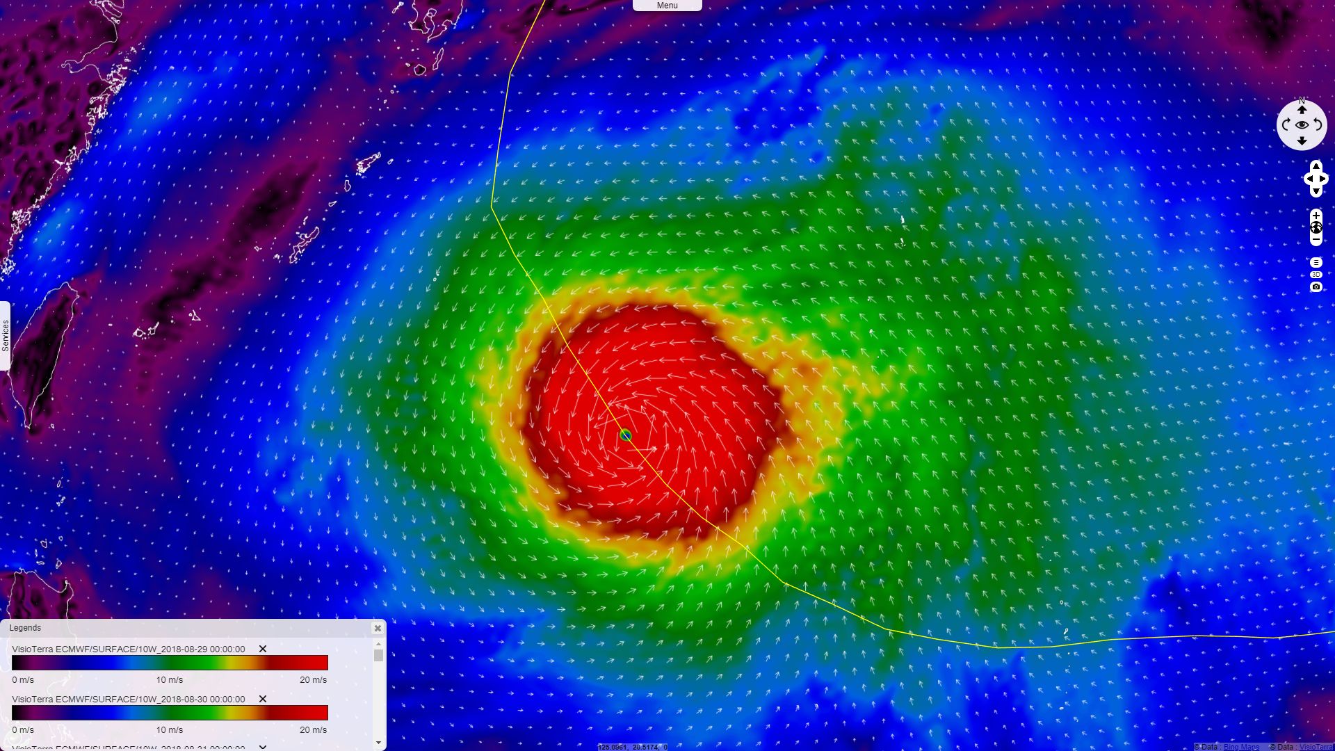
10 meter wind speed 02.09.2018 at 00:00 by ECMWF - 3D animation in VtWeb 3D view in VtWeb
He added: "As Jebi heads north toward Japan, it will run into cooler water and more wind shear, which tend to weaken storms. However, the storm’s fast forward speed and interactions with the jet stream may help it maintain its strength longer than it otherwise would. The European model predicts a relatively intact tropical system just offshore Japan, so this is certainly a system to continue to watch. Japan has already dealt with a few tropical cyclones this year, including Typhoon Prapiroon, which brought historic flooding [shown in a previous Sentinel Vision story] to parts of the country this summer."
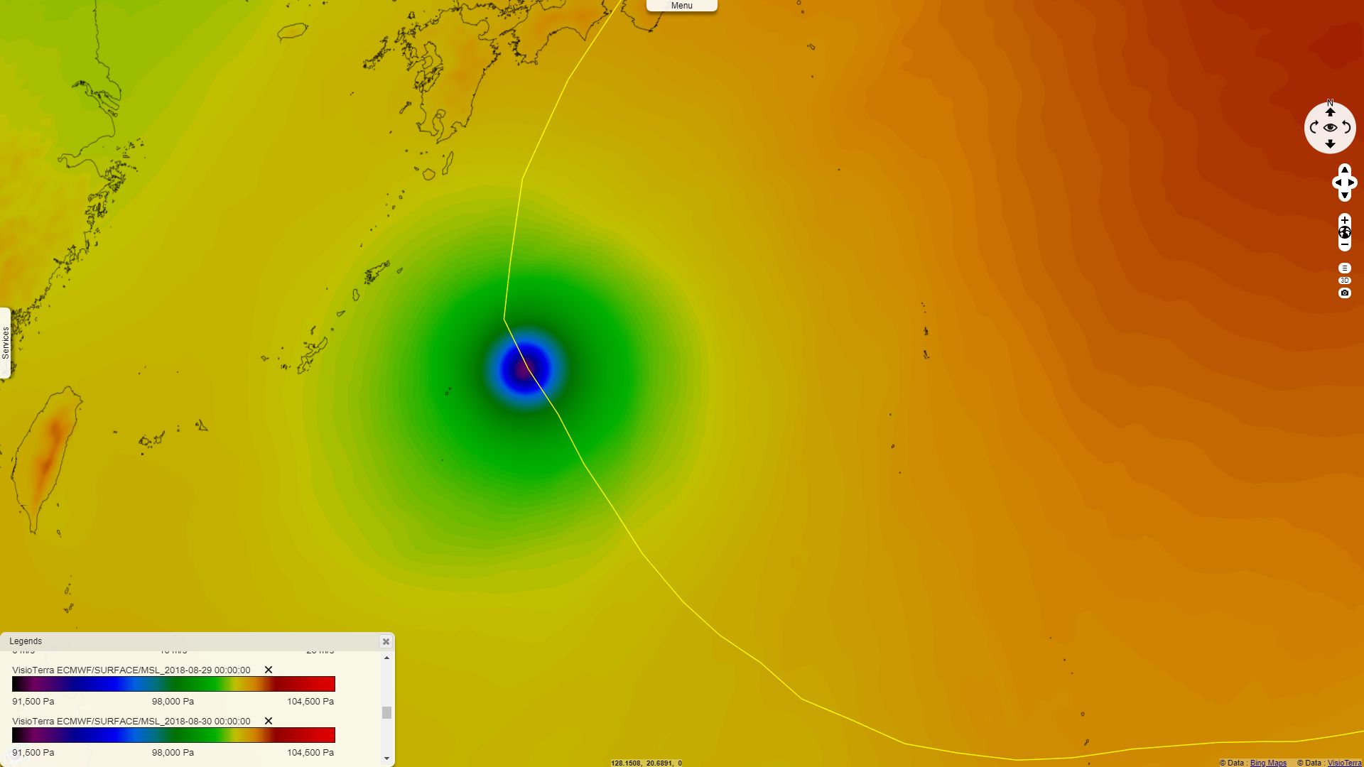
Mean sea level pressure 03.09.2018 at 00:00 by ECMWF - 3D animation in VtWeb 3D view in VtWeb
According to an article published by Al Jazeera the 04 September 2018: "At least nine people have been reported dead and more than 300 injured as Typhoon Jebi pummelled Japan. The reports on Tuesday came after the Japanese government issued evacuation advisories for more than a million people following the storm's landfall on Shikoku, the smallest main island. Jebi - whose name means "swallow" in Korean - raked across the western part of the largest main island, Honshu, near the city of Kobe, several hours later, heading rapidly north. Jebi is considered a category-3 typhoon, out of five, on the Saffir-Simpson scale. According to Kyodo News, it was the strongest typhoon to make landfall in Japan since 1993."
Mainichi Japan evoked an unusual accident cause by Typhoon Jebi: "A tanker smashed into the bridge linking Kansai International Airport with the mainland and left around 3000 people stranded on Tuesday as strong winds and high waves from a powerful typhoon blasted western Japan. The 2,591-ton Houn Maru, which had been anchored in the bay, was swept toward the approximately 3700-meter-long bridge around 1 p.m., damaging the sole gateway by land to the airport." No pollution has been mentionned regarding this accident.

A tanker that crashed into the bridge linking Kansai International Airport with the mainland in Osaka Prefecture is pictured in this photo taken from a Mainichi Shimbun helicopter on Sept. 4, 2018. Source: Mainichi Japan
The freelance geologist David Bressan published an article on the Forbes website that makes a link between the heavy rainfalls and landslides such as those triggered by the earthquake that shaked Hokkaidō the 06 September 2018, two days after the Jebi swept across Japan: "According to the geological map of Japan, the underground in the area is composed of a compex succession of shale, conglomerate, mudstone- and sandstone-layers. The area is also deformed by tectonic movements, part of the Habiu-dome, and crossed by a series of faults. Such poorly consolidated and tectonized sediments, waterlogged and heavy after the rains, easily liquefy and collapse downwards when shacked during an earthquake, taking the forest cover along with it."

Simplified geological map with areas affected by landslides - Source: David Bressan.
The views expressed herein can in no way be taken to reflect the official opinion of the European Space Agency or the European Union.
Contains modified Copernicus Sentinel data 2026, processed by VisioTerra.
Contains modified Copernicus Sentinel data 2026, processed by VisioTerra.
| More on European Commission space: |  |
 |
 |
||||
| More on ESA: | |
|
|
S-1 website | S-2 website | S-3 website | |
| More on Copernicus program: | |
|
|
Scihub portal | Cophub portal | Inthub portal | Colhub portal |
| More on VisioTerra: | |
|
|
Sentinel Vision Portal | Envisat+ERS portal | Swarm+GOCE portal | CryoSat portal |