Tonlé Sap lake in Cambodia
Sentinel-3 OLCI FR acquired on 05 February 2017 at 03:15:26 UTC
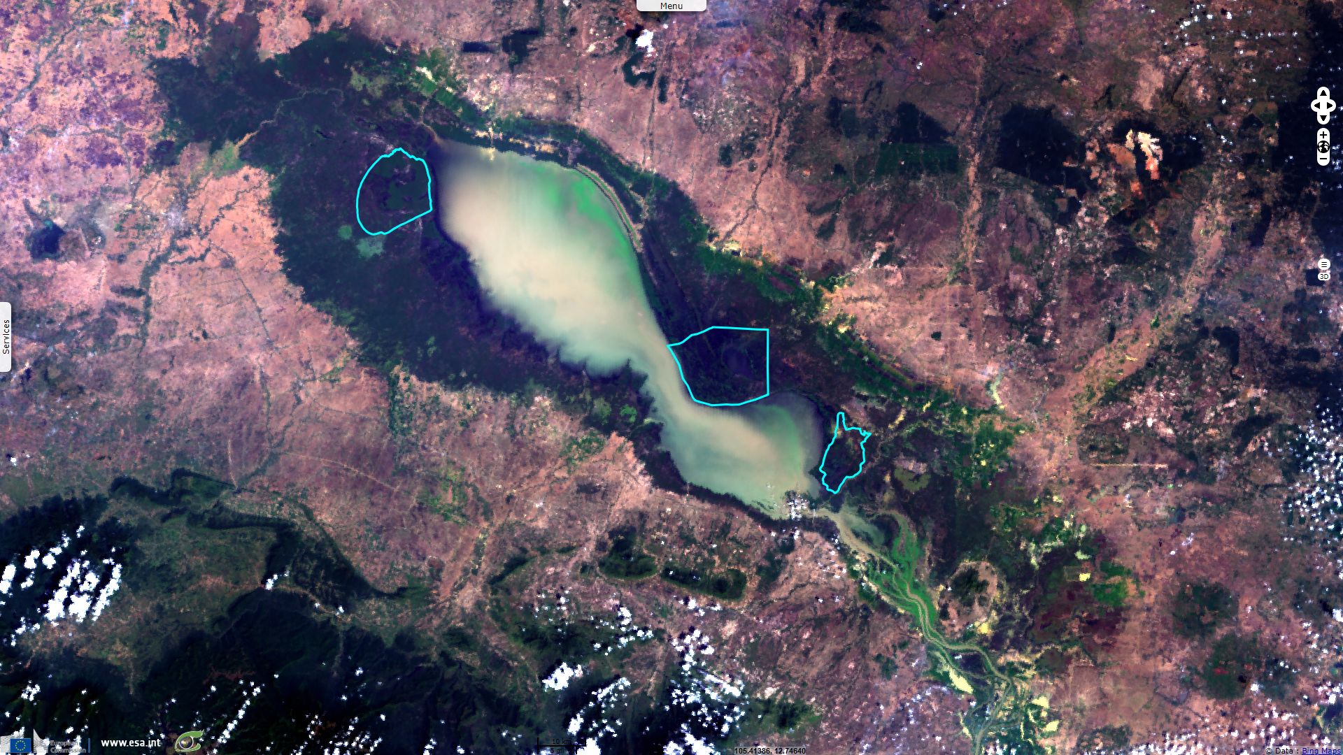
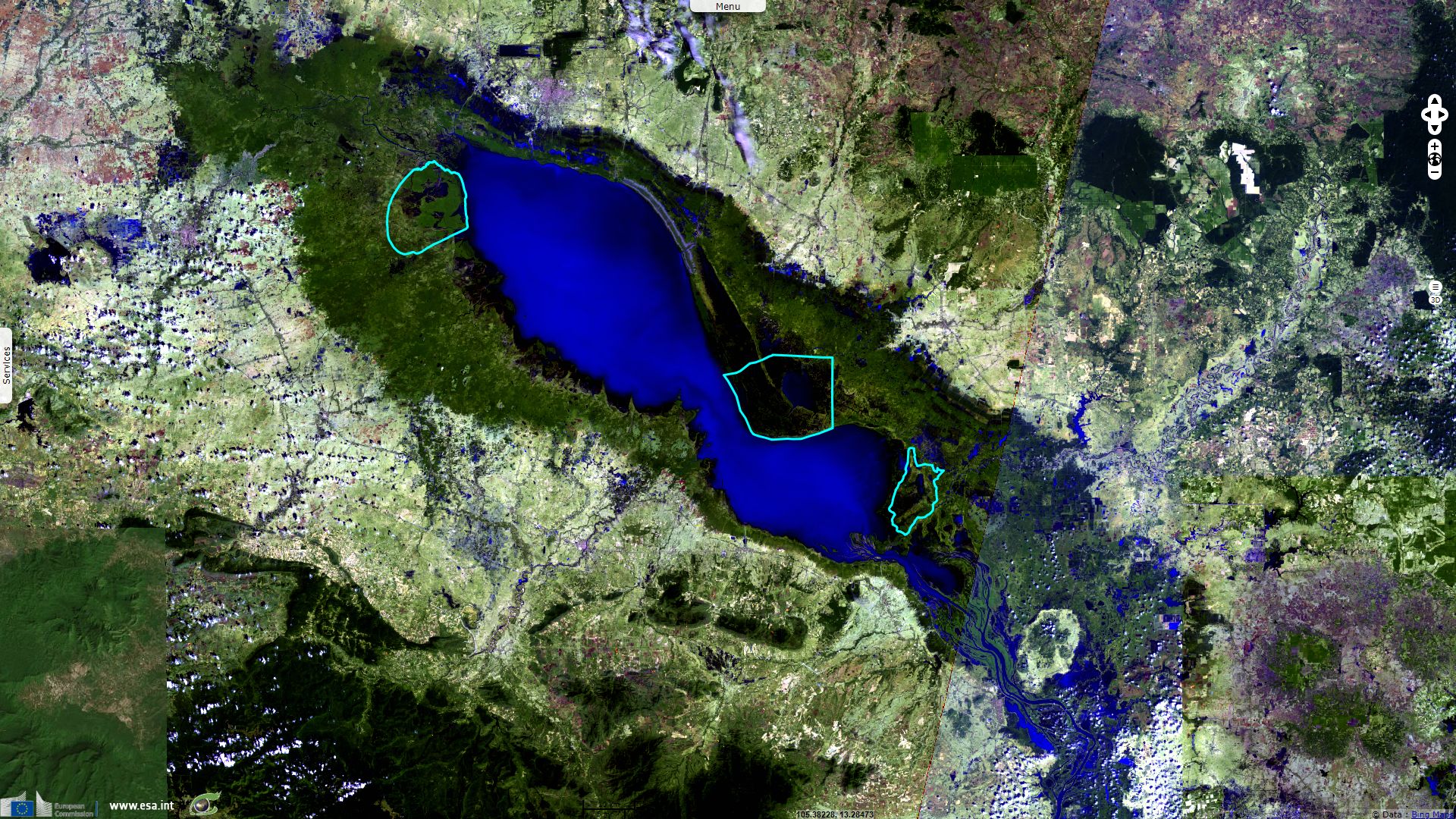
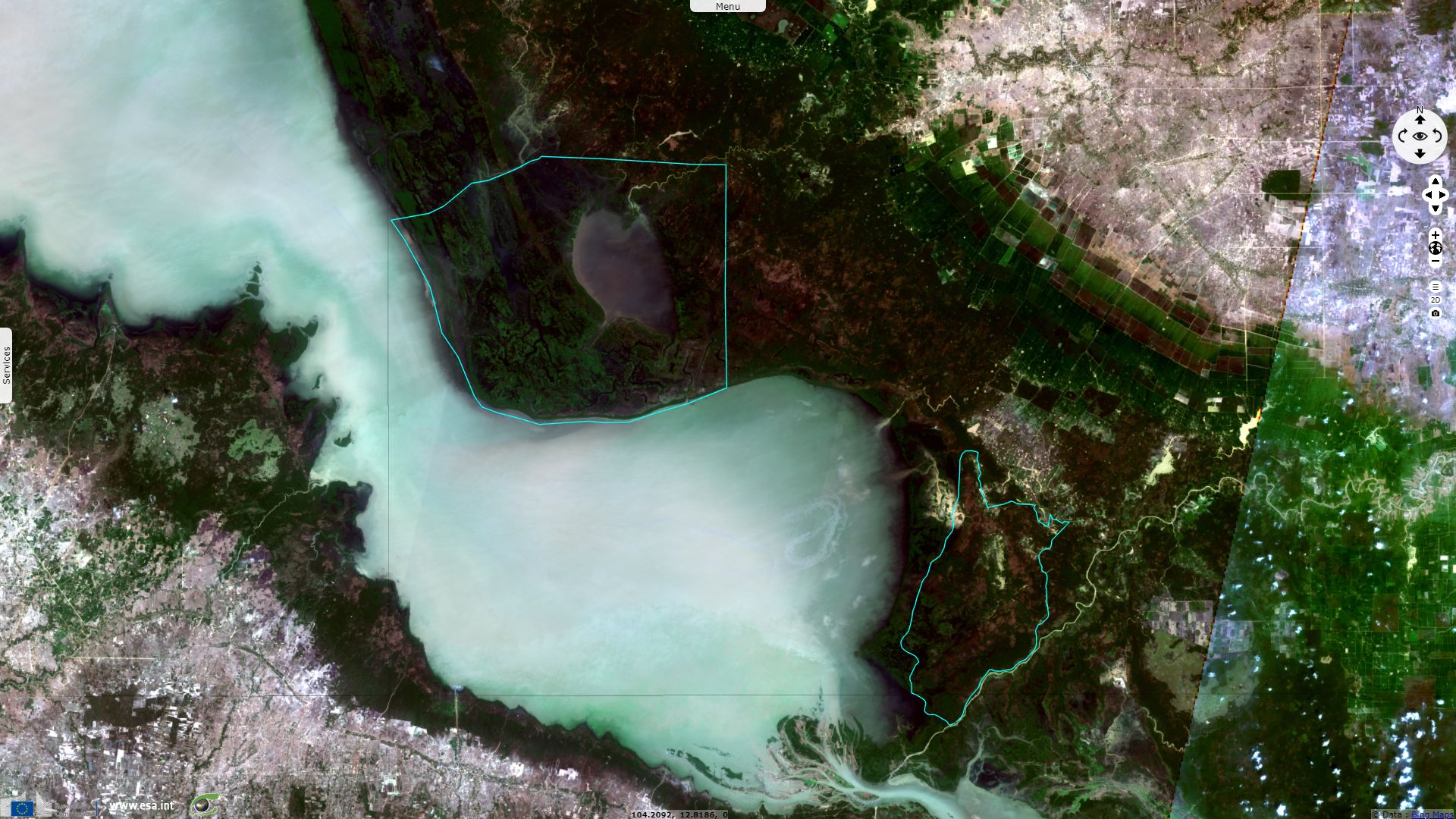
Sentinel-2 MSI acquired on 05 February 2018 at 03:32:41 UTC
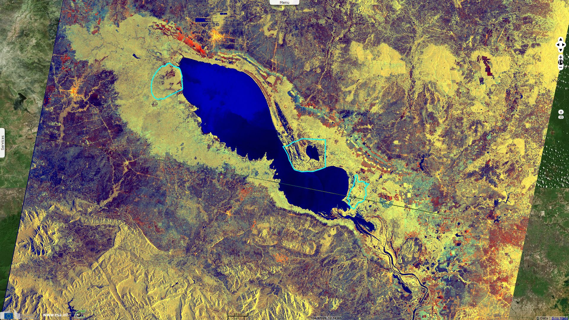
Sentinel-2 MSI acquired on 13 February 2018 at 03:28:29 UTC
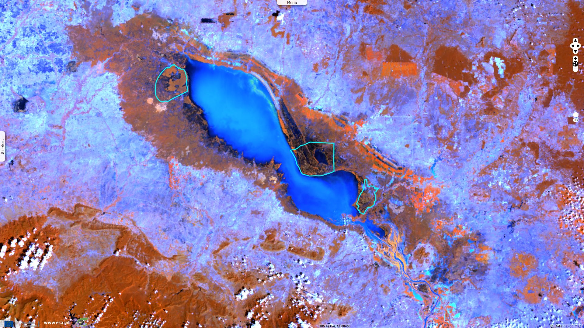
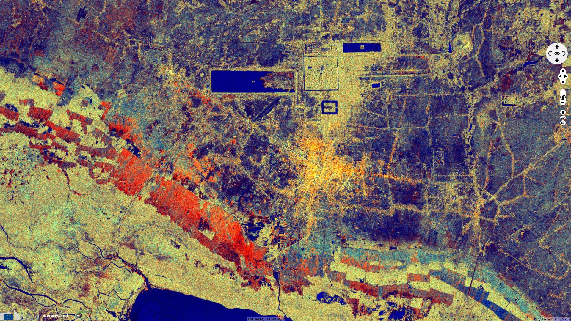
Sentinel-1 CSAR IW acquired on 16 February 2018 from 22:52:44 to 22:53:09 UTC
Sentinel-2 MSI acquired on 05 February 2018 at 03:32:41 UTC
Sentinel-2 MSI acquired on 13 February 2018 at 03:28:29 UTC
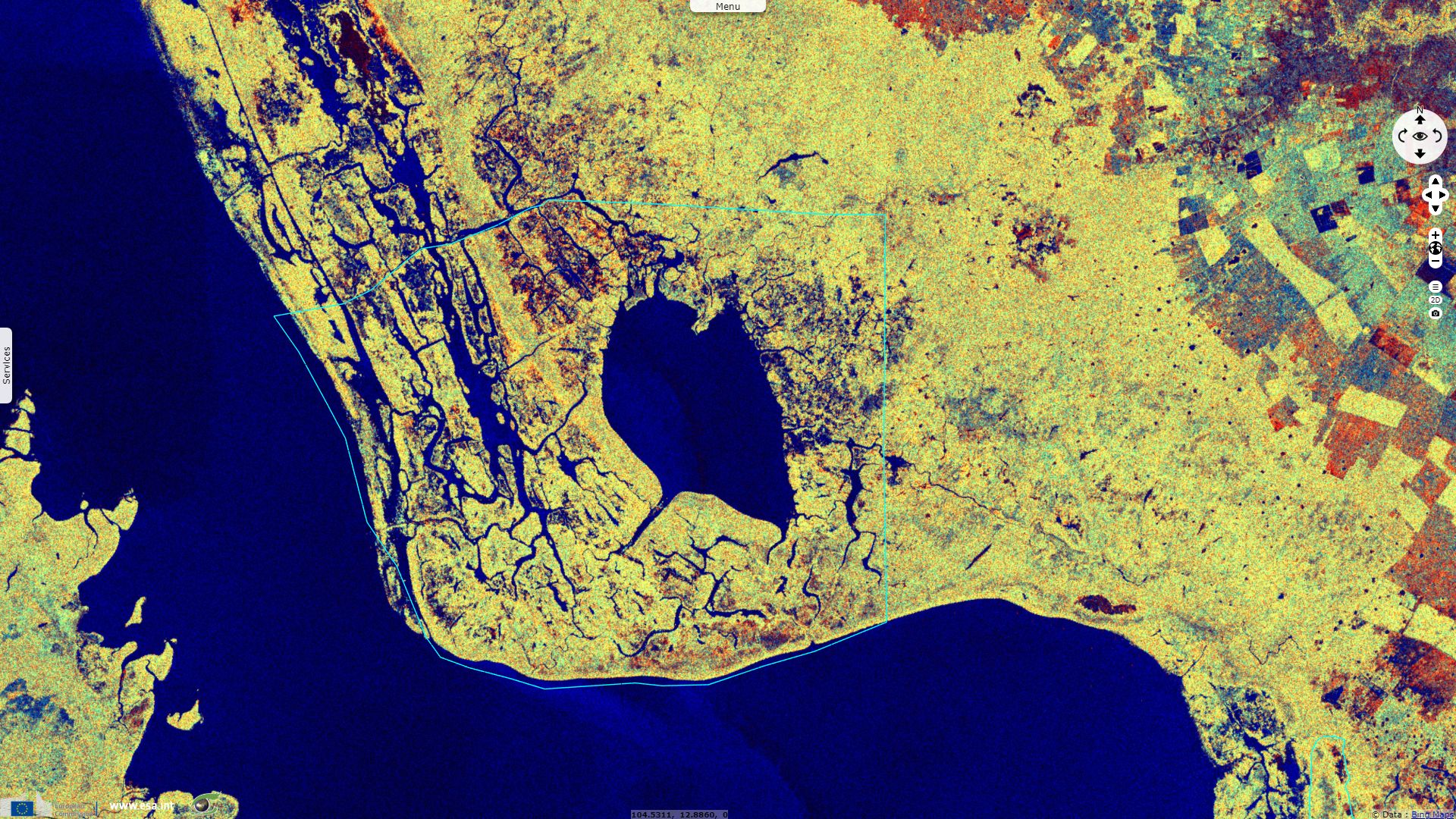
Sentinel-1 CSAR IW acquired on 16 February 2018 from 22:52:44 to 22:53:09 UTC
Keyword(s): Hydrology, lake, river, wetland, flooding, biodiversity, UNESCO biosphere reserve, Ramsar site, UNESCO World Heritage, canals, reservoir, food security, fishing, agriculture, Cambodia
Tonlé Sap is "the largest freshwater lake in Southeast Asia, it contains an exceptional large variety of interconnected eco-regions with a high degree of biodiversity and is therefore a biodiversity hotspot. It was designated a UNESCO biosphere reserve in 1997", its Wikipedia sheet says.
Tonlé Sap and Mekong River "form the central part of a complex hydrological system, in the 12876 km2 Cambodian floodplain covered with a mosaic of natural and agricultural habitats that the Mekong replenishes with water and sediments annually. The central plain formation is the result of millions of years of Mekong alluvial deposition and discharge. From a geological perspective, the Tonlé Sap Lake and Tonlé Sap River are a current freeze-frame representation of the slowly, but ever shifting lower Mekong basin. Annual fluctuation of the Mekong's water volume, supplemented by the Asian monsoon regime causes a unique flow reversal of the Tonle Sap River."
"The Tonlé Sap Lake occupies a geological depression (the lowest lying area) of the vast alluvial and lacustrine floodplain in the lower Mekong basin, which had been induced by the collision of the Indian Plate with the Eurasian Plate. The lake's size, length and water volume varies considerably over the course of a year from an area of around 2500 km2, a volume of 1 km3 and a length of 160 km at the end of the dry season in late-April to an area of up to 16,000 km2, a volume of 80 km3 and a length of 250 km as the Mekong maximum and the peak of the southwest monsoon's precipitation culminate in September and early-October."
"As one of the world's most varied and productive ecosystems the region has always been of central importance for Cambodia's food supply. It proved capable of largely maintaining the Angkorean civilization, the largest pre-industrial settlement complex in world history. Directly and indirectly it affects the livelihood of large numbers of a predominantly rural population. Due to ineffective administration and widespread indifference towards environmental issues, the lake and its surrounding ecosystem is coming under increasing pressure from over-exploitation and habitat degradation, fragmentation, and loss".
"A belt of freshwater mangroves known as the "flooded forest" surrounds the lake. The floodplains in turn are surrounded by low hills, covered with evergreen or deciduous seasonal tropical forest . The eco-region consists of a mosaic of habitats for a great number of species. The forest gradually yields to bushes and finally grassland with increasing distance from the lake. On higher quality soils or at higher elevation, areas of mixed deciduous forest and semi-evergreen forests occur. This variety of vegetation types accounts for the quantity and diversity of species of the Great Lake ecosystem."
"Inflow starts in May or June with maximum rates of flow of around 10000 m3/s by late-August and ends in October or November, amplified by precipitation of the annual monsoon. In November the lake reaches its maximum size. The annual monsoon coincides to cease around this time of the year. As the Mekong River is at its minimum flow around this time of the year and its water level falls deeper than the Tonle Sap Lake, the Tonle Sap River and surrounding wetlands, waters of the lake's basin drains via the Tonle Sap River into the Mekong.
As a result the Tonle Sap River (length around 115 km) flows six months a year southeast (Mekong) to northwest (lake) and six months a year in the opposite direction. The mean annual reverse flow volume in the Tonle Sap is 30 km3, or about half of the maximum lake volume. A further 10 percent is estimated to enter the system by overland flow from the Mekong. The Mekong branches off into several arms near Phnom Penh and reaches Vietnamese territory south of Koh Thom and Loek Daek Districts of Kandal Province."
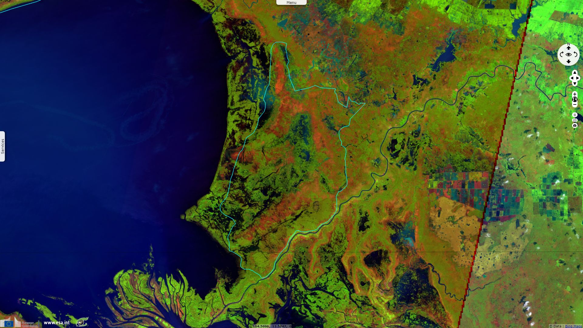
According to its information sheet, Stung Sen "is located along the south-eastern edge of the Tonle Sap Great Lake, and mainly comprises seasonally flooded freshwater swamp forests. Along the Stung Sen River, there are gallery forests, low-stature shrub land, inundated and submerged trees, and extensive mats of herbaceous and aquatic vegetation which provide habitat for a variety of species. The vegetation of Stung Sen is strongly influenced by the exchange of water between the Mekong River, the Stung Sen River and the Great Lake, and the area is subject to an annual flooding cycle that makes it extremely fertile."
Boeng Chhmar and Associated River System and Floodplain is characterised as: "a lake formed amid inundated forest in the northeast fringe of Tonle Sap lake, consisting of permanent open water surrounded by a creek system and flooded forest which becomes one with Tonle Sap in the wet season. The site is a good example of near-natural wetlands that play a substantial hydrological and biological role in the natural functioning of two major rivers, Stoeng Stoung and Stoeng Chikreng."
The sheet describing Prek Toal Ramsar Site indicates: "The Prek Toal Ramsar Site includes some of the most pristine floodplains in the Tonle Sap Biosphere Reserve in Cambodia. During the dry seasons, the Site is dry and covered mostly by freshwater swamp forests, but it floods annually, with the water depth reaching up to eight metres. Prek Toal is at the north-west upstream end of Tonle Sap Lake and the rise and fall of the lake’s waters play a vital role in maintaining its biological wealth. The forests trap large quantities of sediment, and the nutrients deposited stimulate the growth of plants and fish which support the high numbers of waterbirds and other wildlife at the Site."
The water management of Tonle Sap via a huge system of canals of reservoir was a key to the success of the Khmer Empire for six centuries and possibly to its demise. It prevented floods, provided a communication road, allowed fishing & fed crops. Its capital Angkor is a UNESCO World Heritage site described as: "one of the most important archaeological sites of Southeast Asia. It extends over approximately 400km² and consists of scores of temples, hydraulic structures (basins, dykes, reservoirs, canals) as well as communication routes. For several centuries Angkor, was the centre of the Khmer Kingdom. With impressive monuments, several different ancient urban plans and large water reservoirs, the site is a unique concentration of features testifying to an exceptional civilization."
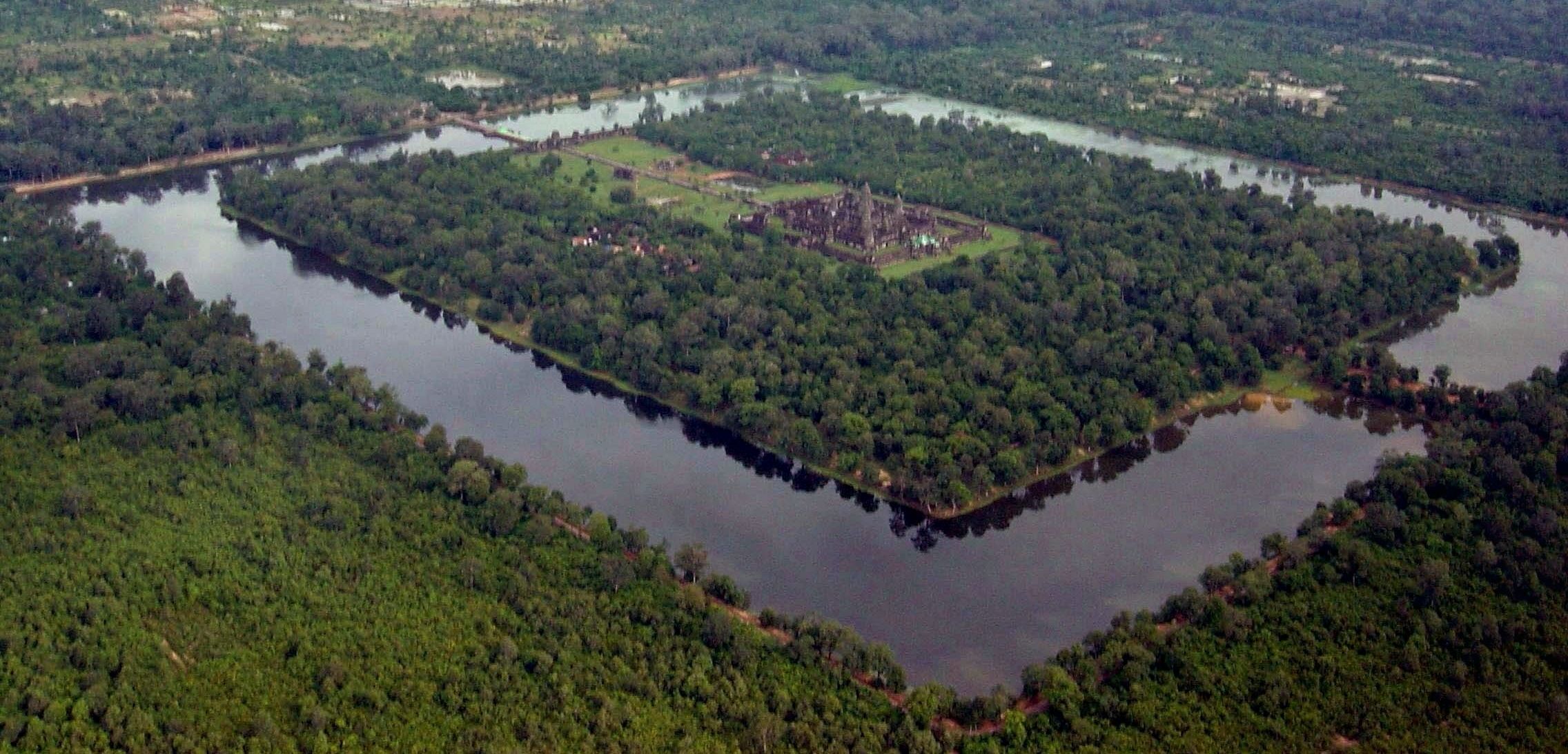
Angkor Wat seen from helicopter - Source: Charles J Sharp
The views expressed herein can in no way be taken to reflect the official opinion of the European Space Agency or the European Union.
Contains modified Copernicus Sentinel data 2026, processed by VisioTerra.
Contains modified Copernicus Sentinel data 2026, processed by VisioTerra.
| More on European Commission space: |  |
 |
 |
||||
| More on ESA: | |
|
|
S-1 website | S-2 website | S-3 website | |
| More on Copernicus program: | |
|
|
Scihub portal | Cophub portal | Inthub portal | Colhub portal |
| More on VisioTerra: | |
|
|
Sentinel Vision Portal | Envisat+ERS portal | Swarm+GOCE portal | CryoSat portal |