World Day to Combat Desertification and Drought - Shelterbelts in Russia and Kazakhstan
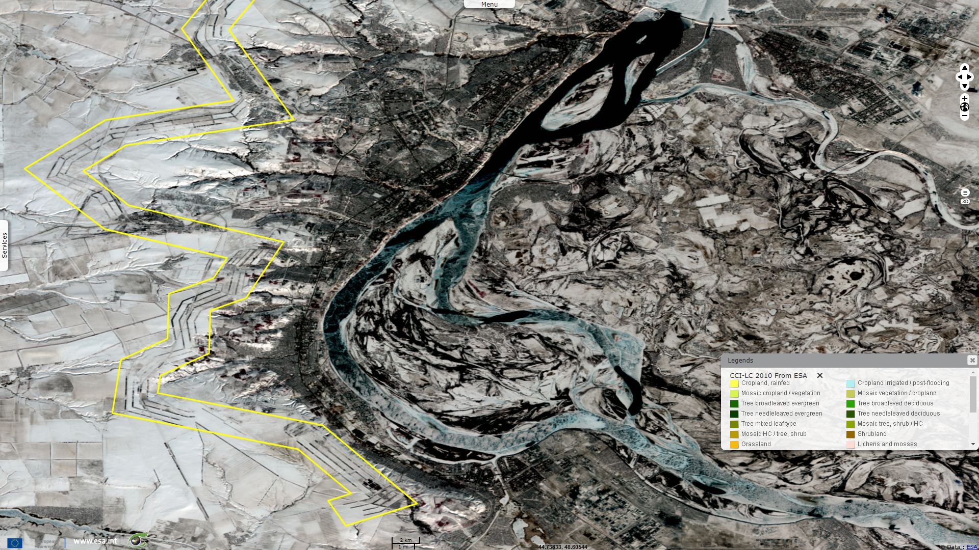
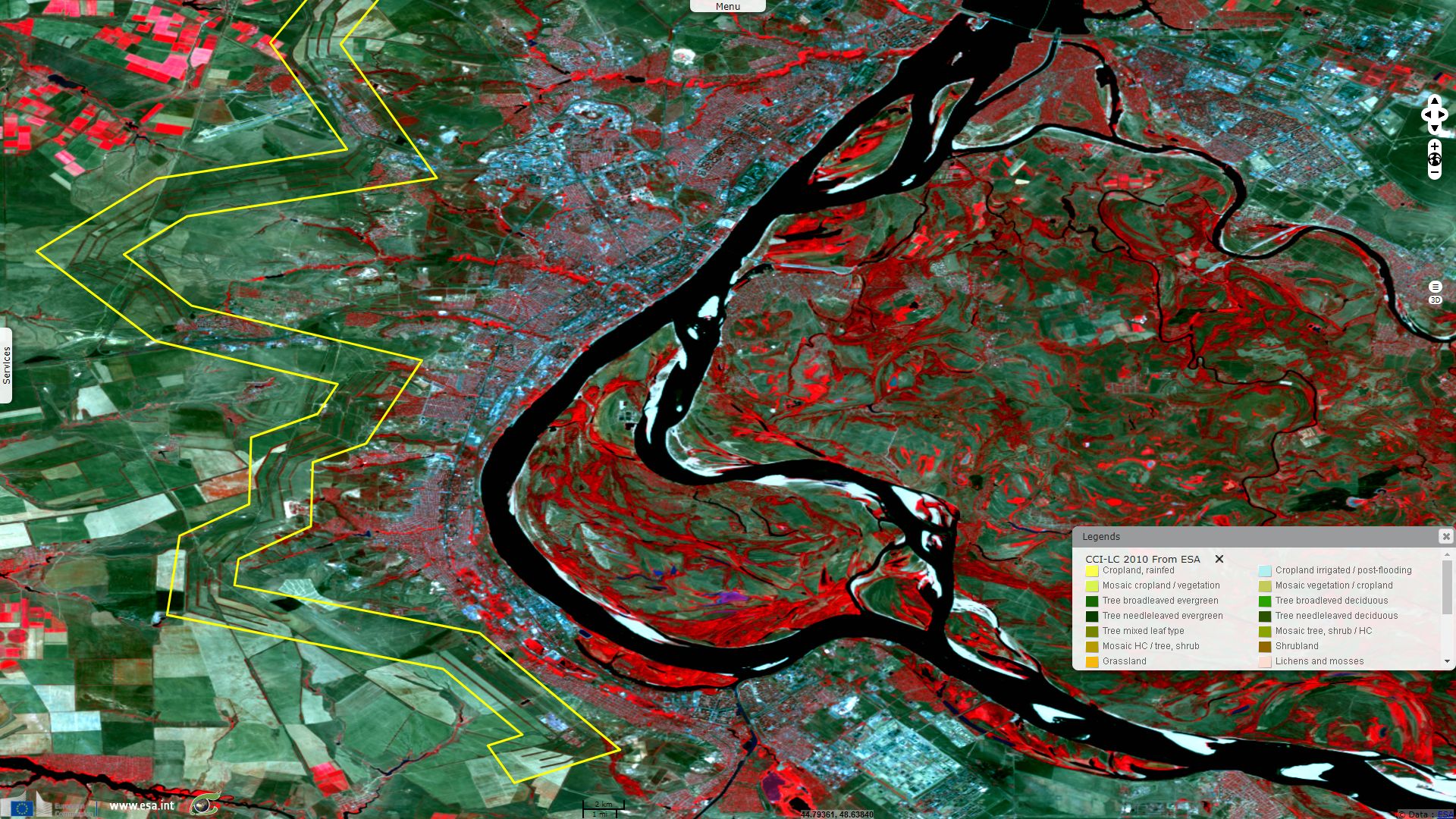
Sentinel-2 MSI acquired on 24 August 2015 at 08:00:16 UTC
...
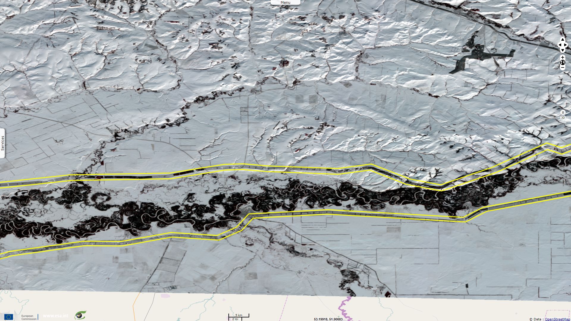
Sentinel-2 MSI acquired on 14 March 2017 at 07:16:41 UTC
...
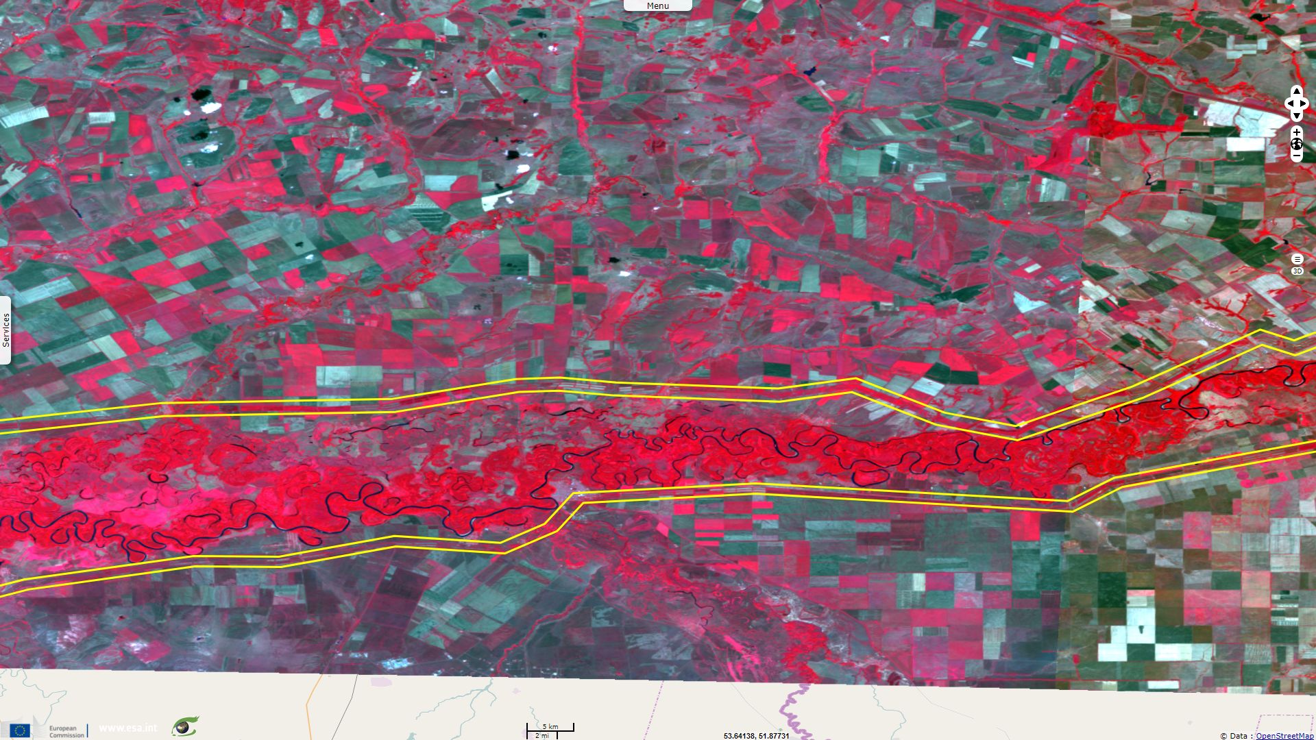
Sentinel-2 MSI acquired on 14 March 2017 at 07:16:41 UTC
Keyword(s): land, forestry, afforestation, agriculture, desertification, drought, flood, erosion, wind, windbreak, shelterbelt, soil moisture, fertility, Ural, Volga, Caspian Sea, Russia, Kazakhstan
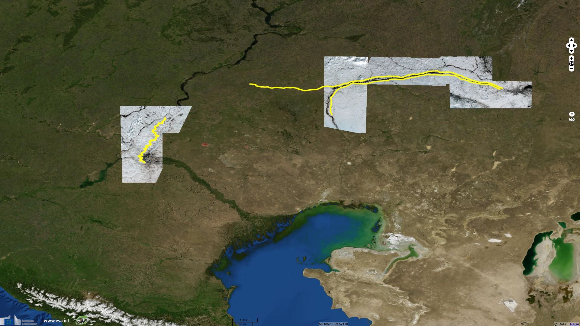
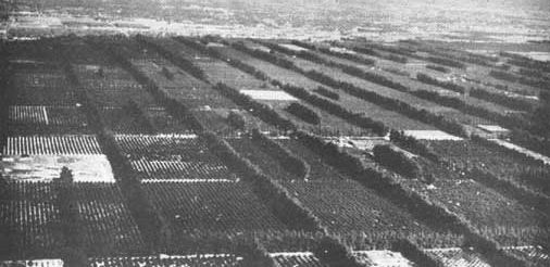
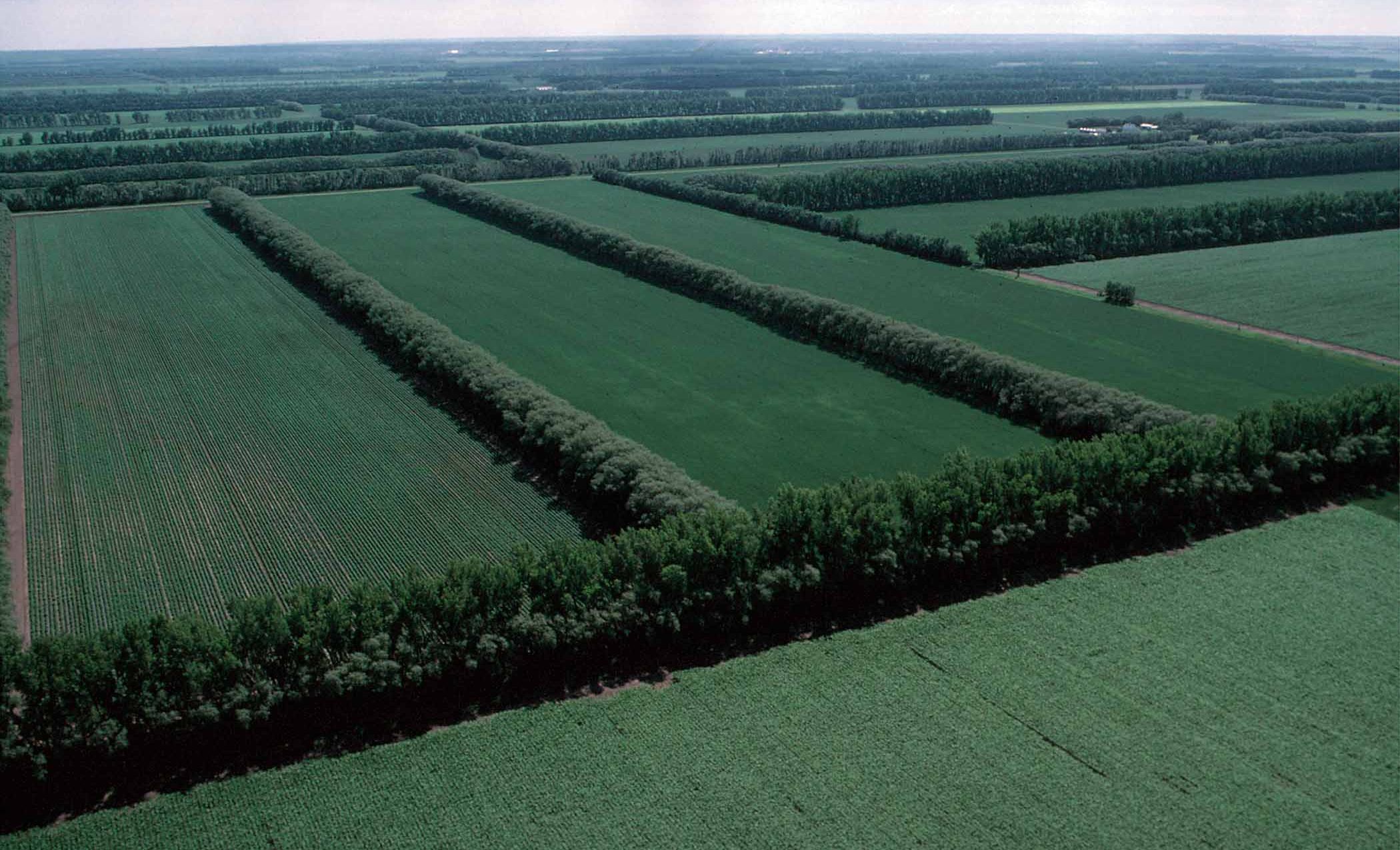
Several shelterbelts were built in USSR from 1949 to 1965 to protect cropland from droughts, dust, from soil erosion by wind or water and thus from desertification.
All did not survive to this day, the belts between Kamishin and Volgograd and between Mt Vishnevaia and Caspian Sea remain very visible from space. While larger in scale, the Great Plains Shelterbelt built in the USA from 1935 to 1942 do not bear such striking patterns.
In Unasylva, A Review of Forestry and Forest Products - Vol. 3, No. 2 released in March-April 1949, Raphael Zon published the article The Volga valley authority - the New fifteen-year conservation plan of the Ussr, he wrote "No region can sustain for long a stable productive agriculture if its forests are allowed to deteriorate and become waste land. Neglect the forests and a Pandora's box of disastrous effects is opened. Snow and rainfall permeate the ground under the protection of dense forest cover and enrich the subsoil with moisture; without forest protection they run off as flood waters damaging agricultural land, impeding navigation, causing property damage, and endangering human life. Poor sandy soils when overgrazed or improperly cultivated become blowing sands encroaching upon good agricultural land. As a result of excessive erosion by wind and water, deep gullies scar the land; the ground waters sink lower. Deprived of the moderating influence of the forest, the land is exposed to the extreme fluctuations of the weather. Droughts occur more frequently. The whole environment becomes less hospitable to human life. There are, unfortunately, only too many such degraded regions throughout the world bearing tragic testimony to the folly of man."
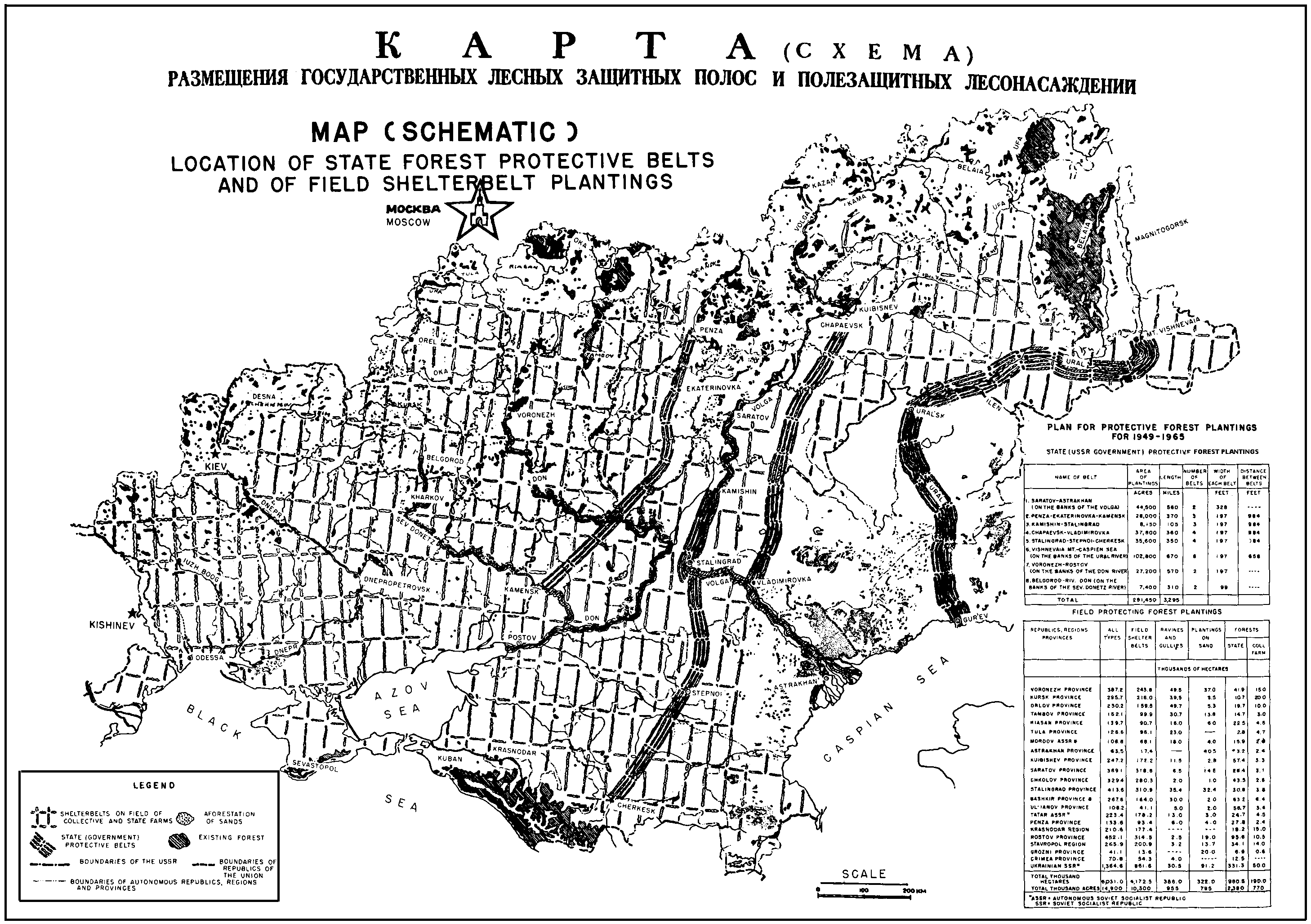
In A Little Corner of Freedom - Russian Nature Protection from Stalin to Gorbachev, Douglas R. Weiner wrote "Among the key goals of the "Stalin Plan" were "overcoming the lethal influence of sukhoveis (arched eastern winds) on agricultural crops" as well as implementing soil conservation in the Povolzh'e, North Caucasus, and Black Earth regions. Over a fifteen-year period ending in 1965, it was intended to establish seven large-scale shelter belts, some of which were almost 1,000 kilometers long. Responsibility rested with the USSR Ministry of Forestry. By 1965 the area under shelter belts was projected to be 5,709,000 hectares."
Raphael Zon explained "The purpose of these forest zones is to break the force of the hot dry winds from the deserts, to prevent wind and water erosion of the fertile soils of the Volga area and Northern Caucasus and of the black soils of Central Russia, to improve moisture conditions, and generally to temper the climate of the region. The vast undertaking is to be completed by 1965.
[...]
Because of their proximity to the Kizel Kum and Kara Kum deserts and the prevailing dry easterly and southeasterly winds that blow from the direction of those deserts, the whole region is exposed to periodic droughts
Raphael Zon added, "These zones, distinct from shelterbelts around cultivated fields and orchards, are to be established on divides, ridges, slopes of ravines, river banks, and lake shores, and around ponds and reservoirs. The greatest project of this nature is to be the planting by the Ministry of Forestry of the Federated Republic of eight long, continuous protection zones oriented at right angles to the prevailing dry southeasterly and easterly winds. Each of these eight protection forest zones is to consist of 1 to 6 parallel narrow belts of trees, each belt from 30 to 60 meters wide, with a distance of about 300 meters between the belts. The total length of all eight protection zones will be over 5,300 kilometers."
The views expressed herein can in no way be taken to reflect the official opinion of the European Space Agency or the European Union.
Contains modified Copernicus Sentinel data 2026, processed by VisioTerra.
Contains modified Copernicus Sentinel data 2026, processed by VisioTerra.
| More on European Commission space: |  |
 |
 |
||||
| More on ESA: | |
|
|
S-1 website | S-2 website | S-3 website | |
| More on Copernicus program: | |
|
|
Scihub portal | Cophub portal | Inthub portal | Colhub portal |
| More on VisioTerra: | |
|
|
Sentinel Vision Portal | Envisat+ERS portal | Swarm+GOCE portal | CryoSat portal |