Marvels of ancient civilisations in Iran
Sentinel-3 OLCI FR acquired on 31 May 2017 from 06:50:09 to 06:53:09 UTC
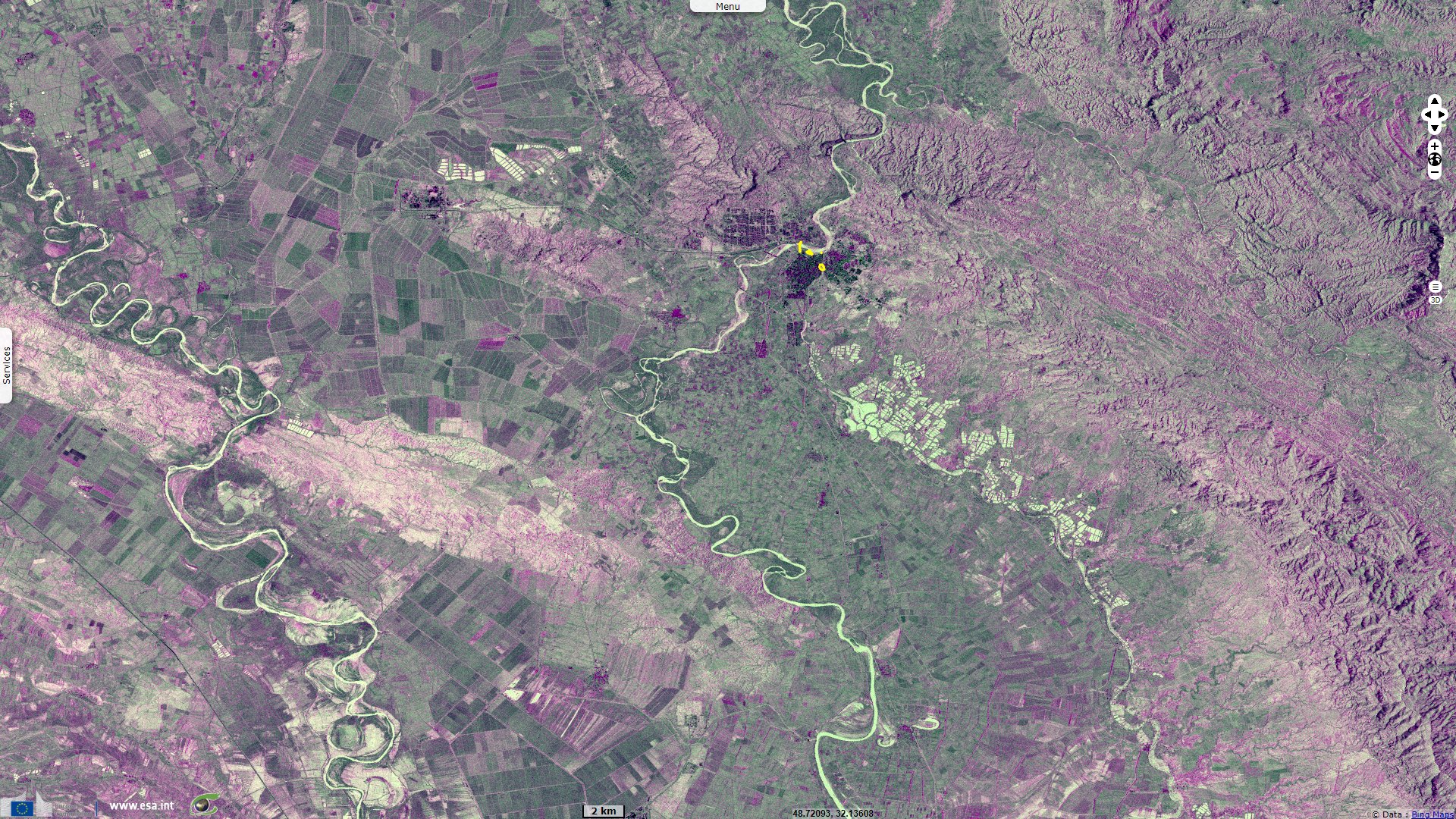
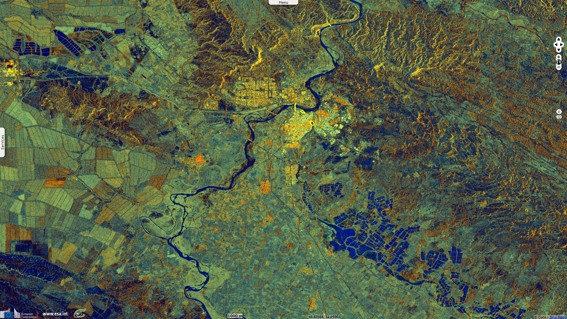
Sentinel-1 CSAR IW acquired on 14 April, 26 April & 08 May 2019 from 02:46:06 to 02:46:31 UTC
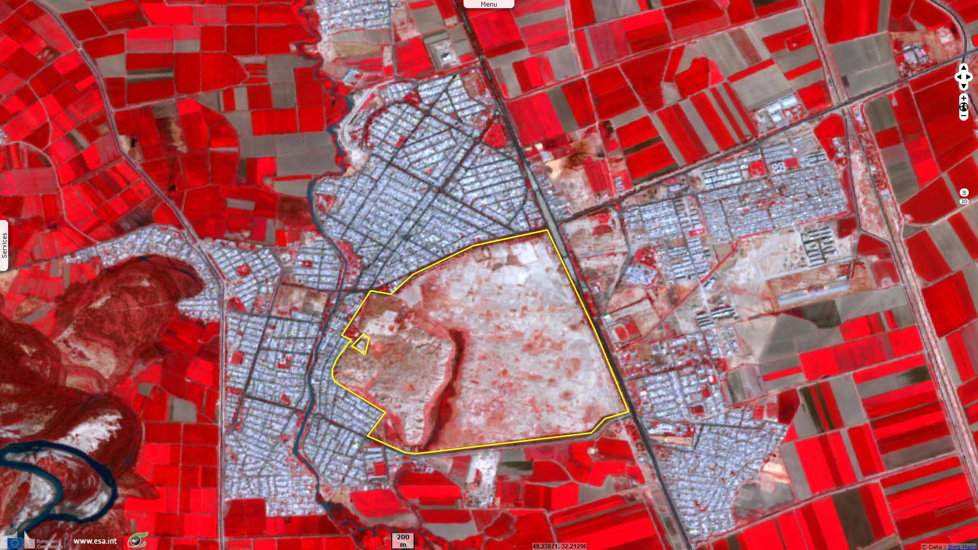
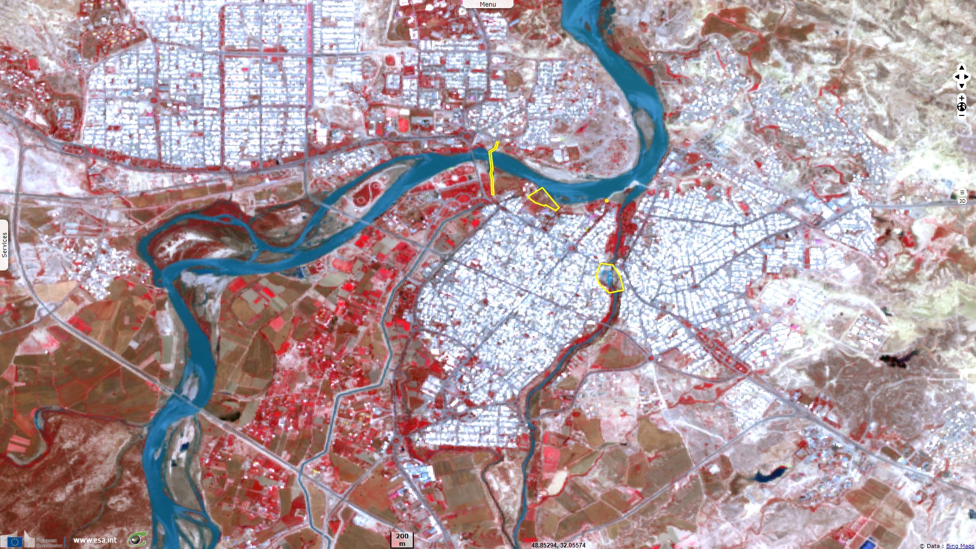
Sentinel-2 MSI acquired on 01 May 2019 at 07:26:29 UTC
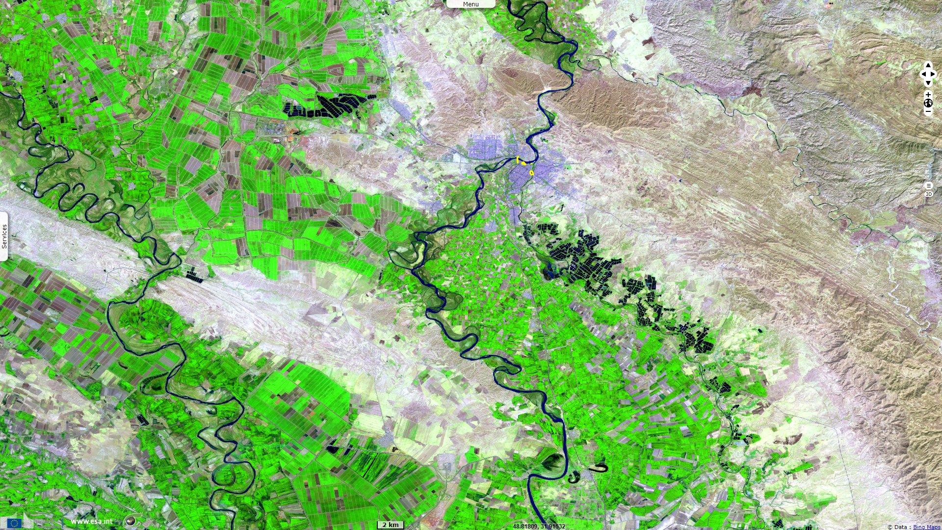
Sentinel-2 MSI acquired on 28 September 2019 at 07:26:59 UTC
Sentinel-1 CSAR IW acquired on 14 April, 26 April & 08 May 2019 from 02:46:06 to 02:46:31 UTC
Sentinel-2 MSI acquired on 01 May 2019 at 07:26:29 UTC
Sentinel-2 MSI acquired on 28 September 2019 at 07:26:59 UTC
Keyword(s): Urban, land, river, plain, capital city, dam, canal, irrigated agriculture, infrastructure, UNESCO World Heritage, Iran
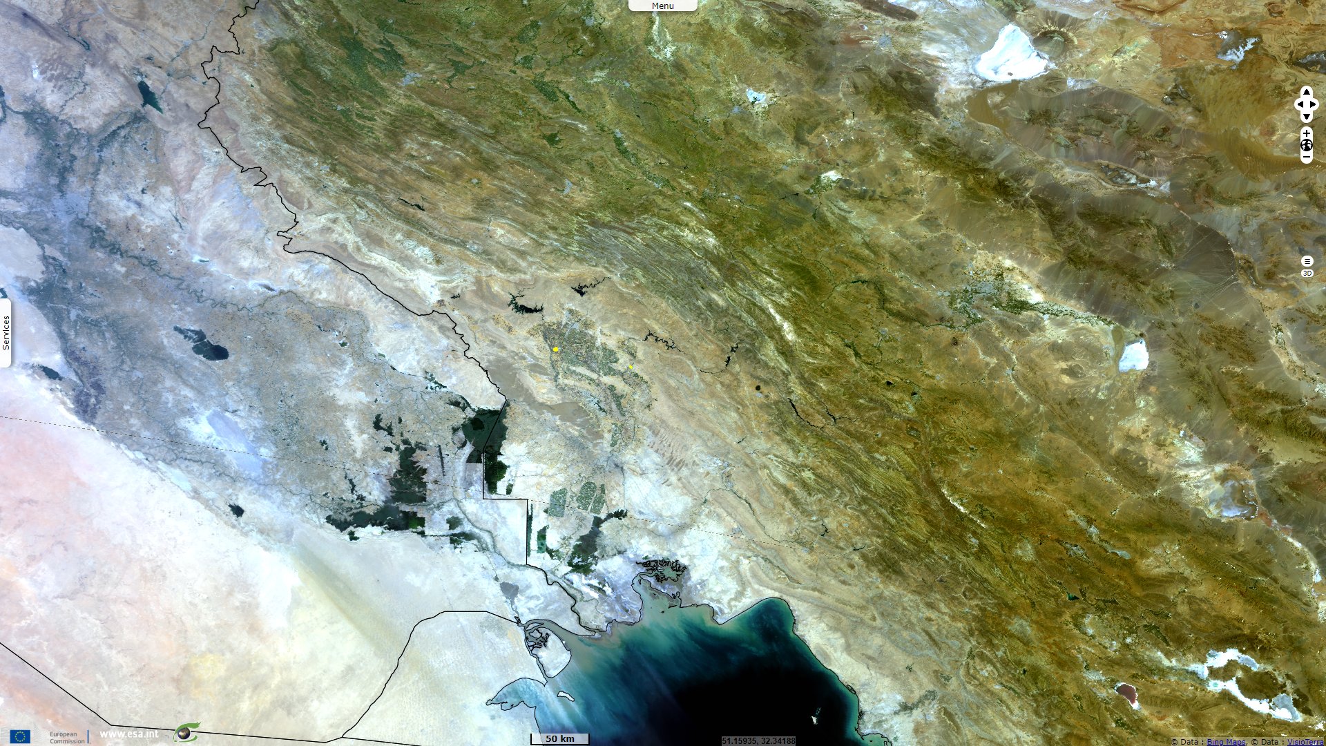
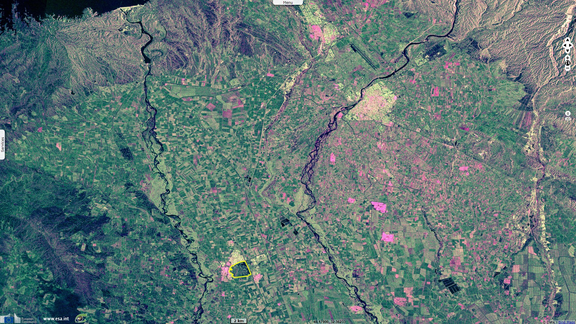
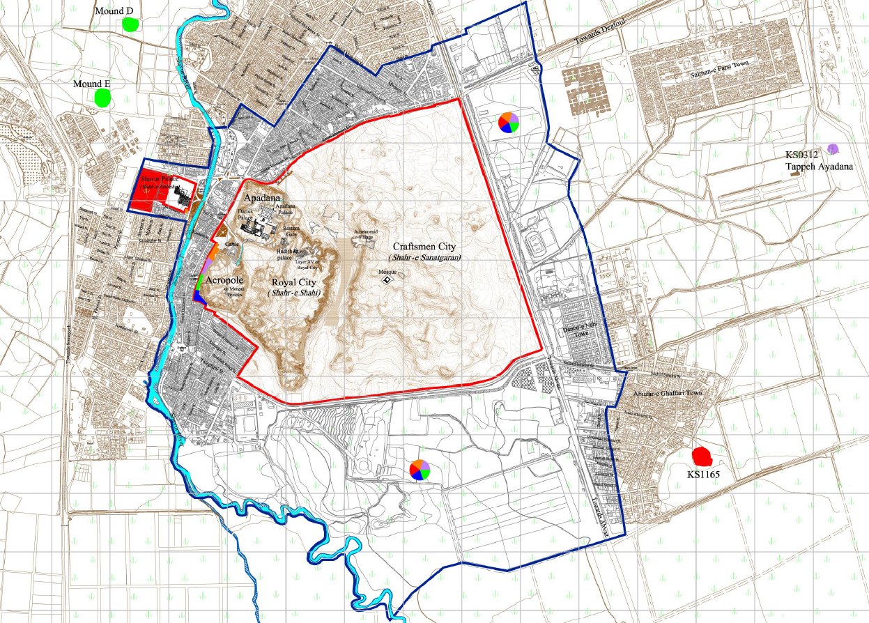
During the antiquity, the Fertile Crescent gave birth to numerous civilisations renown for their science, culture or expansion. Located in the south-west part of Iran next to what would become Mesopotamia, Sisa also lies between two rivers and served as capital of both the Elam civilisation and later the Achaemenid Empire.
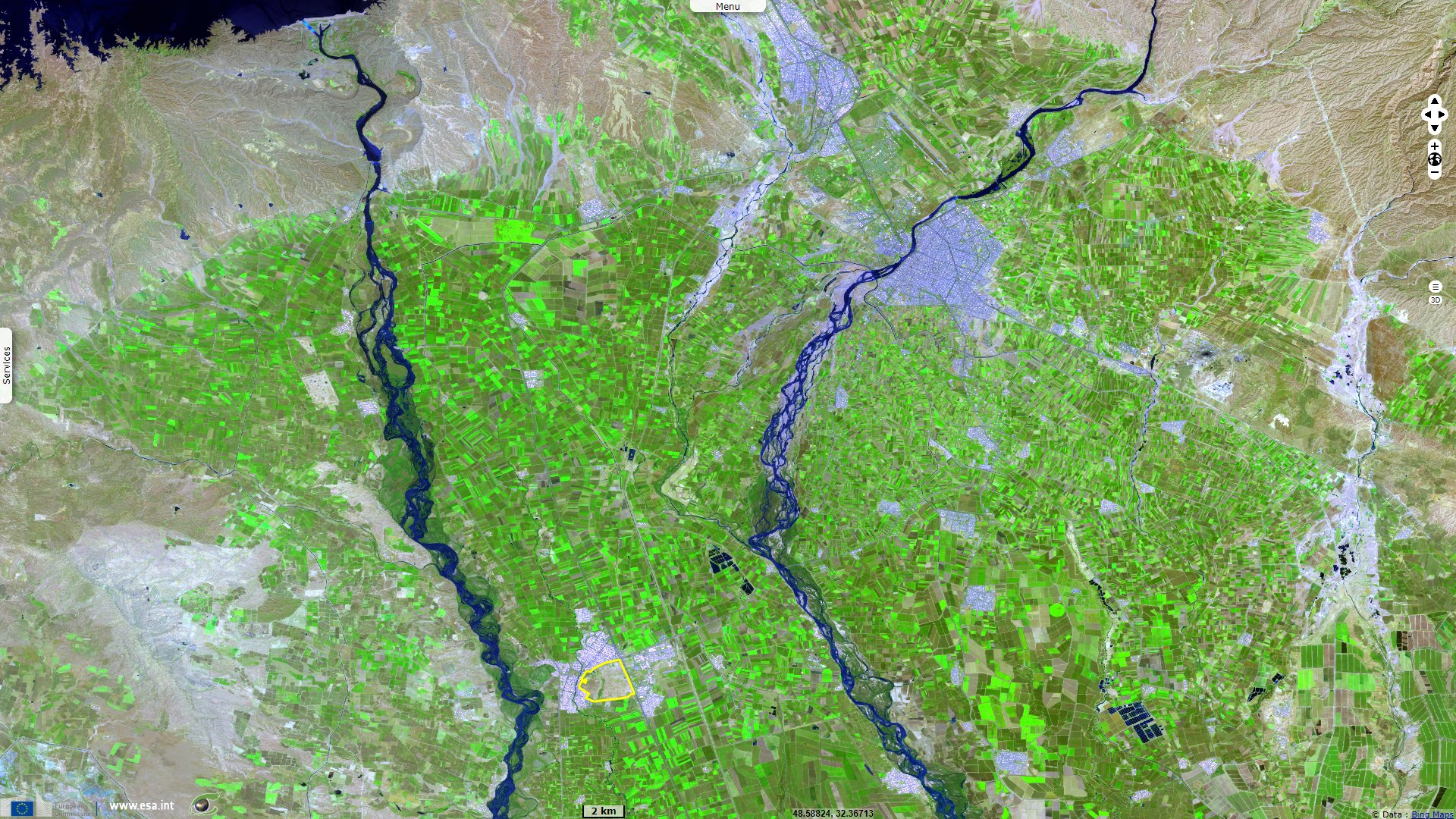
Declared a UNESCO World Heritage site, its sheet describes the six millenia old city as follows: "Located in the lower Zagros Mountains, in the Susiana plains between the Karkheh and Dez Rivers, Susa comprises a group of artificial archaeological mounds rising on the eastern side of the Shavur River, encompassing large excavated areas, as well as the remains of Artaxerxes' palace on the other side of the Shavur River."
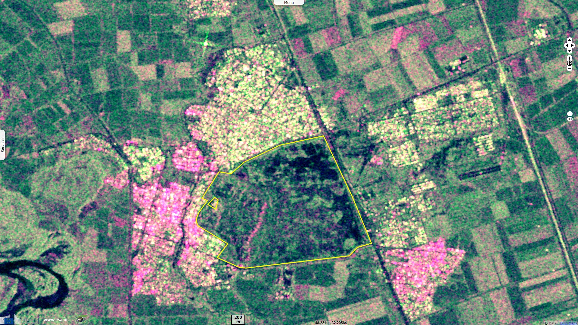
"Susa developed as early as the late 5th millennium BCE as an important centre, presumably with religious importance, to soon become a commercial, administrative and political hub that enjoyed different cultural influences thanks to its strategic position along ancient trade routes. Archaeological research can trace in Susa the most complete series of data on the passage of the region from prehistory to history."
Susa archaeological complex & Ardeshir Palace - maps of inscribed property - Source: UNESCO
"Susa appears as the converging point of two great civilisations which reciprocally influenced each other: the Mesopotamian and the Iranian plateau civilisations. Susa’s long-lasting and prominent role in the region, either as the capital of the Elamites, or of the Achaemenid Empire, or as a strategic centre sought by neighbouring powers (e.g., Assyrian, Macedonian, Parthian, Sassanid) is witnessed by the abundant finds, of disparate provenance and of exceptional artistic or scientific interest, and by the administrative, religious, residential and palatial, as well as functional structures and traces of urban layout (e.g., the remains of the Haute Terrasse in the Acropolis, the Palace of Darius in the Apadana, the residential or production quarters, the Ardeshir Palace) that more than 150 years of archaeological investigations have revealed."
During the first Persion empire, the neighbouring city of Shushtar was chosen as the location of a key irrigation infrastructure for the area. It is another UNESCO World Heritage site depicted in these words: "The Shushtar Historical Hydraulic System demonstrates outstanding universal value as in its present form, it dates from the 3rd century CE, probably on older bases from the 5th century BCE under Darius the Great. It is complete, with numerous functions, and large-scale, making it exceptional.
The Shushtar system is a homogeneous hydraulic system, designed globally and completed in the 3rd century CE. It is as rich in its diversity of civil engineering structures and its constructions as in the diversity of its uses (urban water supply, mills, irrigation, river transport, and defensive system). The Shushtar Historical Hydraulic System testifies to the heritage and the synthesis of earlier Elamite and Mesopotamian knowhow; it was probably influenced by the Petra dam and tunnel and by Roman civil engineering."
"The Shushtar hydraulic system, in its ensemble and most particularly the Shâdorvân Grand Weir (bridge-dam), has been considered a Wonder of the World not only by the Persians but also by the Arab-Muslims at the peak of their civilisation." Also called Band-e Kaisar ('Caesar's dam' in Persian) due to the Roman origin of its design, it was the first of many dam bridges in the region. This approximately 500 m long overflow dam over the Karun, Iran's most effluent river, was the core structure of the Shushtar Historical Hydraulic System from which the city derived its agricultural productivity.
"The Gargar canal is a veritable artificial watercourse which made possible the construction of a new town and the irrigation of a vast plain, at the time semi-desert. The Shushtar Historical Hydraulic System sits in an urban and rural landscape specific to the expression of its value."
"Shushtar is a unique and exceptionally complete example of hydraulic techniques developed during ancient times to aid the occupation of semi-desert lands. By diverting a river flowing down the mountains, using large-scale civil engineering structures and the creation of canals, it made possible multiple uses for the water across a vast territory: urban water supply, agricultural irrigation, fish farming, mills, transport, defence system, etc."
"It testifies to a technical culture dating back eighteen centuries serving the sustainable development of a human society, in harmony with its natural and urban environment. It forms a spectacular cliff from which water cascades into a downstream basin. It then enters the plain situated south of the city where it has enabled the planting of orchards and farming over an area of 40 000 ha known as Mianâb (Paradise)."
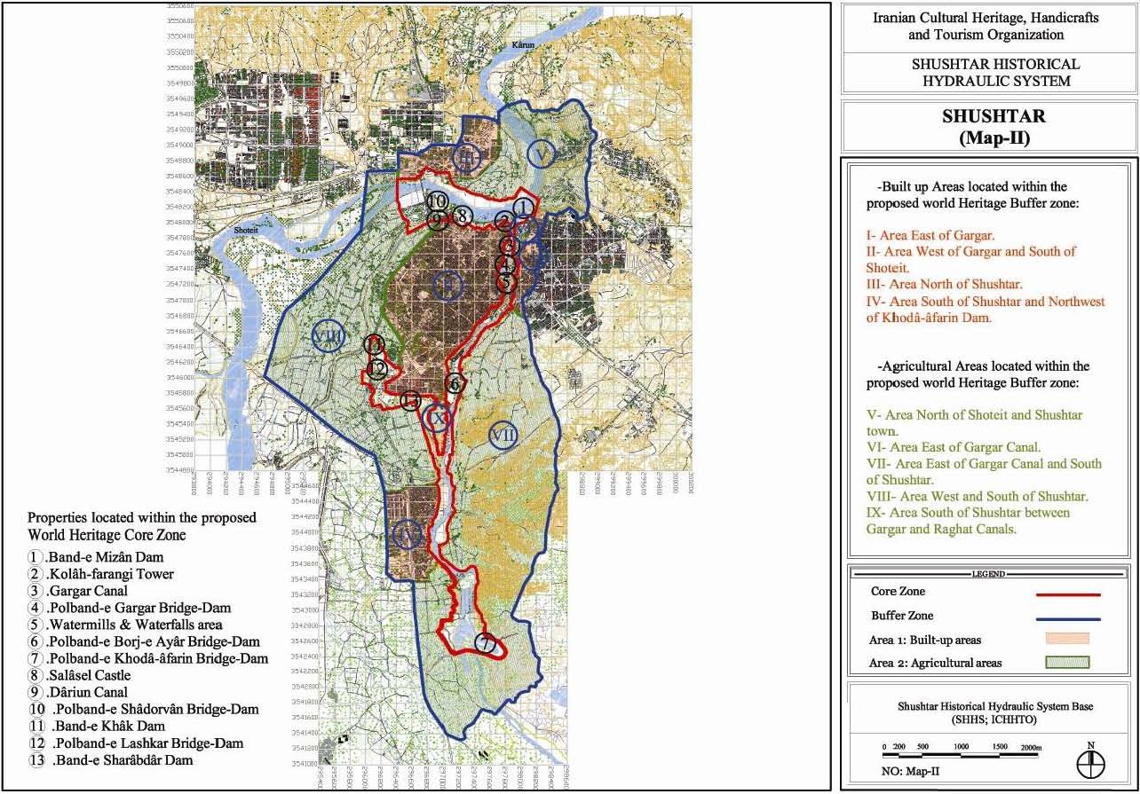
Shushtar Historical Hydraulic System - inscribed property - Source: UNESCO
The views expressed herein can in no way be taken to reflect the official opinion of the European Space Agency or the European Union.
Contains modified Copernicus Sentinel data 2026, processed by VisioTerra.
Contains modified Copernicus Sentinel data 2026, processed by VisioTerra.
| More on European Commission space: |  |
 |
 |
||||
| More on ESA: | |
|
|
S-1 website | S-2 website | S-3 website | |
| More on Copernicus program: | |
|
|
Scihub portal | Cophub portal | Inthub portal | Colhub portal |
| More on VisioTerra: | |
|
|
Sentinel Vision Portal | Envisat+ERS portal | Swarm+GOCE portal | CryoSat portal |