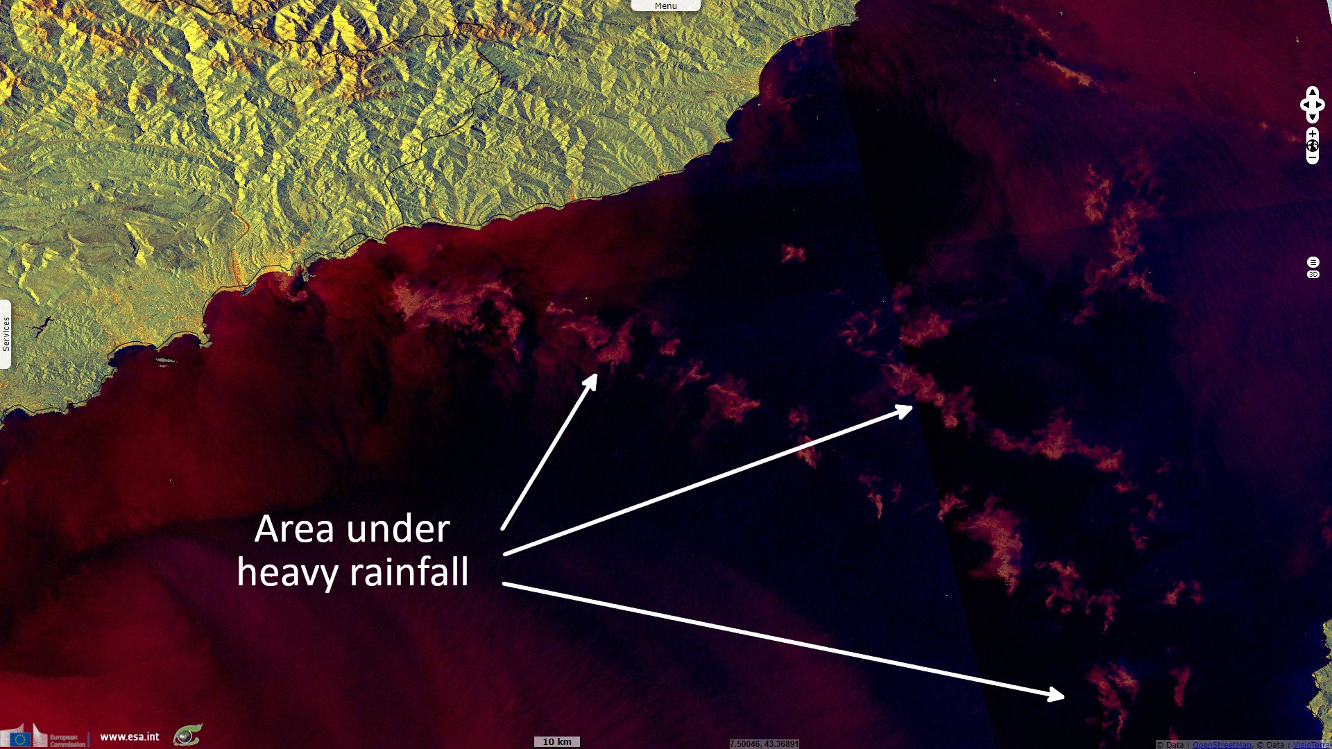
Heavy rainfall over south-east France & north Italy
Sentinel-3 SLSTR RBT acquired on 02 October 2021 from 20:01:52 to 22:41:27 UTC
...
Sentinel-1 CSAR IW acquired on 03 October 2021 from 17:30:58 to 17:31:23 UTC
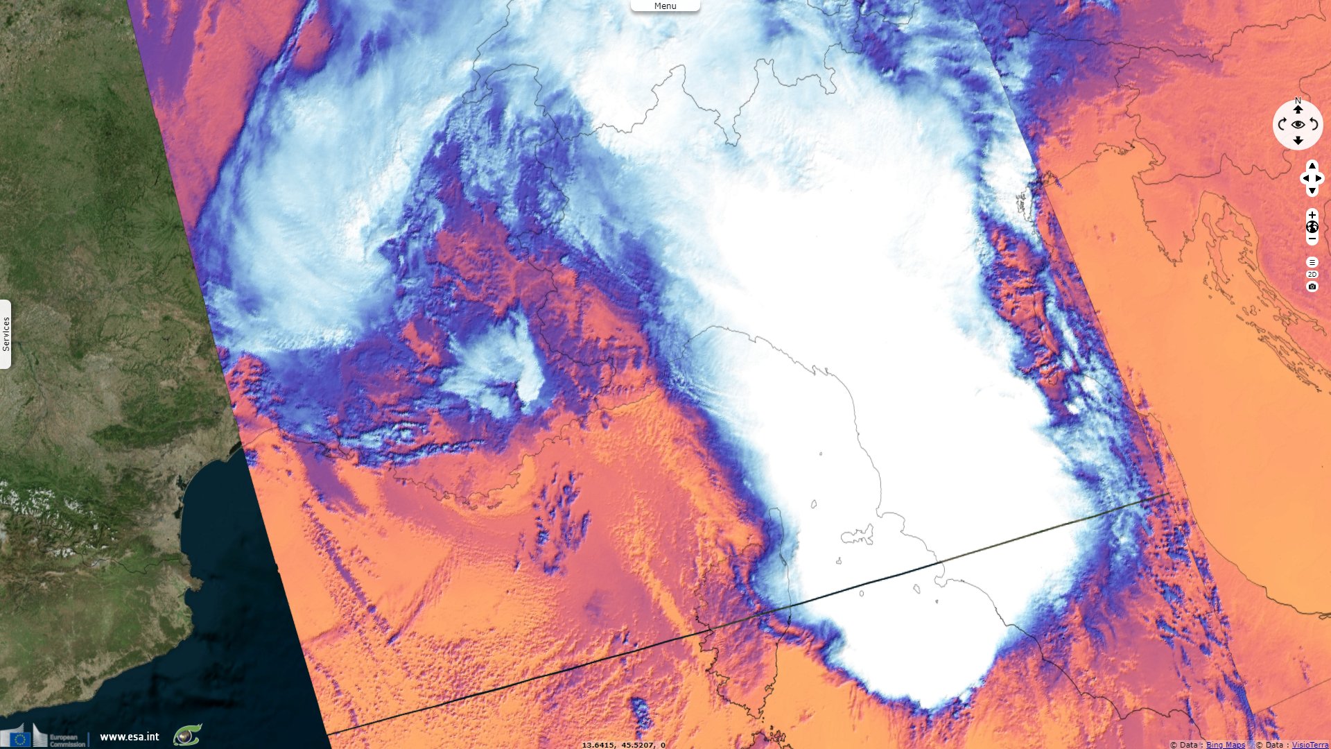
Sentinel-3 SLSTR RBT acquired on 04 October 2021 from 09:15:35 to 20:53:29 UTC
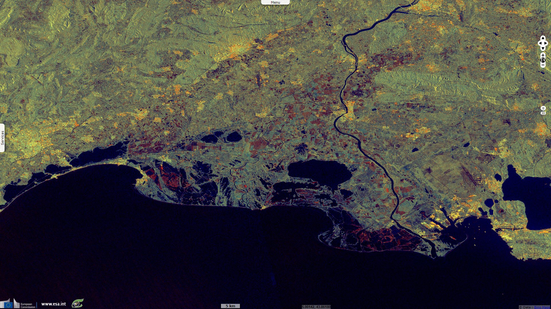
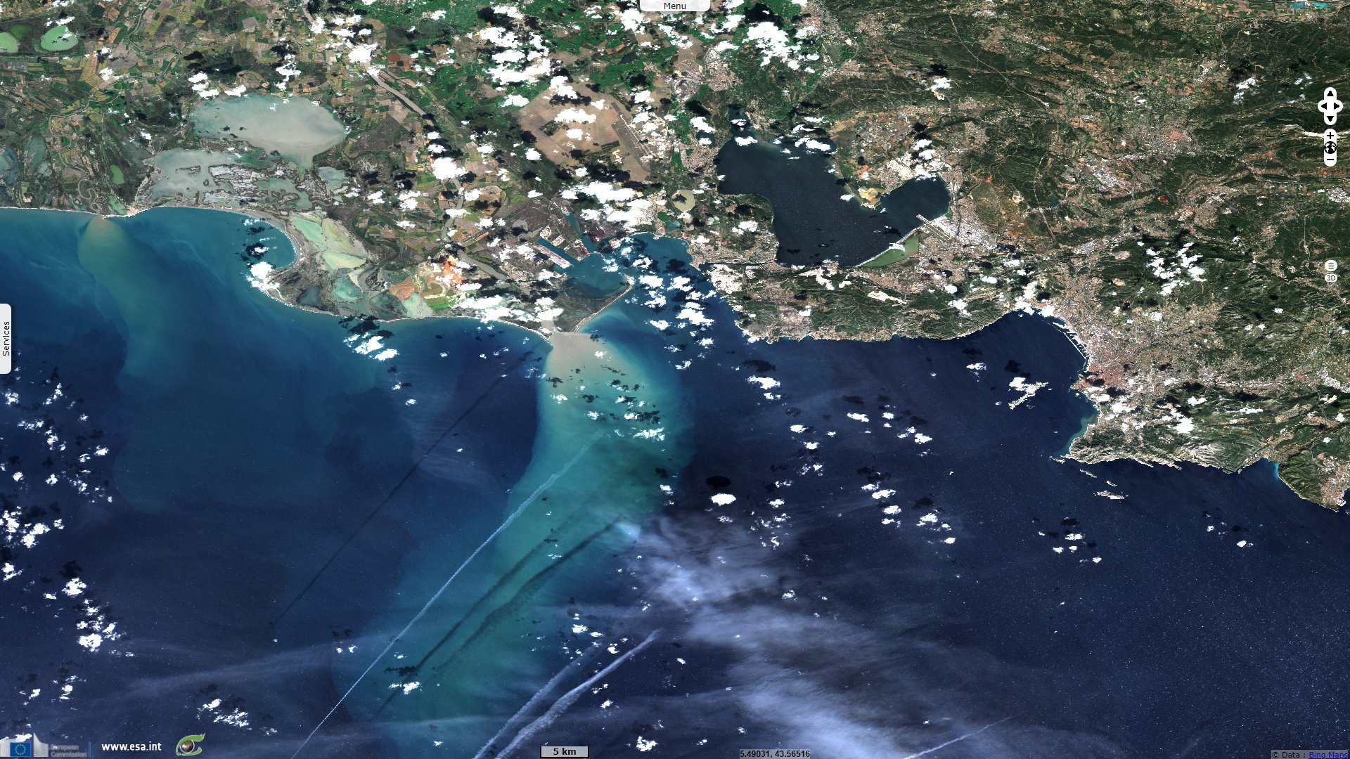
Sentinel-2 MSI acquired on 06 October 2021 at 10:29:21 UTC
...
Sentinel-1 CSAR IW acquired on 03 October 2021 from 17:30:58 to 17:31:23 UTC
Sentinel-3 SLSTR RBT acquired on 04 October 2021 from 09:15:35 to 20:53:29 UTC
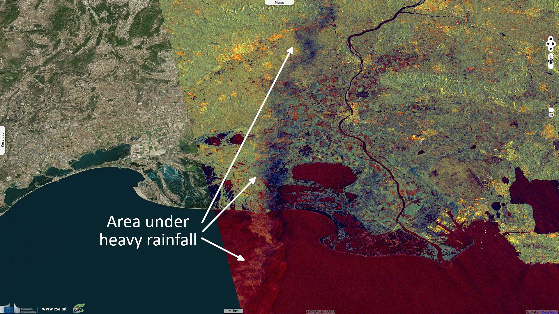
Sentinel-2 MSI acquired on 06 October 2021 at 10:29:21 UTC
Keyword(s): Precipitations, rainfall, emergency, water colour, alluvium, sediments, Italy, France
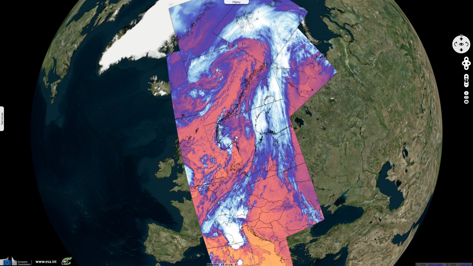
In south-east of France, up to 180 mm fell on Marseille, 250 mm in the Var department (where power outage affected 23 000 homes), in Cevennes mountains and 365 mm in Lozere department. It is in the Rhone Valley that satellite images best showed the phenomenon.
Floodlist reported staggering amounts of rain fell in northern Italy on 04 October 2021, causing floods and landslides in Liguria and Piedmont Regions. Liguria’s environment agency reported a record 181 mm of rainfall in just 1 hour and over 900 mm in 24 hours.
The views expressed herein can in no way be taken to reflect the official opinion of the European Space Agency or the European Union.
Contains modified Copernicus Sentinel data 2026, processed by VisioTerra.
Contains modified Copernicus Sentinel data 2026, processed by VisioTerra.
| More on European Commission space: |  |
 |
 |
||||
| More on ESA: | |
|
|
S-1 website | S-2 website | S-3 website | |
| More on Copernicus program: | |
|
|
Scihub portal | Cophub portal | Inthub portal | Colhub portal |
| More on VisioTerra: | |
|
|
Sentinel Vision Portal | Envisat+ERS portal | Swarm+GOCE portal | CryoSat portal |