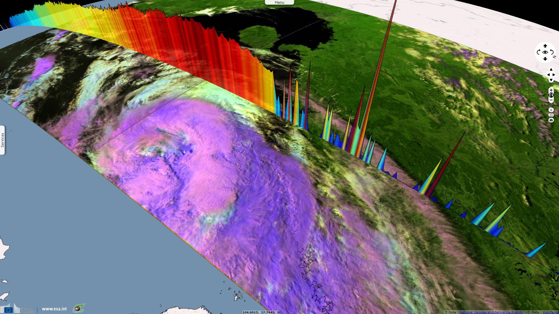
Super typhoon Yutu crosses Mariana & Philippines
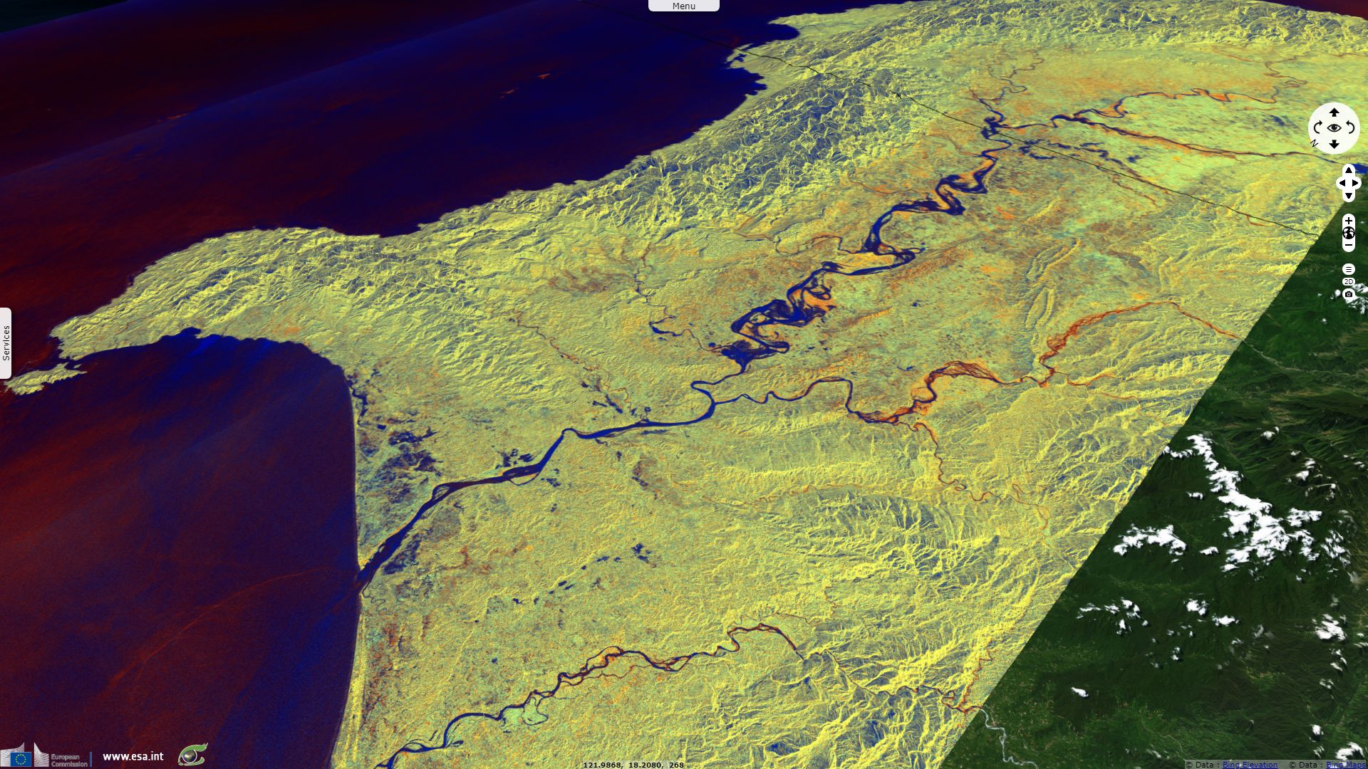
Sentinel-1 CSAR IW acquired on 19 October 2018 from 09:58:20 to 09:59:10 UTC
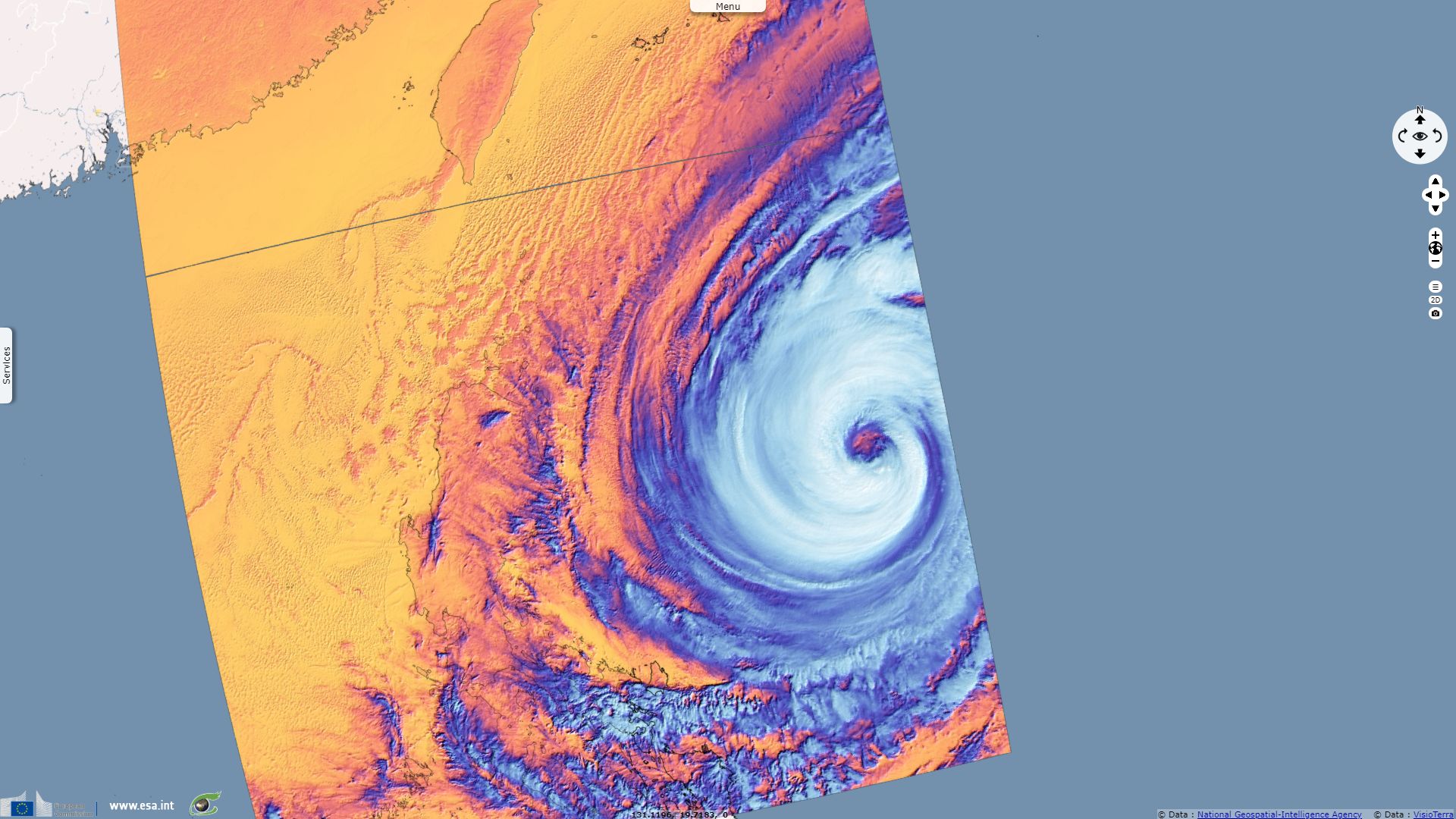
Sentinel-2 MSI acquired on 20 October 2018 at 00:52:39 UTC
...
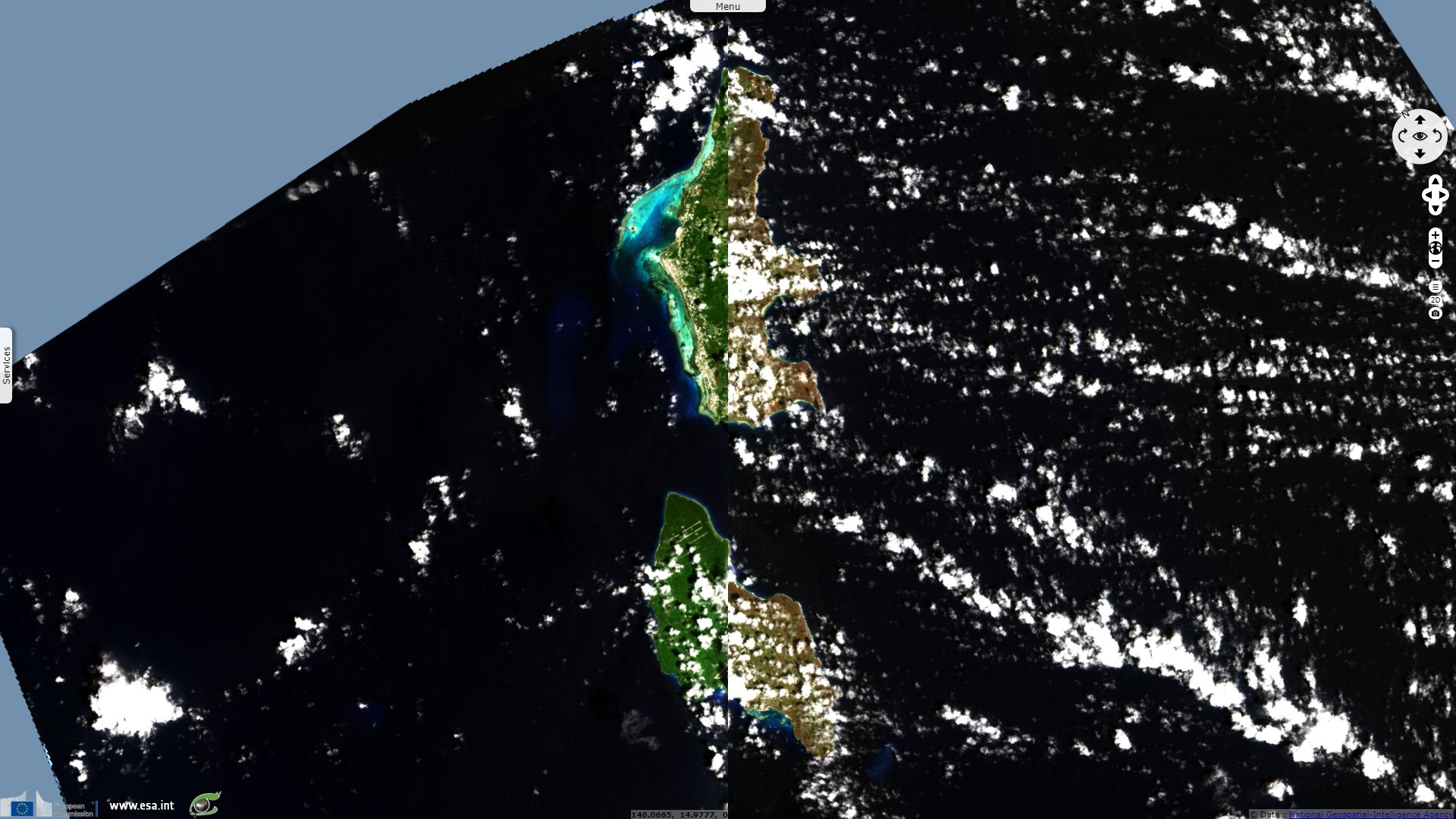
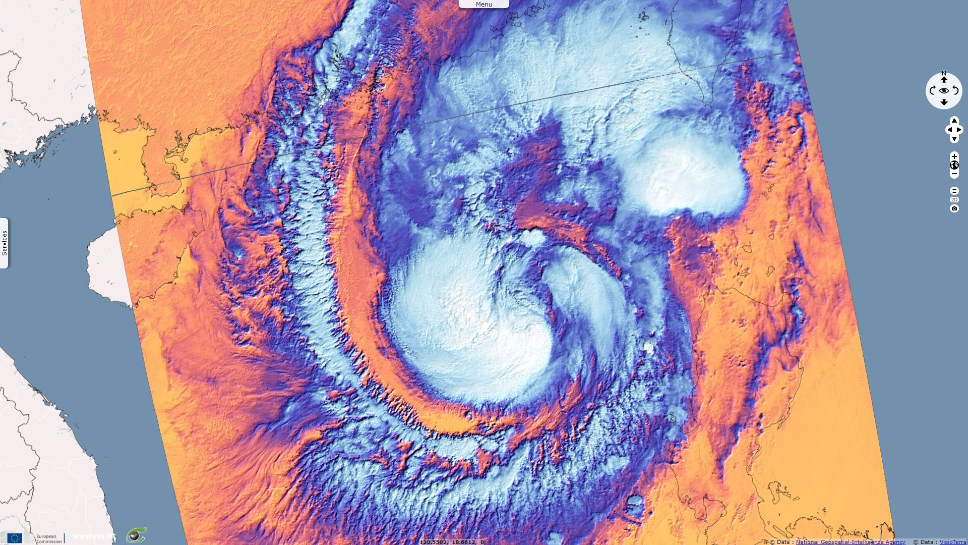
Sentinel-3 SRAL LAND acquired on 01 November 2018 at 02:21:26 UTC
Sentinel-3 SLSTR RBT acquired on 01 November 2018 from 02:35:14 to 02:38:14 UTC
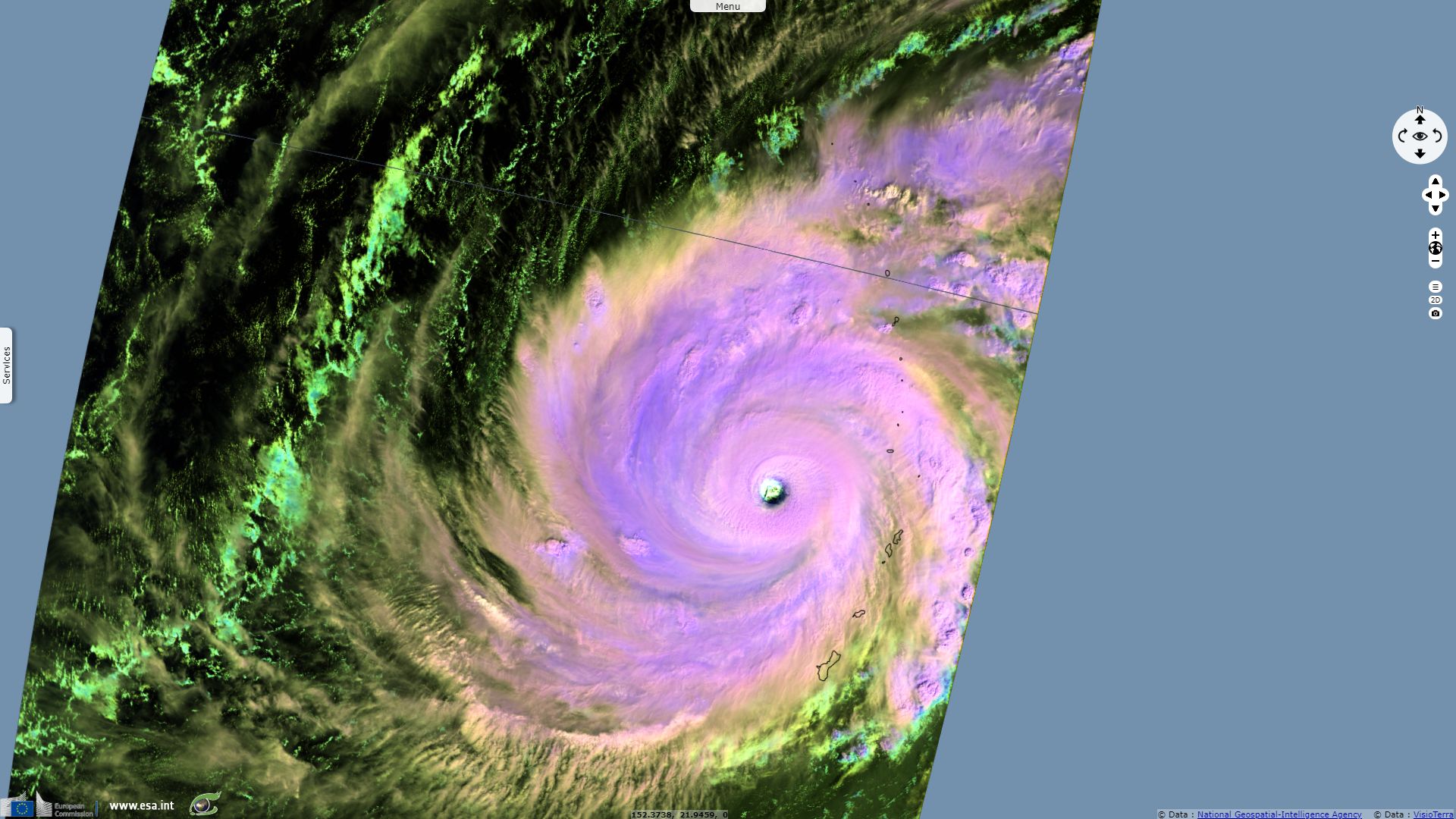
Sentinel-2 MSI acquired on 20 October 2018 at 00:52:39 UTC
...
Sentinel-3 SRAL LAND acquired on 01 November 2018 at 02:21:26 UTC
Sentinel-3 SLSTR RBT acquired on 01 November 2018 from 02:35:14 to 02:38:14 UTC
Keyword(s): Emergency, natural disaster, atmosphere, storm, climate, wind, rain, precipitations, wave height, cyclone.
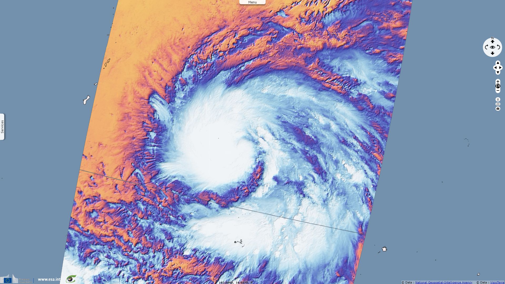
According to Weather Underground, Yutu quickly intensified from a young stropical storm (88kph) the 22 October 6pm to cat-5 typhoon (290kph) the 24 October at noon.

Typhoon Yutu's eye over U.S. Northern Mariana Islands - Source: Weather Underground
Pacific Daily News wrote:
"By 8 p.m., Yutu had strengthened to carry 265kph sustained winds, which made it the strongest typhoon to hit the Marianas since Super Typhoon Karen flattened Guam in 1962. With winds reaching 160 mph early Wednesday afternoon, Super Typhoon Yutu began lashing the Marianas in an assault that was expected to continue into Thursday evening.
The storm was expected to make its closest point of approach a few miles from Tinian between 1 and 2 a.m., but with dangerous winds extending 130 miles to the west and southwest and 230 miles to the east, forecasters said the worst was expected after the eye passed. Tinian Island and part of Saipan entered the typhoon eye. "Earth's strongest storm of 2018" but also 'one of the most intense hurricane strikes on record for the United States and its territories."
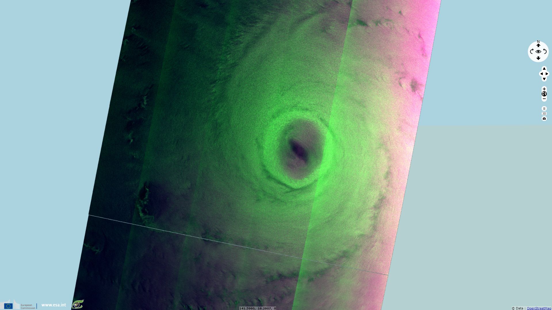
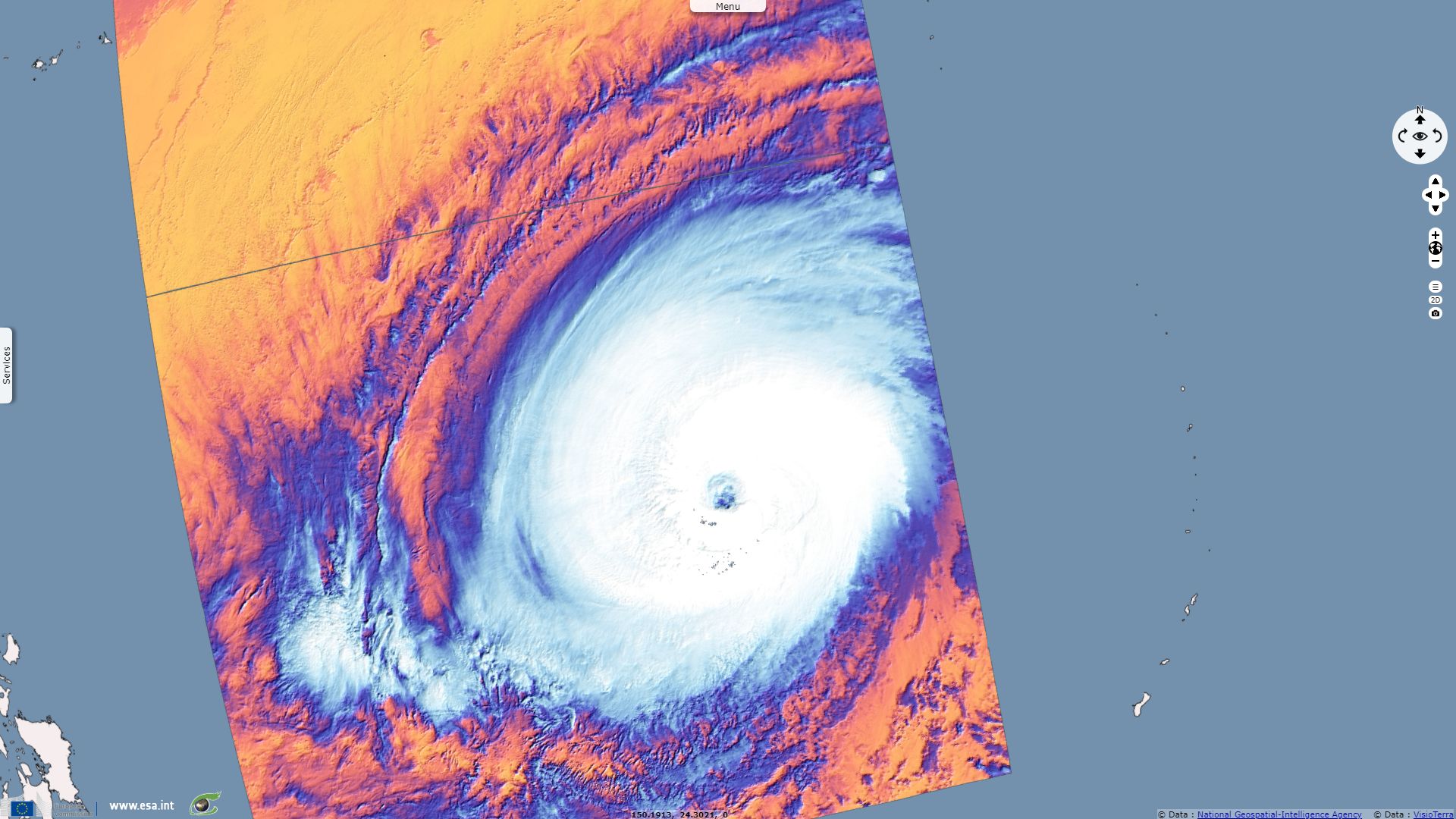
Weather Underground resumed: "Earth's strongest storm of 2018, Super Typhoon Yutu, was pounding the U.S. Northern Mariana Islands late Wednesday morning (U.S. EDT) with sustained winds of 290 kph, according to the Joint Typhoon Warning Center (JTWC). At 10 am EDT, the northern eyewall of Yutu was over Tinian Island, which will likely experience catastrophic damage. Yutu is Earth’s tenth Category 5 storm of 2018, an astonishing total that has only been exceeded only once on record (twelve, in 1997). Yutu is tied with Super Typhoon Mangkhut, which also had 290 kph winds, as the strongest storm of 2018.
Tinian will experience a full landfall, including the eyewall winds of Yutu and catastrophic damage; Saipan lies a bit farther to the north, and may experience lower Category 4 winds, although the eyewall may affect southern Saipan. Here is the damage one can expect in Category 5 winds, according to the National Hurricane Center (note that construction in the Mariana Islands is typically built to high standards due to the frequent typhoons they get, so damage may not be this extreme):
- High percentage of framed homes destroyed, with total roof failure and wall collapse.
- Fallen trees and power poles will isolate residential areas.
- Power outages will last for weeks to possibly months.
- Most of the area will be uninhabitable for weeks or months.
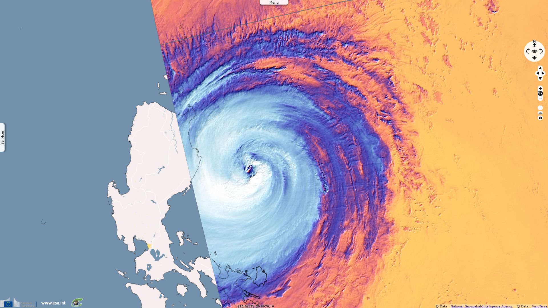
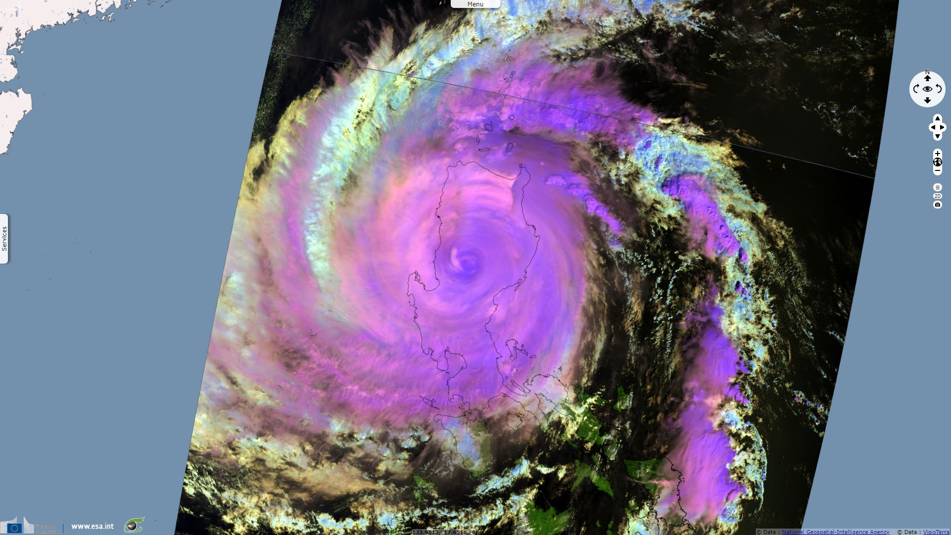
Late on October 29, Yutu made landfall in the Philippine province of Isabela with 10-minute sustained winds of 155 km/h. The JTWC estimated 1-minute winds to be 165 km/h at that time. Reuters reported: "Three provinces in north Luzon were elevated to warning signal 3 on the severity scale of 5, and 28 more put on the earliest warnings of 1 and 2, with strong winds and rains expected later on Monday." "Known locally as Rosita, the typhoon will be the 18th to hit the Philippines this year and comes six weeks after super typhoon Mangkhut tore across Luzon, triggering landslides that killed dozens of people and damaged about $180 million of crops." "About half of the Philippines’ 105 million population live in the Luzon region. The country is hit by an average 20 typhoons each year."
The views expressed herein can in no way be taken to reflect the official opinion of the European Space Agency or the European Union.
Contains modified Copernicus Sentinel data 2026, processed by VisioTerra.
Contains modified Copernicus Sentinel data 2026, processed by VisioTerra.
| More on European Commission space: |  |
 |
 |
||||
| More on ESA: | |
|
|
S-1 website | S-2 website | S-3 website | |
| More on Copernicus program: | |
|
|
Scihub portal | Cophub portal | Inthub portal | Colhub portal |
| More on VisioTerra: | |
|
|
Sentinel Vision Portal | Envisat+ERS portal | Swarm+GOCE portal | CryoSat portal |