After 3 months, La Palma eruption ended, Canaries
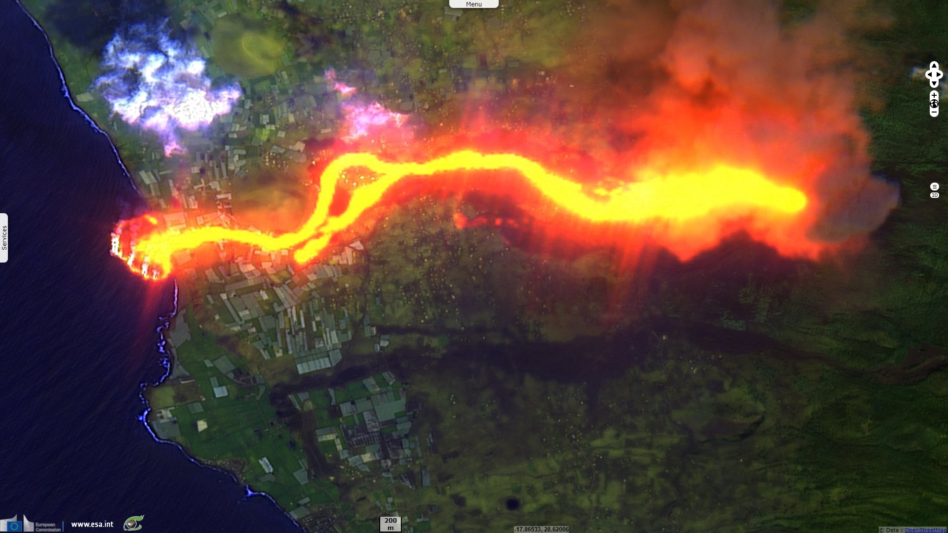
Sentinel-2 MSI acquired on 26 August 2021 at 12:03:19 UTC
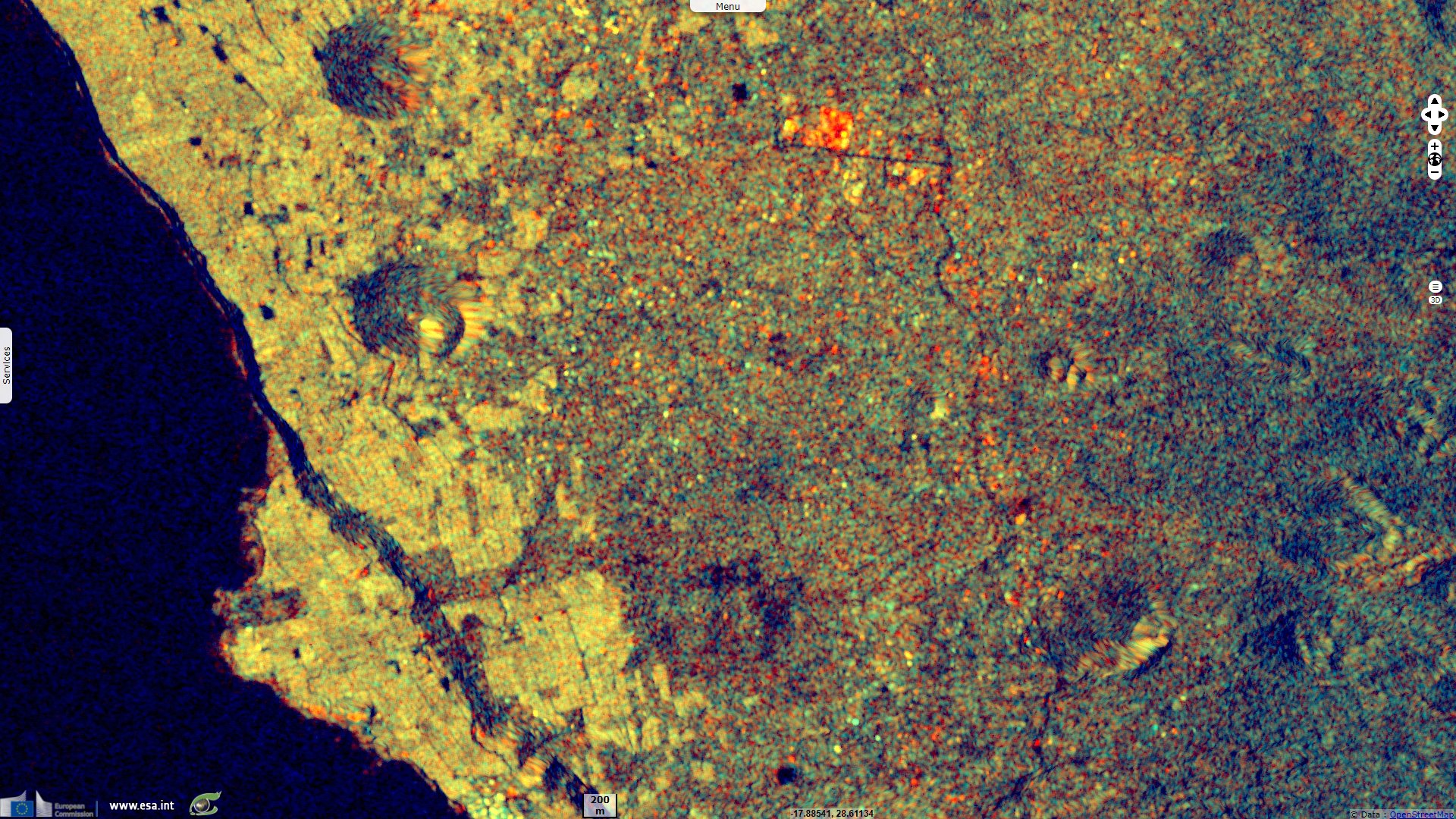
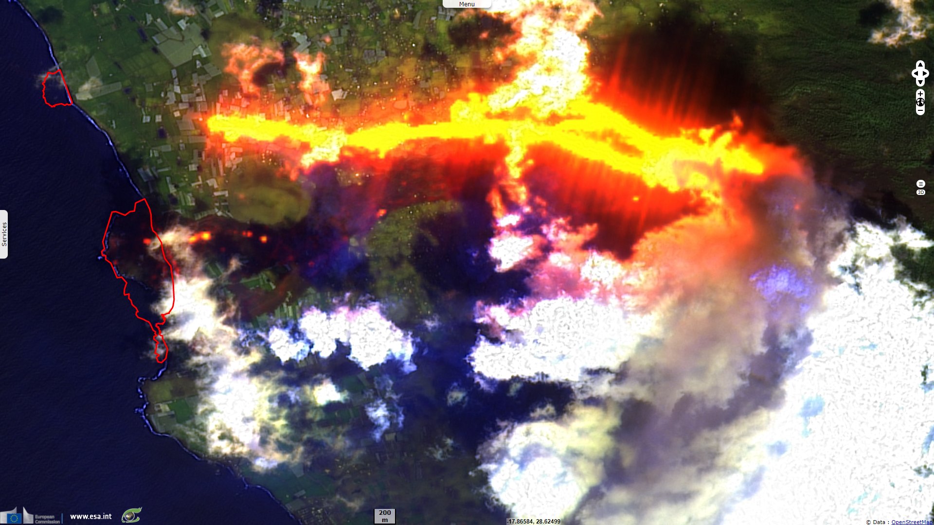
Sentinel-1 CSAR IW acquired on 10 September 2021 at 07:11:03 UTC
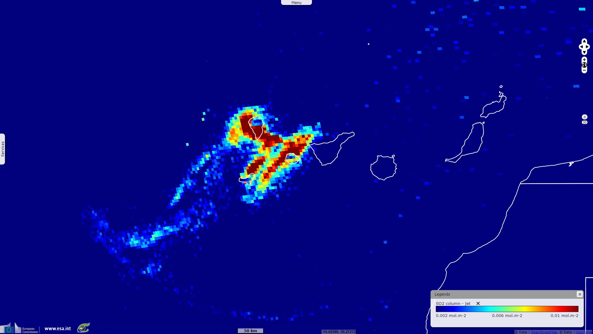
Sentinel-5P TROPOMI SO2 acquired on 13 December 2021 at 14:37:40 UTC
Sentinel-1 CSAR IW acquired on 15 December 2021 at 07:11:02 UTC
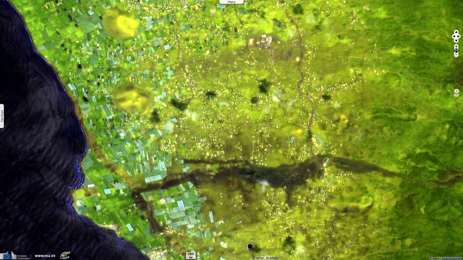
Sentinel-2 MSI acquired on 03 January 2022 at 12:03:19 UTC
Sentinel-1 CSAR IW acquired on 10 September 2021 at 07:11:03 UTC
Sentinel-5P TROPOMI SO2 acquired on 13 December 2021 at 14:37:40 UTC
Sentinel-1 CSAR IW acquired on 15 December 2021 at 07:11:02 UTC
Sentinel-2 MSI acquired on 03 January 2022 at 12:03:19 UTC
Keyword(s): Volcano, eruption, island, natural disaster, geohazard, geology, lava flow, crater, Canaries archipelago, Spain

On 15 December 2021, Guillermo Vega wrote for the English version of El Pais: "The activity of the volcano on the Canary Island of La Palma stopped completely on Tuesday, nearly three months after it first began to erupt. “It is not emitting lava, nor sulfur dioxide, nor is it registering any tremors or seismic activity,” sources from the National Geographic Institute (IGN) confirmed."
"The new – and still unnamed – volcano on La Palma began to erupt on September 19. Its 86 days of life have made it the longest eruption in the history of the Canary Island, after exceeding the length of activity of Tehuya in 1585."
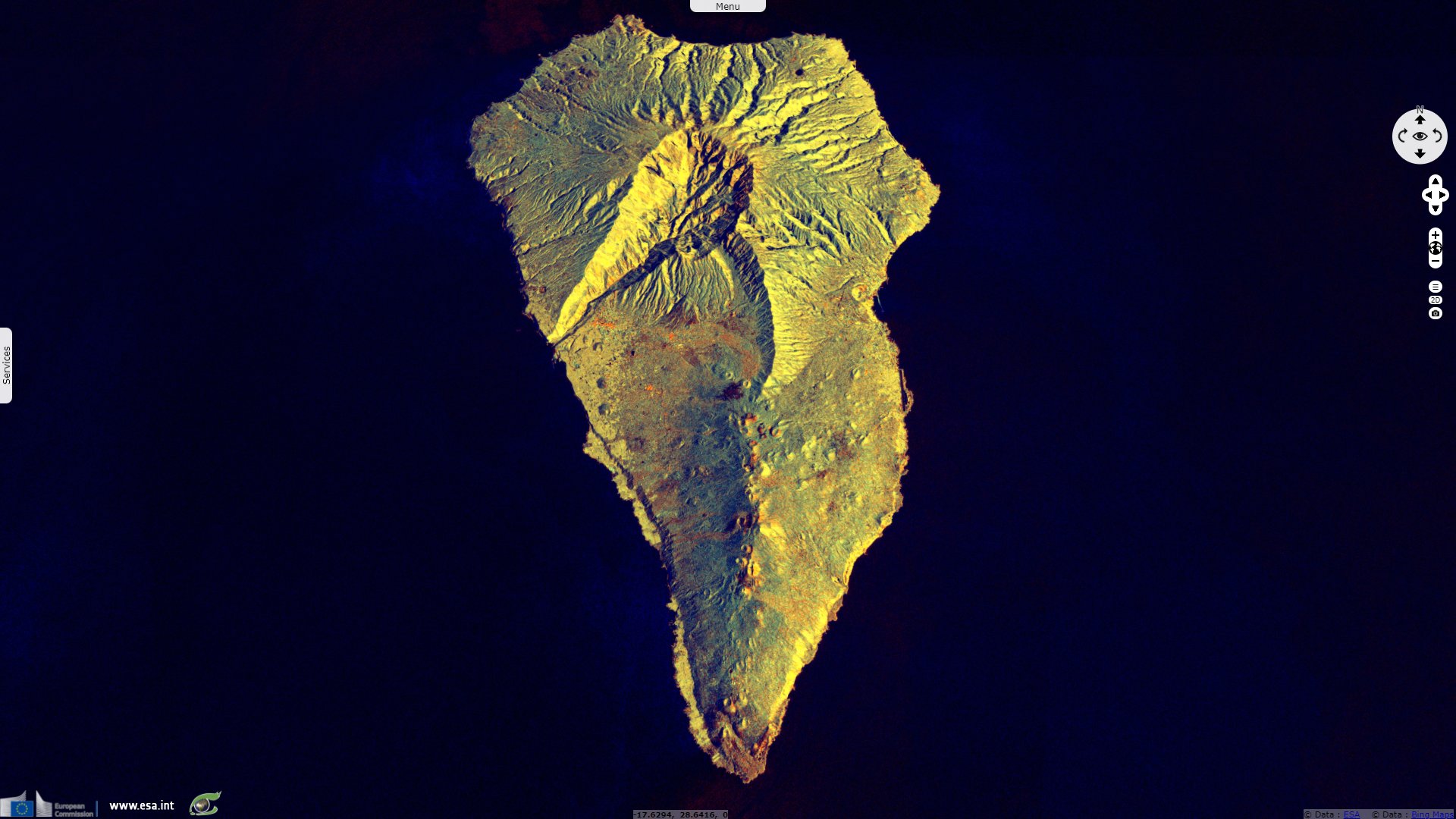
With flows up to 70 metres thick in places, a total of about 200 million cubic metres of lava and ash was expelled from six different craters, all newly formed during the eruption.
The La Palma volcano has a volcanic building about 200 m high on its base, with a total altitude of approximately 1100 m above sea level, around an eruptive fissure visible from the sky, with at least 6 craters
But if the volcano seems to be well and truly asleep, all is not over and the area remained very dangerous for several weeks. The lava, although solidified on the surface, is still incandescent at the base of the flows, as shown in several videos made by Involcan scientists. In some places, the heat released is still 1000°C several days after the end of activity.

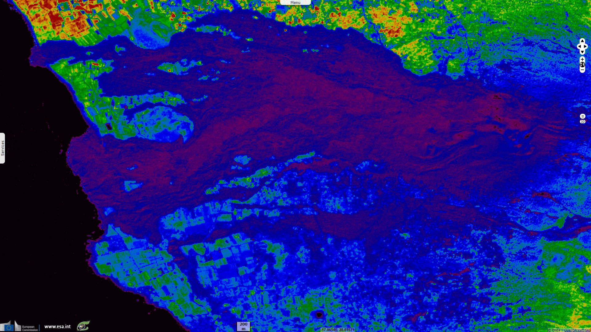
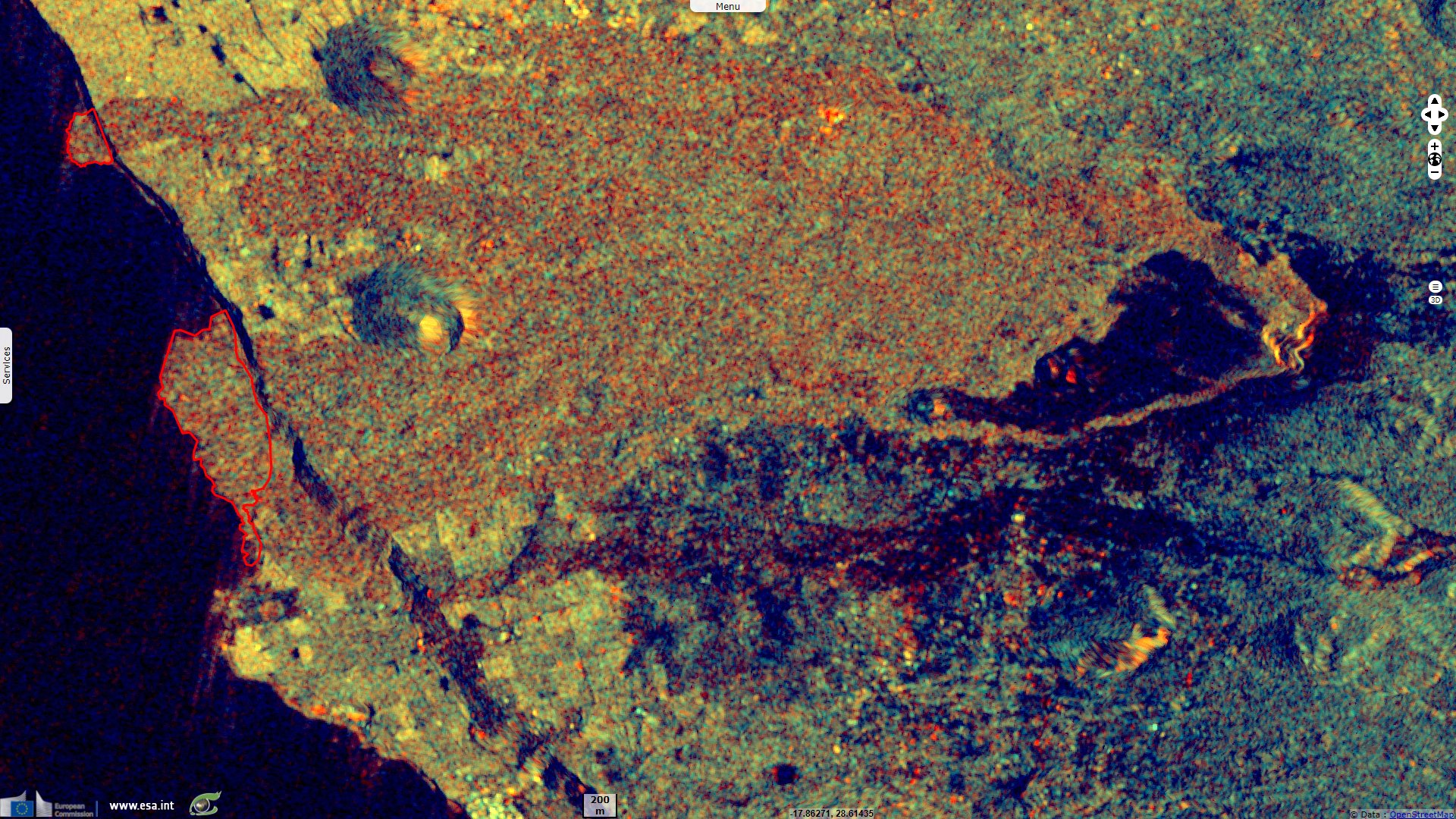
Created by solidified lava, two new deltas are visible in the sea. They show in cyan, delimited by a red polygon.
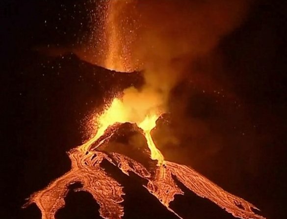
From October, two new vents caused further eruptions from the Cumbre Vieja volcano - Source: BBC
Also on 15 December 2021, Aritz Parra published in Associated Press: "The eruption, which began on Sept. 19, is the longest on record on La Palma and has been a milestone for islanders, many of whom live from farming and tourism. The volcanic Canary Islands are a popular European vacation destination due to their mild climate."
"No injuries or deaths have been directly linked to the La Palma eruption, and life has continued largely as normal on most of the island of 83 000 residents. However, 7000 people were forced to abandon their homes and farms as they were engulfed by lava and a section of La Palma’s southwestern side is severely damaged." 33 000 people have been confined on La Palma due to bad air quality from volcano.
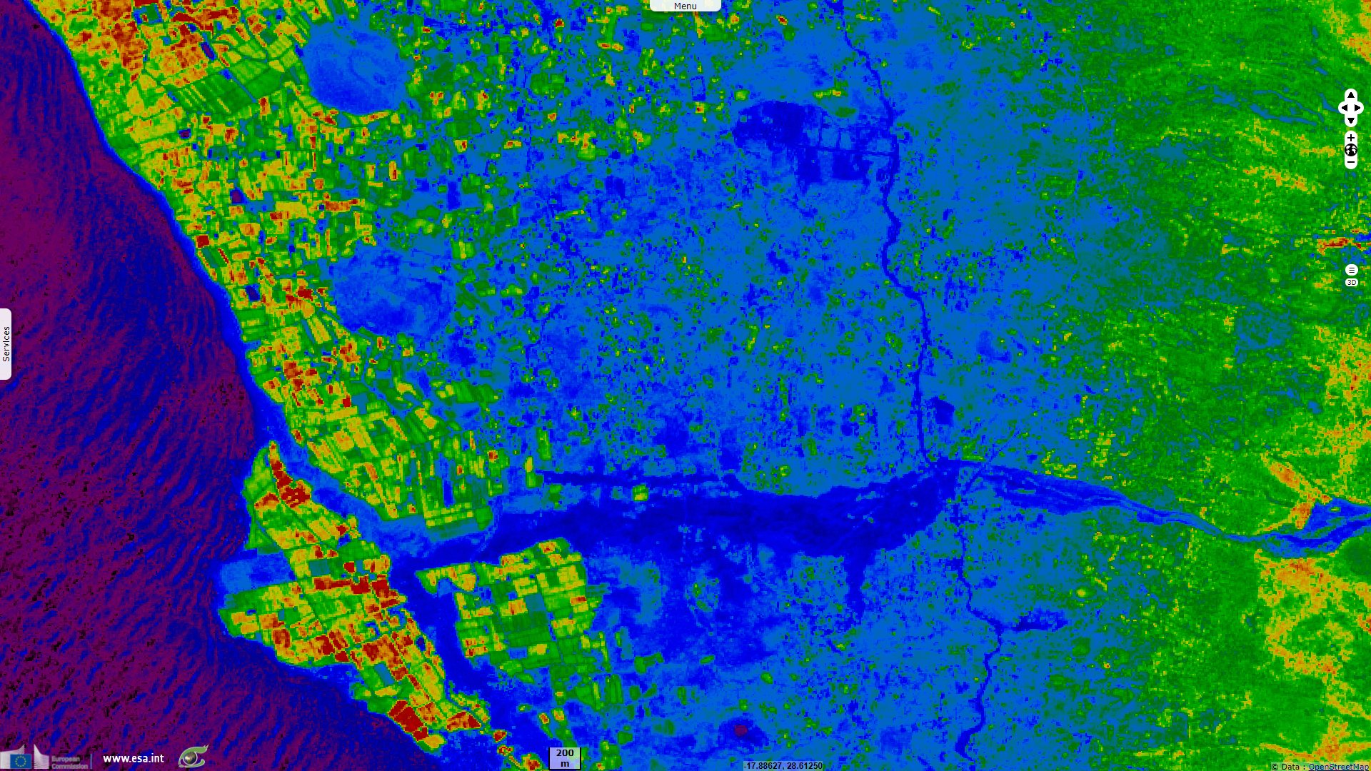
"Fiery molten rock flowing from Cumbre Vieja down toward the sea has destroyed around 3000 buildings. The fields of thick, black hardened lava have entombed banana plantations, ruined irrigation systems and cut off roads. The hardened lava covers 1219 hectares, according to the Canary Islands volcanic emergency unit, Pevolcan. Where the molten rock has poured into the Atlantic Ocean, rocky deltas have formed over 48 hectares, Pevolcan said."
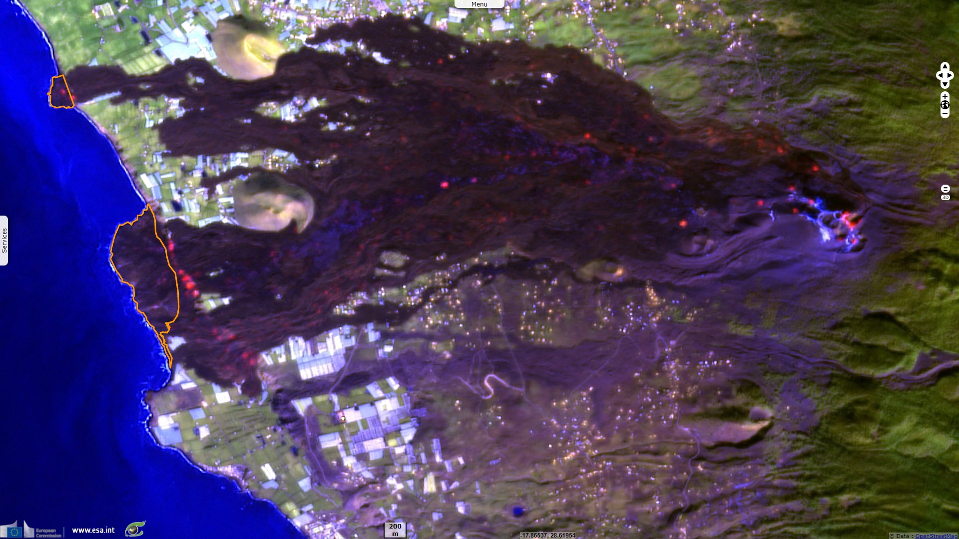
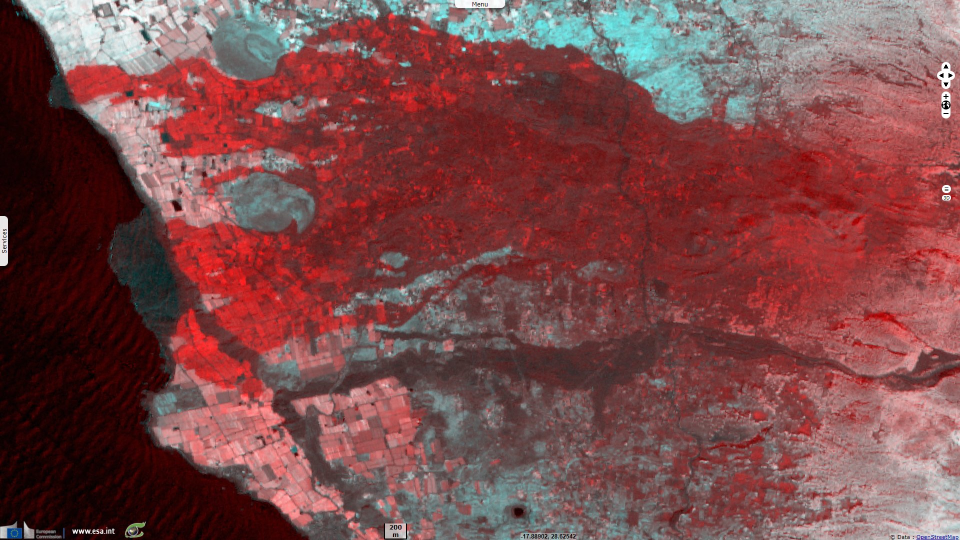
Compared to the area delimited in the red polygon above, the extension of the island several days later, delimited in orange, is smaller. It is likely due to the sea erosion of this unconsolidated material.
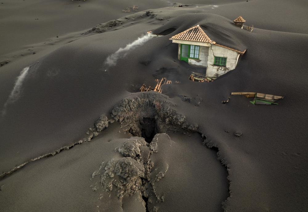
"A fissure is seen next to a house covered with ash on the Canary island of La Palma, Spain, Dec. 1 2021" - Source: Emilio Morenatti for Associated Press.
The views expressed herein can in no way be taken to reflect the official opinion of the European Space Agency or the European Union.
Contains modified Copernicus Sentinel data 2026, processed by VisioTerra.
Contains modified Copernicus Sentinel data 2026, processed by VisioTerra.
| More on European Commission space: |  |
 |
 |
||||
| More on ESA: | |
|
|
S-1 website | S-2 website | S-3 website | |
| More on Copernicus program: | |
|
|
Scihub portal | Cophub portal | Inthub portal | Colhub portal |
| More on VisioTerra: | |
|
|
Sentinel Vision Portal | Envisat+ERS portal | Swarm+GOCE portal | CryoSat portal |