Deadly floods at NW of Lake Tanganyika, DRC, Burundi
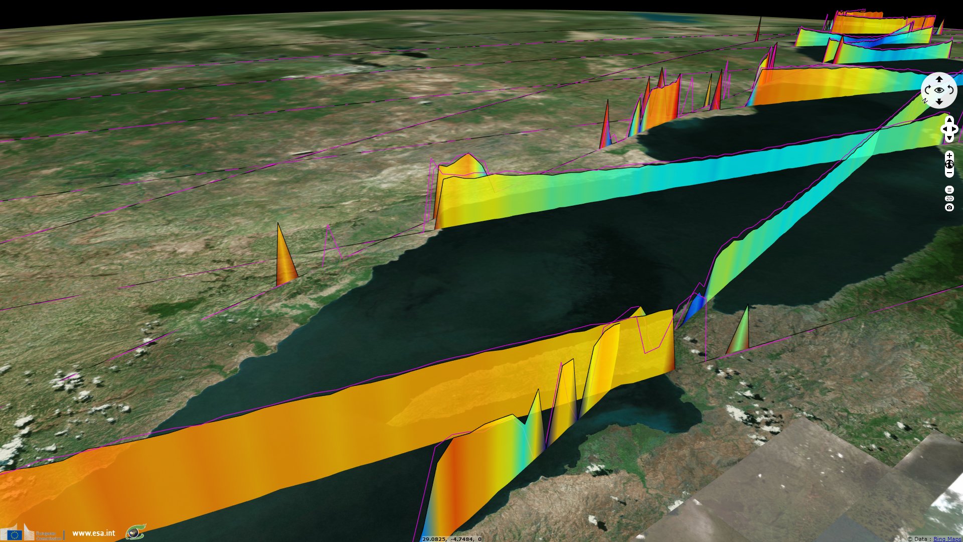
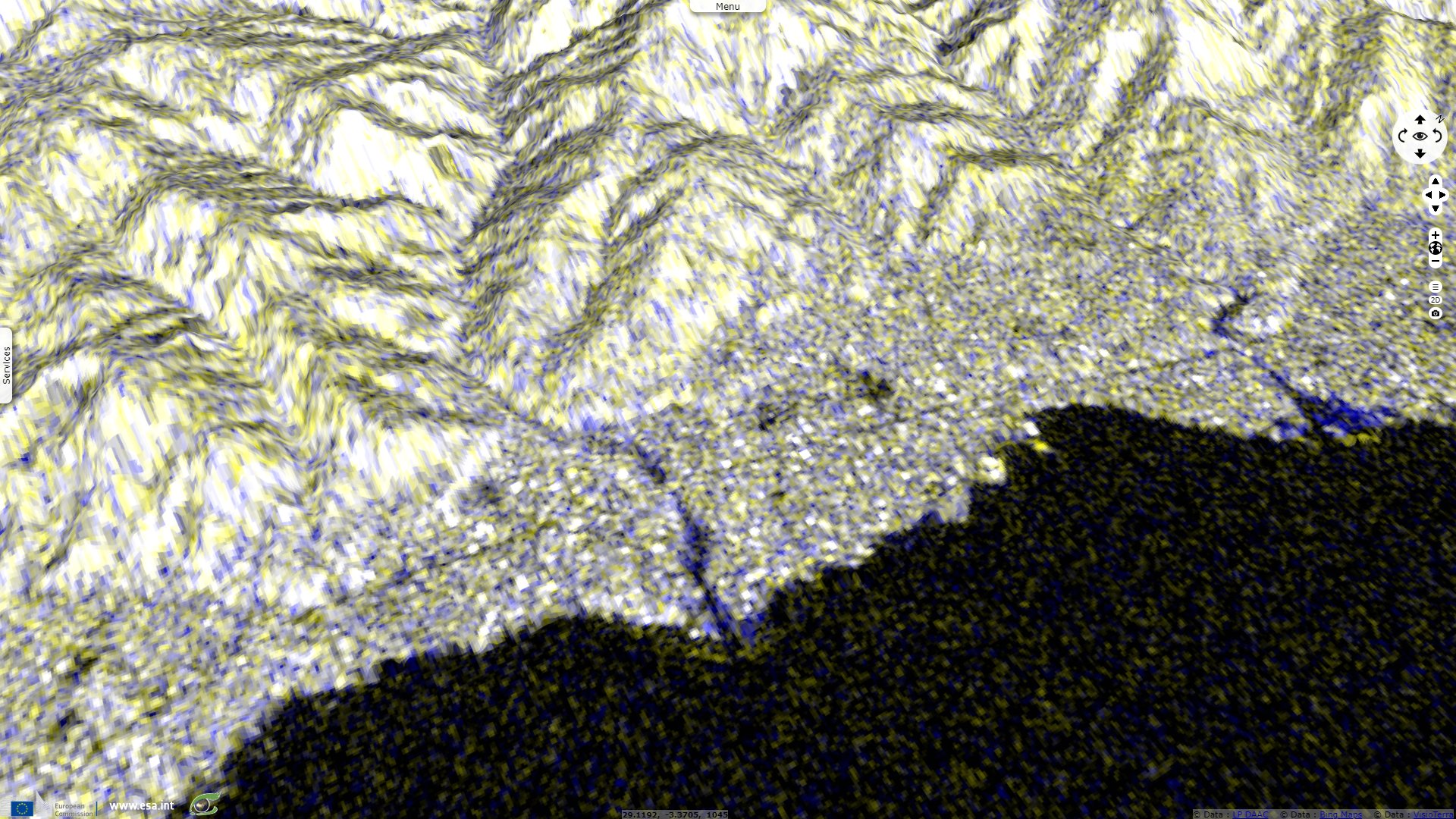
Sentinel-3 SRAL LAND acquired on 16 March 2020 at 07:33:30 UTC
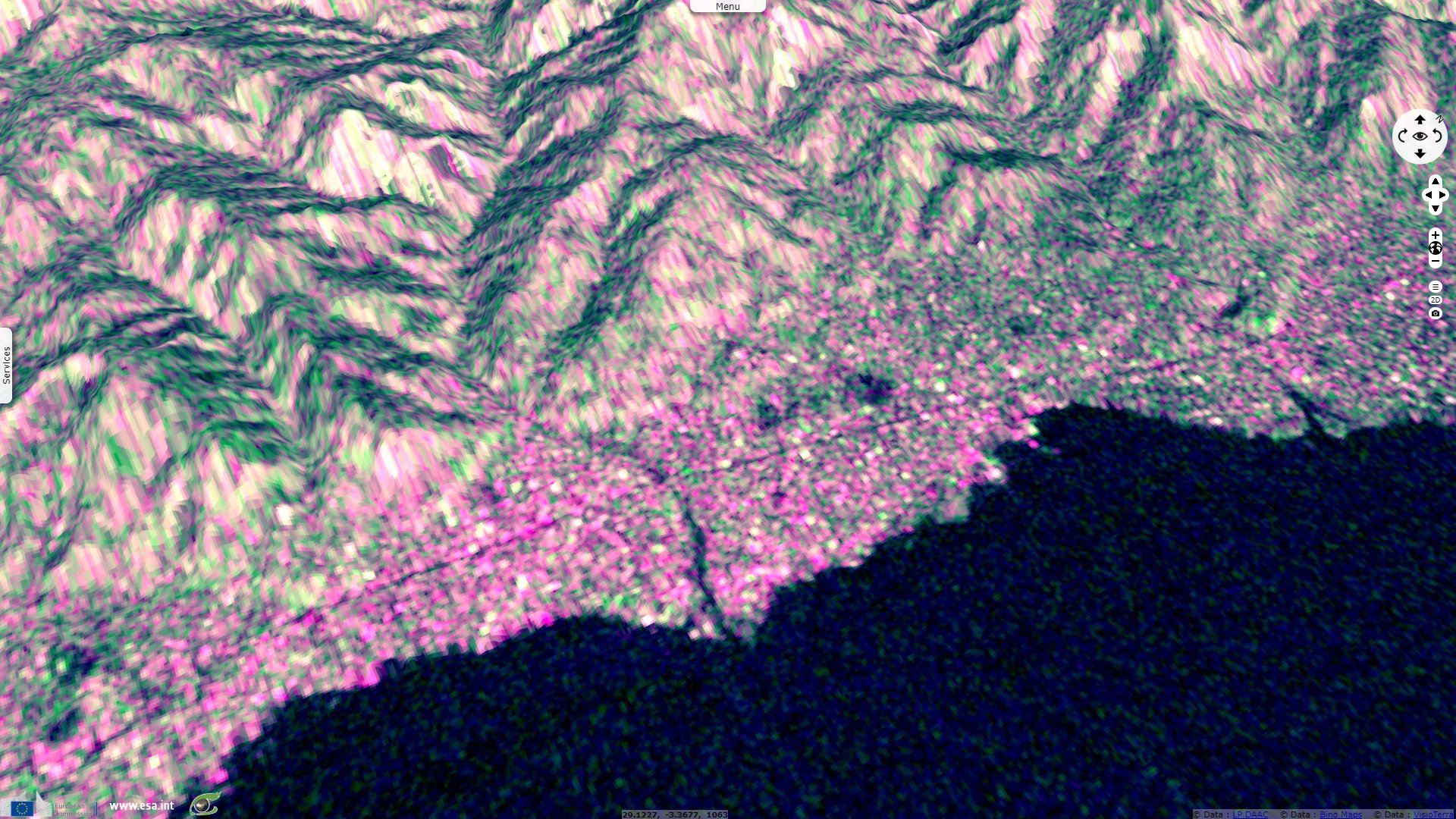
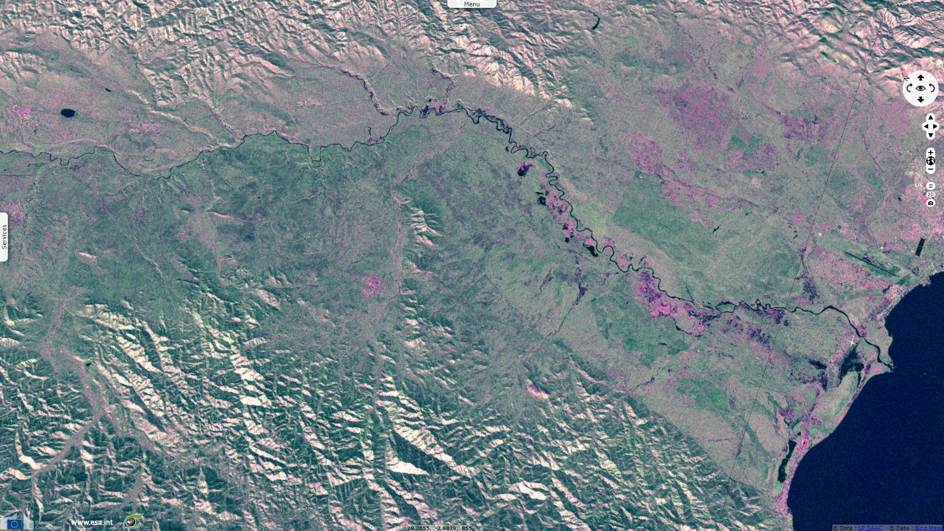
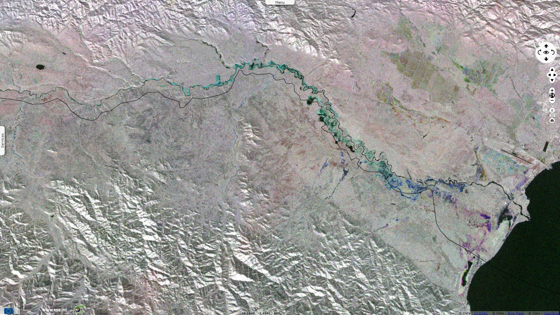
Sentinel-1 CSAR IW acquired on 31 March 2020 from 16:20:11 to 16:20:36 UTC
...
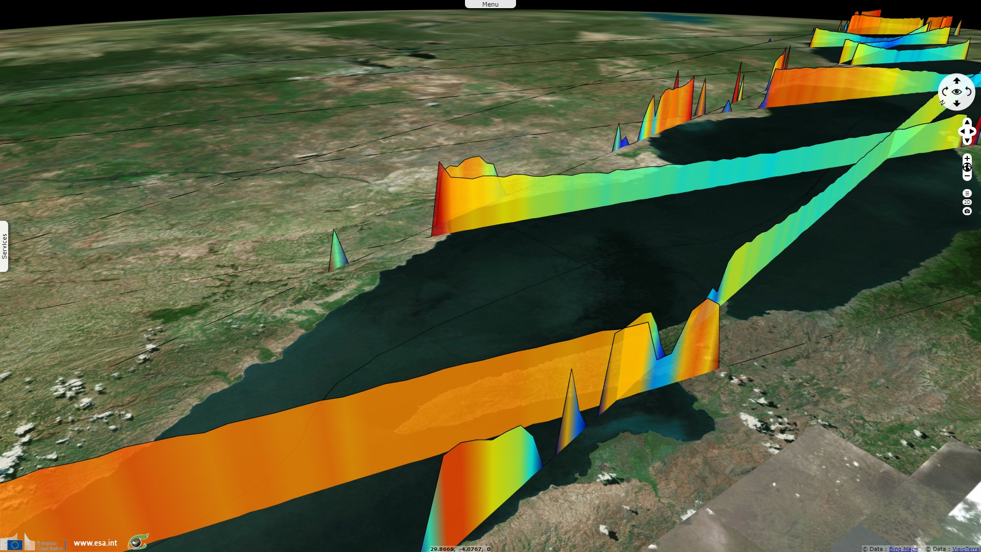
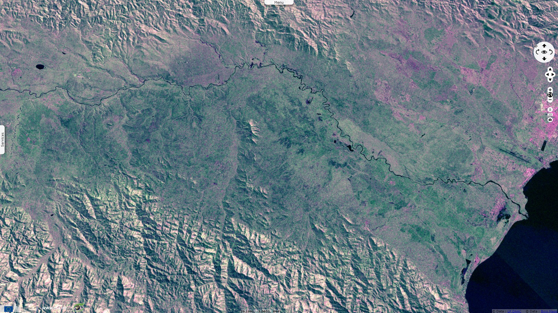
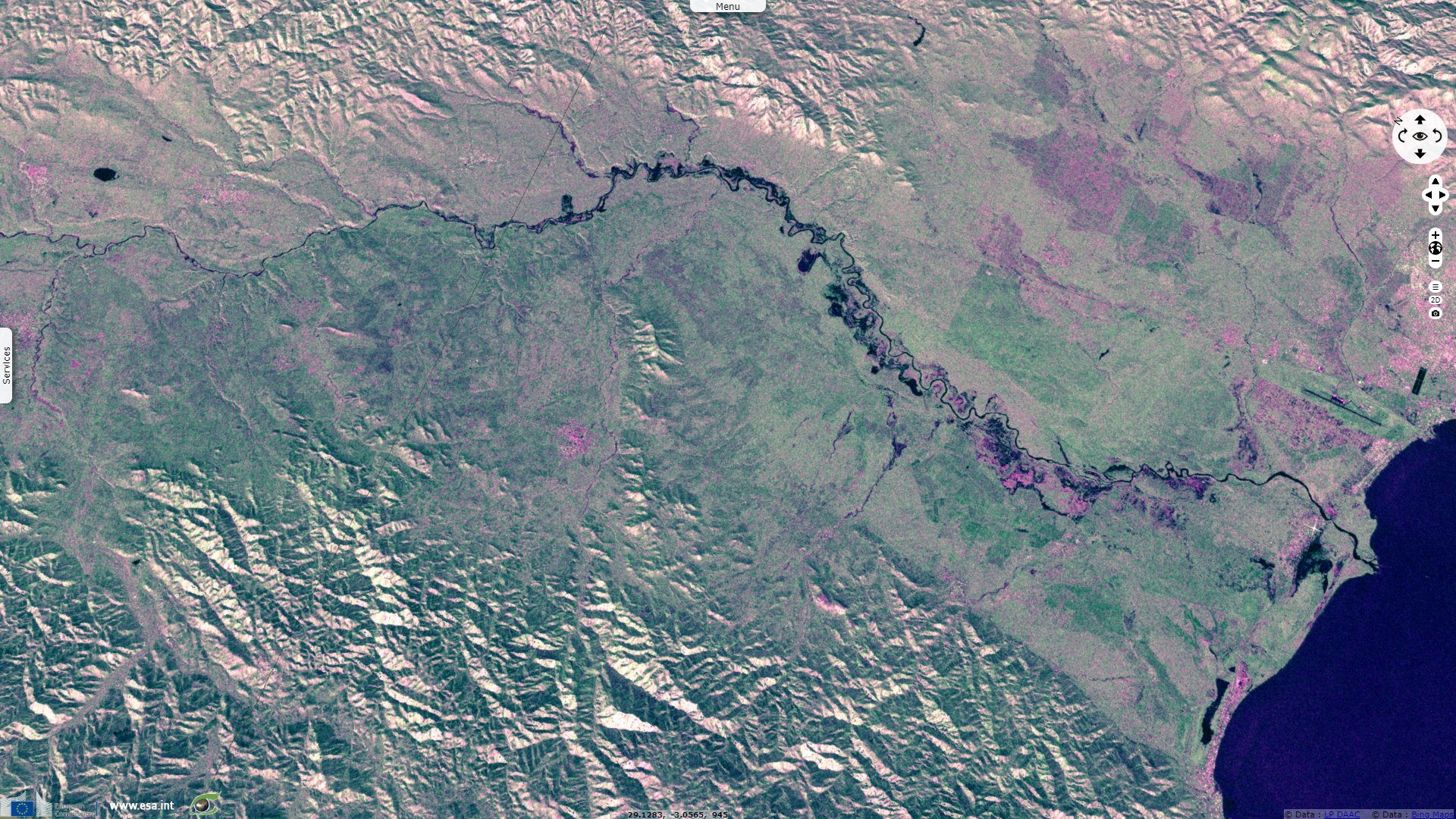
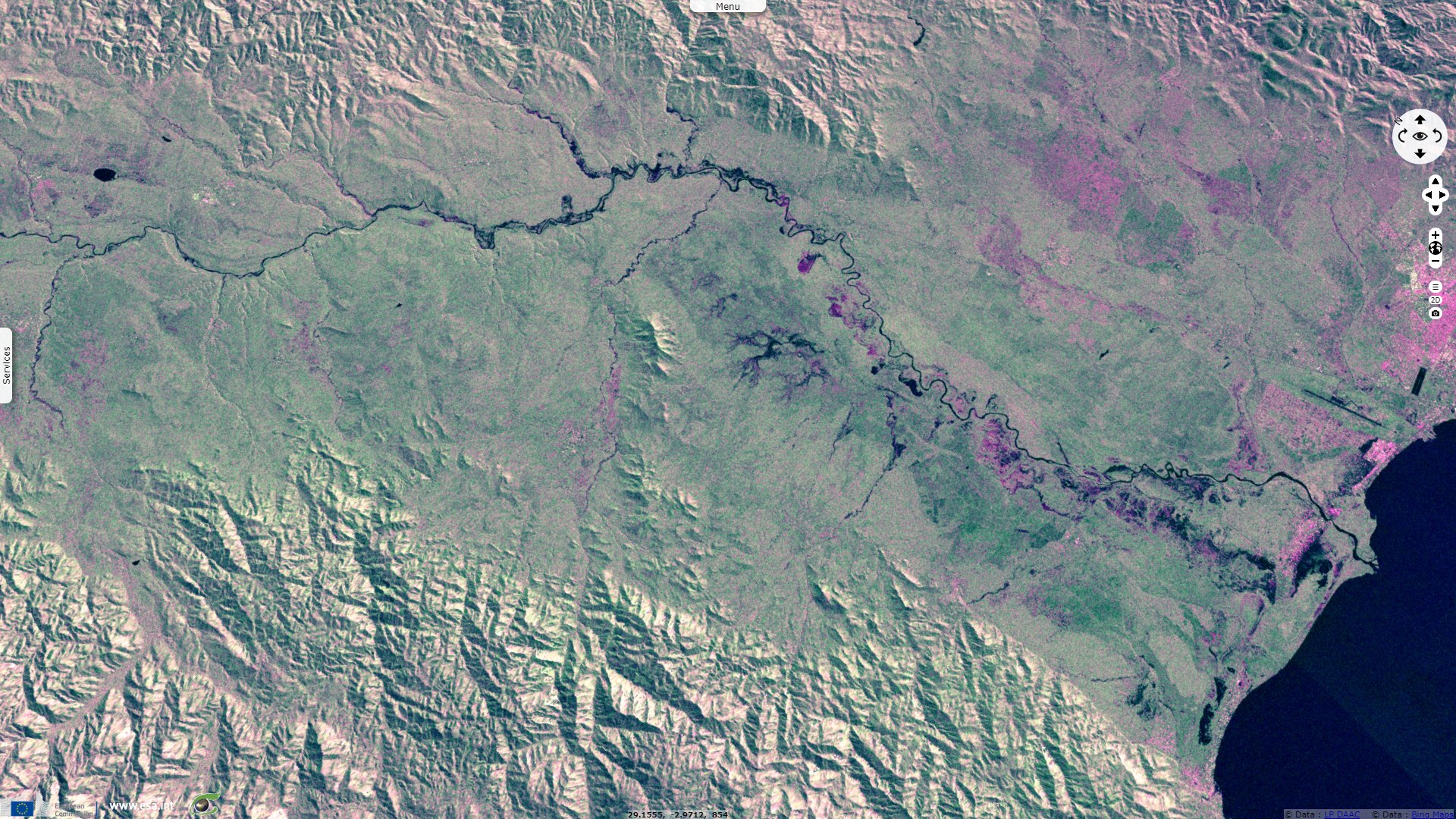
Sentinel-3 SRAL LAND acquired on 01 May 2020 at 19:38:05 UTC
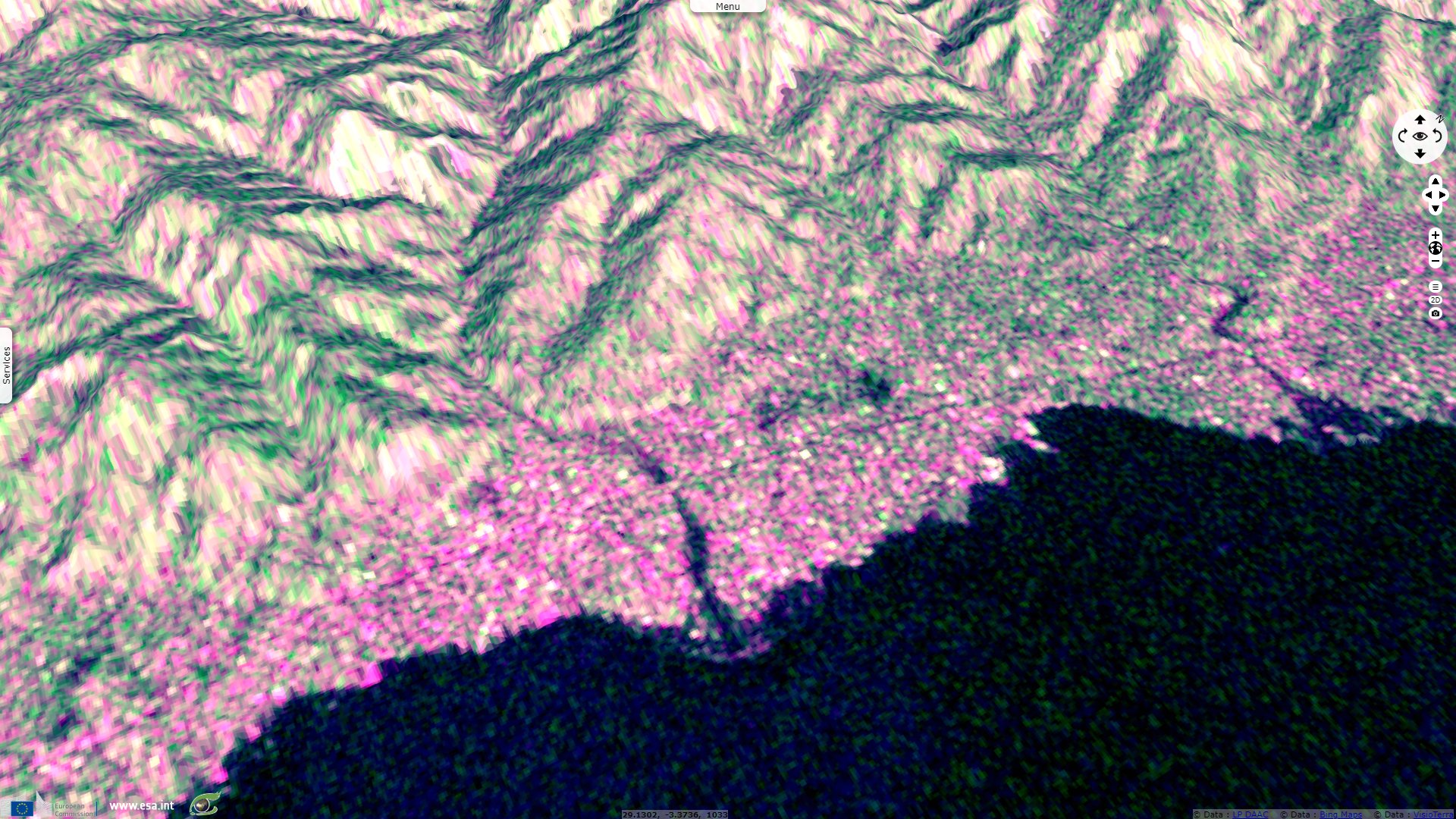
Sentinel-1 CSAR IW acquired on 02 May 2020 at 03:44:49 UTC
Sentinel-1 CSAR IW acquired on 31 March 2020 from 16:20:11 to 16:20:36 UTC
...
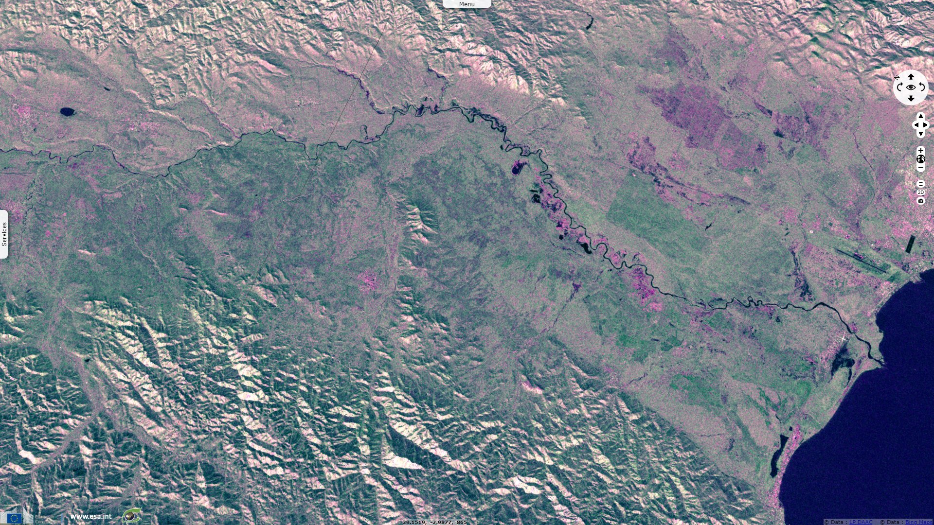
Sentinel-3 SRAL LAND acquired on 01 May 2020 at 19:38:05 UTC
Sentinel-1 CSAR IW acquired on 02 May 2020 at 03:44:49 UTC
Keyword(s): Flooding, precipitations, river, hydrology, urban planning, mountain range, erosion, agriculture, deforestation, DRC, Democratic Republic of Congo, Burundi, Great Rift Valley
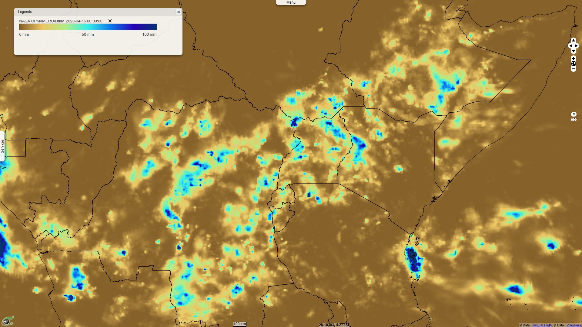
Following heavy precipitations, several deadly floodings have been observed in the region north-west of Lake Tanganyika. Fidèle Kasangandjo Mwagalwa, agronomic engineer in water and soil management and research assistant at the Congo Basin Water Resources Research Center (Centre de Recherche en Ressource en Eau du Bassin du Congo, CRREBaC) explains the context of this area:
"The territory of Uvira is located in the southern hemisphere on the north-western edge of Lake Tanganyika between 3°21' and 3°27' South latitude and between 29°7' and 29°12' East longitude. Uvira is a rapidly growing agglomeration of 200 000 inhabitants located within a radius of 16 km². The territory of Uvira forms a narrow and elongated geomorphologic flat area of about 1 km wide and about 12 km long. This flatland is bounded to the east by Lake Tanganyika and to the west by the Mitumba mountain range escarpments with very steep slopes often exceeding 100%."
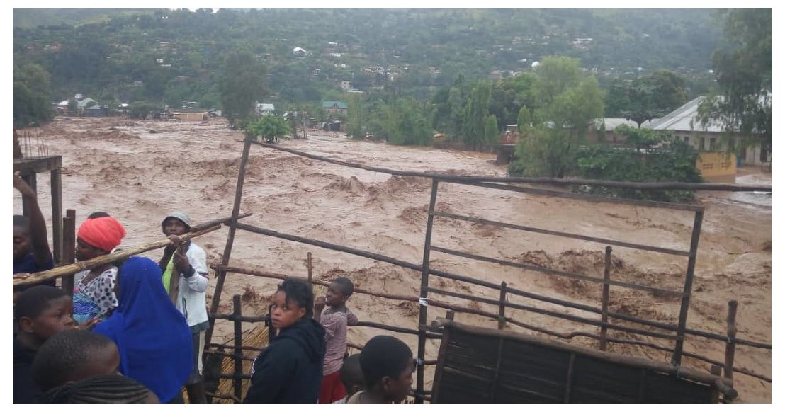
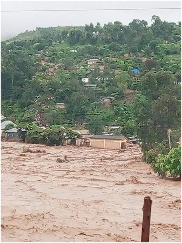
Mulongwe river during its flooding in Uvira, 18 April 2020 – Source: Fidele Kasangandjo Mwagalwa.
It should be noted that studies have been carried out in the region by the Regional Post-graduate Training School of integrated management of tropical forests and lands (Ecole Régionale postuniversitaire d’Aménagement et de gestion Intégrés des Forêts et Territoires tropicaux, ERAIFT). It is the case of the masters thesis written by Jean-Marie Bantu Baluge, Role of traditional knowledge in the participatory approach to protected area management - Case of Itombwe Nature Reserve, that can be found here.
This work details the relief of the Itombwe mountains located on the western shore of Lake Tanganyika: "The ancient geological formations, preserved in the form of the high tectonic movements of the Quaternary era, gave rise to the present relief. Geologically, the massif is formed by metamorphic and crystalline Precambrian rocks. This relief can be described as a sequence of hills ranging from 900 to 1500 m in altitude in the west followed by a low escarpment (1500 to 2000 m) in the central sector at the origin of a vast set of high plateaus generally located above 2700 m with several peaks exceeding 3000 m along the eastern ridges of the massif before reaching a large escarpment in the east (formed by altitude differences sometimes making a fall from 2400 m to 900 m) overlooking Lake Tanganyika located at 773 m altitude."
Fidèle Kasangandjo Mwagalwa then described the hydrologic features of the coastal area north-west of the lake: "Geologically, the area encompasses alluvial fans that have been actively advancing into the Lake Tanganyika rift with a rhythm of a few metres over the last 50 years and thus constitute an alluvial plain (Munyololo et al. 1999). This territory extends the alluvial fan of three rivers: the Kalimabenge River (sub catchment area: 22 km and 91 km²), the Mulongwe River (sub catchment area: 25.5 km and 115 km²) and the Kavimvira River (sub catchment area: 17.5 km and 42 km²). The temperatures of these three rivers are between: 16.8 - 25.2ºC; 15.9 - 26.8ºC and 20.0 - 29.4 ºC respectively. Soil erosion and/or sedimentation are immense problems that threaten water resources within the Lake Tanganyika catchment area."
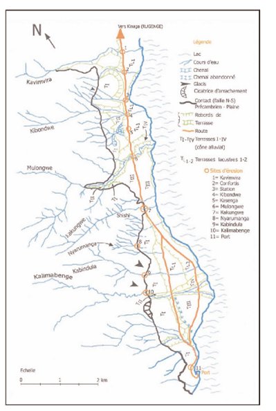
Geomorphological map of Uvira – Source: Ilunga, 2006.
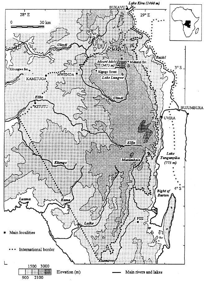
Location of the Itombwe Forest Massif – Source: Bantu, 2012.
"The territory of Uvira has a very specific geographical situation, which strongly attracts the surrounding due to the following factors:
- Port activities,
- Trade, facilitated by the direct road from the city of Bujumbura (Burundi) less than 30 km away,
- The lake connection with the port city of Kigoma in Tanzania via the city of Kalemie (D.R. Congo),
- Lake fishery activities represent a potential source of revenue relative rather accessible to anyone.
"These factors currently explain the strong overpopulation encountered within the territory which is at the root of several damages encountered, some of which are of natural origin while others are of anthropic origin, for example landslides (a type of erosion process), the severity of which dates back to the 70s and 80s. A very strong degradation followed and caused several damages, among which:
- overflowing rivers and the formation of large gullies that carry away everything in their path (including houses and roads),
- sandy-gravel to sandy-silt alluvium deposits which results in the progressive burial of dwellings, clogging of drainage nozzles and road degradation.
Jean-Marie Bantu Baluge also deals with several other phenomenons that led to loss of tree cover, increasing the erosion and water runoff:
"Transhumance farming: towards the middle of the 20th century (1945), Tutsi pastoralist immigrants from Rwanda settled in localities of Itombwe including Lwamba and Tulambo with the aim of implementing the colonial project called ‘Elevage de l'Itombwe’ (ELIT). And from 1960 onwards, the largest wave of Rwandan Tutsi refugees invaded Itombwe. This second wave of refugees also practises peasant livestock farming. The difference between the immigrants of 1945 and those of 1960 lies in this: The ELIT project practiced pasture farming in an orderly, neat and well-targeted manner. The peasant farmers, on the other hand, practiced day-to-day clearing of land for pasture management. They are more likely to target bamboo forests. Likewise, transhumance herding of livestock is accompanied by the practice of uncontrolled fires. This explains the fact that Itombwe is marked in places by biomass losses, poor soil and deforestation.
Agriculture: the Balega and Babembe people practice the shifting cultivation system of felled crops. This practice consists in felling large trees and using fire to clear large forested in order to establish fields for agriculture.
There are farming communities that come only for mercantile reasons as a result of deforestation and soil degradation. They practice bushfires. These communities also come in search of land for grazing. Other population movements are due to the search for refuge in case of war, in search of fertile land and pastures."
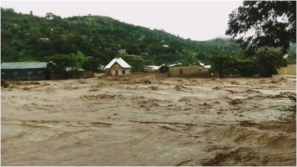
The Mulongwe flooding damaged and destroyed houses and buildings near the river bed in Uvira, 18 April 2020 – Source: Fidele Kasangandjo.
Fidèle Kasangandjo Mwagalwa then reminds the impact of past floods in the region: "Flooding is one of the most common hydrological hazards in the territory of Uvira, and one of the hazards most frequently responsible for colossal loss of goods and services in the region. Floods cause serious consequences including loss of life and infrastructure. The year 1987 was marked by a strong flood in the territory of Uvira which caused several losses including the death of 12 persons reminds the following report .
In February 2002, torrential floods killed more than 46 people and destroyed thousands of houses in Uvira (Moeyersons et al., 2010)."
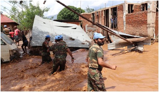
ONU MONUSCO forces helping the inhabitants during the Mulongwe flood in Uvira, 18 April 2020 – Source: Fidele Kasangandjo.
"According to the United Nations Organization Stabilization Mission in the Democratic Republic of the Congo (MONUSCO), heavy rains fell in the territory of Uvira and its surrounding in South Kivu during the night of Thursday, 16 to Friday, 17 April 2020. The authorities said the heavy rains caused the Mulongwe River to overflow its bed towards the banks of the city of Uvira.
The subsequent flooding caused extensive property damage. Provincial Governor Theo Kassi reported that, as at 17 April, at least 3500 houses had been destroyed. MONUSCO reported that 15 000 houses had been damaged or destroyed and 7 bridges damaged or completely collapsed."
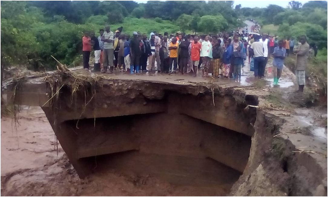
The might of the river damaged or destroyed 7 bridges in Uvira, 18 April 2020 – Source: Fidele Kasangandjo.
"Almost 78 000 people are reported to have been left homeless. Roads have been blocked and piped water has been cut off. MONUSCO reported that the floods caused the death of 36 persons, including 26 in the town of Uvira and 6 in Uvira territory. More than 40 people were injured and had to be hospitalized. A search is underway in order to find survivors under the rubble of destroyed houses."
The steep slopes caused a rapid runoff to the river bed, 18 April 2020.– Source: Fidele Kasangandjo.
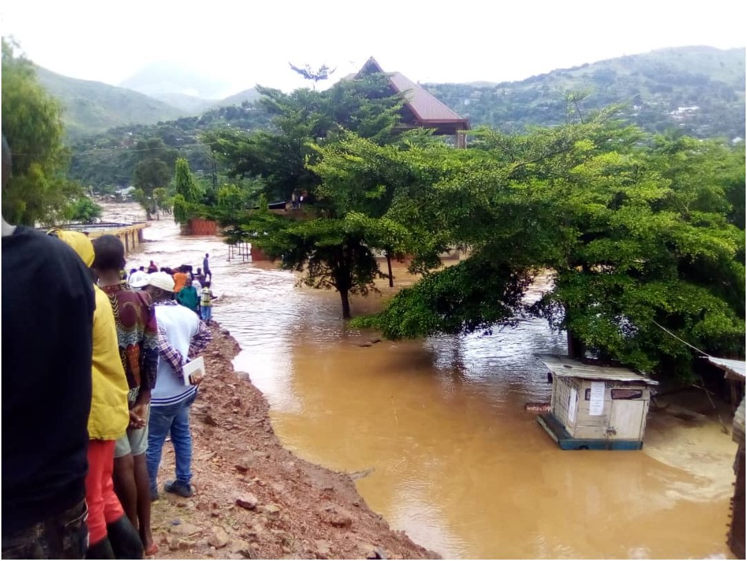
Children in streets flooded by the River Mulongwe in Uvira, 18 April 2020 – Source: Fidele Kasangandjo.
"Flooding has also affected other provinces in recent weeks, including Haut-Lomami, Tanganyika and Maniema, where the Congo River in Kindu reached 6.75 metres on 18 April."
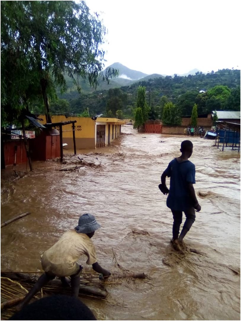
Children in streets flooded by the River Mulongwe in Uvira, 18 April 2020 – Source: Fidele Kasangandjo.
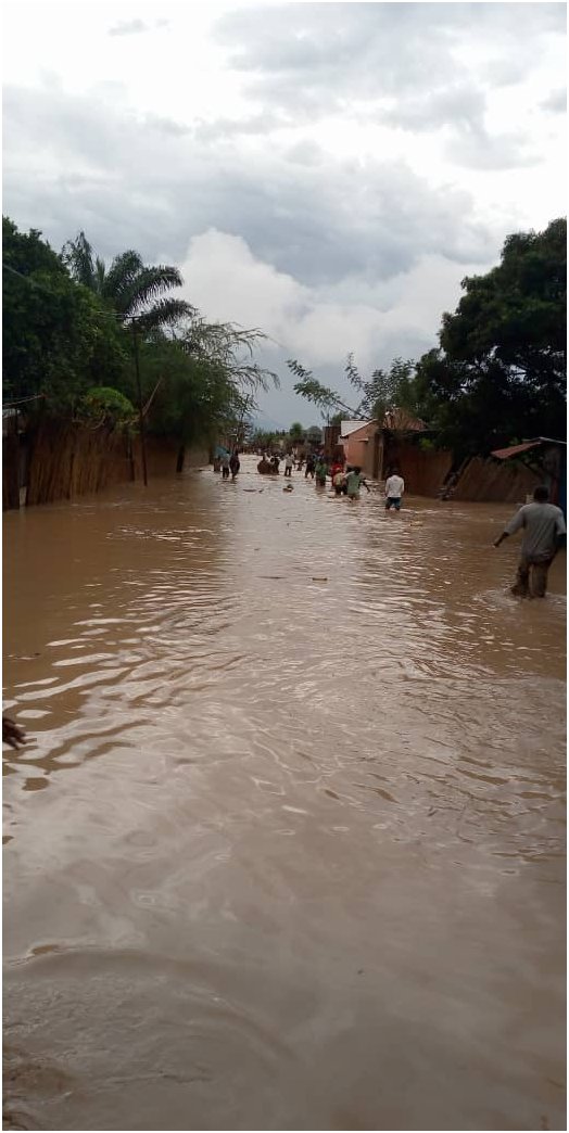
People in flooded Uvira streets assess the damage after the speed of River Mulongwe decreased, 18 April 2020 – Source: Fidele Kasangandjo.
The views expressed herein can in no way be taken to reflect the official opinion of the European Space Agency or the European Union.
Contains modified Copernicus Sentinel data 2026, processed by VisioTerra.
Contains modified Copernicus Sentinel data 2026, processed by VisioTerra.
| More on European Commission space: |  |
 |
 |
||||
| More on ESA: | |
|
|
S-1 website | S-2 website | S-3 website | |
| More on Copernicus program: | |
|
|
Scihub portal | Cophub portal | Inthub portal | Colhub portal |
| More on VisioTerra: | |
|
|
Sentinel Vision Portal | Envisat+ERS portal | Swarm+GOCE portal | CryoSat portal |