Flood-controlled cycle of life in the Okavango delta
Sentinel-3 OLCI FR acquired on 17 November 2016 at 08:01:14 UTC
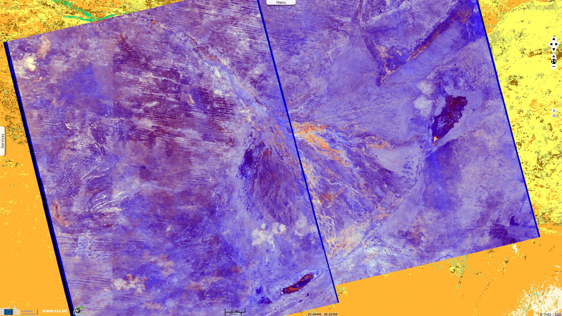
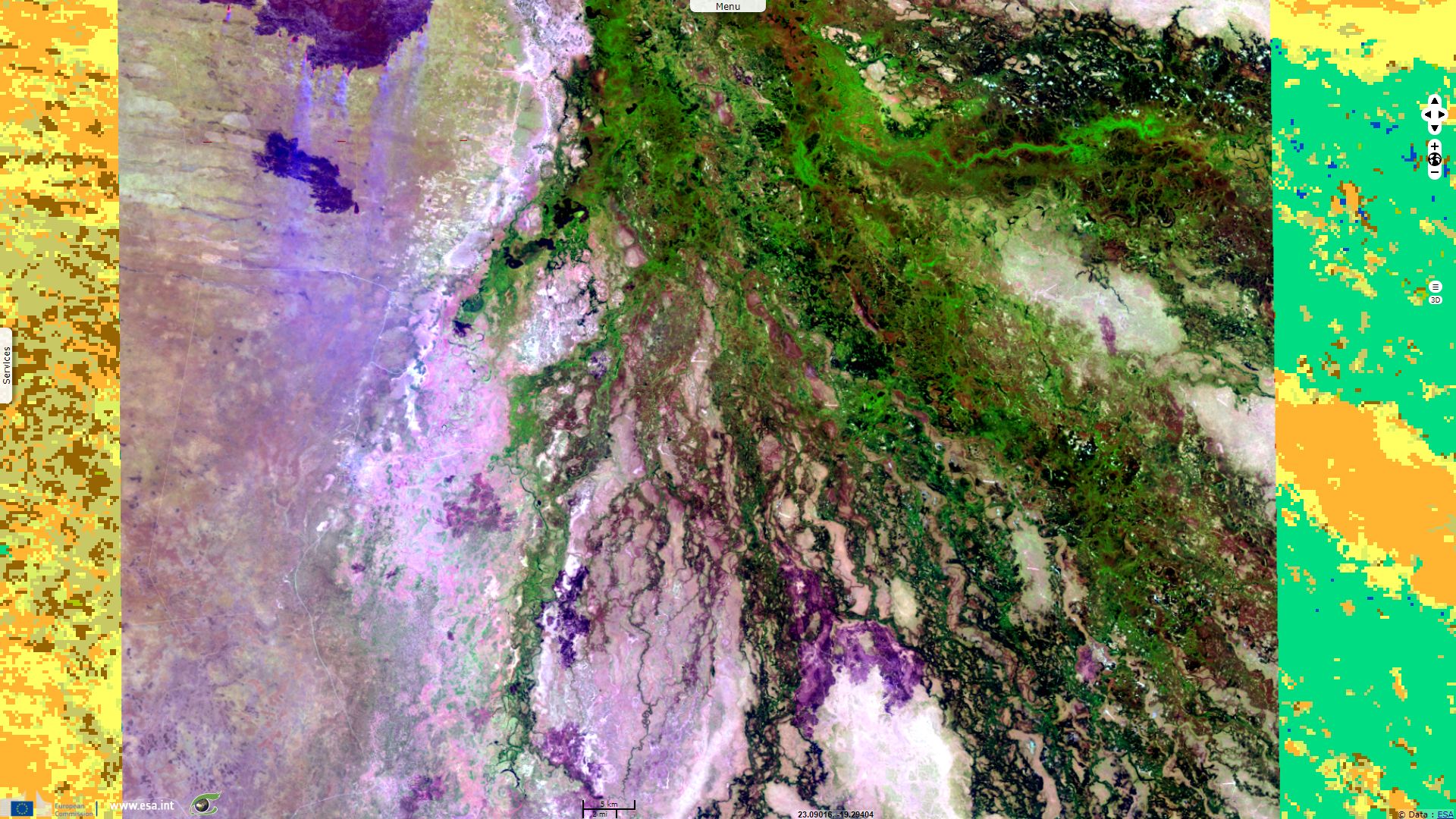
Sentinel-1 CSAR IW acquired on 18 November 2016 from 16:56:01 to 16:56:26 UTC
Sentinel-2 MSI acquired on 02 December 2016 at 08:23:12 UTC
...
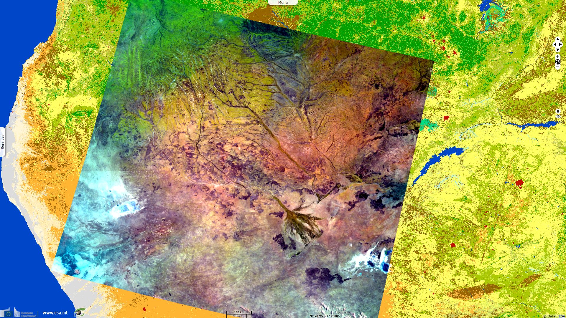
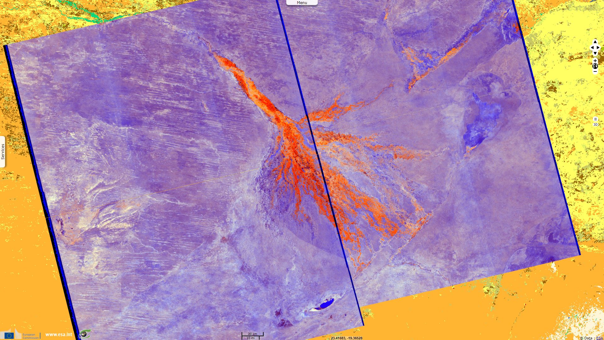
Sentinel-1 CSAR IW acquired on 18 November 2016 from 16:56:01 to 16:56:26 UTC
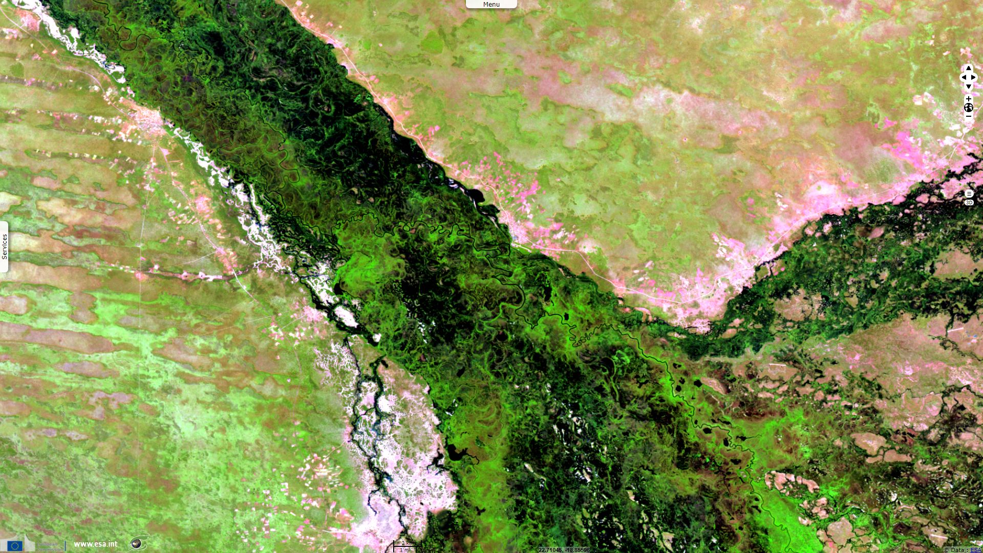
Sentinel-2 MSI acquired on 02 December 2016 at 08:23:12 UTC
...
Keyword(s): Floodplain, marsh, alluvial fan, endorheic basin, salt pan, salinisation, ramsar wetland, UNESCO World heritage, wildlife conservation area, fire, burn scar, Kalahari desert, Okavango, Botswana, Namibia, Angola
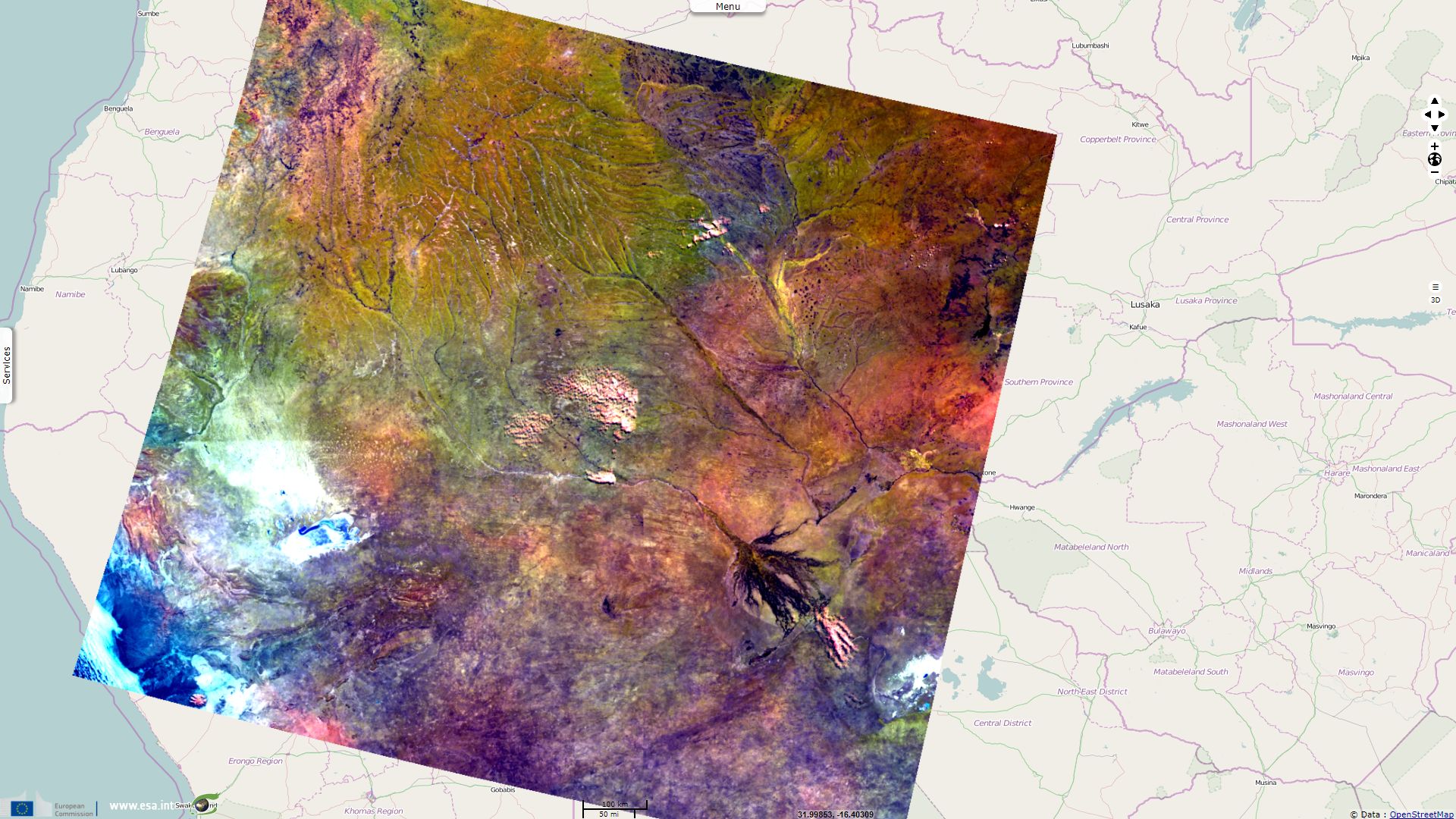
The Kalahari desert encompasses most of Botswana and Namibia. It is a semi-arid endorheic basin located on a flat 1000m high plateau. It contains two large seasonally inundated flat pans, the Makgadikgadi Pan in Botswana and Etosha Pan in Namibia. The Angolan high plateau ultimately feeds the Zambezi River, the Congo river, the Cunene River but a network of gently sloping rivers also feed the only permanent river of the Kalahari, the Okavango. For most of its journey through the Kalahari, the Okavango river crosses an alternation of sand dunes (blue in the S-1) and the iron oxide-rich laterite-filled furrows.
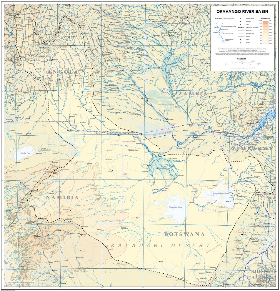
The Okavango river basin - source United Nation.
According to the tour guide Africabespoke: "At some stage in the latest 65 million year period large Rivers flowed into the Kalahari Basin, creating a giant lake which in turn emptied into the Indian Ocean via the Limpopo River. And then about 50 000 years ago, due to the numerous fault lines in the area, all but the Okavango River were diverted, and the Lake began to shrink. Until about 10 000 years ago another fault effectively dammed the Okavango River creating the delta" in a large and flat alluvial fan "and leaving the Lake to become the largest the salt pan complex in the world, the Makgadikgadi Pans – an amazing expanse of whiteness the size Switzerland.". In very wet years, Okavango may flow into its Magweggana distributary river and cross the Kalahari basin, reaching the Zambezi river and finally, the Indian Ocean.
According to UNESCO and Ramsar: "Set in a semi-arid region and subject to large fluctuations in flooded area, the Okavango delta in north-west Botswana includes permanent and seasonal swamp, riverine floodplains and a seasonal freshwater lake."
Africabespoke writes: "Once a year Angola receives three times the amount of rainfall that Botswana does." This "vast inland water flow forms each year when these summer rains in the Angola highlands drain onto the plains of Botswana, flooding a wide flat area slightly larger than Belgium" adds Ramsar. This exceptional landscape is highlighted for the independence day of Botswana, the 30 September.
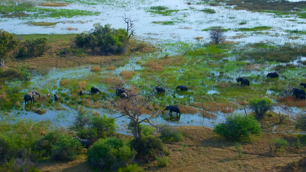
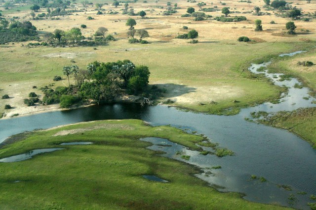
"Group of elephants in the Okavango Delta" by Mario Micklisch
Ramsar rejoices that "On 22 June 2014 the Okavango Delta was inscribed as the 1000th UNESCO World Heritage Site, bringing the number of Ramsar Sites that also carry the World Heritage designation to 62.". It was also voted as one of the seven natural wonders of Africa.
According to Ramsar and Africabespoke: "Although the summer rains fall in Angola in January, they take a whole month to travel the first 1000 km of the Okavango River. And then they take a further four months to filter through the plants and numerous channels of the final 250 kms of the Delta. As a result", "the waters peak between June and August during the region’s parched winter" "and the delta swells to three times its permanent size", "attracting one of Africa’s greatest concentrations of wildlife."
"Wet to dry" by Yannick Ott
UNESCO describes this World Heritage site as "One of the unique characteristics of the site is that the annual flooding from the River Okavango occurs during the dry season, with the result that the native plants and animals have synchronized their biological cycles with these seasonal rains and floods."
This shift creates an unusual dynamic: during the flooded dry season, water first covers the vegetation remaining from the rainy season. Small vegetation then regrows over the water level. As the dry season advances and the seasonal swamp dries up, small vegetation regresses while trees continue to grow for a time. Finally, tree cover also decreases during the end of the dry season, before a new cycle begins. "It is an exceptional example of the interaction between climatic, hydrological and biological processes."
Ramsar wrote that "the Okavango floodplains form critical habitat for many species of birds and wildlife at their southern limits of distribution in the region. The diverse flora and fauna includes 1060 different plant species, 32 large mammal species, over 650 species of birds, 68 species of fish, and a highly diverse insect population, all of which include rare, endangered and endemic species" "such as the cheetah, white rhinoceros, black rhinoceros, African wild dog and lion", as well as the "African elephants, buffalo, zebra, wildebeest, and giraffes" as cited by UNESCO and Ramsar.
Africabespoke adds that "many of these animals live in the Delta but the majority move in and out. They leave with the summer rains to find renewed fields of grass to graze on and trees to browse. And then as winter approaches and the countryside dries up they make their way back to swamps. This leads to some of the most incredible sightings as large numbers of prey and predators get squashed into a smaller and smaller area."
To "promote coordinated and environmentally sustainable regional water resources development, while addressing the legitimate social and economic needs of each of the riparian states", the Permanent Okavango River Basin Water Commission has been established in 1994. One if its tasks is to "prepare criteria for conservation, equitable allocation and sustainable utilisation of water".
Africabespoke describes the topography of the Okavango : "At its widest point in a big flood year the seasonal swamp stretches to 150 km across from east to west. And one of the factors that leads to the ever changing nature of the Delta is the flatness of the area. To give you an idea of how flat it is, if you were to take a cross section of the Delta at its widest point, along this cross section you would find that the height variation from the mean over that 150km is less than 2m.
Here in the Delta, because of the clean waters of the Okavango, there is almost no mud and the river’s load is comprised almost entirely of sand. It is the plants that capture the sand, acting as the glue and making up for the lack of mud and in the process creating further islands on which more plants can take root.
This process is important in the formation of the other type of islands that you see in the swamps, linear islands. They are long and thin and often curved like a gently meandering river. The reason for that is that they are actually the natural banks of old river channels. Which over time have become blocked up by plant growth and sand deposition, resulting in the river changing course and the old river levees becoming islands. Due to the flatness of the Delta, and the large tonnage of sand flowing in to it from the Okavango River, the floor of the delta is slowly but constantly rising."
Africabespoke also raises the subject of soil salinisation: "Of the 11 km3 flowing in the delta, "an incredible 60% of this water leaves into the atmosphere via transpiration, in other words via the leaves of the plants rather than via evaporation. Amazingly only 2% of the water soaks into the desert and about the same amount flows out at the southern end of the delta.
With all of that water leaving the Delta into the atmosphere the Delta is unable to flush itself of the minerals carried in by the river and the water should become salty and uninhabitable like the Dead Sea. But remarkably it hasn’t and there are two reasons for this. Firstly, the water itself has a very low salt content, and secondly as so much of the water is leaving via the plants rather than evaporation the salt from that water collects around the roots of the plants rather than being left behind in the water.
As the water enters the roots it leaves some of the salts behind, these salts concentrate in the sands of the island, causing the islands to grow a little each day. It is for this same reason that the islands have bare, white patches in their centres. Those parts of the island have become too salty to support plants, aside from the odd salt resistant palm tree."
The views expressed herein can in no way be taken to reflect the official opinion of the European Space Agency or the European Union.
Contains modified Copernicus Sentinel data 2026, processed by VisioTerra.
Contains modified Copernicus Sentinel data 2026, processed by VisioTerra.
| More on European Commission space: |  |
 |
 |
||||
| More on ESA: | |
|
|
S-1 website | S-2 website | S-3 website | |
| More on Copernicus program: | |
|
|
Scihub portal | Cophub portal | Inthub portal | Colhub portal |
| More on VisioTerra: | |
|
|
Sentinel Vision Portal | Envisat+ERS portal | Swarm+GOCE portal | CryoSat portal |