Kilimanjaro, fire island in a sea of clouds, Tanzania
Sentinel-2 MSI acquired on 03 July 2016 at 07:36:12 UTC
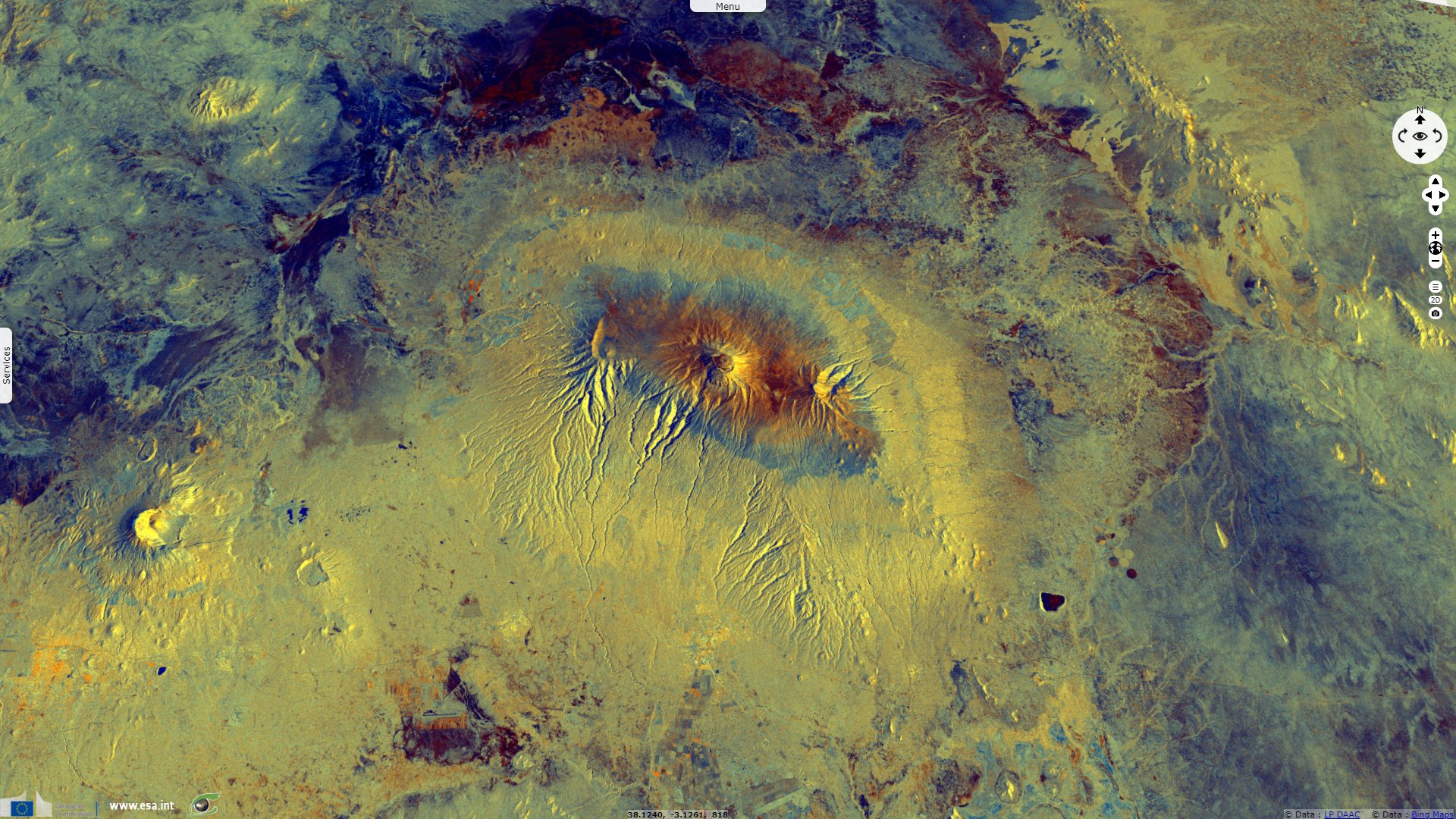
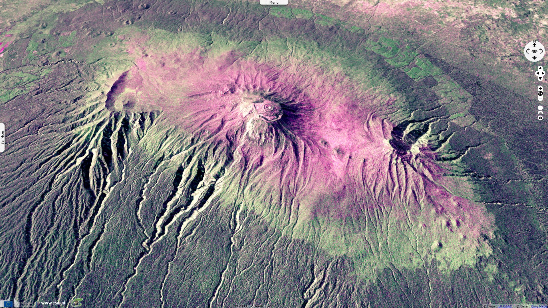
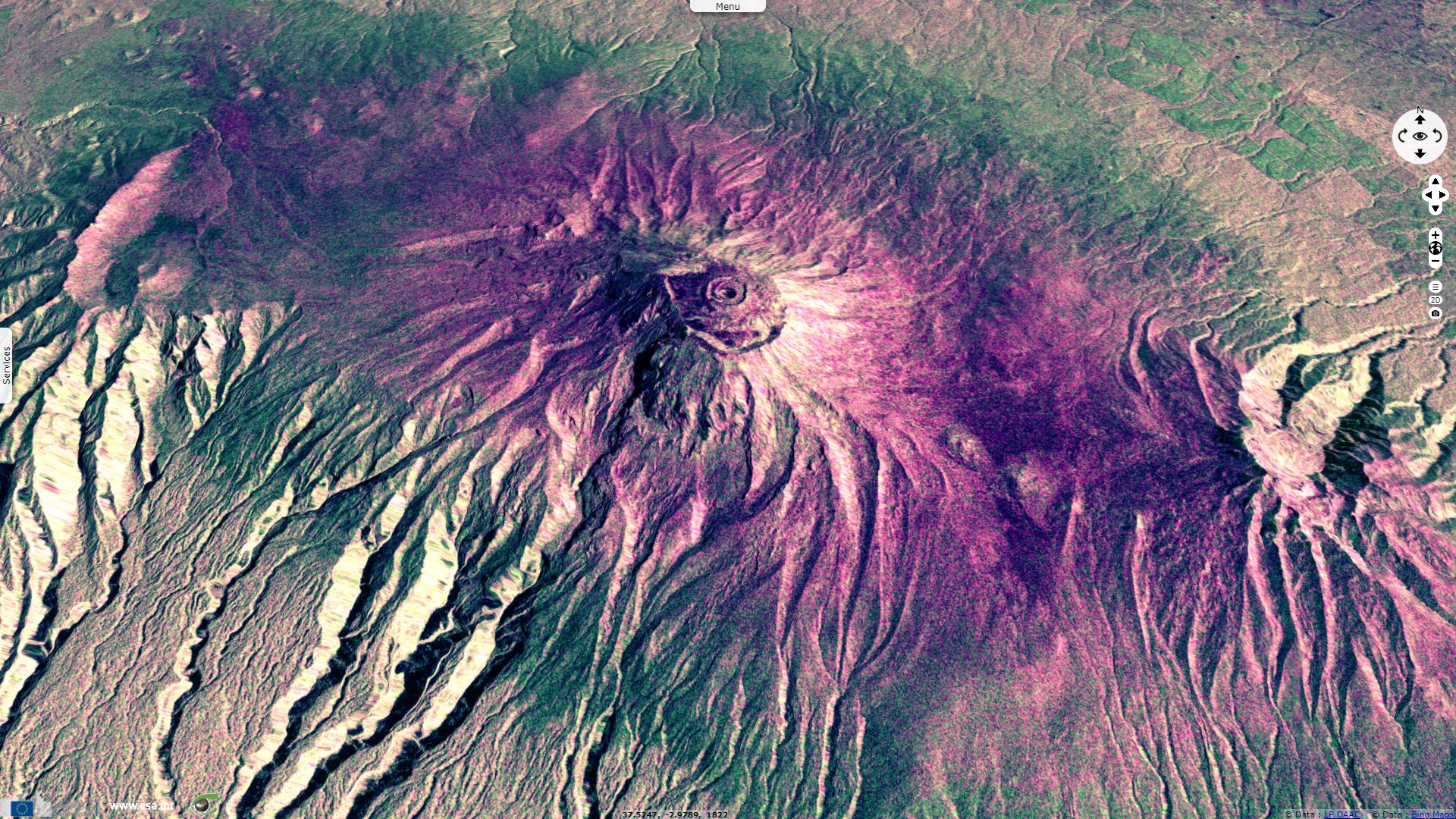
Sentinel-1 CSAR IW acquired on 22 May 2017 at 03:11:37 UTC
...
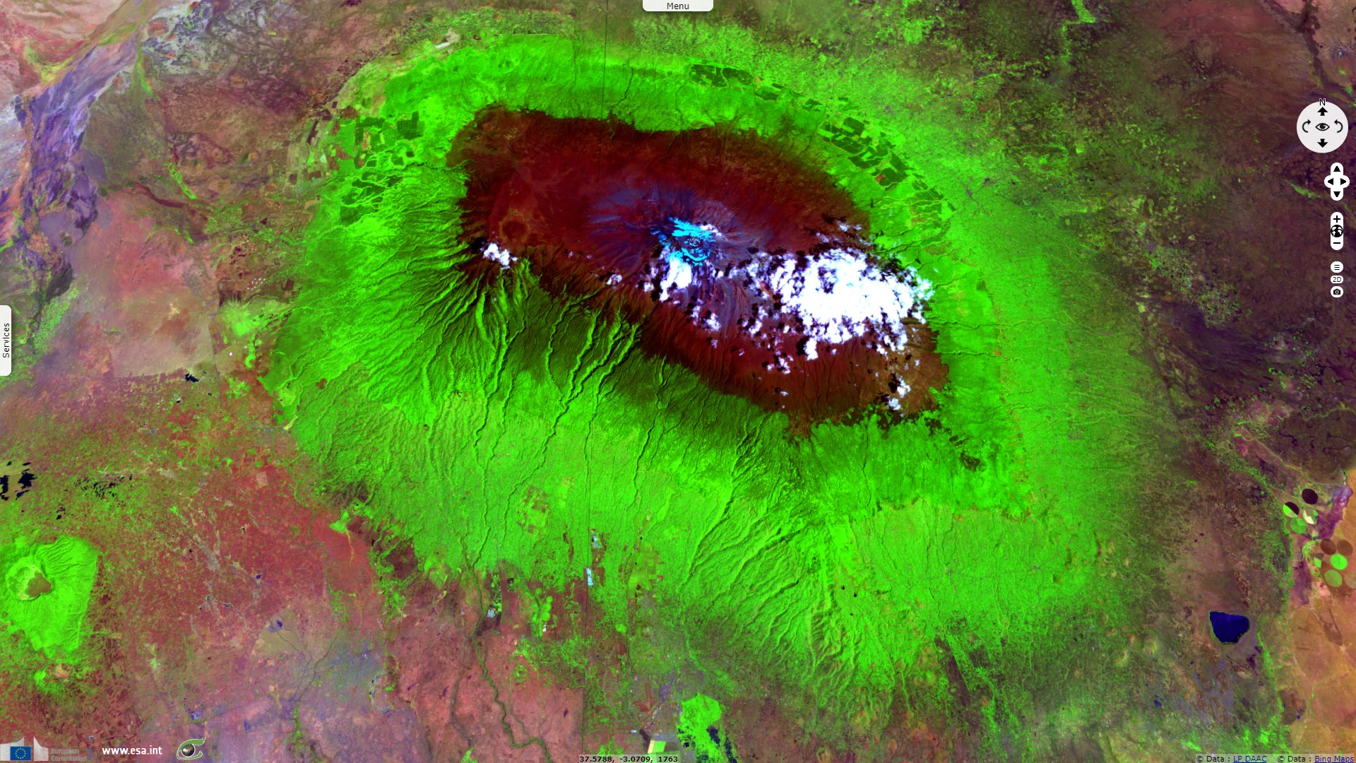
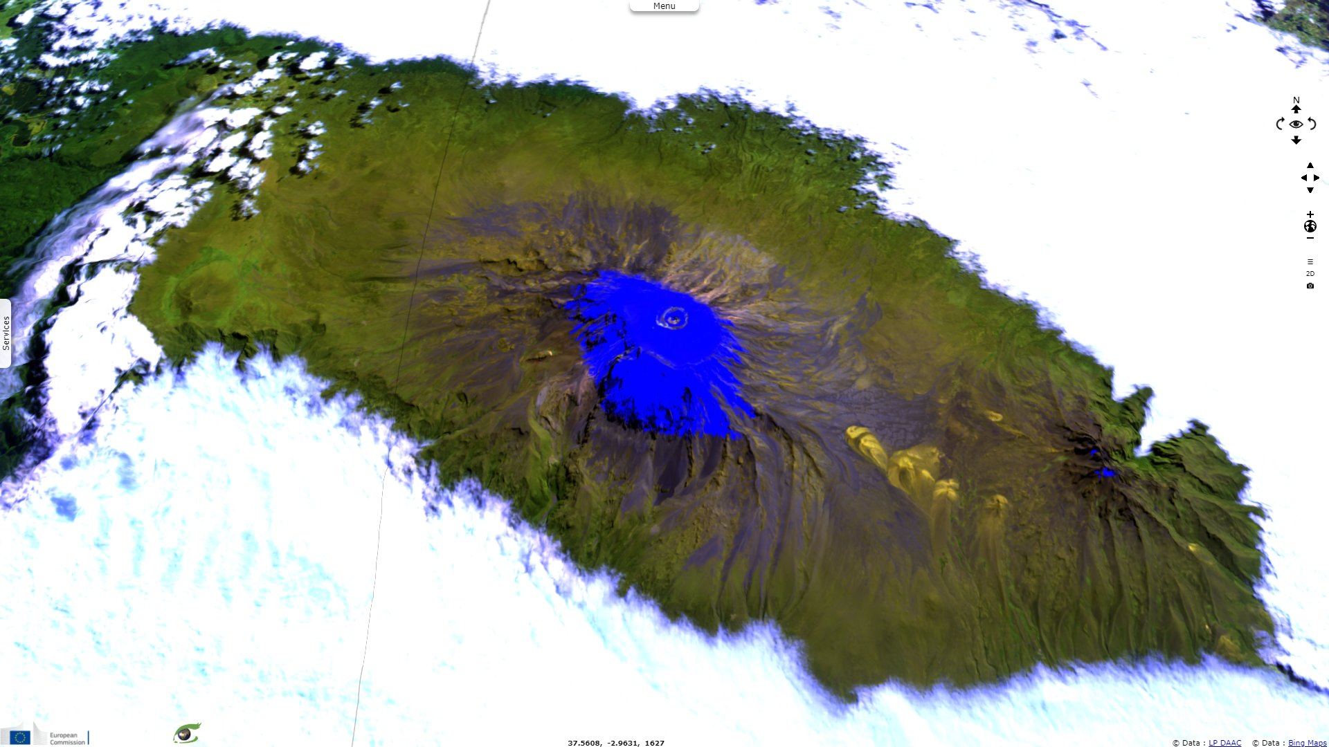
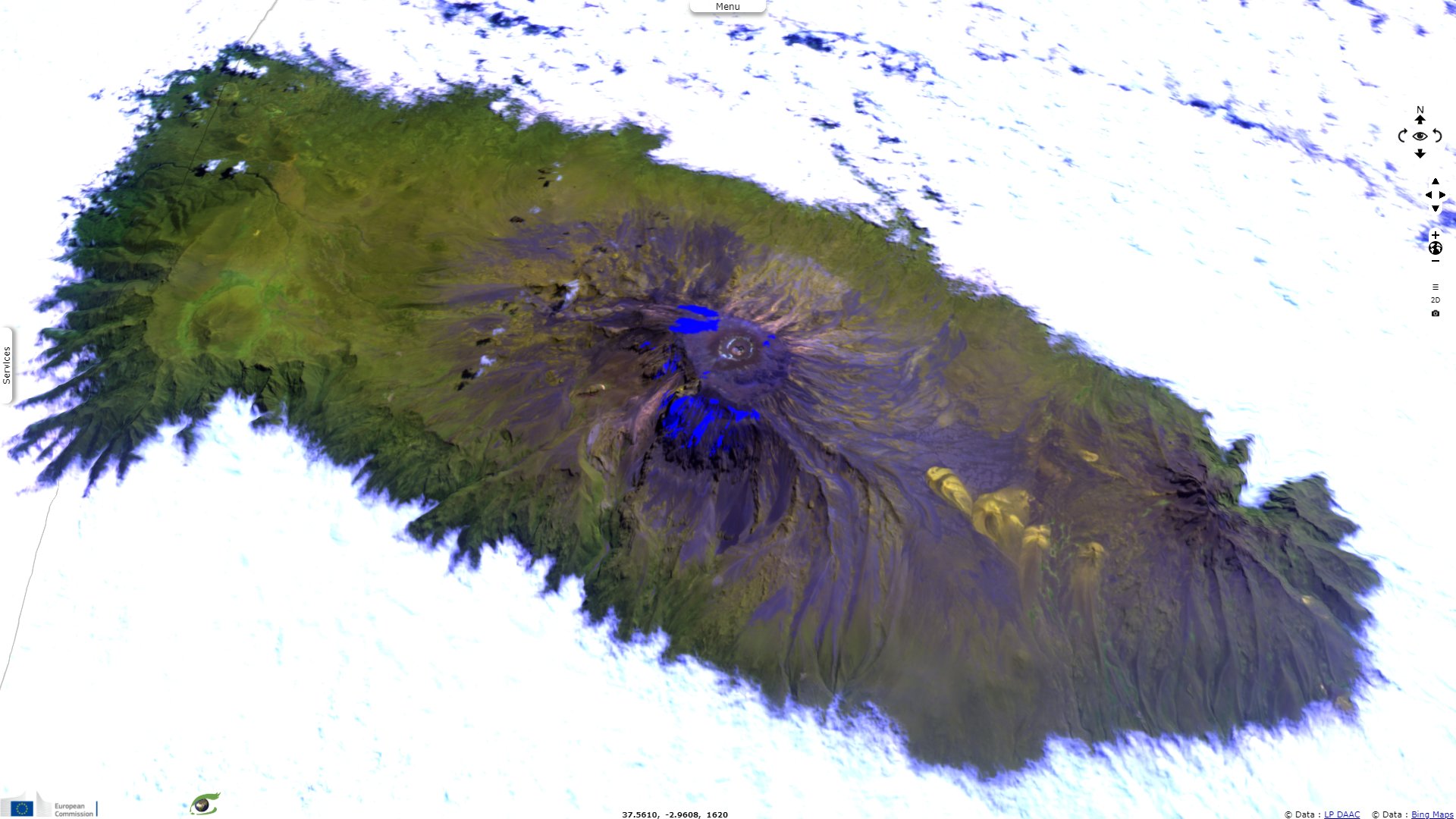
Sentinel-2 MSI acquired on 28 July 2019 at 07:36:21 UTC
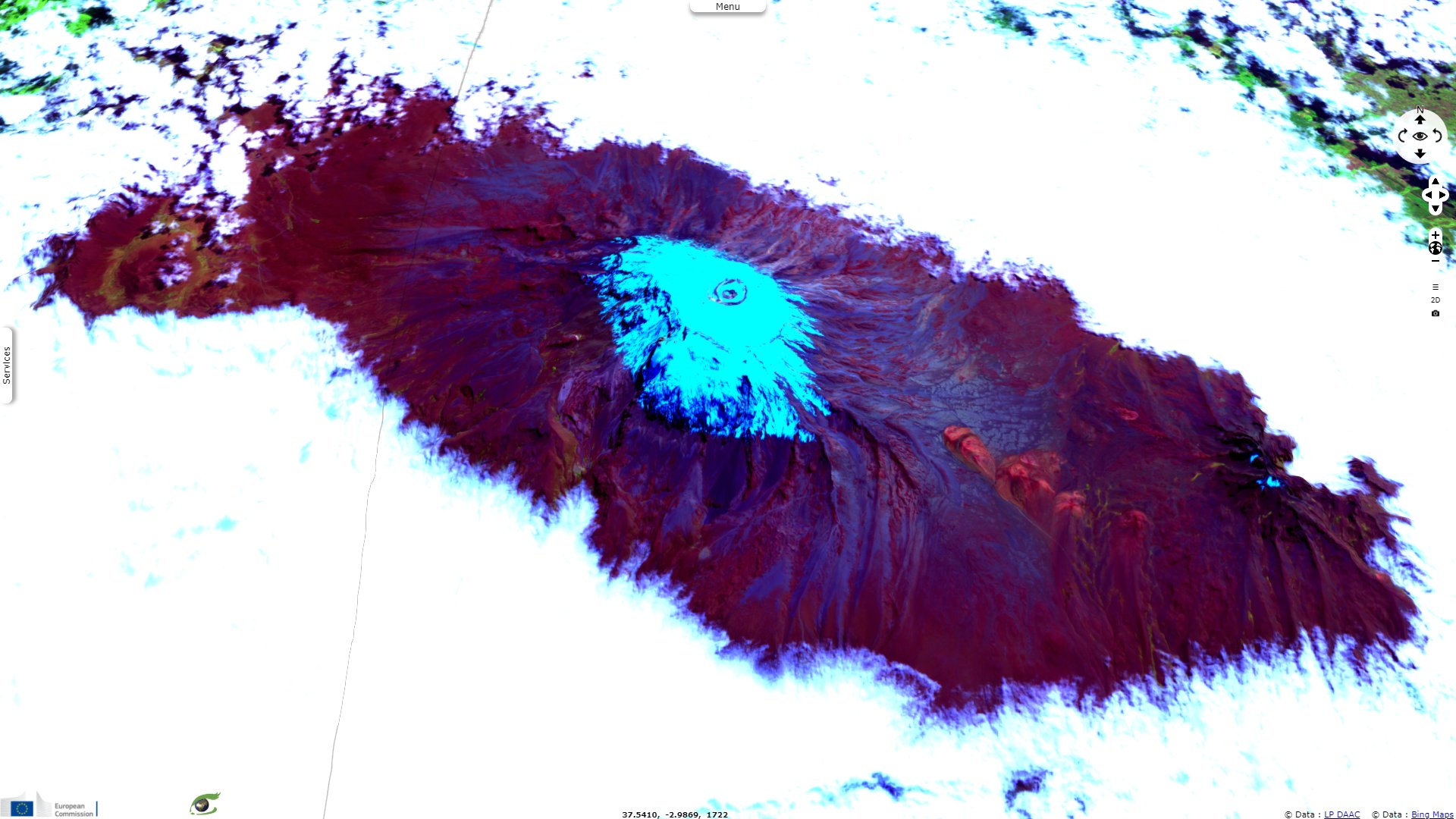
Sentinel-1 CSAR IW acquired on 22 May 2017 at 03:11:37 UTC
...
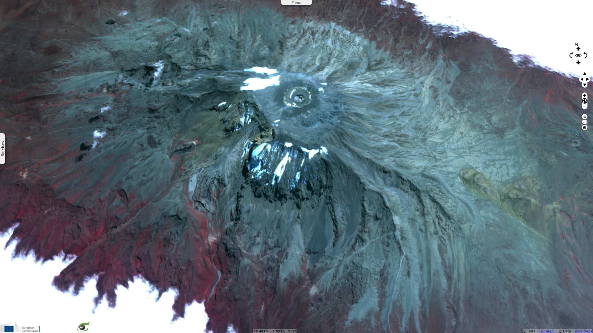
Sentinel-2 MSI acquired on 28 July 2019 at 07:36:21 UTC
Keyword(s): Mountain, volcano, forestry, orographic lift, glacier, cryosphere, National Park, biodiversity, UNESCO World Heritage, Great African Rift, Tanzania
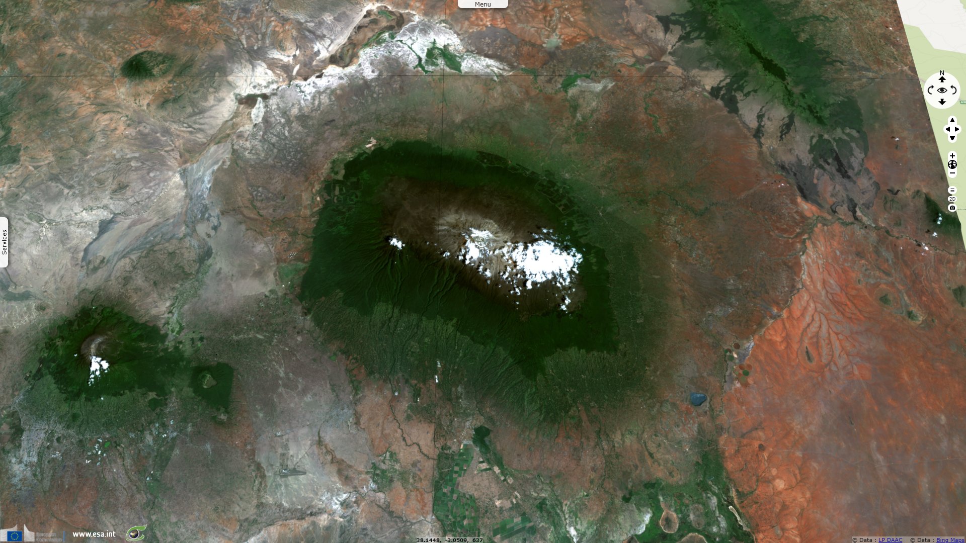
At 5895 m, Kilimanjaro is the highest point in Africa. This outstanding feature is protected by a National Park and became a UNESCO World Heritage site in 1987. It is described on its sheet as follows: "Kilimanjaro National Park covering an area of some 75 575 ha protects the largest free standing volcanic mass in the world and the highest mountain in Africa, rising 4877 m above surrounding plains to 5895m at its peak. With its snow-capped peak, the Kilimanjaro is a superlative natural phenomenon, standing in isolation above the surrounding plains overlooking the savannah."
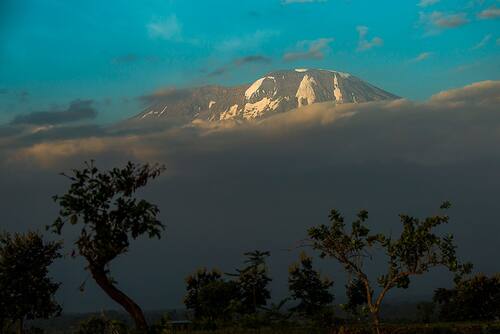

Kilimanjaro National Park - Source: Ko Hon Chiu Vincent.
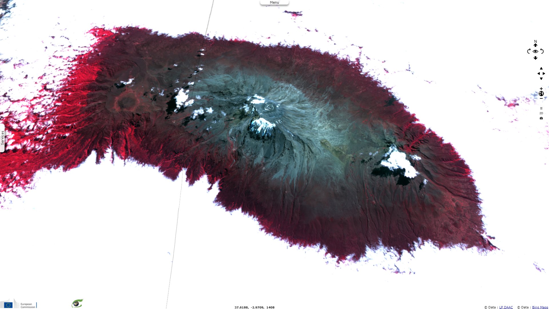
"Mount Kilimanjaro is one of the largest volcanoes in the world. It has three main volcanic peaks, Kibo, Mawenzi, and Shira. With its snow-capped peak and glaciers, it is the highest mountain in Africa. The mountain has five main vegetation zones from the lowest to the highest point: Lower slopes, montane forest, heath and moorland, alpine desert and summit."
"The whole mountain including the montane forest belt is very rich in species, in particular mammals, many of them endangered species. For this combination of features but mostly its height, its physical form and snow cap and its isolation above the surrounding plains, Mount Kilimanjaro is considered an outstanding example of a superlative natural phenomenon."
"Kilimanjaro National Park, established in 1973, initially comprised the whole of the mountain above the tree line and six forest corridors stretching down through the montane forest belt. At the time of inscription in 1987, the main pressures affected mostly the forest reserve which acted as a buffer zone to the park. The World Heritage Committee recommended extending the national park to include more areas of montane forest."


Kilimanjaro National Park - Source: Evergreen.
"Following a 2005 extension, the National Park includes the whole of the mountain above the tree line as well as the natural forest (montane forest) which was under Kilimanjaro Forest Reserve, and as such fulfils the criteria of integrity. It is important that the extension of the National Park be reflected in the boundaries of the property."
"The wildlife of the property is important to the experience of Kilimanjaro, although the property is not inscribed in relation to biodiversity criteria. Pressures on elephant, buffalo and antelope, and logging in the Forest Reserve area, were noted as integrity concerns at the time of inscription. The park is connected to Amboseli National Park, however corridors to Arusha National Park and Tsavo National park have been encroached, impacting on wildlife migration."
"Threats to the property include increasing and cumulative stress from sources such as adjacent land uses, downstream effects of air and water pollution, invasive species, fire and climate change. The glaciers of the property are vulnerable to retreat, and are cited as a feature of particular vulnerability to global climate change. The impacts from these threats need to be closely monitored and minimized."
"Tourism poses a significant threat and careful planning of related infrastructure and access development is required. Human pressure on the property needs to be managed, which can result otherwise in illegal harvest of its resources, encroachments to park boundary and blockage of migratory routes and dispersal areas. Education programmes and integration of park management with all involved partners and stakeholders, including the surrounding rural population, is essential."
The views expressed herein can in no way be taken to reflect the official opinion of the European Space Agency or the European Union.
Contains modified Copernicus Sentinel data 2026, processed by VisioTerra.
Contains modified Copernicus Sentinel data 2026, processed by VisioTerra.
| More on European Commission space: |  |
 |
 |
||||
| More on ESA: | |
|
|
S-1 website | S-2 website | S-3 website | |
| More on Copernicus program: | |
|
|
Scihub portal | Cophub portal | Inthub portal | Colhub portal |
| More on VisioTerra: | |
|
|
Sentinel Vision Portal | Envisat+ERS portal | Swarm+GOCE portal | CryoSat portal |