Lower Puna eruption has expanded Hawaii by 3km² since May
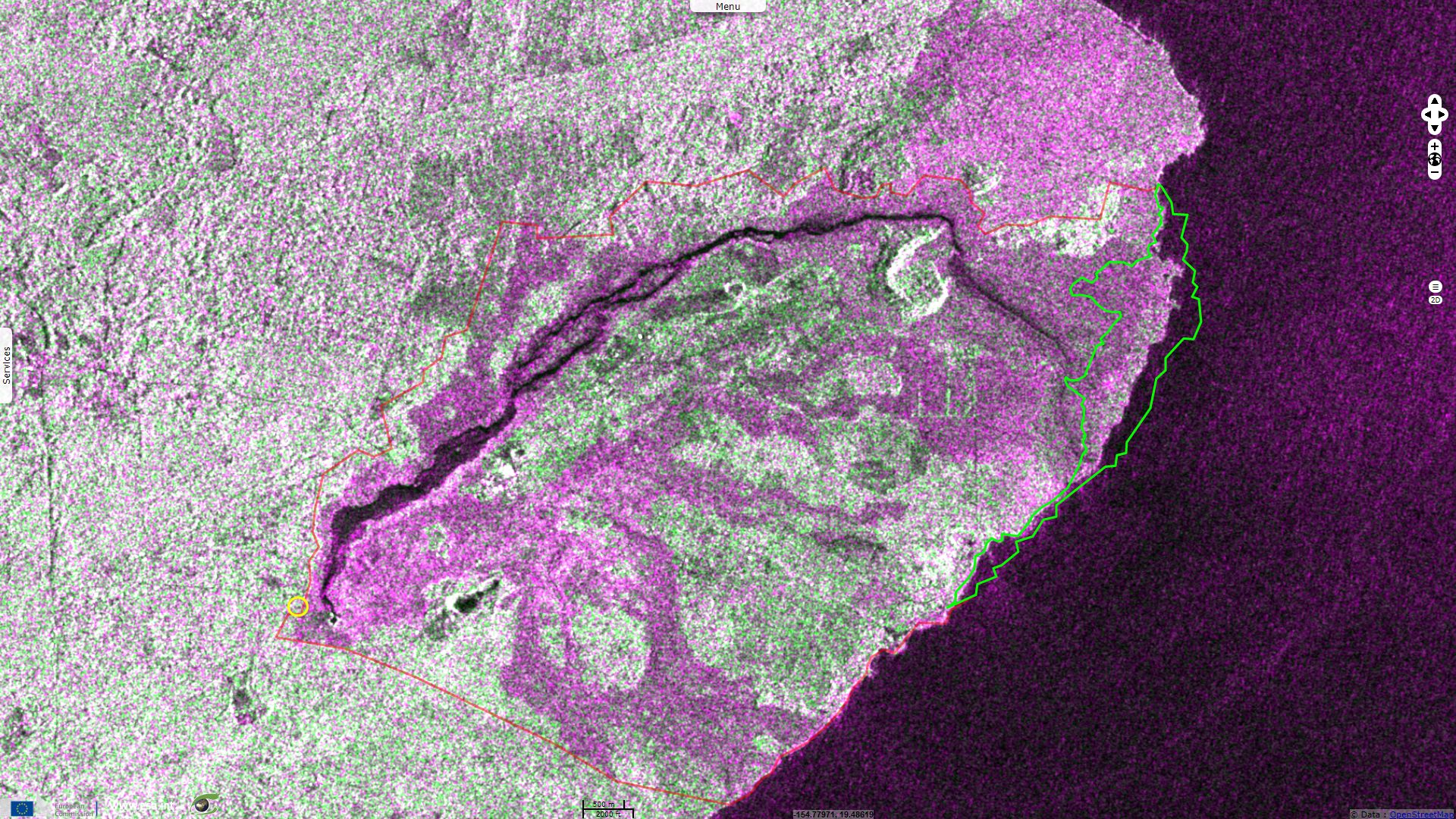
Sentinel-1 CSAR IW acquired on 11 May 2018 at 16:15:52 UTC
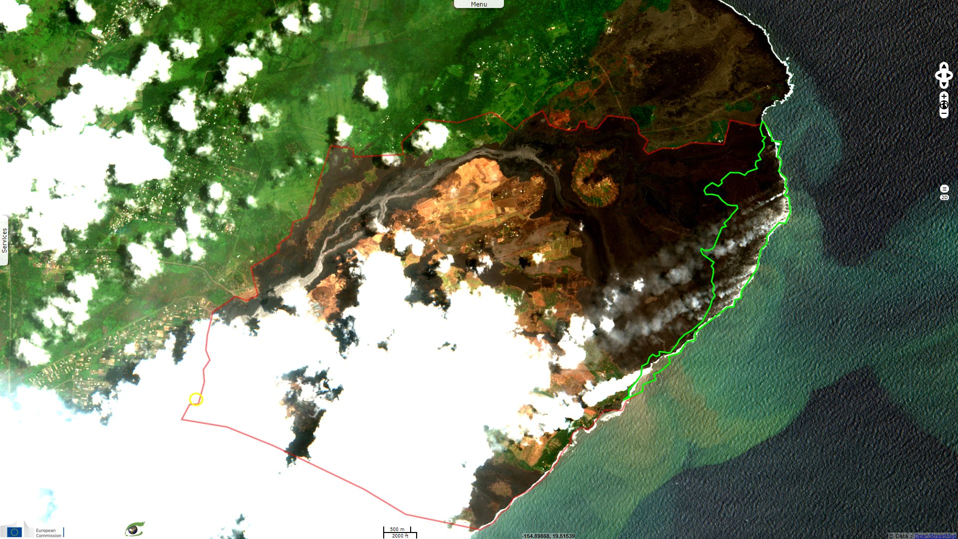
Sentinel-2 MSI acquired on 18 May 2018 at 20:59:41 UTC
...
Sentinel-1 CSAR IW acquired on 16 July 2018 at 16:15:30 UTC
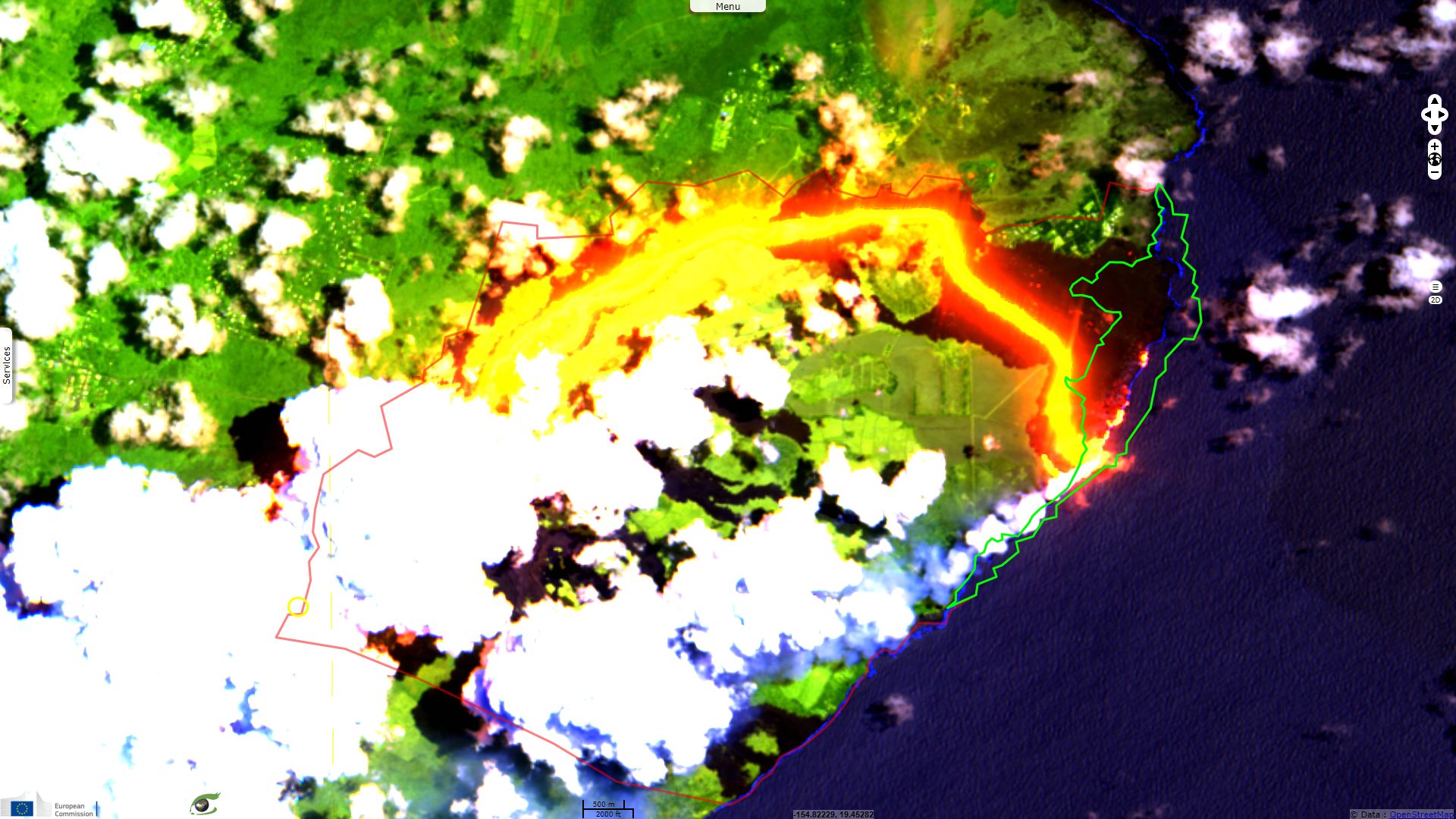
Sentinel-2 MSI acquired on 17 July 2018 at 20:59:41 UTC
Sentinel-2 MSI acquired on 18 May 2018 at 20:59:41 UTC
...
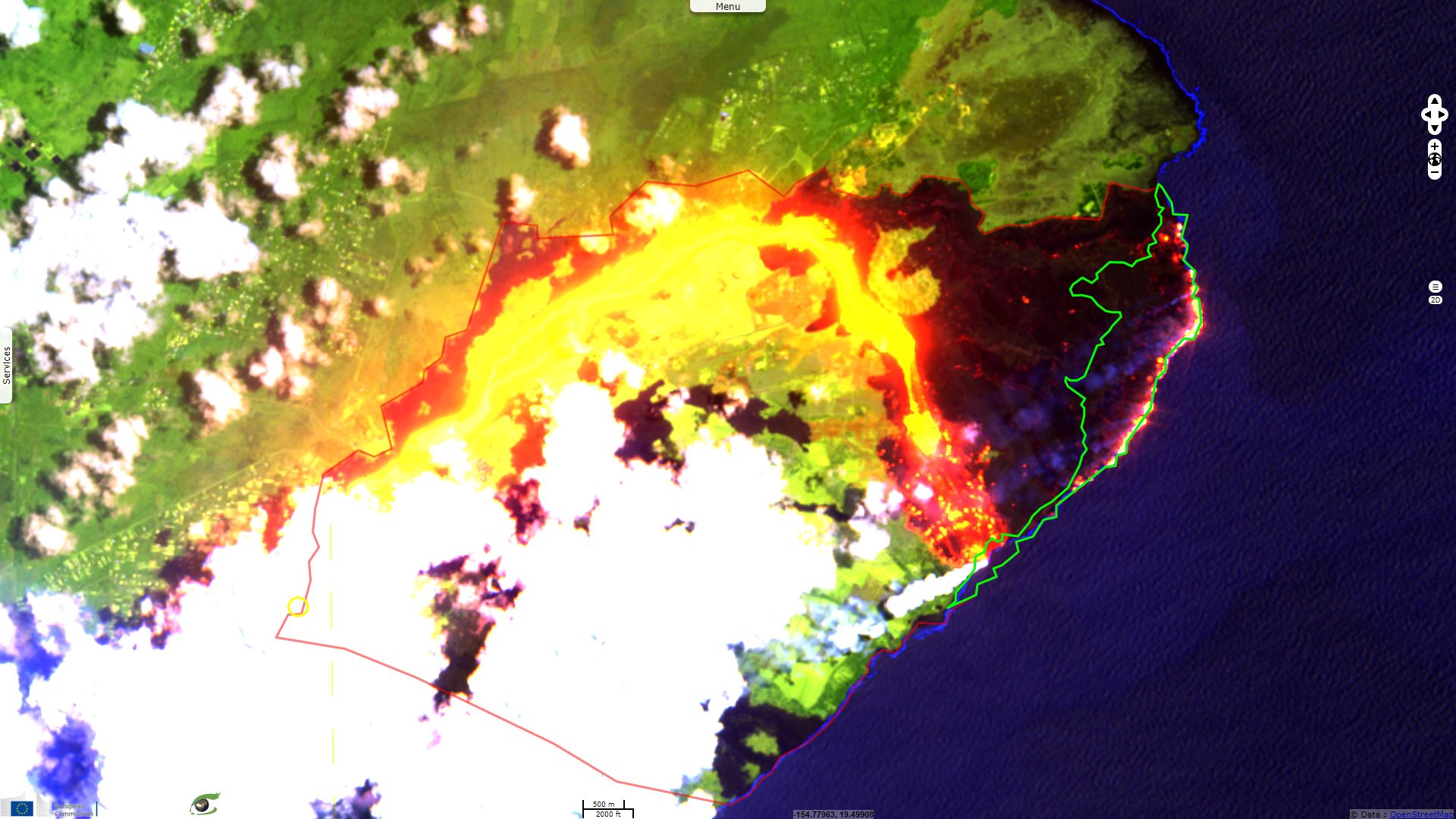
Sentinel-1 CSAR IW acquired on 16 July 2018 at 16:15:30 UTC
Sentinel-2 MSI acquired on 17 July 2018 at 20:59:41 UTC
Keyword(s): Emergency, disaster monitoring, natural disaster, geohazard, geology, coastal, atmosphere, hot spot, lava field, lava flow, volcano, Hawaii, Kilauea, USA, United States
In the figure above, the animation compares the first and the last date.
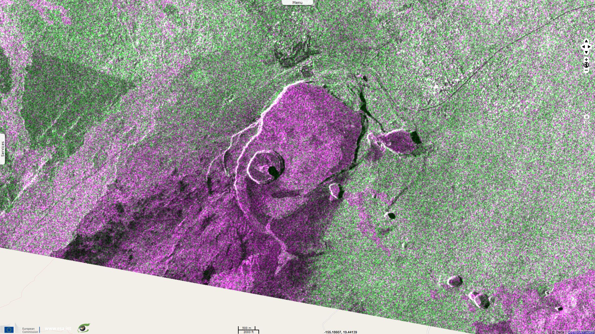
Hawaiian Volcano Observatory (HVO) explains the evolution of the summit of the Kīlauea: "The summit area of Kīlauea Volcano has undergone significant changes since April 2018. On April 21, the lava lake within Halema‘uma‘u overflowed onto the crater floor as the volcano's magmatic system pressurized. On April 30, the floor of the Pu‘u ‘Ō‘ō crater collapsed, as subsurface pressure forced open a pathway for magma to travel from Pu‘u ‘Ō‘ō into the lower East Rift Zone. As magma moved into the lower East Rift Zone, pressure decreased in the summit's magmatic system and the lava lake level began to drop. The summit also started to deflate due to the pressure decrease. As summit deflation (or subsidence) persisted, the number of earthquakes increased.".
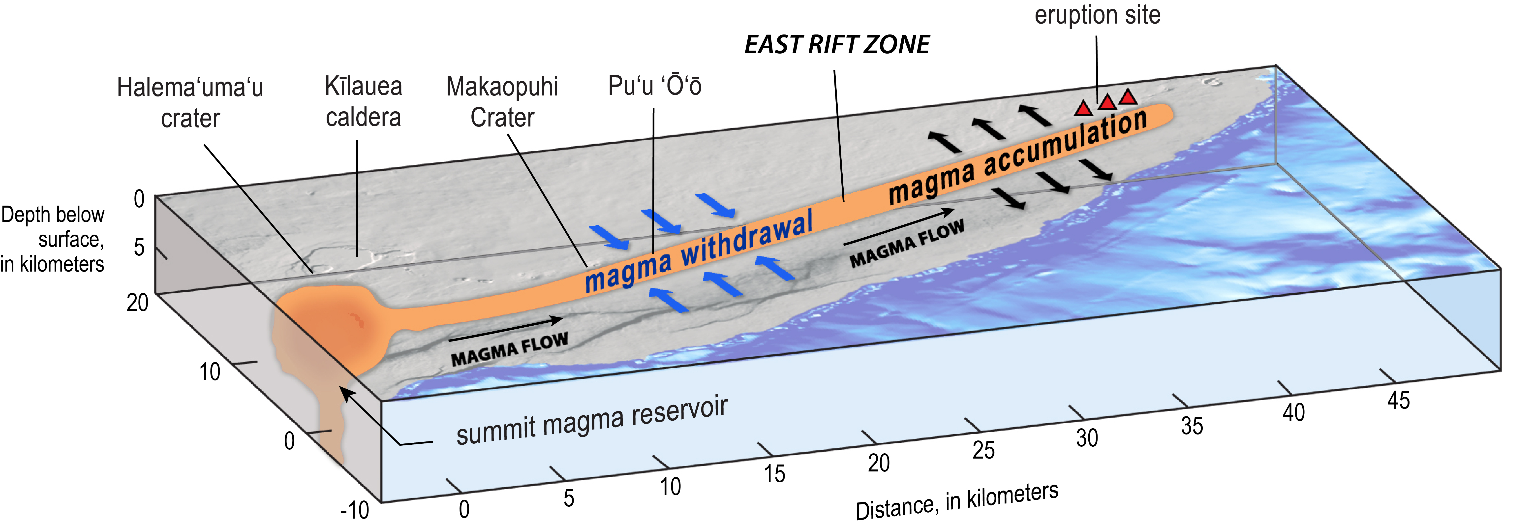
Illustration of Kīlauea Volcano from the summit caldera to the lower East Rift Zone (LERZ). Blue arrows = contraction across the upper and middle rift zone, black arrows = expansion in LERZ. - Source: Lisa Faust for USGS.
In the figure above, the animation hyperlook browses quickly through all the stack of Sentinel-1 acquisitions.
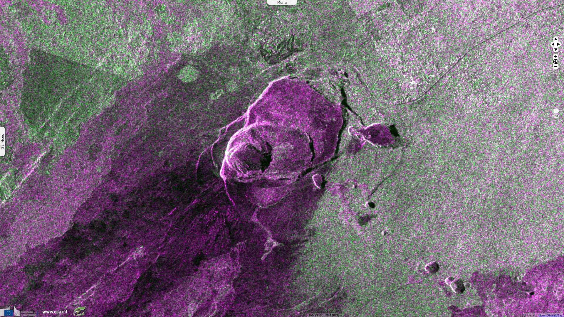
Regarding the Halema`uma`u caldera, the report of the Smithonian Institution for the period 06.06-12.06 notes:
"Inward slumping of the crater rim and walls of Halema`uma`u continued, adjusting from the withdrawal of magma and subsidence of the summit area; the floor had subsided at least 100 m during the previous few weeks, and by 12 June the lowest point was 300 m below the crater rim. Steam plumes rose from areas in the crater as well as from circumferential cracks adjacent to the crater."
The report of the Smithonian Institution for the period 30.05-05.06 notes:
"The lava flow fed by Fissure 8 advanced NE at a rate of 550 m/hour during 29-30 May, but then slowed to 90 m/hour on 31 May. High eruption rates led to the formation of a leveed channel along the W edge of the lava flow; small overflows from the channel occurred along its length. On 2 June lava flowed around the N part of Kapoho Crater and then turned S, entering the Vacationland neighborhood. At 0700 the flow front had entered Kapoho Beach Lots, moving about 75 m/hour. Lava entered Green Lake (70 m x 120 m in dimension, and 60 m deep) at 1000, creating a large steam plume. By 1500 lava had completely filled the lake and boiled off the water. Locals reported that lava (with a flow front 800 m wide) entered the ocean at Kapoho Bay around 2230. By late afternoon on 4 June lava had built a delta extending almost 700 m into the bay."
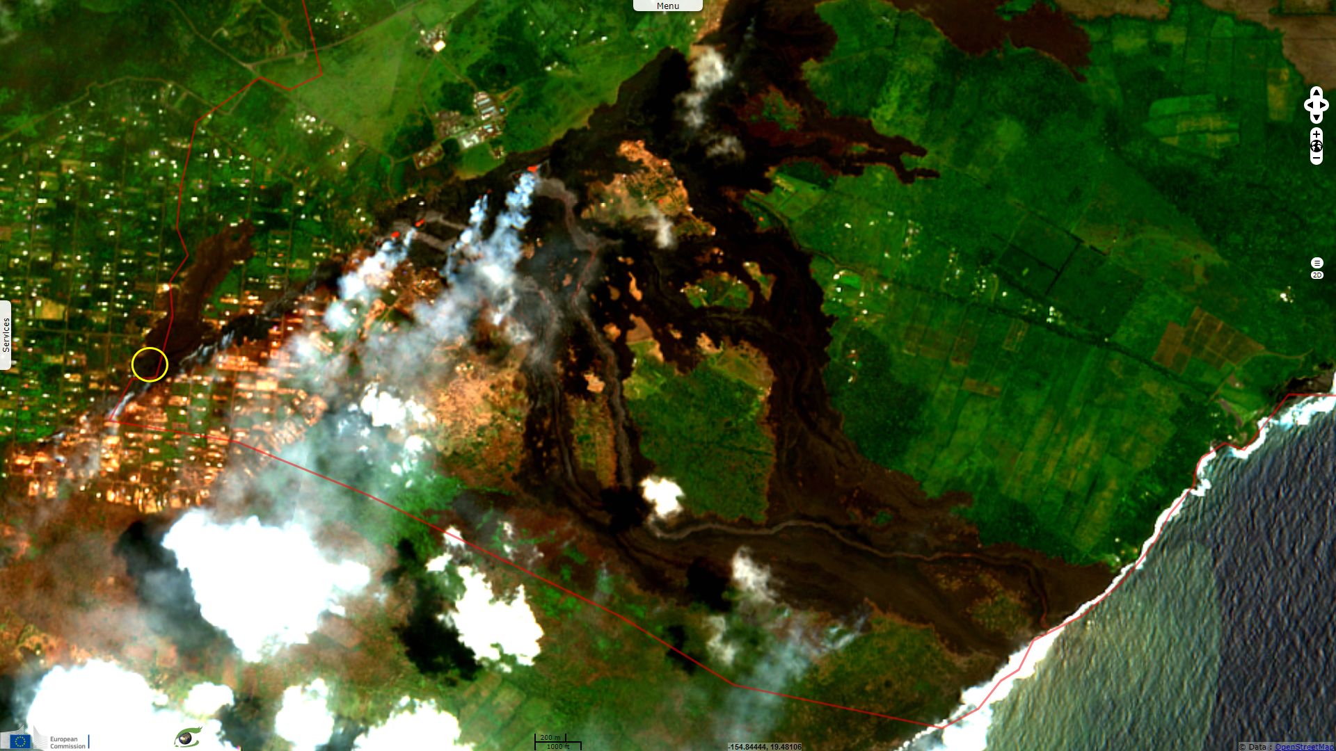
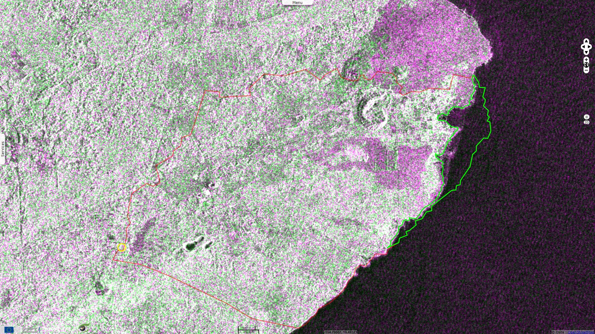
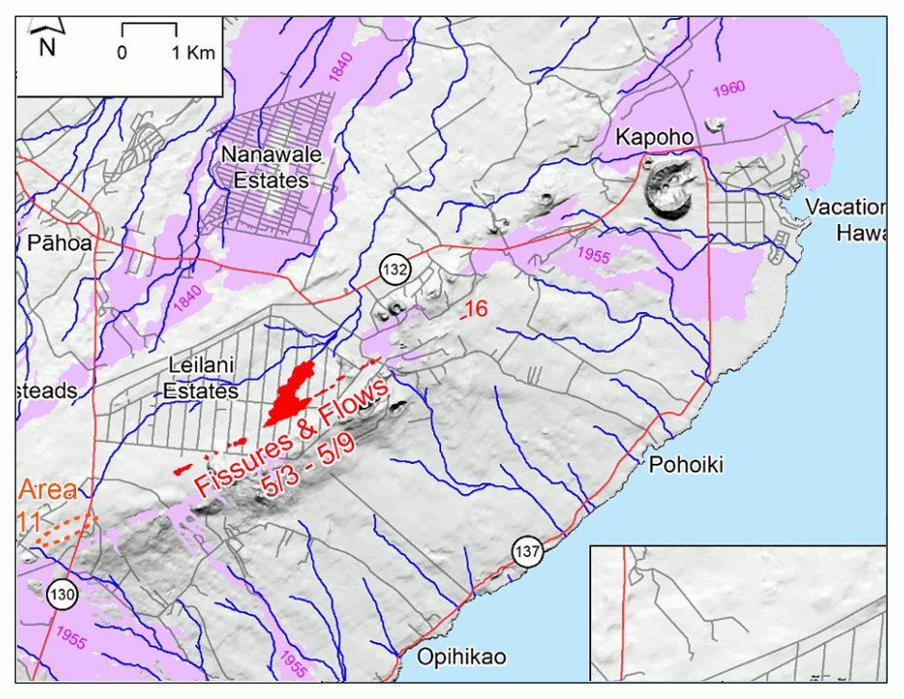
The story EVT-239, Strengthening episode in Kilauea's marathon eruption released early May showed the beginning of a stronger erupting phase. After two months spewing lava flows into the lower rift zone, 33km² of existing land have been covered by lava flows, Hawaii island surface has increased by 3km² (green polygon) while the coastline has moved one kilometer away from now buried Kapoho bay. As of 19.07.2018, over 700 homes have been destroyed. The coastal road network, electricy (Puna Geothermal Venture was damaged) and water (Green Lake has been evaporated) distribution have been impacted. So far, one tourist was seriously wounded and no one was killed.
The report of the Smithonian Institution for the period 13.06-19.06 notes:
"Lava entering the ocean built a lava delta that by 16 June was just over 130 hectares in area. A plume of laze rose from the entry points. An area of thermal upwelling in the ocean out from the visible lava-delta front was visible, suggesting lava flowing on the ocean floor."
The report of the Smithonian Institution for the period 20.06-26.06 notes:
"Fountaining at Fissure 8 continued; lava fountains rose occasionally higher than the 55-m-high spatter cone. The fountains continued to feed the fast-moving lava flow that traveled NE, and then SE around Kapoho Crater, and into the ocean. Occasional overflows sent small flows down the sides of the channel. The lava-flow front at the ocean was almost 3.2 km wide by 25 June, with lava entering the ocean on the S side of the flow front mainly through an open channel, but also along a 1-km-long area marked with billowing laze plumes."
The report of the Smithonian Institution for the period 27.06-03.07 notes:
"The fountains continued to feed the fast-moving lava flow that traveled NE, and then SE around Kapoho Crater, and into the ocean. Occasional overflows sent small flows down the sides of the channel. Lava entered the ocean on the S side of the flow front mainly through an open channel, but also along a 1-km-long area marked with billowing laze plumes. A thermal map showed that on 29 June the lava channel had crusted over about 0.8 km inland from the ocean entry, with lava moving beneath the crust."
In the figure above, the first animation compares one of the first and one of the last dates. The second animation hyperlook browses quickly through all the stack of Sentinel-2 acquisitions.
The report of the Smithonian Institution for the period 04.07-10.07 notes::
"A thermal map from 6 July showed that lava was not entering the ocean from the main channel and that the open channel ended about 2 km inland. Lava was flowing into the ocean at the N part of the broad flow front. Observations on 9 July indicated that a blockage had formed upstream of Kapoho Crater, and by 10 July a small lobe was moving around the W side of the crater."
Compared to the previous figure, one can see how the lava now flows west rather than east of Kapoho Crater.
In the figure above, the first animation compares one of the first and one of the last dates. The second animation hyperlook browses quickly through all the stack of Sentinel-2 acquisitions.
The report of the Smithonian Institution for the period 11.07-16.07 notes:
"The fountains continued to feed the lava flow that traveled NE, and then SSE, W of Kapoho Crater. A few channel overflows occurred. The channelized ‘a’a flow reached the ocean on 12 July, producing a large plume of laze (a corrosive steam plume mixed with hydrochloric acid and fine volcanic glass particles), and covering the Kua O Ka La Charter School and Ahalanui Beach Park. Lava entered the ocean at several points along a broad 6-km-wide flow front, though the main entry area was at Ahalanui (750 m NE of Isaac Hale Park) by 17 July."
Animation of Kīlauea Lower East Rift Zone Fissures and Flows - Compiled from Hawaiian Volcano Observatory.
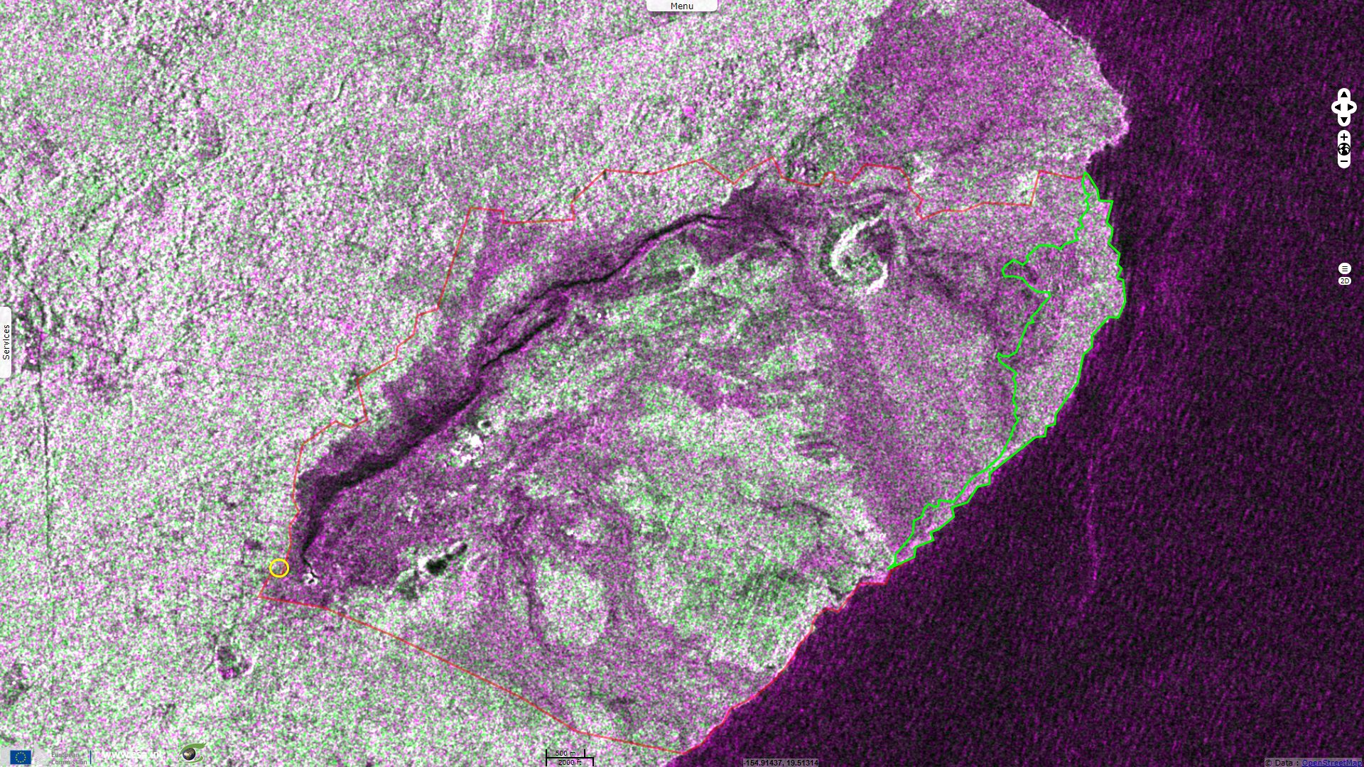
In the figure above, the animation hyperlook browses quickly through all the stack of Sentinel-1 acquisitions.
The report of the Smithonian Institution for the period 11.07-16.07 notes:
"On 13 July a new island, 6-9 m in diameter, formed a few meters offshore, possibly fed by a submarine tumulus. On 16 July explosions were noted at the main ocean entry, some were strong. Hawaii County Civil Defense Agency noted that an explosion early in the morning ejected tephra that injured 23 people on a nearby tour boat. That same day volcanologists using a radar gun measured an average flow velocity of 29 km/hour of lava exiting Fissure 8."
The views expressed herein can in no way be taken to reflect the official opinion of the European Space Agency or the European Union.
Contains modified Copernicus Sentinel data 2026, processed by VisioTerra.
Contains modified Copernicus Sentinel data 2026, processed by VisioTerra.
| More on European Commission space: |  |
 |
 |
||||
| More on ESA: | |
|
|
S-1 website | S-2 website | S-3 website | |
| More on Copernicus program: | |
|
|
Scihub portal | Cophub portal | Inthub portal | Colhub portal |
| More on VisioTerra: | |
|
|
Sentinel Vision Portal | Envisat+ERS portal | Swarm+GOCE portal | CryoSat portal |