Ghosts forests in North Carolina, USA
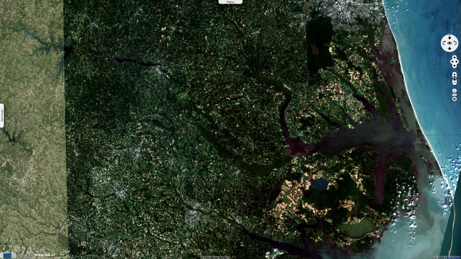
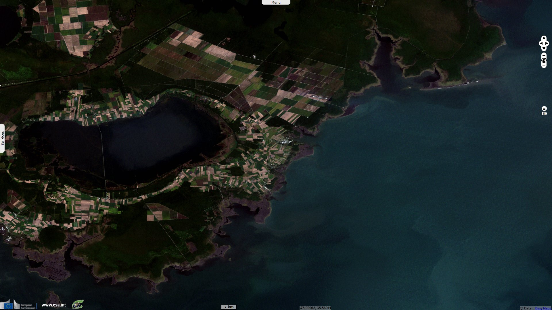
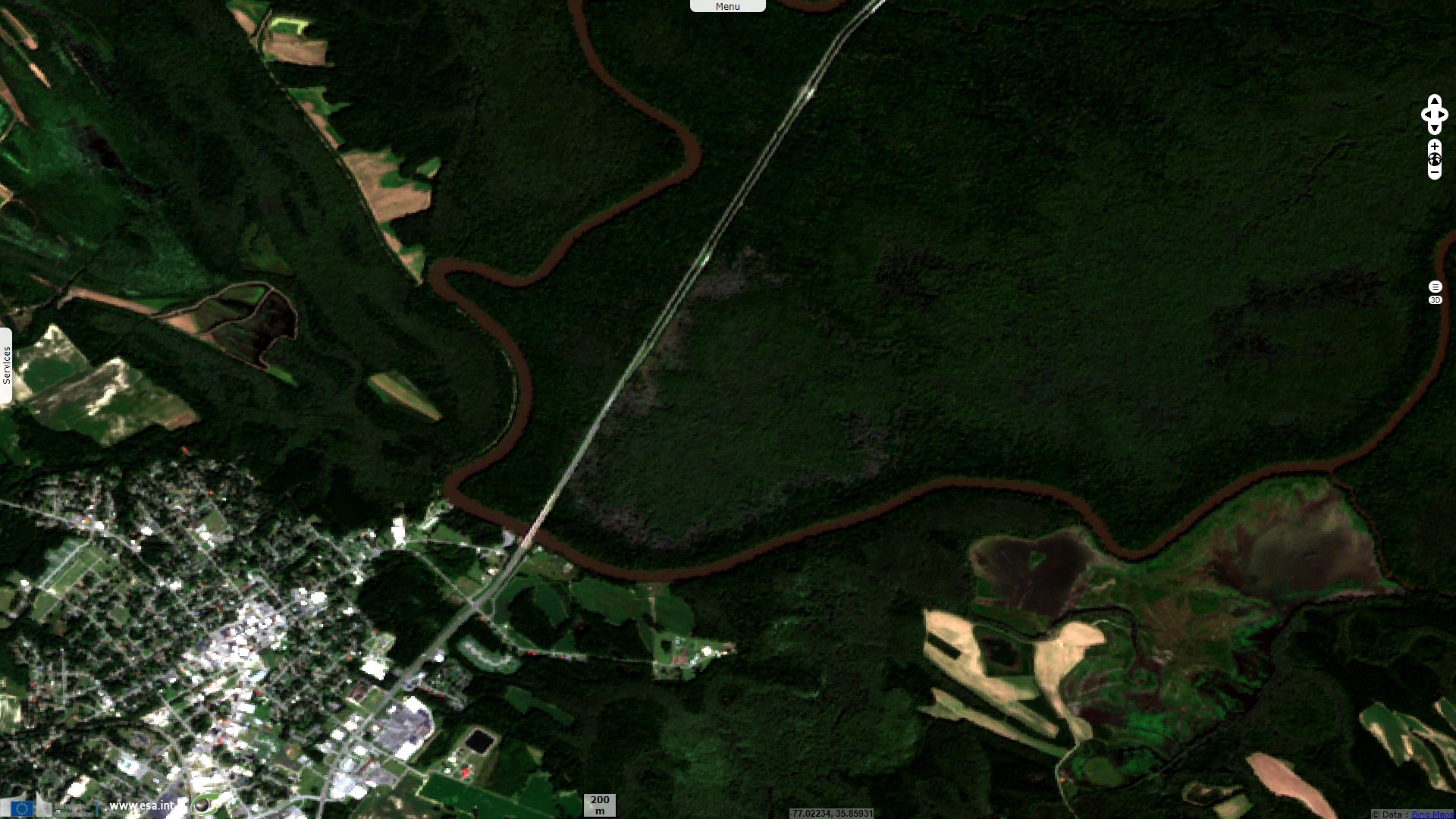
Landsat-5 TM acquired on 21 September 1984 at 15:10:57 UTC
...
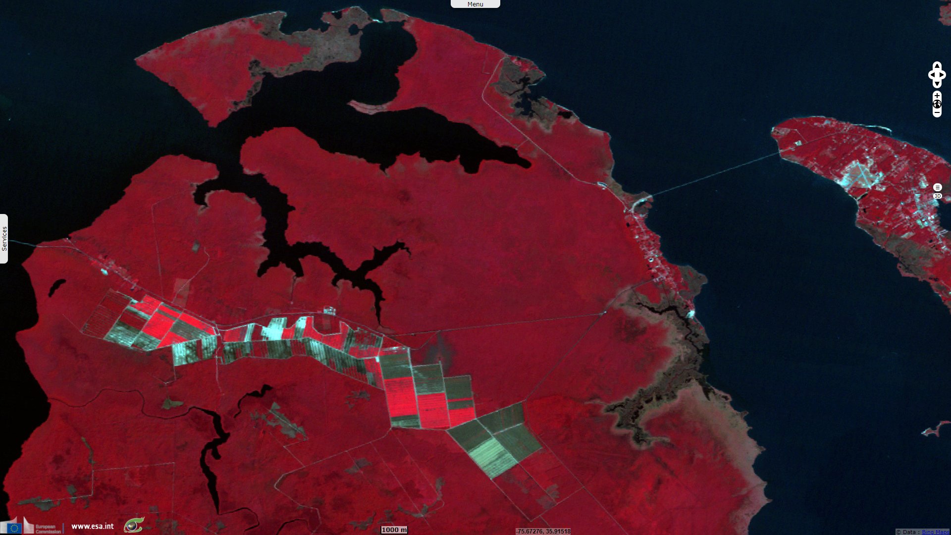
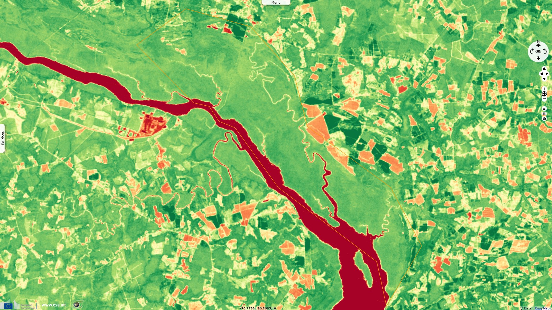
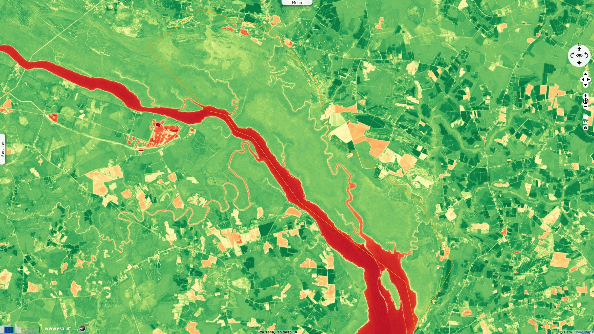
Landsat-7 ETM+ acquired on 23 September 1999 at 15:33:47 UTC
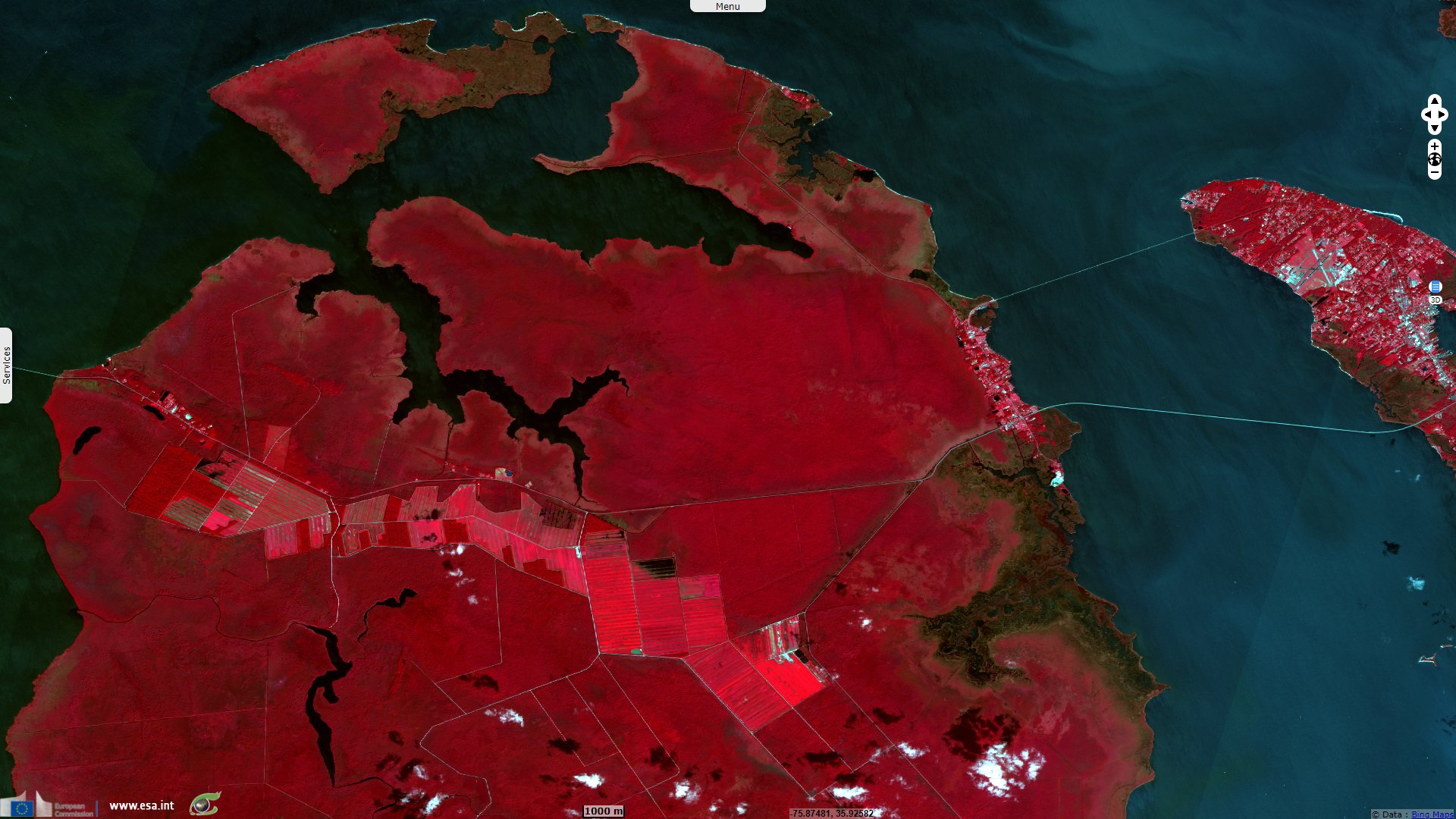
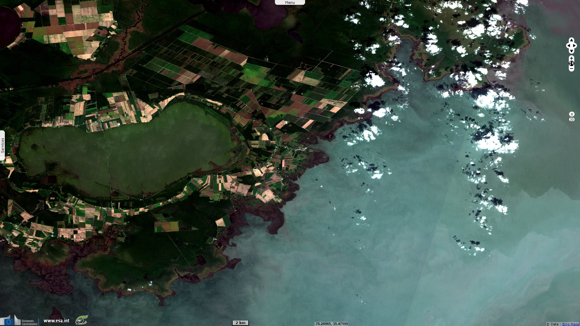
Sentinel-2 MSI acquired on 14 September 2015 at 16:01:36 UTC
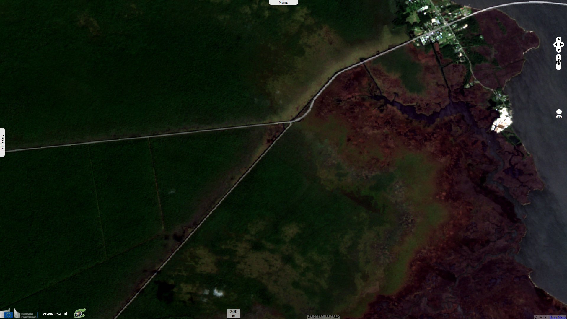
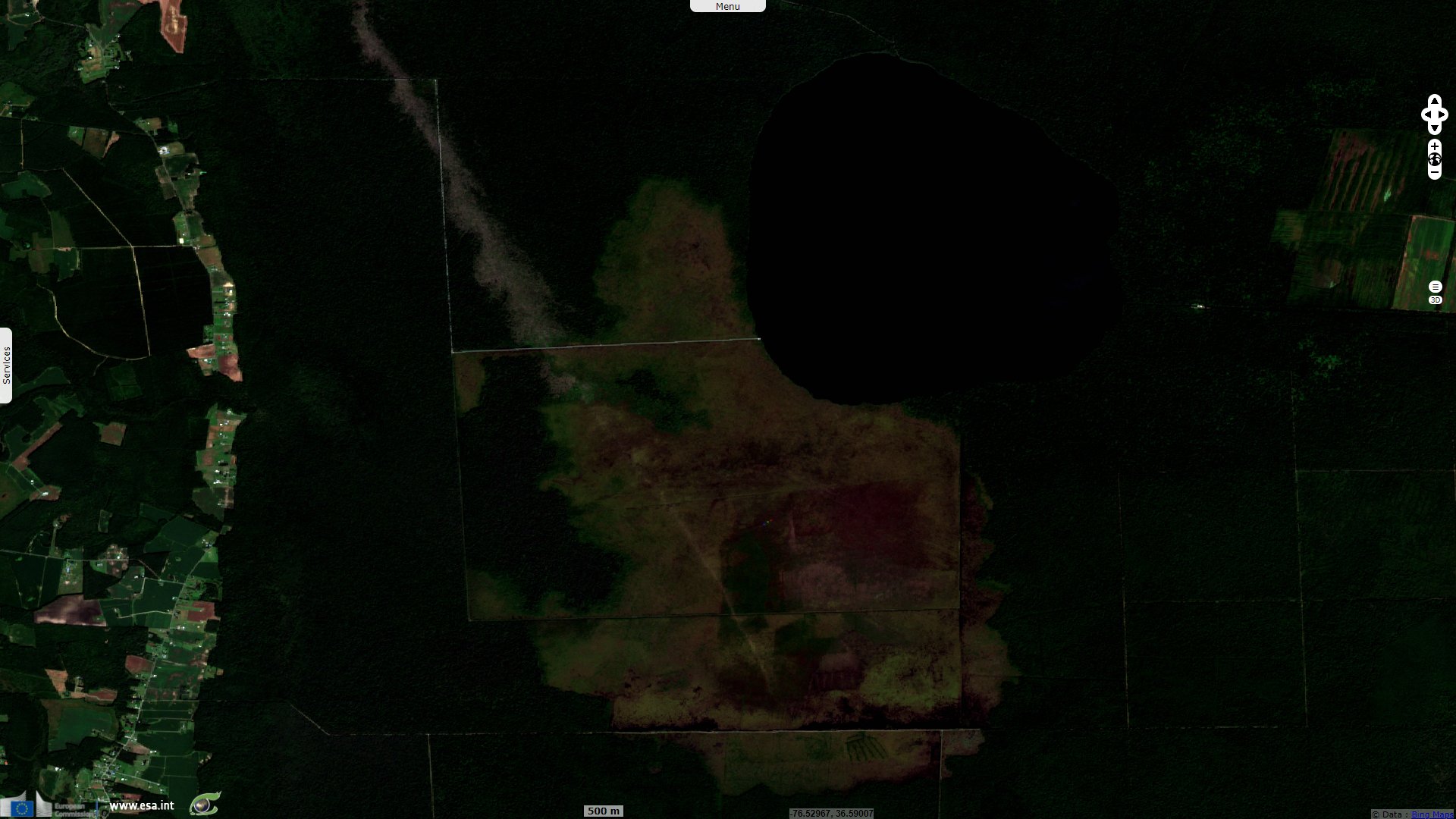
Sentinel-2 MSI acquired on 22 September 2020 at 15:48:59 UTC
...
Landsat-7 ETM+ acquired on 23 September 1999 at 15:33:47 UTC
Sentinel-2 MSI acquired on 14 September 2015 at 16:01:36 UTC
Sentinel-2 MSI acquired on 22 September 2020 at 15:48:59 UTC
Keyword(s): Forestry, coastal, hydrology, salinisation, storm, agriculture, marshes, United States, USA
Emily Ury, Ph.D. Candidate at Duke University, North Carolina published an article in The Conversation: "Throughout coastal North Carolina, evidence of forest die-off is everywhere. Nearly every roadside ditch around the region is lined with dead or dying trees. As an ecologist studying wetland response to sea level rise, I know this flooding is evidence that climate change is altering landscapes along the Atlantic coast. It’s emblematic of environmental changes that also threaten wildlife, ecosystems, and local farms and forestry businesses."
"Like all living organisms, trees die. But what is happening here is not normal. Large patches of trees are dying simultaneously, and saplings aren’t growing to take their place. And it’s not just a local issue: Seawater is raising salt levels in coastal woodlands along the entire Atlantic Coastal Plain, from Maine to Florida. Huge swaths of contiguous forest are dying. They’re now known in the scientific community as 'ghost forests.'"
Lauren J. Young wrote: "Since 2004, Bernhardt and a team of researchers from Duke University and North Carolina State University have been closely monitoring the coastal wetlands of Albemarle-Pamlico Peninsula in North Carolina, a region historically altered for large-scale commercial agriculture. 'It tends to have very organic rich peaty soils and it’s a system that would sequester a lot of carbon in the soils,' says Marcelo Ardon, ecologist at North Carolina State University."
Emily Ury continues: "Sea level rise driven by climate change is making wetlands wetter in many parts of the world. It’s also making them saltier. Rising seas are inundating North Carolina’s coast, and saltwater is seeping into wetland soils. Salts move through groundwater during phases when freshwater is depleted, such as during droughts. Saltwater also moves through canals and ditches, penetrating inland with help from wind and high tides. Dead trees with pale trunks, devoid of leaves and limbs, are a telltale sign of high salt levels in the soil. A 2019 report called them 'wooden tombstones.'"
"As the trees die, more salt-tolerant shrubs and grasses move in to take their place. In a newly published study that I coauthored with Emily Bernhardt and Justin Wright at Duke University and Xi Yang at the University of Virginia, we show that in North Carolina this shift has been dramatic. The state’s coastal region has suffered a rapid and widespread loss of forest, with cascading impacts on wildlife, including the endangered red wolf and red-cockaded woodpecker. Wetland forests sequester and store large quantities of carbon, so forest die-offs also contribute to further climate change."
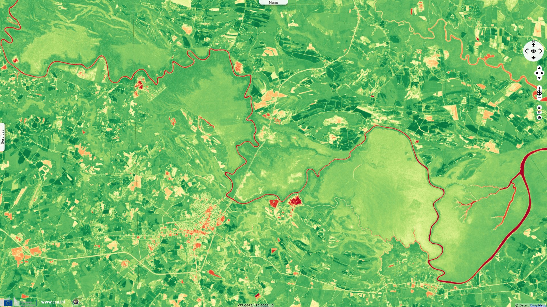
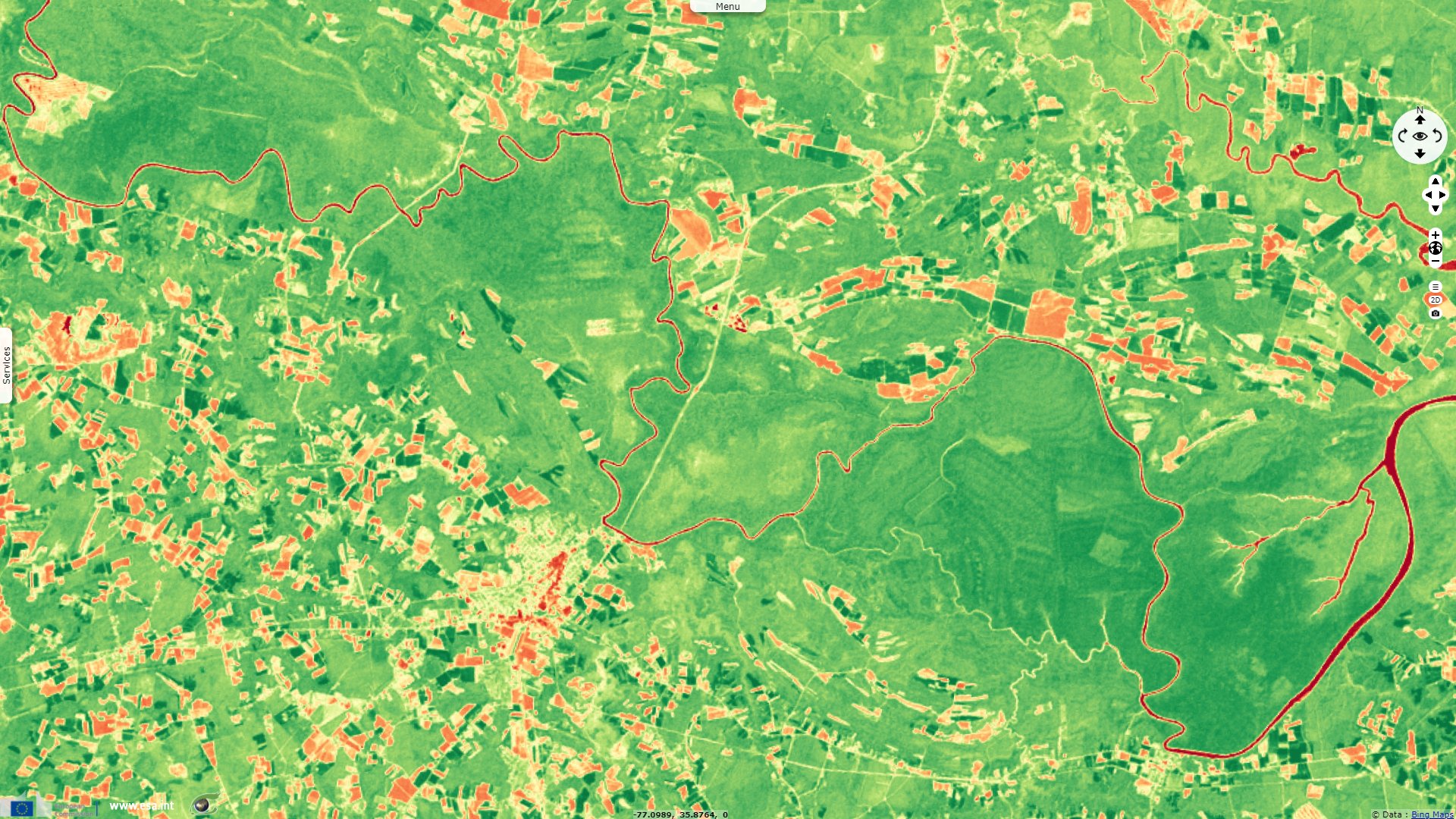
"We found that more than 10% of forested wetland within the Alligator River National Wildlife Refuge was lost over the past 35 years. This is federally protected land, with no other human activity that could be killing off the forest. Rapid sea level rise seems to be outpacing the ability of these forests to adapt to wetter, saltier conditions. Extreme weather events, fueled by climate change, are causing further damage from heavy storms, more frequent hurricanes and drought."
"We found that the largest annual loss of forest cover within our study area occurred in 2012, following a period of extreme drought, forest fires and storm surges from Hurricane Irene in August 2011. This triple whammy seemed to have been a tipping point that caused mass tree die-offs across the region."
Lauren J. Young develops regarding the role of salt: "In the late 1960s through to the 1980s, developers built canals, pumps, and ditches that transect the wetlands to keep farms dry. But the artificial drainage systems have created two-way channels, allowing ocean salt water to flow inland into the peninsula, explains Ryan Emanuel, hydrologist at NC State University. 'You can have storms that push salt water deep into the interior, often through ditches and drains that may not have flow control structures or other protective measures,' says Ryan Emanuel, hydrologist at NC State University."
One solution is mentionned in The Conversation article: "As global sea levels continue to rise, coastal woodlands from the Gulf of Mexico to the Chesapeake Bay and elsewhere around the world could also suffer major losses from saltwater intrusion. Many people in the conservation community are rethinking land management approaches and exploring more adaptive strategies, such as facilitating forests’ inevitable transition into salt marshes or other coastal landscapes. For example, in North Carolina the Nature Conservancy is carrying out some adaptive management approaches, such as creating 'living shorelines' made from plants, sand and rock to provide natural buffering from storm surges."
Emily Ury concludes: "A more radical approach would be to introduce marsh plants that are salt-tolerant in threatened zones. This strategy is controversial because it goes against the desire to try to preserve ecosystems exactly as they are. But if forests are dying anyway, having a salt marsh is a far better outcome than allowing a wetland to be reduced to open water. While open water isn’t inherently bad, it does not provide the many ecological benefits that a salt marsh affords. Proactive management may prolong the lifespan of coastal wetlands, enabling them to continue storing carbon, providing habitat, enhancing water quality and protecting productive farm and forest land in coastal regions."
The views expressed herein can in no way be taken to reflect the official opinion of the European Space Agency or the European Union.
Contains modified Copernicus Sentinel data 2026, processed by VisioTerra.
Contains modified Copernicus Sentinel data 2026, processed by VisioTerra.
| More on European Commission space: |  |
 |
 |
||||
| More on ESA: | |
|
|
S-1 website | S-2 website | S-3 website | |
| More on Copernicus program: | |
|
|
Scihub portal | Cophub portal | Inthub portal | Colhub portal |
| More on VisioTerra: | |
|
|
Sentinel Vision Portal | Envisat+ERS portal | Swarm+GOCE portal | CryoSat portal |