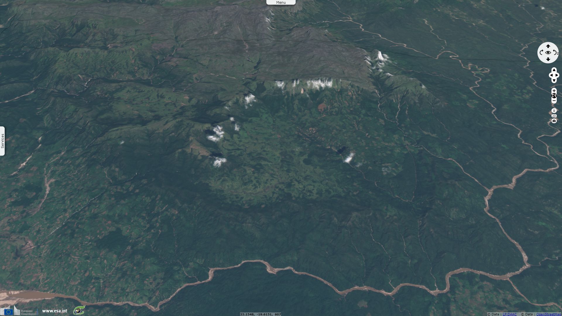
Mudflows in Zimbabwe Eastern Highlands
Sentinel-2 MSI acquired on 23 February 2019 at 07:39:19 UTC
Sentinel-2 MSI acquired on 22 March 2019 at 07:26:19 UTC
Sentinel-2 MSI acquired on 25 March 2019 at 07:36:09 UTC
Sentinel-2 MSI acquired on 22 March 2019 at 07:26:19 UTC
Sentinel-2 MSI acquired on 25 March 2019 at 07:36:09 UTC
Keyword(s): Emergency, natural disaster, land, precipitations, landslide, mudflow, flooding, erosion, cyclone, Mozambique, Zimbabwe.
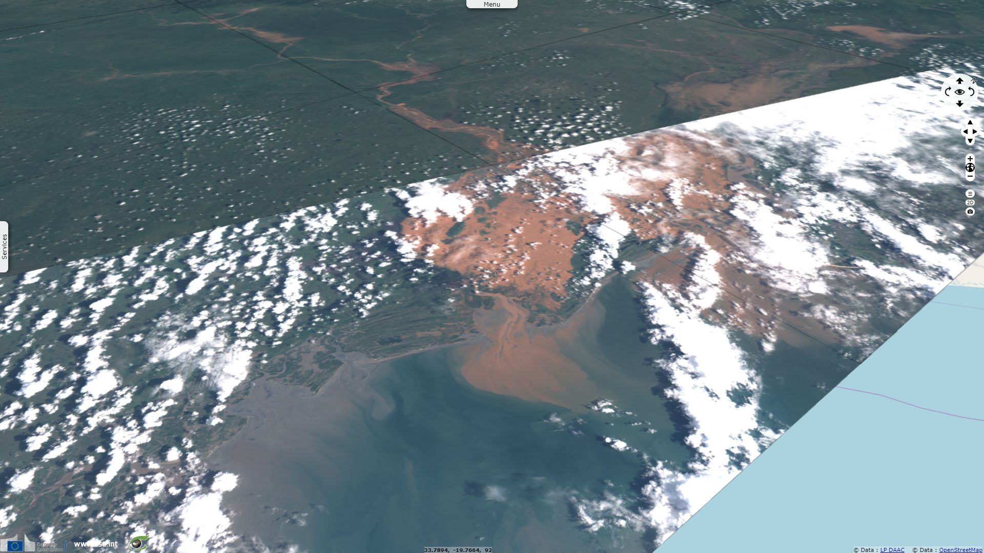
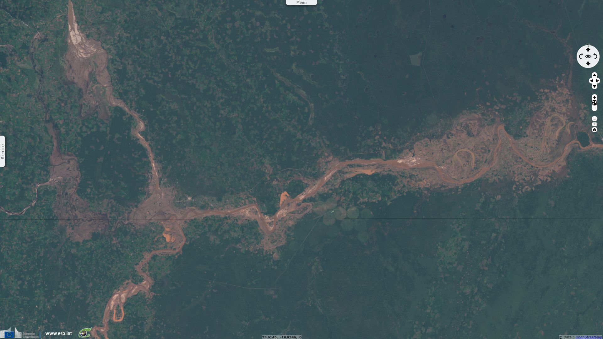
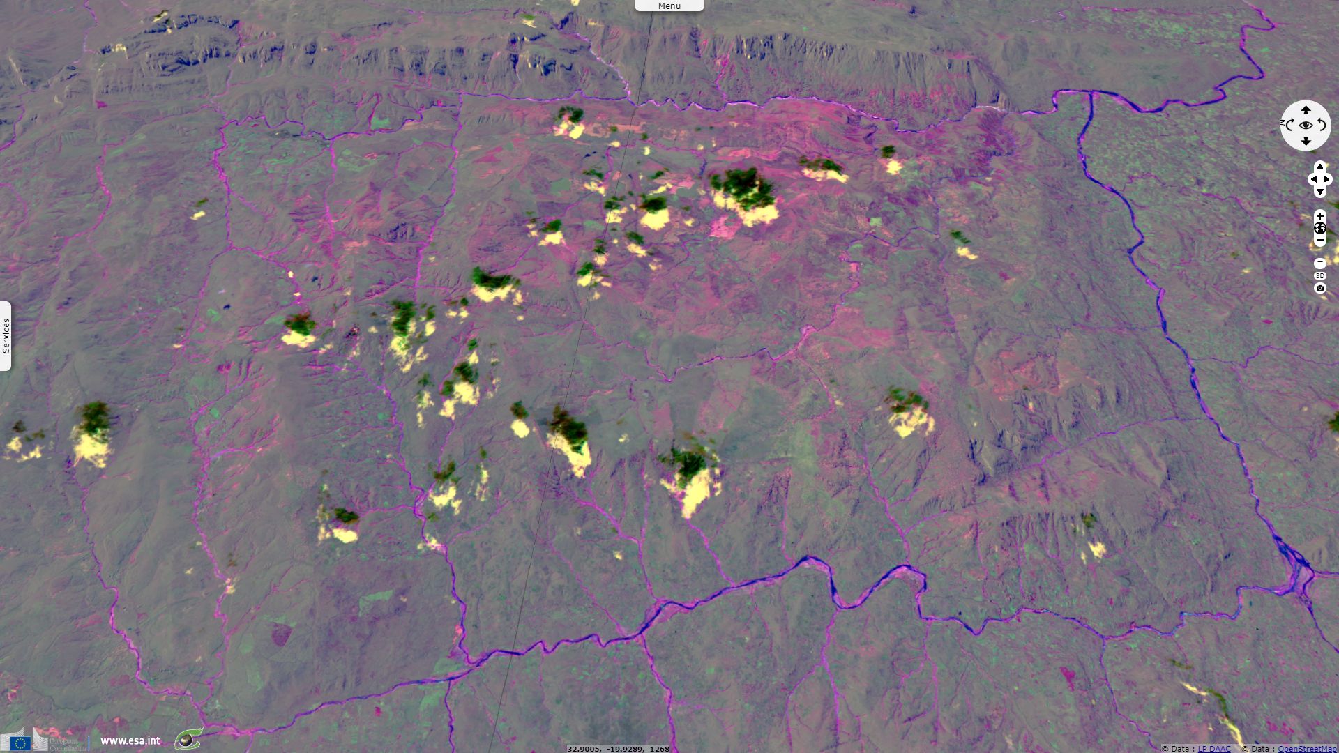
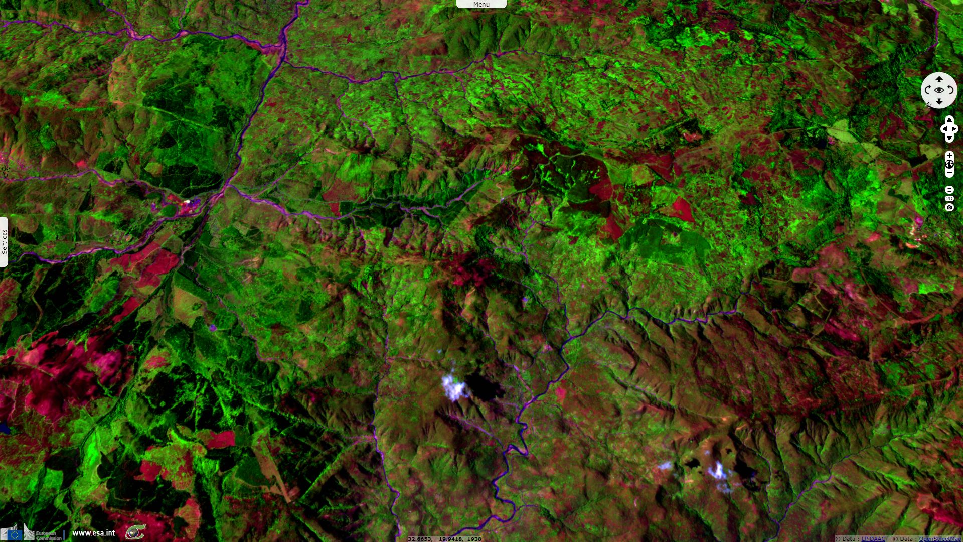
The 11,8,2 colour composite highlights the bare soil, vegetation and water cover. By computing the Normalised Difference Index of these 3 bands before and after Cyclone Idai, the change become more apparent: rivers grew and bare soil replaced vegetation due to erosion and mud deposits. In particular, landslides happened in numerous gullies, showing in pink and purple.
The views expressed herein can in no way be taken to reflect the official opinion of the European Space Agency or the European Union.
Contains modified Copernicus Sentinel data 2026, processed by VisioTerra.
Contains modified Copernicus Sentinel data 2026, processed by VisioTerra.
| More on European Commission space: |  |
 |
 |
||||
| More on ESA: | |
|
|
S-1 website | S-2 website | S-3 website | |
| More on Copernicus program: | |
|
|
Scihub portal | Cophub portal | Inthub portal | Colhub portal |
| More on VisioTerra: | |
|
|
Sentinel Vision Portal | Envisat+ERS portal | Swarm+GOCE portal | CryoSat portal |