Ol Doinyo Lengaï, the white volcano
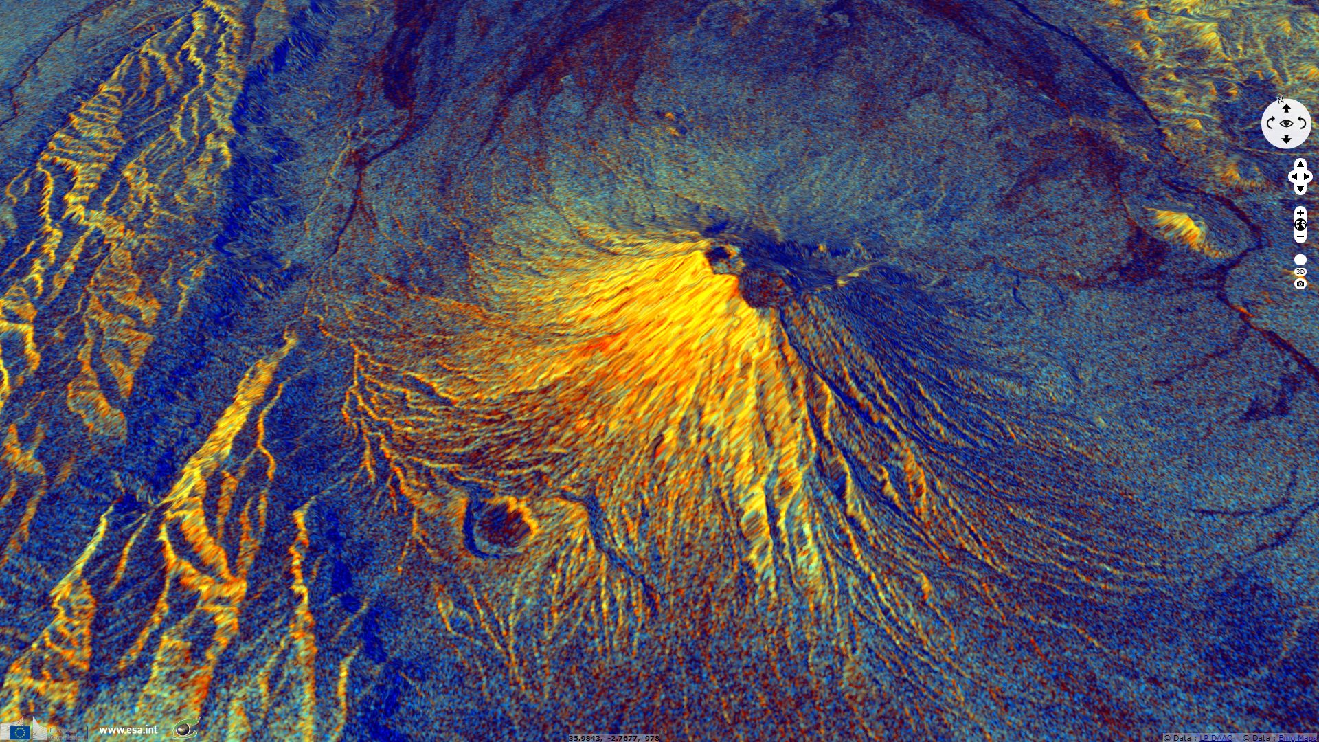
Sentinel-1 CSAR IW acquired on 30 August 2016 at 03:20:36 UTC
Sentinel-1 CSAR IW acquired on 09 September 2016 at 15:55:25 UTC
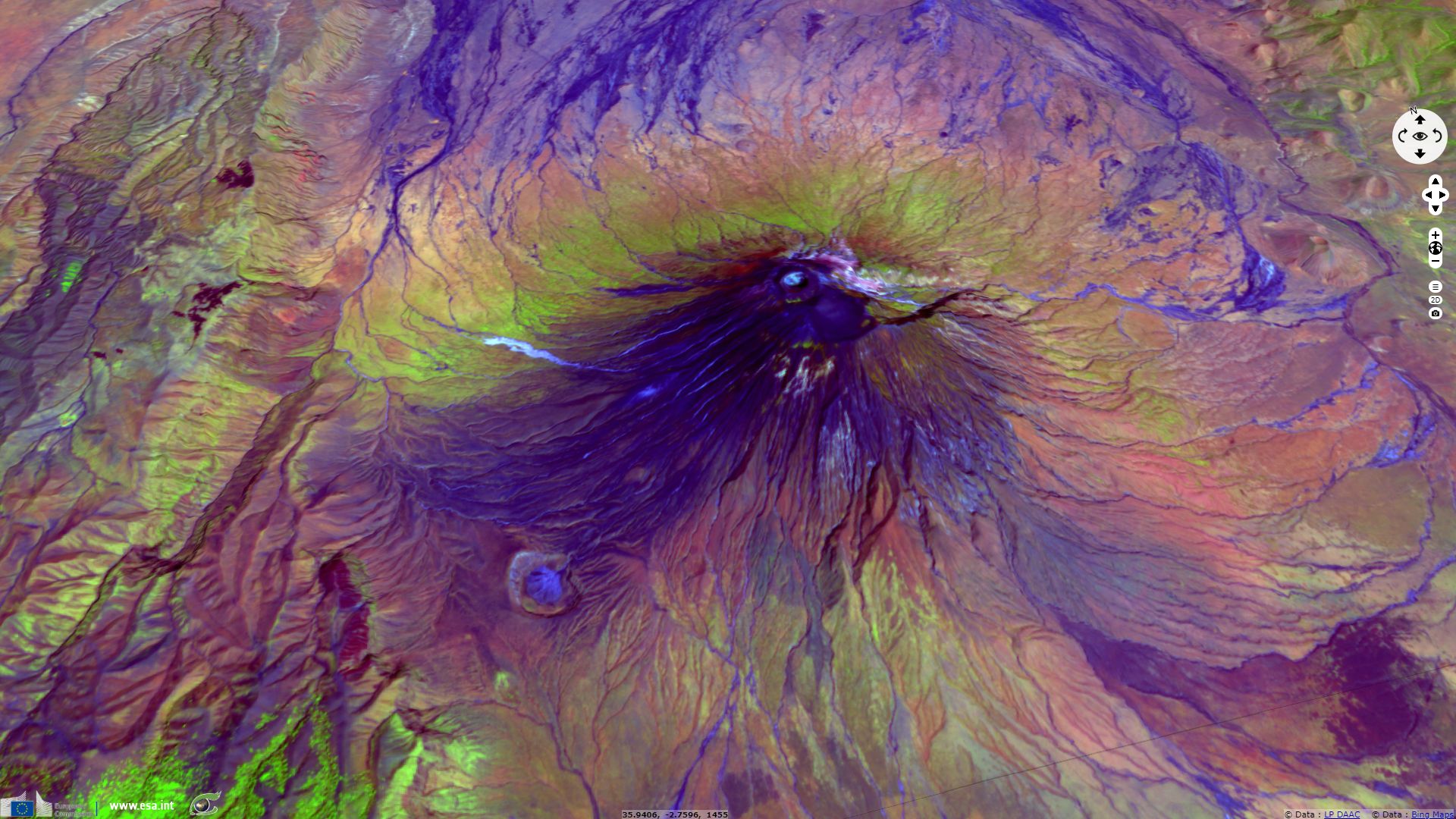
Sentinel-2 MSI acquired on 20 December 2016 at 07:52:12 UTC
Sentinel-1 CSAR IW acquired on 24 December 2018 at 03:19:53 UTC
Sentinel-1 CSAR IW acquired on 28 December 2018 at 15:55:36 UTC
Sentinel-1 CSAR IW acquired on 09 September 2016 at 15:55:25 UTC
Sentinel-2 MSI acquired on 20 December 2016 at 07:52:12 UTC
Sentinel-1 CSAR IW acquired on 24 December 2018 at 03:19:53 UTC
Sentinel-1 CSAR IW acquired on 28 December 2018 at 15:55:36 UTC
Keyword(s): Geohazard, land, volcano, lava flow, geology, Tanzania, Great rift Valley, Gregory rift
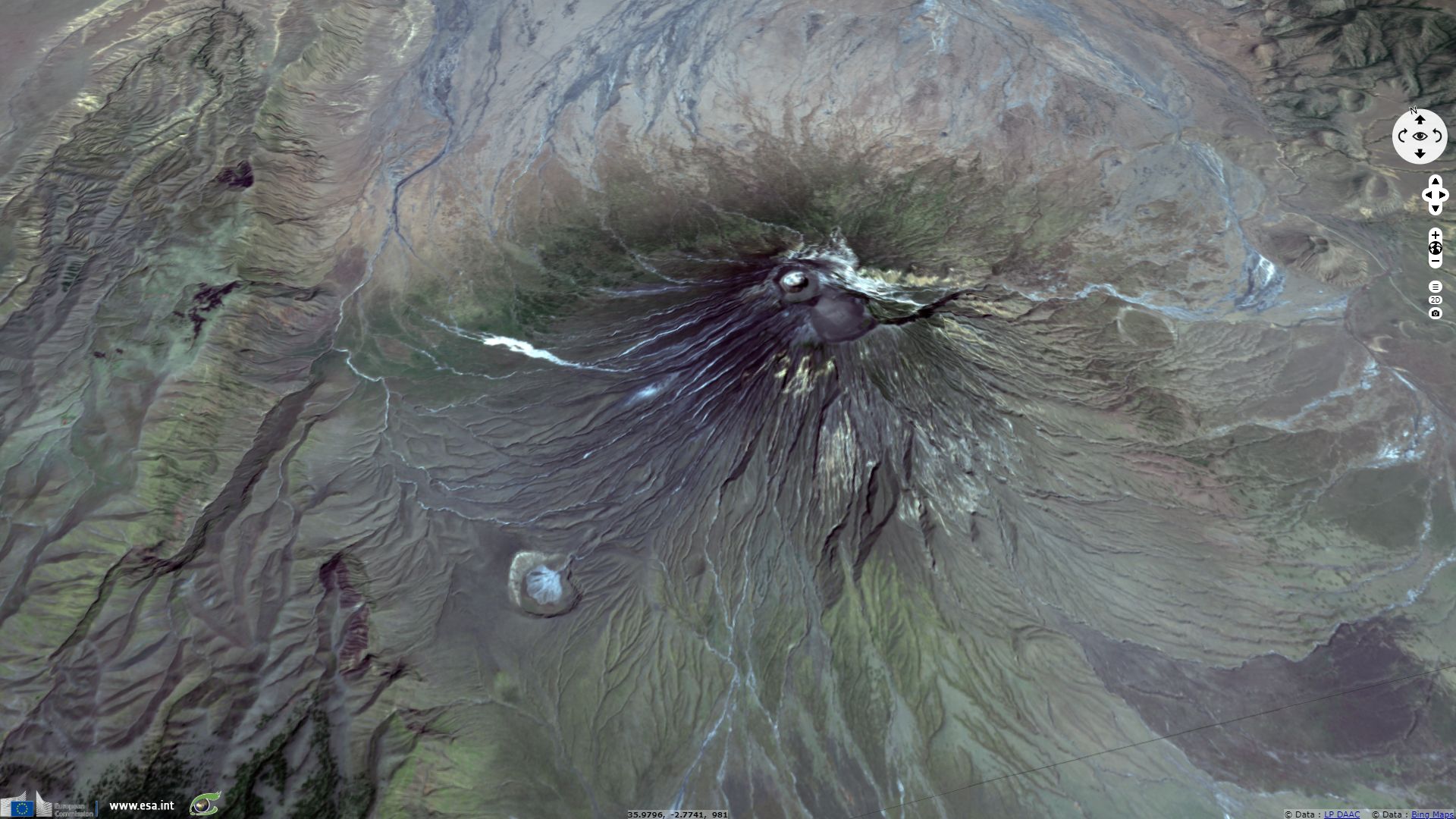
What makes it unique on Earth is its lava flows, made of natrocarbonatite. This lava melts at 500-600 °C, a temperature too low to emit the usual red glow, so that it appears black to the eye when it erupts.
Furthermore, the anhydrous sodium and potassium carbonate minerals of the lavas erupted at Ol Doinyo Lengai are unstable at the Earth's surface and susceptible to rapid weathering as they come into contact with the moisture of the atmosphere. The black or dark brown lava and ash erupted begins to turn white within a few hours. The resulting volcanic landscape is different from any other in the world.
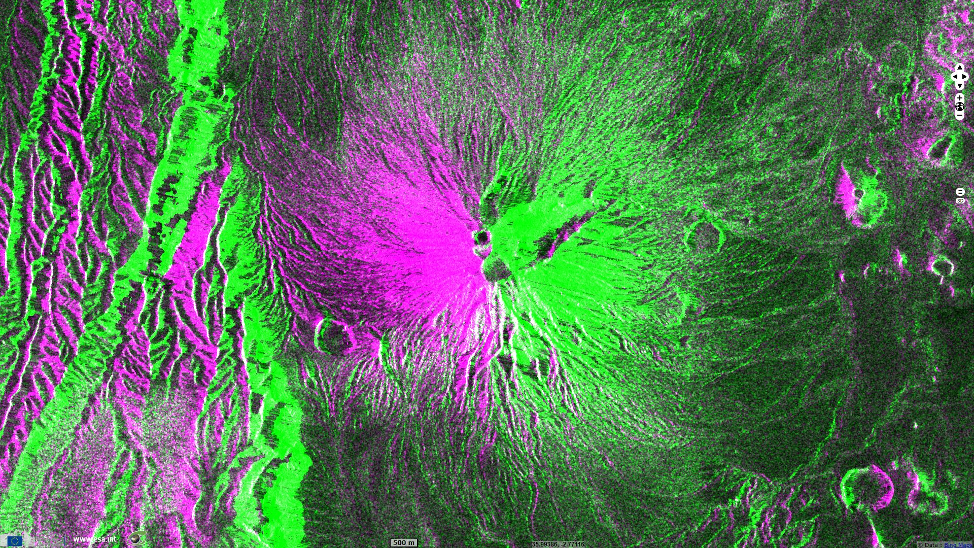
As shown on the multi-date composite above, the pixel-scale on-the-fly orthorectification reprojects each pixel correctly. Ridges and talwegs show at the same location on both ascending and descending images.
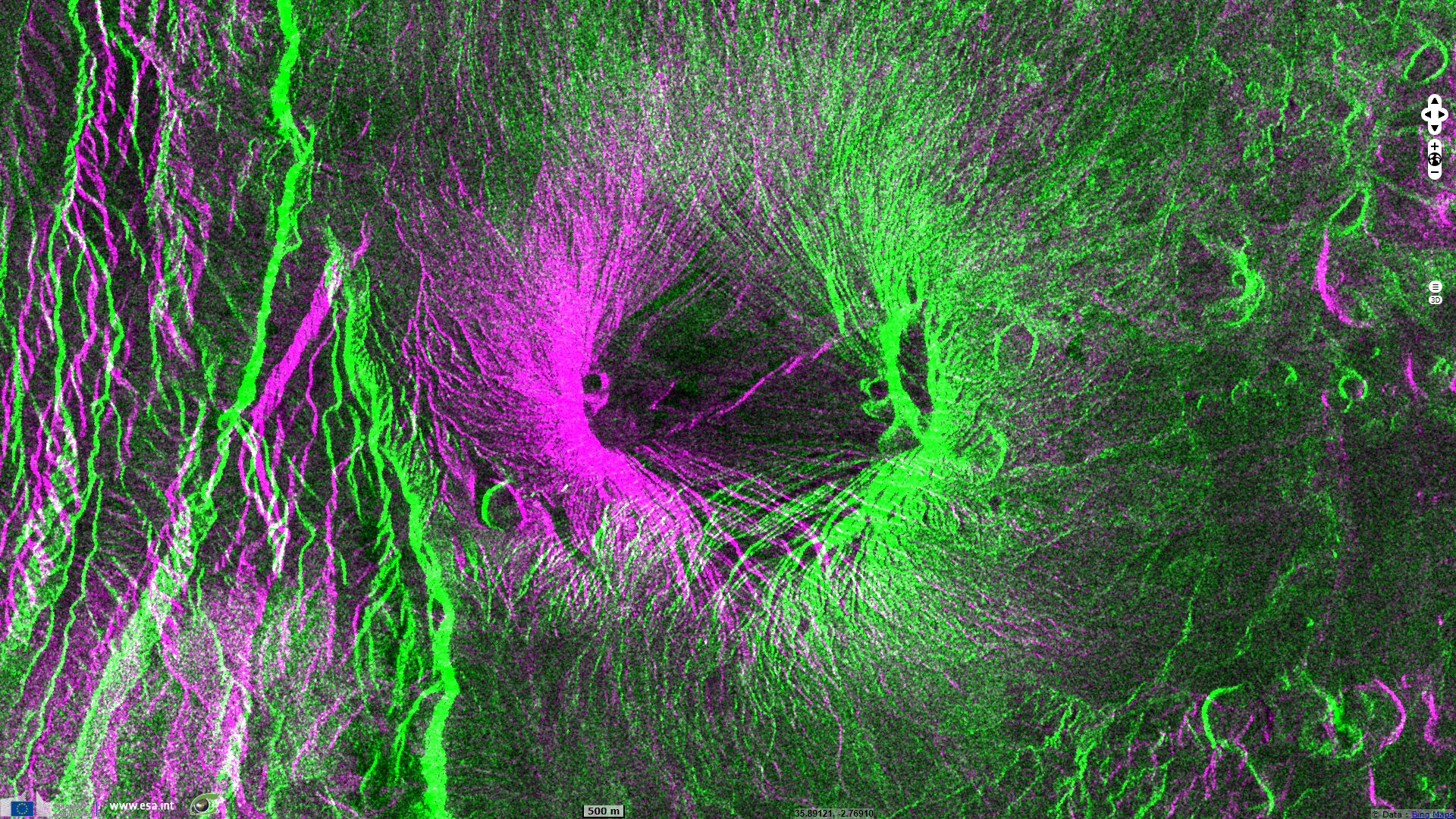
East facing slopes appear in bright on the descending orbit (west looking) image due to radar compression and in dark on the ascending orbit (east looking) image because they are in the shadow of the beam. They thus show in green on the above colour composite. For the same reasons, the west-facing slopes appear in magenta.
On this image, slopes are the dominant factor for single-bound radar backscattering. Note how bright magenta and bright green parts of the image complement each other since a location cannot be sloped toward east and west at the same time.
The views expressed herein can in no way be taken to reflect the official opinion of the European Space Agency or the European Union.
Contains modified Copernicus Sentinel data 2026, processed by VisioTerra.
Contains modified Copernicus Sentinel data 2026, processed by VisioTerra.
| More on European Commission space: |  |
 |
 |
||||
| More on ESA: | |
|
|
S-1 website | S-2 website | S-3 website | |
| More on Copernicus program: | |
|
|
Scihub portal | Cophub portal | Inthub portal | Colhub portal |
| More on VisioTerra: | |
|
|
Sentinel Vision Portal | Envisat+ERS portal | Swarm+GOCE portal | CryoSat portal |