Storm Ciara blows over Europe
Sentinel-5P TROPOMI CLOUD acquired on 08 February 2020 from 13:36:53 to 17:01:53 UTC
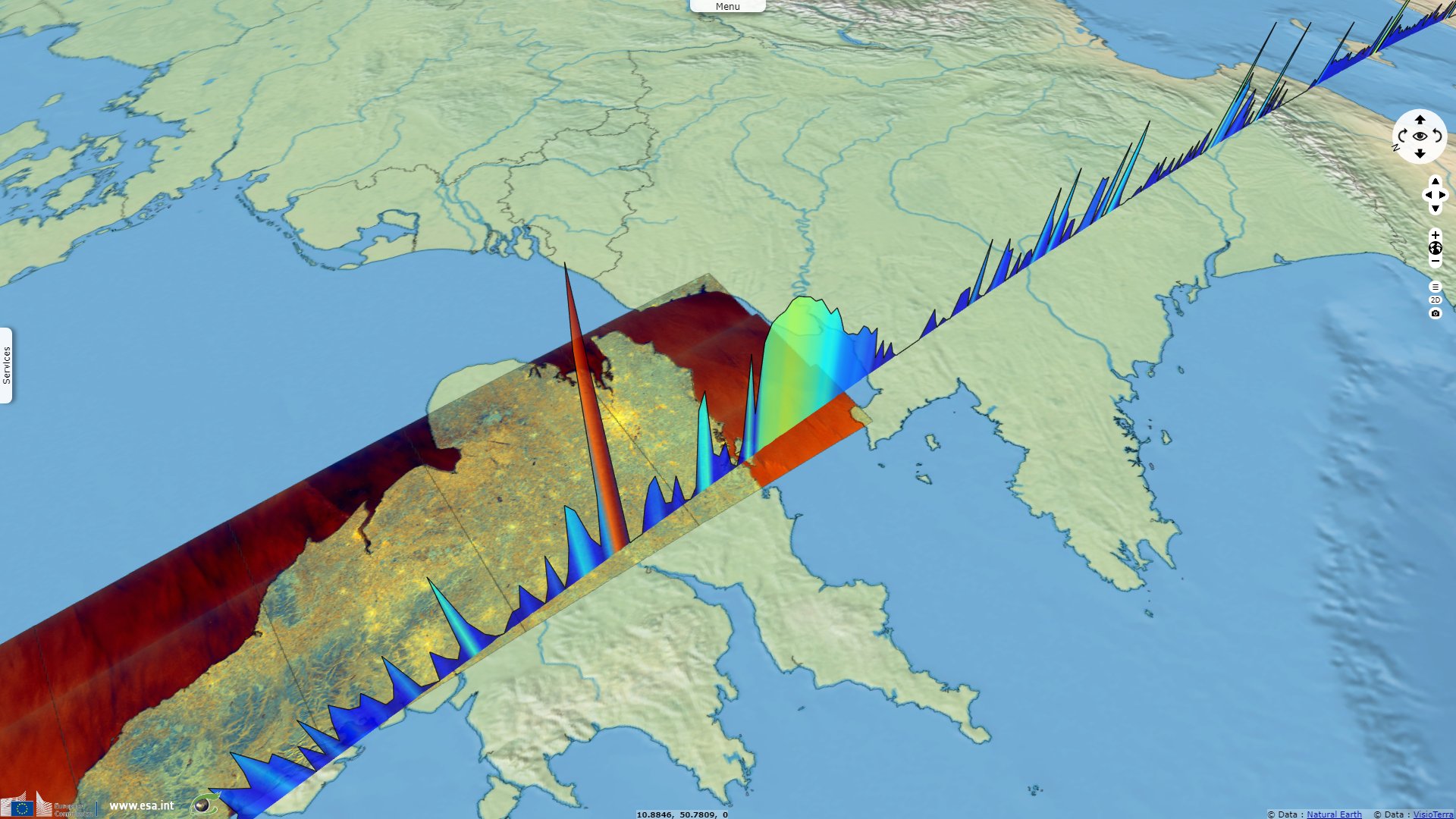
Sentinel-3 SRAL LAND acquired on 09 February 2020 at 11:28:17 & 20:43:42 UTC
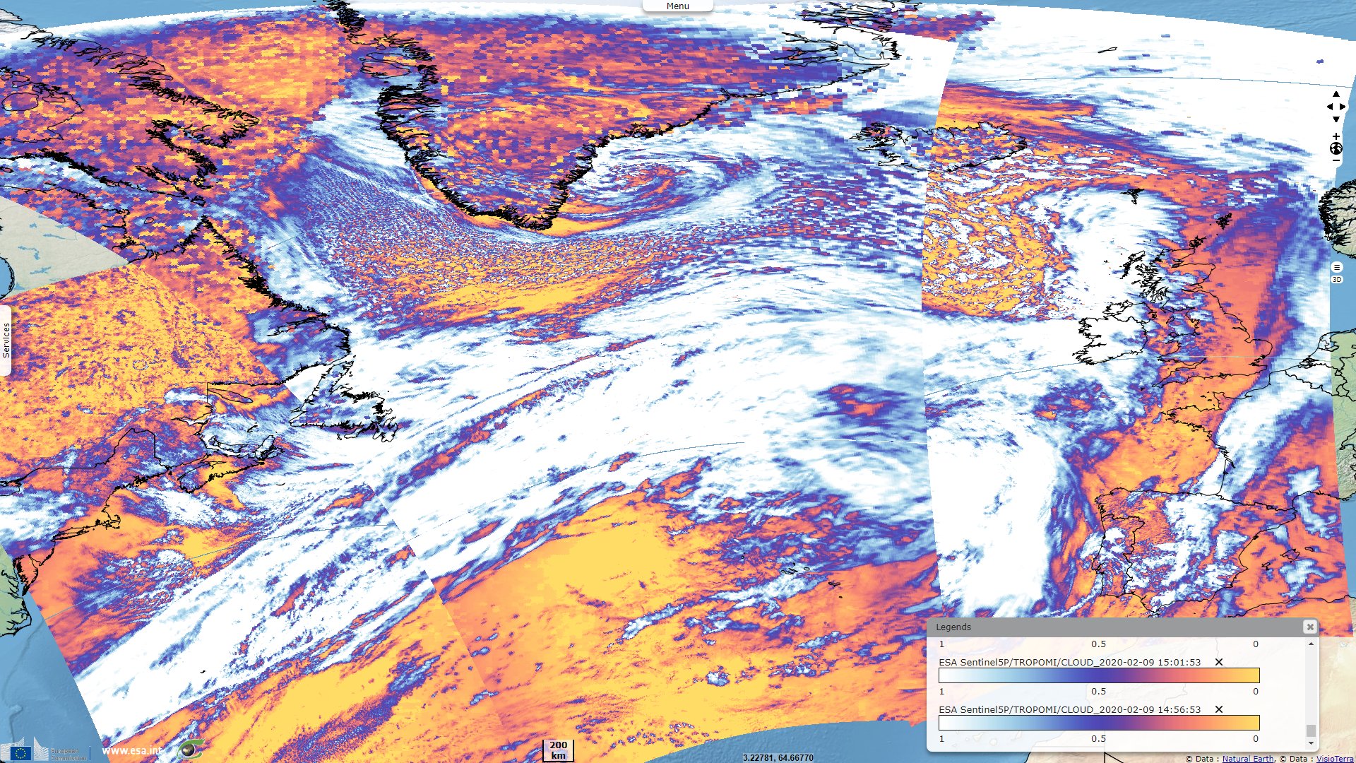
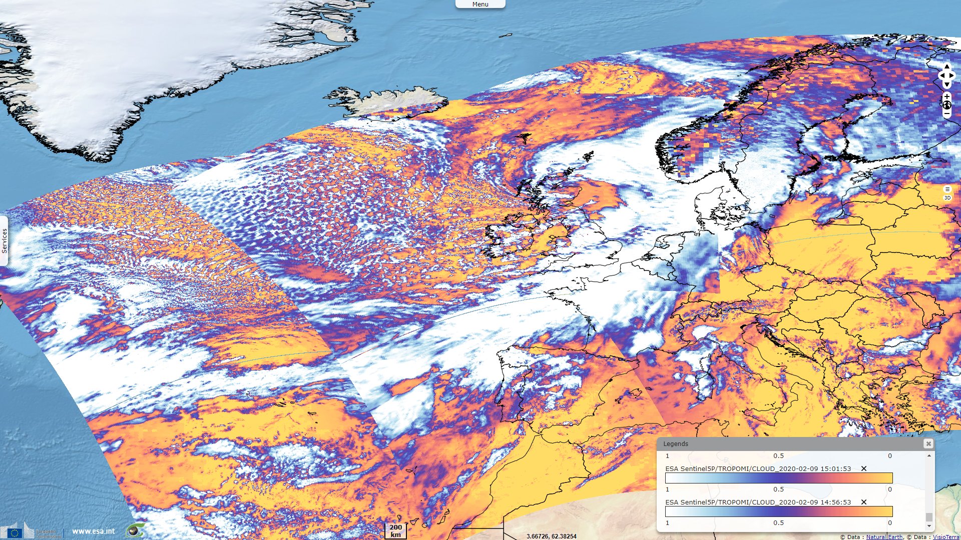
Sentinel-5P TROPOMI CLOUD acquired on 09 February 2020 from 11:36:53 to 15:01:53 UTC
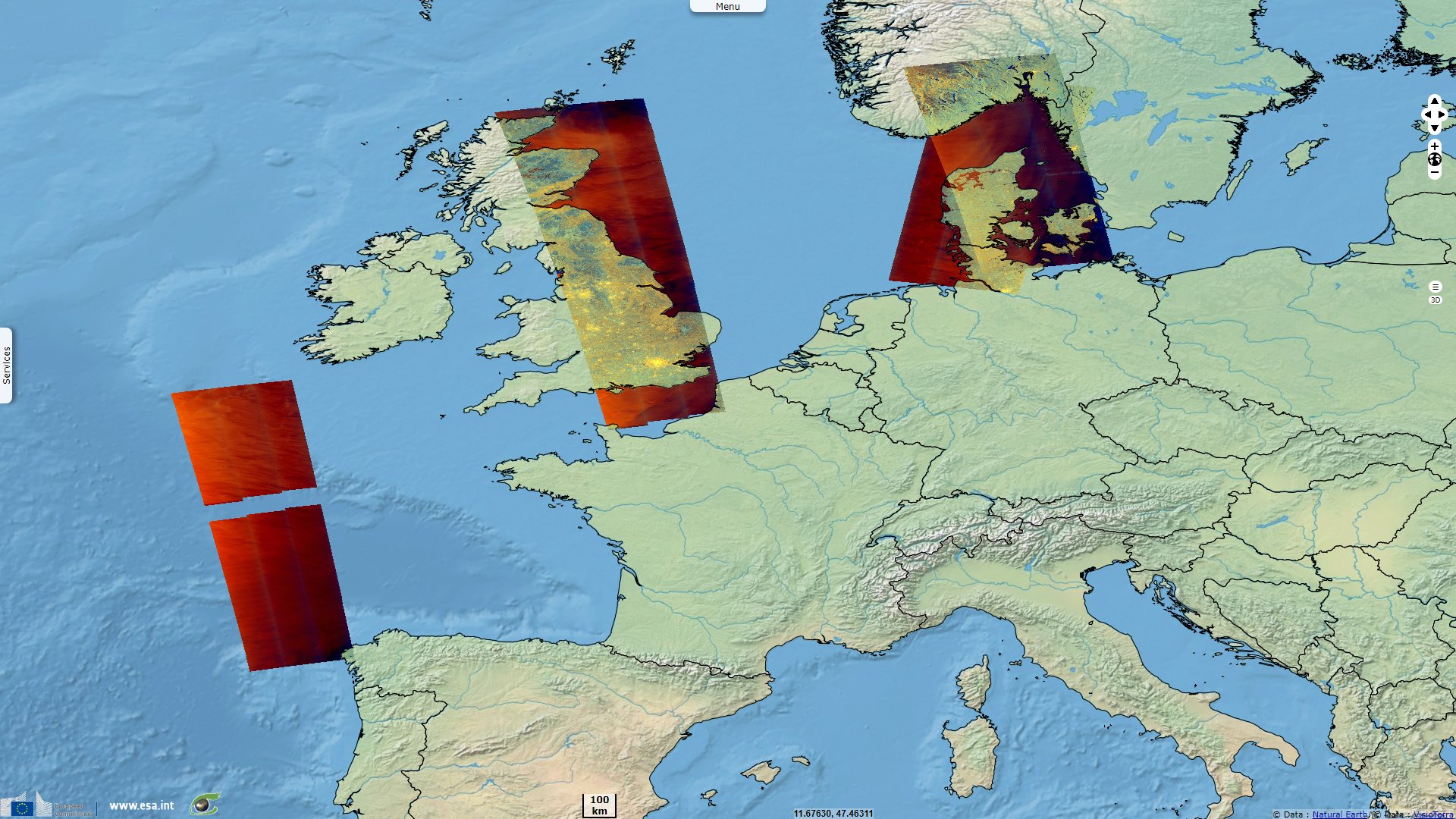
Sentinel-1 CSAR IW acquired on 09 February 2020 from 17:00:29 to 18:37:50 UTC
Sentinel-3 SRAL LAND acquired on 09 February 2020 at 11:28:17 & 20:43:42 UTC
Sentinel-5P TROPOMI CLOUD acquired on 09 February 2020 from 11:36:53 to 15:01:53 UTC
Sentinel-1 CSAR IW acquired on 09 February 2020 from 17:00:29 to 18:37:50 UTC
Keyword(s): Storm, wind, precipitations, rainfalls, flooding, storm surge, atmosphere, Europe
A subsonic flight crossed the Atlantic in 4h56, beating the record by 17'. Tailwind & jet stream pushed it up to 1328kph, over its 1004kph topspeed.
The views expressed herein can in no way be taken to reflect the official opinion of the European Space Agency or the European Union.
Contains modified Copernicus Sentinel data 2026, processed by VisioTerra.
Contains modified Copernicus Sentinel data 2026, processed by VisioTerra.
| More on European Commission space: |  |
 |
 |
||||
| More on ESA: | |
|
|
S-1 website | S-2 website | S-3 website | |
| More on Copernicus program: | |
|
|
Scihub portal | Cophub portal | Inthub portal | Colhub portal |
| More on VisioTerra: | |
|
|
Sentinel Vision Portal | Envisat+ERS portal | Swarm+GOCE portal | CryoSat portal |