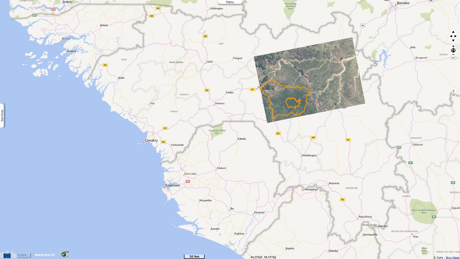
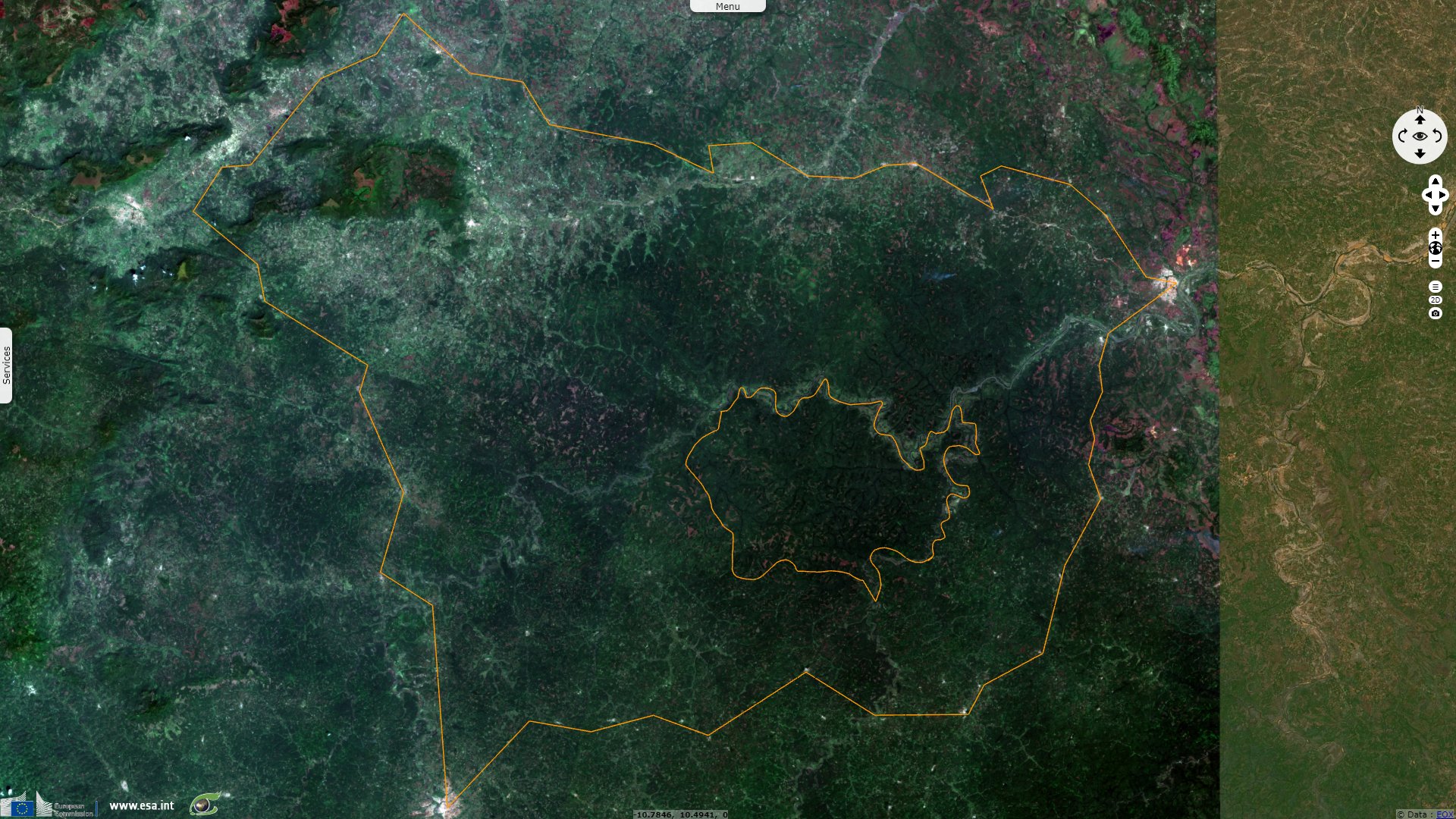
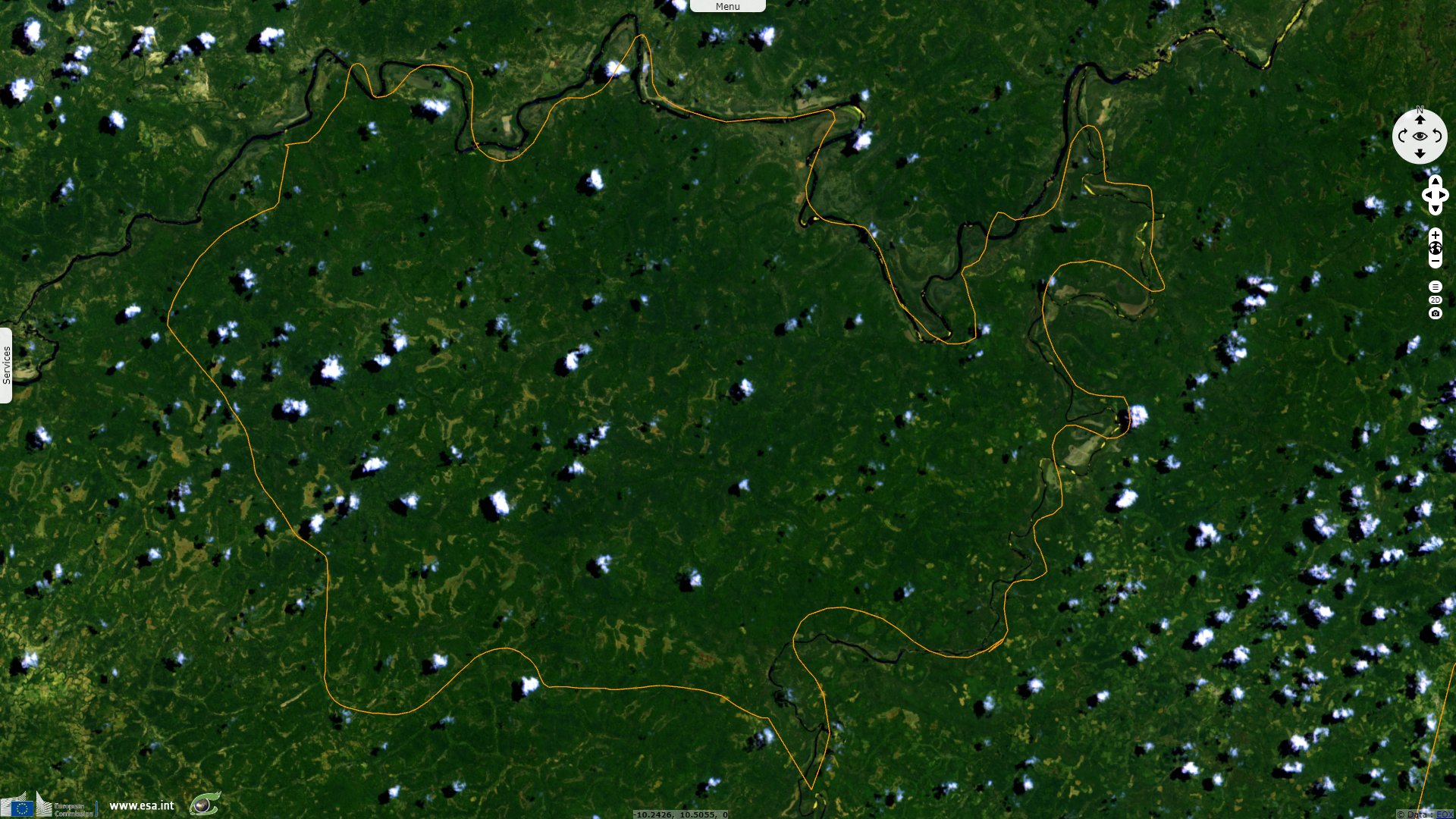
National Park of Upper Niger, Guinea
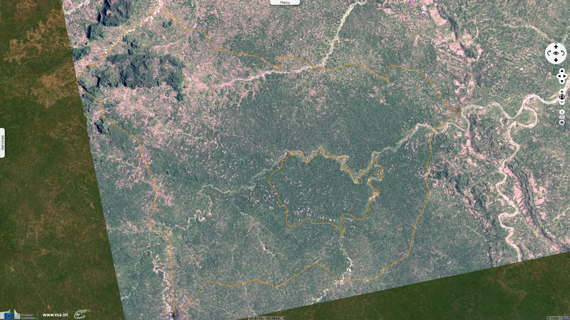
Sentinel-2 MSI acquired on 09 March 2022 at 10:57:59 UTC
...
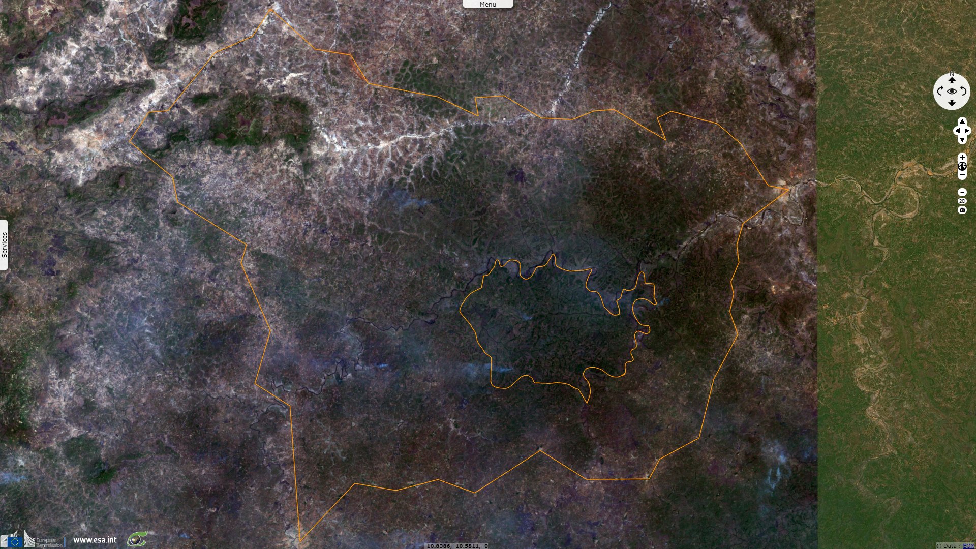
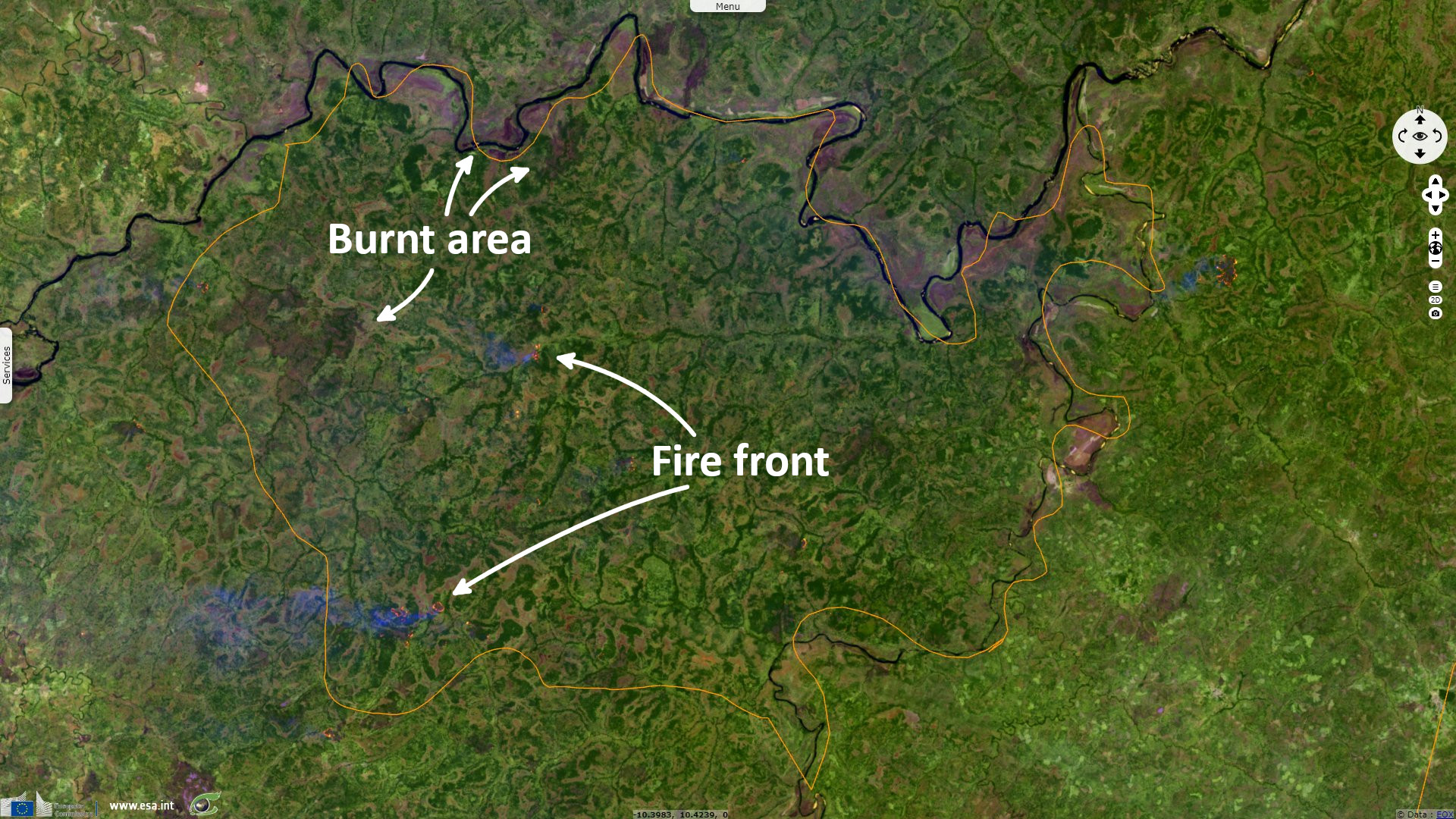
Sentinel-1 CSAR IW acquired on 19 June 2022 at 18:52:40 UTC
Sentinel-1 CSAR IW acquired on 23 September 2022 at 18:52:44 UTC
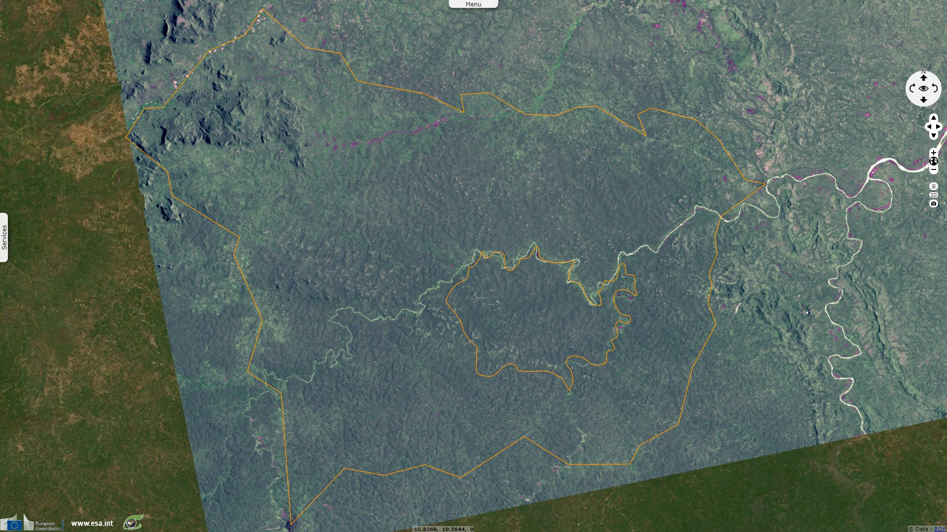
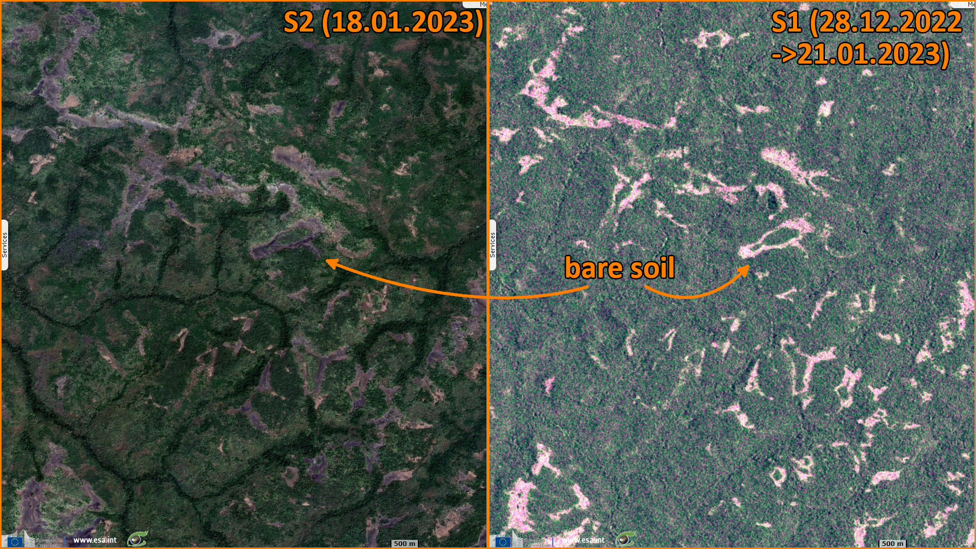
Sentinel-2 MSI acquired on 18 January 2023 at 11:04:01 UTC
...
Sentinel-1 CSAR IW acquired on 19 June 2022 at 18:52:40 UTC
Sentinel-1 CSAR IW acquired on 23 September 2022 at 18:52:44 UTC
Sentinel-2 MSI acquired on 18 January 2023 at 11:04:01 UTC
Keyword(s): Land, forestry, national park, biodiversity, seasons, Guinea
The journaliste Abdallah Baldé introduced the Upper Niger National Park in the local newspaper Guinée Matin:
The Upper Niger National Park, included in the World Network of Biosphere Reserves by UNESCO's Man and the Biosphere programme on 16 December 2002, is the largest reserve in Guinea with its twelve thousand square kilometres.
Located along the Niger River, this park touches the prefectures of Faranah, Dabola, Kouroussa, Kankan and Kissidougou. It contains many animal and plant species, according to Captain Abdoulaye Kouyaté, Chief Conservator. On the Faranah side, the park is about 70 km north-east of the capital and is linked by a rural track to Sidakoro, in the rural commune of Bendou.
It covers an area of one million 200 000 hectares and contains two nuclei: Mafou with 55 000 hectares and Kouya with 65 000 hectares. All the animal species of the savannah live in these two cores. Surveys in the park conducted during 1996–97 revealed a diverse mammalian fauna of 94 species including:
- 24 rodents,
- 18 bats which of the Franquet's epauletted fruit bat and the horseshoe bat,
- 17 carnivores which of the Caracal, the Egyptian and Gambian mongooses and the spot-necked otter,
- 14 ungulates which of the giant forest hog, the kob and the waterbuck,
- 9 insectivores which of the four-toed hedgehog and the climbing shrew,
- seven primates which of the chimpanzee and the Senegal galago,
- giant and tree pangolins and the African savanna hare.
- The African elephant) once occurred in the park but is now extinct.
However, according to the conservators who watch over this unknown treasure, several species are in danger of extinction. These include panthers, chimpanzees (currently protected by a French NGO on the site), pangolins, hippos, buffaloes, aardvarks... In 1997, lion returned to the protected area, probably migrating from the Tinkisso River region.
At the entrance to the park, a beautiful city of nature conservationists has been built. Half a dozen agents, led by Captain Abdoulaye Kouyaté, surround the entrances, preventing poachers and nature abusers from infiltrating the park.
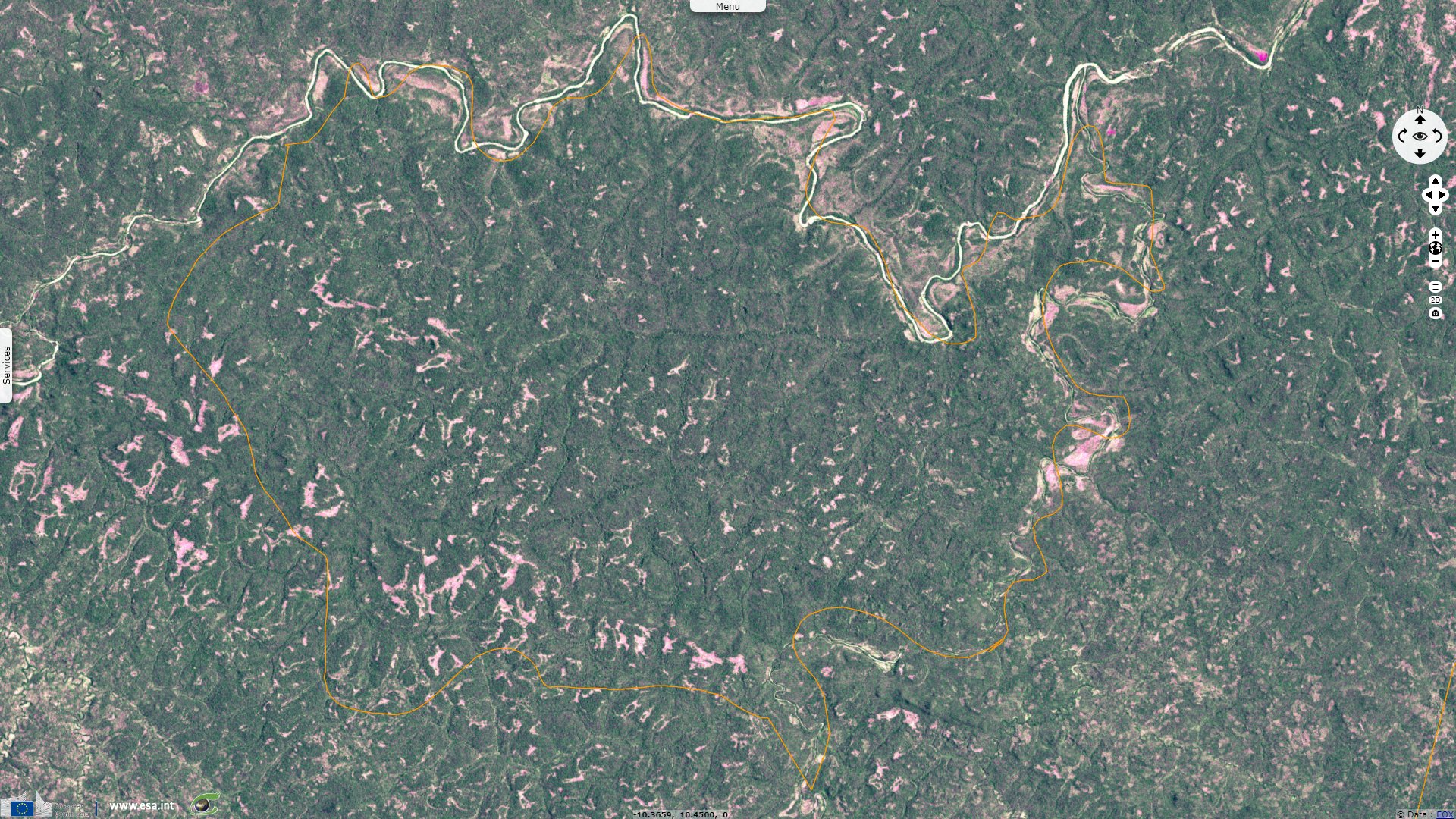
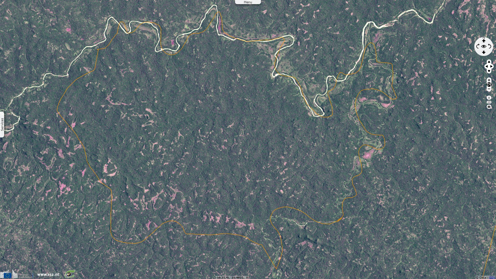
Situated in the Niger basin, UNESCO reminds it is part of the sudano-guanese vegetation zone. The biosphere reserve plays an important role in protecting the primary open dryforests which are believed to represent the last relicts in Guinea and probably in all western Africa.
It covers open dry forests, gallery forests along the Niger River and its tributaries, woodland and herbaceous savanna, ponds as well as agroforestry ecosystems. Among scientific projects undertaken in the biosphere reserve are species inventories, a rehabilitation project for chimpanzees and the monitoring of the West African Manatee and the endangered endemic catfish Arius gigas.
More than 4000 people live in the biosphere reserve who mostly depend on agriculture, stock raising, hunting, gathering and fishing.
The area has a high potential for eco-tourism development. A development plan (1999-2003) has been established in order to improve the community participation in the management of the biosphere reserve.
Social, tourist and forestry development projects will be carried out in close cooperation with the local communities.
The views expressed herein can in no way be taken to reflect the official opinion of the European Space Agency or the European Union.
Contains modified Copernicus Sentinel data 2026, processed by VisioTerra.
Contains modified Copernicus Sentinel data 2026, processed by VisioTerra.
| More on European Commission space: |  |
 |
 |
||||
| More on ESA: | |
|
|
S-1 website | S-2 website | S-3 website | |
| More on Copernicus program: | |
|
|
Scihub portal | Cophub portal | Inthub portal | Colhub portal |
| More on VisioTerra: | |
|
|
Sentinel Vision Portal | Envisat+ERS portal | Swarm+GOCE portal | CryoSat portal |