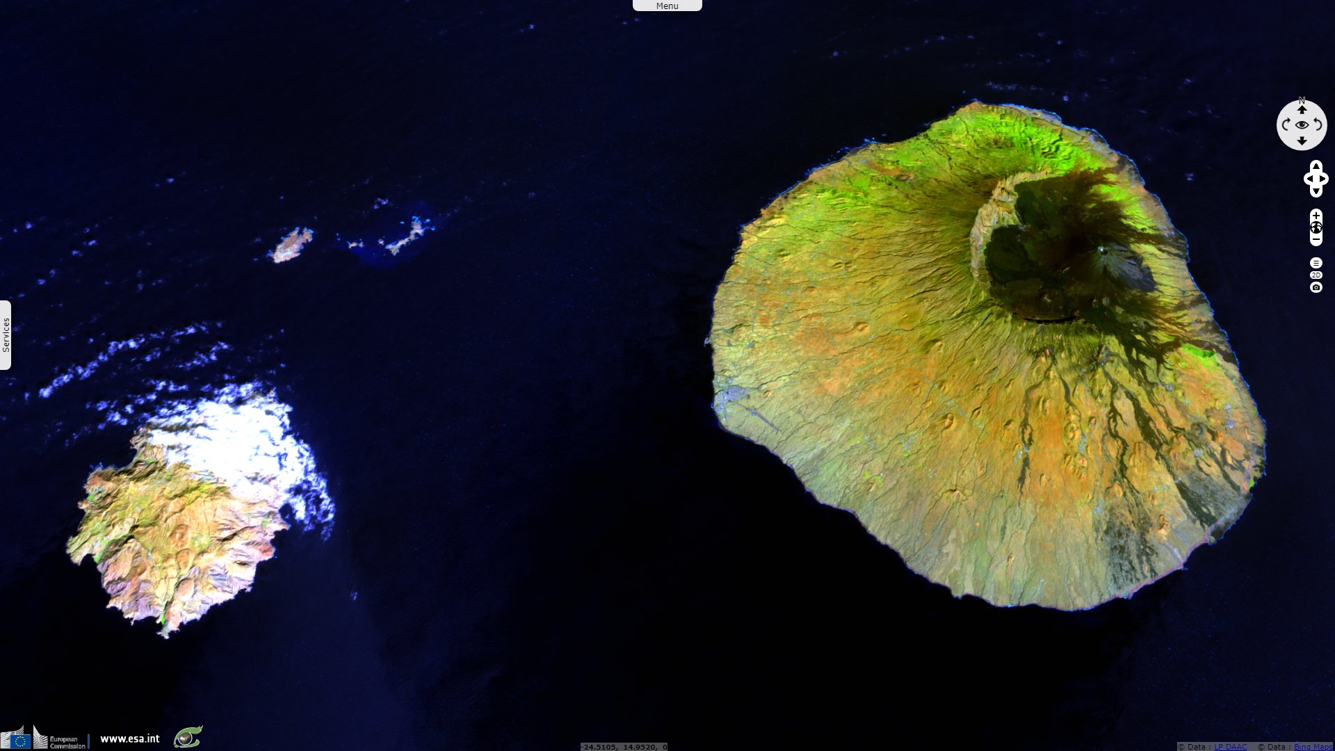
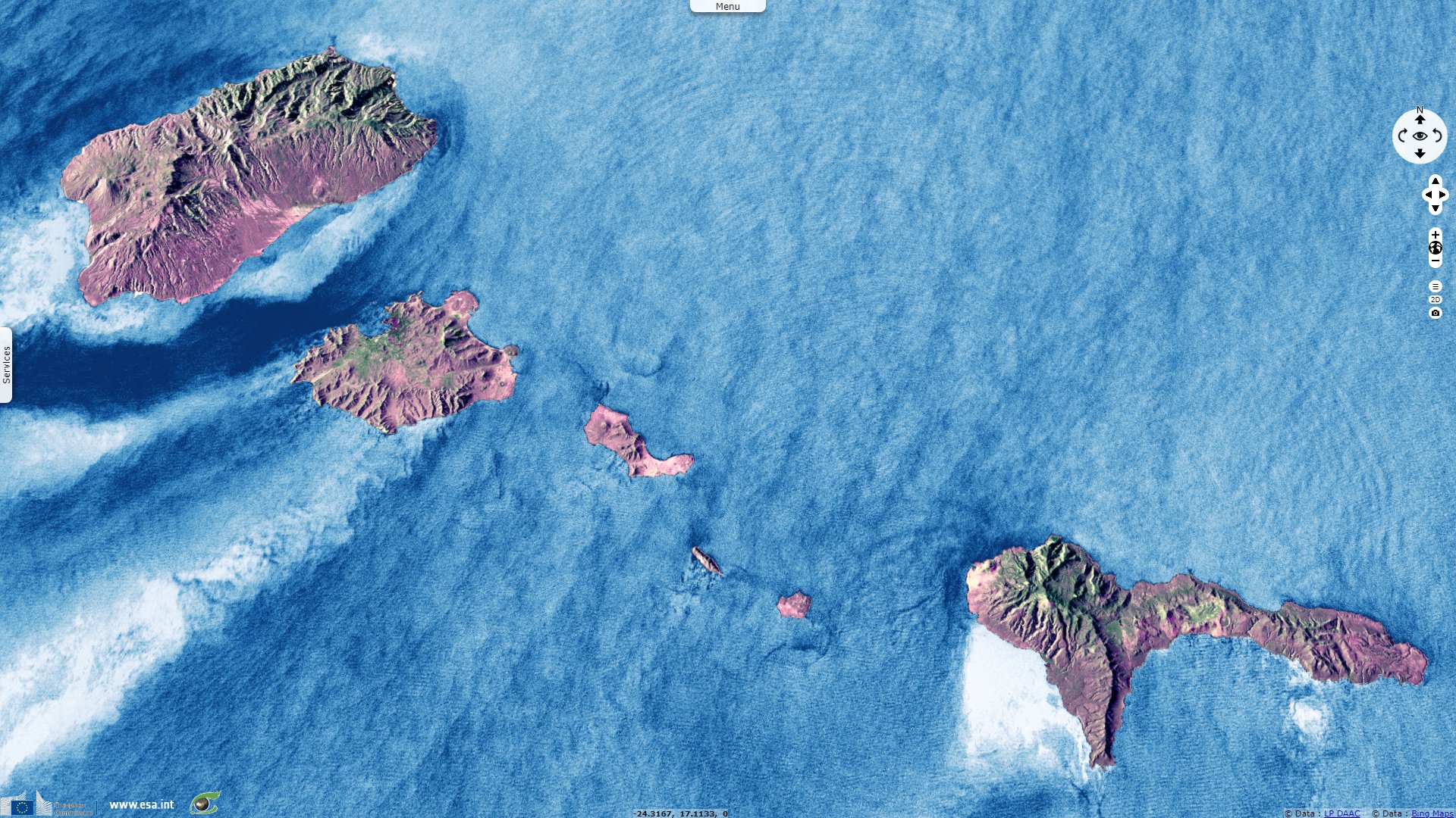
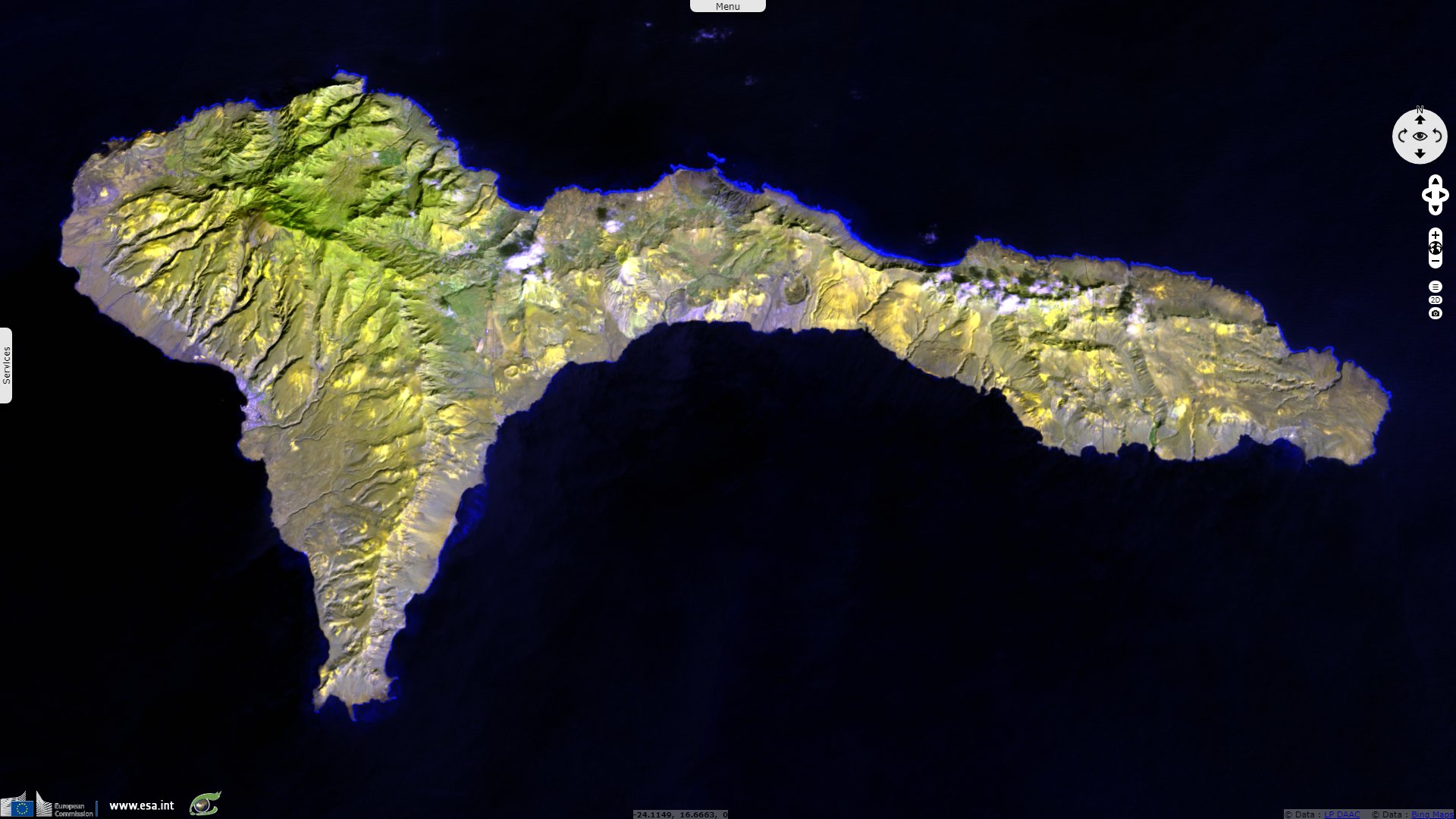
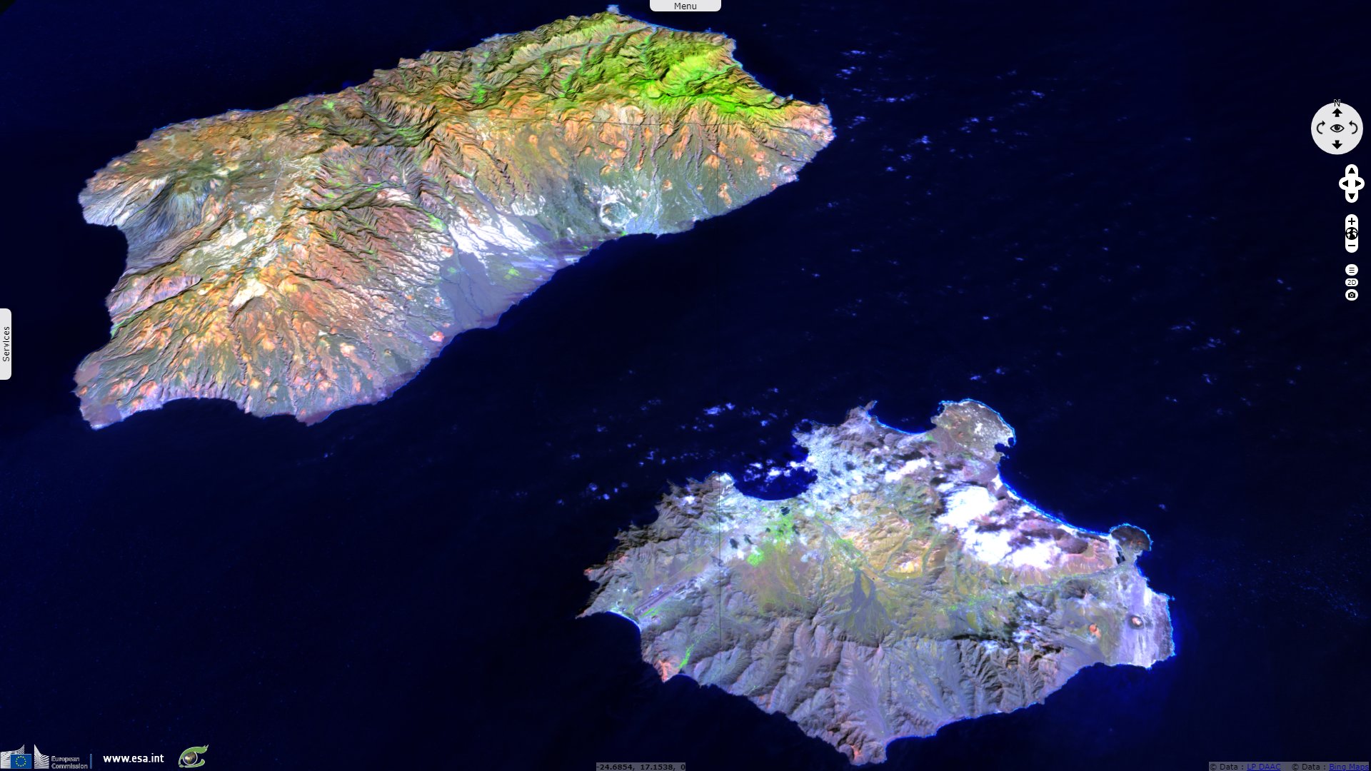
Cape Verde volcanic archipelago
Sentinel-1 CSAR IW acquired on 01 June 2016 from 07:21:49 to 07:22:18 UTC
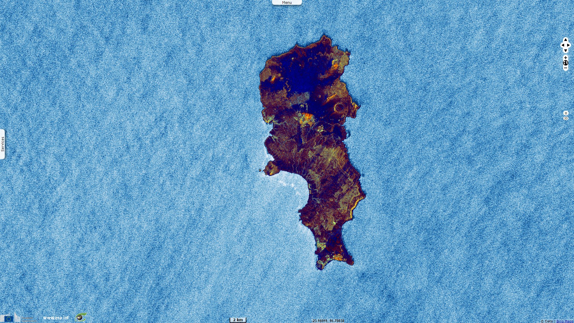
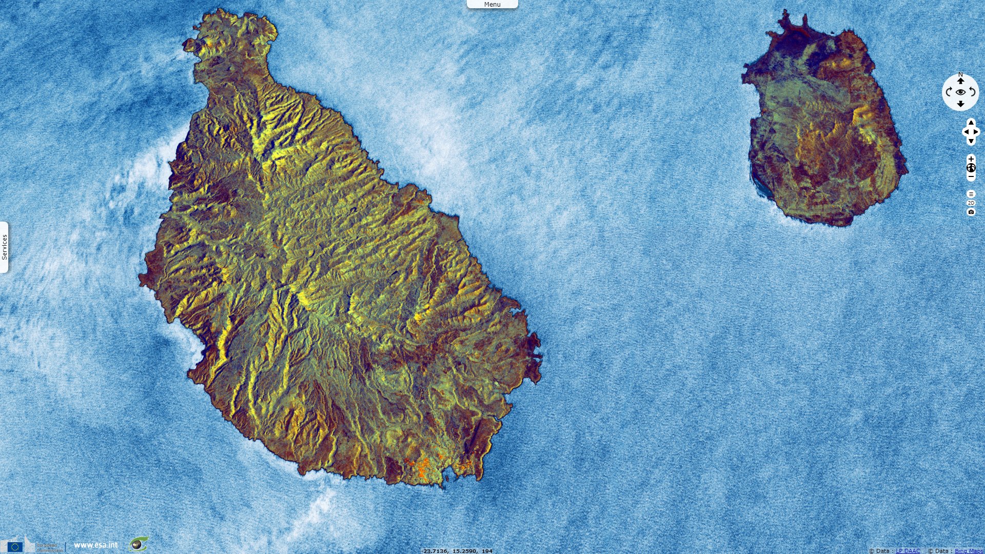
Sentinel-1 CSAR IW acquired on 06 June 2016 from 07:30:04 to 07:30:33 UTC
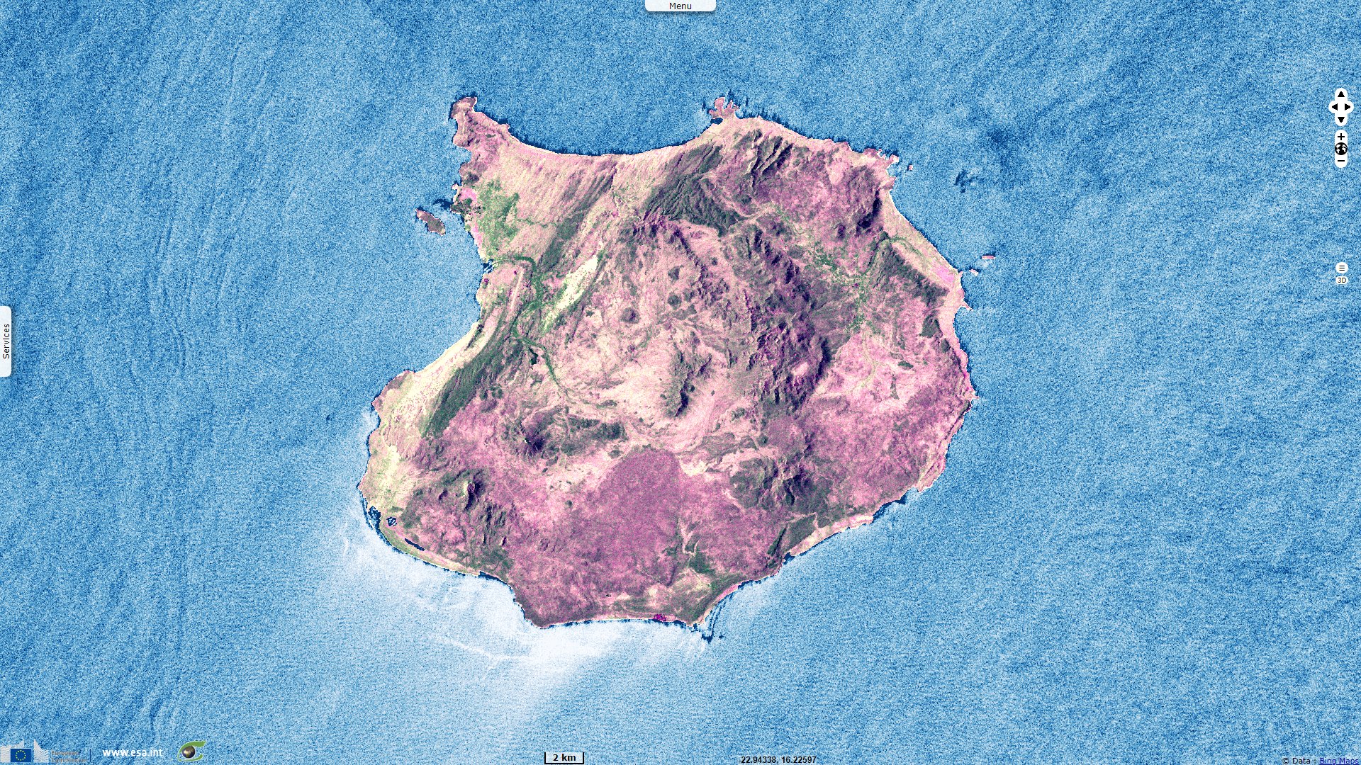
Sentinel-3 OLCI FR acquired on 27 December 2019 at 11:49:40 UTC
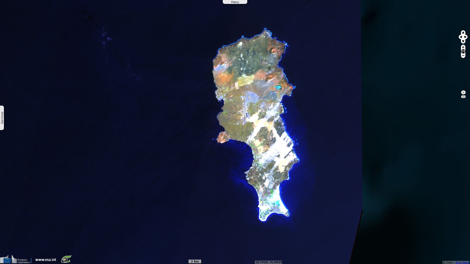
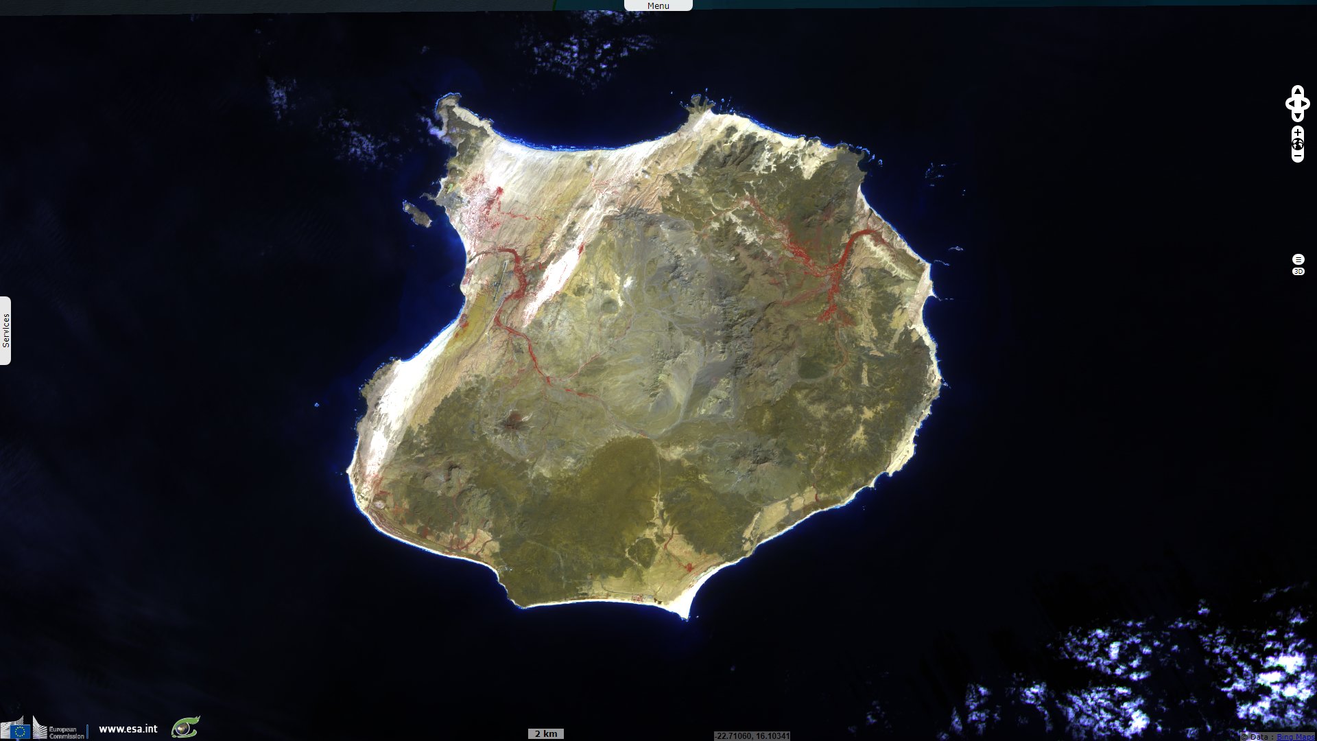
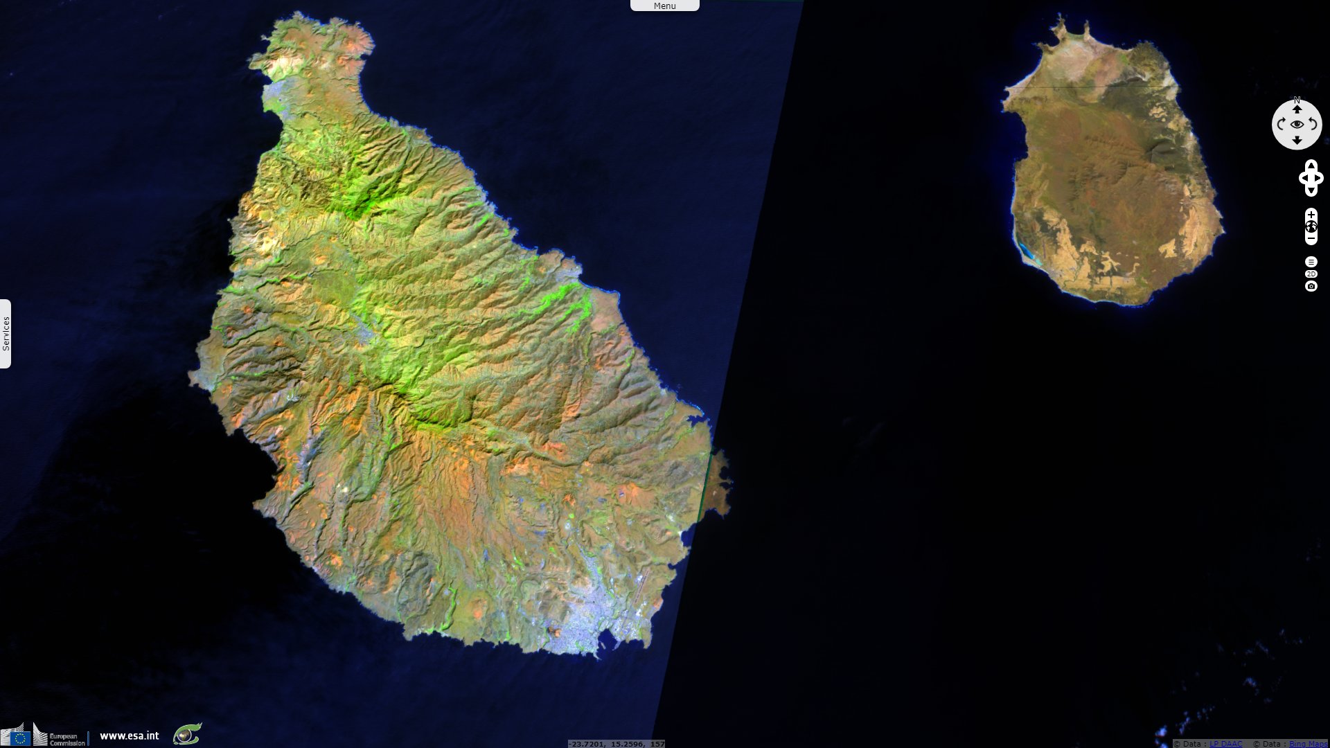
Sentinel-2 MSI acquired on 24 January 2020 at 12:06:49 UTC
Sentinel-2 MSI acquired on 27 January 2020 at 12:16:49 UTC
Sentinel-1 CSAR IW acquired on 06 June 2016 from 07:30:04 to 07:30:33 UTC
Sentinel-3 OLCI FR acquired on 27 December 2019 at 11:49:40 UTC
Sentinel-2 MSI acquired on 24 January 2020 at 12:06:49 UTC
Sentinel-2 MSI acquired on 27 January 2020 at 12:16:49 UTC
Keyword(s): Archipelago, island, coastal, hotspot, volcano, climate change, food security, Cape Verde, Atlantic Ocean
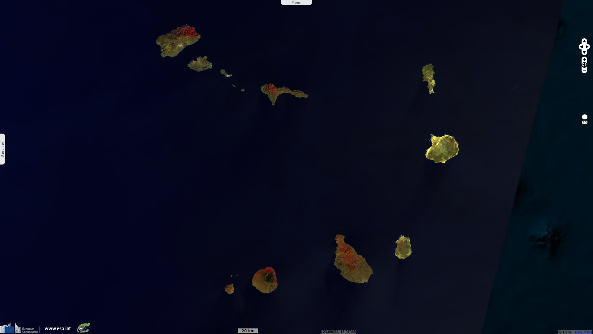
The Cape Verde Islands are located in the mid-Atlantic Ocean some 570 km off the west coast of the continent of Africa. The landscape varies from dry plains to high active volcanoes with cliffs rising steeply from the ocean.
The 4033 km² archipelago consists of ten islands and five islets, divided into the windward (Barlavento) and leeward (Sotavento) groups. All but Santa Luzia are inhabited. Three islands – Sal, Boa Vista, and Maio – generally are level and lack natural water supplies.
At east, Sal, Boa Vista and Maio have a flat landscape and arid climate, whilst the other islands are generally rockier and have more vegetation. Because of the infrequent occurrence of rainfall the landscape is arid. The archipelago can be divided into four broad ecological zones — from arid to humid, according to altitude and average annual rainfall ranging from 200 millimetres in the arid areas of the coast to more than 1000 millimetres in the humid mountain. Most rainfall precipitation is due to condensation of the ocean mist. In some islands, as Santiago, the wetter climate of the interior and the eastern coast contrasts with the dryer one in the south/southwest coast.
A cold Atlantic current produces an arid atmosphere around the archipelago. December–June is cool and dry, with temperatures at sea level averaging 21°C; July–November is warm and dry, with temperatures averaging 27°C. Although some rain comes during the latter season, rainfall is sparse overall and very erratic. Accumulations are generally around 130 mm annually in the northern islands and 300 mm in the south. When the rain comes, if it comes, it can be very strong. Half of the rain in a particular year can often fall into a single storm.
Before the arrival of Europeans, the Cape Verde Islands were uninhabited. They were discovered by Genoese and Portuguese navigators around 1456. Today, of the 540 000 inhabitants of Cape Verde, 160 000 live in Praia, on the southern coast of Santiago island.
Cape Verde is often praised as an example among African nations for its stability and developmental growth despite its lack of natural resources. Since the early 1990s, Cape Verde has been a stable representative democracy, and remains one of the most developed and democratic countries in Africa. Lacking natural resources, its developing economy is mostly service-oriented, with a growing focus on tourism and foreign investment.
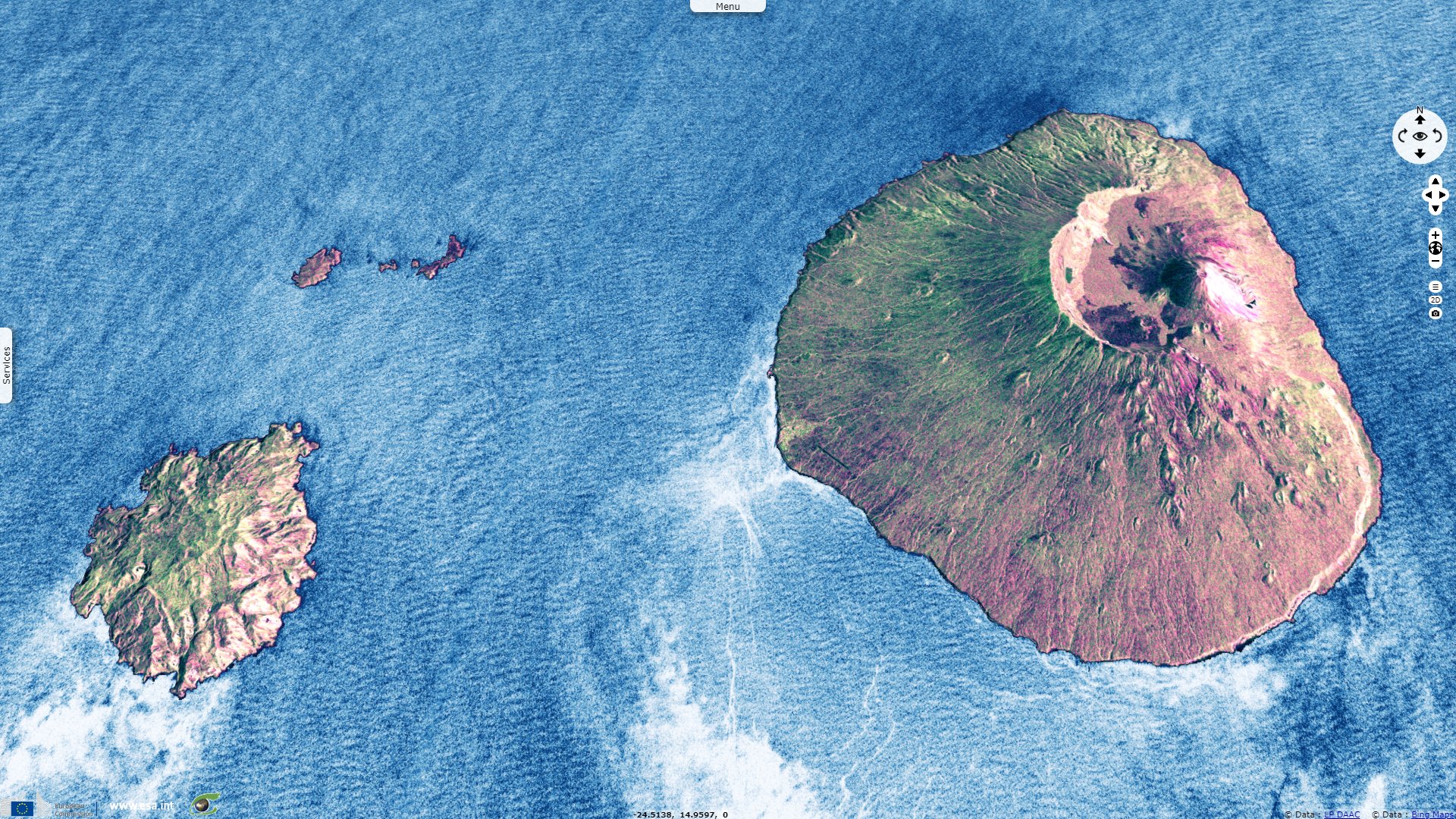
The Cape Verde islands are a very degraded area. Due to their proximity to the Sahara, most of the Cape Verde islands are dry, but on islands with high mountains and farther away from the continent, by orography, the humidity is much higher, giving a rainforest habitat, but strongly affected by human presence. Northeastern slopes of high mountains often receive a lot of rain and southwest slopes not.
These are umbria areas, situated in the north hillsides or shaded slopes of the mountainous areas, oriented behind the sun in the northern hemisphere, in the shadyside orographic. So the amount of solar radiation that it receive is much lower than it would if it had without the island's relief which intercepts much of the sun. In terms of botanical ecology, these umbria areas are identified as being cool and moist. Some islands, as Santiago with its steep mountains, are covered with vegetation (cloud forests) where the dense moisture condenses and soaks the plants, and soil.
Sand carried by strong winds has caused erosion on all islands, especially the windward ones. Sheer, jagged cliffs rise from the sea on several of the mountainous islands. The lack of natural vegetation in the uplands and coast also contributes to soil erosion. Only the interior valleys support natural vegetation.
Almost all of the natural environment has been destroyed by conversion to agriculture and logging for firewood, as well as natural soil erosion, all of which has threatened several species of birds and reptiles. The remaining original forest exists at high altitudes only. Newer problems include illegal beach sand extraction and overfishing while the nesting birds are vulnerable due to introduced mammals, including goats, cats and rats.
The archipelago is subject to cyclical droughts; a devastating drought began in 1968 and was broken only briefly in 1975, 1978, 1984, and 1986. Rainfall is irregular temporally, but also spacially, ofter concentrated around sloped elevated areas. This limits the arable land to a fraction of the surface of Cape Verde.
With both food and water a lasting issue, inhabitatnts have faced periodic droughts and famines that "have killed tens of thousands and forced many more to emigrate. Climate change experts have linked the volcanic archipelago's droughts and varied rainfall amounts to ever-warming global temperatures." reported Nathan Lee in the UNO-backed IRIN News.
"Desalination plants now provide water to more than half the country's population. Most of the country’s water must be purified at energy-intensive production plants. It costs about $1 to desalinise 1000 litres of water, according to the government. The state electricity company spent nearly $4 million dollars on water purification in 2006.
According to the government’s June 2008 anti-poverty strategy, the state electricity and water company 'faces serious difficulties in meeting the growing demand for water' and has asked larger-scale hotel operators to include water purification facilities on site."
"Portuguese engineers first experimented with fog nets in Cape Verde during the 1960s. A decade later, Dutch companies tried to revive fog water 'harvesting,' but the trend again faded. Antonio Sabino, a local water engineer who tested fog nets 20 years ago for the National Institute of Agricultural Development and Investigation, told IRIN the nets offer a cheaper solution to cover the island’s water needs. 'There is no pollution, no need for [purification-desalination] pumps, fossil fuels or motors.'
He estimated that on a windy, foggy day the 15 nets can produce more than 4000 litres of water at a fraction of the cost residents paid for trucked-in water. Sabino told IRIN each net costs about $800, which includes labourand a filter and net screen made from locally-available materials. “Cape Verde has some zones that offer optimal [fog] conditions – some of the best in the world. The areas are small, but these small areas have enormous potential.” The engineer said Cape Verde’s more than 1000 hectares of land is sufficiently foggy to produce billions of litres of affordable clean water per year.
Starting in November, Saharan desert winds from northern Africa blow dust onto the nets, making it harder to ensure water quality. Sabino said it is important during this period to change the filters, clean the nets and check water quality. Also, there is not year-round fog in Cape Verde, which markets itself as a sunny tourist destination. 'Nets should be built with sufficiently large dimensions to produce enough water to accommodate these periods,' advised Sabino."
The views expressed herein can in no way be taken to reflect the official opinion of the European Space Agency or the European Union.
Contains modified Copernicus Sentinel data 2026, processed by VisioTerra.
Contains modified Copernicus Sentinel data 2026, processed by VisioTerra.
| More on European Commission space: |  |
 |
 |
||||
| More on ESA: | |
|
|
S-1 website | S-2 website | S-3 website | |
| More on Copernicus program: | |
|
|
Scihub portal | Cophub portal | Inthub portal | Colhub portal |
| More on VisioTerra: | |
|
|
Sentinel Vision Portal | Envisat+ERS portal | Swarm+GOCE portal | CryoSat portal |