A violent flooding bereaves Western Europe
Sentinel-3 SLSTR RBT acquired on 13 July 2021 from 10:13:59 to 10:16:59 UTC
...
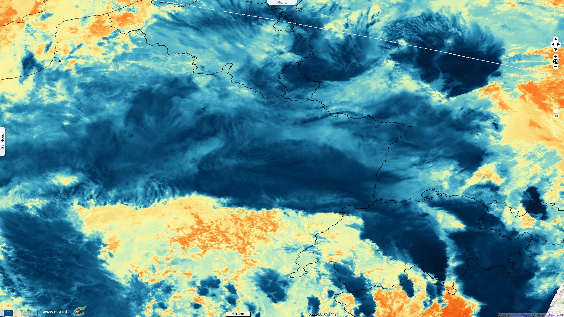
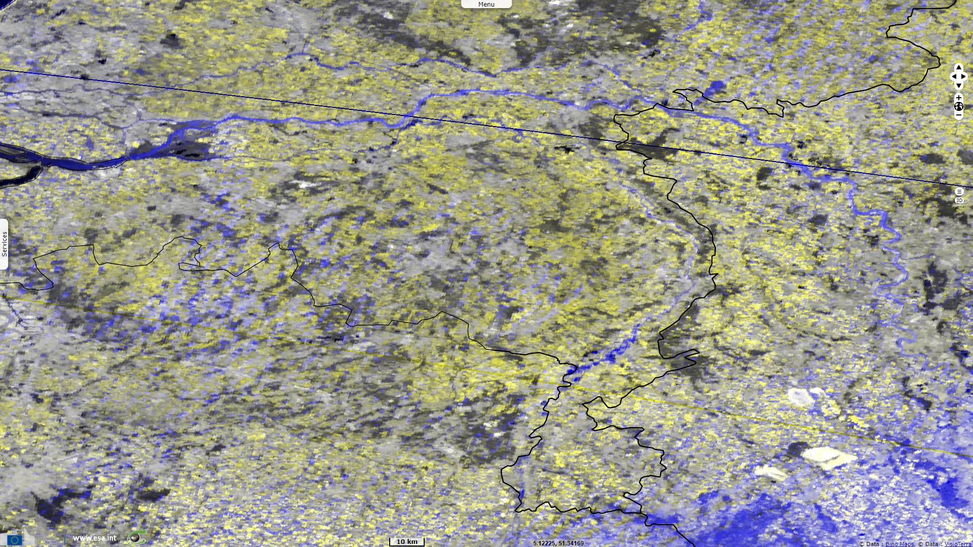
Sentinel-3 OLCI FR acquired on 17 July 2021 from 10:10:14 to 10:13:14 UTC
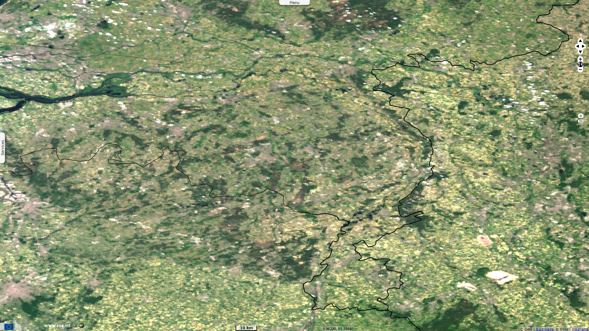
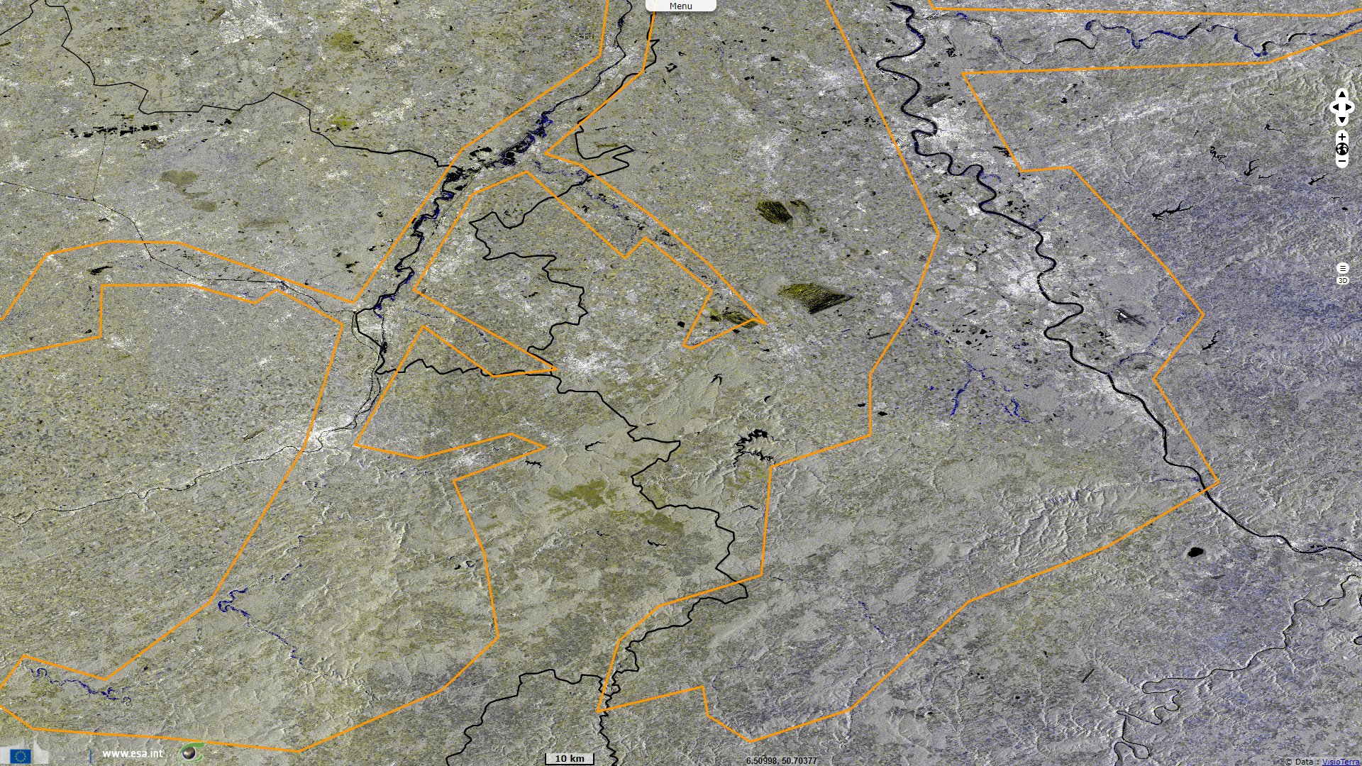
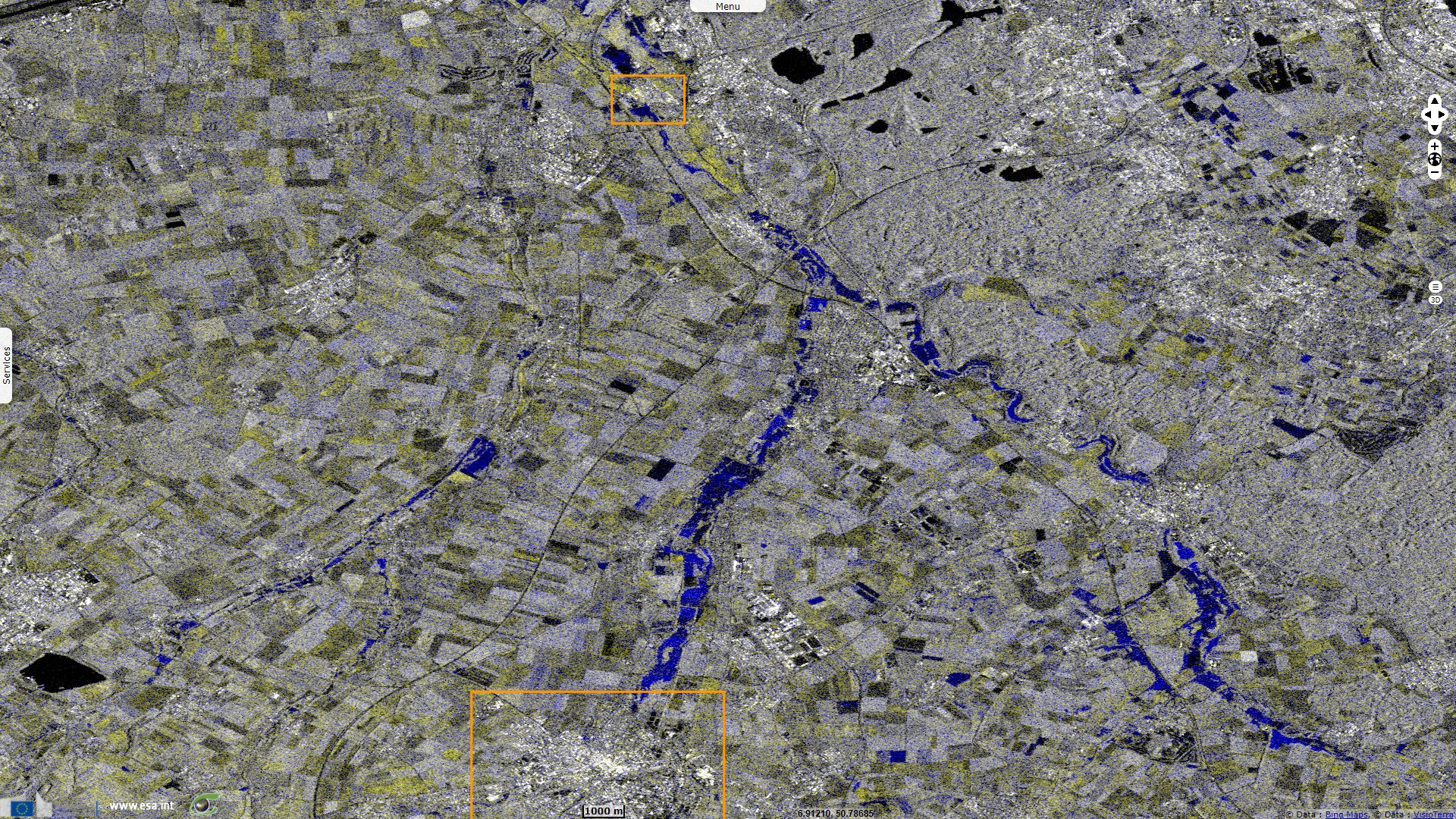
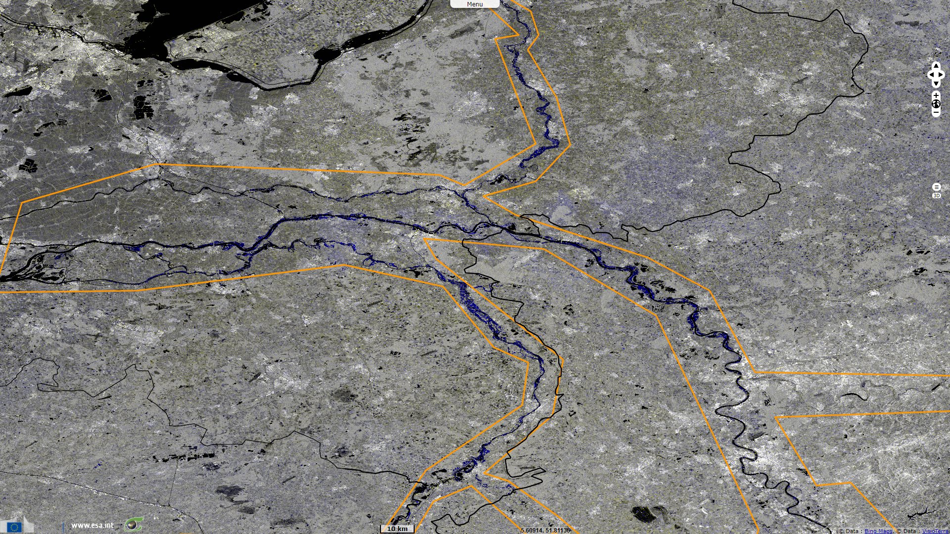
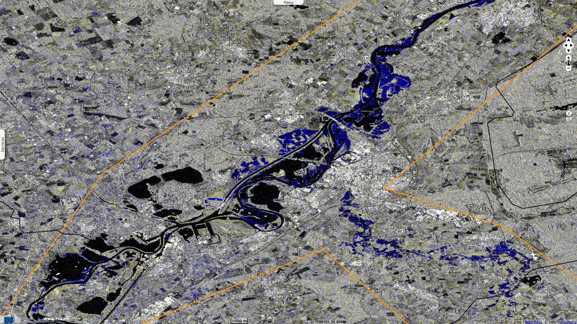
Sentinel-1 CSAR IW acquired on 18 July 2021 from 17:24:04 to 17:25:19 UTC
...
Sentinel-3 OLCI FR acquired on 17 July 2021 from 10:10:14 to 10:13:14 UTC
Sentinel-1 CSAR IW acquired on 18 July 2021 from 17:24:04 to 17:25:19 UTC
Keyword(s): Emergency, natural disaster, river, hydrology, urban planning, water colour, sediment, Germany, Belgium, Netherlands, France
The Copernicus-backed site Floodlist.com dedicated several articles to the deadly flood that left Germany and Belgium mourning. About the impact on Germany, it reports: "A series of storms throughout June and July 2021 left ground saturated in affected areas. This was followed by heavy rainfall from 12 July, and in particular on 14 July. Figures from Germany’s weather service Deutscher Wetterdienst (DWD) show at least 7 locations recorded more than 150 mm of rain in 72 hours to 15 July, 2021."
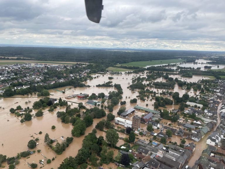
Flooding in Bliesheim, Rhein-Erft-District in Nordrhein-Westfalen, Germany, July 2021 - Source: Stadt Erftstadt.
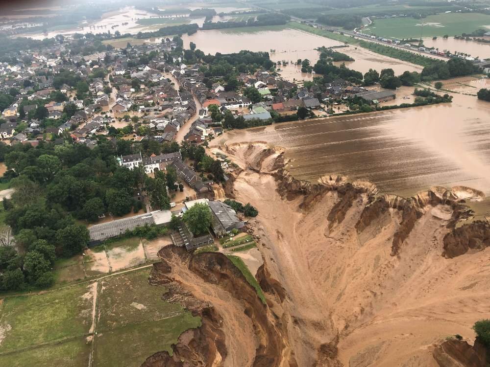
Flood damage in Erftstadt-Blessem in Rhein-Erft District - Source: Rhein-Erft-Kreis via Bezirksregierung Köln.
"Germany’s Civil Protection agency said as of 16 July the affected districts include Hagen, Rhein-Erft-Kreis, Städteregion Aachen in North Rhine-Westphalia; Landkreis Ahrweiler, Eifelkreis Bitburg-Prüm, Trier-Saarburg and Vulkaneifel in Rhineland-Palatinate; and Hof district in Bavaria. The full extent of the damage is still to be confirmed but dozens of homes are thought to have been completely destroyed after rivers broke their banks, in particular in Schuld municipality in the district of Ahrweiler. Hundreds of troops from the Bundeswehr (German army) have been deployed to help with clean-up operations."
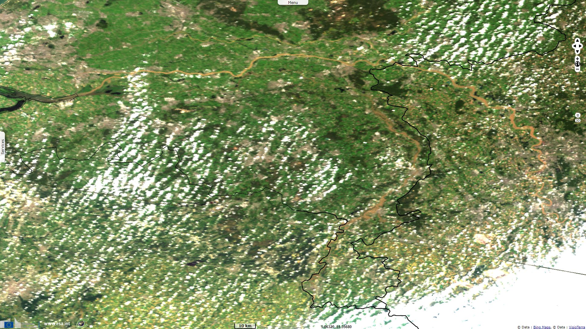
Another article deals with the toll on Belgium: "The worst affected areas are in Liège Province and also the provinces of Namur and Luxembourg. Hervé Jamar, Governor of the province of Liège said the Vesdre, Ourthe, Amblève and Meuse rivers were experiencing historical floods. The Meuse river in the city of Liege jumped from 1.2 metres on 14 July to 4.01 metres by early 15 July, prompting the evacuation of residents living close to the river. The city government said around 1000 people had been evacuated, with the worst of the flood damage reported in the districts of Chênée and Angleur, which are situated in the south of the city close to where the Ourthe river meets the Meuse. Evacuations were also carried out in neighbouring Chaudfontaine situated to the south of the city of Liège due to the overflowing Vesdre river, which increased by 3.5 metres in the space of 24 hours to 14 July."
"Flooding along the Vesdre river also caused widespread damage in Pepinster and the neighbouring town of Verviers. A bridge and several houses collapsed in Pepinster. Further east flood damage and fatalities were also reported in Eupen, where the Vesdre river jumped from under 0.6 metres to 2.98 metres in the space of a few hours between 13 and 14 July. More than 21,000 people are without electricity in the south of the country due weather damage to infrastructure. Drinking water supply has been interrupted in the municipalities of Huy and Marchin in the province of Liège. Rivers across the Walloon region remain above danger levels."
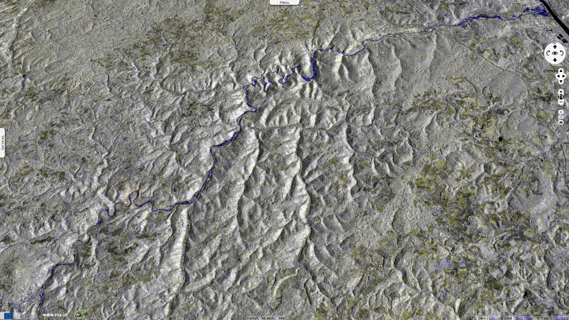
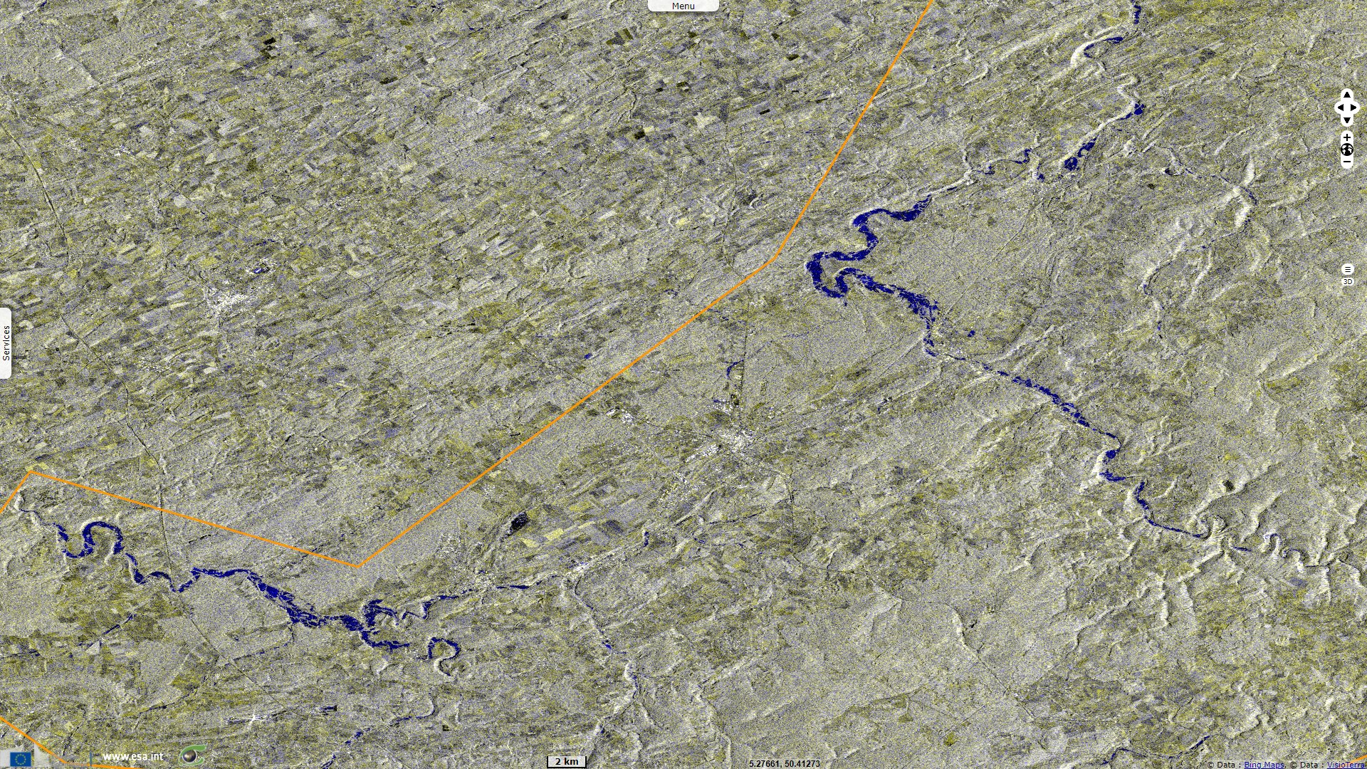
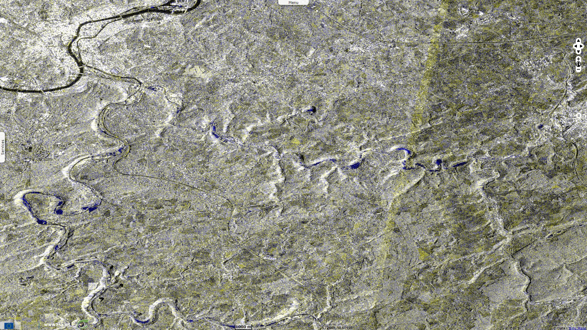
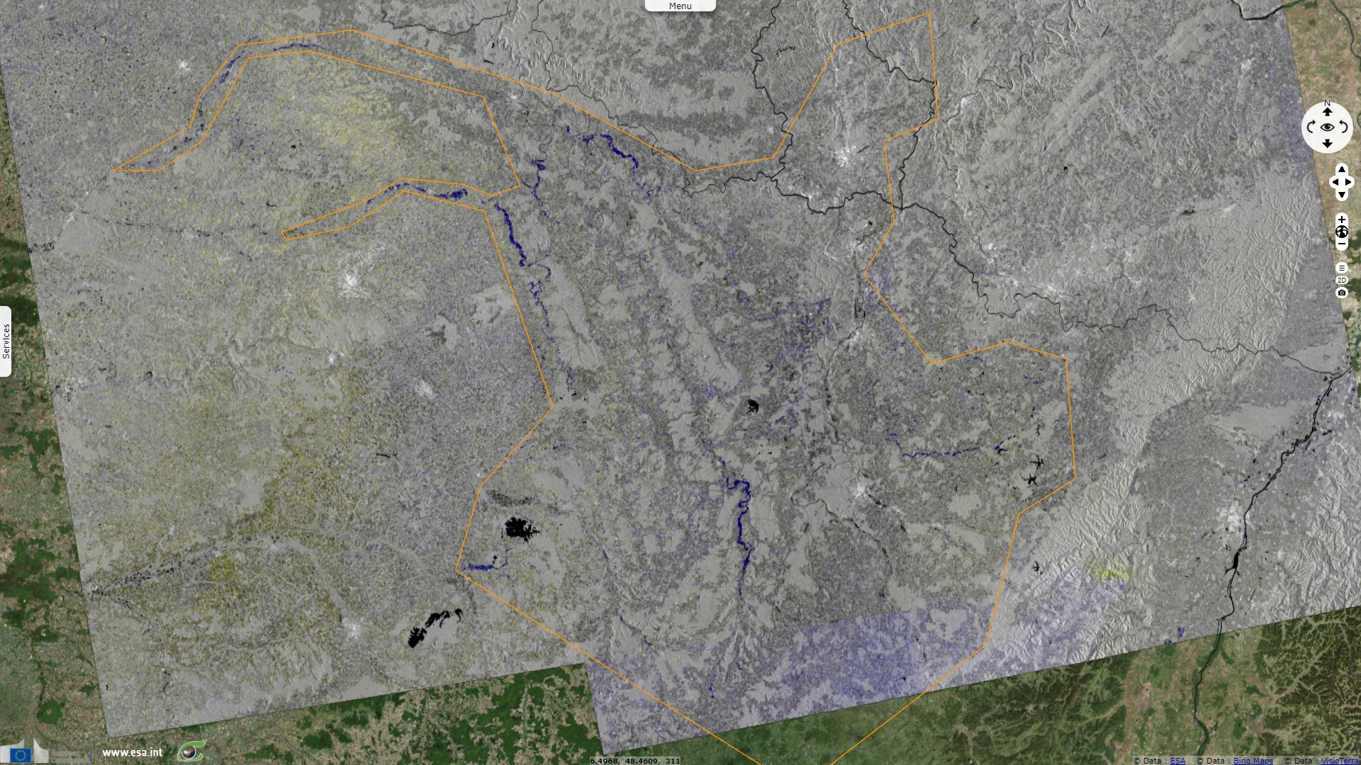
This processing shows the extent of the flood (blue areas along watercourses) in upstream regions. It features Sentinel-1 images acquired on 15 & 16 July (red and green channels) along with images acquired on 9 and 10 July 2021 (blue channel). In vh polarisation with gamma0 processing, the open water shows in dark in each image while the shores shows brighter. On the images acquired before the flood (blue channel), the “dark” rivers are still in the river bed while they overflow the “brighter” banks during the flood event. So the blue colour is caused by the drop in backscattering in the red and green channels, not by an increase in the blue channel caused by the flood.
A third sums up the impact on Luxembourg: "In Luxembourg the Fire and Rescue Service CGDIS said Born, Steinheim, Rosport and Echternach were the worst affected. After initially warning residents in affected areas to stay in their homes, over 150 people were evacuated in Echternach, which is situated on the Sauer / Sûre river on the border with Germany. Evacuations were also reported in Rosport and a small number of people were also evacuated in Vianden." "CGDIS and Police teams carried out more than 1200 weather-related interventions across the country on 15 July. No injuries or fatalities were reported. However the government’s crisis information service said material damage is significant."
In total, it is estimated:
"The number of people who have lost their lives in the recent floods in western Germany and Belgium has increased to 183. Officials in Belgium confirmed 27 fatalities as of 18 July 2021. In North Rhine-Westphalia state in Germany, 46 people were confirmed dead, including four firefighters. In the neighbouring state of Rhineland-Palatinate 110 fatalities were confirmed."
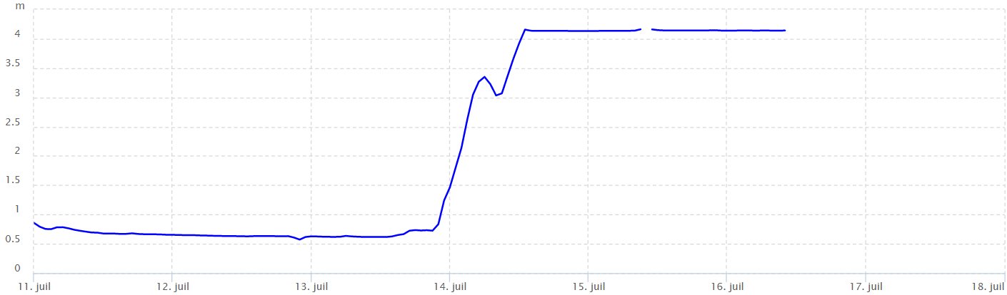
Levels of the Vesdre river at Chaudfontaine, Belgium, July 2021. Its level rose by 3.5 m in ~14 hours Source: - Voies Hydrauliques Wallonie
Hannah Cloke, Professor of Hydrology at University of Reading, published an article in the Conversation to bring some explanations about what went so wrong regarding this catastrophic flooding despite it was forecast well in advance. "Forecasts on Friday July 9 and Saturday 10 for the Rhine catchment, covering Germany and Switzerland, had shown a high probability of flooding that would begin on Tuesday July 13. Subsequent forecasts also showed the Meuse in Belgium would be affected. The forecasts in the following days showed that there was little doubt that a major flood was coming."
"The first The European Flood Awareness System (EFAS) bulletin was sent to the relevant national authorities on Saturday July 10. More updates continued over the following days as more precise predictions became available. The German weather service issued warnings for more than 200 mm of rain in the same areas several days ahead of time, saying that flooding was possible. Regional warnings were also issued, for example by the Environment Agency in the German state of Rhineland-Palatinate, one of the areas hit particularly hard by flooding."
"The floods that did happen matched the scale and distribution of those that were forecast several days before. Clearly, tragically, the whole system designed to save lives by ensuring people act on warnings before floods arrive, did not work as it should have done. In some areas, many authorities did act in time, to evacuate people, erect temporary flood defences, and move vehicles to higher ground. But this clearly did not happen everywhere."
"What is the use of a perfect forecast if the people it is supposed to warn cannot see the danger they are in ? Effective flood warnings require people to be able to see into the future and imagine their house full of water, to assess the likelihood of that happening, and to see the multiple paths they could take to keep them, their family, and their property safe. We are seeing what happens when people cannot visualise the threat of a river ripping down their street, or a lake appearing in their house. These are the elements of flood warnings that must improve."
She concludes: "As climate change increases risks from heatwaves, fires and floods, we need to not only slash emissions but prepare ourselves for the problems we already have in store."
Her colleague Jeff Da Costa, PhD researcher in Environmental Science at the University of Reading also released an article in the Conversation where he offers another lead to improve efficency:
"It is within each country’s laws and regulations to determine which authority has the power to issue warnings to their citizens. This delegation of responsibility meant that the southern Dutch province of Limburg issued evacuation warnings on the Wednesday afternoon, well before the flood hit the region, while in neighbouring Germany, the state of Rhineland-palatinate only started evacuating people when it was too late." "Evacuating people when they are already knee deep in water is not a successful way to mitigate against disaster and it does not bode well for the ability of countries to adapt to these events in future."
"The European Flood Awareness System (EFAS) did send out early notifications, sometimes in addition to information from national services. But the bodies receiving this information were specific to each country. As a result, the responsibility of implementing any actions on the ground based on a flood warning is taken at a political level. While the EFAS is highly effective in detecting threats, the different ways countries delegate responsibility for warning their citizens creates a gridlock along the chain of transmission."
The views expressed herein can in no way be taken to reflect the official opinion of the European Space Agency or the European Union.
Contains modified Copernicus Sentinel data 2026, processed by VisioTerra.
Contains modified Copernicus Sentinel data 2026, processed by VisioTerra.
| More on European Commission space: |  |
 |
 |
||||
| More on ESA: | |
|
|
S-1 website | S-2 website | S-3 website | |
| More on Copernicus program: | |
|
|
Scihub portal | Cophub portal | Inthub portal | Colhub portal |
| More on VisioTerra: | |
|
|
Sentinel Vision Portal | Envisat+ERS portal | Swarm+GOCE portal | CryoSat portal |