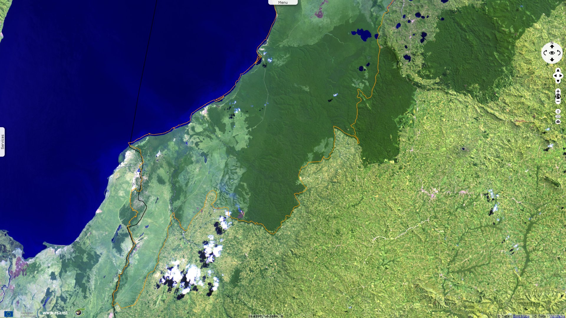
Unusual features of Queen Elizabeth Biosphere Reserve and National Park, Uganda
Sentinel-2 MSI acquired on 07 July 2018 at 08:06:09 UTC
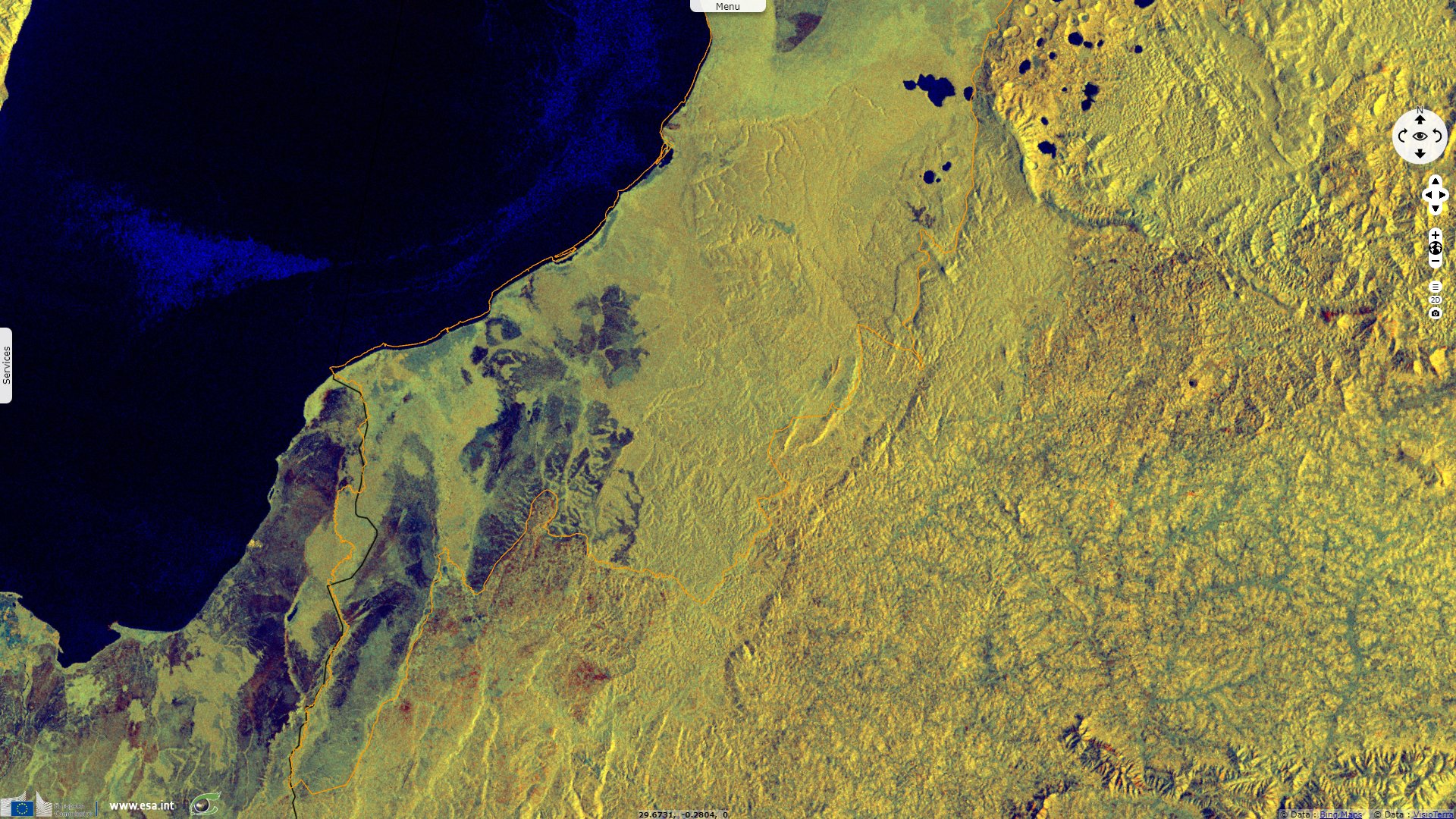
Sentinel-1 CSAR IW acquired on 17 July 2019 at 16:20:24 UTC
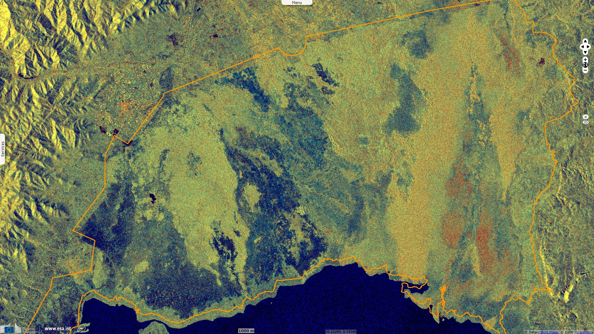
Sentinel-1 CSAR IW acquired on 13 August 2021 at 03:44:07 UTC
Sentinel-1 CSAR IW acquired on 17 July 2019 at 16:20:24 UTC
Sentinel-1 CSAR IW acquired on 13 August 2021 at 03:44:07 UTC
Keyword(s): Land, National Park, biosphere reserve, Ramsar wetland, maar, volcano, lake, canal; biodiversity, geology, geohazard, Uganda, DRC, African Rift Valley, Albertine Rift
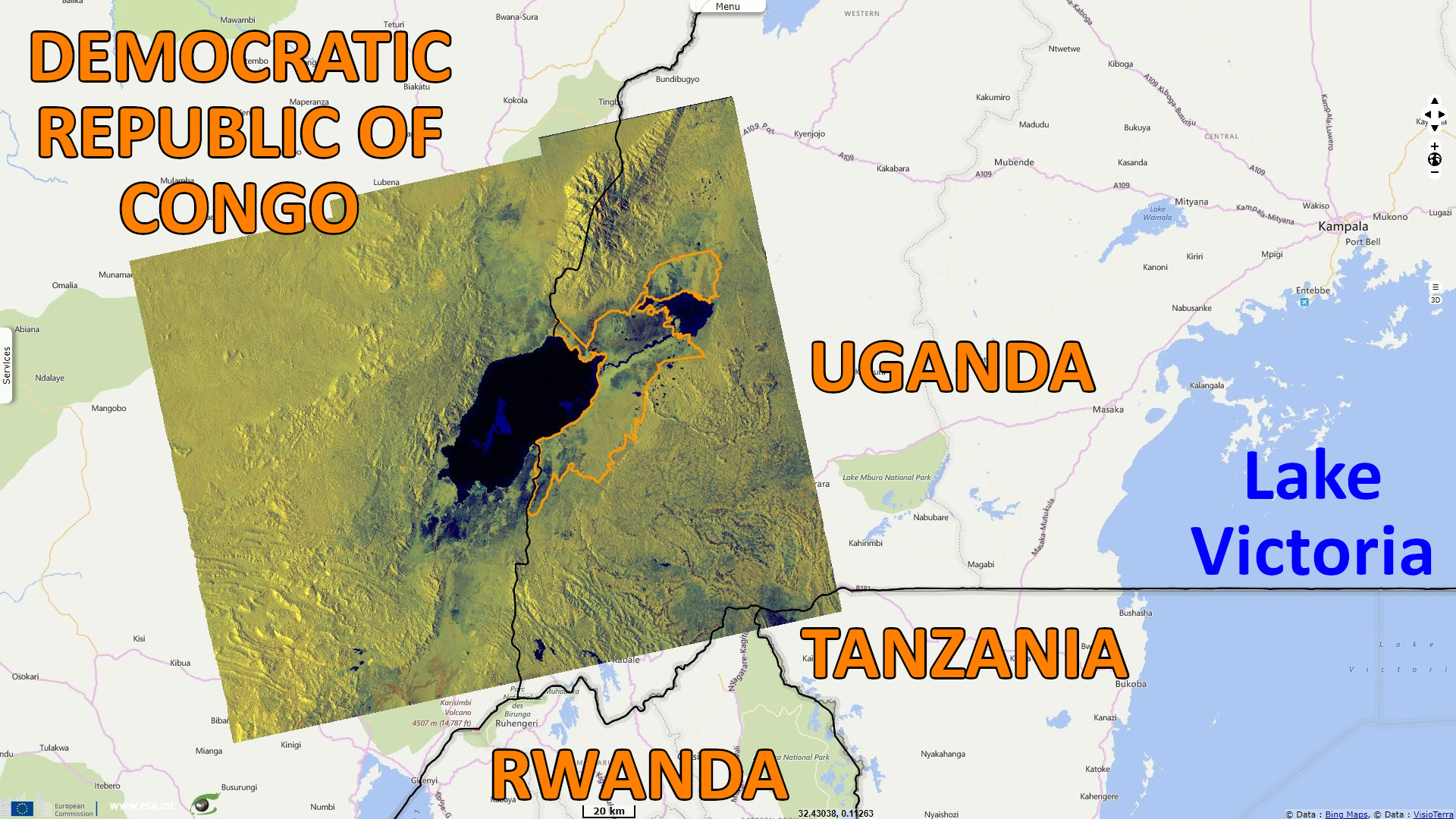
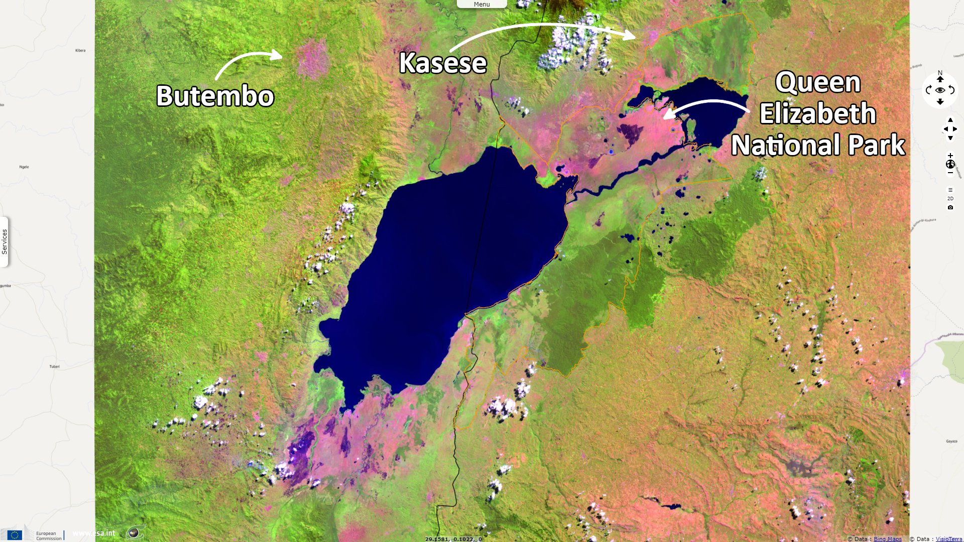
Queen Elizabeth National Park is in the Western Region of Uganda, spanning the districts of Kasese, Kamwenge, Rubirizi, and Rukungiri. The park is approximately 400 kilometres by road south-west of Kampala, Uganda's capital and largest city.
The Park is a also a biosphere reserve, it is described by UNESCO as follows: "Queen Elizabeth Biosphere Reserve and National Park straddle the equator in western Uganda. Covering an altitudinal range of 910 to 1390 meters above sea level, it is composed of a wide range of ecosystems: semi-deciduous tropical high forests, undulating savanna grasslands, Acacia savanna, tundra and wetlands. The area also includes (partly salt) lakes among which are Lake George (a Ramsar site) and Lake Edward."
"The core area of the reserve supports a wide range of Uganda’s natural habitats and landforms, including grassy plains, distinctive savanna woodlands, tropical forest, wetlands, rivers, swamps, lakes and volcanic craters. The reserve has a greater biodiversity than any other protected area in Uganda. The core area is also used as a model for conservation education, research and monitoring of biodiversity trends. The vast savannah and forest animal species and the scenic landforms attract an increasing number of tourists to the reserve. Hence, the reserve contributes to the tourism industry, which is the second Uganda’s leading income earner."
"Large herbivores species include hippopotamus, elephant, buffalo, Uganda Kob, waterbuck and Topi. Large carnivore species include lion, leopard, and spotted hyena. The reserve is also inhabited by over 600 species of birds both migrant and residents."
"The following are amongst the endangered wildlife species found in the reserve: chimpanzee, the African elephant, leopard, and the Shoebill stork. The northern Queen Elizabeth lions are at a high risk of extinction due to human-lion livestock conflicts."
"Fishing and salt extraction provide the main sources of income for the 20 000 inhabitants within the ten settlements of the biosphere reserve. There is some impact on the biosphere reserve’s woodlands for example by using wood for smoking fish, cooking, lime production and handicrafts. The area surrounding the biosphere reserve has a very high population density with crop cultivation being the major economic endeavour."
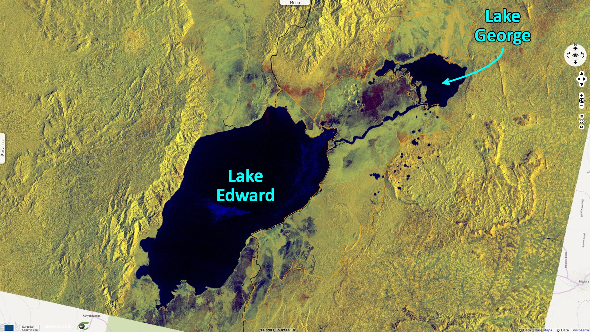
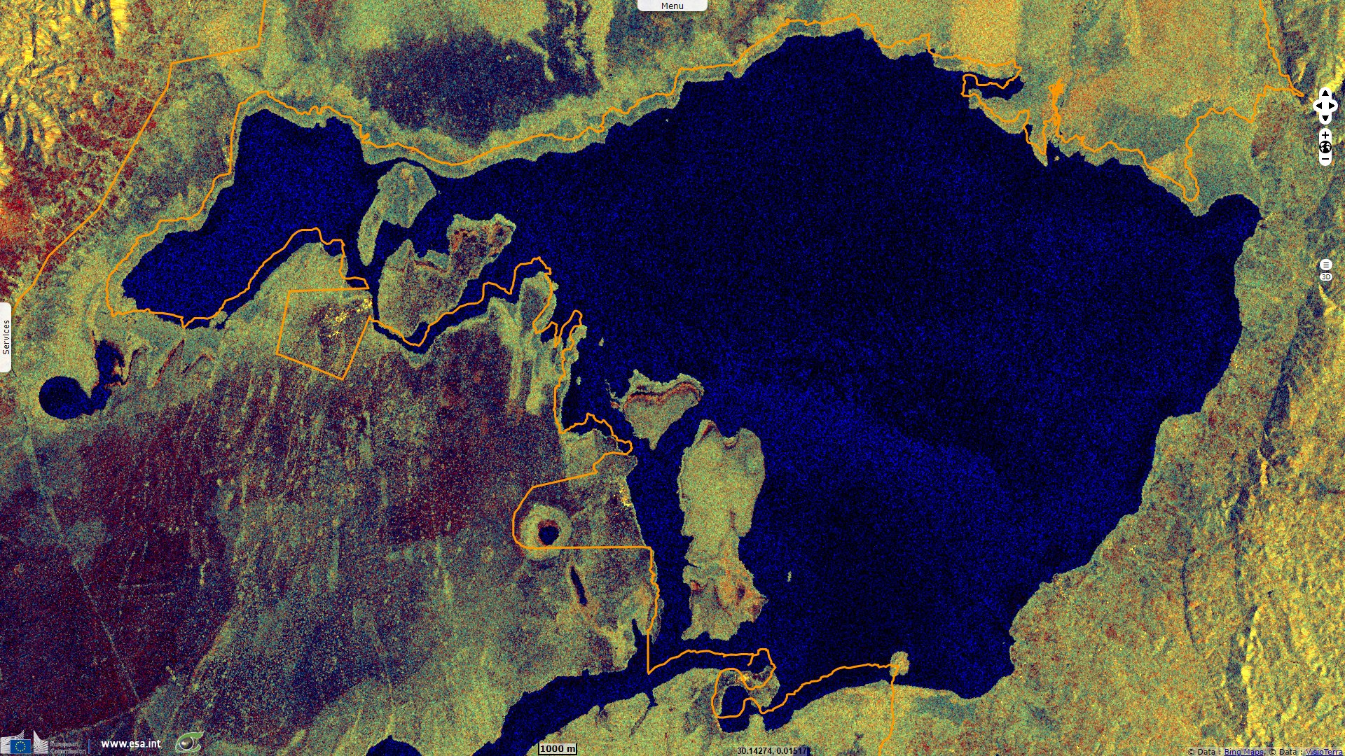
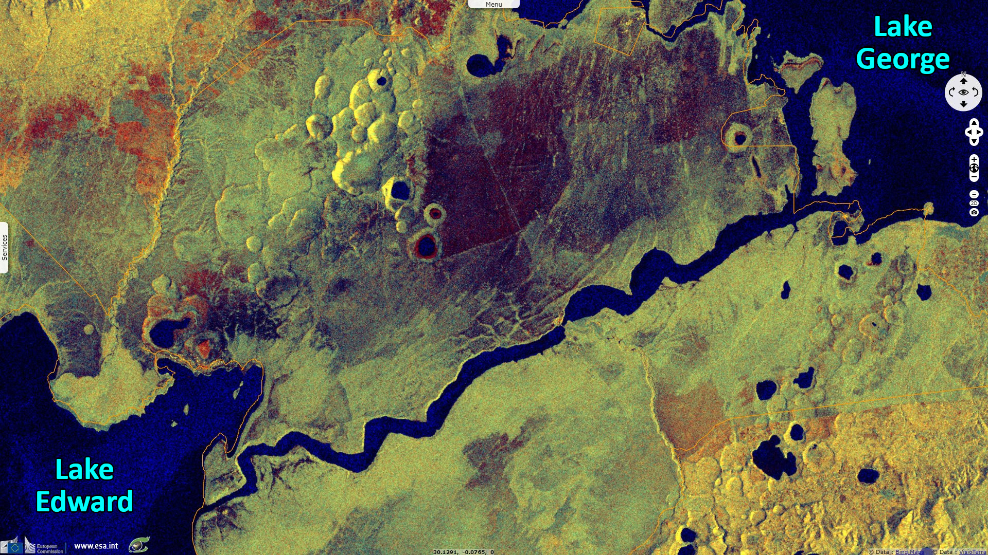
"Lake Edward is one of the great lakes of Africa lying in the western Rift Valley. Its length is about 65 km and the maximum width is 38 km. The deepest region is a trench only 5 km from the western shore from which the escarpment rises precipitously to highlands exceeding 2500 m in altitude. The eastern side of this trench is much less steep and rises with an almost uniform gradient for more than 30 km under water to the Uganda shore." according to the World Lake Database. "The Main inflows to Lake Edward are the Nyamugasani River, which drains the southwestern end of the Rwenzoris, and Ishasha, Rutshuru and Rwindi Rivers from the Kigezi and Rwanda highlands and the Virunga volcanoes in the south. The annual contribution from the Kazinga Channel is probably small compared with that from the rivers."
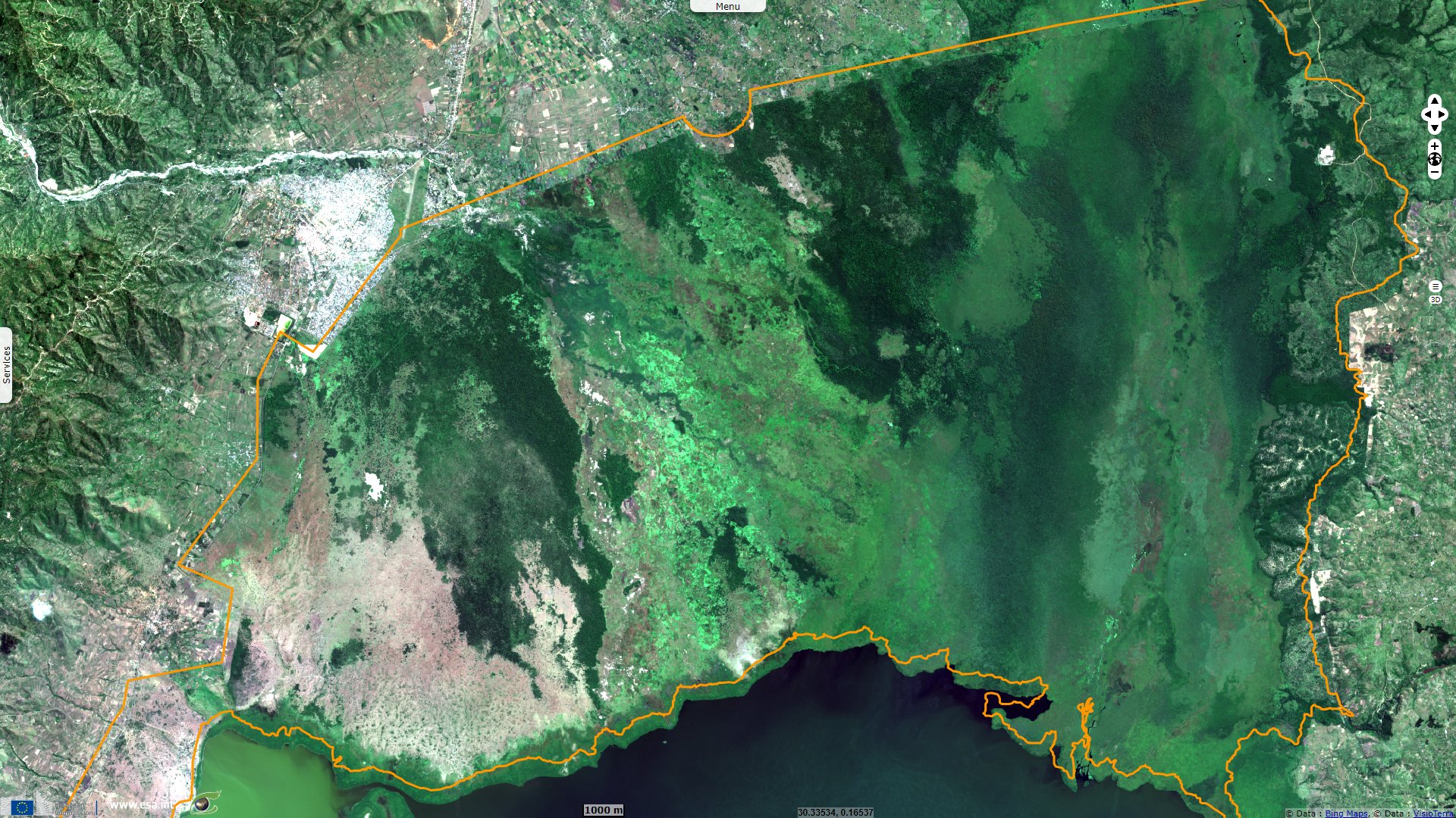
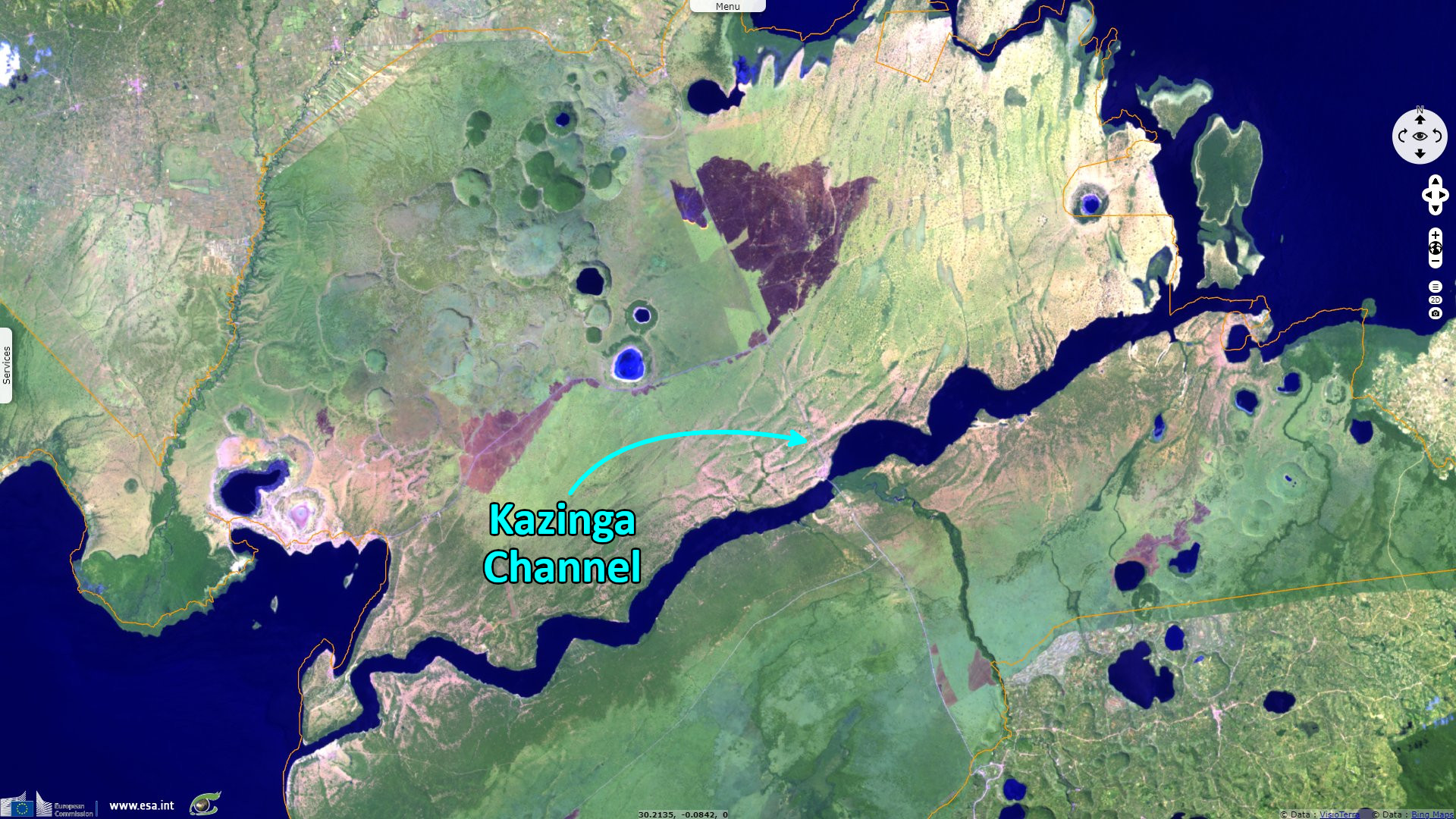
"The Kazinga Channel in Uganda is a wide, 32-kilometre long natural channel that links Lake Edward and Lake George, it is a dominant feature of Queen Elizabeth National Park. The channel attracts a varied range of animals and birds, boasting one of the world's largest concentration of hippos and numerous Nile crocodiles."
In the official site dedicated to Queen Elizabeth Park, it is written: "Lake George is located in the western part of the East Africa’s Rift Valley. The lake is a small and shallow of approximately 250 km² and a middling depth of just 2.4 meters. The lake is supplied by several inflows from the extensive mountain Rwenzori ranges as well as from the northeastern agricultural area. Its outflow is into the Kazinga Channel that drains toward the adjacent Lake Edward. The lake’s northern shore is majorly lined with a dense papyrus swamp. Its water levels keep on fluctuating but to a very minimal level.
The Ramsar sheet dedicated to the lake completes: "Vegetation consists of grassland, woodland, and three major swamp types. The site supports large mammals, including elephants, hippopotamus, and antelope, and is important for numerous species of wintering Palearctic waterbirds and various notable resident birds. Mine water seepage, agricultural runoff, and effluent inputs are impacting the site."
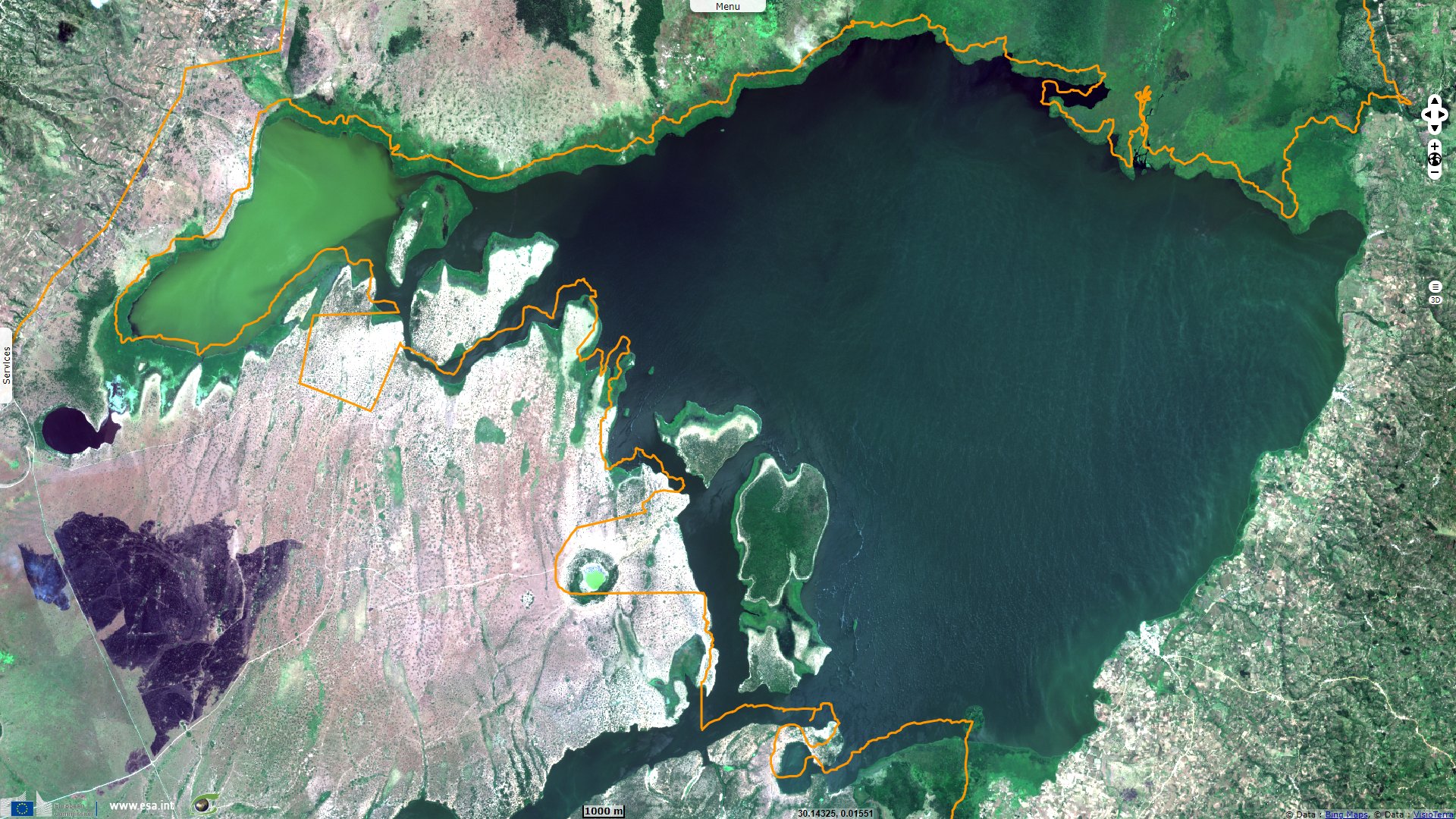
The park encompasses numerous volcanoes, the official site of the park explains how this landscape formed: "Several extinct volcanoes of a specifically violent type called the ‘explosion craters’ are found within western Uganda. These explosion craters are called so because during the long ago days these eruptions were extremely violent and instead of piling debris just about their vents similar to a number of other volcanoes, they discharged ash in addition to rock over a far as well as wide area. in the present day, they are majorly extinct craters although a few still release sulphurous smells.
The crater lakes were actually formed somewhat recently in the light of long ago volcanic activity within Uganda which is about only 8 000 to 10 000 years back."
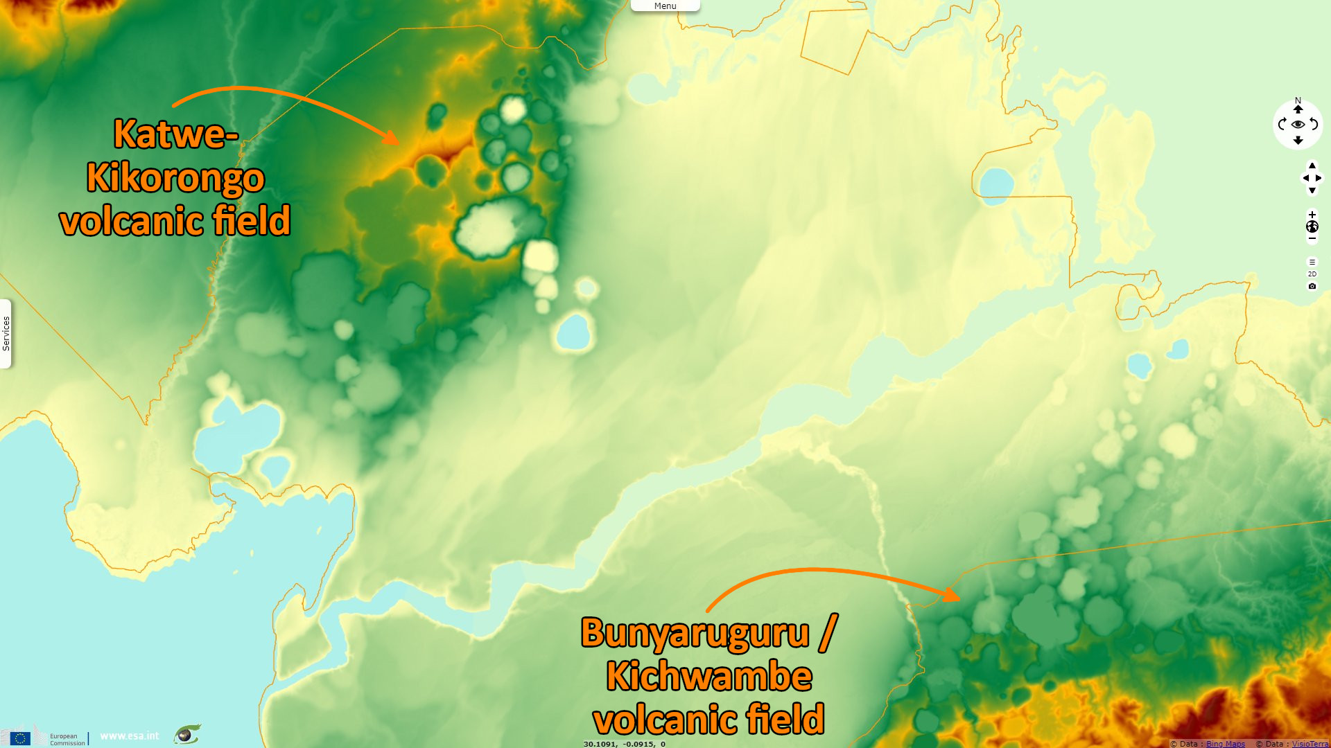
In a website dedicated to volcanoes, John Seach, Research Fellow of the University of Southern Queensland notes about the volcanic field at south-east of the canal: "The Bunyaruguru volcanic field may have been created as a result of subsidence between two major faults. The main type of activity was gas explosions. Only four of the 152 craters are associated with lava" and 27 contain freshwater to saltwater lakes. They are stretching along a south-west-north-east axis along the western edge of the Great Rift Valley, between which are tuff cones rising to an altitude of 1554 m and foiditic lava flows.
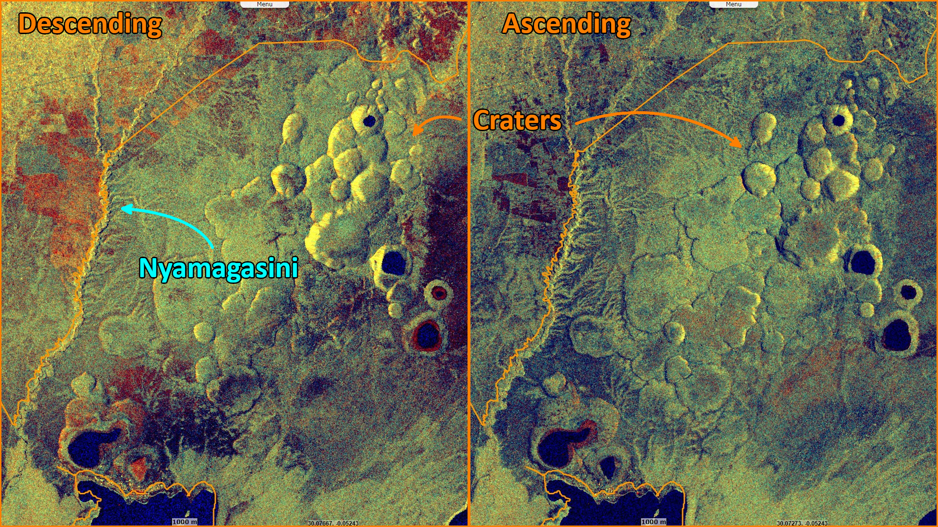
Regarding the other field located within the biosphere reserve, north-est of the canal, the Smithsonian Institution details: "The Katwe-Kikorongo volcanic field, stretching from the NE shore of Lake Edward to the W shore of Lake George, south of the Ruwenzori Range, is the most extensive of a series of volcanic fields in the Western Rift Valley of Uganda. The field covers an area of about 180 km² and contains a group of about 80 foiditic tuff cones and maars, some of which are filled by lakes. Lake Katwe is a shallow 3-km-long body of water that occupies two of three intersecting craters immediately NE of Lake Edward. Local stories suggest observations of volcanism in and around this area.
The views expressed herein can in no way be taken to reflect the official opinion of the European Space Agency or the European Union.
Contains modified Copernicus Sentinel data 2026, processed by VisioTerra.
Contains modified Copernicus Sentinel data 2026, processed by VisioTerra.
| More on European Commission space: |  |
 |
 |
||||
| More on ESA: | |
|
|
S-1 website | S-2 website | S-3 website | |
| More on Copernicus program: | |
|
|
Scihub portal | Cophub portal | Inthub portal | Colhub portal |
| More on VisioTerra: | |
|
|
Sentinel Vision Portal | Envisat+ERS portal | Swarm+GOCE portal | CryoSat portal |