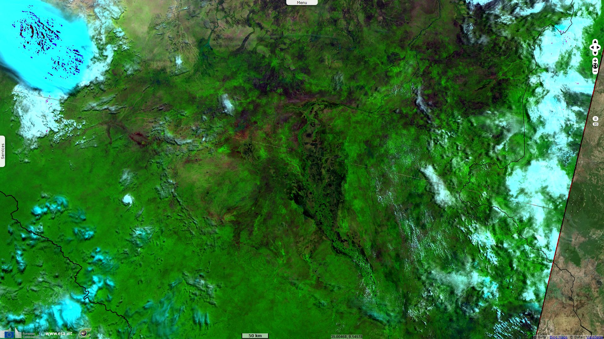
Sudd marshes shortly avoided draining, South Sudan
Sentinel-3 OLCI FR & SLSTR RBT acquired on 03 May 2018 from 07:59:45 to 08:02:53 UTC
...
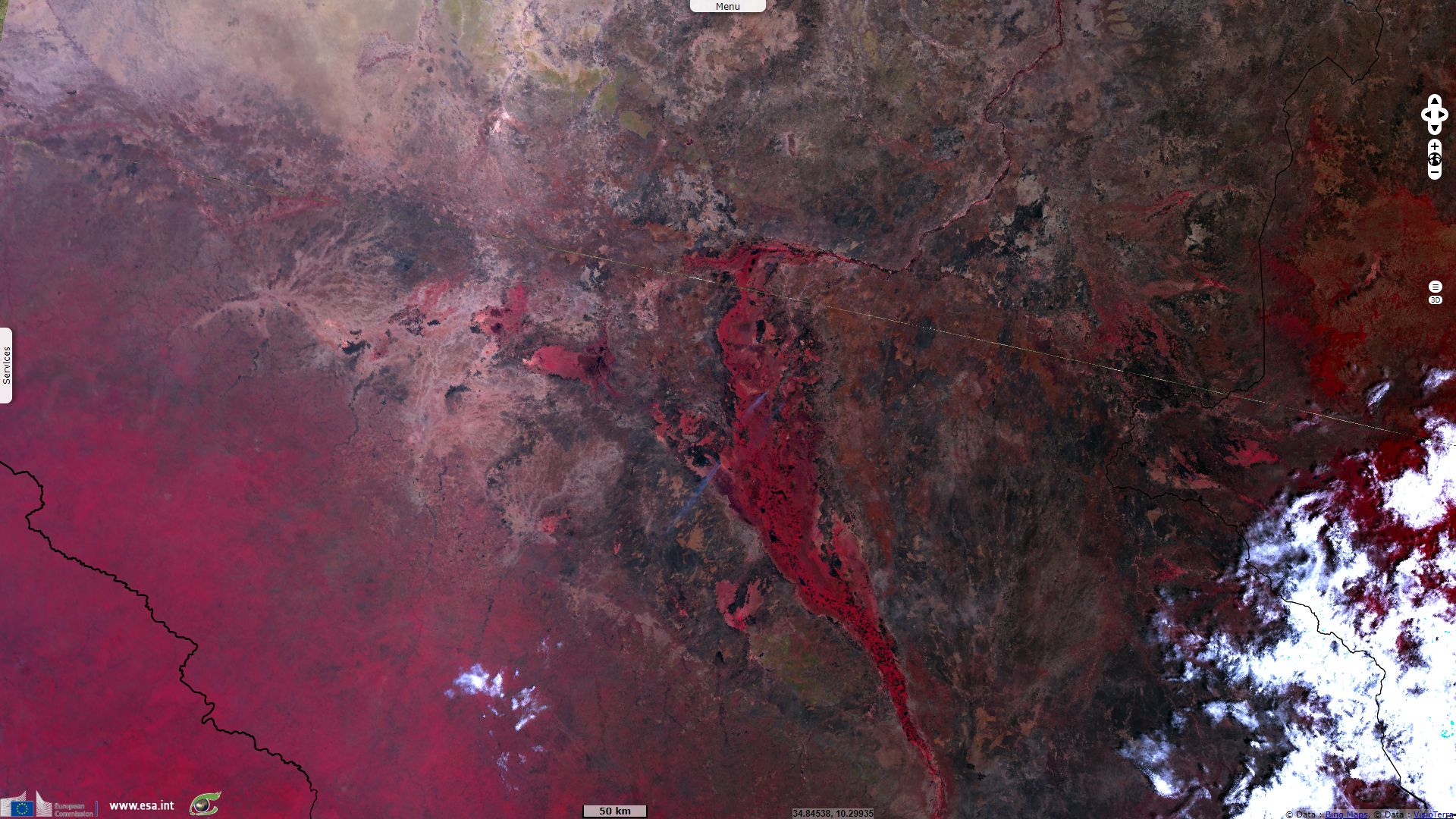
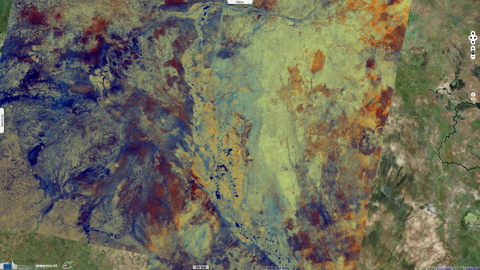
Sentinel-3 OLCI FR acquired on 08 March 2019 from 07:48:37 to 07:51:37 UTC
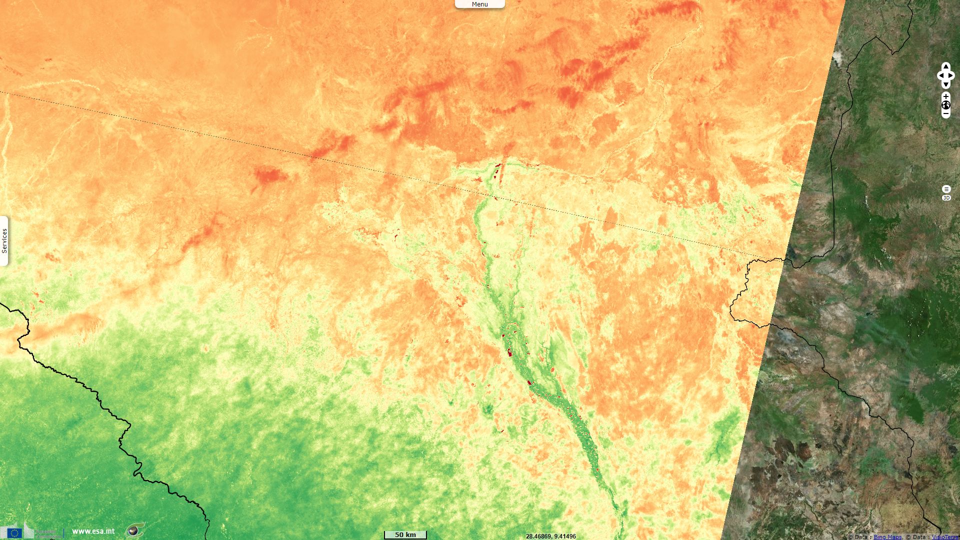
Sentinel-1 CSAR IW acquired on 01 June 2019 from 03:41:02 to 03:42:17 UTC
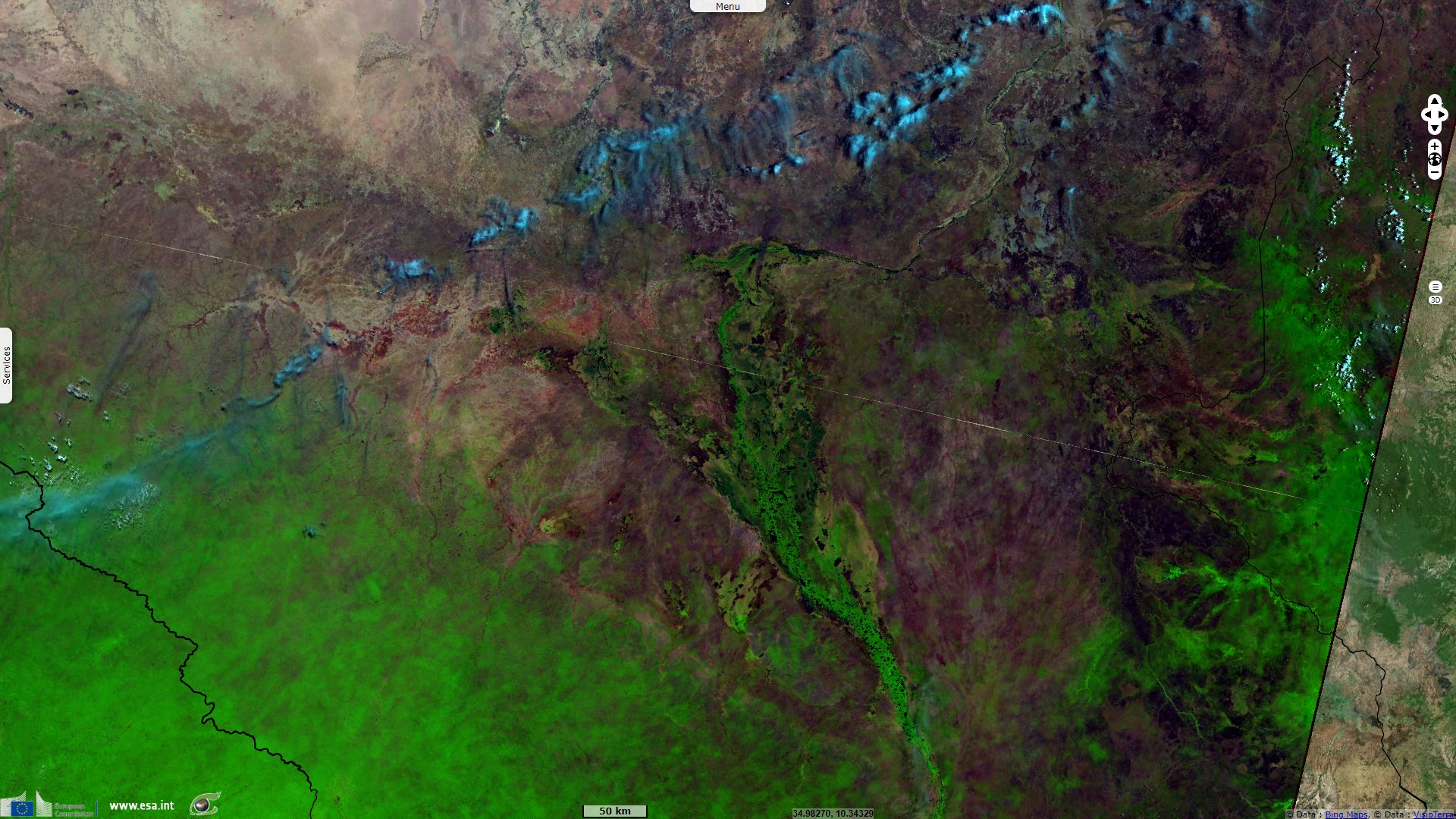
Sentinel-2 MSI acquired on 04 December 2019 at 08:13:11 UTC
...
Sentinel-3 OLCI FR acquired on 08 March 2019 from 07:48:37 to 07:51:37 UTC
Sentinel-1 CSAR IW acquired on 01 June 2019 from 03:41:02 to 03:42:17 UTC
Sentinel-2 MSI acquired on 04 December 2019 at 08:13:11 UTC
Keyword(s): National park, Ramsar wetland, marsh, river, biodiversity, canal, infrastructure, oil production, irrigated agriculture, fishing, South Sudan, Egypt
The Nile Basin water resources atlas described the Sudd wetland as "one of the largest wetland areas worldwide and is located along the Nile in southern Sudan between Mongalla in the south and Malakal in the north, covering an area between 57 000 km² – 130 000 km². The size of the wetland is variable, consisting of permanent swamps during the dry season (November until March) and seasonal swamps, created by flooding of the Nile (Bahr el Jebel), in the wet season (April until October)."
Its Ramsar sheet reminds it: "includes National Park and game reserves. One of the largest tropical wetlands in the world, located in South Sudan in the lower reaches of Bahr el Jebel, a section of the White Nile. The site is composed of various ecosystems, from open water and submerged vegetation to floating fringe vegetation, seasonally inundated woodland, rain-fed and river-fed grasslands, and floodplain scrubland. It is an important wintering ground for birds such as Pelecanus onocrotalus, Balearica pavonina, Ciconia ciconia and Chlidonias nigra, and home to some endemic fish, birds, mammal and plant species."
"The wetland serves as a filter that controls water quality and a sponge that stabilizes water flow. It is the major source of water for domestic, livestock, and wildlife use and an important source of fish. The socio-economic and cultural activities of local people are dependent on its annual floods and rains to regenerate floodplain grasses to feed their cattle, as they move from permanent settlements on the highlands to dry-season grazing in the intermediate lands and return to the highlands in May-June when the rainy season starts.
Threats to the site include oil exploration - Sudd contains South Sudan's largest oil reserve - and the Jonglei Canal Project, which is currently on hold, but would reduce wet and dry season flows by 20% and 10% respectively, thus impacting the wetland's ecology and consequently its inhabitants."
Regarding the first threat, Africanews related on 24.10.2019 that the oil production in the Muglad - Sudd Rift Basin would resume: "Block 5A is located in the Muglad-Sudd Rift Basin on the same geological trend as the Greater Nile Oil Project in Sudan. It has a production capacity of 80 000 bpd [baril per day] of high-quality Nile blend. Production in Block 5A began in 2006 at 40 000 bpd and peaked at 54 000 bpd in 2009. By 2014, however, production was reduced significantly to 4 500 bpd, eventually ceasing entirely. South Sudan is preparing to restart production in various oil fields, including Block 5A operated by Sudd Petroleum Operating Company."
Due to the Sudd swamp, the water from the southwestern tributaries of the Nile, the Bahr el Ghazal system, for all practical purposes does not reach the main river and is lost through evaporation and transpiration. Hydrogeologists in the 1930s proposed digging a canal east of the Sudd which would divert water from the Bahr al Jabal above the Sudd to a point farther down the White Nile, bypassing the swamps and carrying the White Nile's waters directly to the main channel of the river.
The Jonglei Canal is a canal project that has been proposed, started but never completed to divert water through the vast Sudd wetlands of South Sudan so as to deliver more water downstream to Sudan and Egypt for use in agriculture. By bypassing the swamps, it was calculated that evaporation of the Nile's water would vastly decrease. It is estimated that the Jonglei canal project would divert 3.5-4.8 km³ of water per year (equal to a mean annual discharge of 110–152 m³/s, an increase of around five to seven per cent of Egypt's current supply, allowing an increase in the area of cultivatable land in Egypt by 8000 km².
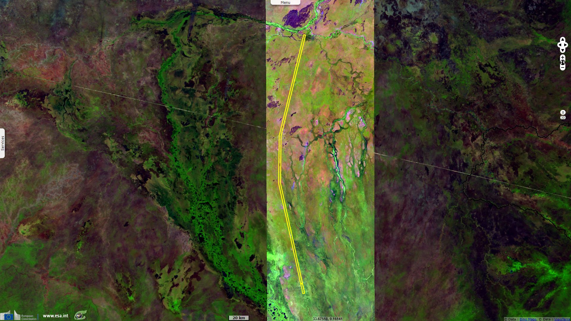
Construction work on the canal began in 1978 but the outbreak of political instability in Sudan has held up work for many years. By 1984 when the Sudan People's Liberation Army brought the works to a halt, 240 km of the canal of a total of 360 km had been excavated. In 2008, Sudan and Egypt agreed to restart the project and finish the canal after 24 years.
The Paris-based Sudan Tribune denounced: "About 96 percent of the economically active population in Egypt is engaged in agriculture and Egyptian agriculture is entirely dependent on irrigated land. In Egypt 88 percent of the water is consumed in agriculture. As Egypt is about 98 percent desert any expansion of agriculture to feed the growing population means an increase in irrigated land. Egypt’s desperate need for enormous quantities of water is therefore abundantly clear."
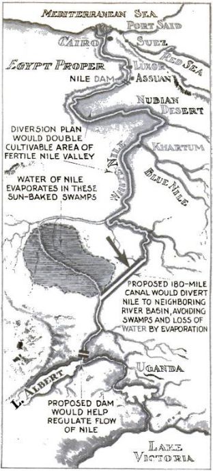

Left: A 1933 sketch of proposed infrastructure work on the White Nile course - source: Popular Science Oct. 1933.
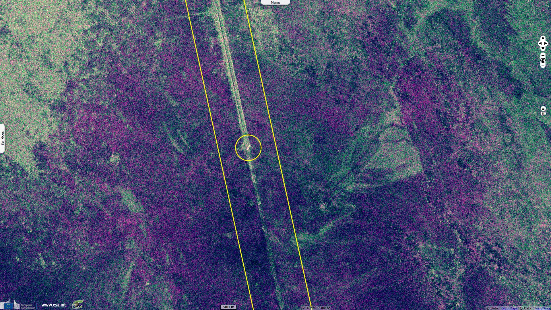
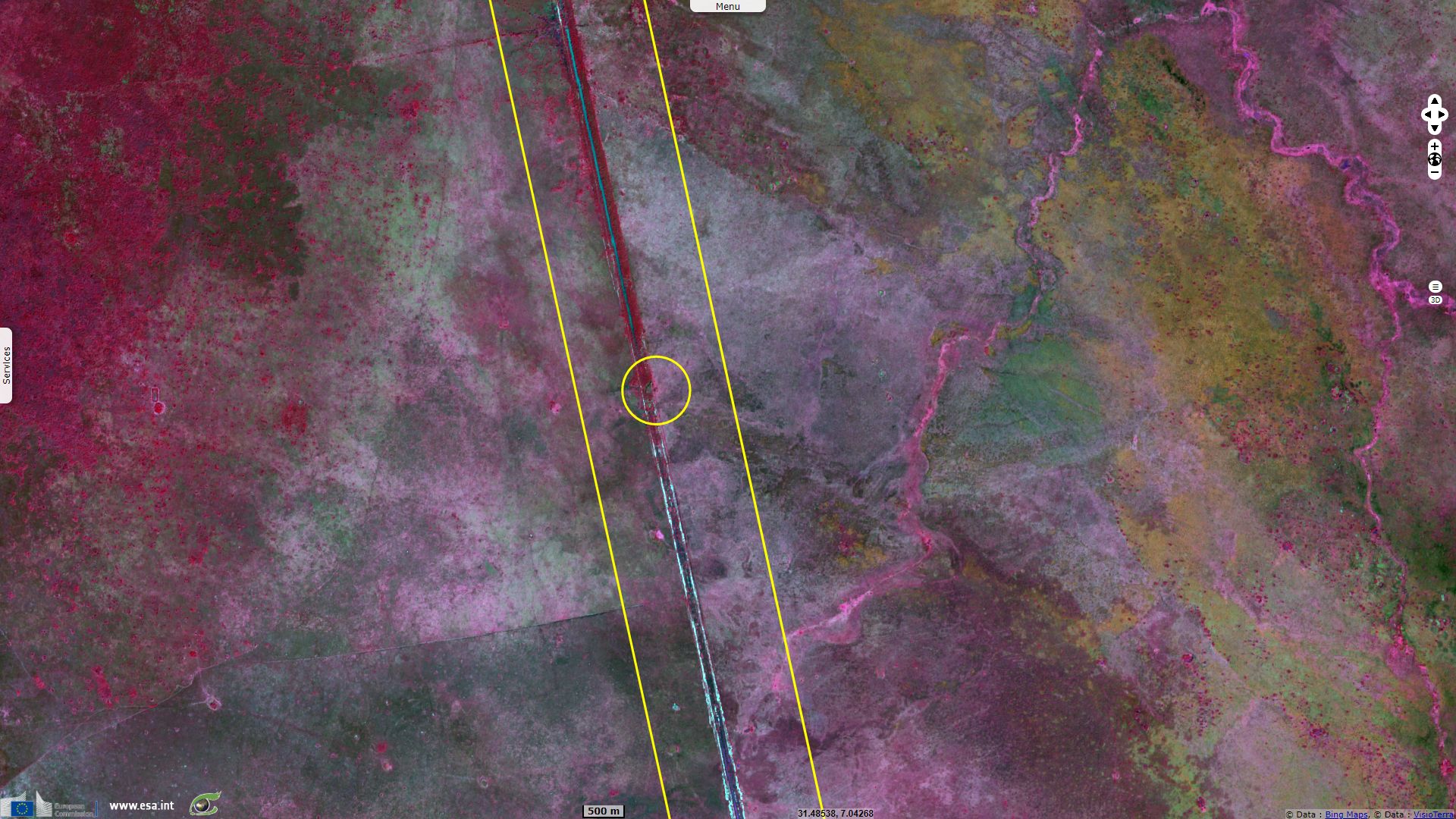
Right: A German digger used to dig the Jonglei Canal, in Jonglei state of the Greater Upper Nile region of northeastern South Sudan. Construction of the canal ended in 1983 and the digger has remained here, it was since damaged by a missile.