Nagorno-Karabakh under blockade since December despite the armistice between Azerbaijan and Armenia
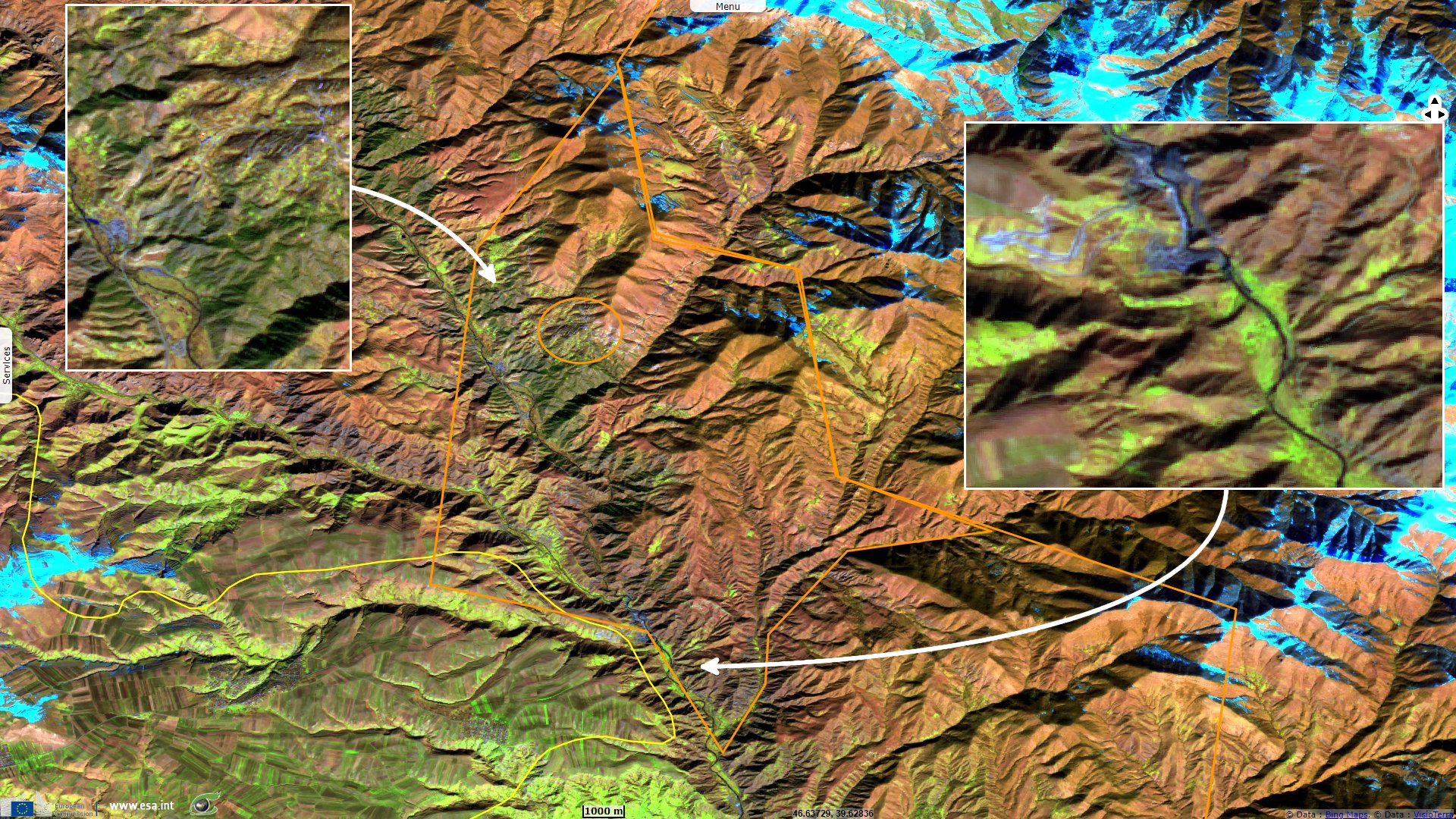
Sentinel-2 MSI acquired on 13 February 2019 at 07:40:29 UTC
Sentinel-2 MSI acquired on 26 January 2023 at 07:51:09 UTC
Sentinel-2 MSI acquired on 26 January 2023 at 07:51:09 UTC
Keyword(s): Security, infrastructure, roads, Armenia, Azerbaijan
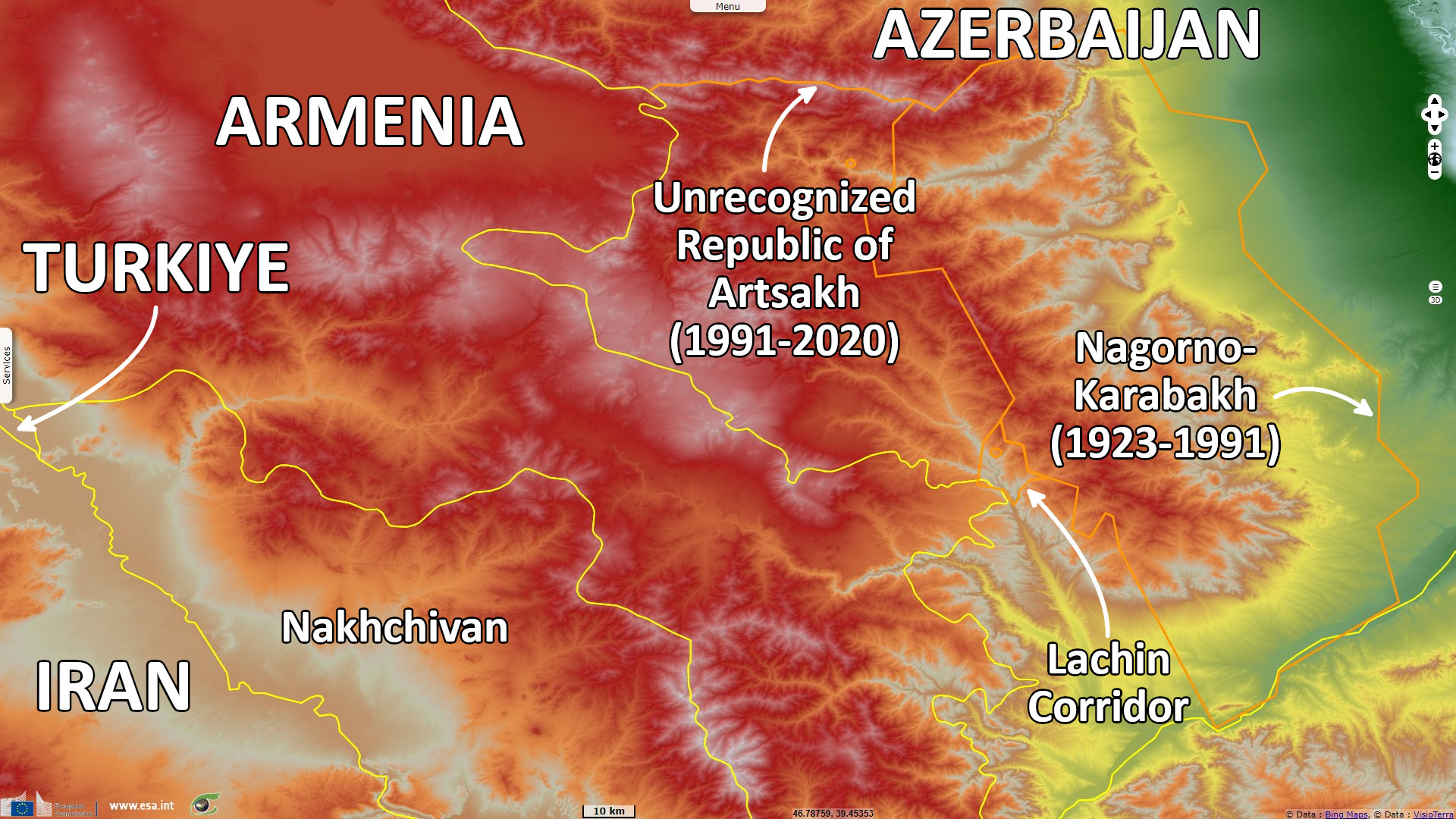
The historic Armenia area has been near the moving border of conflicting powers, located in what is today Russia, Turkiye and Iran. After the Armenian genocide, Nagorno-Karabakh was inhabited by 90% of Armenian but the Soviet government granted it to Soviet Azerbaijan.
Following the 1991 collapse of the Soviet Union, Nagorno-Karabakh declared independence after a referendum recognized only by Armenia, the Republic of Artsakh remains De jure Azeri.
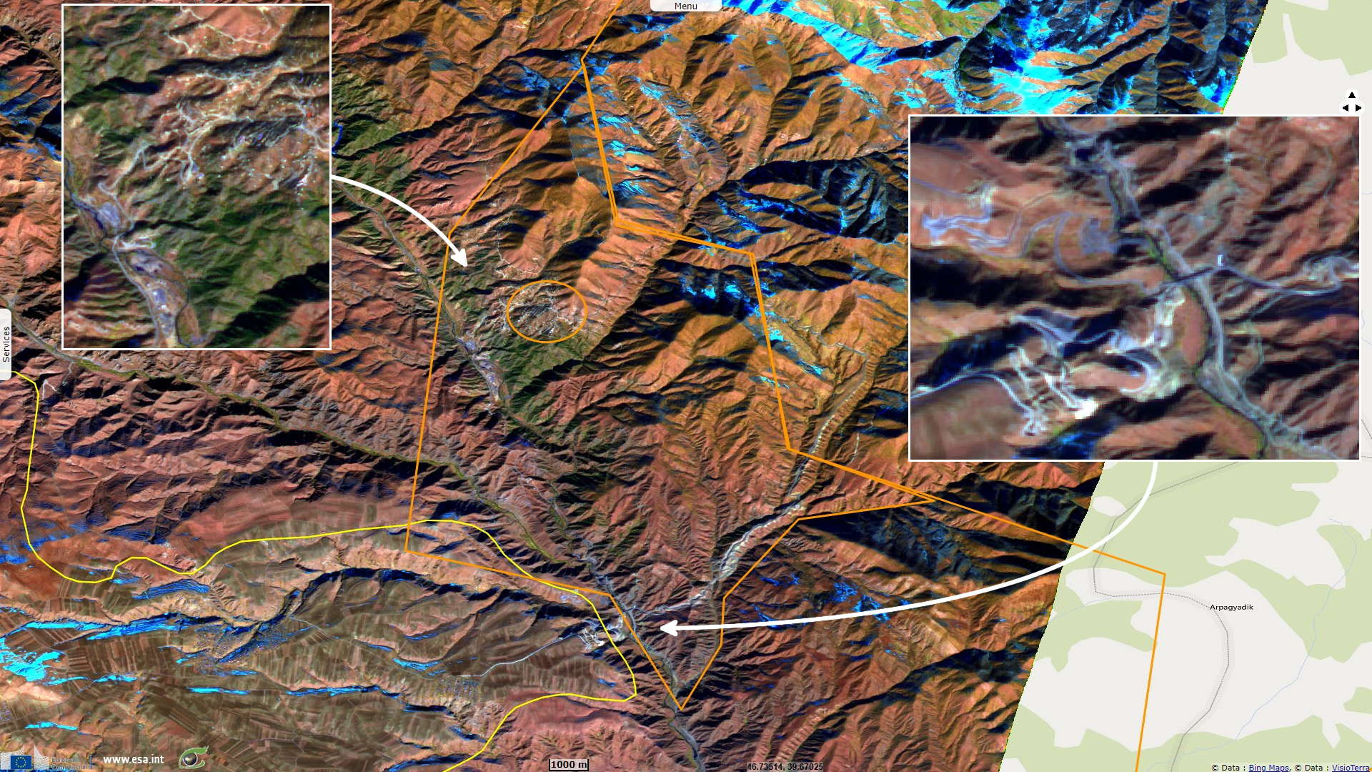
After the 2020 armistice of the second Nagorno-Karabakh war, Lachin corridor became the sole connection between Armenia and Nagorno-Karabakh, protected by a Russian peacekeeping force.
On 12 December 2022, so-called Azerbaijani eco-activists launched a blockade of the Lachin corridor. Importation of food, fuel, and medicine is blocked, and the 120 000 residents of the region are trapped, creating a humanitarian crisis. During the blockade, various vital infrastructure which passes from Armenia to Artsakh through Azerbaijani-controlled territory has been damaged at different times, including gas, electricity, and Internet.
The views expressed herein can in no way be taken to reflect the official opinion of the European Space Agency or the European Union.
Contains modified Copernicus Sentinel data 2026, processed by VisioTerra.
Contains modified Copernicus Sentinel data 2026, processed by VisioTerra.
| More on European Commission space: |  |
 |
 |
||||
| More on ESA: | |
|
|
S-1 website | S-2 website | S-3 website | |
| More on Copernicus program: | |
|
|
Scihub portal | Cophub portal | Inthub portal | Colhub portal |
| More on VisioTerra: | |
|
|
Sentinel Vision Portal | Envisat+ERS portal | Swarm+GOCE portal | CryoSat portal |