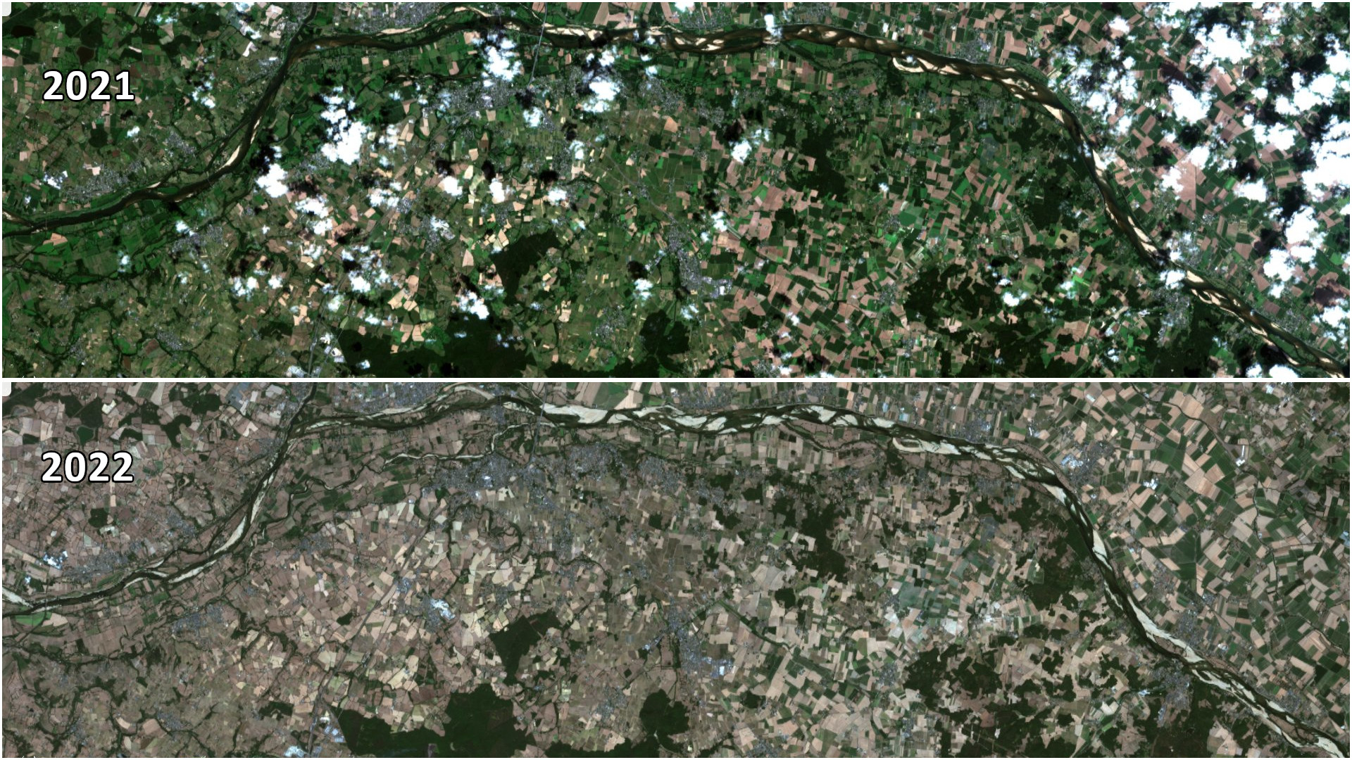
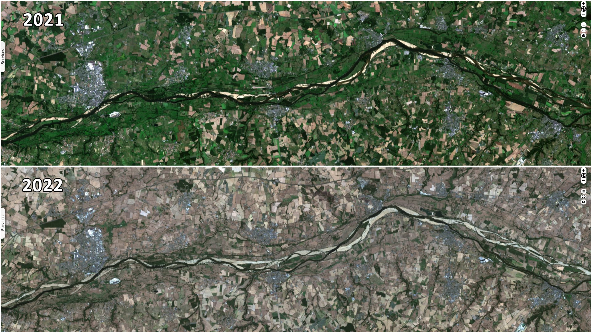
Dry river beds during the worst drought in Europe for 500 years
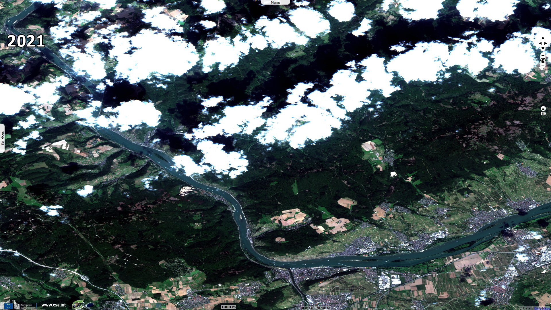
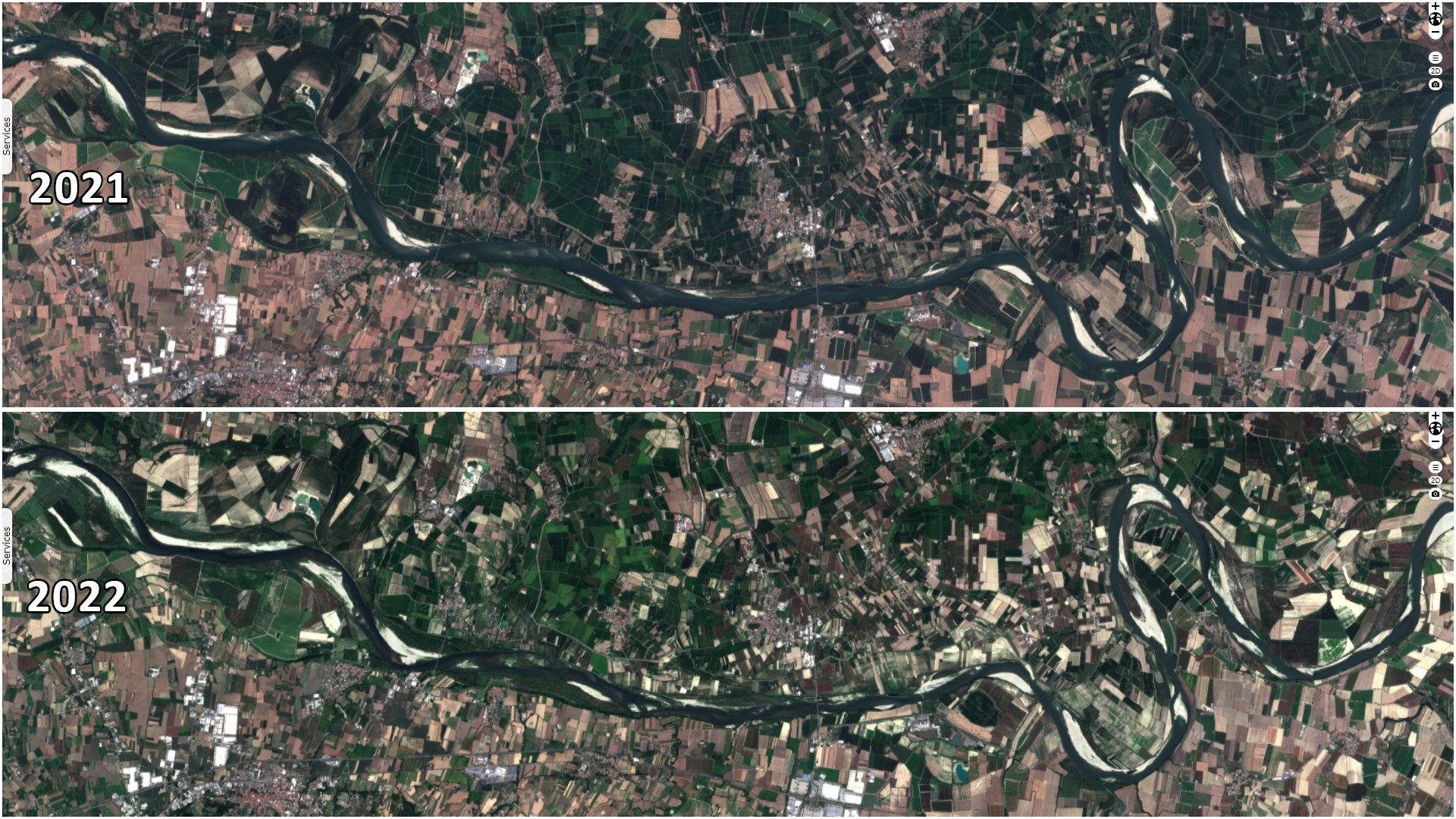
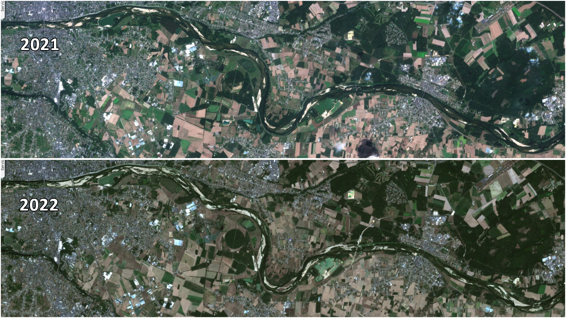
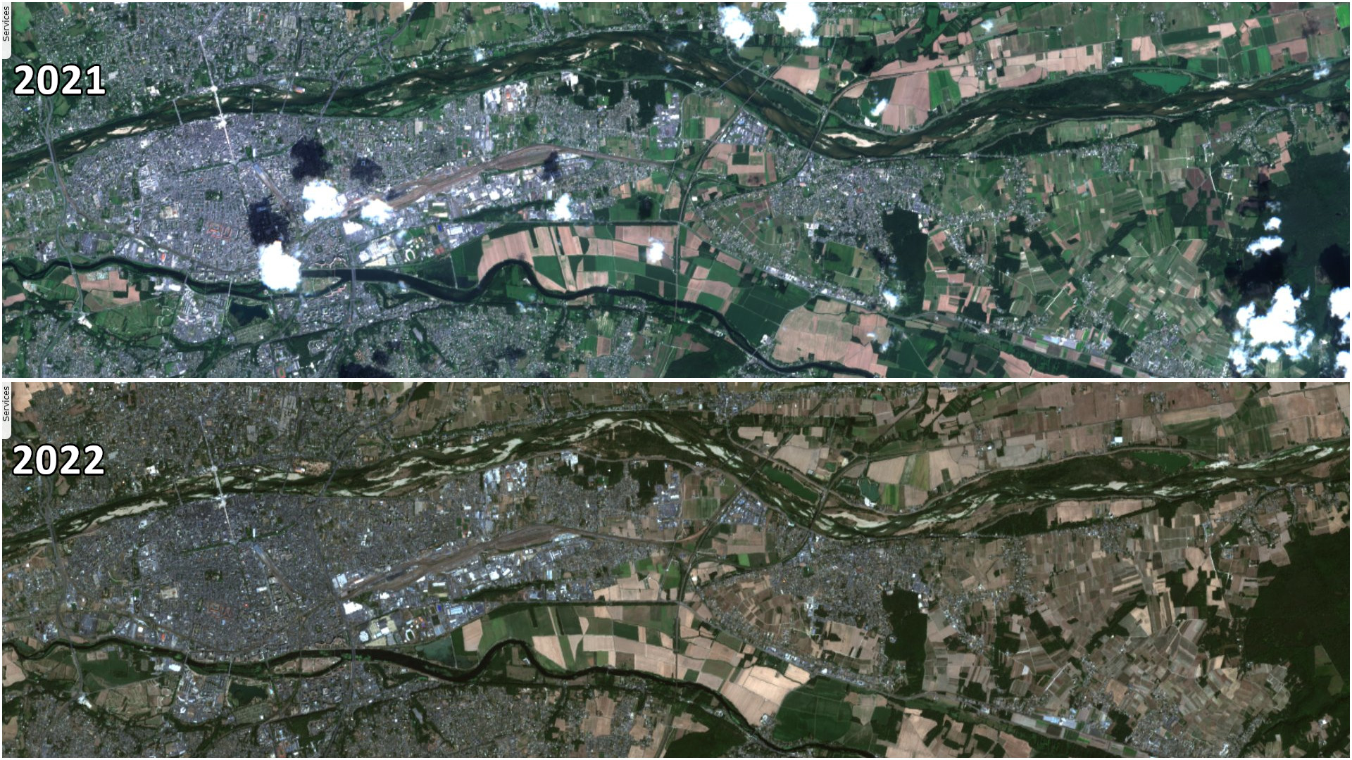
Sentinel-2 MSI acquired on 13 August 2021 at 10:50:31 UTC
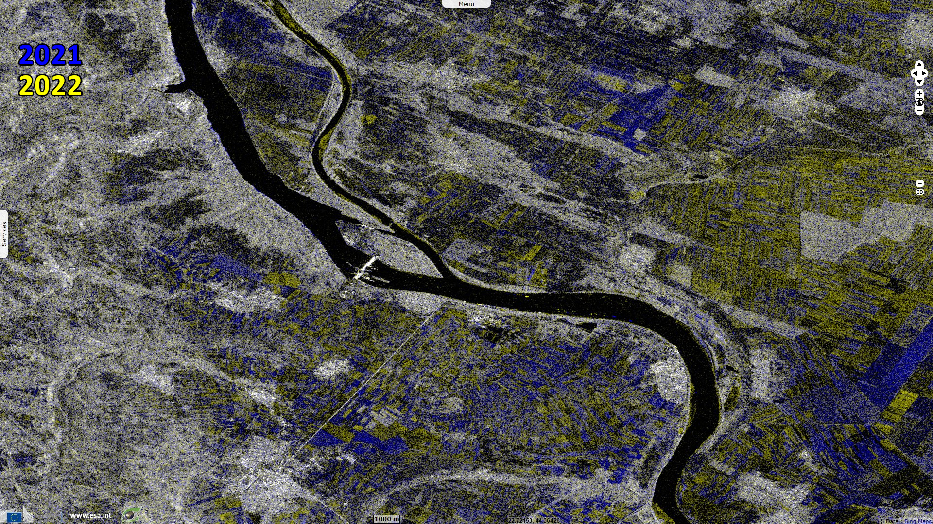
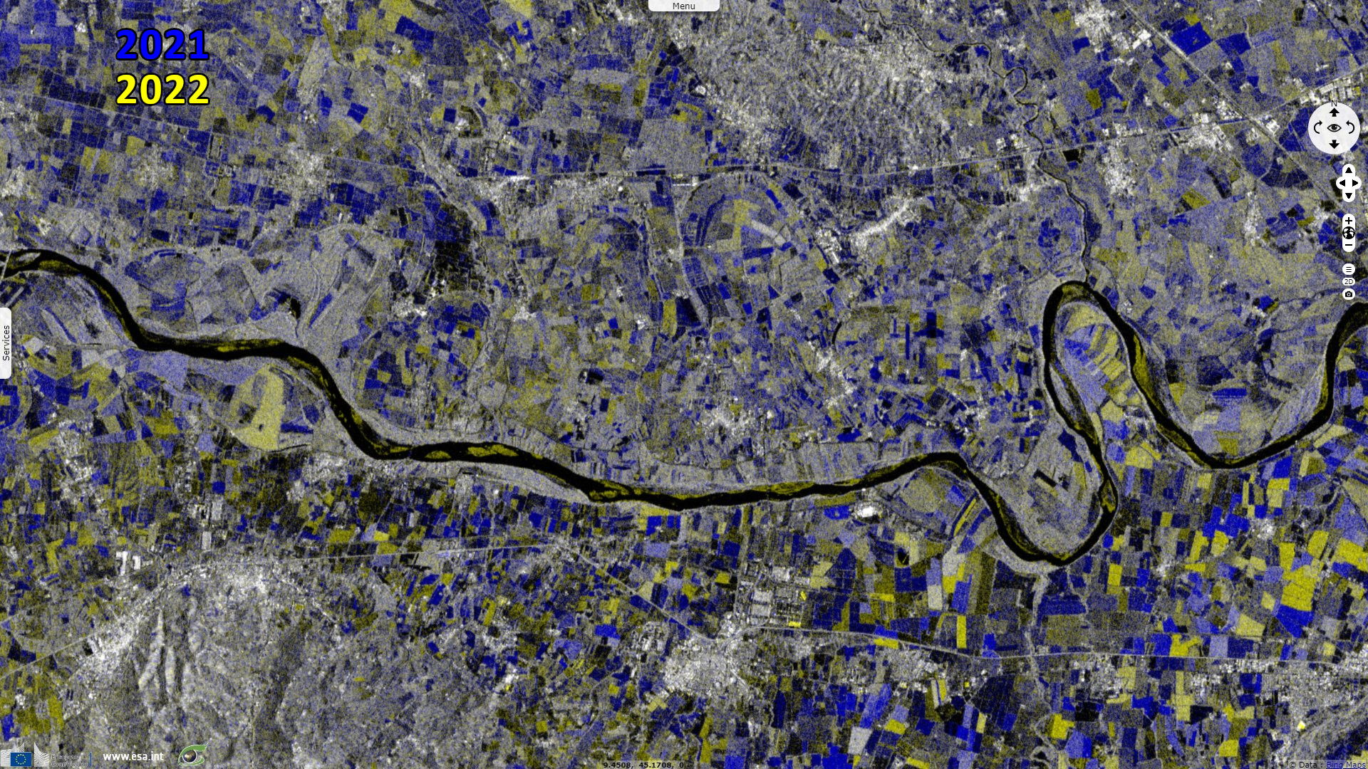
Sentinel-1 CSAR IW acquired on 17 August 2021 from 05:27:23 to 05:27:48 UTC
...
Sentinel-2 MSI acquired on 12 August 2022 at 10:30:31 UTC
Sentinel-1 CSAR IW acquired on 17 August 2022 from 05:35:42 to 05:36:07 UTC
Sentinel-1 CSAR IW acquired on 17 August 2021 from 05:27:23 to 05:27:48 UTC
...
Sentinel-2 MSI acquired on 12 August 2022 at 10:30:31 UTC
Sentinel-1 CSAR IW acquired on 17 August 2022 from 05:35:42 to 05:36:07 UTC
Keyword(s): River, drought, climate change, hydrology, agriculture, transport, Germany, Serbia, Italy, France
The JRC Global Drought Observatory of the Copernicus Emergency Management Service produced a report explaining the effect of the drought that affected Europe in particular in August:
- "The severe drought affecting many regions of Europe since the beginning of the year has been further expanding and worsening as of early August. Dry conditions are related to a wide and persistent lack of precipitation combined with a sequence of heatwaves from May onwards.
- The severe precipitation deficit has affected river discharges widely across Europe.
- Reduced stored water volume has had severe impacts on the energy sector for both hydropower generation and cooling systems of other power plants.
- Water and heat stresses have substancially reduced summer crop' yields. The most affected crops are grain maize, soybeans, and sunflower."
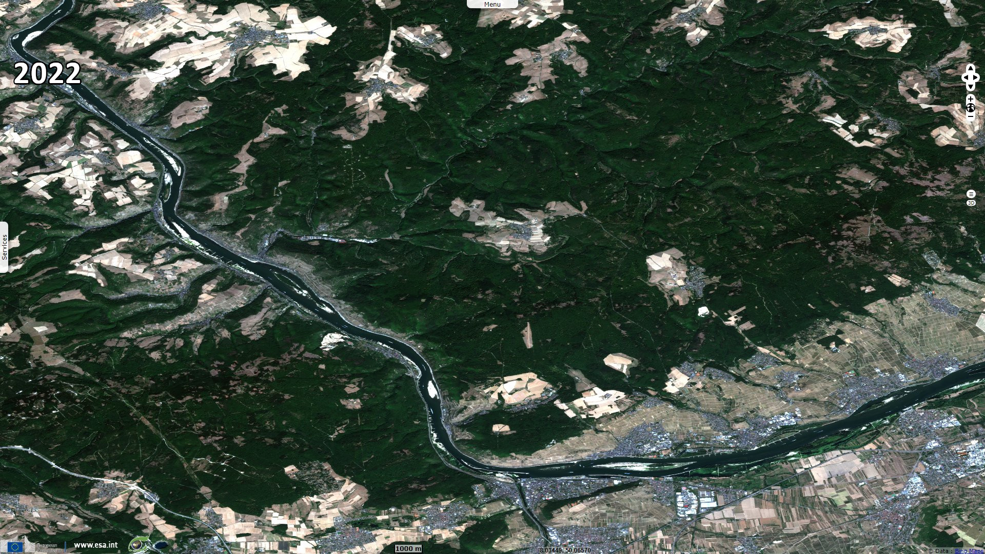
CNN published several exemples of major European rivers drying up under the effect of the drought this summer: "The Rhine starts in the Swiss Alps, flows through Germany and the Netherlands and then flows all the way out to the North Sea. It's a crucial channel for European shipping, but right now, it's a nightmare to navigate. Parts of the river's bed have emerged above the water's surface, meaning the ships that do try to pass it must weave around a series of obstacles, slowing the entire process."
"The Rhine has many different gauges along the way, including in Kaub, just west of Frankfurt, Germany, where water levels have fallen to as low as 32 cm. Shipping companies generally consider anything less than 40 cm on the Rhine too low to bother with, and in Kaub, less than 75 cm usually means a container ship has to reduce its load to about 30%, according to Deutsche Bank economists. Low water levels also mean companies pay higher levees to pass, and all these factors make shipping more expensive, a cost usually passed on to consumers." In the Netherlands, the low flow of the Rhine affects commercial navigation, dike stability, water distribution and seawater intrusion problems, the report highlights. Reduced ship loads affect the transport of coal and oil.
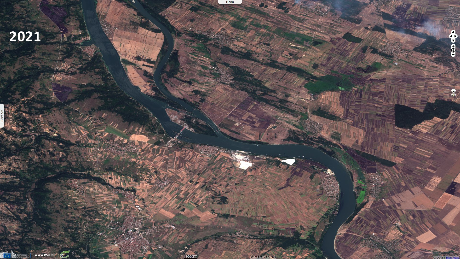
"The Danube is Western Europe's longest river and a crucial shipping channel that passes through 10 countries. In Romania, Serbia and Bulgaria, workers are dredging the river just to ensure vessels can still navigate it."
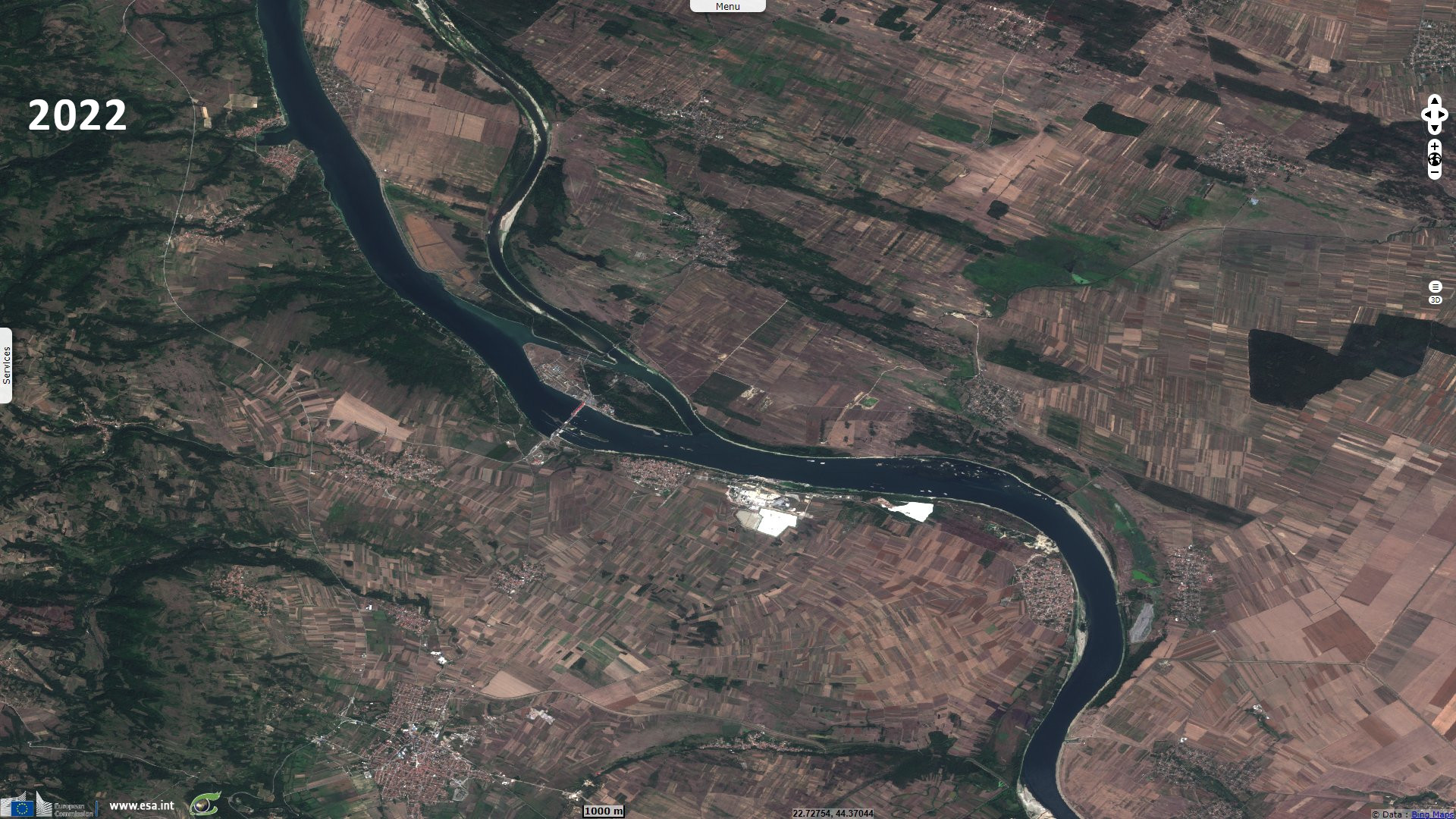
Kelly Kizer Whitt added for earthsky.org: "In Serbia, the receding waters of the Danube River near the town of Prahovo have uncovered dozens of World War II-era German warships, according to an August 19, 2022, Reuters report. Many of the ships still contain ammunition and explosive devices."
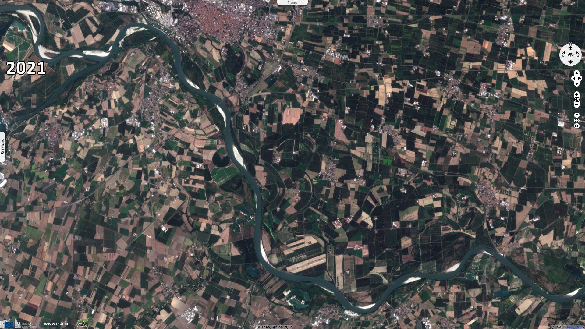
CNN article develops further: "The River Po cuts right across the top of Italy and flows out east into the Adriatic Sea. It's fed by winter snow in the Alps and heavy rainfall in the spring, and has a steep fall that brings a fast flow. Typically, devastating floods are more of a problem around this river."
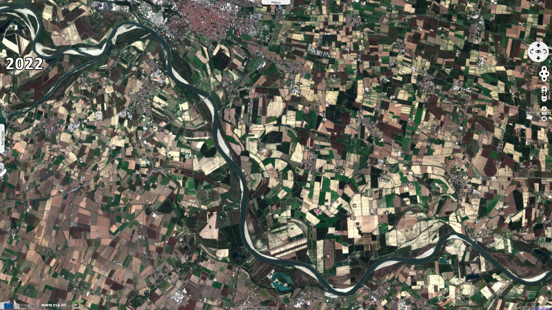
"But now, the Po looks very different. Winter was dry in northern Italy, so snow provided little water, and spring and summer have been dry, too, plunging the region into the worst drought its experienced for seven decades. It's so dried up that a World War II-era bomb was recently found amid its dwindling waters."
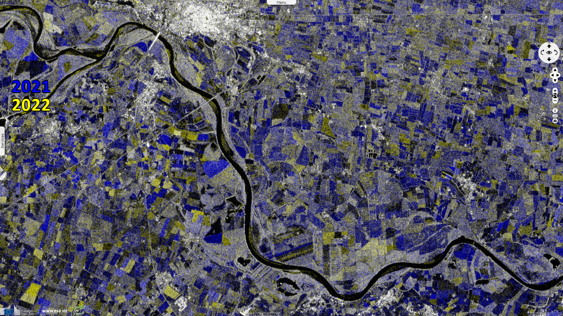
"A big problem is that millions of people rely on the Po for their livelihood, mostly through agriculture. Around 30% of Italy's food is produced along the Po, and some of the country's most famous exports, like Parmesan cheese, is made here."
"The Loire in France sustains a valley of vineyards that produce some of the world's most famous wines. The river stretches over around 1000 kilometres and is considered France's last wild river, supporting biodiverse ecosystems throughout the valley, much of which is protected by The United Nations Educational, Scientific and Cultural Organization."
"Parts of the river are fairly shallow already, but its levels and flow can change rapidly with the weather and as snow at its source melts. Some sections are so dried out from the lack of rain and extreme heat that people can cross by foot."
"The patches of land around it in the valley are mostly brown and withered — a year ago, they were a lush and green. Authorities are releasing water from dams into the river, mostly to ensure there is enough to cool four nuclear power plants that sit along it."
The views expressed herein can in no way be taken to reflect the official opinion of the European Space Agency or the European Union.
Contains modified Copernicus Sentinel data 2026, processed by VisioTerra.
Contains modified Copernicus Sentinel data 2026, processed by VisioTerra.
| More on European Commission space: |  |
 |
 |
||||
| More on ESA: | |
|
|
S-1 website | S-2 website | S-3 website | |
| More on Copernicus program: | |
|
|
Scihub portal | Cophub portal | Inthub portal | Colhub portal |
| More on VisioTerra: | |
|
|
Sentinel Vision Portal | Envisat+ERS portal | Swarm+GOCE portal | CryoSat portal |