Sentinel satellites keep the heritage of Envisat high
Sentinel-3 SRAL LAND acquired on 17 January 2018 at 11:50:38 UTC
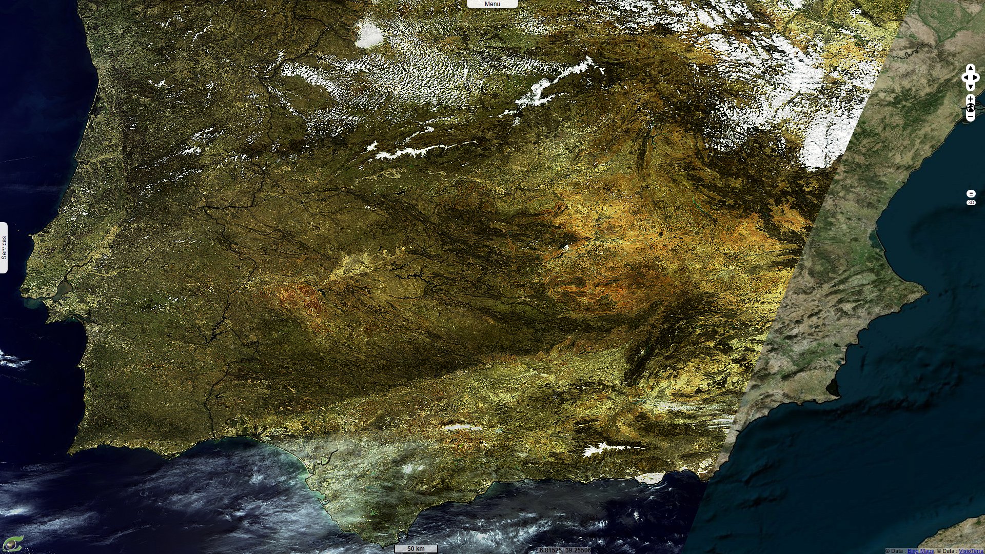
Sentinel-3 SLSTR RBT acquired on 22 September 2021 from 07:36:27 to 08:18:47 UTC
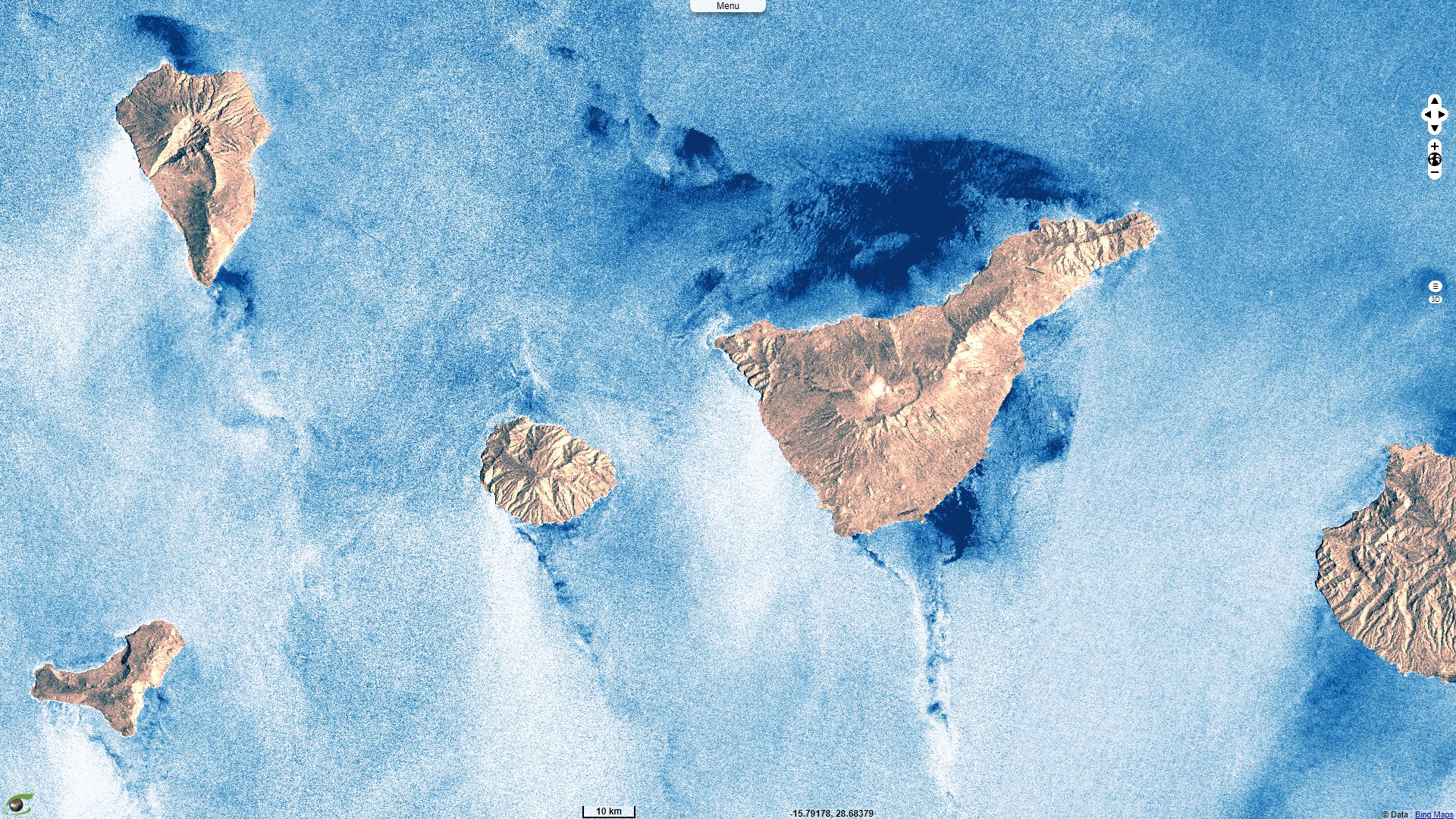
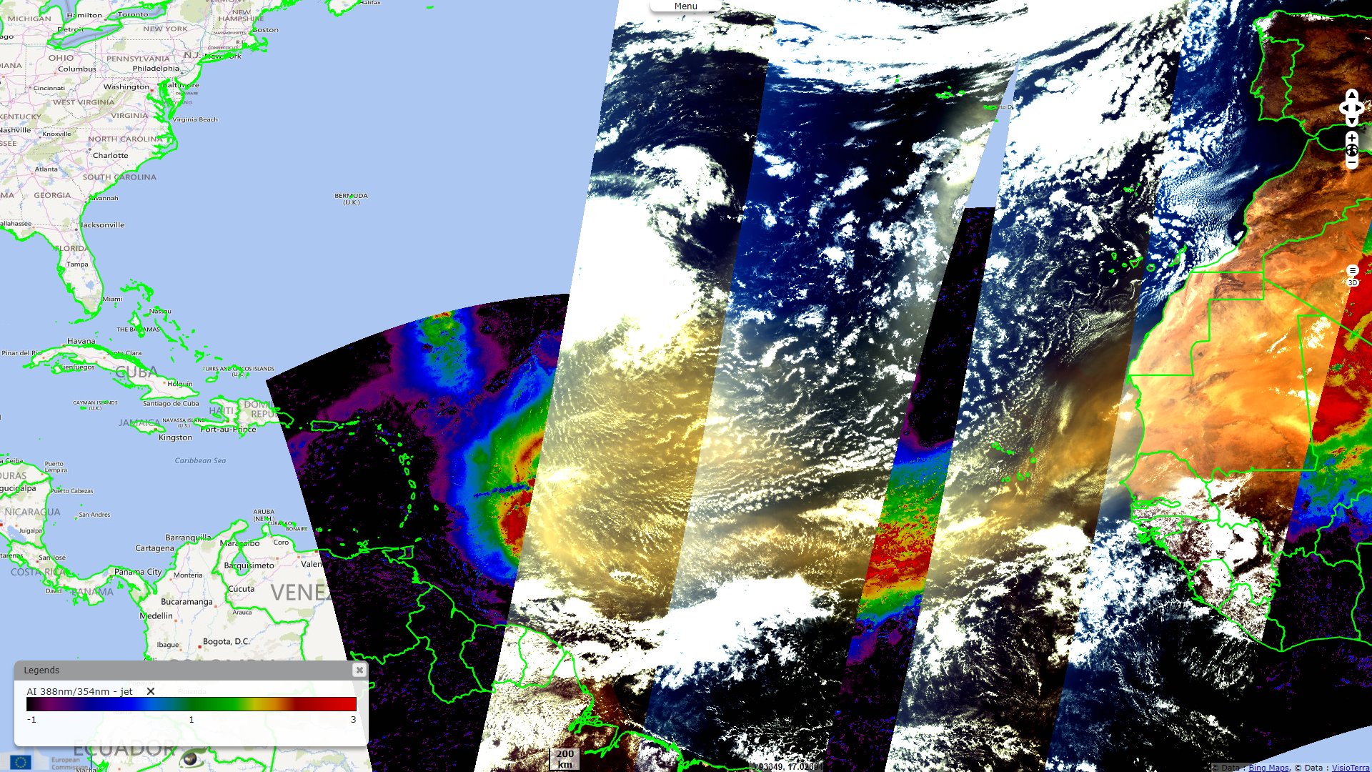
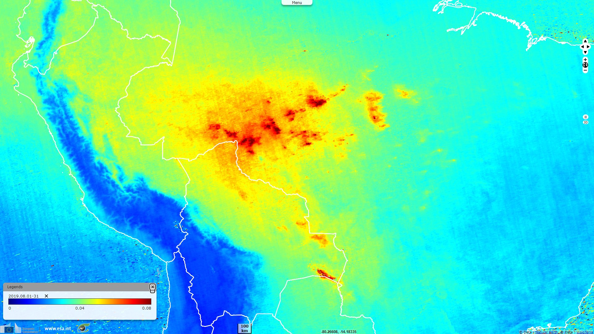
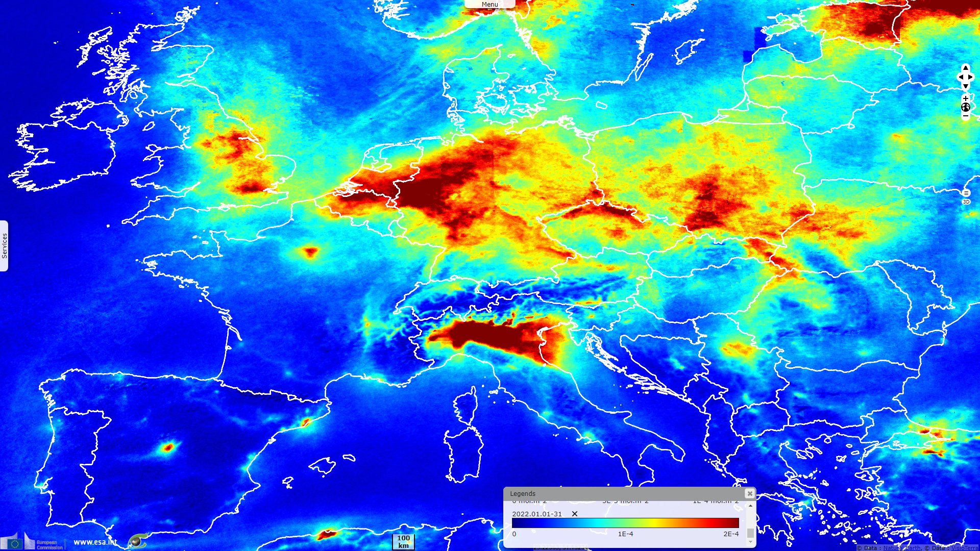
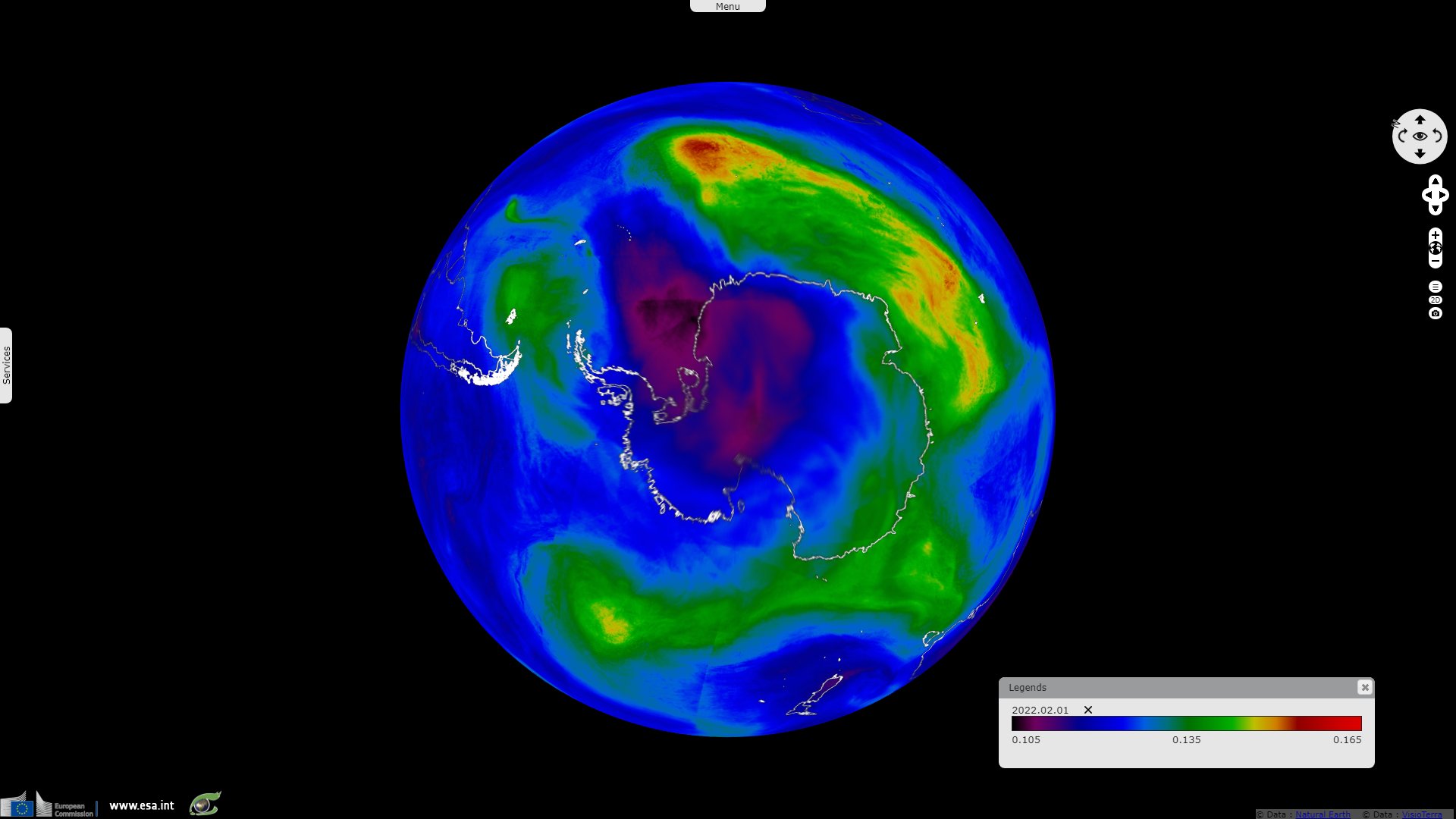
Sentinel-5P TROPOMI NO2 acquired on 01 January 2022 from 11:17:14 to 11:57:07 UTC
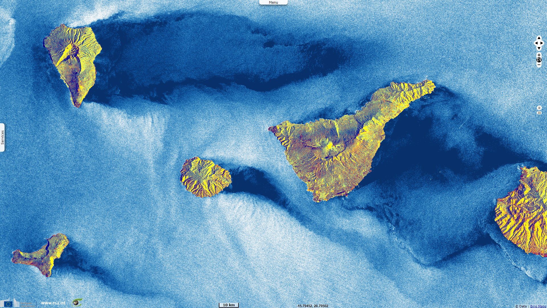
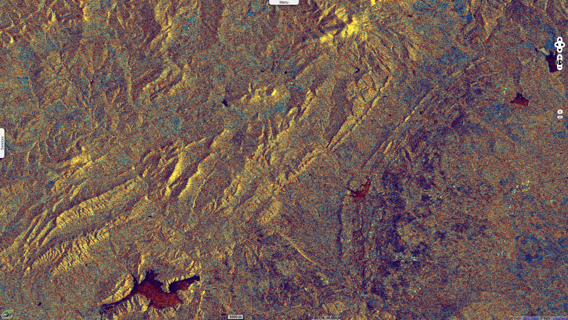
Sentinel-1 CSAR IW acquired on 28 March 2022 from 05:21:43 to 05:22:08 UTC
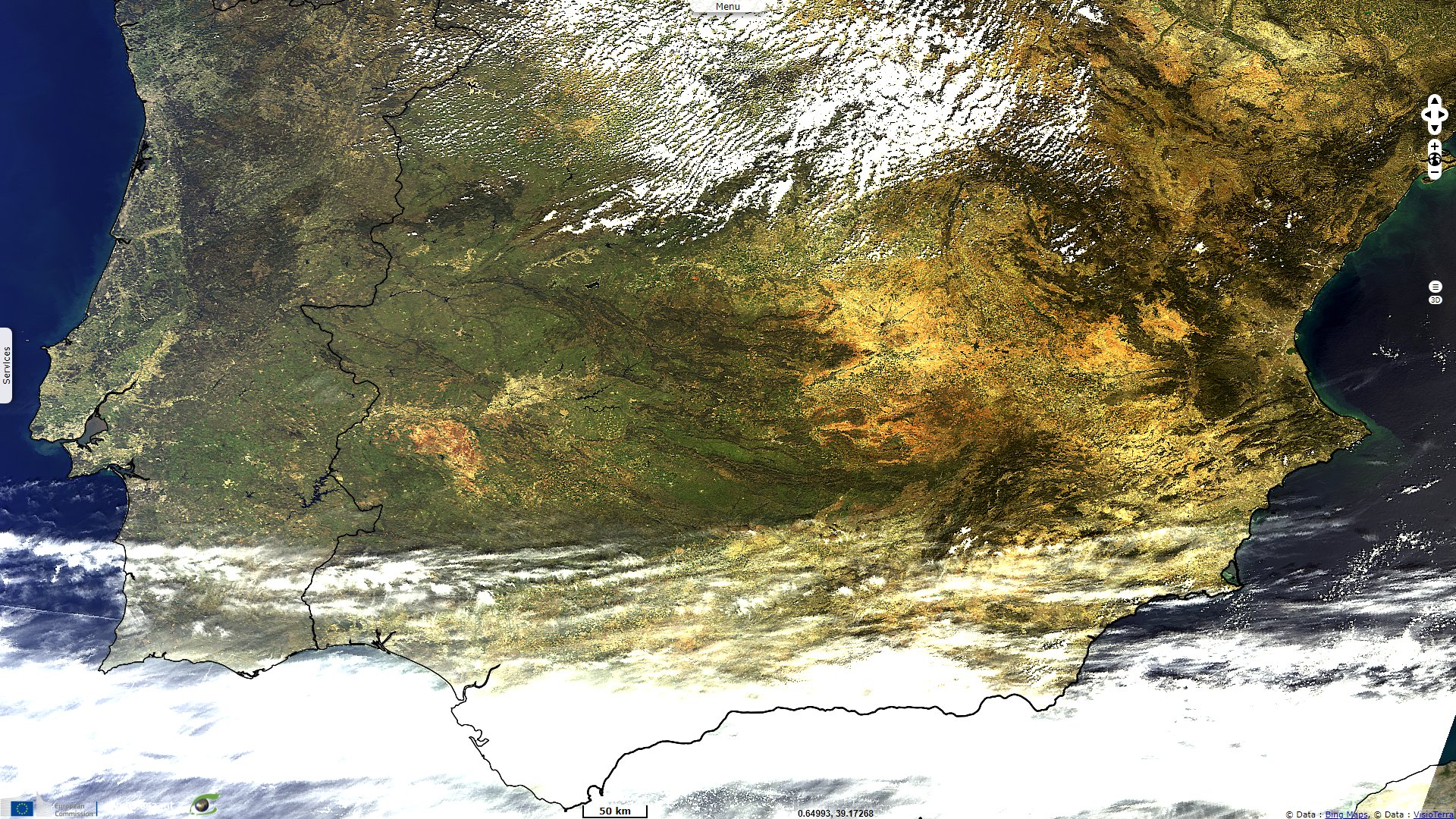
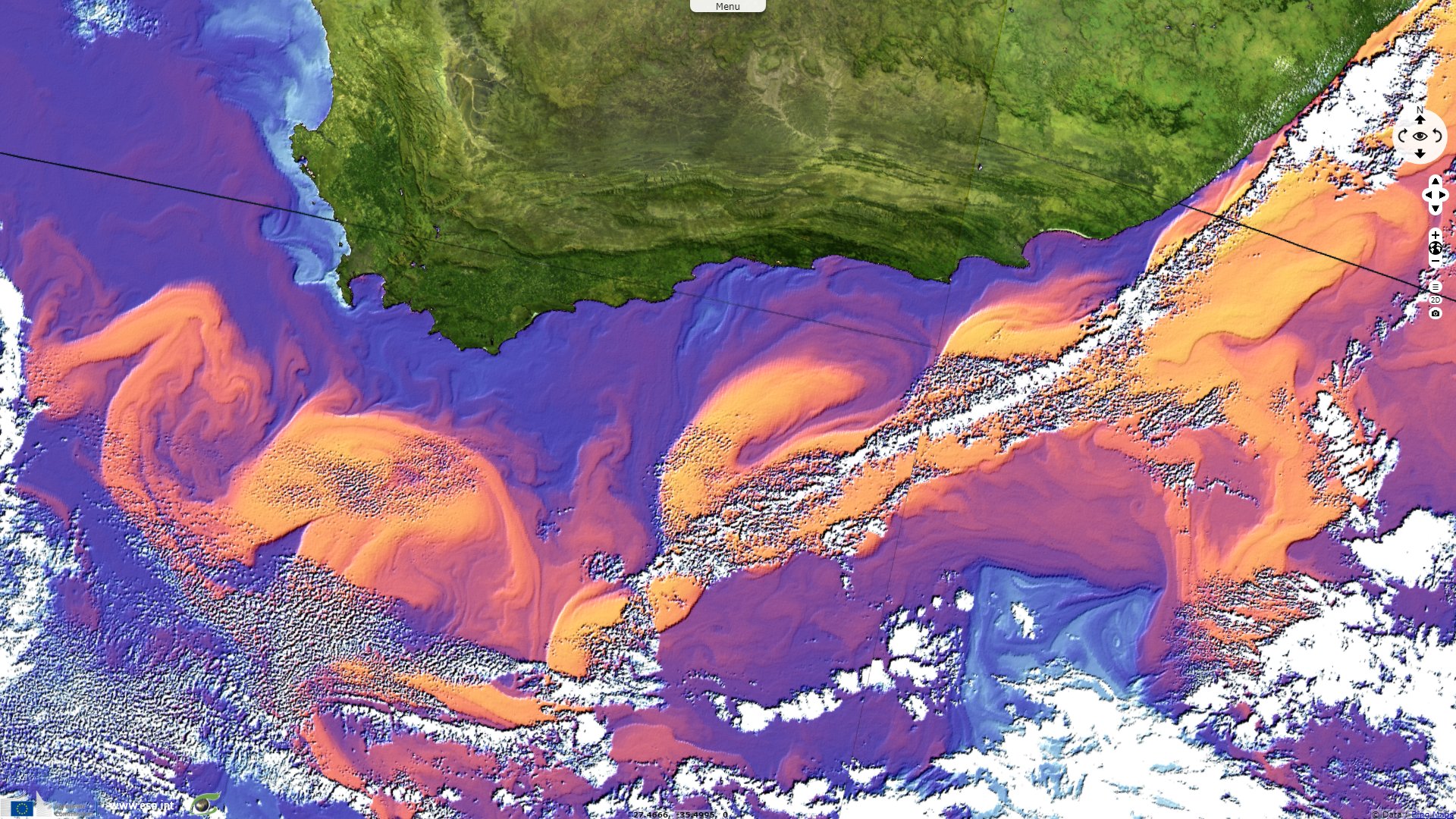
Sentinel-3 OLCI FR acquired on 03 April 2022 from 10:30:38 to 10:36:38 UTC
Sentinel-3 SLSTR RBT acquired on 22 September 2021 from 07:36:27 to 08:18:47 UTC
Sentinel-5P TROPOMI NO2 acquired on 01 January 2022 from 11:17:14 to 11:57:07 UTC
Sentinel-1 CSAR IW acquired on 28 March 2022 from 05:21:43 to 05:22:08 UTC
Sentinel-3 OLCI FR acquired on 03 April 2022 from 10:30:38 to 10:36:38 UTC
Keyword(s): ESA, atmosphere, air quality, wildfires, air pollution, currents, iceberg, sand plume, cyclone.
Envisat MERIS (08.04.2012) - Last image acquired by MERIS
before the Envisat mission ended 2D_View.
On 12 May 2012, the European Space Agency declared: "Just weeks after celebrating its tenth year in orbit, communication with the Envisat satellite was suddenly lost on 8 April. Following rigorous attempts to re-establish contact and the investigation of failure scenarios, the end of the mission is being declared." Owing to the Copernicus program, the Sentinel satellites have since taken the relay on most type of acquisitions allowed by Envisat, often with improved spacial / temporal / radiometric resolution.
Sentinel-3 is a family of satellites carrying on-board three instruments: -OLCI (Ocean and Land Colour Instrument), -SLSTR (Sea and Land Surface Temperature Radiometer) and -SRAL (Sentinel-3 Ku/C Radar Altimeter). The first satellite Sentinel-3A (S3A) has been launched on 16 February 2016 and the second one (S3B) on 25 April 2018. Each satellite has an orbital cycle (i.e. time between the same positions in orbit) of 27 days.
OLCI (Ocean and Land Colour Instrument) is an instrument on-board Sentinel-3 satellites. OLCI is a spectrometer of 21 bands which wavelengths are in the range [0.4,1.02] µm. Instrument is an assembly of 5 cameras operating in pushbroom mode. The total swath width of 1270 km results from a field of view (FOV) of 68.5° tilted of 12.2° westward to minimise the risks of Sun glint. Products have a ground sampling distance (pixel size) of 300 m.
Envisat ASAR WSM (05.04.2012) - The last image sent by Envisat ASAR was taken above Canaries Islands in WSM mode. 2D View
Sentinel-1 radar satellites are equipped with the instrument C-SAR (C-band Synthetic Aperture Radar). Two satellites have been operated to date: S1A launched on April 3, 2014 and S1B launched on April 22, 2016. These satellites have a 12-day cycle and follow each other at 6 days.
The C-SAR instrument operates in C band at a frequency of 5.405 GHz and therefore at a wavelength of approximately 5.5 cm which will determine the size of the targets with which the radar signal interacts. C-SAR operates in two polarizations: -vertical (V) and -horizontal (H). The emission can be done vertically and received vertically (VV) or horizontally (VH). Similarly, horizontal transmission and horizontal (HH) or vertical (HV) reception is an alternative mode of acquisition. The default acquisition mode is (VV,VH) producing two “bands” in the image products.
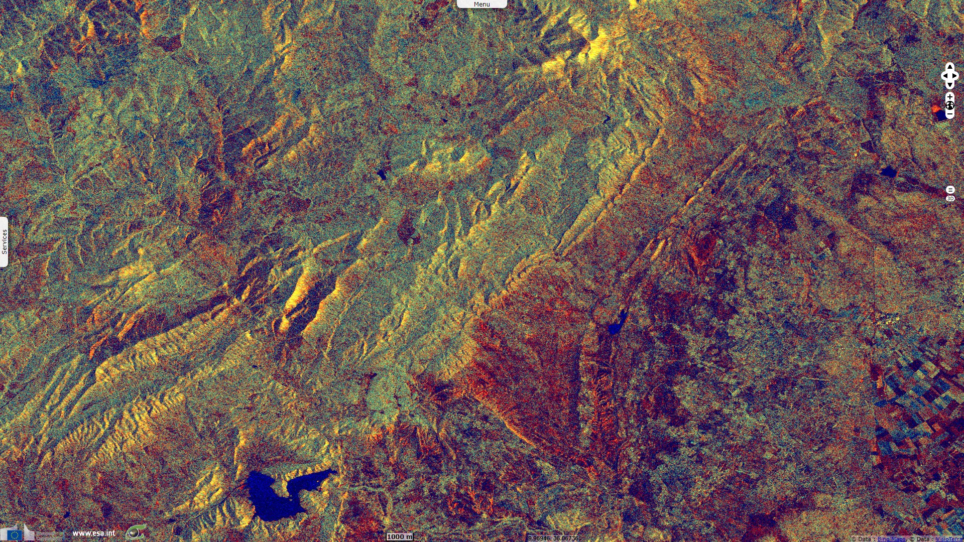
Acquisitions are performed according to three main modes: -IW (Interferometric Wide swath), -EW (Extra Wide swath) or -SM (Stripmap). The default mode is IW leading to swath widths of 240 km against 400 km (EW) and 80 km (SM).
As the instrument is active, the acquisition can operate both in descending orbit (daytime) and ascending orbit (night).
Envisat ASAR APP (08.04.2012) - The last Alternated Polarisation image acquired by Envisat was taken over Tunisia on 08 April 2012. 2D View
SLSTR (Sea and Land Surface Temperature Radiometer) is an instrument on-board Sentinel-3 satellites. SLSTR is a dual conical scanning radiometer enabling to view points of the central swath at Nadir (vertical of the satellite) and backward. This dual viewing of a same target enables to compute atmospheric corrections by analysing the different paths through the atmosphere. Dual viewing is performed with a swath of 740 km while Nadir viewing is performed with a swath of 1400 km. SLSTR radiometer has 9 bands: -3 VIS 500 m, -3 SWIR 500 m, -3 MWIR/TIR 1 km.
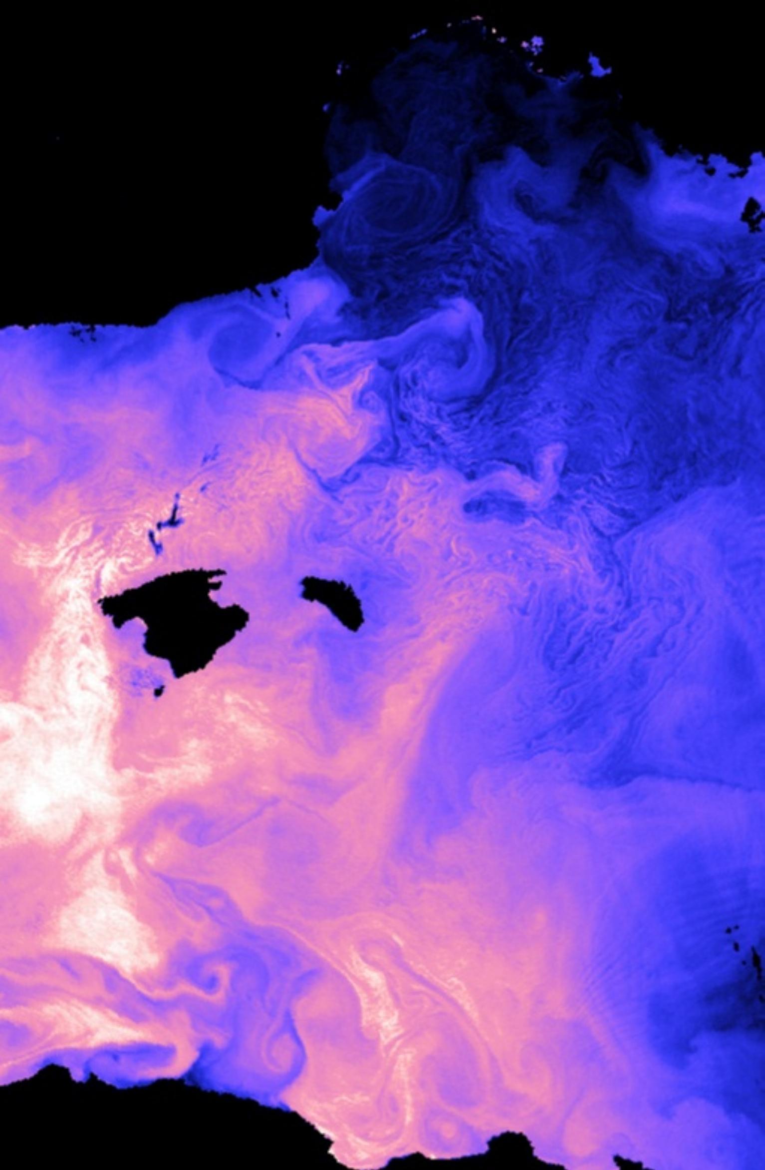
Envisat AATSR - Water temperatures around the Balearic Islands - Source: ESA
.
SRAL (Sentinel-3 Ku/C Radar Altimeter) is an instrument on-board Sentinel-3 satellites. SRAL is an altimeter operating in Ku-band (13.575 GHz) and in C-band (5.41 GHz) in two modes :
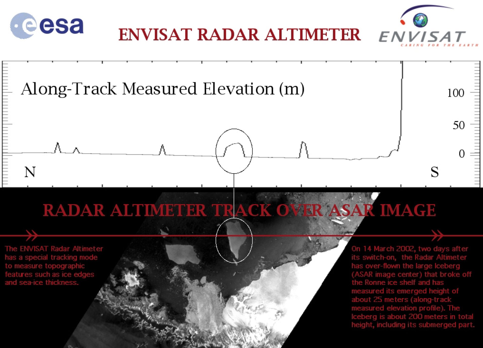
- LRM (Low-Resolution Mode) - being the conventional mode by emitting (3 Ku / 1 C / 3 Ku) successive sequences,
- SAR (Synthetic Aperture Radar) - being the mode with the highest spatial resolution by emitting 64 pulses in Ku-band framed by 1 pulse in C-band.
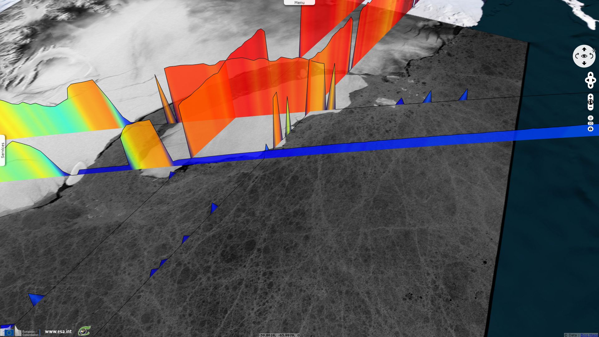
Envisat RA-2 measured near the Antarctic Peninsula on 14 March 2002 - Source: ESA
Sentinel-5P is an intermediate mission to fill the gap before the launch and operations of the Sentinel-5 mission(s). Sentinel-5P measures the atmosphere chemistry with its instrument TROPOMI (TROPOspheric Monitoring Instrument). This absorption spectrometer operates in UV, visible, NIR and SWIR domains. TROPOMI has a low spatial resolution of 7 km (along track) x 3.5 km (across track).
Sentinel-5P has been launched on 13 October 2017 and follows a sun-synchronous orbit with a repeat cycle of 16 days (227 orbits). Swath width is about 2600 km leading to a (at least) daily revisit time in any part of the world.
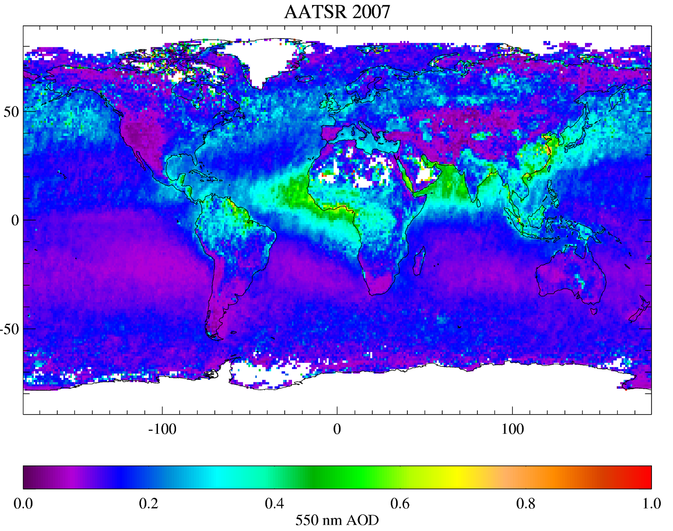
An example of a GlobAerosol product: aerosol optical depth for the year 2007, derived from Envisat AATSR data - Source: ESA.
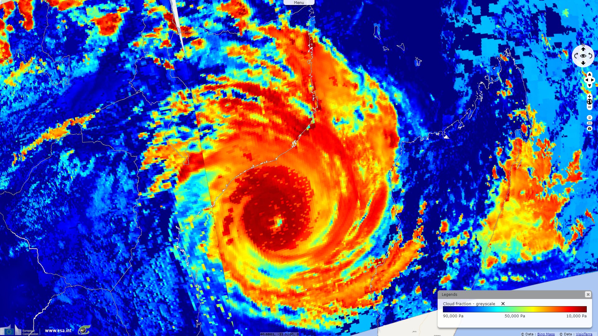
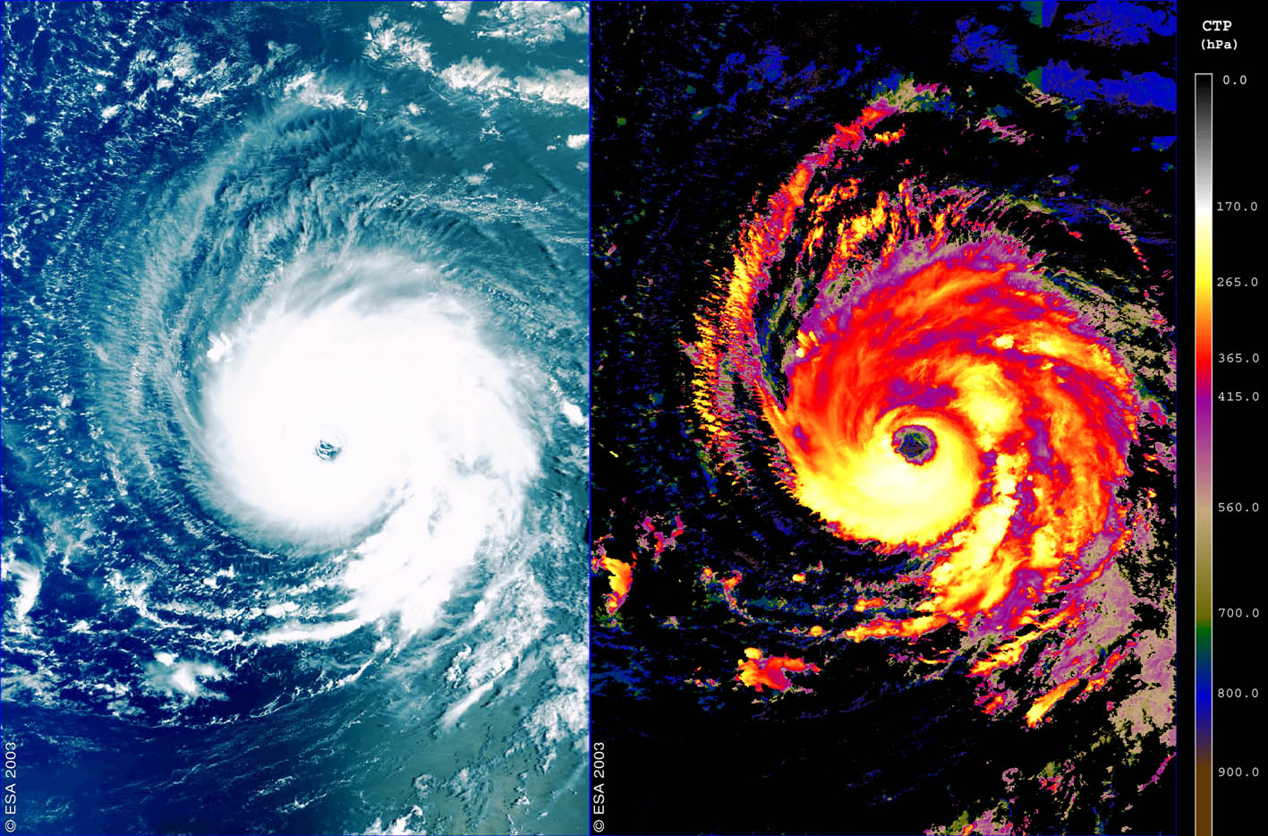
Colour composite (left) and cloud top pressure (right) or Hurricane Isabel measured by MERIS on 8 September 2003 - Source: ESA.
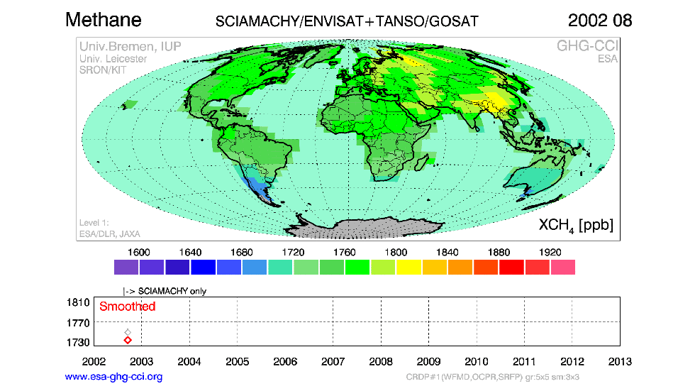
Animation of atmospheric methane from the Sciamachy instrument on Envisat (2002–12) and the TANSO instrument on Japan’s GOSAT (2009–12) - Source: ESA.
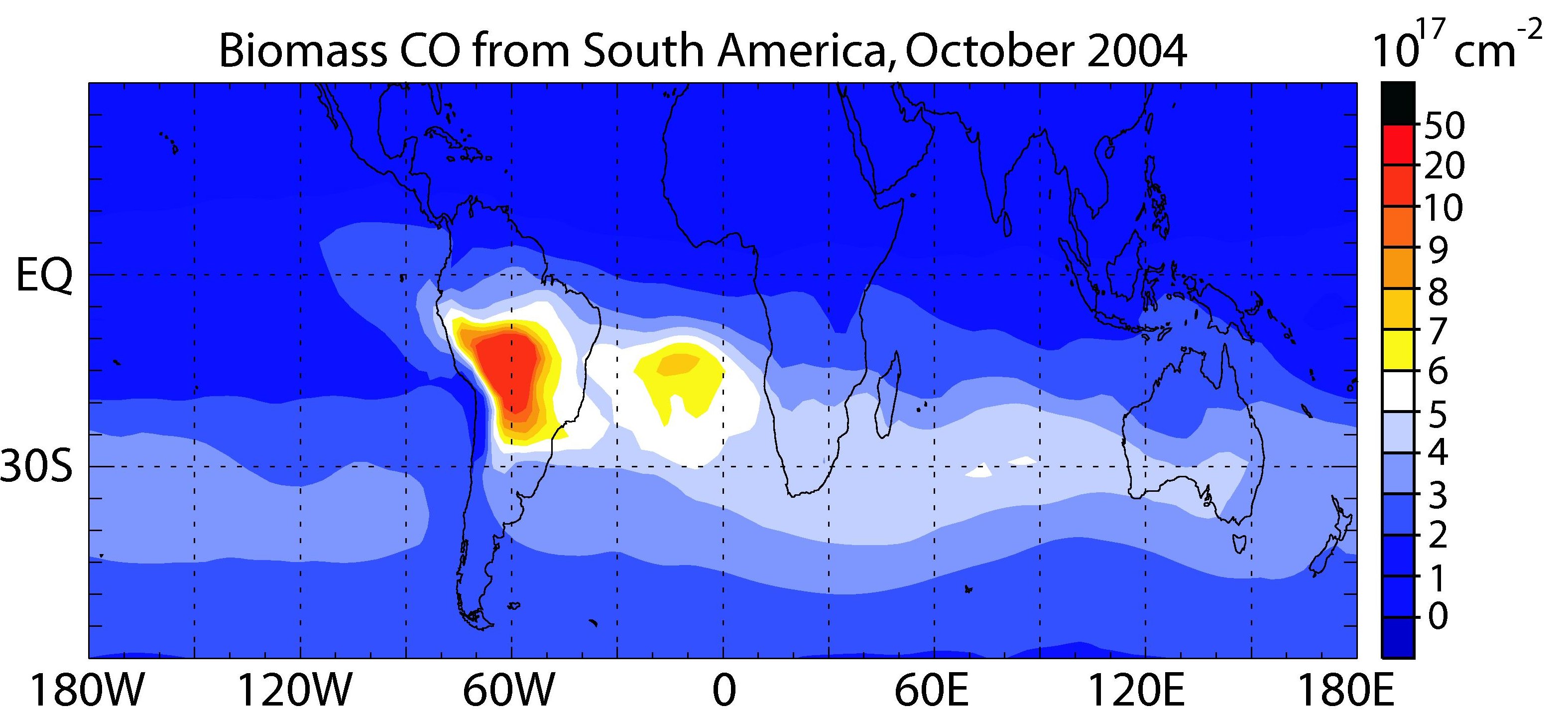
Envisat view of CO emissions from South America confirmed by SCIAMACHY observations - Source : ESA.
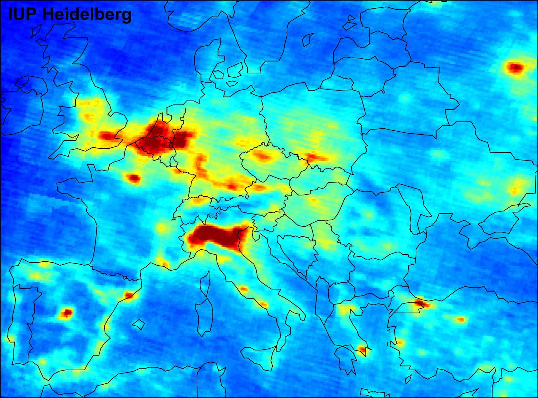
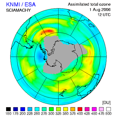
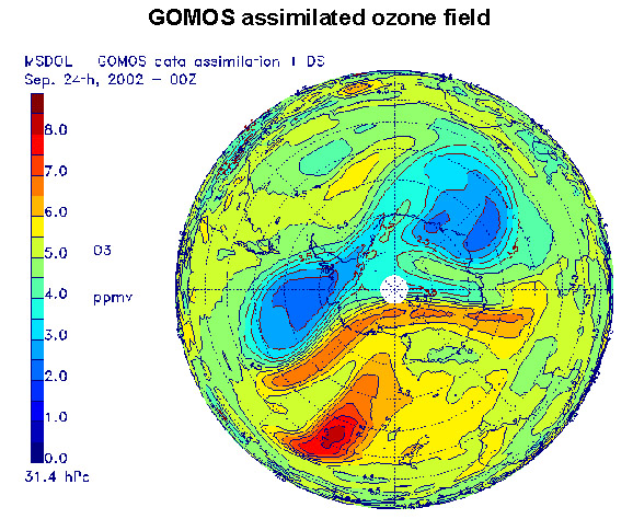
Mean tropospheric nitrogen dioxide (NO2) vertical column density (VCD) between January 2003 and June 2004, as measured by the SCIAMACHY instrument on ESA's Envisat - Source : ESA
The views expressed herein can in no way be taken to reflect the official opinion of the European Space Agency or the European Union.
Contains modified Copernicus Sentinel data 2026, processed by VisioTerra.
Contains modified Copernicus Sentinel data 2026, processed by VisioTerra.
| More on European Commission space: |  |
 |
 |
||||
| More on ESA: | |
|
|
S-1 website | S-2 website | S-3 website | |
| More on Copernicus program: | |
|
|
Scihub portal | Cophub portal | Inthub portal | Colhub portal |
| More on VisioTerra: | |
|
|
Sentinel Vision Portal | Envisat+ERS portal | Swarm+GOCE portal | CryoSat portal |