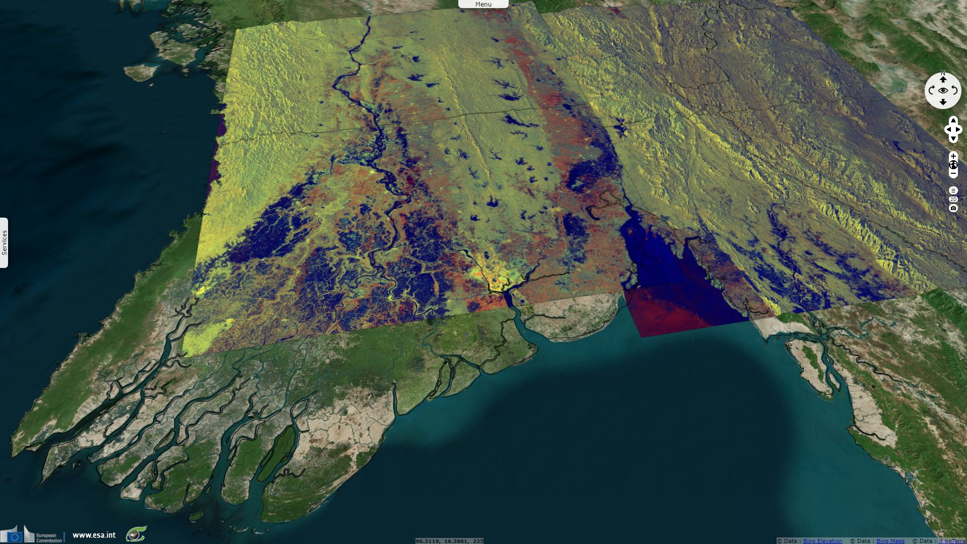
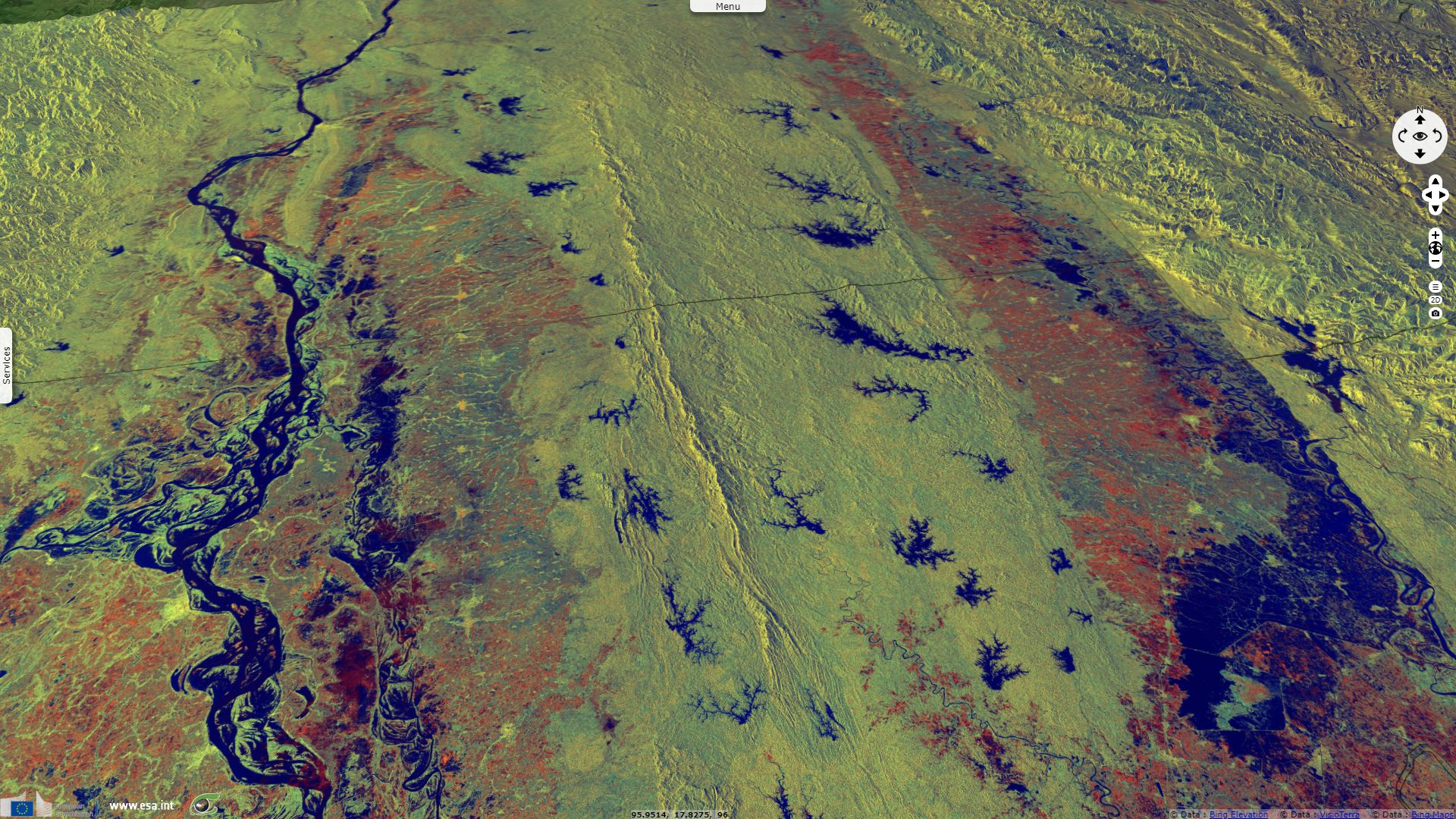
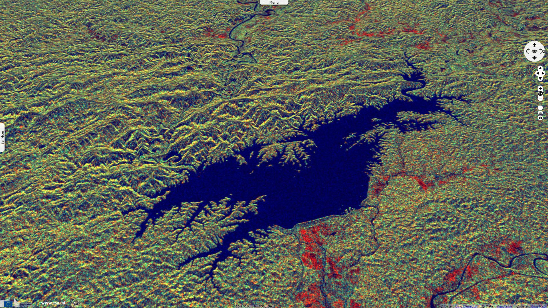
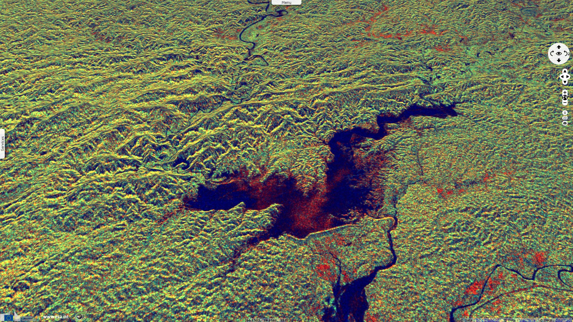
Dam breach causes flooding in Myanmar
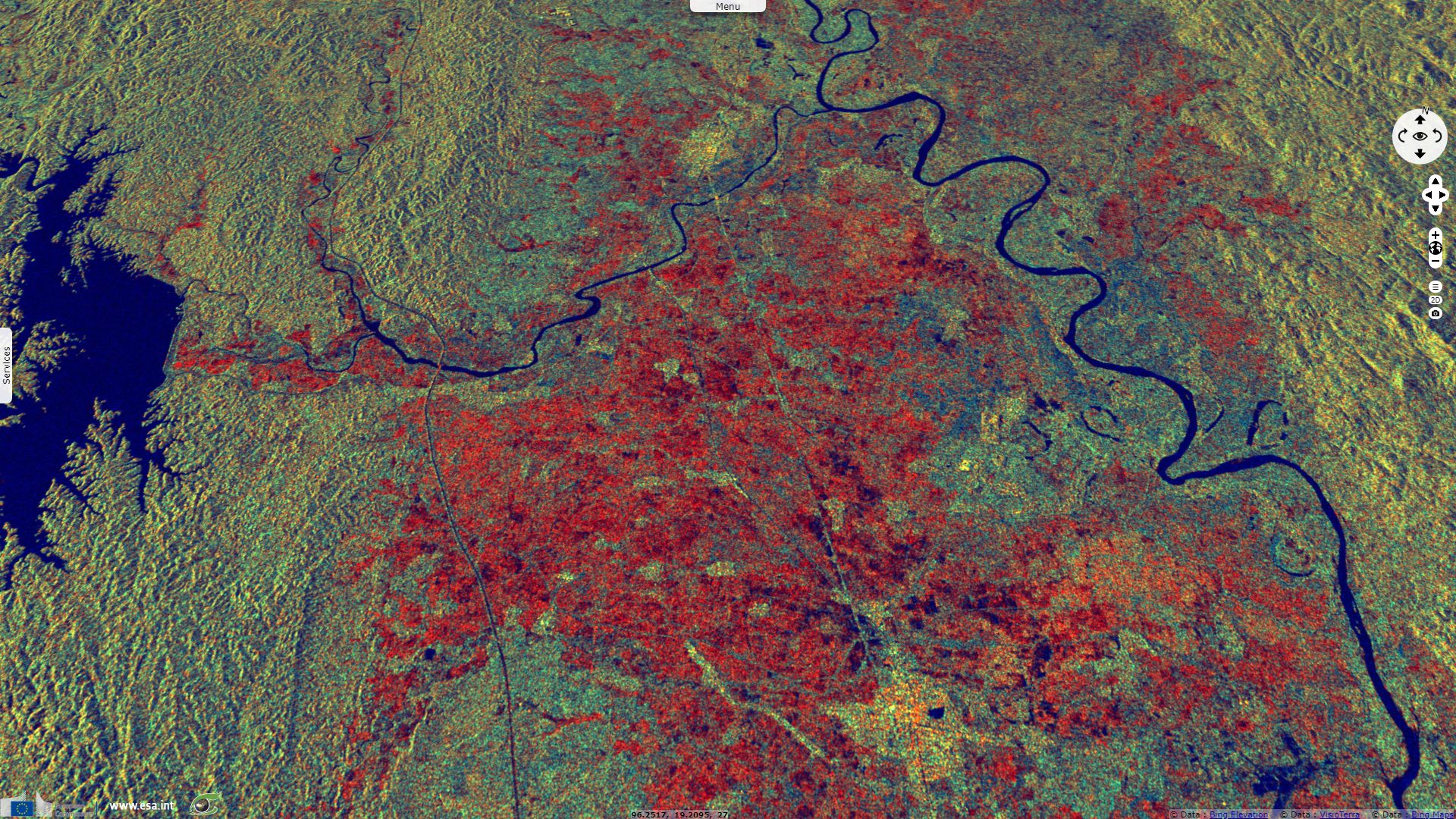
Sentinel-1 CSAR IW acquired on 19 August 2018 from 11:46:12 to 11:46:37 UTC
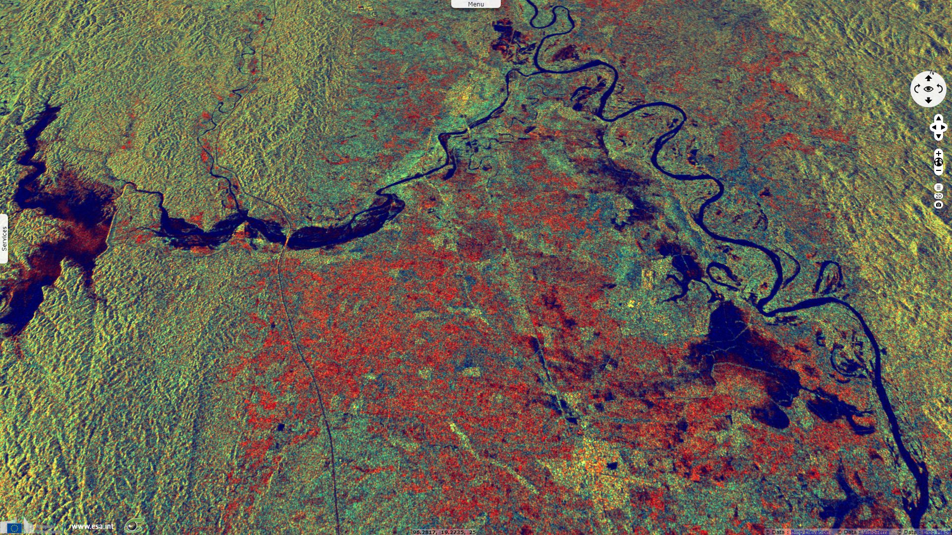
Sentinel-1 CSAR IW acquired on 26 August 2018 from 11:38:00 to 11:38:25 UTC
Sentinel-1 CSAR IW acquired on 31 August 2018 at 11:46:37 UTC
Sentinel-1 CSAR IW acquired on 06 September 2018 at 11:45:28 UTC
Sentinel-1 CSAR IW acquired on 07 September 2018 from 11:38:01 to 11:38:26 UTC
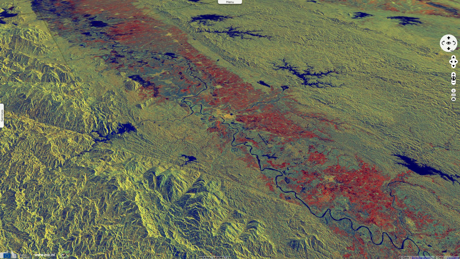
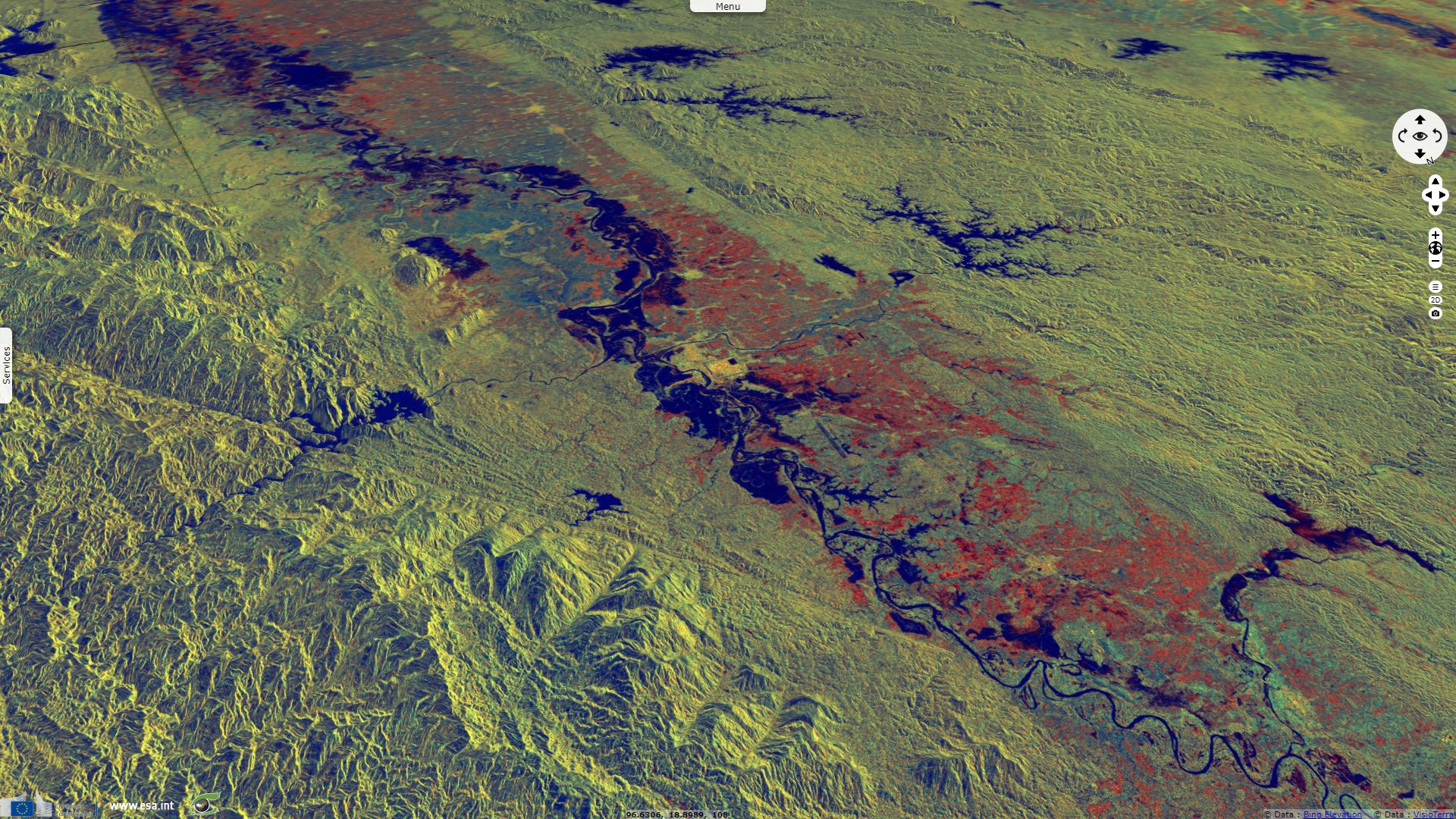
Sentinel-1 CSAR IW acquired on 26 August 2018 from 11:38:00 to 11:38:25 UTC
Sentinel-1 CSAR IW acquired on 31 August 2018 at 11:46:37 UTC
Sentinel-1 CSAR IW acquired on 06 September 2018 at 11:45:28 UTC
Sentinel-1 CSAR IW acquired on 07 September 2018 from 11:38:01 to 11:38:26 UTC
Keyword(s): Hydrology, disaster, emergency, monsoon rain, precipitation, hydropower, renewable energy, reservoir lake, river
Copernicus-funded site floodlist.com reminds the context: "The breach comes after heavy monsoon rains caused widespread flooding and landslides from mid-July, with Bago Region one of the worst affected. By late July, at least 11 people had died and 120000 people displaced. The death toll has since increased to 16. At one point the number of displaced increased to 149000. As of 02 August, 122500 people were still displaced, with 94000 of them in Bago Region."
The non-profit independent service acaps.org details the human impact of this new flooding: "On 29 August, damage to Swar Chaung dam in Myanmar’s Bago Region led to flooding across four townships: Yedashe, Taungoo, Oktwin and Kyaut Gyi. Flooding affected at least 85 villages and by 7 September, some 78500 people from the four townships had to leave their homes. Hundreds of houses were damaged or destroyed, and more than [240km²] of farmland were flooded. As of 6 September, flooding had led to the closure of 325 schools, as infrastructure and materials were damaged. On 4 September, it was announced that of the 772 schools that have been closed, 447 were open again."
Then, ACAPS estimates the economic impact of the dam breach: "Damage to critical infrastructure On 30 August, it was reported that water released from the dam had flooded both highways of new Yangon-Mandalay and old Yangon-Mandalay. (Railway lines were inundated between Swar and Yedashe, and railway services were temporarily closed. (AHACentre 30/08/2018) Traffic on the new YangonMandalay highway was suspended, as water damaged Swar Creek Bridge. However, both lanes on the bridge were reopened for traffic after repairs at 7 pm on 31 August. The Yangon-Mandalay highway is one of the most important routes between Myanmar’s two largest cities. (Ieyenews 04/09/2018, Eleven Myanmar 01/09/2018) On 6 September, the General Manager of Myanmar Railways stated that four miles worth of railway tracks had been damaged, and that repairs were expected to be completed 'within days'."

A man walks over the dried ground of the Swar Chaung dam after water level decreased when the spillway collapsed at Swar township, Bago region on August 30, 2018 - Source: Ye Aung Thu.
The views expressed herein can in no way be taken to reflect the official opinion of the European Space Agency or the European Union.
Contains modified Copernicus Sentinel data 2026, processed by VisioTerra.
Contains modified Copernicus Sentinel data 2026, processed by VisioTerra.
| More on European Commission space: |  |
 |
 |
||||
| More on ESA: | |
|
|
S-1 website | S-2 website | S-3 website | |
| More on Copernicus program: | |
|
|
Scihub portal | Cophub portal | Inthub portal | Colhub portal |
| More on VisioTerra: | |
|
|
Sentinel Vision Portal | Envisat+ERS portal | Swarm+GOCE portal | CryoSat portal |