Evolution of Lukanga swamps, Zambia
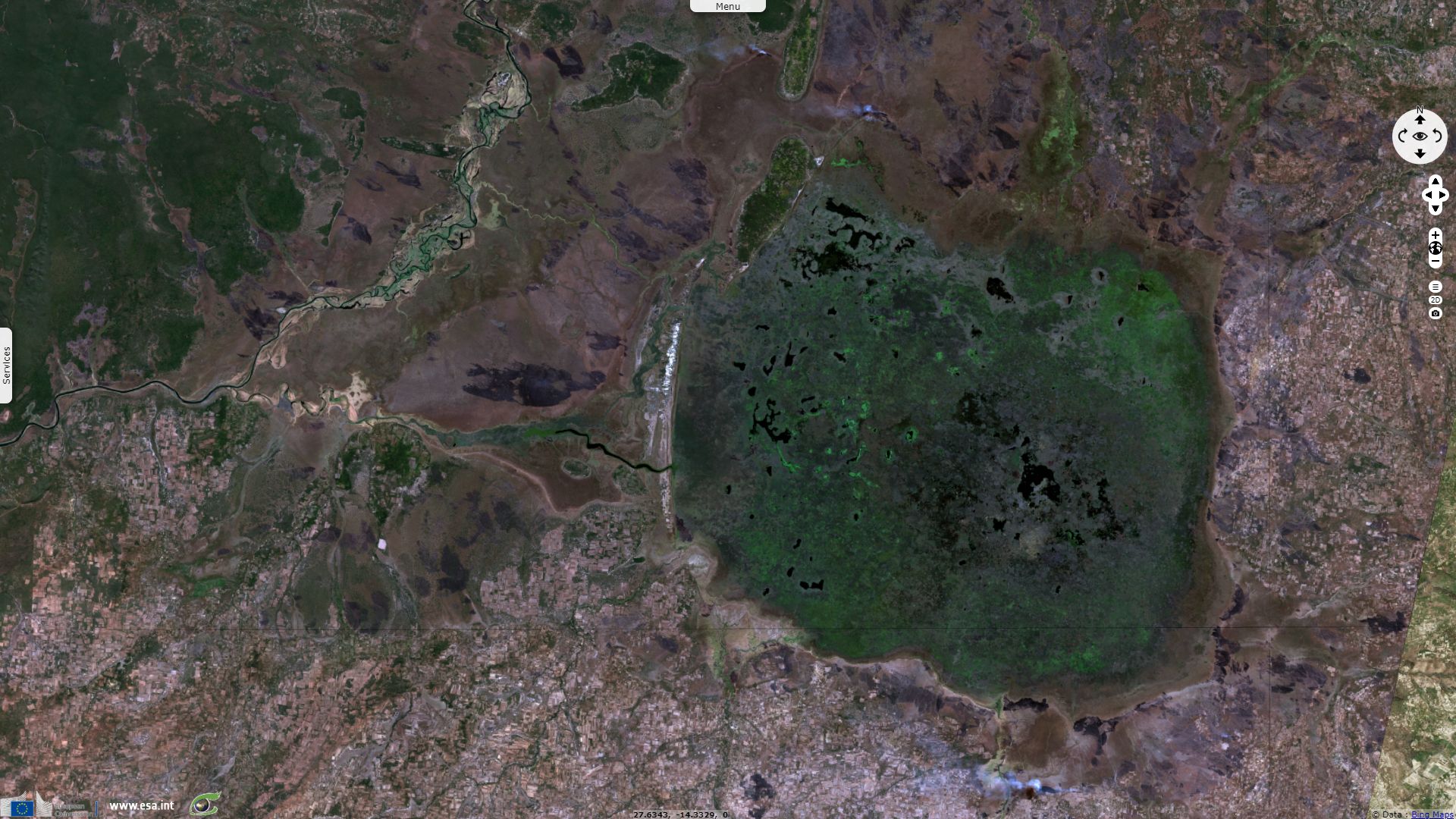
Sentinel-3 OLCI FR acquired on 14 July 2017 at 08:05:00 UTC
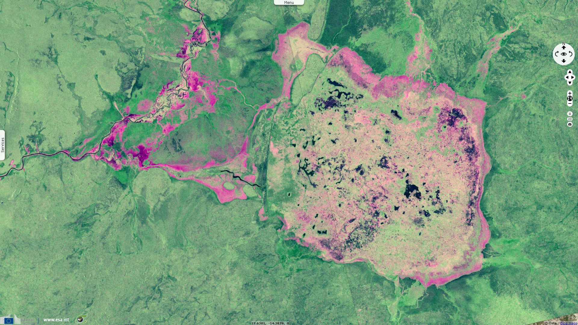
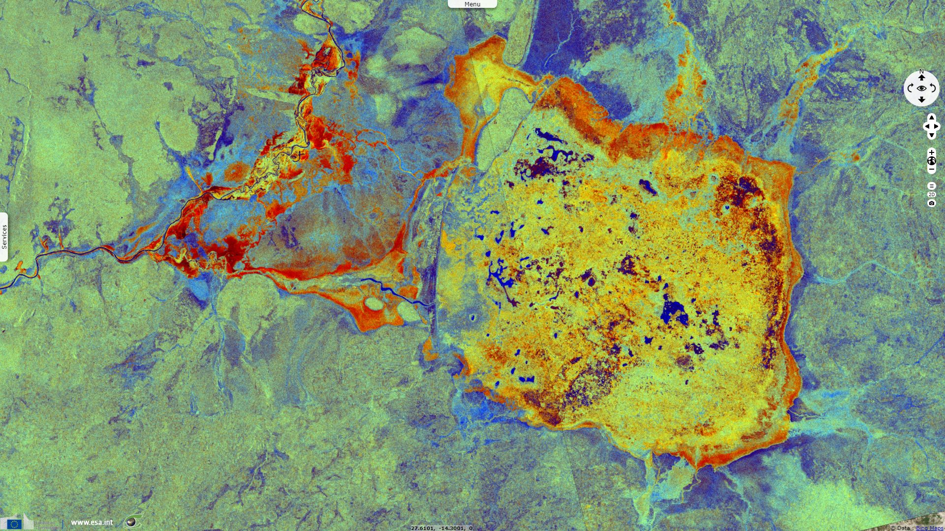
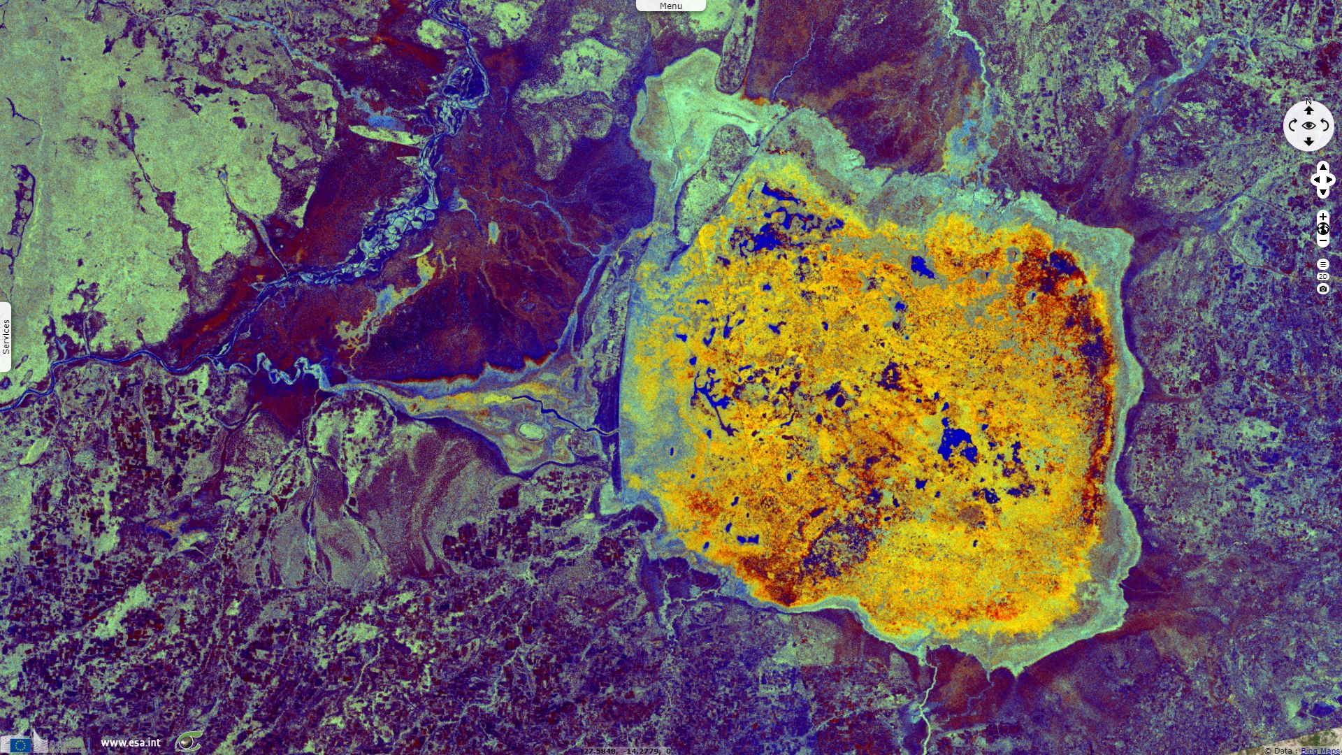
Sentinel-1 CSAR IW acquired on 06 September 2018 at 16:33:07 UTC
...
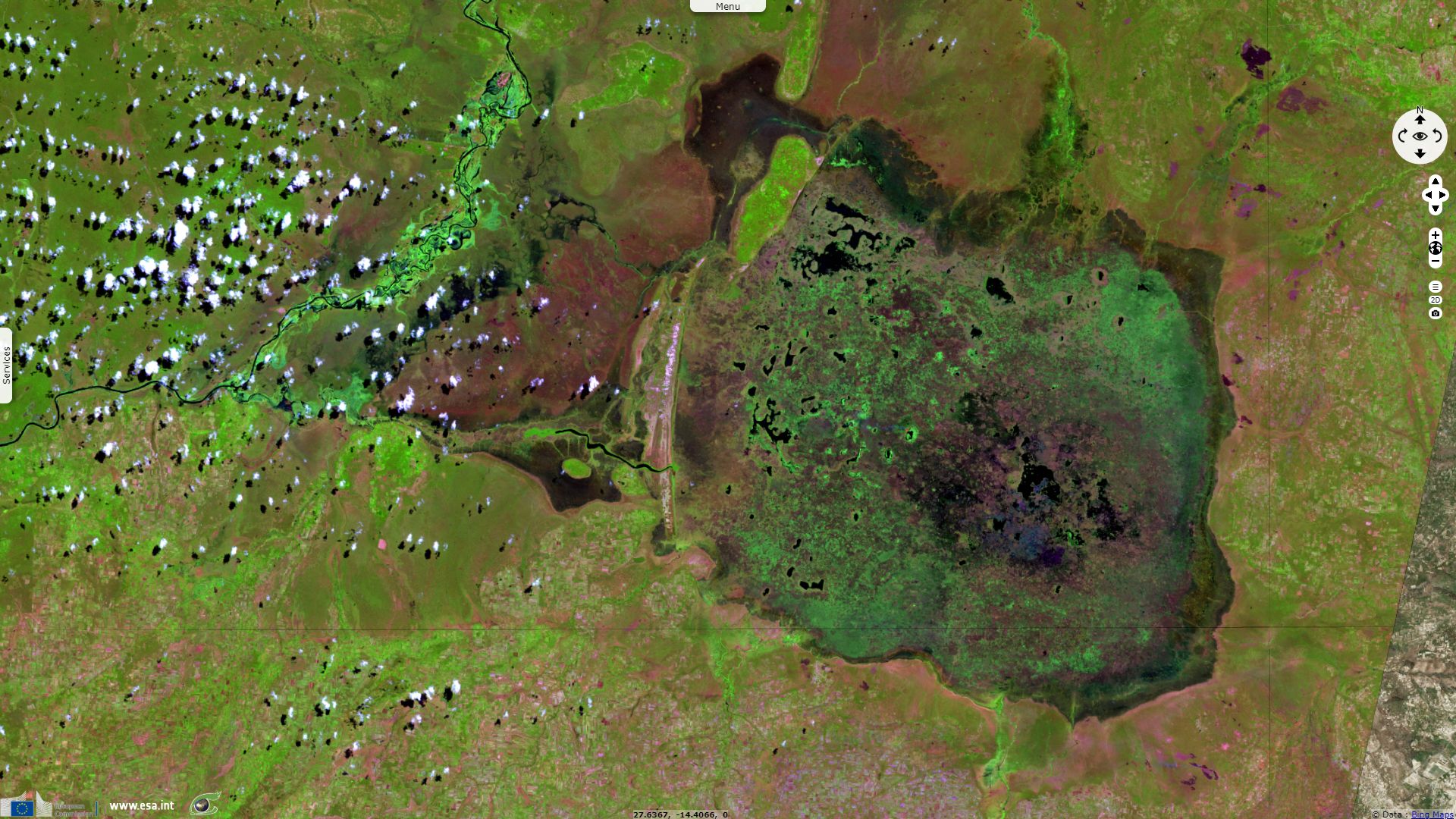
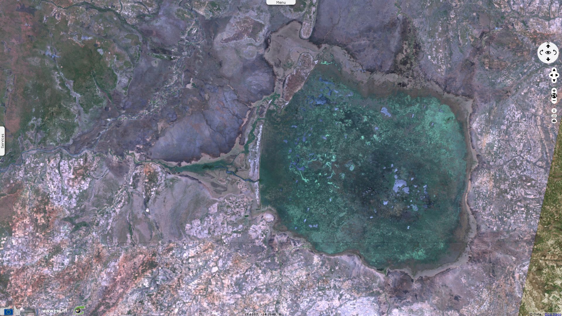
Sentinel-2 MSI acquired on 28 April 2019 at 08:06:11 UTC
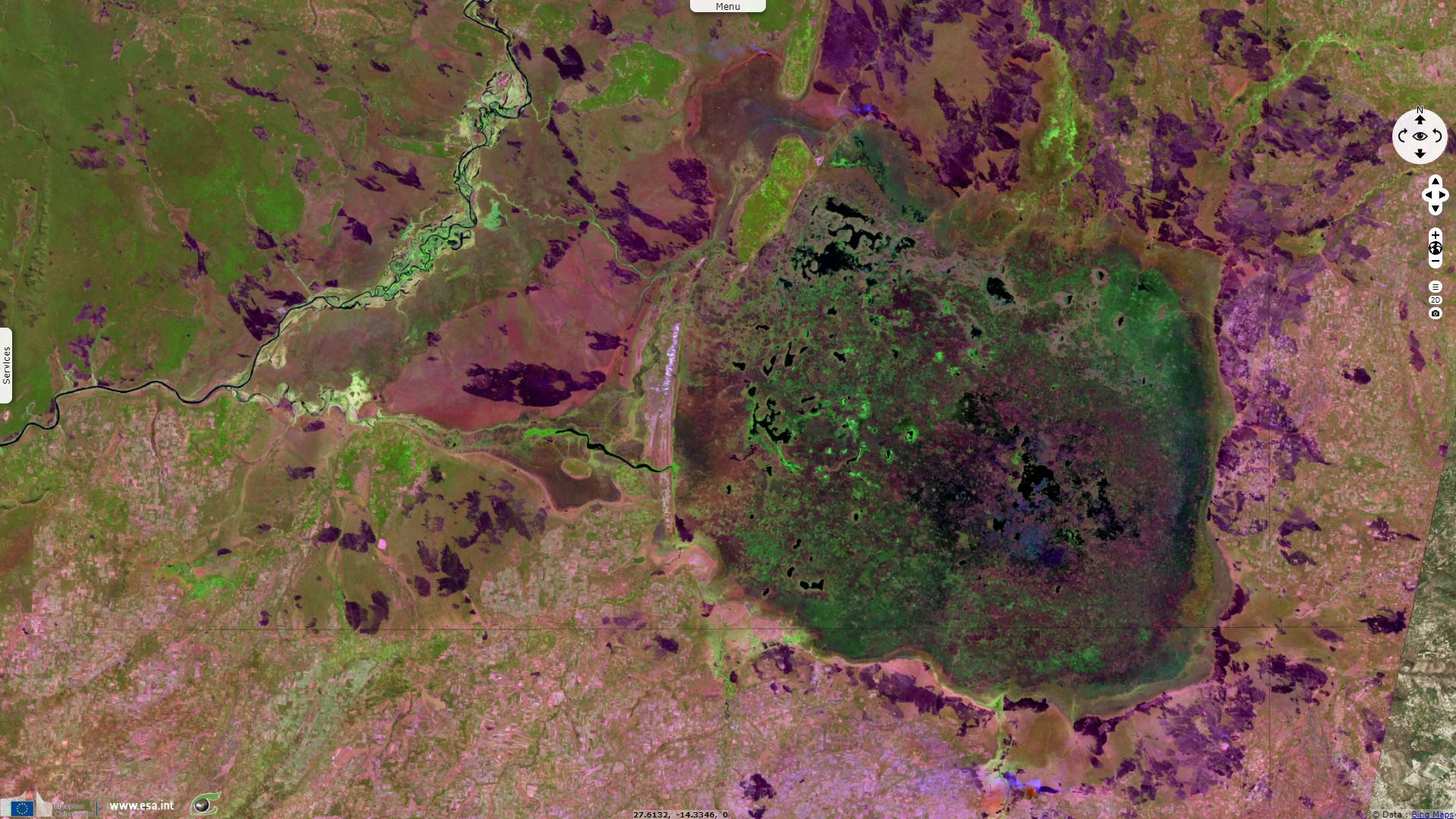
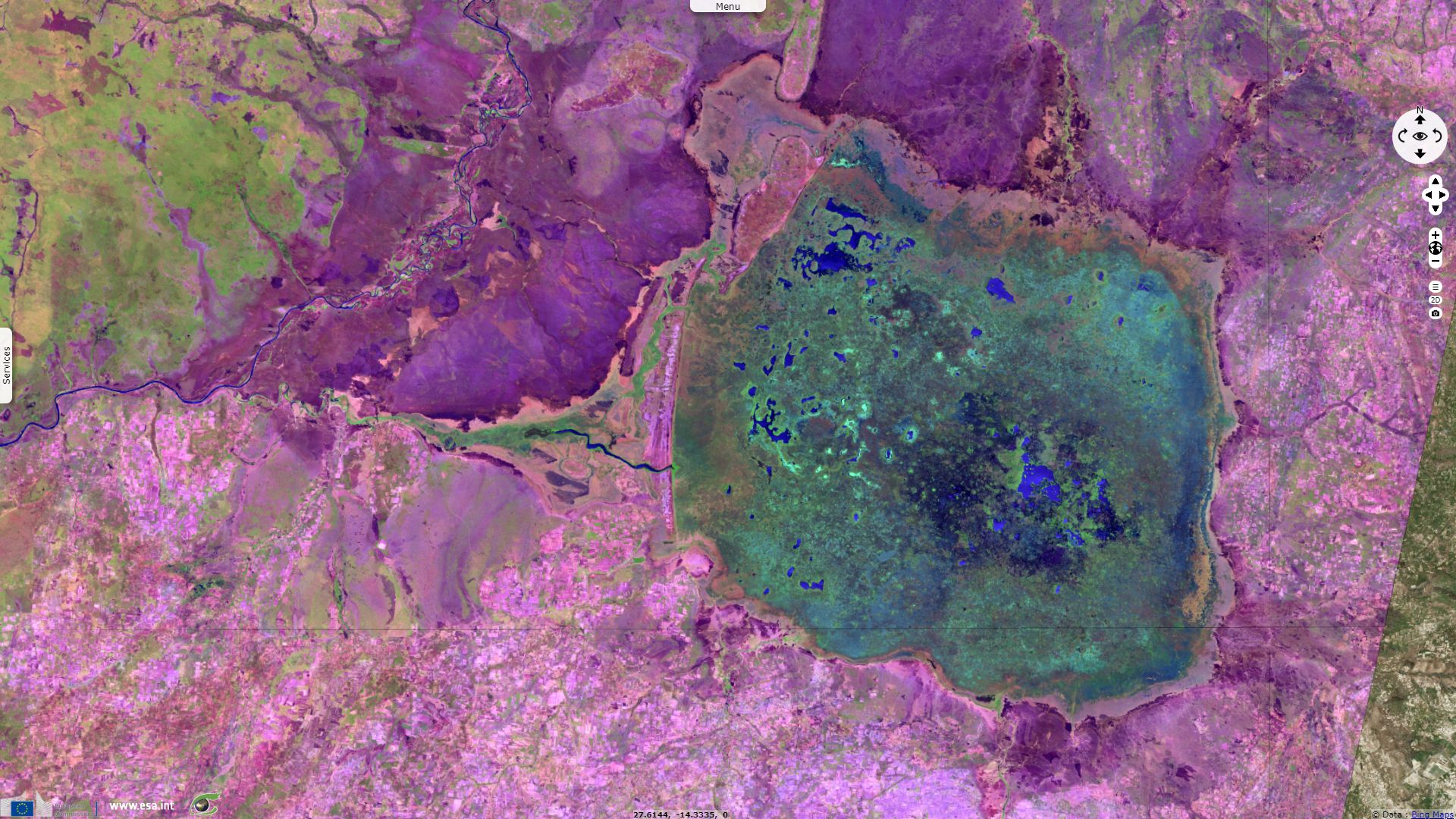
Sentinel-2 MSI acquired on 07 June 2019 at 08:06:11 UTC
Sentinel-1 CSAR IW acquired on 06 September 2018 at 16:33:07 UTC
...
Sentinel-2 MSI acquired on 28 April 2019 at 08:06:11 UTC
Sentinel-2 MSI acquired on 07 June 2019 at 08:06:11 UTC
Keyword(s): Land, hydrology, biodiversity, Ramsar wetland, savannah, marsh, swamp, seasons, overfishing, deforestation, fire, Zambia
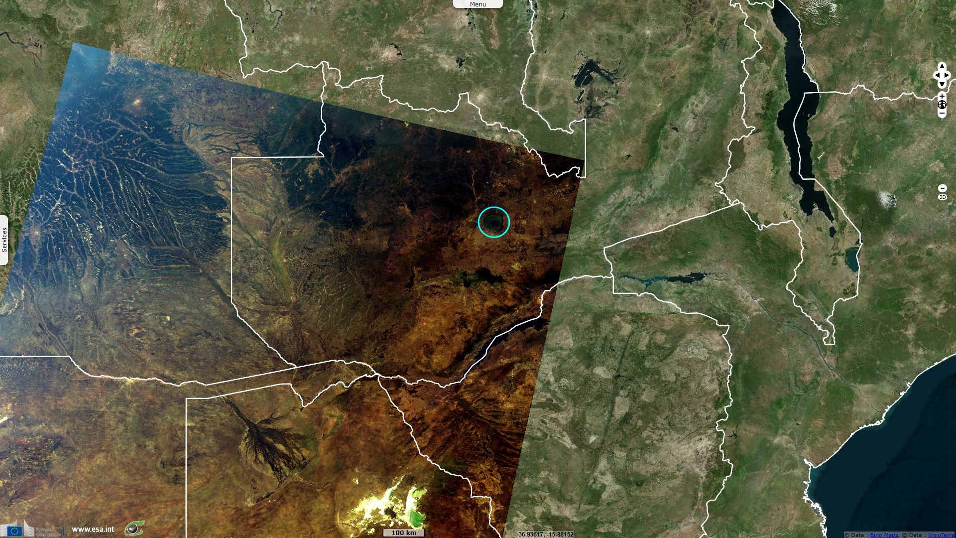
According to a prepared by Global Environment Facility in the framework of a project led in 2000 in Zambia dedicated to Community-Based Natural Resources Management and Bio-diversity Conservation in the Lukanga Swamps Watershed area: "With an estimated area of 2590 km², Lukanga Swamps is the largest permanent water body in the Kafue basin. It is situated in Central Province, roughly halfway between Lusaka and the Copper belt, west of the Great North Road. According to an ecological evaluation, conducted under the supervision of the ECZ [Environmental Council of Zambia], Lukanga Swamps is among the richest wetlands in the country, especially with regards to wild life and fisheries."

Map of Lukanga swamps Ramsar site - source: Ramsar.
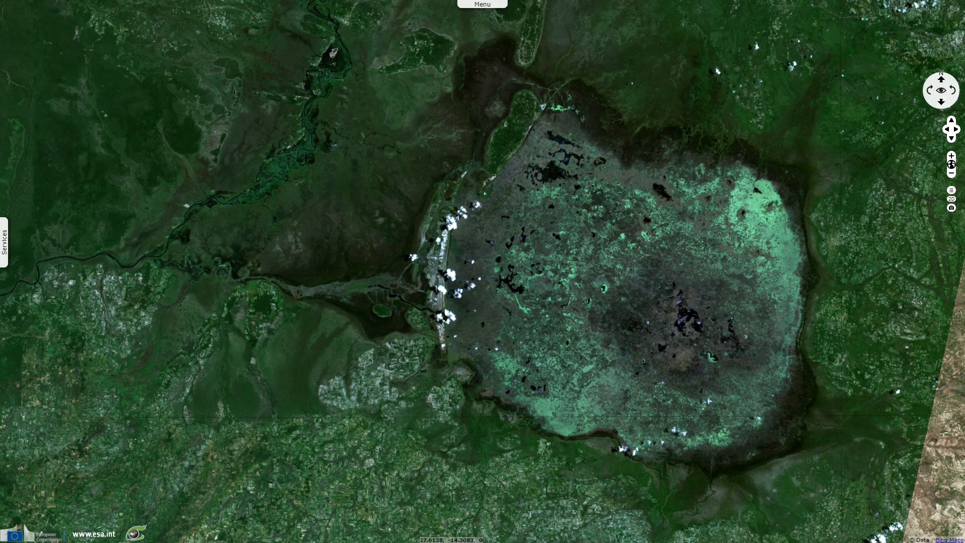
Its permanently swampy area consists of a roughly circular area with a diameter of 40 to 50 km covering 1850 km2, plus roughly 250 km2 in the mouths of and along rivers discharging into it such as the Lukanga River from the north-east, plus another 500 km2 either side of the Kafue River to the west and north-west, making 2600 km2 in total. It contains many lagoons such as Lake Chiposhye and Lake Suye but few large channels, and its average depth is only 1.5 m.
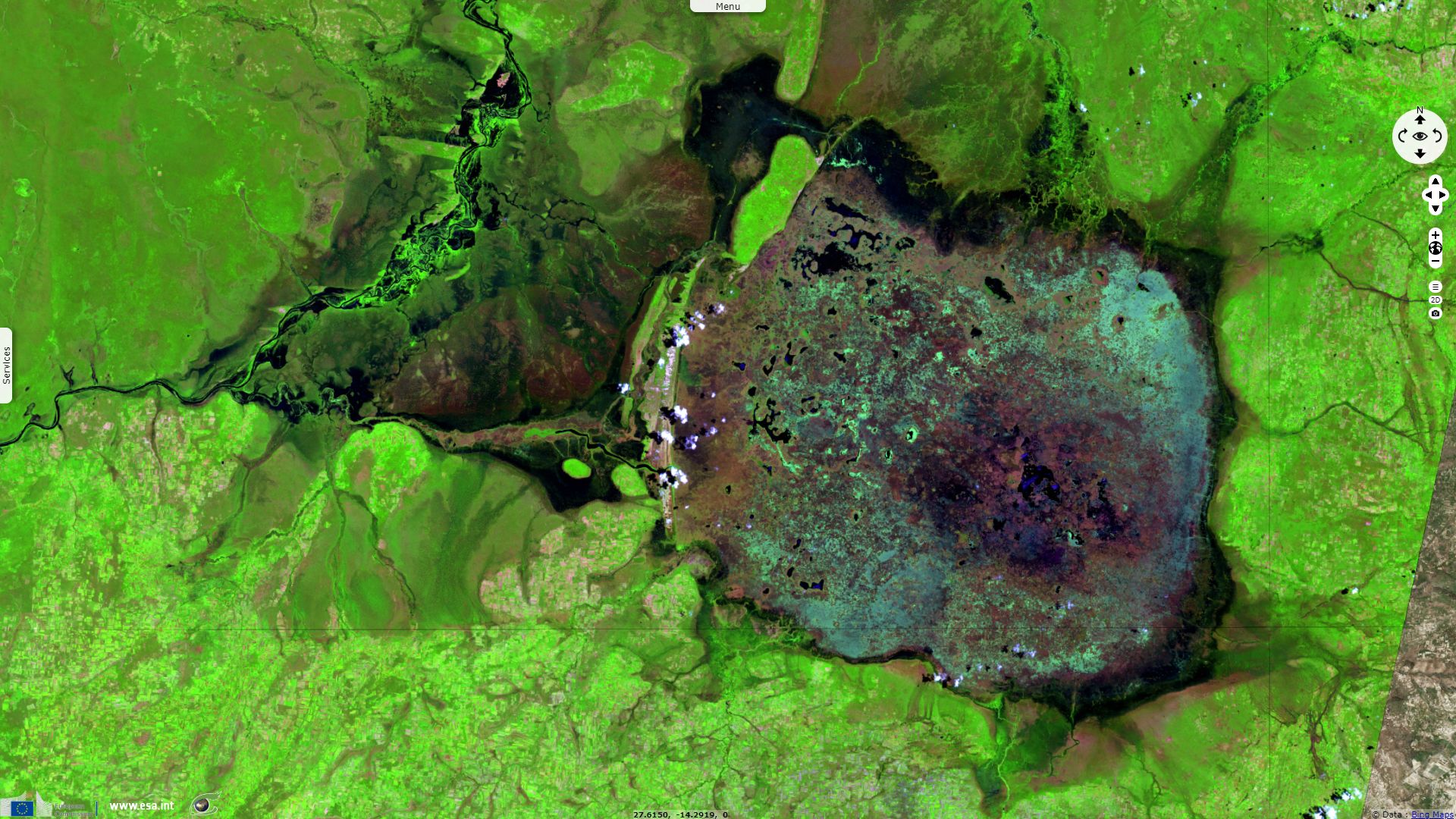
It is susceptible to important seasonal variations: The permanent swamp is surrounded by a seasonally-inundated floodplain, varying from about 5 to 25 km wide in the south and east, up to 40 km in the north, and reaching the Kafue River and its swamps 25 km to the west and north-west. When the Kafue floods it overflows north-west through the normally dry Mwinuna channel and into the lower Lukanga River, while another channel drains out of the swamp back into the Kafue in the south-west. The Kafue meanders through its own swamps which are up to 10 km wide and extend for 90 km along the river. Numerous short rivers and streams flow into the swamp from the south, east and north, of which the Lukanga is the largest. In the rainy season the floodplains are inundated increasing the area of the wetland to 6000 km2, reaching a maximum of 8000 km2 at the peak flooding of a good rainy season.
Global Environment Facility wrote: "At least 316 species of birds have been reported in literature. 67% of these are Wetland species, while the rest consists of upland species and migratory birds. Waterfowl is perhaps the most important species of wildlife in terms of international relevance. The areas around the Mufukushi River, all lakes within the swamp, and lagoons along the Kafue River are significant areas for waterfowl. The area around the Mongo Fishing Camp and the Itundu plain are possibly breeding site for the Wattled Crane, a bird of international significance. This area is also seen as crucially important for the conservation of Lechwe, Oribi and Marsh Mongoose. Other wildlife species that merit special consideration include the Sitatunga [a swimming antelope], Bush Buck, Hippopotamus, Crocodile and Python. It was also reported that Elephant, Buffalo, Eland and Roan Antelope visit the Western side of Swamp." Lukanga Swamps Ramsar sheet completes: "The area is also an important breeding ground for fish, the most abundant of which is Tilapia."
The report written by Global Environment Facility around 2000 found that in spite its ecological importance and long-term economical potential, "the wetland has remained unmanaged over the years. In sample survey of communities near the swamps, for instance, 96% of those interviewed said they were engaged in fishing, 60% harvest reeds and grass, 28% use the area for cattle grazing and 4% are involved in hunting wildlife. There is no crop cultivation inside the swamp except at Chilwa Island and areas along the Kafue and Lukanga River. On the upper reaches, maize is the main crop while other crops include: cotton and sunflower and some traditional crops such as sweet potatoes, groundnuts and mixed beans. Livestock is also kept."
The survey adds "Non-wood forest products such as fruits, honey, mushrooms and insects are collected for food in unknown quantities. Of the people interviewed, most use forests for firewood collection (100%), cutting poles and furniture building (92%), handicraft and furniture making (36%) and commercial timber (4%). Charcoal production accounts for 8%, while 48% of the people clear forest areas for agriculture. Deforestation has become a major threat to the wetland ecosystem mainly because it results in siltation. Nearly all areas surrounding the swamp in the Lukanga watershed are subjected to severe deforestation through land clearing and charcoal production."
"Overfishing, deforestation, and use of agro-chemicals pose potential threats. It is proposed to develop a local strategic management plan with full participation of the local communities.", wrote the Ramsar sheet.
These threats are further detailed: "Although present surveys indicate that only 4% of the population in the swamp are actively involved in hunting, it is strongly believed that the number of hunters is much higher than currently stated."
"The economy in the area is actually based on the fishing industry - nearly every inhabitant is a fisherman - and fish constitutes the major diet of communities around the region. Nevertheless, the Lukanga fishery is currently under severe threat due to over-fishing. It has been estimated that as much as 1200 tons of fish are caught per year. Much of the Lukanga Swamp is a breeding area, in particular all streams leading to the swamp are important for breeding fish species. The Lukanga Swamp is linked to the Kafue River through the Mwinuna channel and the Lukanga River, and these are the major migratory routes of fish between the two water bodies. Whereas declining water levels pose considerable threat to the abundance and reproduction of most fish species, excessive fishing has been a major factor. Continued lack of management may lead to further depletion of the resource."
Programs such as "Natural Resources Management and Bio-diversity Conservation in the Lukanga Swamps Watershed area" promoted by the Global Environment Facility are needed to allow sustainable development. Disrupting the cycle of life by excessive extraction of natural ressources would also durably impact inhabitants of the region, ensueing in a loss/loss for both environment and human communities.
The views expressed herein can in no way be taken to reflect the official opinion of the European Space Agency or the European Union.
Contains modified Copernicus Sentinel data 2026, processed by VisioTerra.
Contains modified Copernicus Sentinel data 2026, processed by VisioTerra.
| More on European Commission space: |  |
 |
 |
||||
| More on ESA: | |
|
|
S-1 website | S-2 website | S-3 website | |
| More on Copernicus program: | |
|
|
Scihub portal | Cophub portal | Inthub portal | Colhub portal |
| More on VisioTerra: | |
|
|
Sentinel Vision Portal | Envisat+ERS portal | Swarm+GOCE portal | CryoSat portal |