World Climate Day - Polynya in Weddell Sea
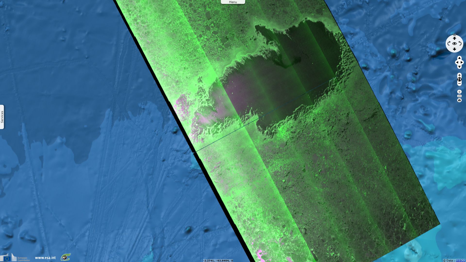
Sentinel-1 CSAR EW acquired on 02 September 2017 at 19:12:10 UTC
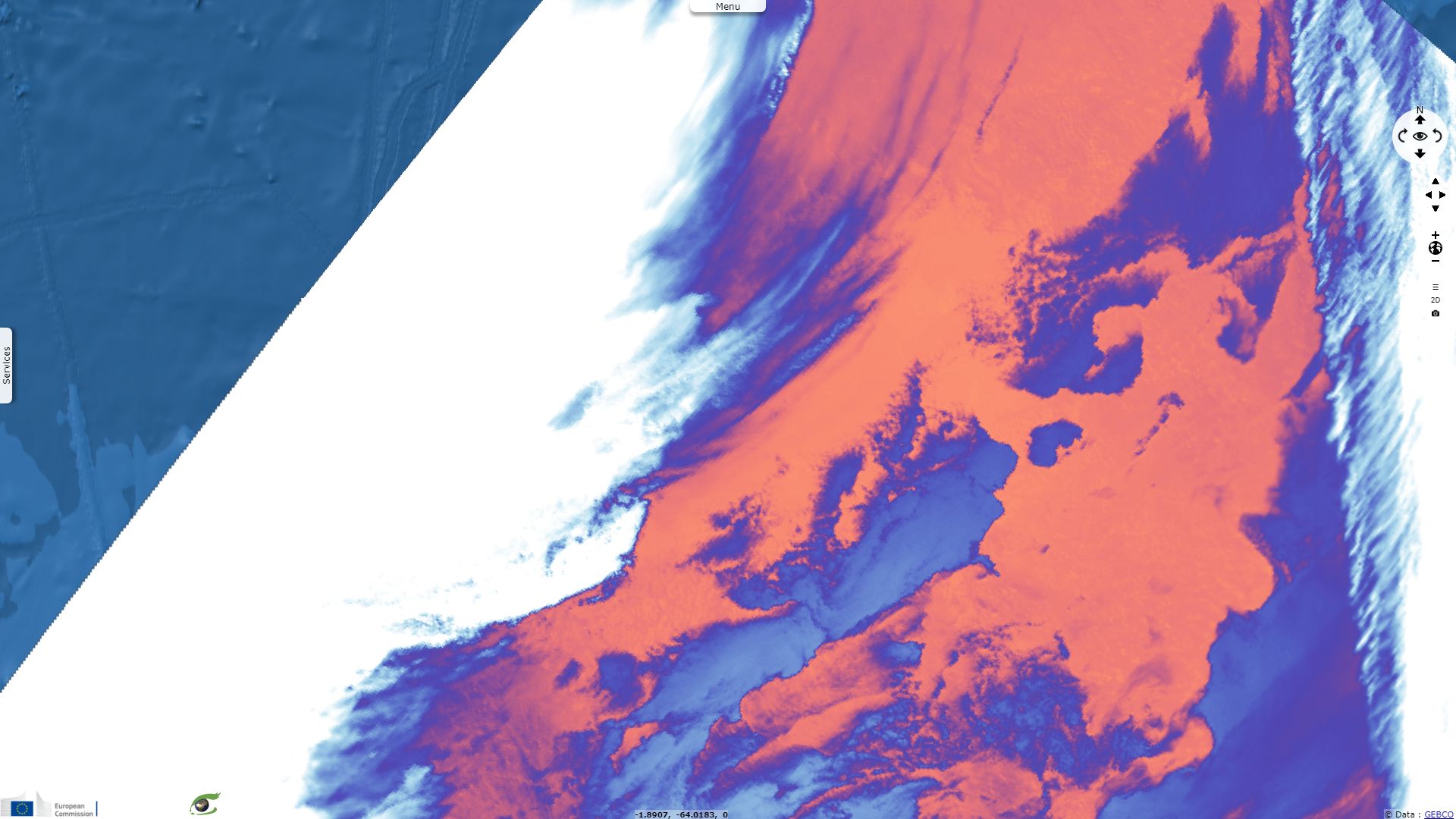
Sentinel-3 SLSTR RBT acquired on 03 September 2017 at 23:18:26 UTC
...
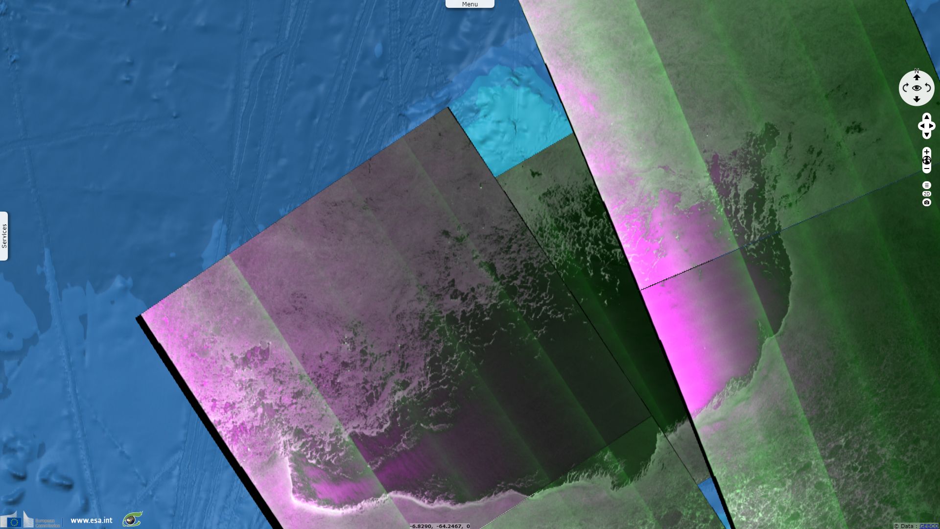
Sentinel-1 CSAR EW acquired on 18 November 2017 from 19:19:22 to 19:20:22 UTC & from 20:06:57 to 20:08:01 UTC
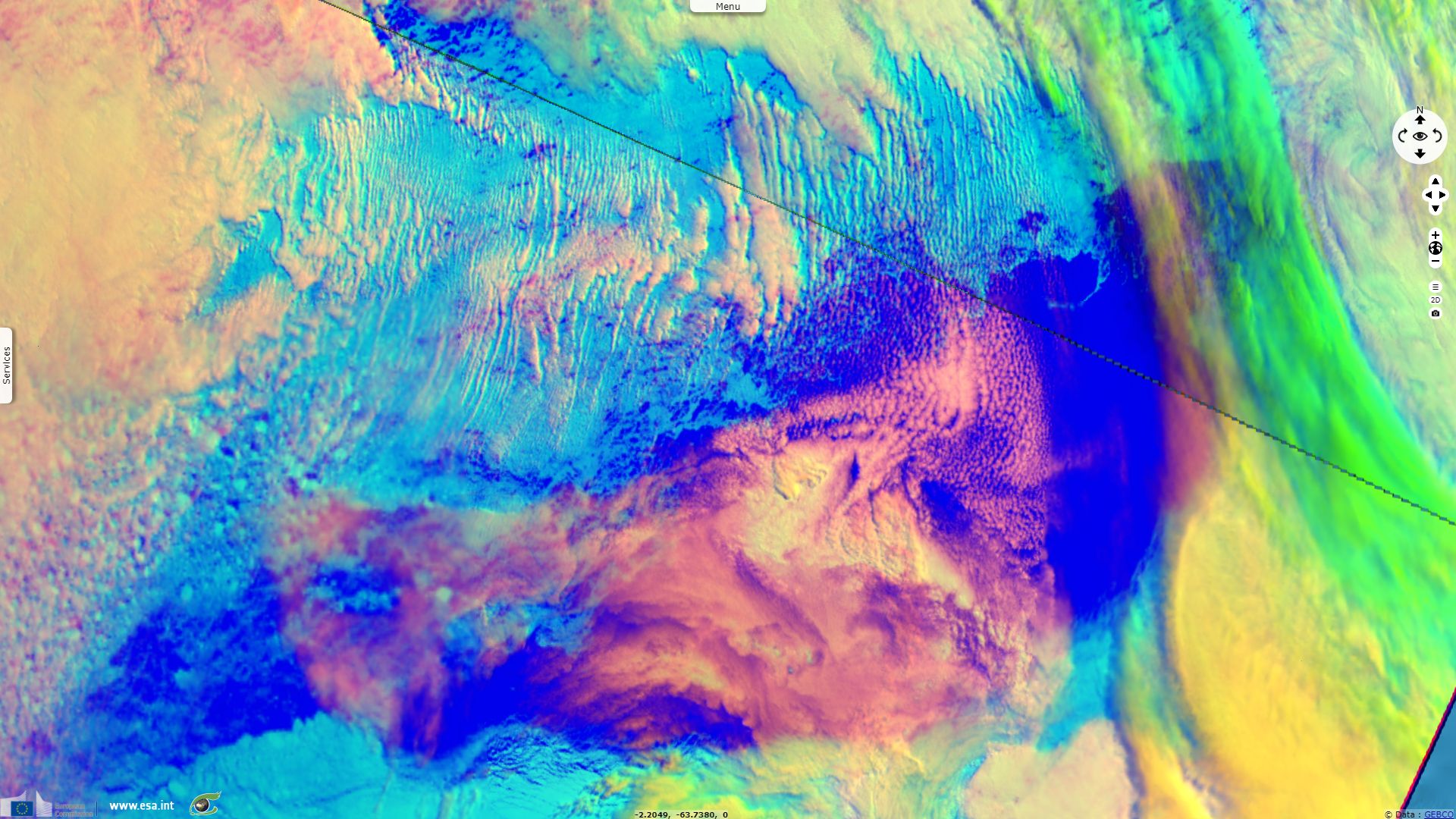
Sentinel-3 SLSTR RBT acquired on 21 November 2017 from 08:46:55 to 08:49:55 UTC
Sentinel-3 SLSTR RBT acquired on 03 September 2017 at 23:18:26 UTC
...
Sentinel-1 CSAR EW acquired on 18 November 2017 from 19:19:22 to 19:20:22 UTC & from 20:06:57 to 20:08:01 UTC
Sentinel-3 SLSTR RBT acquired on 21 November 2017 from 08:46:55 to 08:49:55 UTC
Keyword(s): Polar, climate, polynya, sea ice, open sea, Weddell Sea, Antarctic Ocean

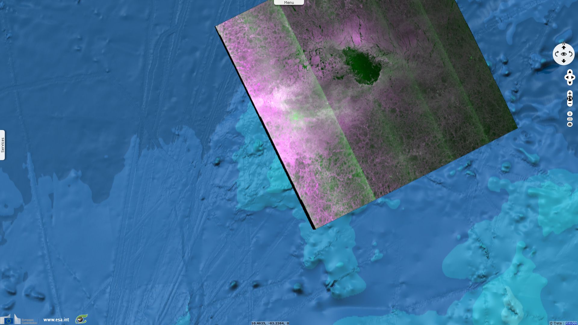
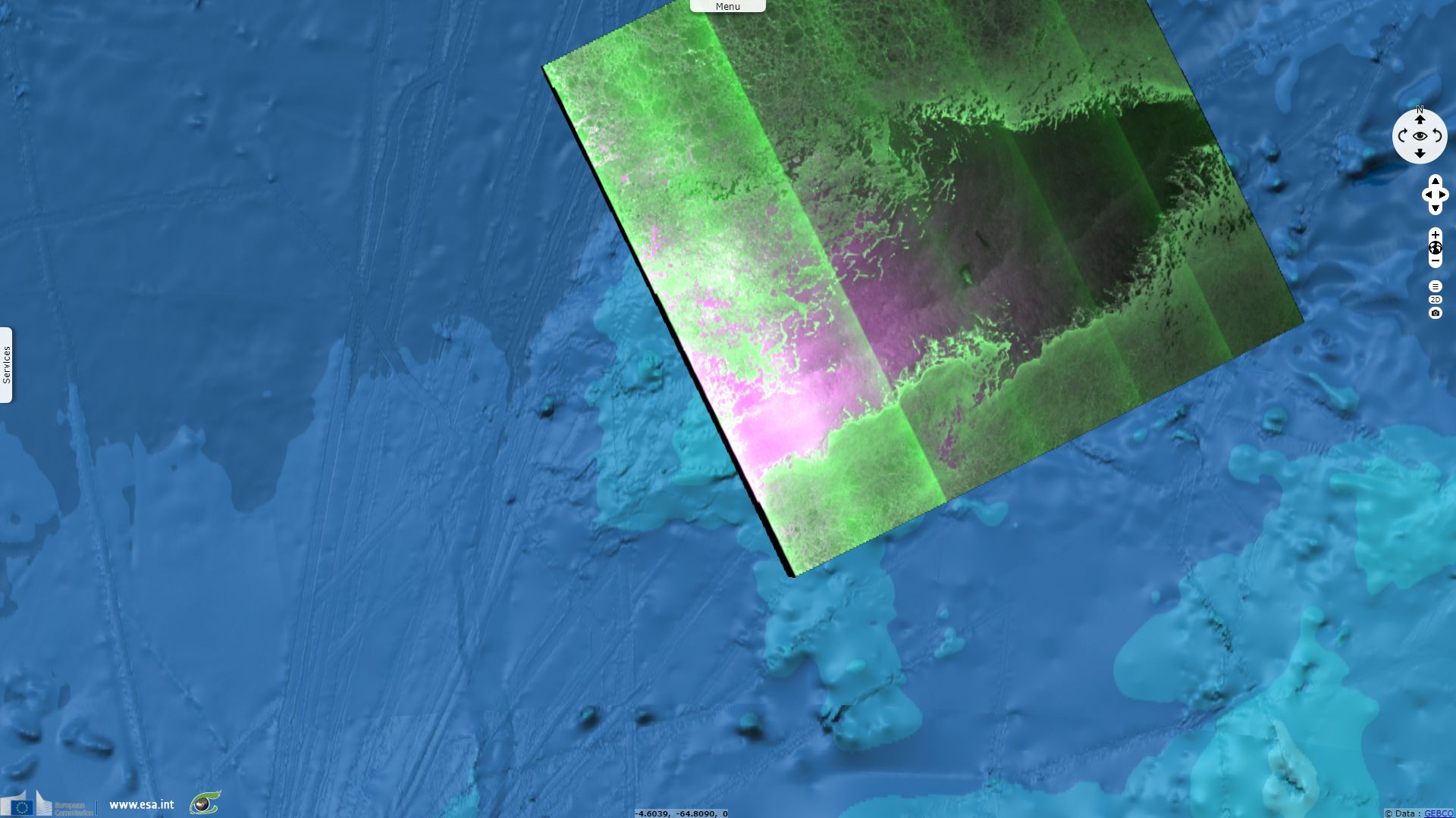
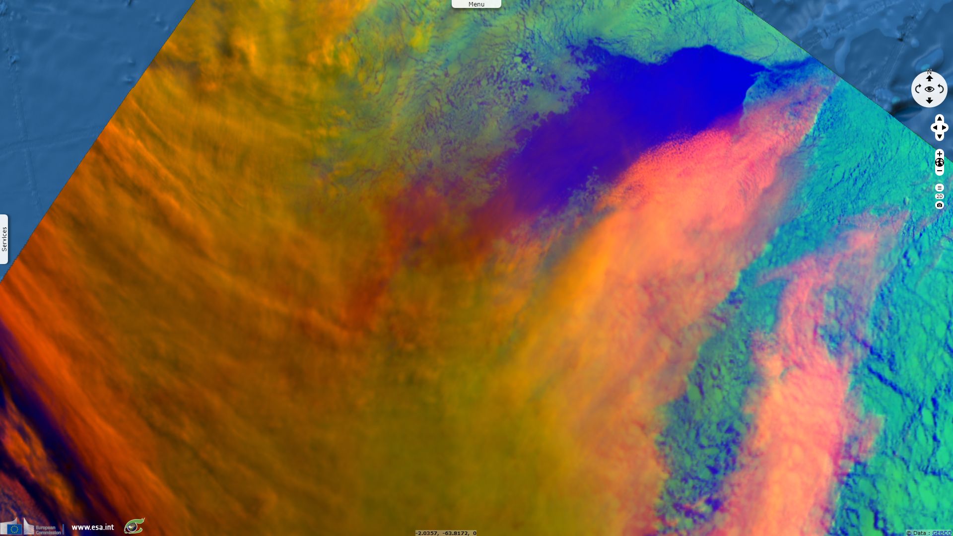
These three animations use images acquired from 02.09.2017 to 21.11.2017, using respectively Sentinel-1 EW images displayed in hh,hv,hh colour composite, Sentinel-3 SLSTR RBT displayed in S5,S1,S8 colour composite and Sentinel-3 SLSTR RBT using the S8 thermal band shown with thermal Look Up table.
On these animations, we can see a hole larger than Netherlands opening up in the Weddell Sea in Antarctica. This hole showed up in satellite images around September 3. According to Quartz, this hole – known as a polynya – "was about 30,000 square miles at its largest, making it the biggest polynya observed in Antarctica’s Weddell Sea since the 1970s."
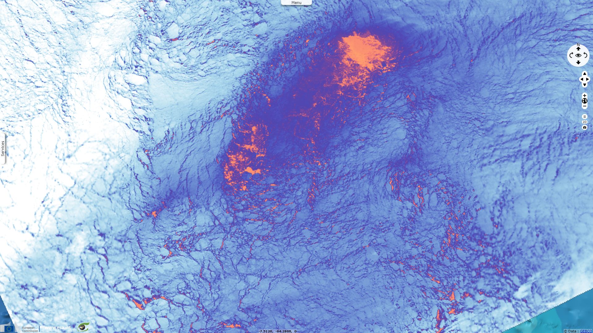
The polynya is already very visible on this thermal image acquired on a cloudless day at the beginning of September.
Indeed, Polynyas in the Antarctic ice are not a first. According to Bustle magazine, "On Dec. 11, 1972, at Vandenberg Air Force Base in California, the U.S. government launched an unmanned satellite named Nimbus V, one of the first satellites sent to observe Earth from space. In 1974, researchers were treated to images of Antarctica, including the Weddell Sea, an area of open ocean between the southern continent and the Atlantic. It was there that researchers observed the sea ice that covered the water during the Antarctic winter — but there was a hole in the ice in Antarctica, as big as the state of Oregon. It reappeared the next winter, when the ice spread out over the water, in the same spot, and again in 1976. But then in 1977 it disappeared, not to be seen for 40 years. But now, the hole is back."
On 1st October 2017, as ESA’s Mark Drinkwater showed the persistence of the Weddell Sea polynya, the very same day Carolina O. Dufour published in American Meteorological Society an article (first submitted in August 2016) explaining how, while only observed in the winters of 1974-76, the Weddell Sea polynya could be a recurring feature.
She explained: "The Weddell Sea polynya forms following a destabilization of the stratification leading to vertical mixing of warm deep waters to the surface that initially slows down the growth of sea ice and eventually prevents its formation (e.g., Martinson et al. 1981; Goosse and Fichefet 2001). The heat brought to the surface originates from a reservoir of relatively warm waters [~(0.5°–1°C)] in the subsurface [~(300–1500 m)]; Gordon 1998). Once the polynya is formed, the surface ocean is directly exposed to the freezing atmosphere (~−30°C) inducing a strong cooling of surface waters that eventually become dense enough to sink to the deep ocean. The sinking waters are replaced by the more buoyant subsurface waters that are cooled down and the vertical exchange continues. An intense chimney of deep convection (~3000 m; Gordon 1978) thus takes place in the polynya region. The polynya closes once the convection shuts down owing to the depletion of the subsurface heat reservoir (Martinson et al. 1981; Martin et al. 2013) or an excessive input of freshwater at the surface (Comiso and Gordon 1987). Hence, the buildup of a heat reservoir in the subsurface is a necessary precondition for the occurrence and maintenance of the polynya."
In other places in the world, polynyas can also be formed as winds push sea ice away from land, it is called latent-heat polynya.
On this colour composite, open sea (blue) is the warmest feature and is both absorbent in visible and mid infrared. Sea ice (cyan) is a few degrees colder but reflects better in visible than in mid infrared. Clouds properties vary depending on their altitude, they are colder and show in red to yellow to green, or even in white for lower clouds. A mix of sea ice, open sea and translucent clouds over an area results in a mix of those colours.
At this time, it would be premature to connect polynya to climate change and scientists aren’t sure what this polynya will mean for Antarctica’s oceans and climate (changing circulation currents in the Southern Ocean could be caused by climate change). The induced convection process could affect circulation currents. The lower albedo of polynya compared to surrounding ice means that a lower fraction of sunlight is backscattered to space as ultimately the ocean absorbs more heat.
It is likely that marine mammals could be using this new opening to breathe and feed. Indeed, polynyas play an important role in Antarctic marine ecology, as they offer a free place for marine mammal that don’t migrate during winter and bring light to phytoplankton that can grow in the polynya. This second phenomenon initiates the food chain.
The views expressed herein can in no way be taken to reflect the official opinion of the European Space Agency or the European Union.
Contains modified Copernicus Sentinel data 2026, processed by VisioTerra.
Contains modified Copernicus Sentinel data 2026, processed by VisioTerra.
| More on European Commission space: |  |
 |
 |
||||
| More on ESA: | |
|
|
S-1 website | S-2 website | S-3 website | |
| More on Copernicus program: | |
|
|
Scihub portal | Cophub portal | Inthub portal | Colhub portal |
| More on VisioTerra: | |
|
|
Sentinel Vision Portal | Envisat+ERS portal | Swarm+GOCE portal | CryoSat portal |