The Panama Canal, waterway between the Atlantic Ocean and the Pacific Ocean
Landsat7 ETM acquired on 17 January 2001 and 28 May 2002
Sentinel-2 MSI acquired on 30 January 2017 and 21 September 2022
Sentinel-1 CSAR IW acquired on 27 August 2023 at 11:06:51 UTC
Sentinel-2 MSI acquired on 30 January 2017 and 21 September 2022
Sentinel-1 CSAR IW acquired on 27 August 2023 at 11:06:51 UTC
Keyword(s): Infrastructure, canal, marine traffic, ship, hydrology, climate change, Panama
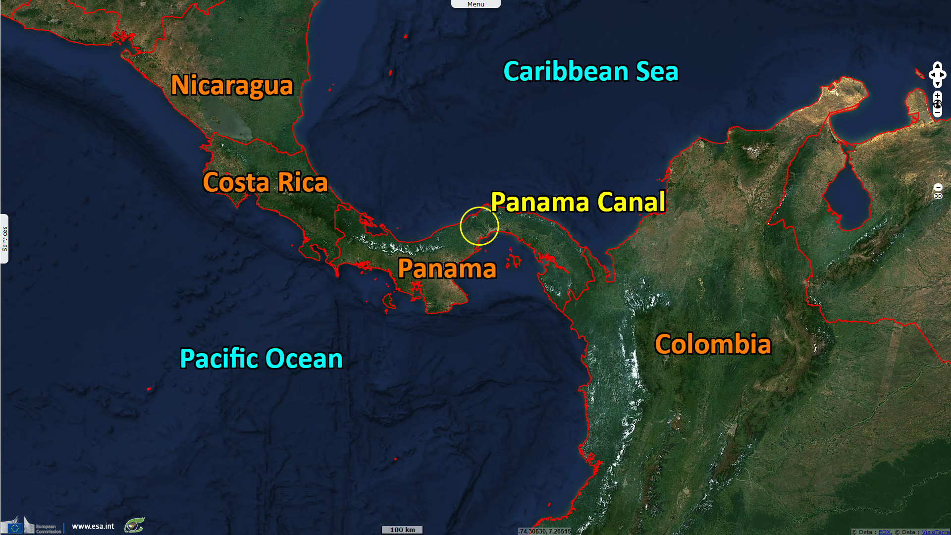
The Panama Canal is an artificial waterway connecting the Atlantic and Pacific oceans.
Inaugurated in 1914, it is a major shipping route, largely to and from the United States, China, Chile, and South Korea (Source pancanal.com).
Each year, more than 13,000 vessels and 250 million long tons of cargo pass through this canal (13,369 in 2020, 13,342 in 2021 and 14,239 in 2022 - Source pancanal.com).
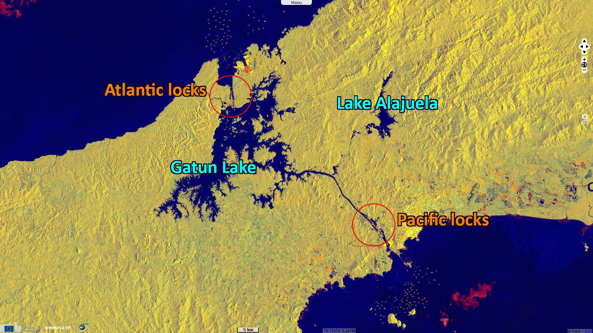
The passage of each vessel through the canal uses an average of 200,000 m3 of fresh water.
To supply the canal, two artificial lakes were created, Gatun Lake in 1913 and Lake Alajuela in 1935.
Gatun Lake, with a surface area of 425 km², is part of the canal route for approximately 30 km.
Lake Alajuela, with a surface area of 50 km², provides 45% of the canal's water and supplies Panama City with drinking water.
These two lakes smooth out annual rainfall variations. However, climate change, deforestation and competition for fresh water uses are having an impact on canal traffic.
For example, in December 2010, the canal was closed for 17 hours due to high water levels in the lakes (Nasa Earth Observatory).
Conversely, passage restrictions were put in place in August 2023 due to low water levels caused by drought (CNBC).
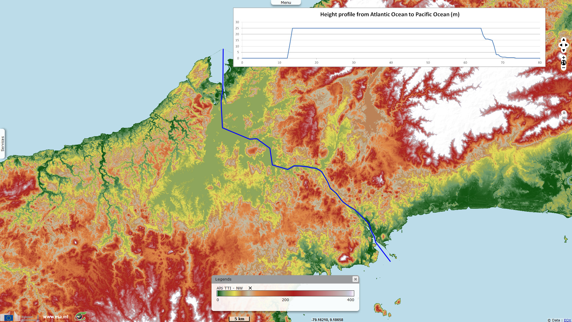
80km long, the history of the canal has been eventful.
The idea of the Panama Canal dates back to the 16th century when the first European explorers crossed the isthmus of Panama.
Work began in 1881, under the direction of the Frenchman Ferdinand de Lesseps, the man behind the Suez Canal.
Accidents on the site and illnesses like malaria and yellow fever led to a high mortality rate among the workers.
In September 1882, an earthquake caused major damage to the construction site.
Originally, the canal was to be open to the sea (sea level), but the terrain made the project too complex, and in 1887, Lesseps finally adopted a project with locks.
The project fell behind schedule and costs soared.
In 1889, the company managing construction of the Panama Canal went bankrupt, and in 1892, the Panama scandals broke out.
The United States took over the project in 1902, construction resumed in 1904 and the canal was inaugurated in 1914. More details may be found here.
In 2006, a national referendum approved the proposal of the Panama Canal expansion project.
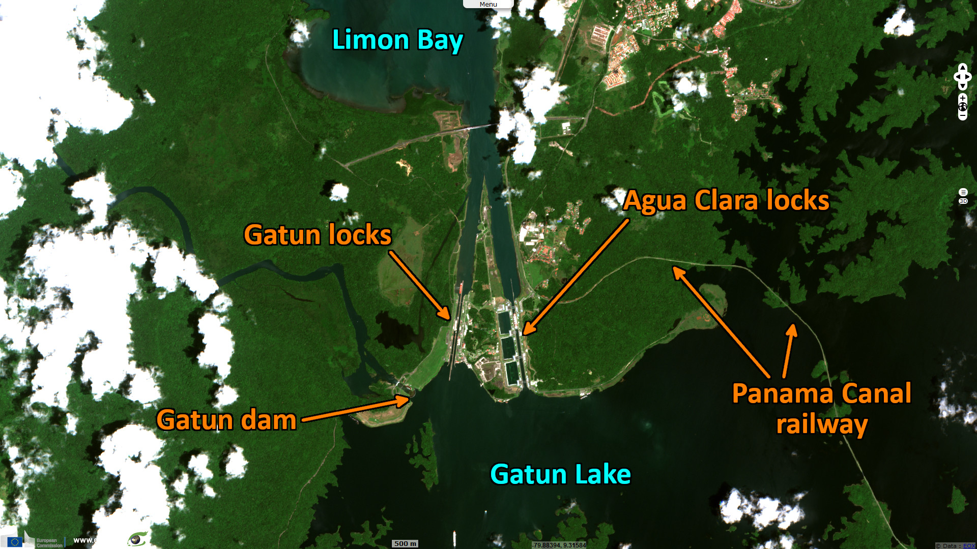
Work began in 2007, with the addition of two new sets of locks, one each on the Atlantic and Pacific sides, allowing larger vessels to pass through.
The expansion was opened on 26 June 2016 and doubled the Canal’s capacity.
On the Atlantic side, the Agua Clara locks complement the Gatun locks.
The new locks are made up of 3 chambers and 3 water saving basins, reducing the amount of water that is needed in lock operation.

On the Pacific side, the Cocoli locks complement the Pedro Miguel locks (1911) and the Miraflores locks (1913).
The design of the Cocoli locks is similar to that of the Agua Clara locks (3 chambers and 3 water saving basins).
The views expressed herein can in no way be taken to reflect the official opinion of the European Space Agency or the European Union.
Contains modified Copernicus Sentinel data 2026, processed by VisioTerra.
Contains modified Copernicus Sentinel data 2026, processed by VisioTerra.
| More on European Commission space: |  |
 |
 |
||||
| More on ESA: | |
|
|
S-1 website | S-2 website | S-3 website | |
| More on Copernicus program: | |
|
|
Scihub portal | Cophub portal | Inthub portal | Colhub portal |
| More on VisioTerra: | |
|
|
Sentinel Vision Portal | Envisat+ERS portal | Swarm+GOCE portal | CryoSat portal |