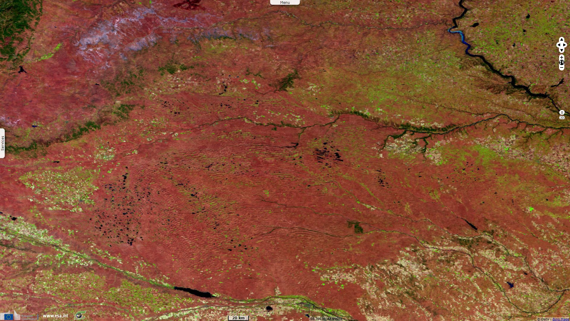
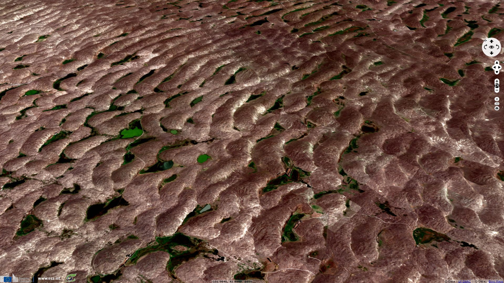
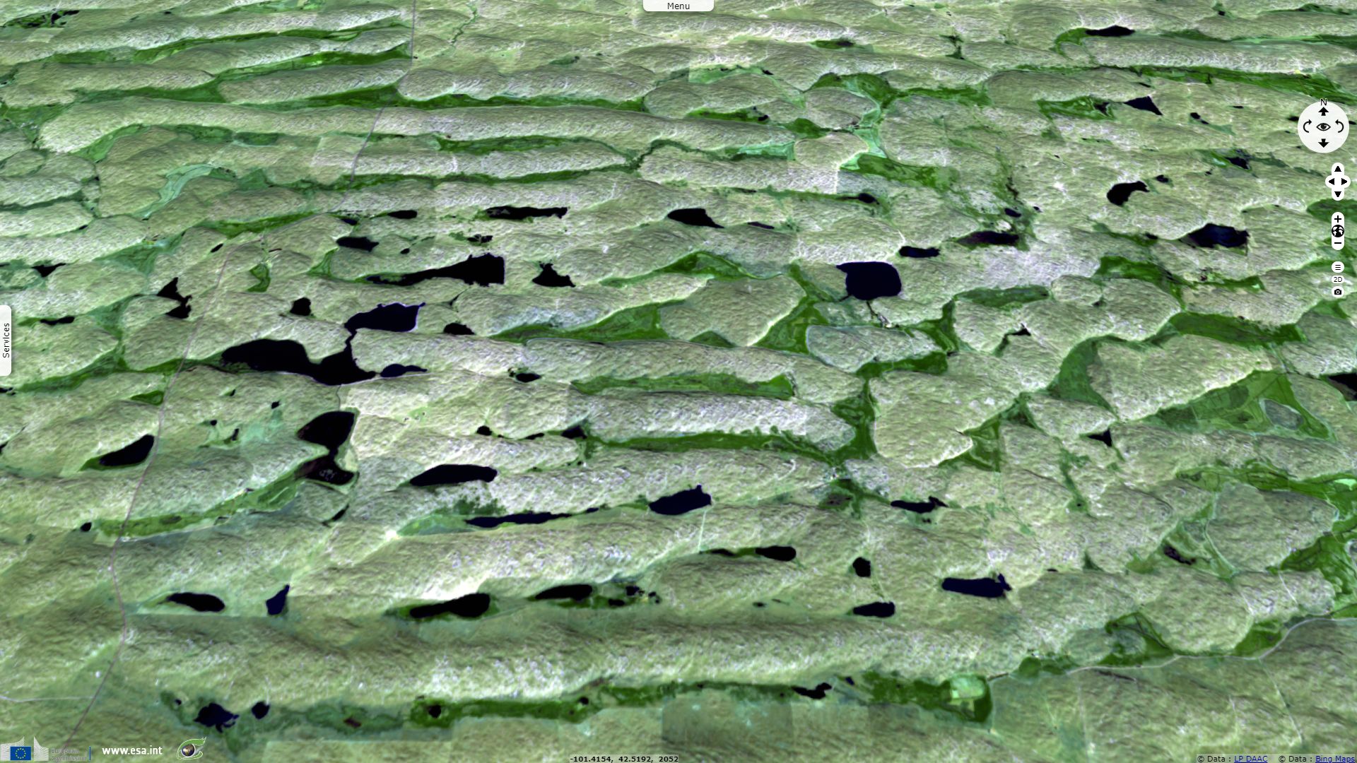
Nebraska Sandhills wetland endangered by irrigated agriculture
Sentinel-3 OLCI FR acquired on 03 November 2016 at 17:11:45 UTC
Sentinel-3 SLSTR RBT acquired on 03 November 2016 at 17:11:45 UTC
...
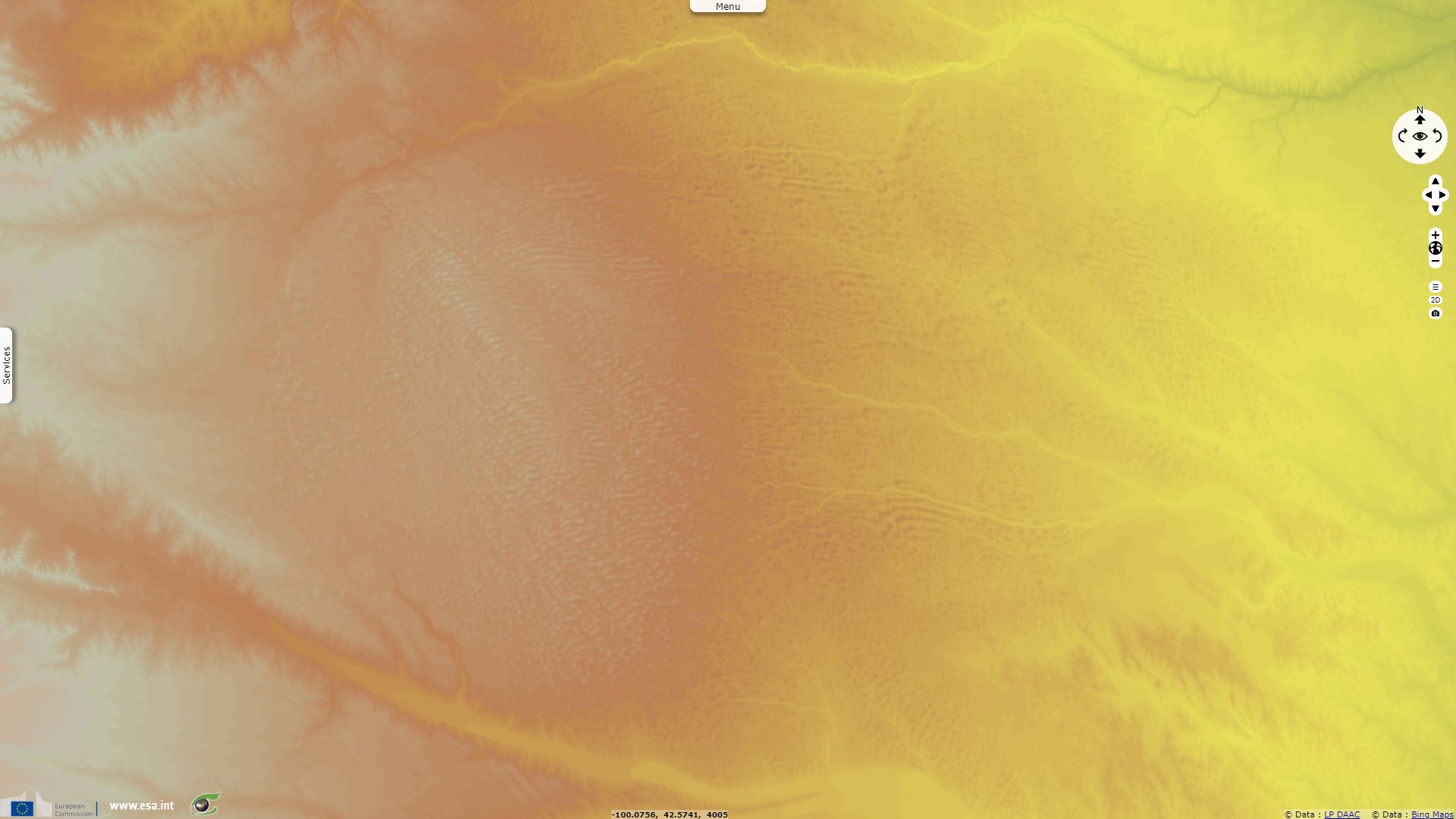
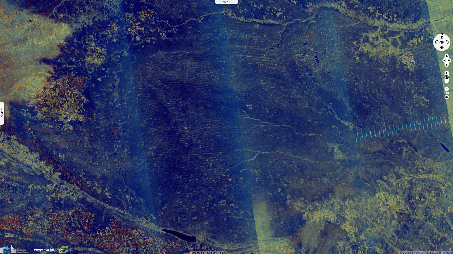
Sentinel-1 CSAR IW acquired on 04 September 2018 at 00:37:55 UTC
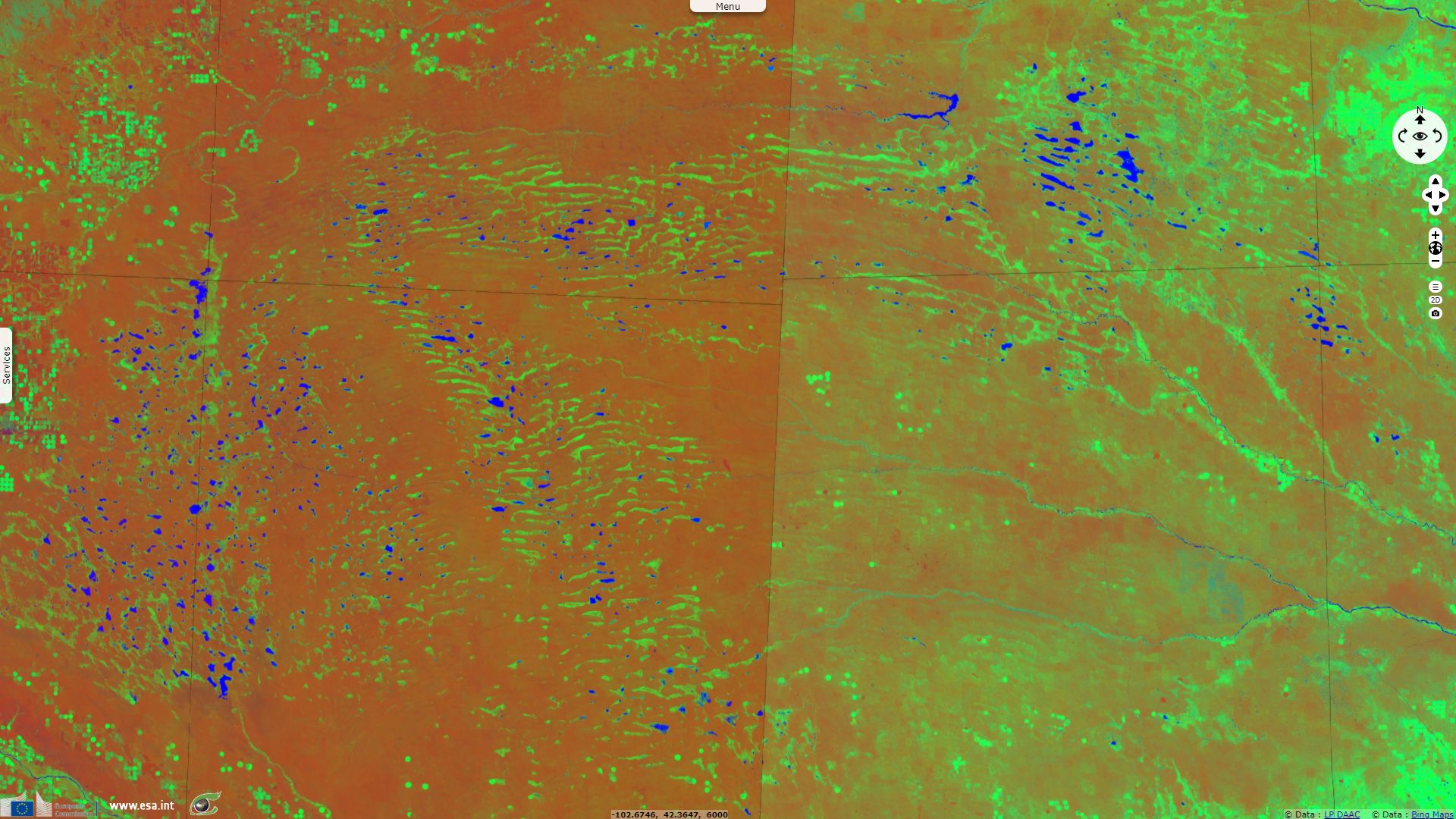
Sentinel-2 MSI acquired on 16 September 2018 at 17:39:39 UTC
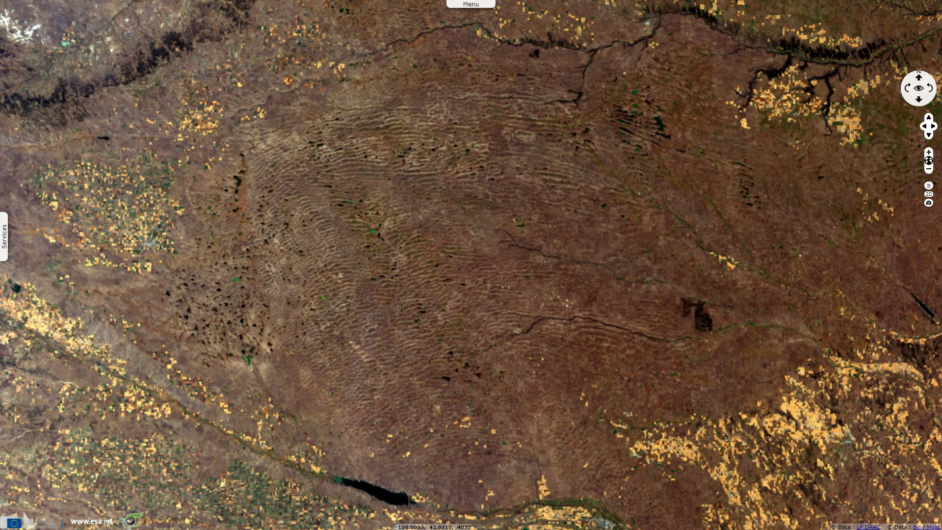
Sentinel-3 SLSTR RBT acquired on 03 November 2016 at 17:11:45 UTC
...
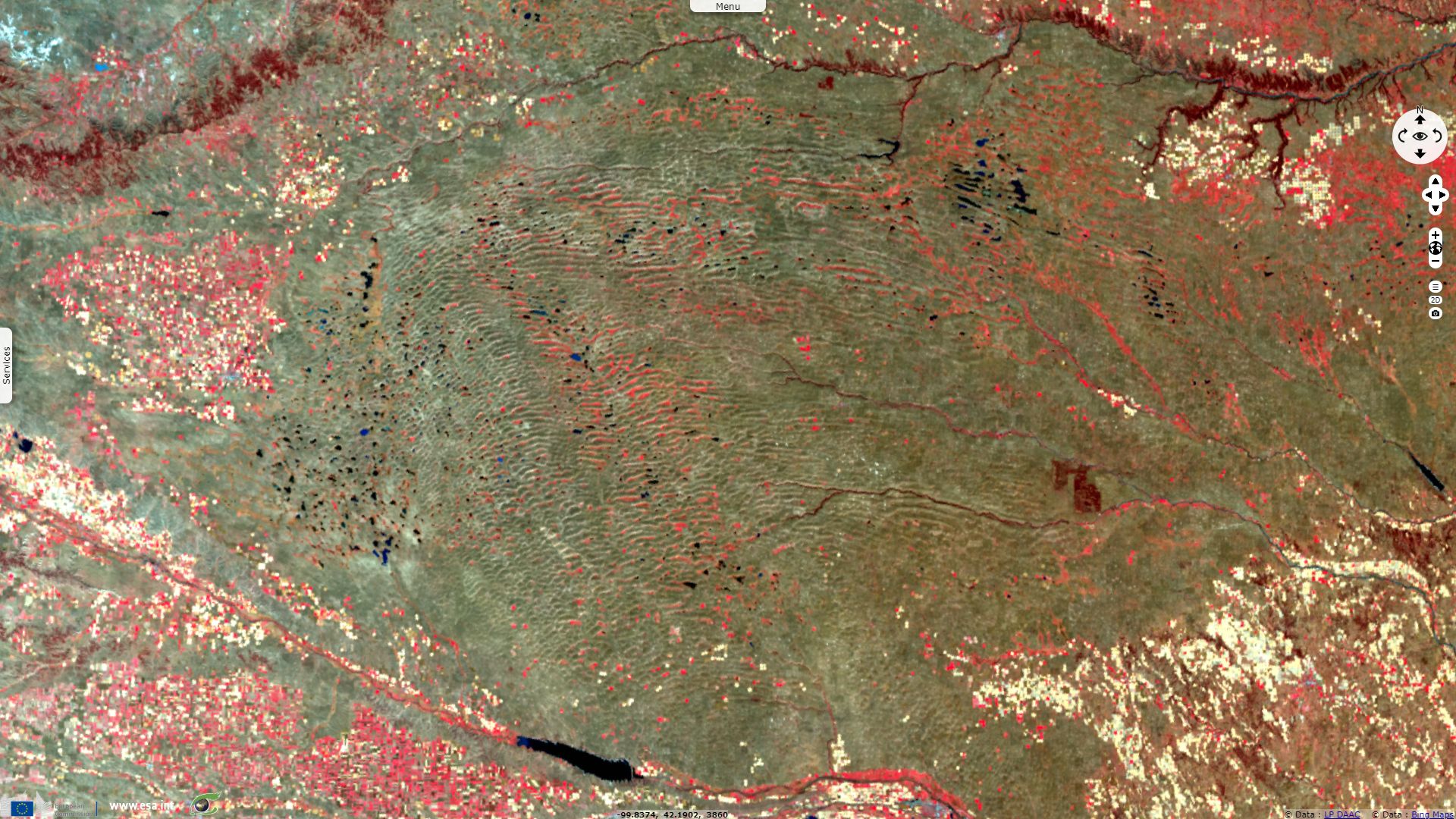
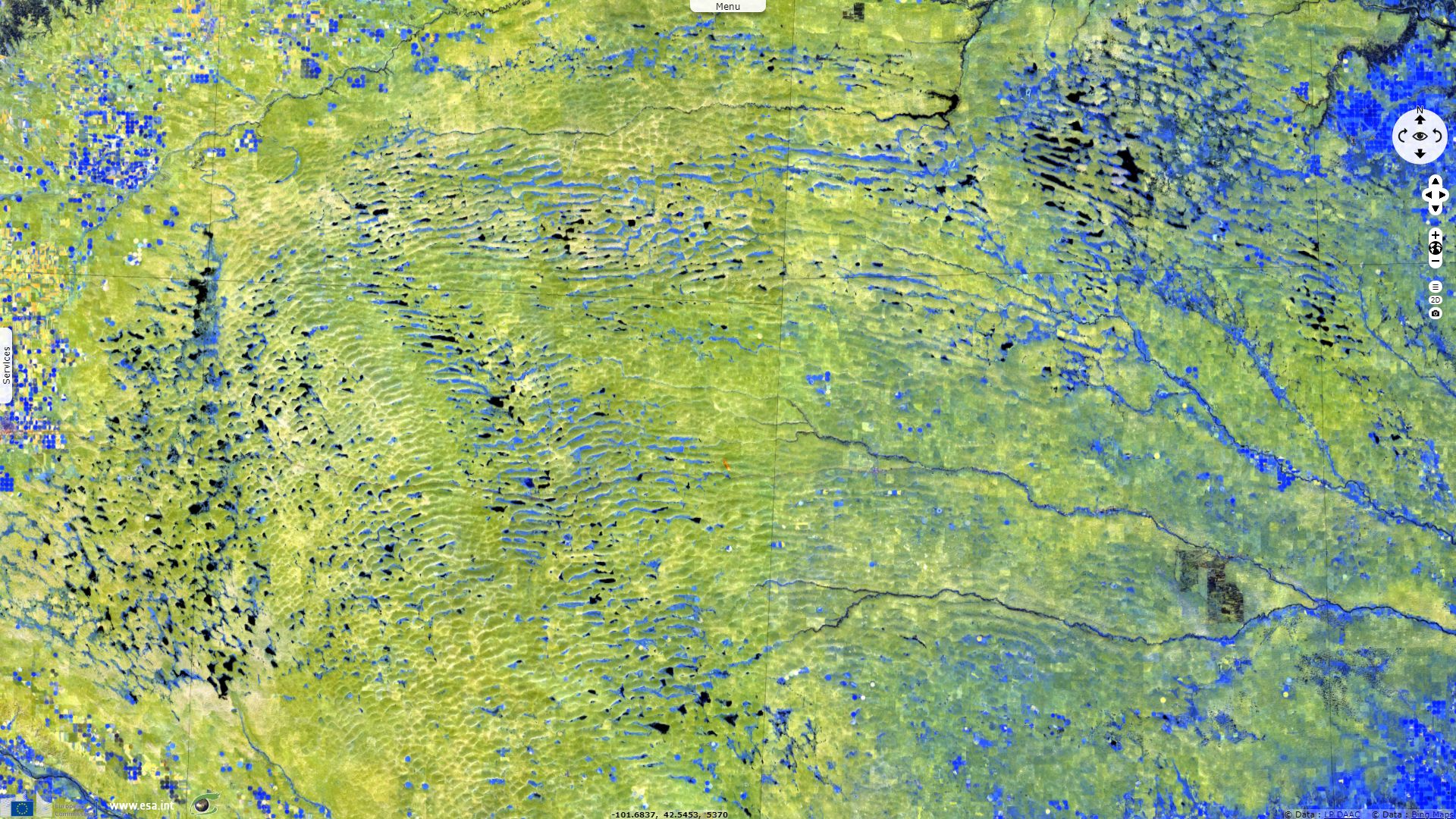
Sentinel-1 CSAR IW acquired on 04 September 2018 at 00:37:55 UTC
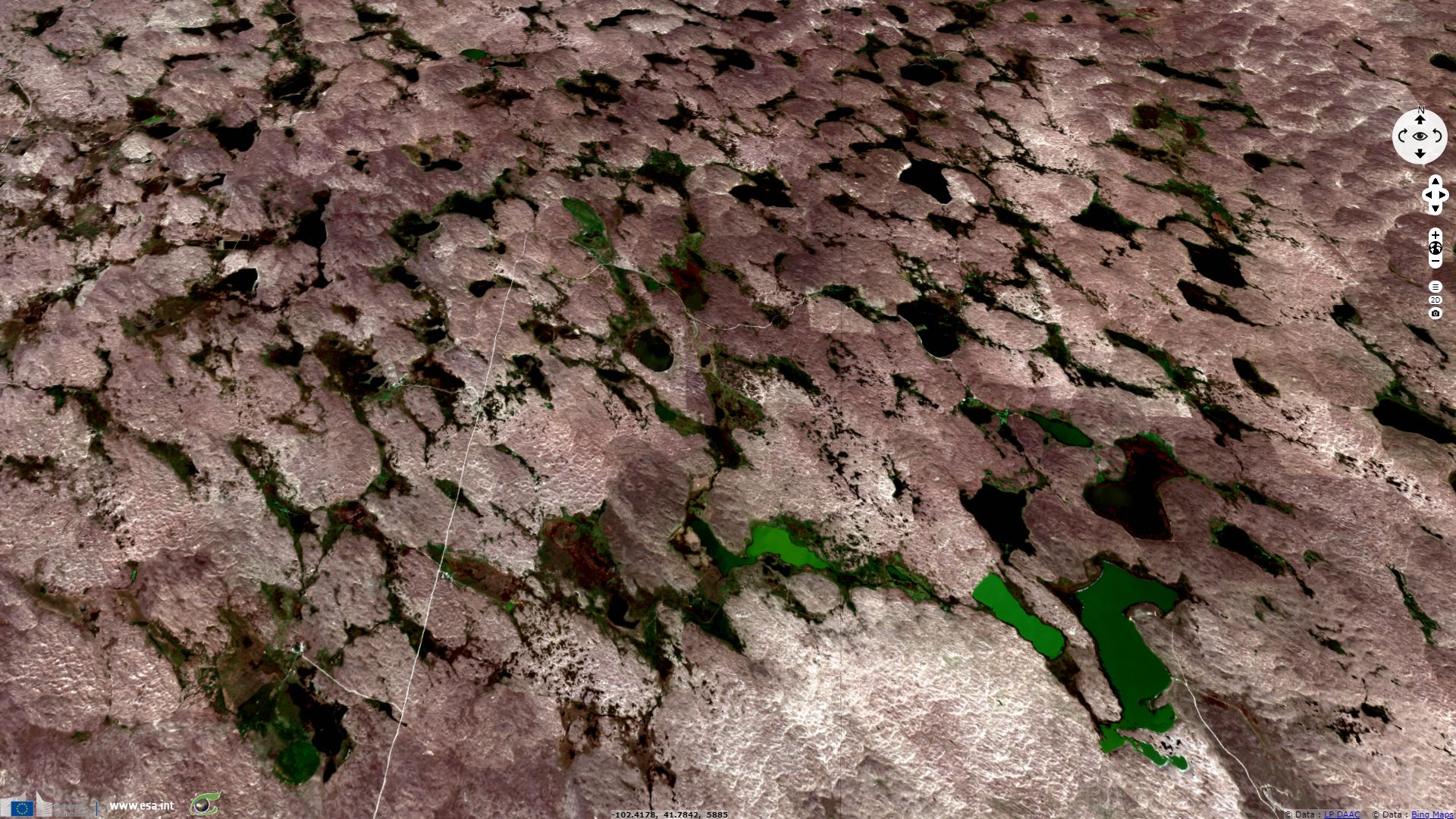
Sentinel-2 MSI acquired on 16 September 2018 at 17:39:39 UTC
Keyword(s): Land, hydrology, wetland, lake, dunes, agriculture, irrigation, aquifer, erosion, USA, United States
The US Fish and Wildlife Service introduce Nebraska Sandhills, saying: "The Nebraska Sandhills is a unique area, both in size and appearance. Native grassland covers 7570 km² of wind-deposited sand dunes." The US National Park Service made it a National Natural Landmark as: "Nebraska Sand Hills is the largest sand dunes complex in the Western Hemisphere. The site differs from other large dunes of the world because it is almost completely stabilized by vegetation." "Its geology makes the area rich for wildlife, water and ranching."
According to the World Wildlife Fundation, "The Sand Hills contain the most intact natural habitat of the Great Plains ecoregions. The Sand Hills contain a distinct grassland association dominated by sand bluestem (Andropogon hallii), Calamovilfa longifolia, and needleandthread (Stipa comata)."
"It is estimated that as much as 85% of the Sand Hills is still intact. Toward the eastern section of this ecoregion, habitat loss and degradation are higher than in the rest of the Sand Hills due to central pivot irrigation and development. Degradation of the tallgrass prairie is less in the Sand Hills than in other grassland ecoregions; fragility of soils has dissuaded excessive overgrazing and cropping (Sims 1988). In overgrazed areas, decreases in little bluestem (Schizachyrium scoparium), needleandthread (Stipa comata), and Andropogon hallii, and increases in hairy grama (Bouteloua hirsuta), Calamovilfa longifolia, and dropseed (Sporobolus cryptandrus) are apparent.
Very little of the Sand Hills has been plowed; remaining blocks cover large parts of the ecoregions. The absence of farming in the region and other developments contribute to an extraordinarily low level of fragmentation for a Great Plains ecoregion."
While the land use of the Nebraska Sand Hills ecoregion has not changed much, the dynamic of the hydrological system underneath, Ogallala Aquifer, has been deeply modified as it is explained by the US Fish and Wildlife Service: "The sand dunes' influence on the area's hydrology is the basis of the Sandhills ecology. Hundreds of feet of course sand and gravel lie below the surface and contain one of the largest aquifers in North America. The dunes act like a giant sponge that quickly absorbs precipitation, allowing very little to run off. One fourth to one-half of the annual rainfall percolates downward to the groundwater. In the lower interdunal valleys, the water table is elevated above the surface and forms many of the 3210 km² of wetlands scattered throughout the area."
"Wetland drainage began in the early 1900's to provide additional winter hay for livestock. The linear orientation of the dunes allowed ditches to connect from one valley to the next until they reached natural streams. Drainage extended the reach of natural streams and affected the balance of groundwater and wetlands. Wetlands that once buffered the discharge of groundwater were no longer effective and a continual discharge of groundwater occurs into the ditches. The added flows cause natural streams to adjust their shape to wider and deeper channels. As the streams cut downward, the lower streambeds capture more groundwater, lower the local water table, drain adjacent wetlands, and lower the productivity of the valleys."


Left: "Digital map of saturated thickness in the High Plains aquifer in parts of Colorado, Kansas, Nebraska, New Mexico, Oklahoma, South Dakota, Texas, and Wyoming, 1996 to 1997"; the depth is maximal underneath Nebraska Sand Hills - Source: Brian C. Fischer
Right: Effects of Stream Degradation on the Local Water Table - Source: USFWS
"Cultivation attempts in the early 1900's failed because the semi-arid climate did not provide adequate rainfall to sustain row crops. Today, abundant groundwater supplies and center pivot irrigation has made it possible to irrigate the porous and erodible sands. The sandy soils require large amounts of water and fertilizer to grow crops. The excess water leaches agrichemicals downward to the local water table. Domestic wells are becoming contaminated with nitrates and pesticides. Pumping water from deep depths to the surface has flooded the local water table and increased stream flows. Thus, adding to the impact of wetland drainage and channelization."
Large scale extraction for agricultural purposes started after World War II due partially to center pivot irrigation and to the adaptation of automotive engines for groundwater wells. Today about 27% of the irrigated land in the entire United States lies over the aquifer, which yields about 30% of the ground water used for irrigation in the United States. The aquifer is at risk for over-extraction and pollution. Since 1950, agricultural irrigation has reduced the saturated volume of the aquifer by an estimated 9%. Once depleted, the aquifer will take over 6000 years to replenish naturally through rainfall.
The depletion between 2001 and 2008, inclusive, is about 32% of the cumulative depletion during the entire 20th century. In the United States, the biggest users of water from aquifers include agricultural irrigation and oil and coal extraction.
US Fish and Wildlife Service goes further : "Nebraska’s wetland resources have been greatly reduced since settlement. Historically, Nebraska contained an estimated 7185 km² of wetlands that covered about 6% of the State. By 1989, approximately 2481 km² of wetland or 35% had been lost, and many of the remaining wetlands have been degraded. Wetland losses primarily occurred as a result of agricultural and urban development and was accomplished primarily by draining, filling, tiling, ditching, digging concentration pits, land leveling, stream degradation, and increasing sedimentation. While wetlands have been lost throughout Nebraska, we estimate that about 90% of the historic Rainwater Basins, 45% of central Platte River wet meadows, and 36% of the original Sandhills wetlands have been lost."
Nebraska Sand Hills and the Ogallala Aquifer are both threatened by the last section of the Keystone XL Pipeline project. Keystone XL, attracted opposition from environmentalists, becoming a symbol of the battle over climate change and fossil fuels. In 2015 Keystone XL was temporarily delayed by then–President Barack Obama. On January 24, 2017, President Donald Trump took action intended to permit the pipeline's completion.
The views expressed herein can in no way be taken to reflect the official opinion of the European Space Agency or the European Union.
Contains modified Copernicus Sentinel data 2026, processed by VisioTerra.
Contains modified Copernicus Sentinel data 2026, processed by VisioTerra.
| More on European Commission space: |  |
 |
 |
||||
| More on ESA: | |
|
|
S-1 website | S-2 website | S-3 website | |
| More on Copernicus program: | |
|
|
Scihub portal | Cophub portal | Inthub portal | Colhub portal |
| More on VisioTerra: | |
|
|
Sentinel Vision Portal | Envisat+ERS portal | Swarm+GOCE portal | CryoSat portal |