Lasting arsenic pollution in Salsigne gold mine, France
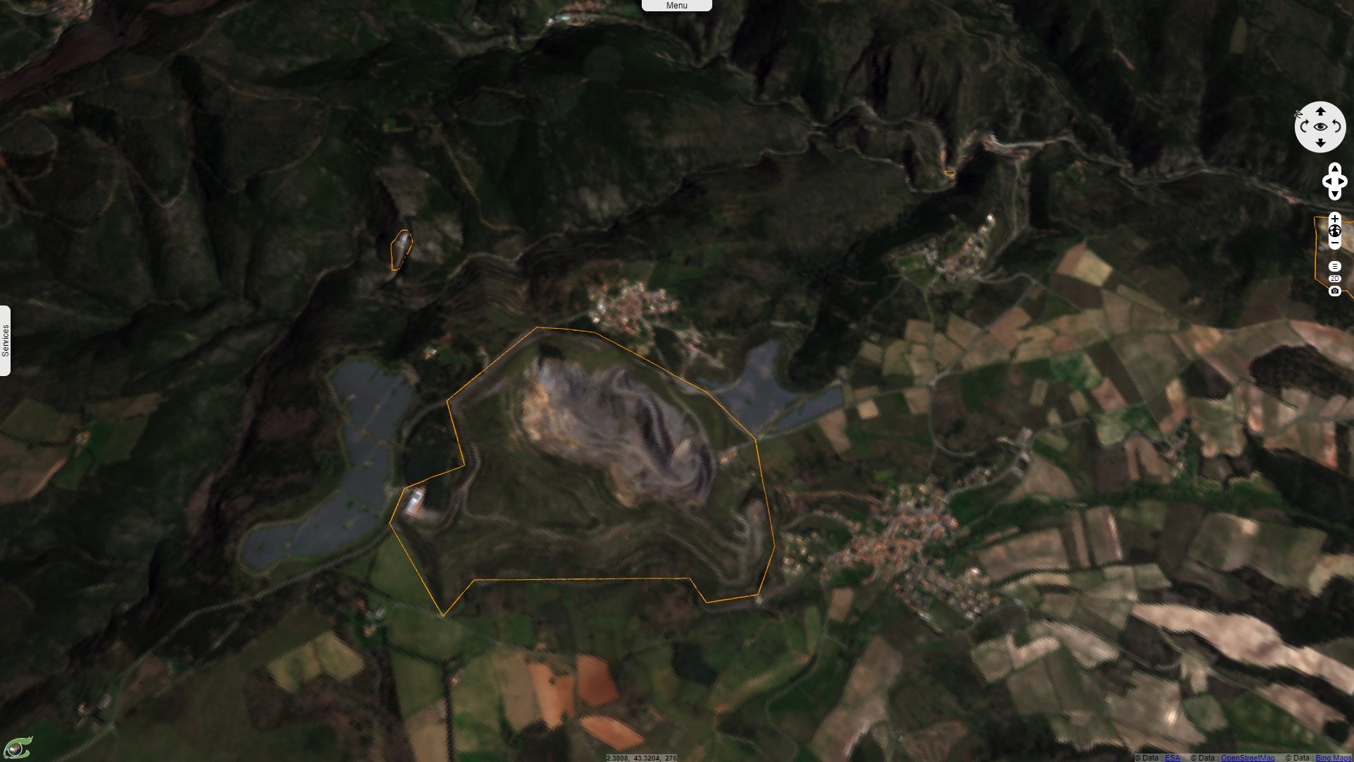
Sentinel-2 MSI acquired on 23 September 2016
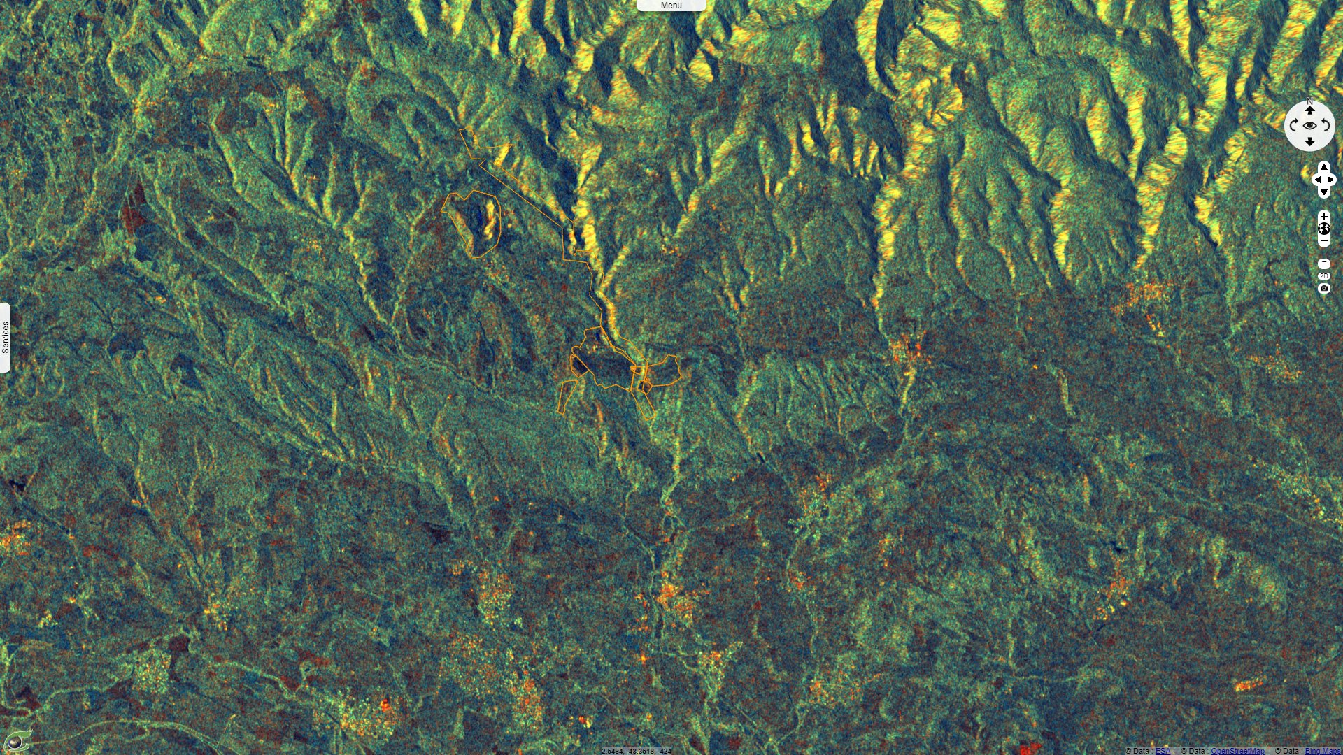
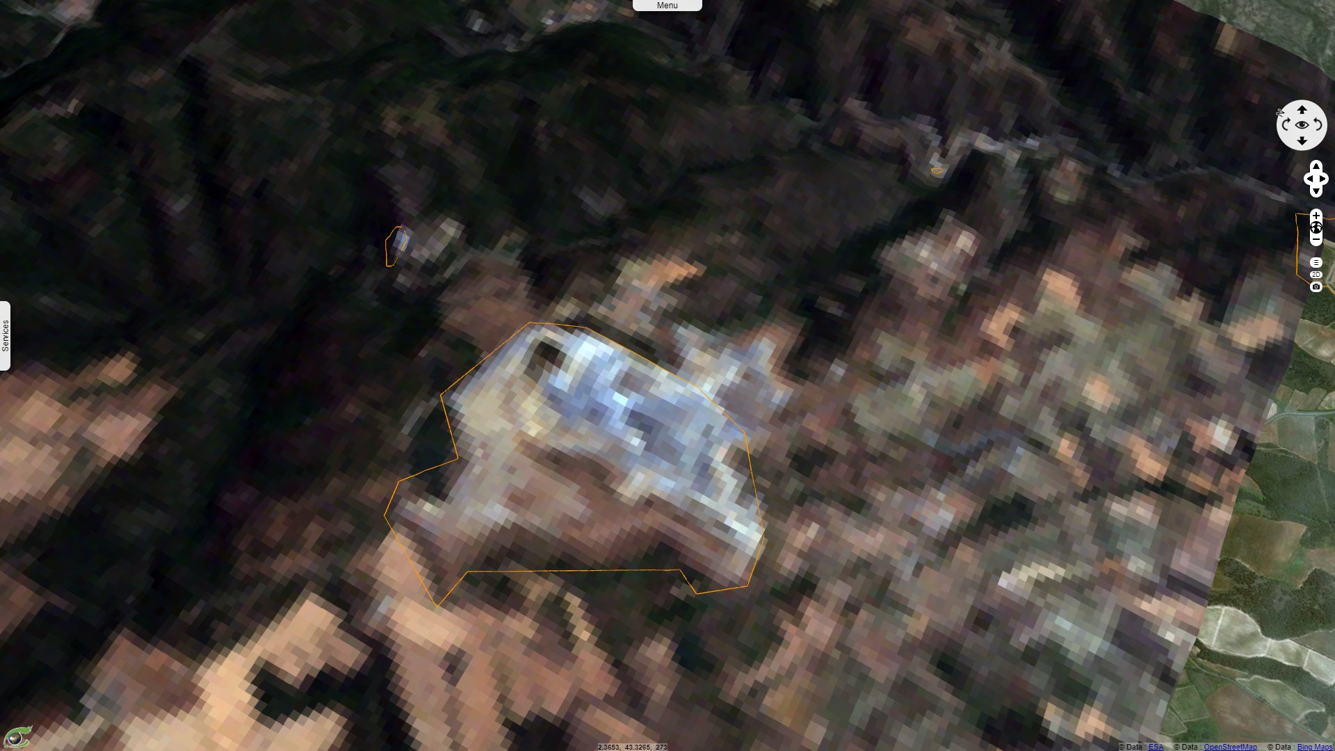
Sentinel-1 CSAR IW acquired on 12 September 2016
...
Sentinel-1 CSAR IW acquired on 06 April 2018
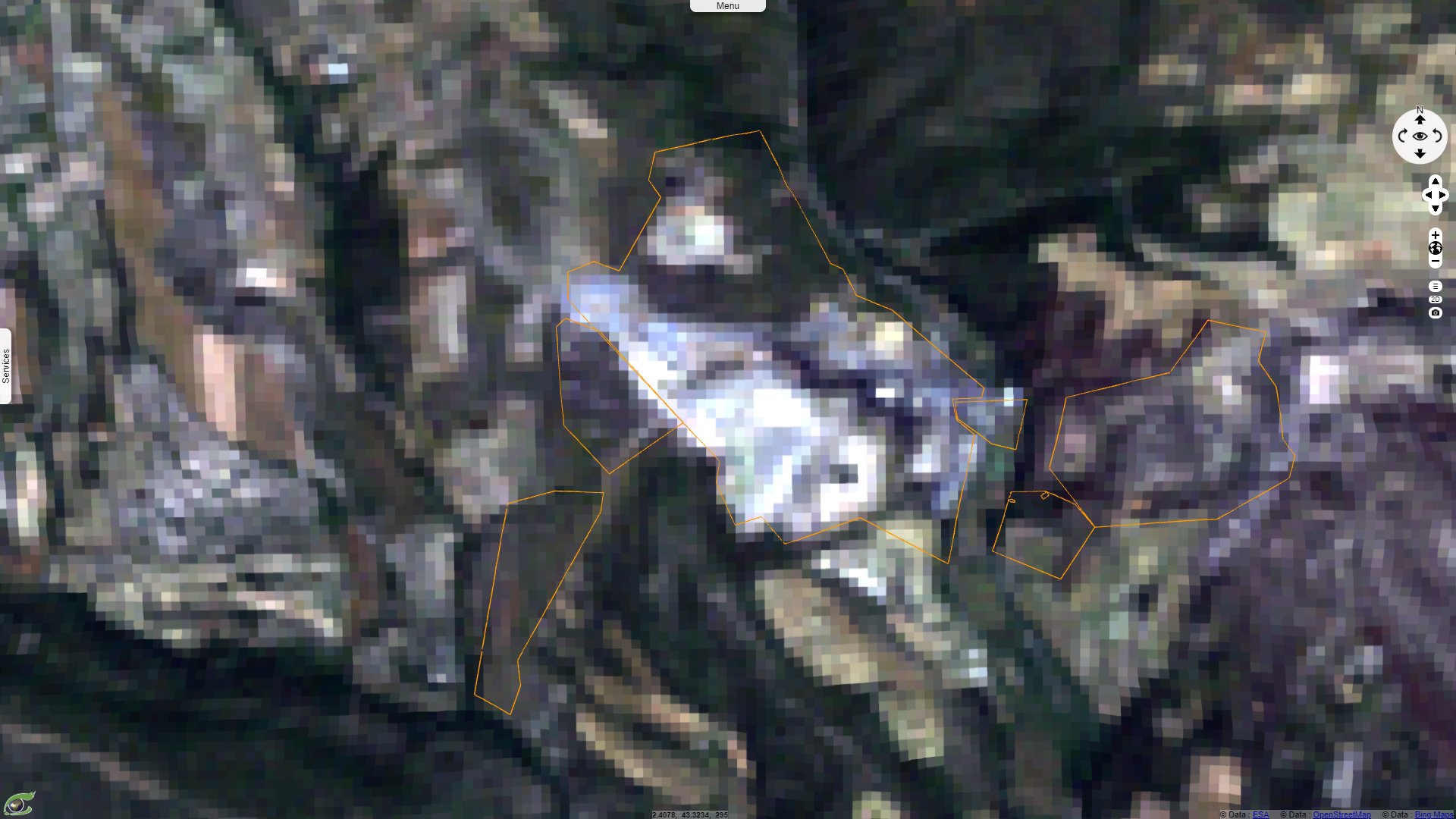
Sentinel-2 MSI acquired on 20 April 2020
Keyword(s): Natural ressources, mines, pollution, environment, health, biodiversity, France.
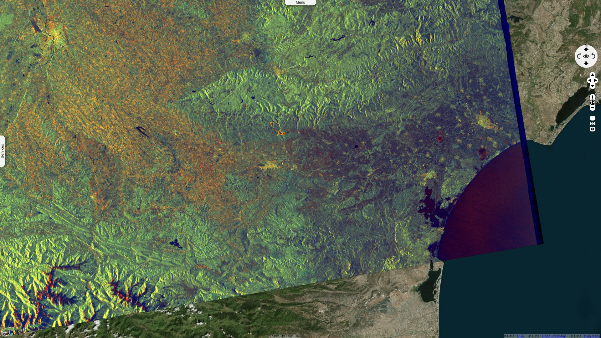
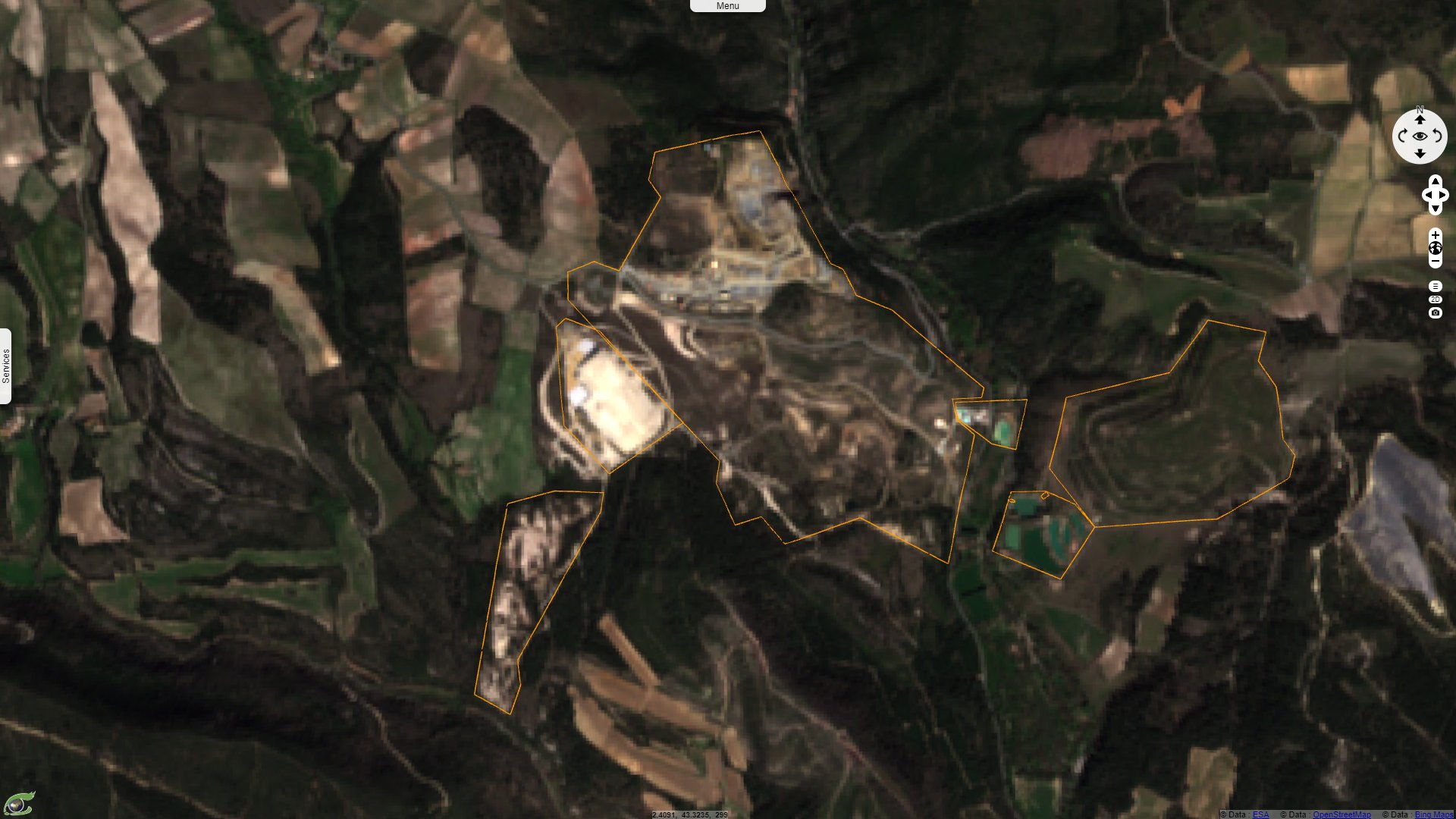
Salsigne mine (Aude, France) is located on the southern flank of the Montagne Noire, 15 km north of Carcassonne, and its exploitation dates back to Gallo-Roman times. From that time until the 19th century, iron was exploited sporadically, with the discovery of gold only at the end of the 19th century. From 1892 to 2004, the Salsigne mine provided tons of gold, silver or copper, as well as work to a whole valley.
It was the largest arsenic mine in the World with 10% of the production, 500 000 tons have been extracted during its history. The ore contained 15% Arsenic, 0.67% Copper, 0.13% Bismuth, 0,07% lead, 0.04% antimony, 0.03% Zinc. It also contained 114 g/t of silver and 14 g/t of gold, which made of Salsigne the biggest gold mine in Europe. 120 tons of gold (which could hold in 25 m3) have been extrated in these 112 years, requiring the processing of millions of tons of material.
In a study dedicated to the Salsigne gold mine, the Geological Society of France reminds: "Arsenic occurs naturally in soils and waters upstream of all potential anthropogenic sources of pollution. Leaching studies on soil and alluvial samples have clearly shown a correlation between the results on the media and those on the leachate."
Le Monde newspaper wrote on 05 December 2018: "The cumbersome legacy of this century-long gold rush is the millions of tonnes of waste filled with arsenic, sulphur and bismuth that were found in the same rock as the precious metals, and that had to be buried somewhere, and which today form two hills, Artus (253 m) and the pech de Montredon (277 m). As a result, the water and soil are permanently contaminated in the Orbiel valley, the river on the banks of which the waste was buried." The name "Orbiel" means "old gold" in the langue d'oc; no doubt this river carried patches of gold in ancient times.
Frédéric Ogé, Research fellow at French National Centre for Scientific Research said during an interview by France Culture: "The problem is that this arsenic was extracted, modified in a way, and there it was caught in a gangue and the treatment was such, given the different processes (whether hydrometallurgy or pyrometallurgy), that this arsenic is found in infinitely higher doses than they were naturally. In addition, there are products that have been imported into this territory. Lead nitrates, for example, and of course cyanide, which were brought in at certain periods of exploitation in order to be able to extract metals that were of economic interest.
The clean-up is absolutely impossible, but to secure the site so that the arsenic released from the site is at 'relatively acceptable' doses, i.e. between 2 and 3 tonnes of arsenic per year that are released from this site and this will last for thousands of years."
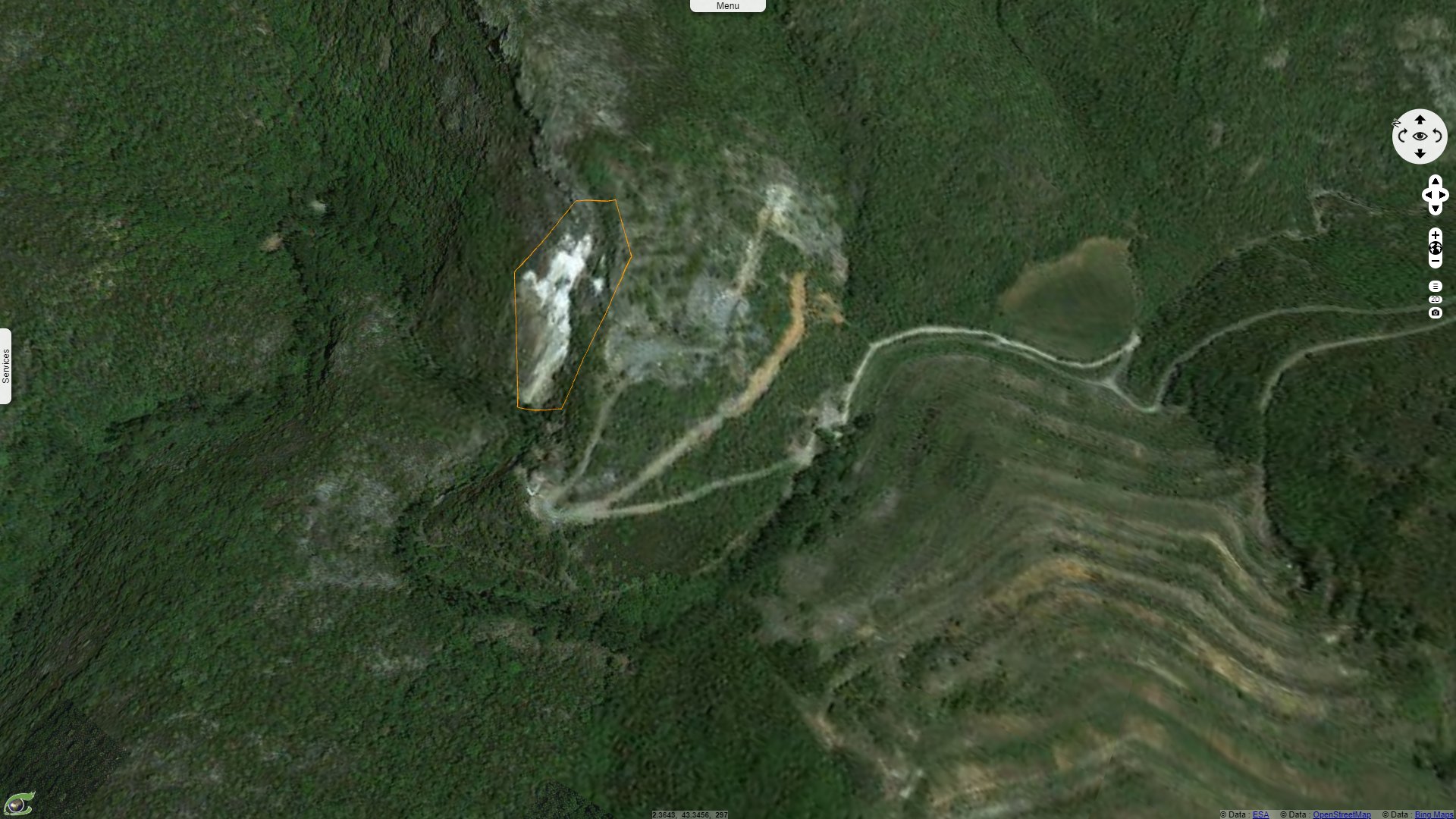
The Association SystExt wrote a report dedicated to the consequences of the exploitation of Salsigne mine. Regarding the arsenic deposit of the Nartau site, it states: "This mine waste dump is located to the north of the Salsigne open pit mine and more precisely on the Nartau site. From 1896 to 1910, the Nartau deposit was mined underground for mispickel, the ore from which iron and arsenic were extracted. Excavation waste rock and residues from pyrometallurgical processing were stored on site, for a total estimated volume of 20 000 tonnes. These materials, which are estimated to contain between 10 and 20% arsenic, were simply dumped into the slope and then abandoned on site. The slope overhangs the Grésillou River which flows into the Orbiel. Thus, the erosion of this deposit, although limited by the presence of a toe protection, is at the origin of high concentrations of arsenic in these watercourses, even today."
Frédéric Ogé adds "34 million euros from the French taxpayer's pocket - some say 55 million euros - have been spent to try to give this area a new face. But there is not only an aesthetic concern, there is also a concern for the protection of human health. So the French Agency for the Environment and Energy Management (ADEME) has tried to revegetate this area. For example, 30 tonnes of scrap iron per hectare were planted to allow a certain type of vegetation to return to the land, thanks to a clever mixture, and if there are no accidents, fires or catastrophic floods, perhaps in 20 or 30 years we will have a semblance of vegetation on this land which is, in a way, still abandoned, not to say stigmatised."
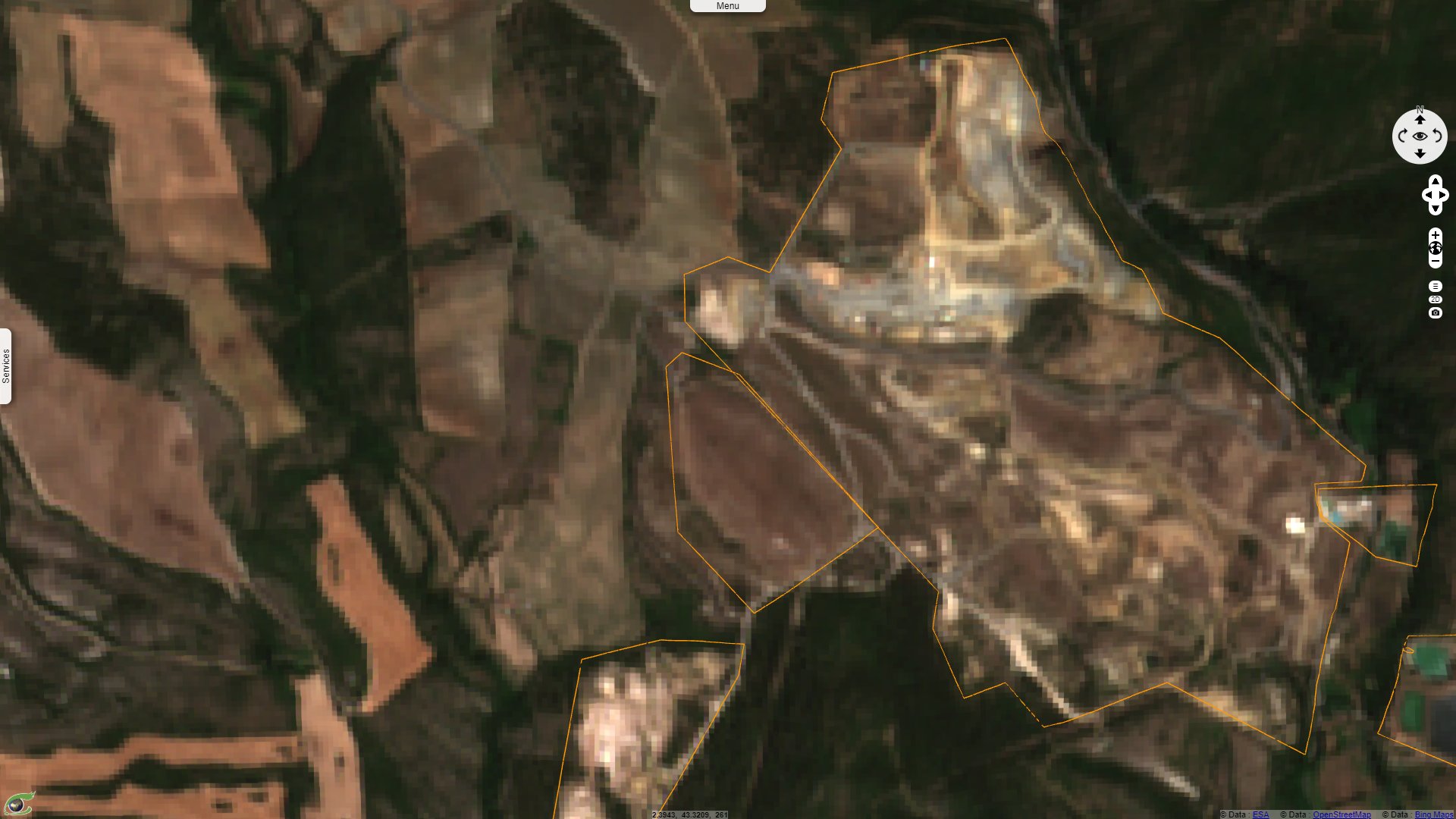
SystExt also deals with the phytoremediation attempt: "In the Salsigne district, the Combe du Sault site covers 120 hectares. The main ore processing facilities and numerous toxic product storage facilities were located there. The site was rehabilitated between 2000 and 2006 as part of the European "Difpolmine" programme. It consisted of dismantling and burying the infrastructure and waste, setting up a water management system and an extensive revegetation programme (the first in Europe to be applied on an industrial scale)."
Frédéric Ogé details the process: "This technique, based on the addition of an amendment that immobilises the pollutant and encourages the reinforcement of plant cover, helps to reduce the transfer of pollutants and also contributes to the aesthetic improvement of the sites concerned. In total, 10 hectares were phytostabilised, an operation for which 330 tonnes of steel shot were used. Planting and sowing were carried out after at least one month of stabilisation of the shot in the soil."
SystExt completes: "Different plant species capable of storing arsenic were used for this purpose. More than 10 years after the work was carried out, the difference between control and amended zones remains very blurred. And the revegetation, which has slowed down considerably, does not hide the stigma of a past that is still close..."
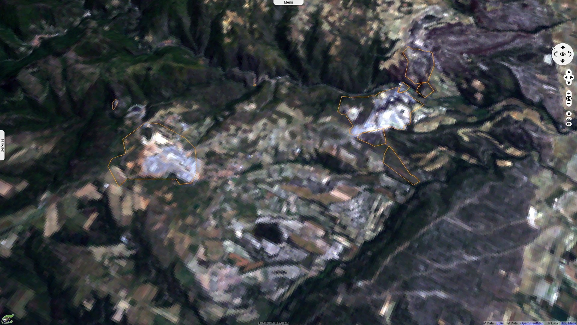
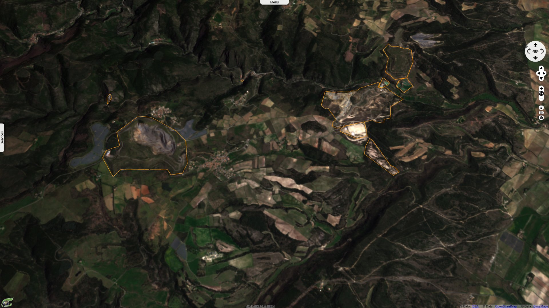
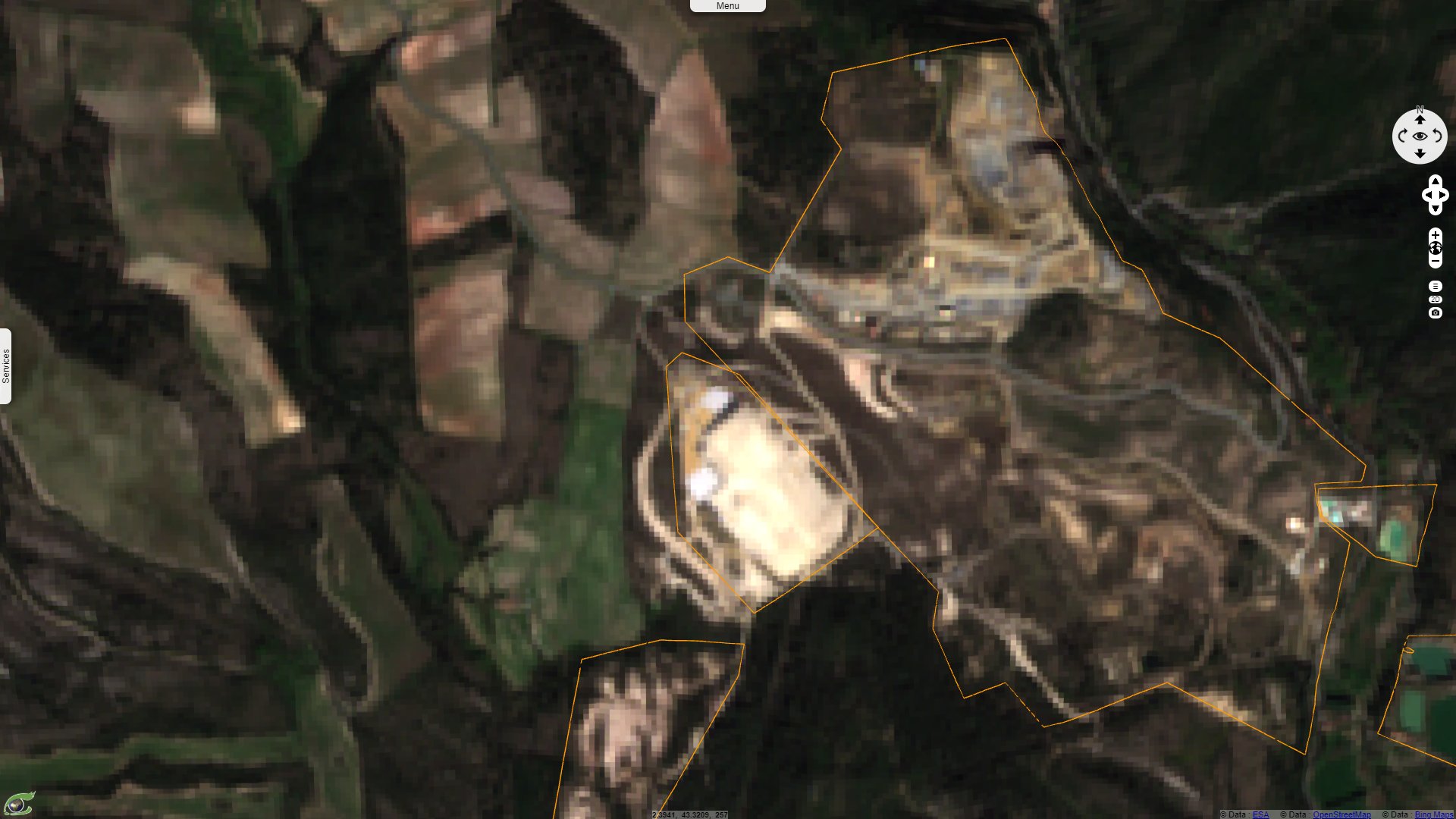
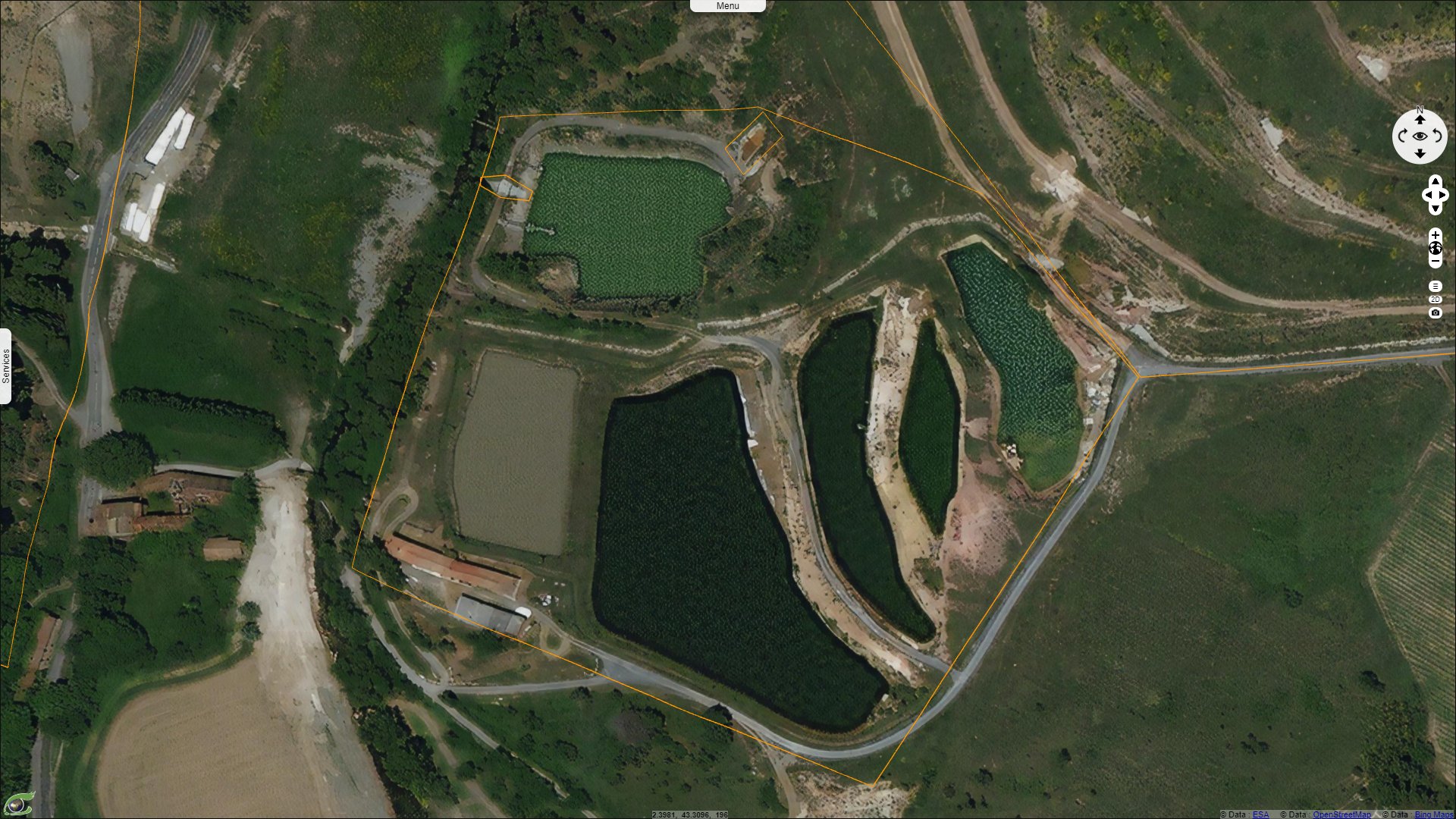
The rehabilitation of the site has lead to the creation of two large hills, the larger is known as Artus dam. SystExt explains: "From 1989 to 1997, SNC Lastours installed a cyanidation unit on the Combe du Sault site to reprocess the residual gold from the tailings that had originally been stored there. The waste from this reprocessing, together with that produced in parallel by flotation, is stored in the Artus dam, for a total volume of 7 million cubic metres. This storage was made safe in 2004-2005 by modelling, placing a cover of clay and marl and then vegetating. As the Artus is not watertight, drains and 6 evaporation basins were installed at the foot of the dyke to recover the percolating water. This water represents a major environmental problem, as it constitutes 70% of the flow entering the water treatment plant."
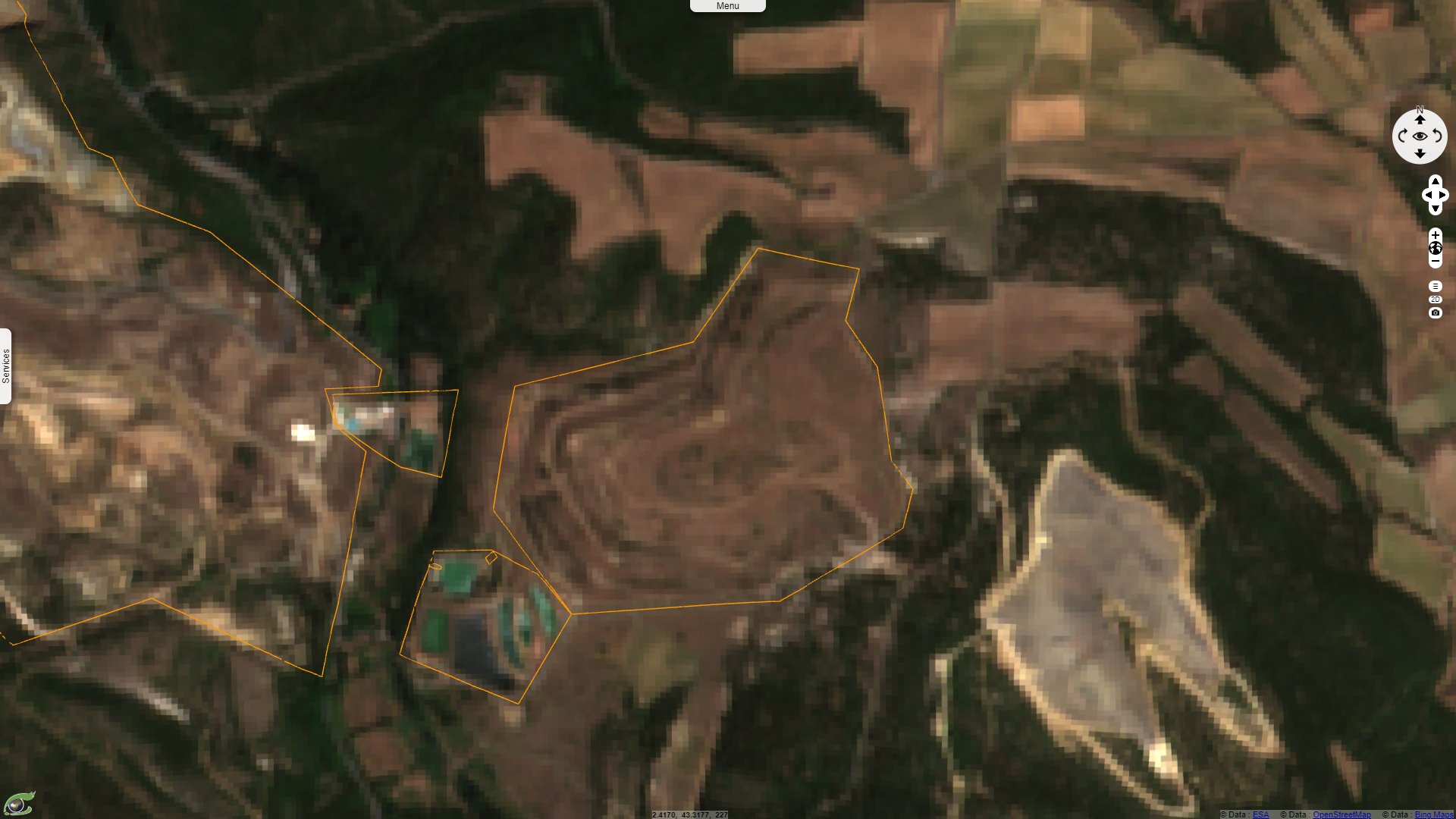
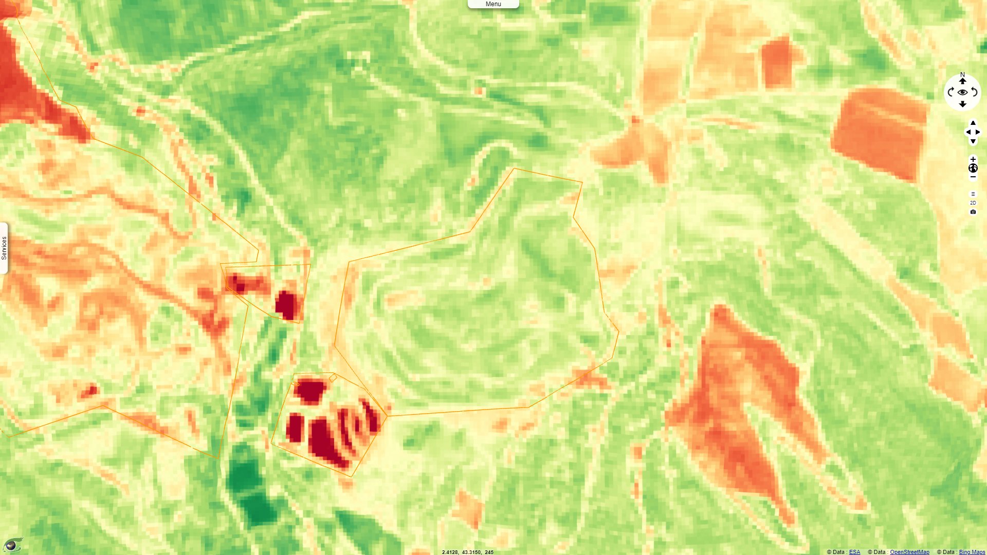
Its size has been increased since the study, this hill with arid vegetation located on the left bank of the Orbiel now hides ten million tons of polluted sand, 2% of which is arsenic. Quad bikes and 4x4s visit the Artus storage site, damaging its vegetation and reducing its protecting capabilities. SystExt addresses the topic of neighbouring Montredon hill: "In 1993, a new treatment unit was built, which residues filled the Montredon dam. When it was rehabilitated in 2004-2005, it was reinforced with 400 000 tonnes of 'low-concentration' tailings before storing an equivalent quantity of highly contaminated waste. This operation raises questions, even though signs of instability had been reported since 1997. The dam was secured in the same way as the Artus dam, but was confined at the base and surface by a geomembrane to ensure watertightness. Containing more than one million cubic metres of waste, Montredon has waterproofing defects and reinforcement work is underway. Costly earthworks and monitoring since the 1990s have not succeeded in reducing the geotechnical and environmental risks."
More recent sources estimate Montredon dam encompasses 2 million tonnes of waste including about 18% sulphur and arsenic (plus cyanide inside).
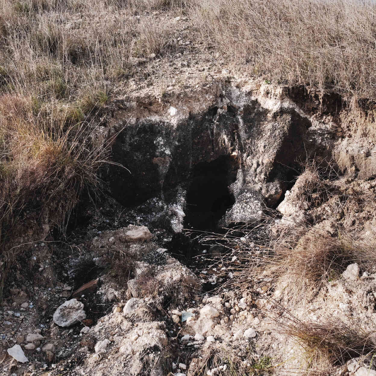
Left: "The Montredon storage area hidden under the hill is 27 metres high. In 1994 it was only 17 metres high. The work to raise it in 1999 was poorly done. As a result, the hill is collapsing in places, revealing, as here, holes through which arsenic-laden water is escaping - Source: Guillaume Riviere for Le Monde."
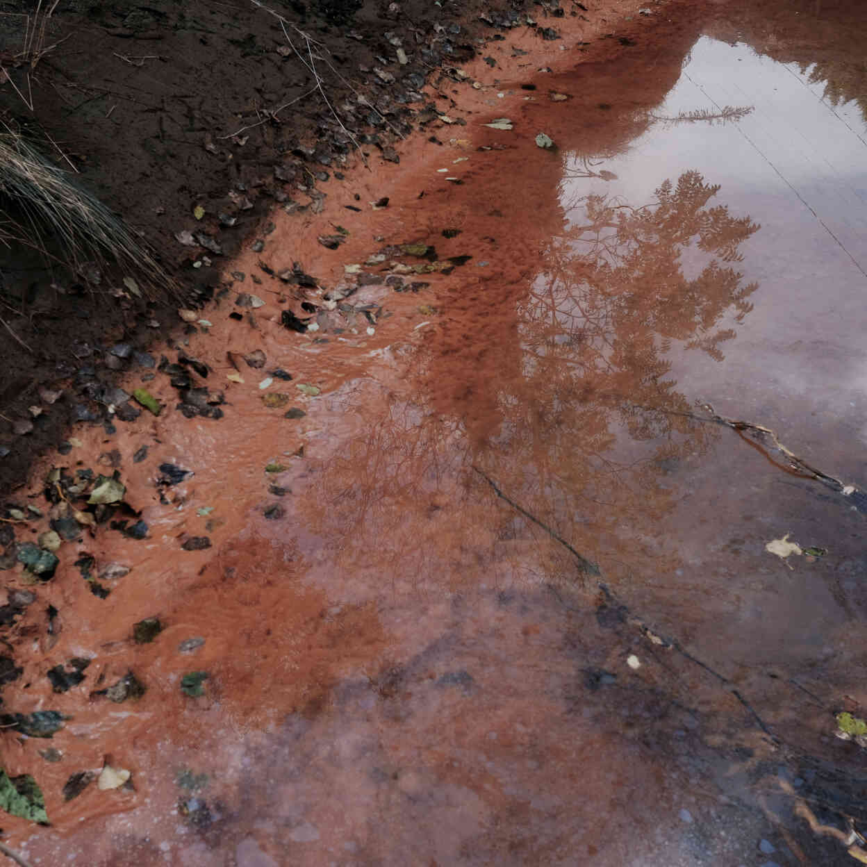
Right: "Some parts of the Orbiel, after the flood of 15 October, have taken on a rusty hue, reminiscent of the episode of the Sindilla channel. In 2013, this small watercourse parallel to the Orbiel and intended for irrigation suddenly turned red. The local residents had then asked for analyses. Results, according to the prefecture: 20 micrograms of arsenic per litre. The real results, revealed by 'Le Canard enchaîné': 4469 micrograms of arsenic per litre". This is 450 times higher than the WHO standard, wildlife does not sustain such levels. The poison came from a leak in the Montredon storage facility, two kilometres above. The prefect had to leave his post. - Source: Guillaume Riviere for Le Monde.
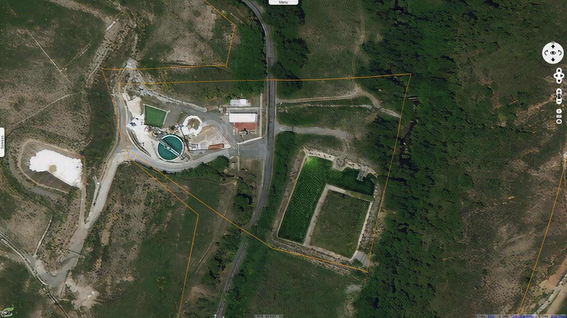
The SystExt report finally focuses on the water treatment plant: it is "supplied with arsenic-contaminated water from: the Montredon dam, the ADEME containment (Combe du Sault), the 'Point V' spring, and the Artus dam. The treatment consists of precipitating the arsenic by adding lime. The lime arsenate sludge resulting from this operation is packaged in big bags and stored in a cell. The latter is left in the open air and is already full, causing concern to associations and local residents. As for the residual water from this treatment, it is sent to an infiltration lagoon. At this point, despite the treatment, arsenic concentrations remain very high, at around 1100 µg/l", but 15 times less than what it is before the big bags. "This water then infiltrates the soil and flows into the Orbiel. The station, now managed by the BRGM, was not intended to last but is still in operation in the absence of an alternative solution." It is estimated only 20% of the contaminated water is processed through the treatment plant.
The study of the Geological Society of France adds: "The pollution of the Grésillou is partly due to the former Nartau mine, but mainly due to the discharge of water from the mine. In the Combe du Saut, the pollution is mainly linked to heavy rainfall. In the Ru sec (high water), the pollution comes mainly from runoff from the old mines and the associated metallurgical districts of Malabau, and to a lesser extent from Gourg Peyris." Runoff transports a large quantity of arsenic to the Orbiel River: 1300 kg/year on average and 1260 kg of arsenic during the storm of 1999 alone.

The region is prone to catastrophic rainfalls such as on 14-15 February 2017. The schoolyard of Lastours was washed away by the flood of 15 October 2018. Sediments full of arsenic were deposited there. The levels in arsenic are five times that or the WHO recommandations. Many schoolchildren were poisoned. - Source: Olivier Saint-Hilaire.
The study concludes: "The sources of risk are the consumption of well or spring water and of fruit and vegetables from the garden. Checks carried out by the DDASS on the waters of the Orbiel and its tributaries, as well as analyses of fish by the French Directorate-General for Competition, Consumer Affairs and Fraud Control (DGCCRF) show that the threshold of 50 µg of arsenic per litre is frequently exceeded in the Grésillou, a tributary of the Orbiel, or in nearby wells (in particular, the communal well in Conques). The abnormal levels of metals and arsenic found in vegetables led to a ban on the marketing of leafy vegetables for a period of one year (ministerial decree of 30 May 1997, periodically renewed since)."
Other recommandations include limiting the consumption of plants in flooded gardens, not consuming water from private wells, providing protection for the skin and respiratory tract during earthworks and soil excavation, reducing the spread of dust inside houses by frequent wet washing of floors, washing hands carefully after playing or working outdoors. Eight decrees 'suspending schoolyards', 'playgrounds', 'the consumption of leafy vegetables, root vegetables, leeks, rice, mushrooms, asparagus, snails' in flood-prone areas. Swimming, fishing and any other activity in the Orbiel and its tributaries were also prohibited. The figures speak for themselves: scientists have found that an increase of more than 11% of all cancers. And for some cancers, such as lung or stomach cancer, this prevalence is multiplied by two or three.
The views expressed herein can in no way be taken to reflect the official opinion of the European Space Agency or the European Union.
Contains modified Copernicus Sentinel data 2026, processed by VisioTerra.
Contains modified Copernicus Sentinel data 2026, processed by VisioTerra.
| More on European Commission space: |  |
 |
 |
||||
| More on ESA: | |
|
|
S-1 website | S-2 website | S-3 website | |
| More on Copernicus program: | |
|
|
Scihub portal | Cophub portal | Inthub portal | Colhub portal |
| More on VisioTerra: | |
|
|
Sentinel Vision Portal | Envisat+ERS portal | Swarm+GOCE portal | CryoSat portal |