Souapiti Hydropower Station, Republic of Guinea
Sentinel-1 CSAR IW acquired from 27 July 2019 to 07 October 2019
Sentinel-2 MSI acquired from 19 December 2015 to 07 January 2020
Sentinel-3 OLCI FR acquired on 22 November 2022 at 10:40:47 UTC
Sentinel-2 MSI acquired from 19 December 2015 to 07 January 2020
Sentinel-3 OLCI FR acquired on 22 November 2022 at 10:40:47 UTC
Keyword(s): Hydrology, hydropower, renewable energy, endorheic basin, infrastructure, reservoir lake, Guinea, Africa
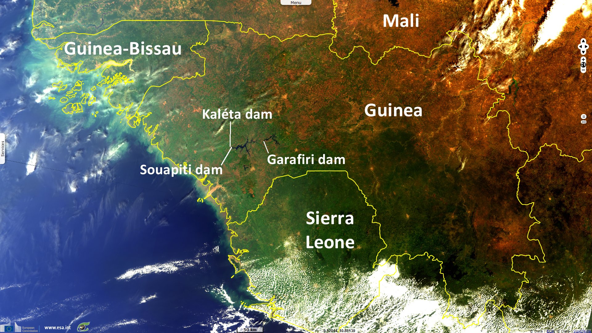
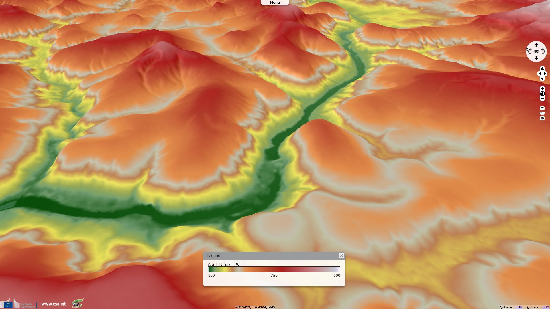
Souapiti Dam is an hydroelectric power station located in the Guinea on the Konkouré River, 303 km long, which flows to the Atlantic Ocean north of the Sangareya Bay.
The installed capacity of 450 MW (4 Francis turbines and 4 electric generators) may produce 1.9 TWh per year.
The construction of the dam began the 22 December 2015 by China International Water & Electric Corporation (CWE) and the commercial operation started the 24 June 2021.
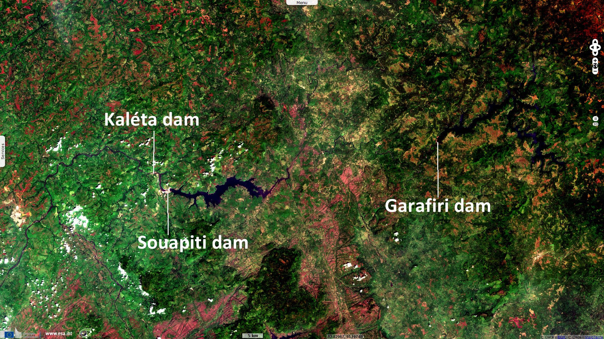
The Souapiti dam is part of a succession of four hydroelectric power stations on the Konkouré river,
the Garafiri dam (1999), 66 km upstream (straight line), with an installed capacity of 75 MW,
the Kaléta dam (2015), 6 km downstream, with an installed capacity of 240 MW and
the Amaria dam (started in 2018), further downstream with an installed capacity of 300 MW.
These four power stations makes the most of the 1200 MW potential of the Konkouré River according to La Tribune Afrique.
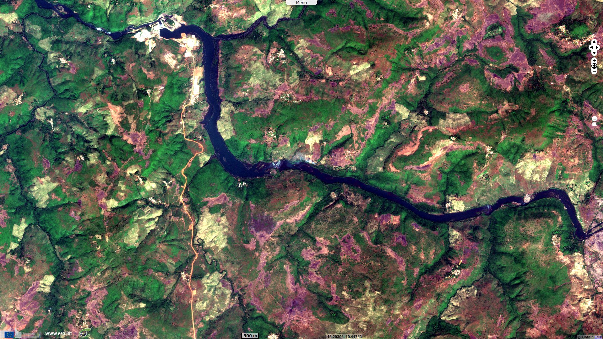
The Souatipi dam is 1150 metres wide and 117 metres high (source Tractebel).
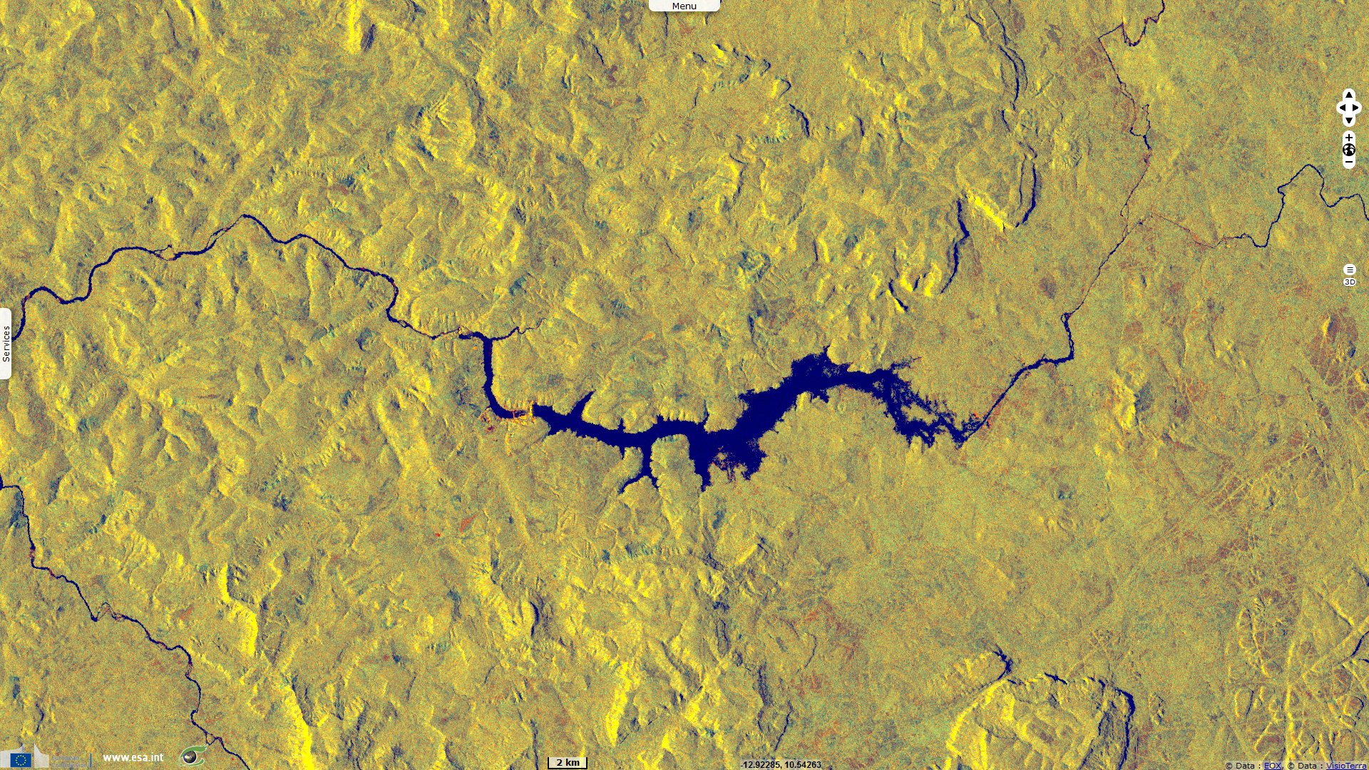
The dam has created an artificial lake that cover 253 km² and containing more than 6 km3 of water during the wet season. In addition to power generation, this reservoir lake is used as water supply during the dry season and may regulate the production of the Kaléta power station, 6 km downstream.
The artificial lake has flooded 51 villages, 42 km² of cropland, more than 550 000 fruit trees and has forced around 16 000 people to relocate (source Citizenpost). Finally, the lake has required the construction of 160 km of roads.
The artificial lake has flooded 51 villages, 42 km² of cropland, more than 550 000 fruit trees and has forced around 16 000 people to relocate (source Citizenpost). Finally, the lake has required the construction of 160 km of roads.
The power generated by this infrastructure alleviates the country's power grid which is undersized for its needs, both for the population and the mining industry.
According to an article published in Bloomberg "Guinea has the world’s biggest reserves of bauxite, which is refined into alumina and then smelted into aluminum, and its mines are the backbone of the $6.6 billion economy." The cost of the project is estimated at $1.4 billion (source Jeune Afrique) which of $1.175 billion (almost 50% of the 2020 budget of Guinean state) loaned by China via the China Eximbank. Since the revision of the Mining Code in 2011, Chinese mining and steel companies have multiplied in the country. The creation of an integrated production chain, from bauxite to aluminium in Guinea requires significant input of energy. An issue that has prompted China to invest in the construction of new dams on the Konkouré River (source Citizenpost).
The views expressed herein can in no way be taken to reflect the official opinion of the European Space Agency or the European Union.
Contains modified Copernicus Sentinel data 2026, processed by VisioTerra.
Contains modified Copernicus Sentinel data 2026, processed by VisioTerra.
| More on European Commission space: |  |
 |
 |
||||
| More on ESA: | |
|
|
S-1 website | S-2 website | S-3 website | |
| More on Copernicus program: | |
|
|
Scihub portal | Cophub portal | Inthub portal | Colhub portal |
| More on VisioTerra: | |
|
|
Sentinel Vision Portal | Envisat+ERS portal | Swarm+GOCE portal | CryoSat portal |