Historic low levels in critical south-west US reservoir lakes
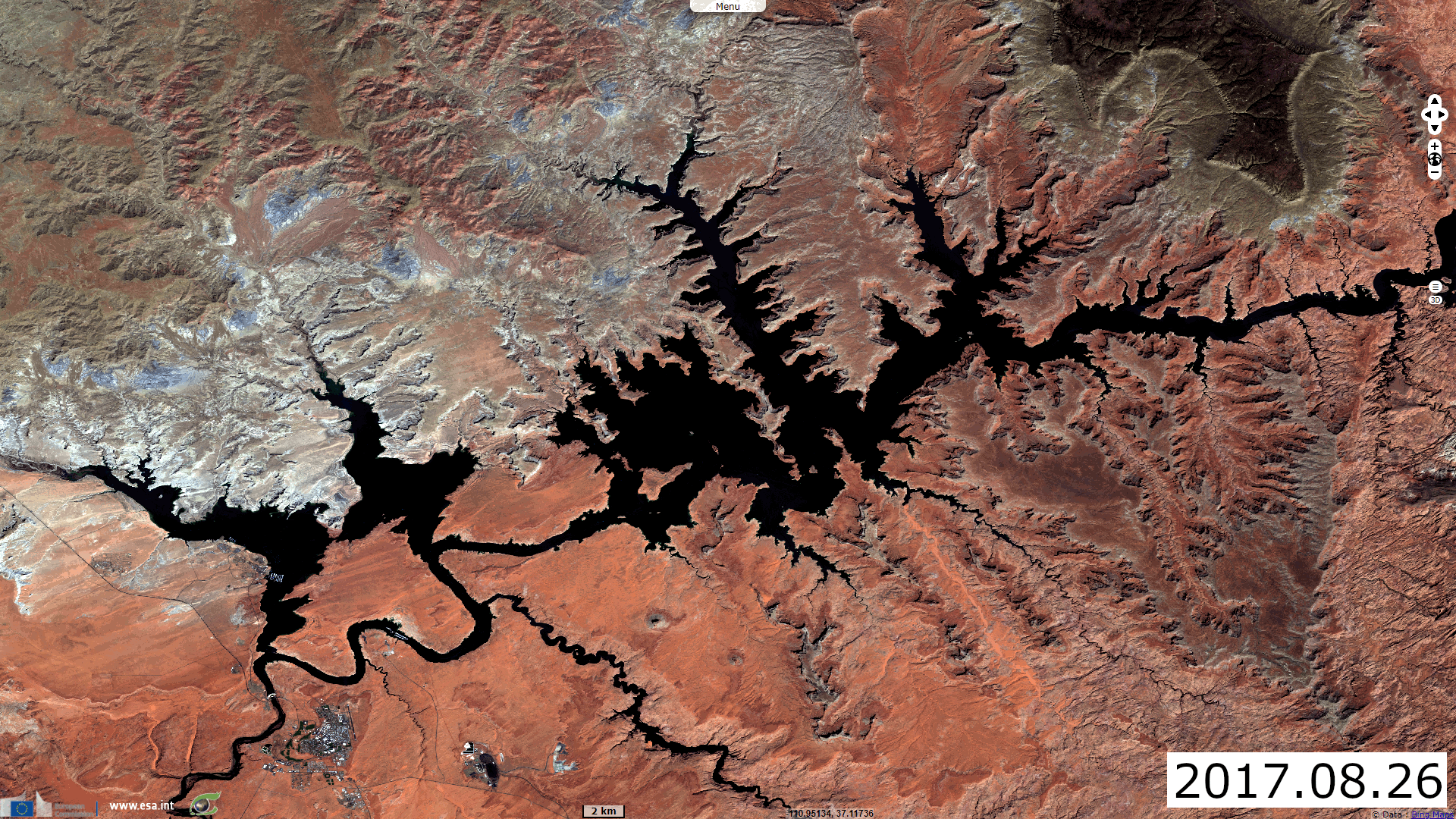
Sentinel-2 MSI acquired on 26 August 2017 and 15 August 2021
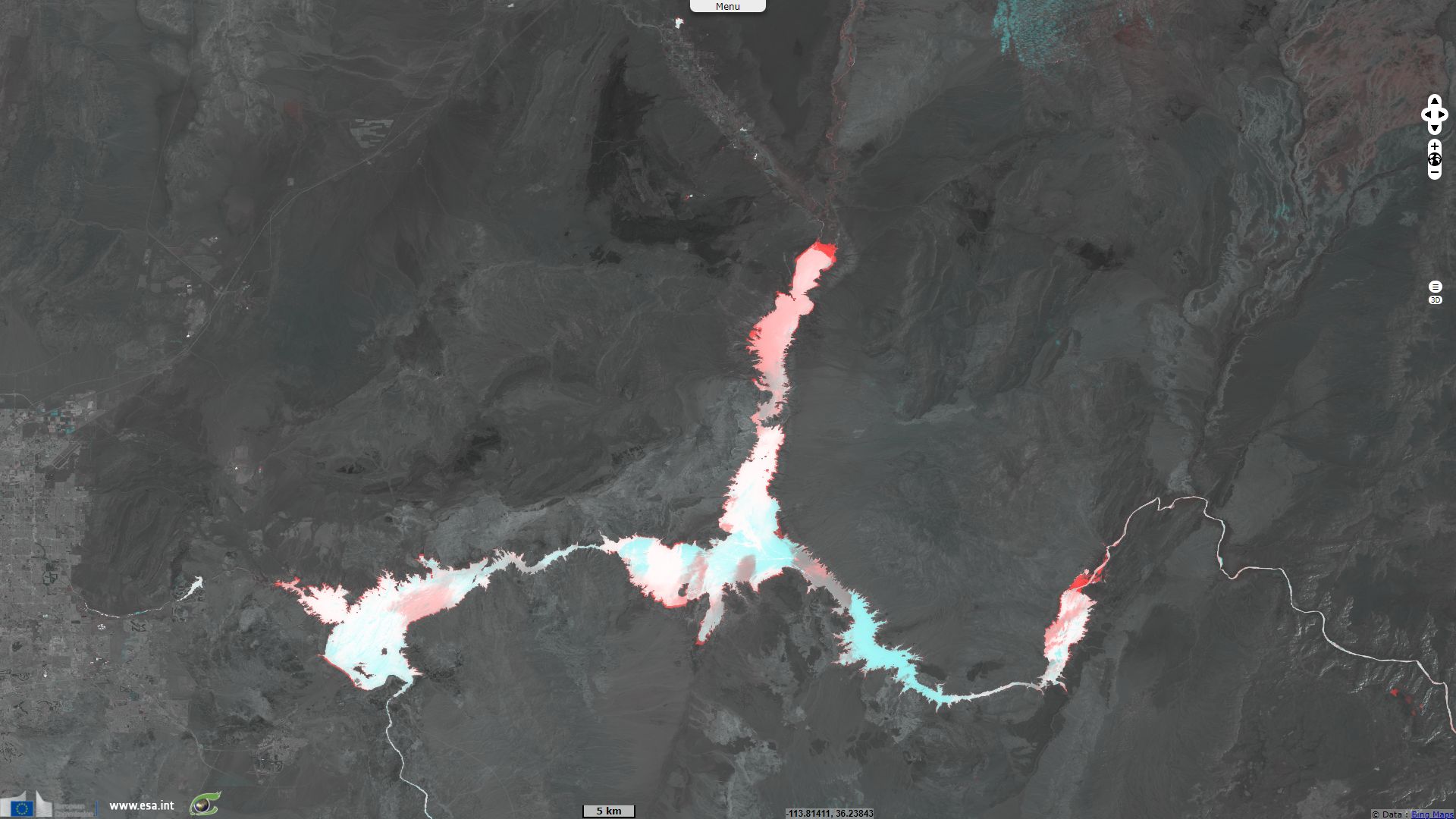
Sentinel-2 MSI acquired on 04 July 2020 and 09 July 2021
Sentinel-2 MSI acquired on 04 July 2020 and 09 July 2021
Keyword(s): Climate change, drought, precipitations, natural disaster, infrastructure, urban growth, reservoir lake, dam, USA, United states
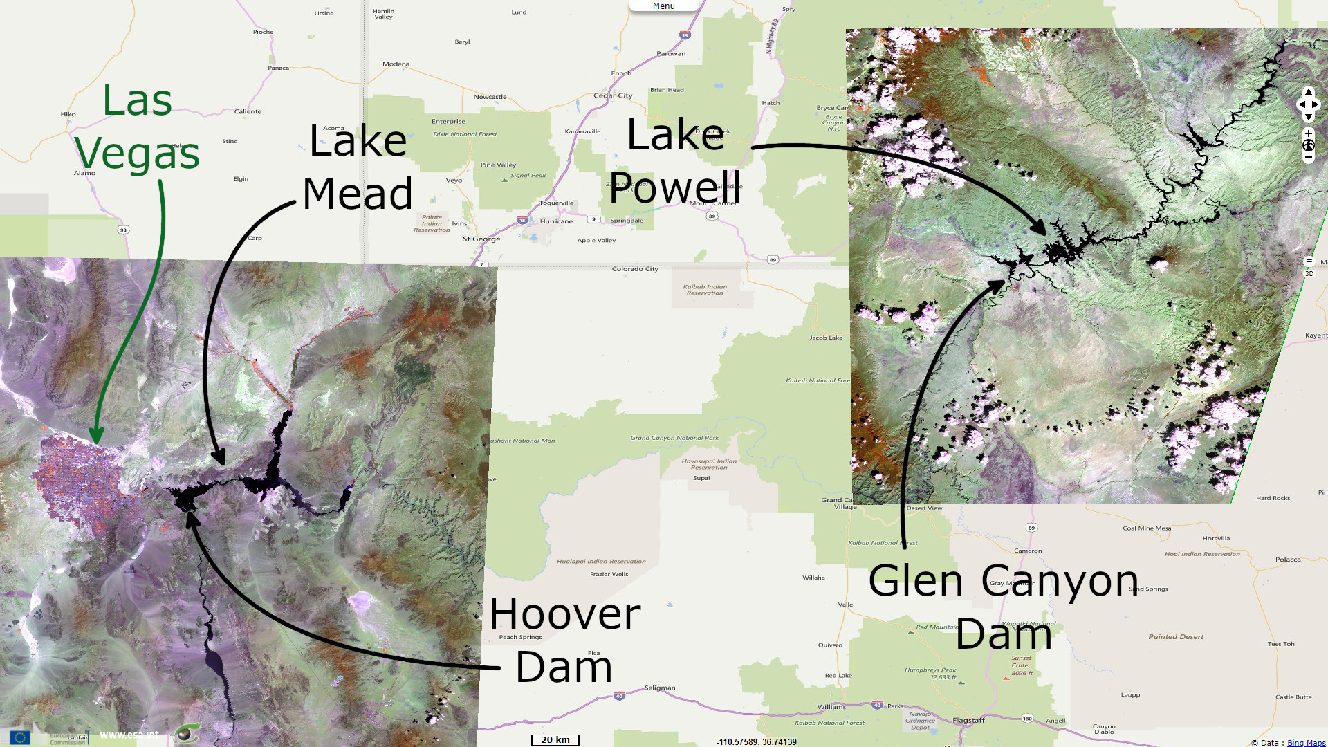
Lake Mead and Lake Powell are the two largest reservoir lakes. The Hoover Dam was opened in 1936 and the Glen Canyon Dam in 1966.
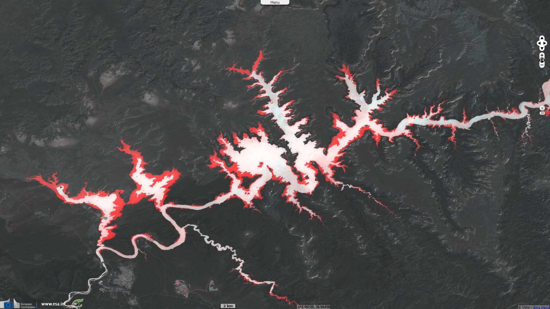
The figure 3 shows a multi date colour composite. The red channel is the Normalized Difference Water Index for Open Water (NDWI-OW) for the 15.08.2021. The green and blue panel are both also a NDWI-OW but for the 26.08.2017. It displays in white places where the water was present in both date, in dark grey places where there was no water and in red places where the water receded between the two acquisition date.
The lake is now around a third of its full capacity. If the water level is still decreasing, this may lead to water cuts and a reduced electricity production.
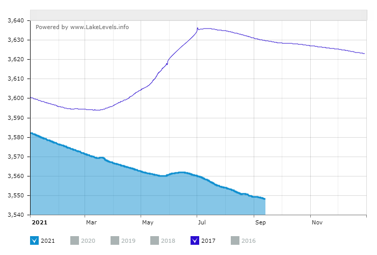
Provided by www.lakelevels.info
The figure here above shows the water level in feets for the 2017 and the 2021 year. There is a difference of 24.5 metres in the water level between the two Sentinel-2 acquisition date.The lake is now around a third of its full capacity. If the water level is still decreasing, this may lead to water cuts and a reduced electricity production.
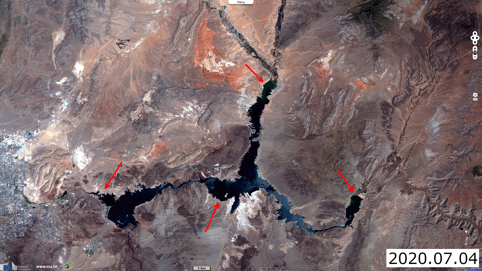
Lake Mead, the US's largest reservoir, is also around a third of its capacity. This will have an impact on the neighbour states. The Guardian states "Arizona will be hardest hit, losing nearly a fifth of the water it receives from the Colorado River. In Pinal county, farmers and ranchers will see the amount of water they get from the river drop by half next year, and disappear altogether by 2023, when the federal government is projected to enact even more severe cuts. Farmers, who have already had to make some land fallow, will probably have to continue to do so in the coming years and rely increasingly on groundwater."
"This is a very big deal, because there’s never been a shortage like this over the almost 100-year history," said Sarah Porter, director of the Kyl Center for Water Policy at Arizona State University. "The immediate impacts of this will not probably be felt by most people. But it’s a big, giant red flag telling a region that is dependent on Colorado River water that we need to adjust to a drier future." (The Guardian).
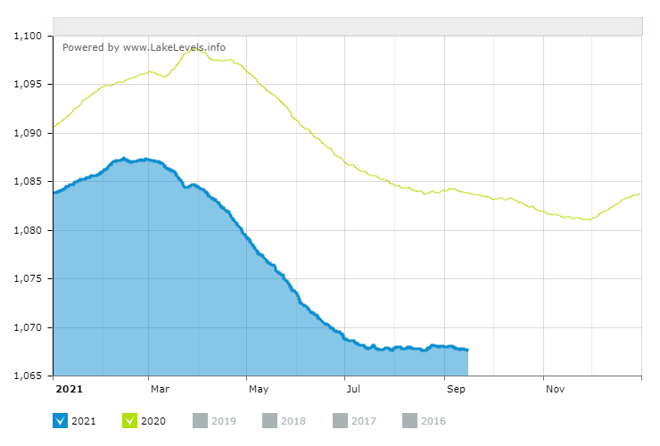
Here is shown the water level of the Lake Mead for the 2020 year and the 2021 year. The level has dropped from 331.2 metres to 325.5 metres (around 6 meters lower).
Here is shown the water level of the Lake Mead for the 2020 year and the 2021 year. The level has dropped from 331.2 metres to 325.5 metres (around 6 meters lower).
The views expressed herein can in no way be taken to reflect the official opinion of the European Space Agency or the European Union.
Contains modified Copernicus Sentinel data 2026, processed by VisioTerra.
Contains modified Copernicus Sentinel data 2026, processed by VisioTerra.
| More on European Commission space: |  |
 |
 |
||||
| More on ESA: | |
|
|
S-1 website | S-2 website | S-3 website | |
| More on Copernicus program: | |
|
|
Scihub portal | Cophub portal | Inthub portal | Colhub portal |
| More on VisioTerra: | |
|
|
Sentinel Vision Portal | Envisat+ERS portal | Swarm+GOCE portal | CryoSat portal |