Monsoon overflows in the Gange floodplains, Bihar state, India
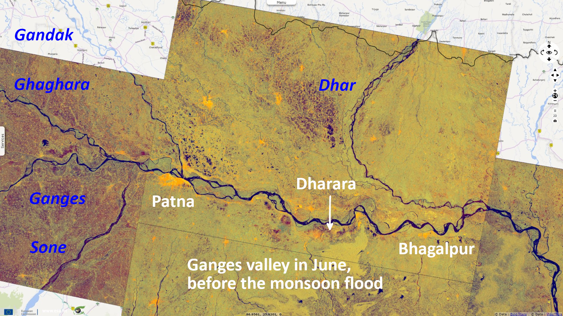
Sentinel-1 CSAR IW acquired on 08 June 2021 at 00:20:15 UTC
...
Sentinel-1 CSAR IW acquired on 16 June 2021 from 23:55:29 to 23:56:19 UTC
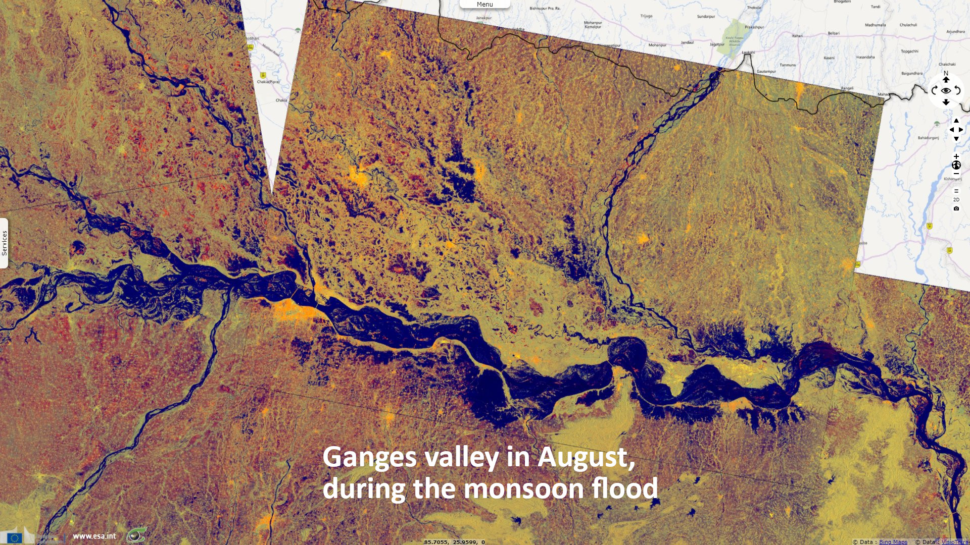
Sentinel-1 CSAR IW acquired on 09 August 2021 from 00:04:04 to 00:04:29 UTC
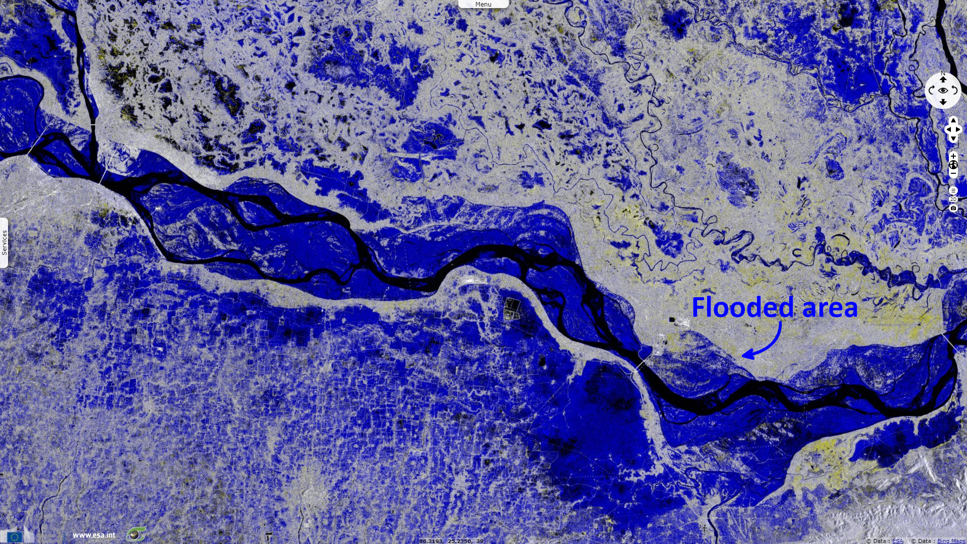
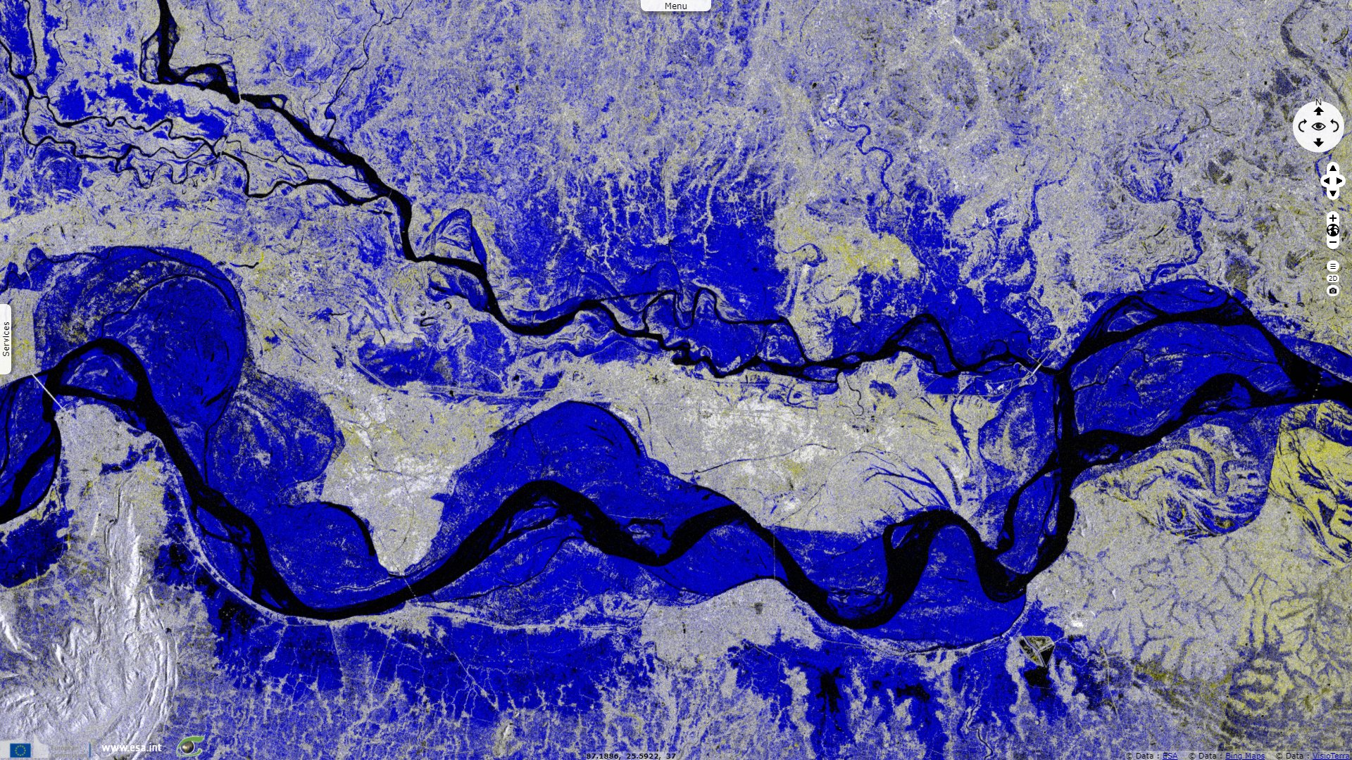
Sentinel-1 CSAR IW acquired on 16 August 2021 from 12:29:44 to 12:30:13 UTC
...
Sentinel-1 CSAR IW acquired on 16 June 2021 from 23:55:29 to 23:56:19 UTC
Sentinel-1 CSAR IW acquired on 09 August 2021 from 00:04:04 to 00:04:29 UTC
Sentinel-1 CSAR IW acquired on 16 August 2021 from 12:29:44 to 12:30:13 UTC
Keyword(s): Emergency, precipitations, natural disaster, river, hydrology, urban planning, India
The views expressed herein can in no way be taken to reflect the official opinion of the European Space Agency or the European Union.
Contains modified Copernicus Sentinel data 2026, processed by VisioTerra.
Contains modified Copernicus Sentinel data 2026, processed by VisioTerra.
| More on European Commission space: |  |
 |
 |
||||
| More on ESA: | |
|
|
S-1 website | S-2 website | S-3 website | |
| More on Copernicus program: | |
|
|
Scihub portal | Cophub portal | Inthub portal | Colhub portal |
| More on VisioTerra: | |
|
|
Sentinel Vision Portal | Envisat+ERS portal | Swarm+GOCE portal | CryoSat portal |