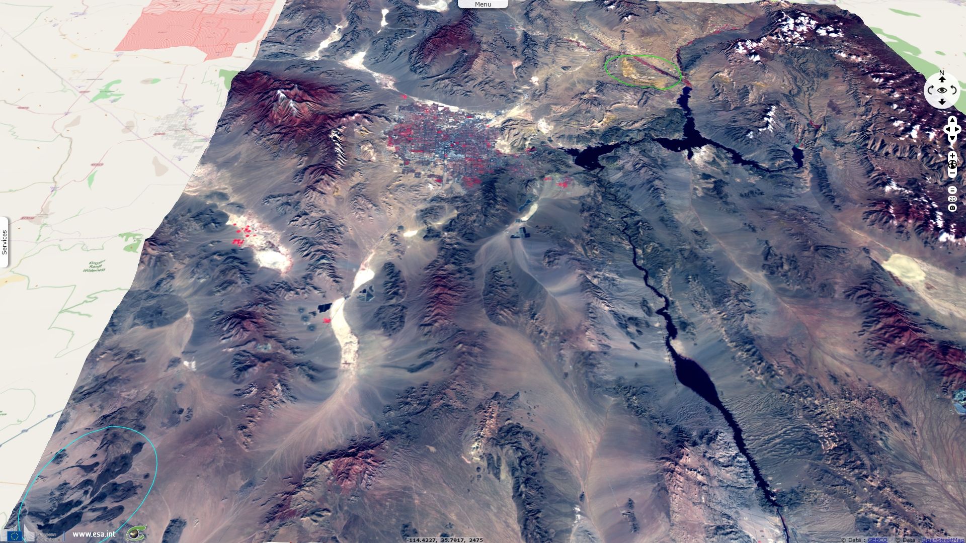
Las Vegas, solar energy & golfs in the desert

Sentinel-2A MSI (4 tiles) acquired on 22 November 2016 at 18:27:02 UTC
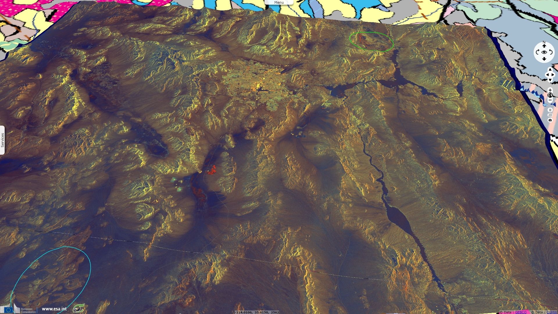
Sentinel-1A CSAR IW DV GRD acquired on 27 February 2017 from 13:43:17 to 13:43:42 UTC
Author(s): Sentinel Vision team, VisioTerra, France - svp@visioterra.fr
Keyword(s): land, land cover, land use, energy, solar energy, photovoltaic power station, concentrated solar power, draught, golf, urban, urban growth, geohazard, subsidence, climate, USA, dam, lake, Nevada
Fig. 1 - S2 image over Las Vegas area - 8-4-3 colour composite
Fig. 2 - S1 image over Las Vegas area- VV-VH-NDI(VH,VV) colour composite
Las Vegas was founded in 1911 in a playa located in the Mojave desert. Several faults run though this region which has a rich tectonic and volcanic history as shown here by numerous features such as the Cima Cinder Cones Volcanic Range (cyan circle on fig. 1 and fig. 2) or the Valley of Fire (green circle, in yellow on fig. 1, in red on fig. 2, ocre in natural color) National Natural Landmarks. The Las Vegas Valley lies in the rain shadow of the American Cordillera, shielded first by the Sierra Nevada range and then by the Spring mountains 20 km West of Las Vegas urban area and visible on fig. 1 and fig. 2.
Fig. 3 - Detail of the S2 image near Ivanpah dry lake
Fig. 4 - Detail of the S1 image near Ivanpah dry lake
On these close-ups on the Ivanpah dry lake, images show the narrow Ivanpah valley in which can be found both families of solar powered stations, ie photovoltaic systems and concentrated solar power stations with their central solar power towers. The power lines and the electric pylons needed to transport the energy generated are can also be identified.
Fig. 5 - Detail of the S2 image near El Dorado dry lake
Fig. 6 - Detail of the S1 image near El Dorado dry lake
On these close-ups on the El Dorado dry lake in the El Dorado valley, images show several photovoltaic systems alongside several quarries. By following the power lines and the electric pylons to the North East, another major node of the United States power grid can be recognized, the Mead substation. It is connected to the Hoover dam which products hydroelectric power from the Colorado river waters collected in the Lake Mead reservoir.
Fig. 7 - Detail of the S2 image North-East of Las Vegas
Fig. 8 - Detail of the S1 image North-East of Las Vegas

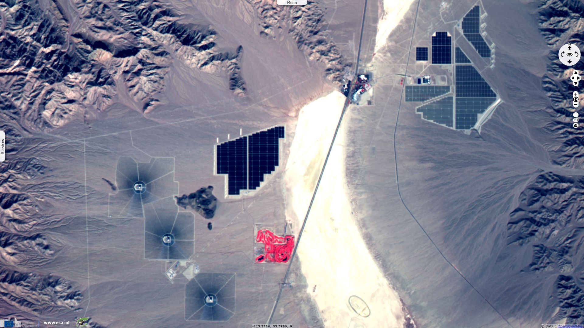
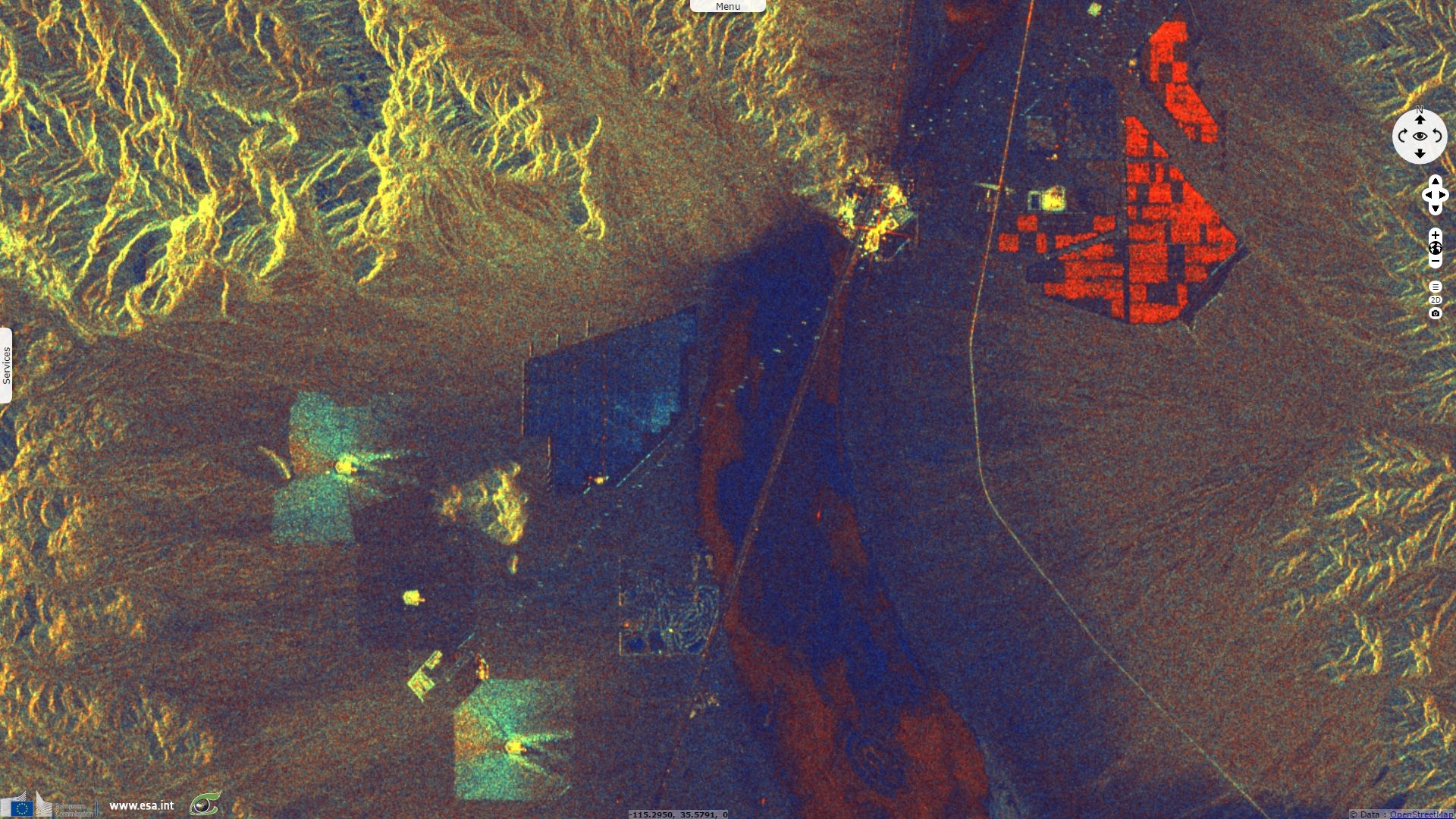
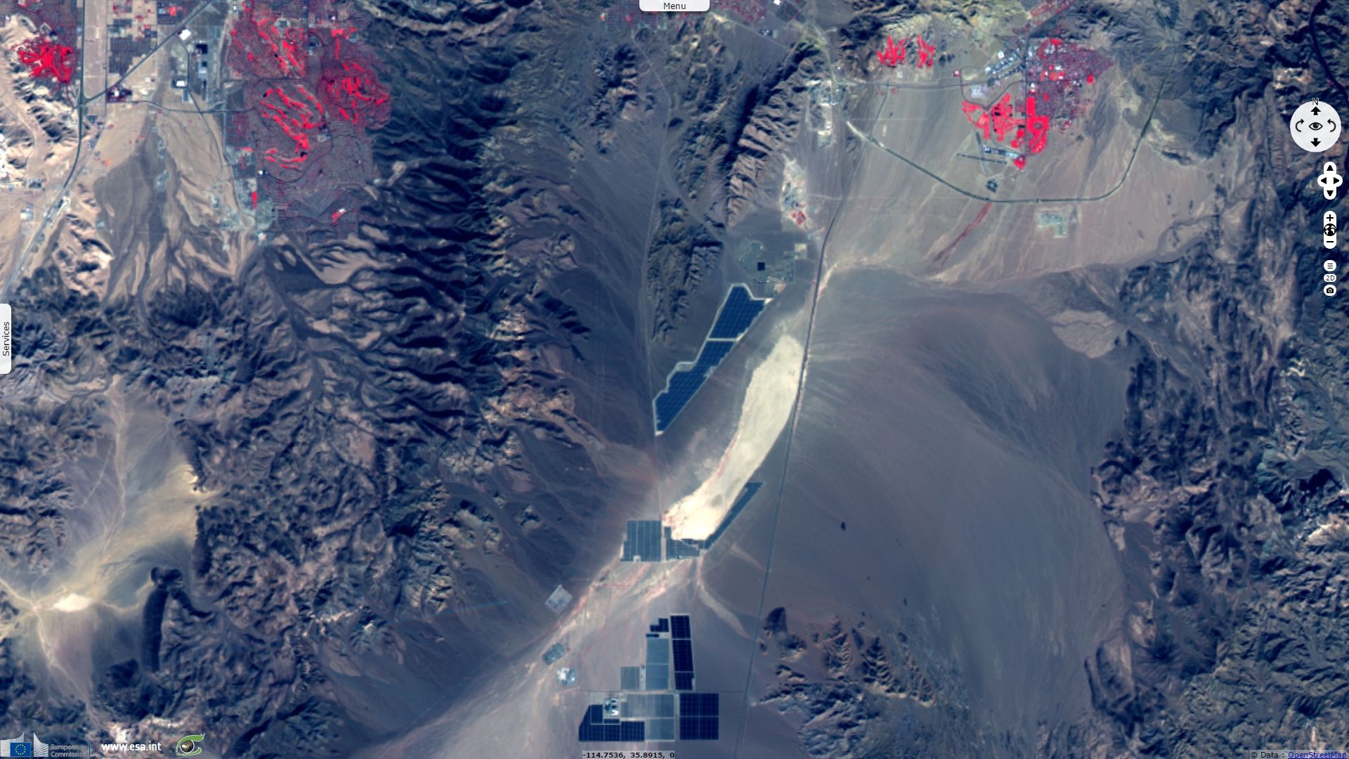
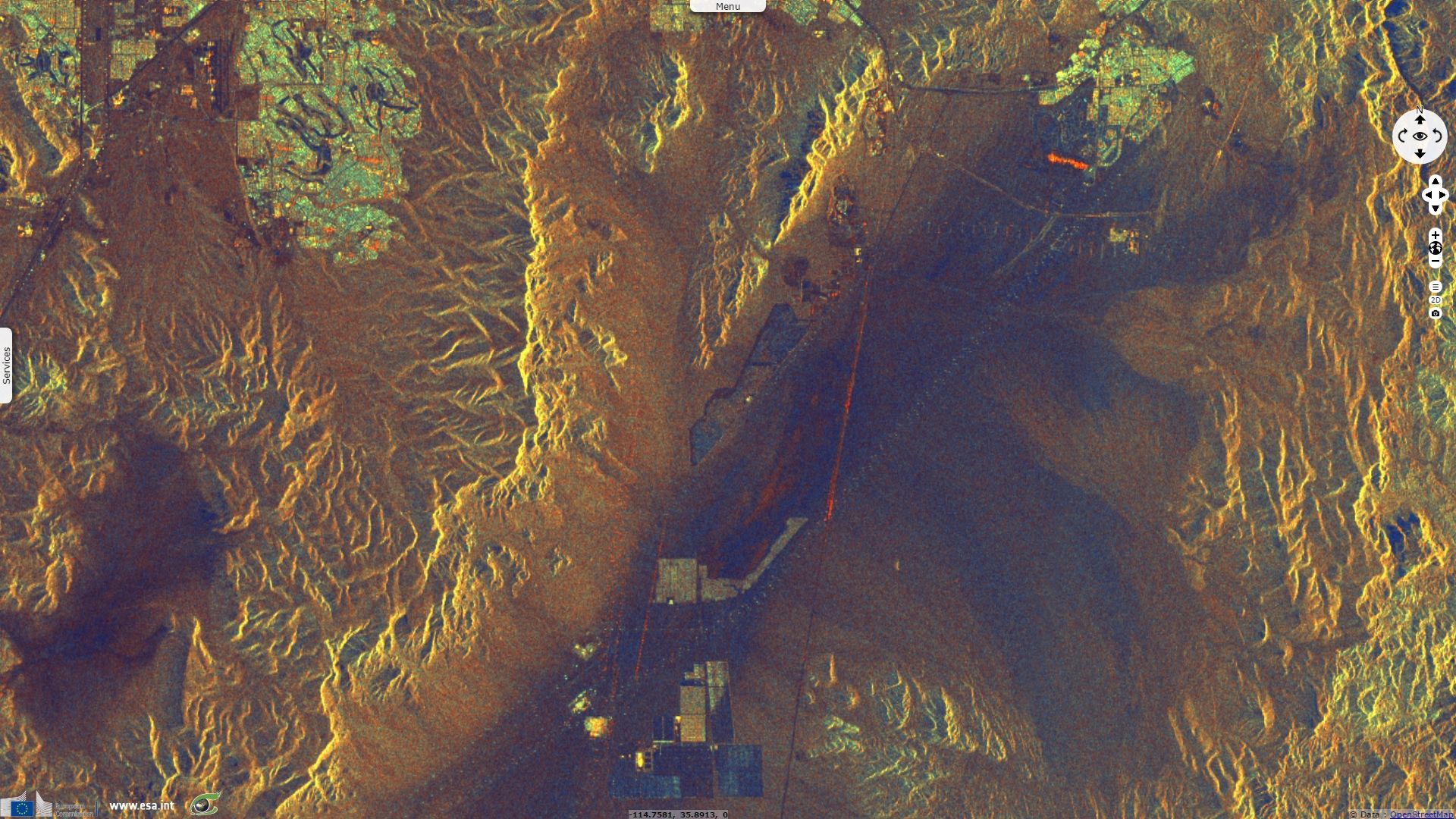
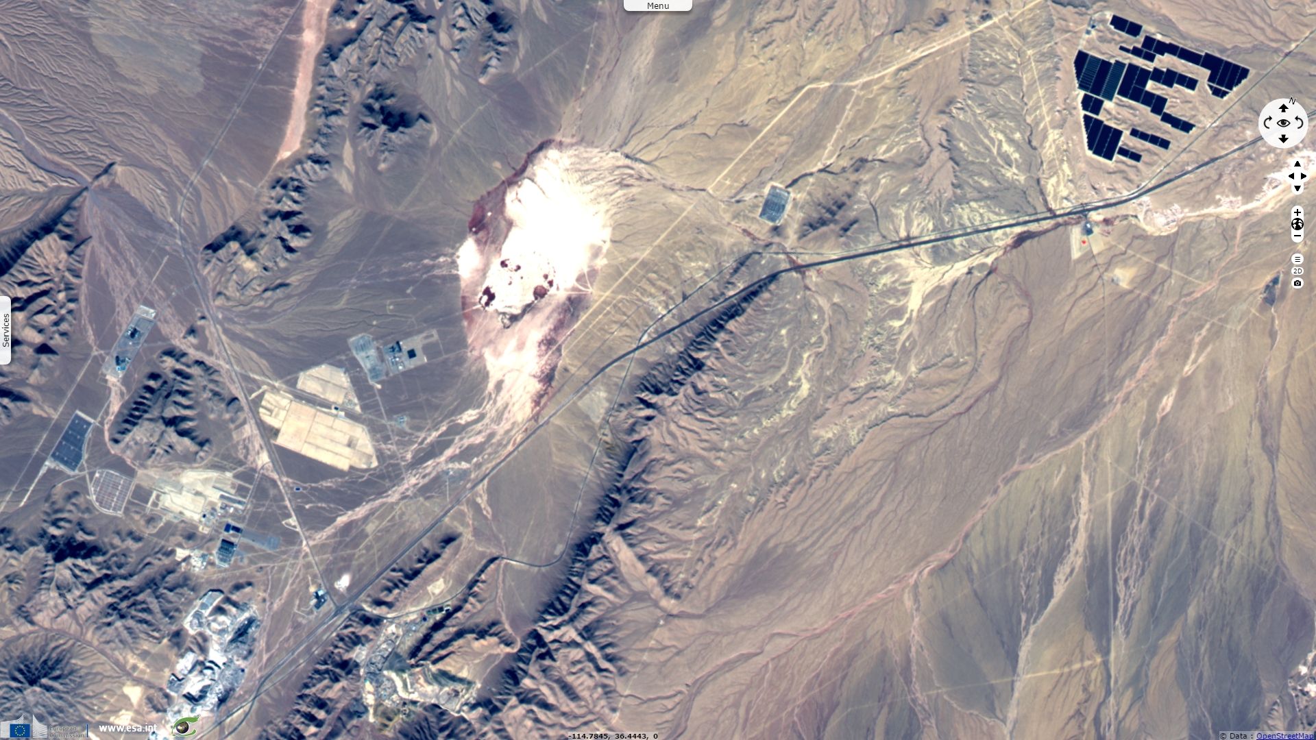
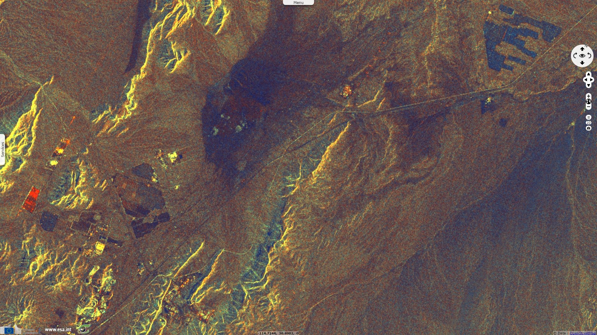
On these zoomed in details, multiple photovoltaic systems, electric pylons and quarries can be identified.

According to Paul Skrbac, Chris Stachelski and Andy Gorelow in their publication « The Climate of Las Vegas, Nevada », the annual mean rain precipitation is 106 mm and precipitation exceed 0.01 inch only 26 days a year.

This location and its associated arid climate are highly favorable to solar energy production which lead to the construction of several photovoltaic and several concentrated solar power stations around Las Vegas. In a report issued in 2015, the Energy agency from the State of Nevada presents a map of the renewable energy projects that were granted subsidies by Nevada in 2015, all projects located near Las Vegas are solar-based energy. See also https://en.wikipedia.org/wiki/Solar_power_plants_in_the_Mojave_Desert

Fig. 9 - S2 image zoomed in on the Las Vegas urban area and West of Lake Mead
Fig. 10 - S1 image zoomed in on the Las Vegas urban area and West of Lake Mead

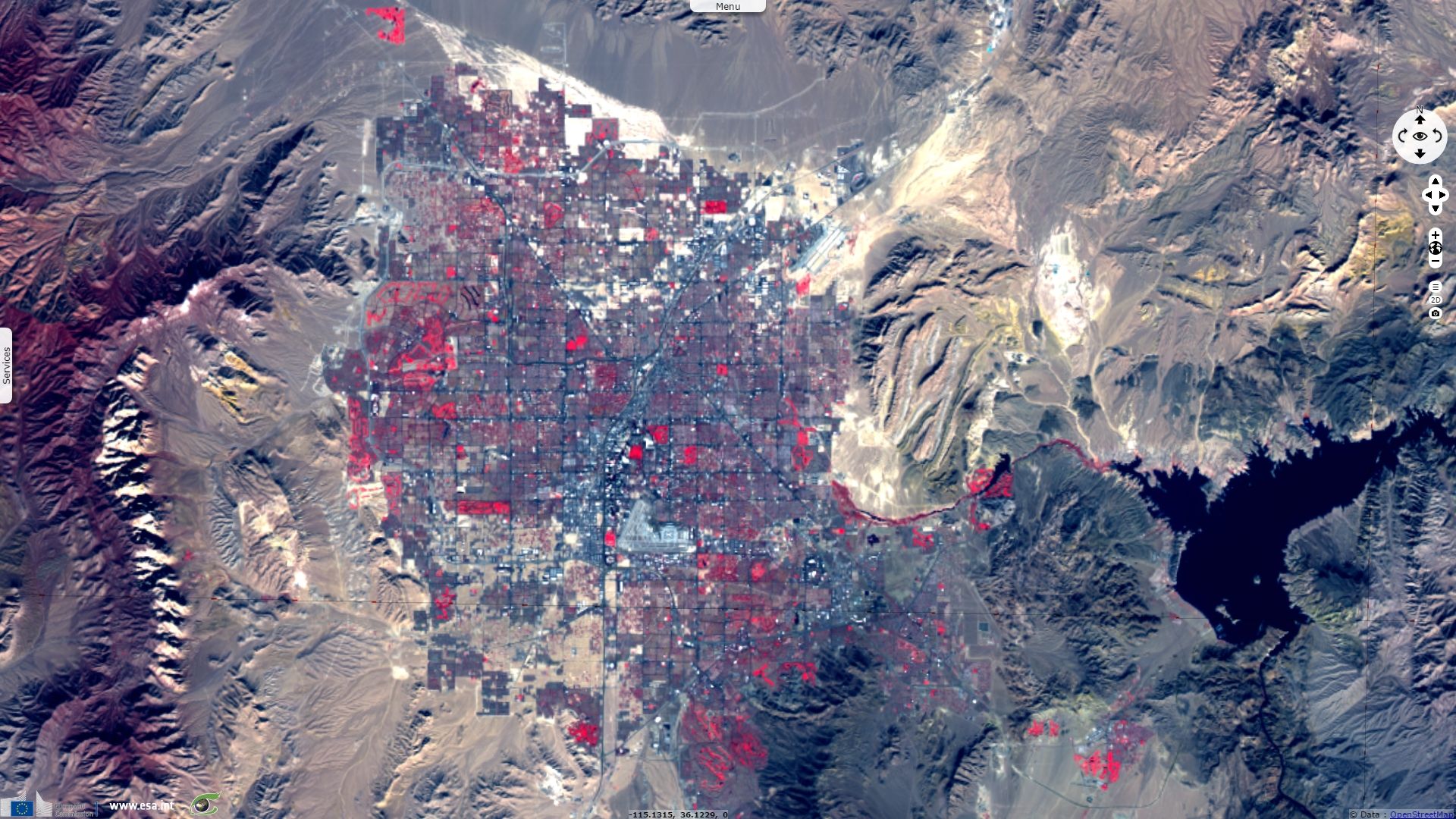
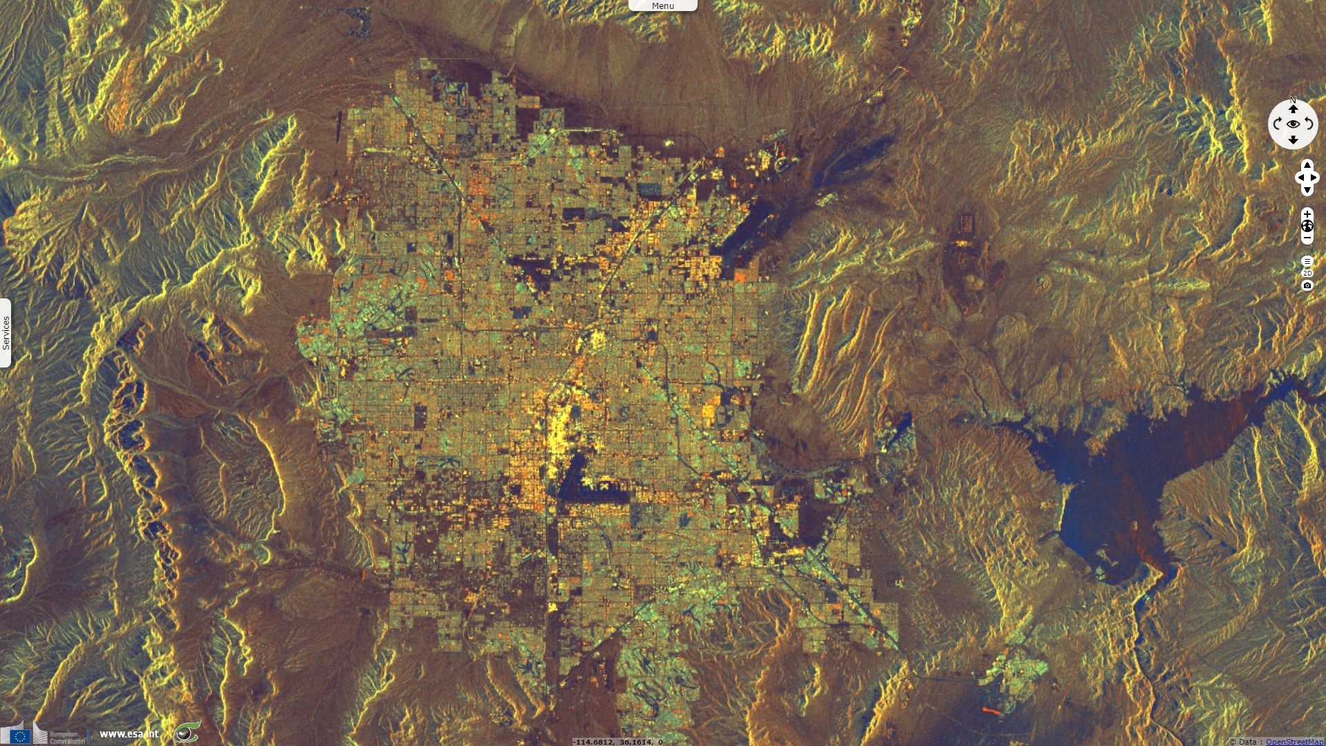
The arid climate of this area makes it unfavourable to vegetation. In fig.1, dark red shows presence of sparse forest in the higher relief such as the Spring Mountains, there is very little natural vegetation in the alluvial fans and almost none in the saline dry lakes. However, irrigation allows domestic vegetation to grow such as a few fields, west of the image, or numerous golf courses which represent the majority of the healthy or dense vegetation in the area. They can be identified, visible in bright red on S-2 images and in dark blue on S-1 images and can compared to the map provided by Las Vegas municipal website which lists 41 golfs greens in the area.

Las Vegas valley lies very close to the « Great Divide » endorheic basin but is located mostly in the Colorado River basin. This implies pollutants and eroded material are occasionnaly washed away from soils by precipitations, avoiding their permanent accumulation in a saline depression. Water then gathers in the Lake Mead reservoir formed after the Hoover dam construction in 1935. While most Colorado water is consumed downstream, Las Vegas area is very reliant on this water source for its needs. At its full capacity, Lake Mead was United States most important reservoir by surface and volume but combination of decreasing inflow and increasing outflow halved Lake Mead’s volume. In this article « When will Lake Mead go dry? » published in 2008, Tim P Barnett explained: « A water budget analysis shows that under current conditions there is a 10% chance that live storage in Lakes Mead and Powell will be gone by about 2013 and a 50% chance that it will be gone by 2021 if no changes in water allocation from the Colorado River system are made. This startling result is driven by climate change associated with global warming, the effects of natural climate variability, and the current operating status of the reservoir system. Minimum power pool levels in both Lake Mead and Lake Powell will be reached under current conditions by 2017 with 50% probability. While these dates are subject to some uncertainty, they all point to a major and immediate water supply problem on the Colorado system. »

Pumping local ground water is used as an alternative source of water, its consequences are described in the article Urban Land Use Change in the Las Vegas Valley written by William Acevedo : “By 1963, the downtown area had subsided as much as 3.4 feet. By 1986, it had sunk another 2.8 feet. Comparable subsidence of the Strip is 2.9 feet and North Las Vegas 5.0 feet. The greatest threat is posed by continued growth of earth fissures. These have been mapped and found to be correlated with preexisting Quaternary geologic faults. Land subsidence is projected to continue as a function of ground water withdrawals. In recent years net withdrawals have exceeded recharge by factors of 2 to 3. This can only be alleviated by reduced dependence on ground water which would increase reliance upon already over-allocated surface water.

Since this estimation of 1.9 m subsidence in 1986, population has more than tripled in Las Vegas metropolitan area, withdrawals to recharge rate has since worsened.

In short, these Sentinel images highlight how climate challenges Las Vegas. Relying on consistent solar power alleviates the pressure on hydroelectric power production and could contribute to turn climate from a weakness into a strength regarding electricity production. However, the lifestyle of this rising population is also challenged by diminishing ground and surface water ressources and land subsidence which may impose new adaptations to ensure sustainbility.