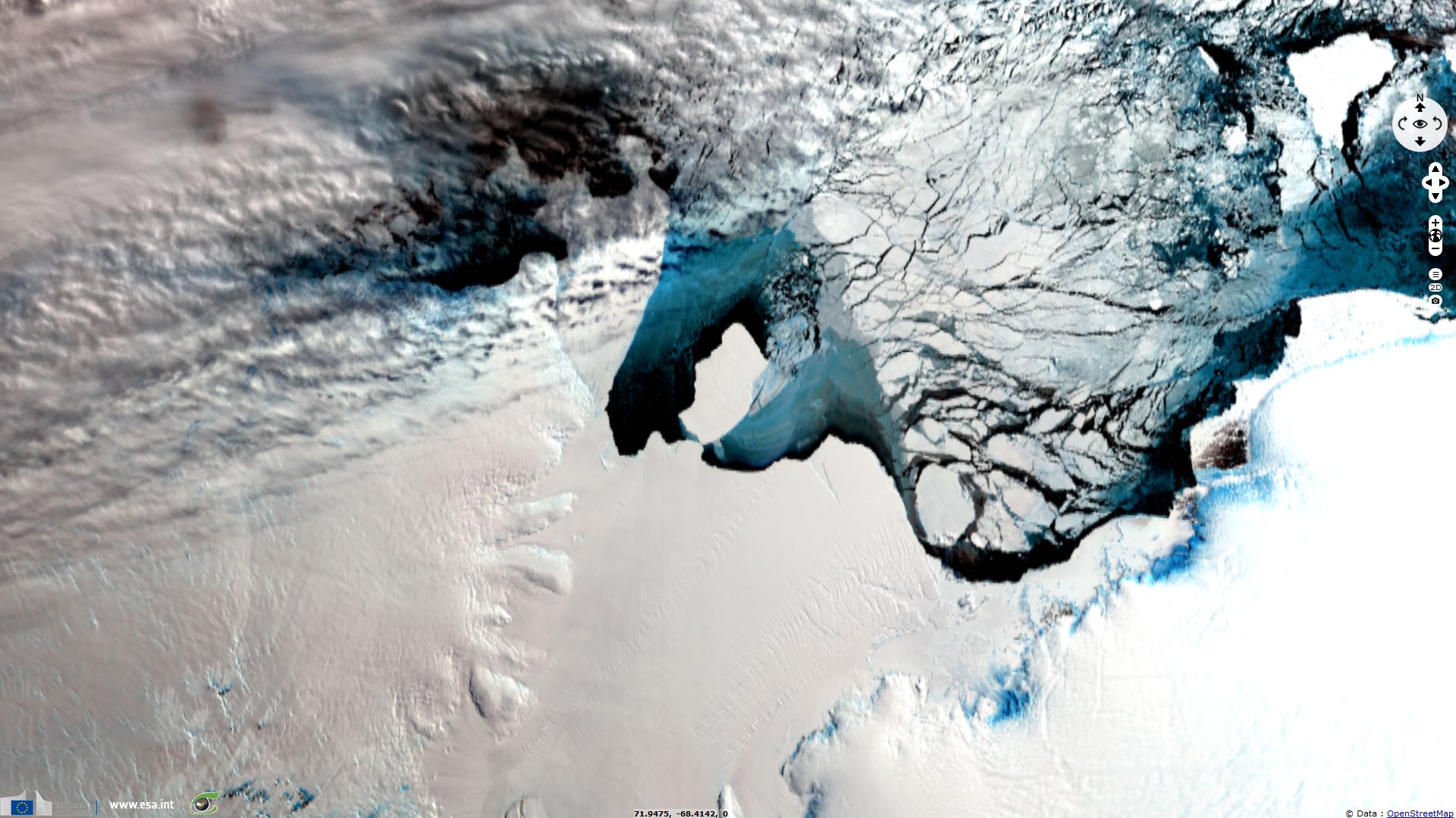
Calving in Amery Ice Shelf
Sentinel-1 CSAR EW acquired from 20 September 2019 to 09 October 2019
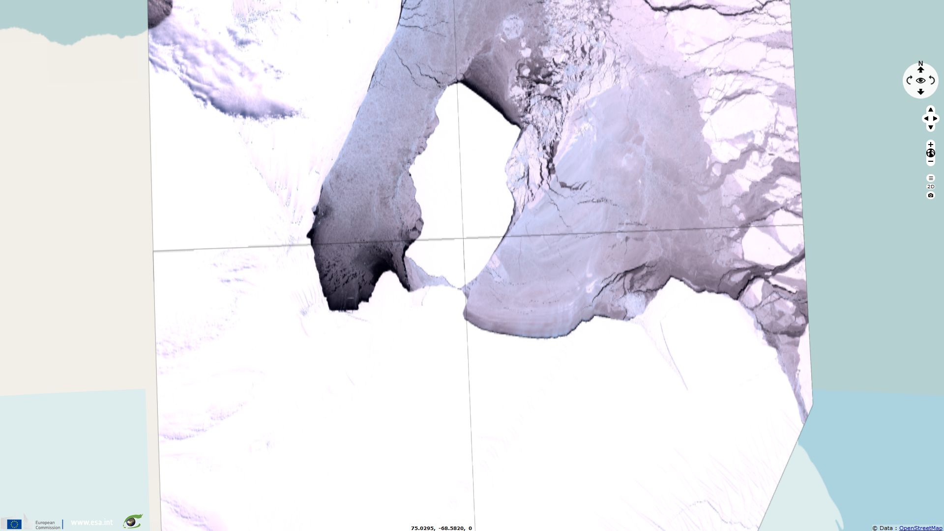
Sentinel-2 MSI acquired on 09 October 2019 at 04:17:29 UTC
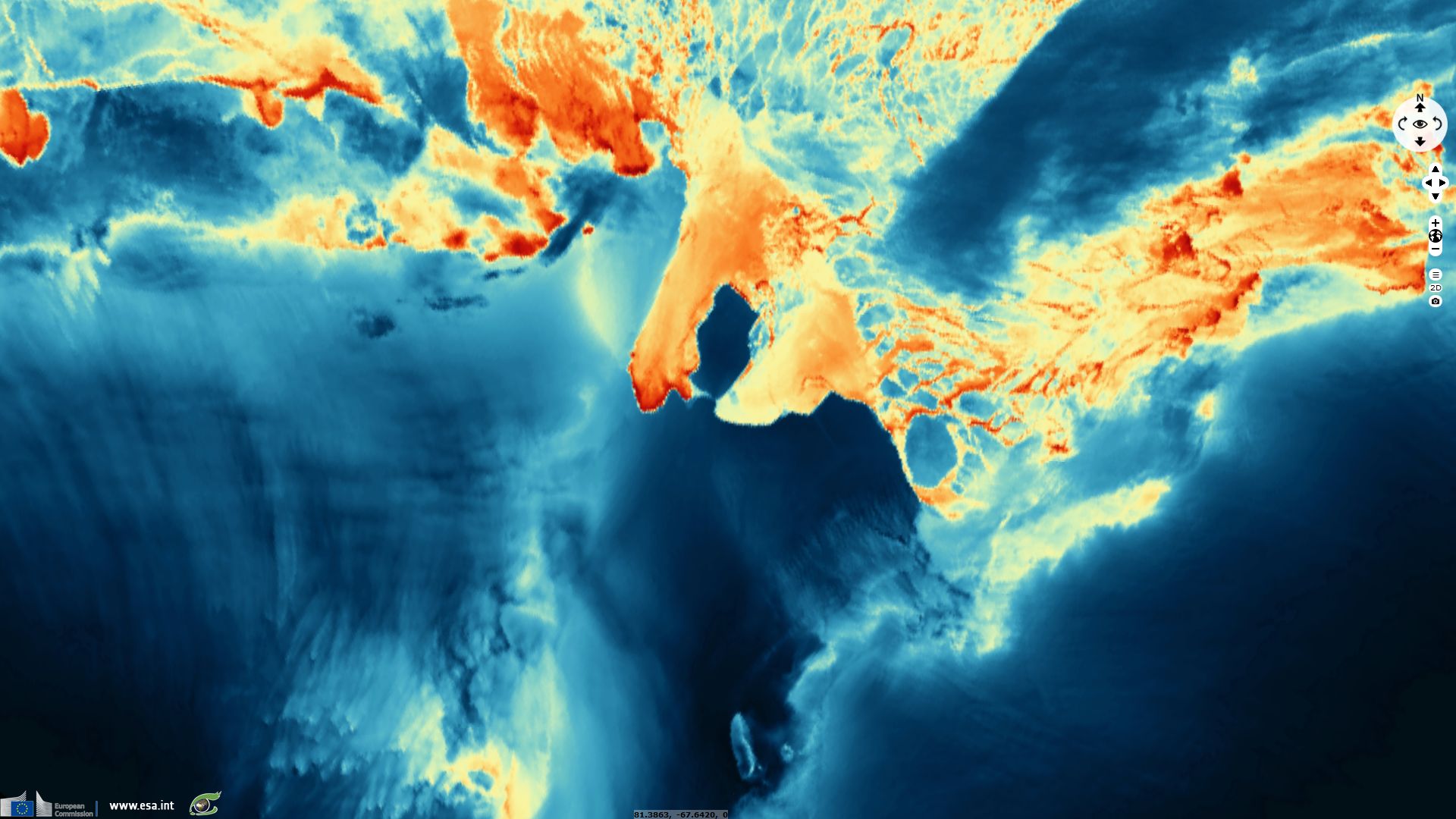
Sentinel-3 SLSTR RBT acquired from 23 September 2019 to 10 October 2019
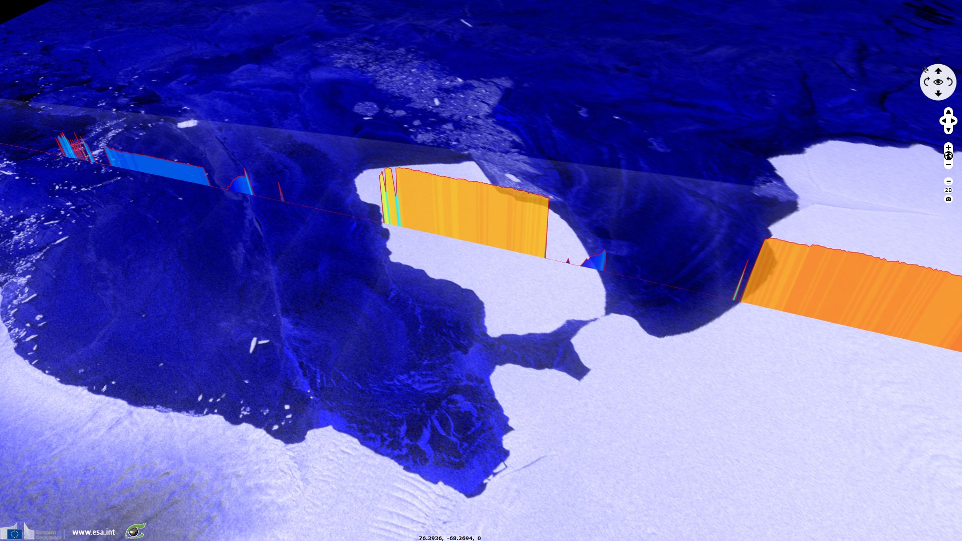
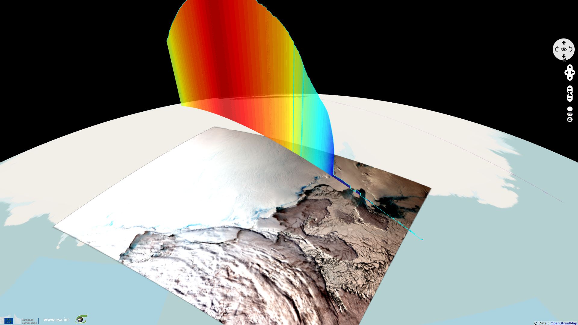
Sentinel-3 SRAL LAND acquired on 08 October 2019 at 18:38:05 UTC
Sentinel-2 MSI acquired on 09 October 2019 at 04:17:29 UTC
Sentinel-3 SLSTR RBT acquired from 23 September 2019 to 10 October 2019
Sentinel-3 SRAL LAND acquired on 08 October 2019 at 18:38:05 UTC
Keyword(s): Iceberg, coastal, polar, sea ice, Antarctica
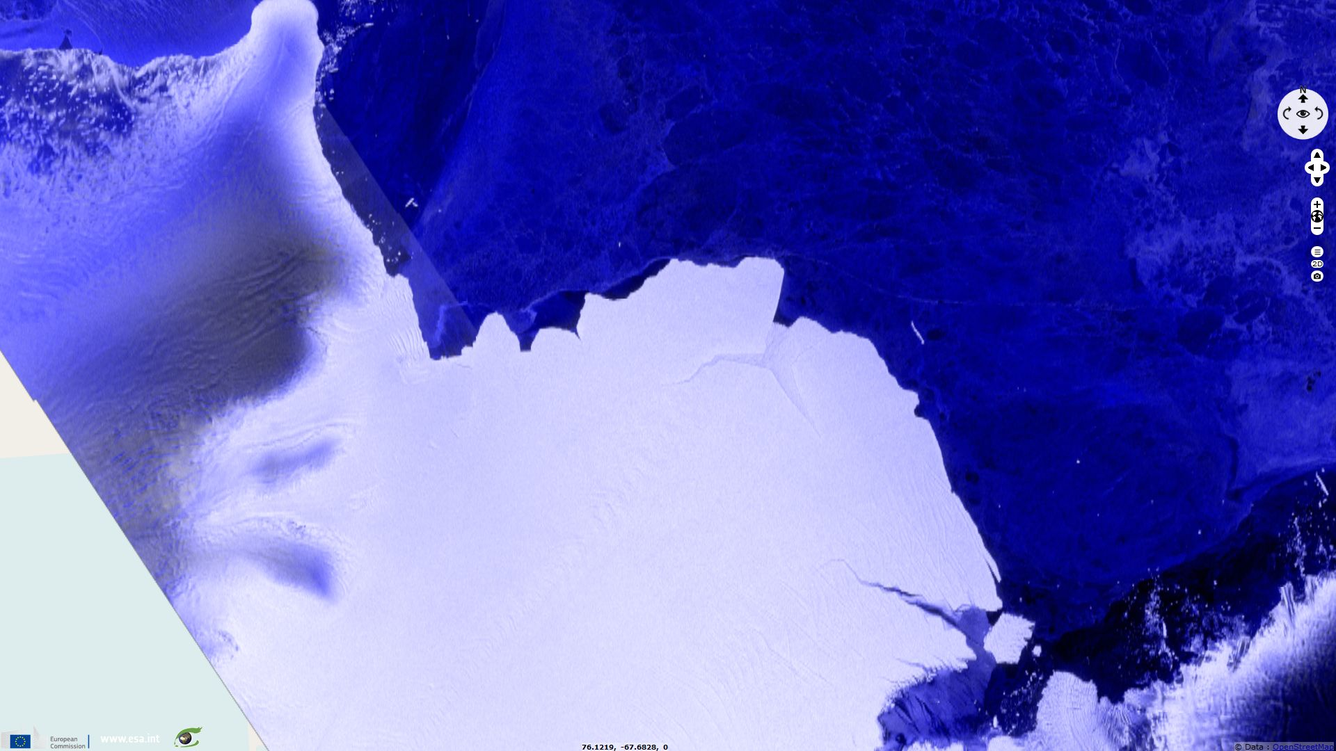
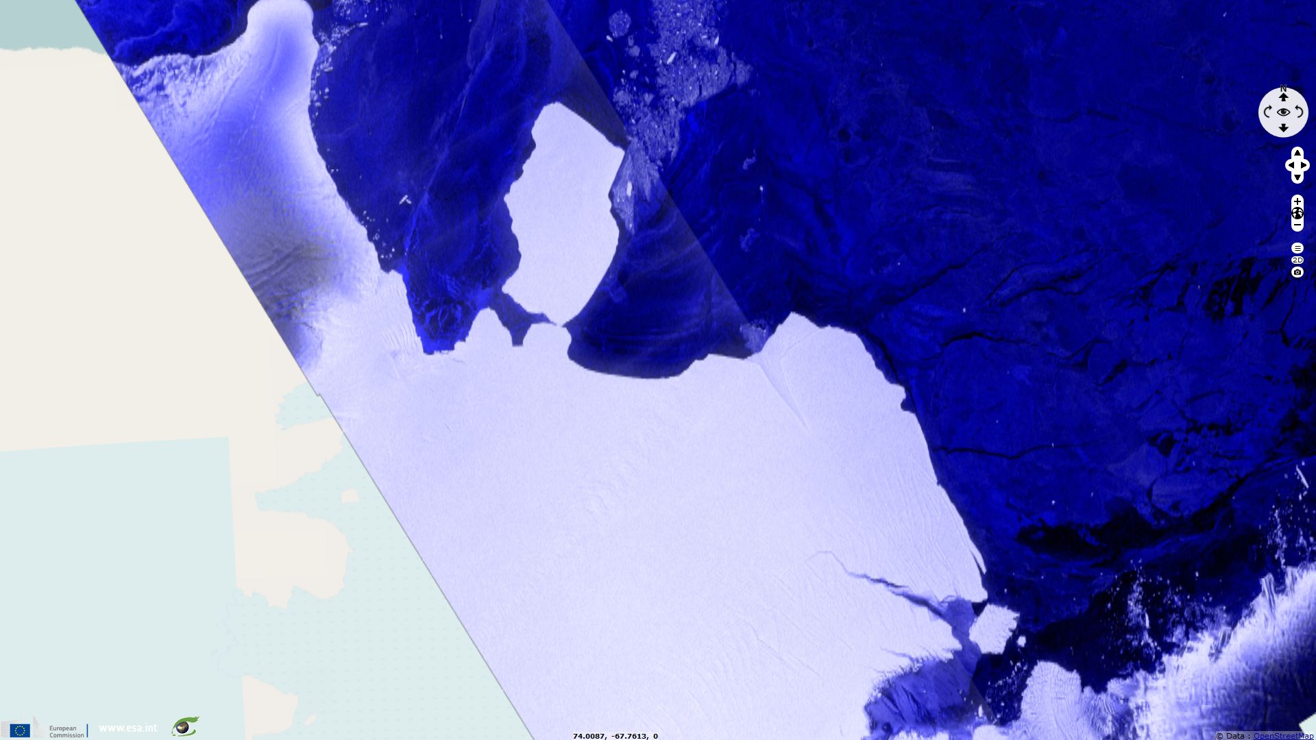
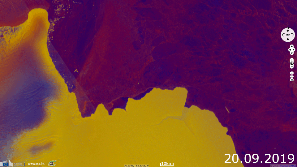
The D28 iceberg is around 1600 square km, about 30 km wide and 60 km long and weighs 315 billion tonnes.
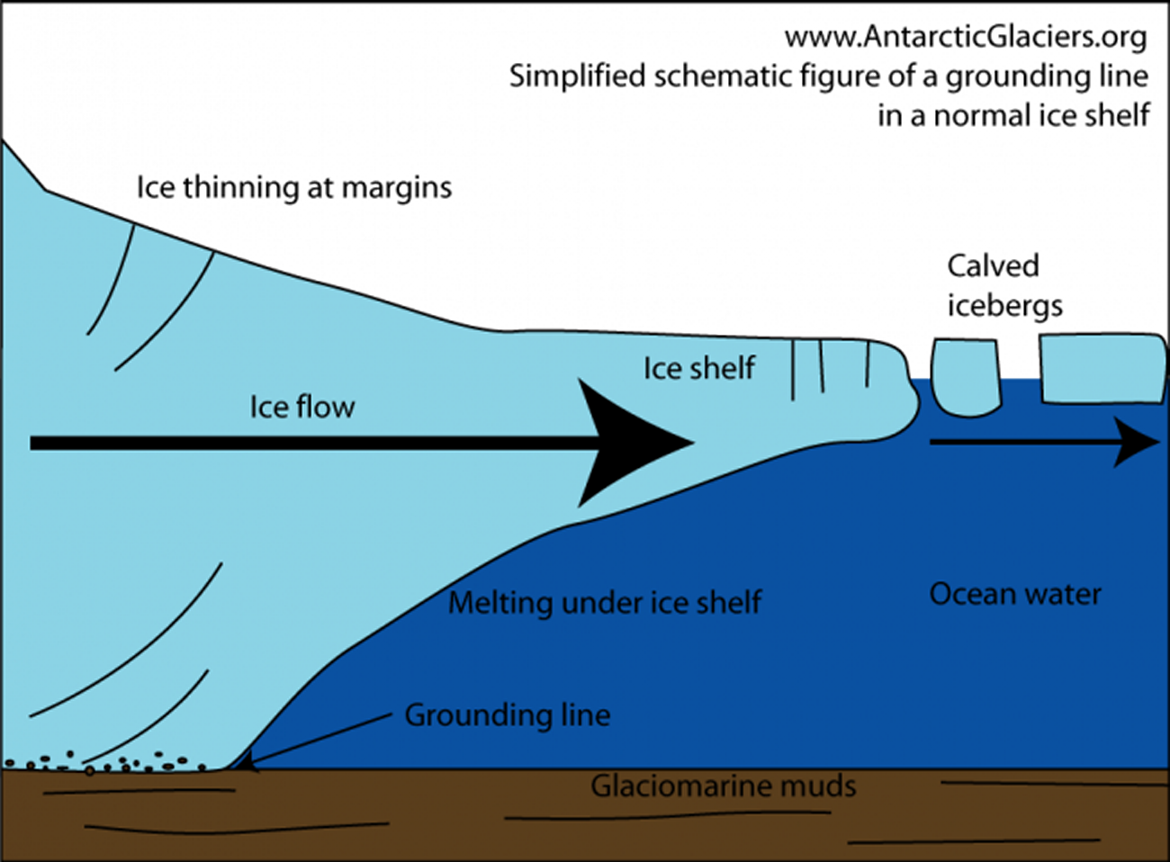
The Scripps Institution of Oceanography wrote on its Twitter page: "Ice shelves are platforms of floating ice that form where the Antarctic ice sheet meets the ocean. They do not directly affect sea level because ice shelves are already floating, much like an ice cube in a glass of water. Grounded ice is the concern for sea level rise."
The Scripps Institution of Oceanography wrote on its Twitter page: "Ice shelves are platforms of floating ice that form where the Antarctic ice sheet meets the ocean. They do not directly affect sea level because ice shelves are already floating, much like an ice cube in a glass of water. Grounded ice is the concern for sea level rise."
Helen Fricker, which is a glaciologist and Professor at Scripps Insitution of Oceanography,
said:
"This type of event is not related to climate change - it’s naturally occurring and happens every 60-70 years."
and:
“This event is part of the ice shelf’s normal cycle though and, while there is much to be concerned about in Antarctica, there is no cause for alarm yet for this particular ice shelf.”
The average altitude of the Antarctica is 2500m and the highest mountain, Mount Vinson, reaches the altitude of 4892m.
The views expressed herein can in no way be taken to reflect the official opinion of the European Space Agency or the European Union.
Contains modified Copernicus Sentinel data 2026, processed by VisioTerra.
Contains modified Copernicus Sentinel data 2026, processed by VisioTerra.
| More on European Commission space: |  |
 |
 |
||||
| More on ESA: | |
|
|
S-1 website | S-2 website | S-3 website | |
| More on Copernicus program: | |
|
|
Scihub portal | Cophub portal | Inthub portal | Colhub portal |
| More on VisioTerra: | |
|
|
Sentinel Vision Portal | Envisat+ERS portal | Swarm+GOCE portal | CryoSat portal |