Rapid growth of Al-Ain oasis city, United Arab Emirates
Landsat TM acquired on 11 July 1987 at 06:11:26 UTC
Sentinel-2 MSI acquired on 18 July 2016 at 06:46:32 UTC
Sentinel-2 MSI acquired on 12 July 2020 at 06:46:29 UTC
Sentinel-2 MSI acquired on 17 July 2023 at 06:46:29 UTC
Sentinel-2 MSI acquired on 18 July 2016 at 06:46:32 UTC
Sentinel-2 MSI acquired on 12 July 2020 at 06:46:29 UTC
Sentinel-2 MSI acquired on 17 July 2023 at 06:46:29 UTC
Keyword(s): Land, infrastructure, food security, agriculture, tourism, irrigation, climate change, greenhouse gases, oil and gas, UNESCO World Heritage, UAE, United Arab Emirates
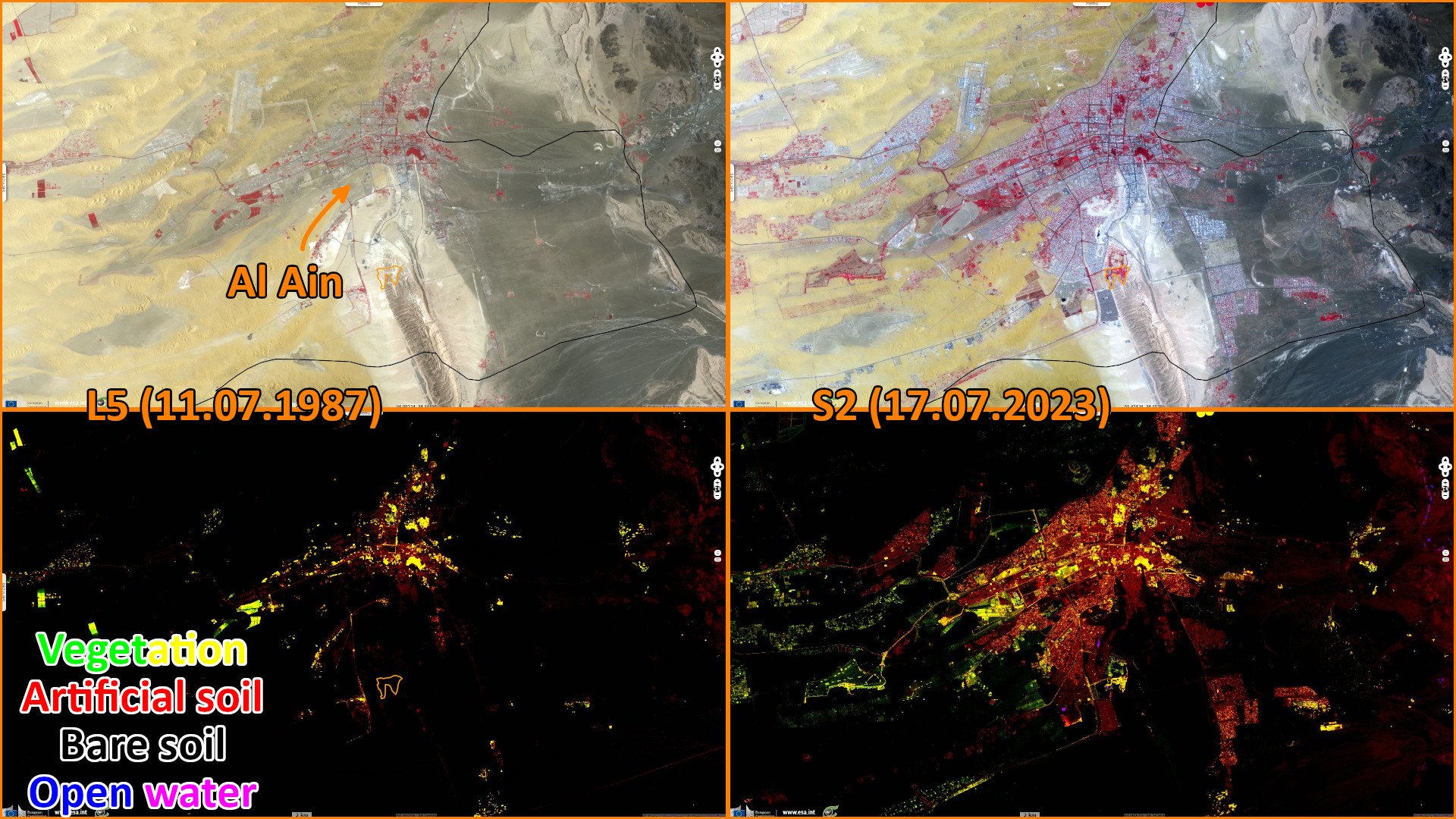
This approximate land use shows the increase in cultivated land, gardens and water used for recreation during the last 35 years. This growth in water consumption, which far exceeds the capacity of the oasis, is fed by desalination plants located by the sea. Most of these plants in the United Arab Emirates use older, power-hungry technology which are fueled by power sources that emit greenhouse gases.
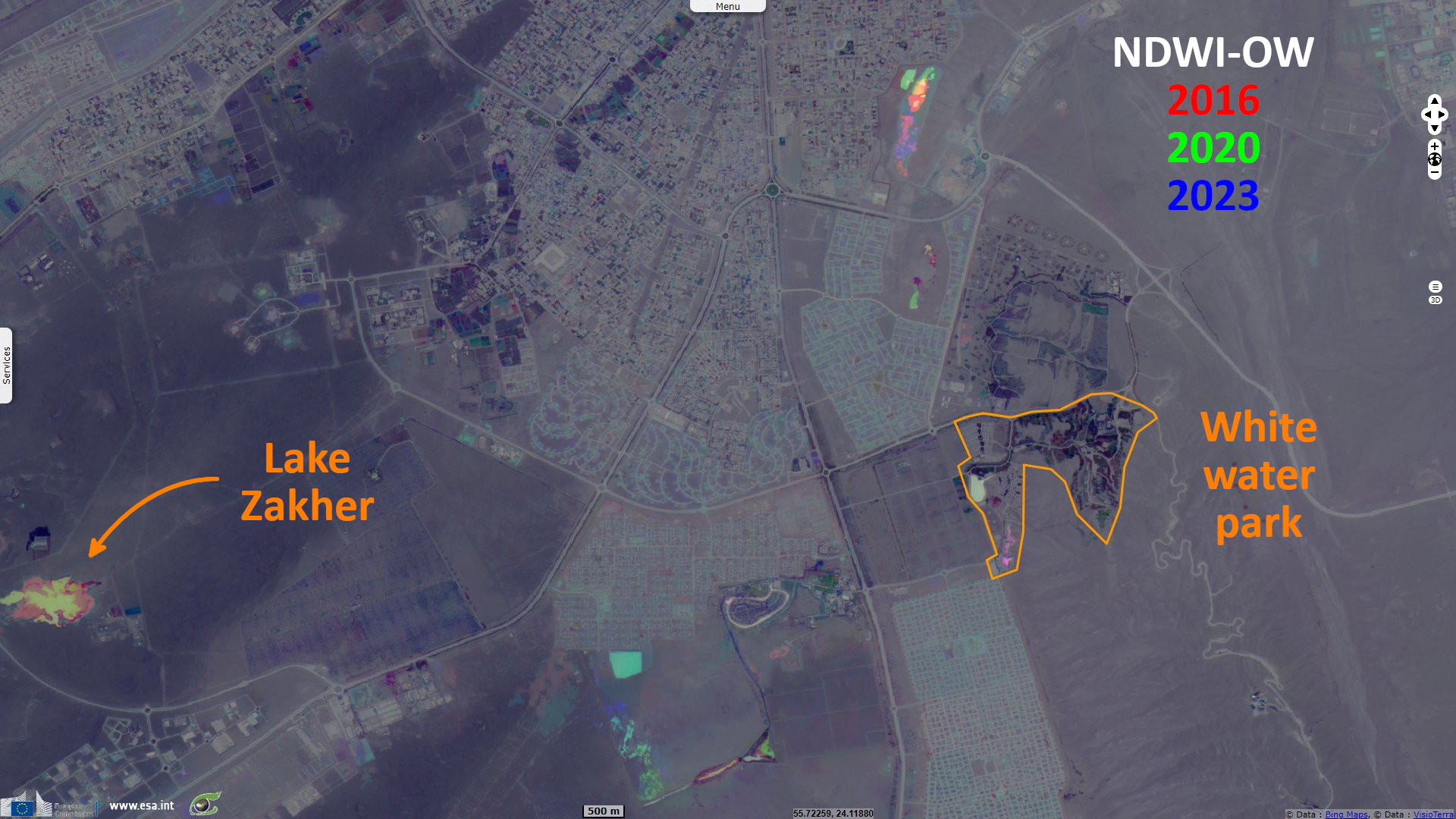
Lake Zaher has dried out in 2023, as shown by the low values in the blue channel. One can see that the white water section of Al Ain adventure park was closed (and dry) during COVID lockdown in 2020 which shows with the absence of blue.
The views expressed herein can in no way be taken to reflect the official opinion of the European Space Agency or the European Union.
Contains modified Copernicus Sentinel data 2026, processed by VisioTerra.
Contains modified Copernicus Sentinel data 2026, processed by VisioTerra.
| More on European Commission space: |  |
 |
 |
||||
| More on ESA: | |
|
|
S-1 website | S-2 website | S-3 website | |
| More on Copernicus program: | |
|
|
Scihub portal | Cophub portal | Inthub portal | Colhub portal |
| More on VisioTerra: | |
|
|
Sentinel Vision Portal | Envisat+ERS portal | Swarm+GOCE portal | CryoSat portal |