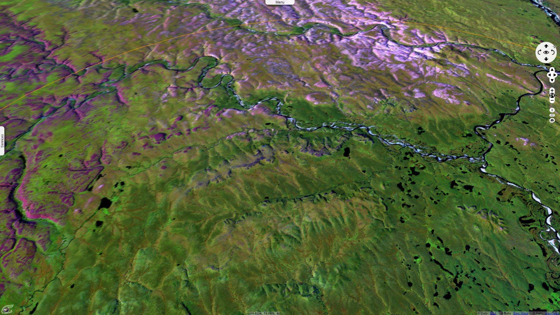
Popigai crater, World geological heritage & first source of impact diamonds, Siberia
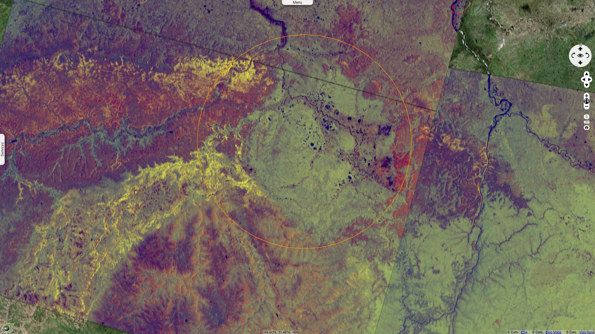
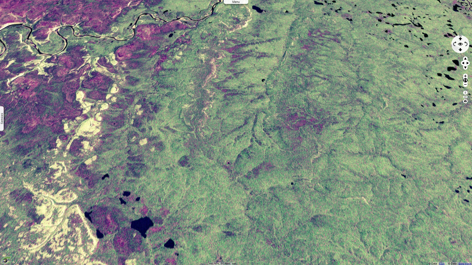
Sentinel-2 MSI acquired on 31 July 2020
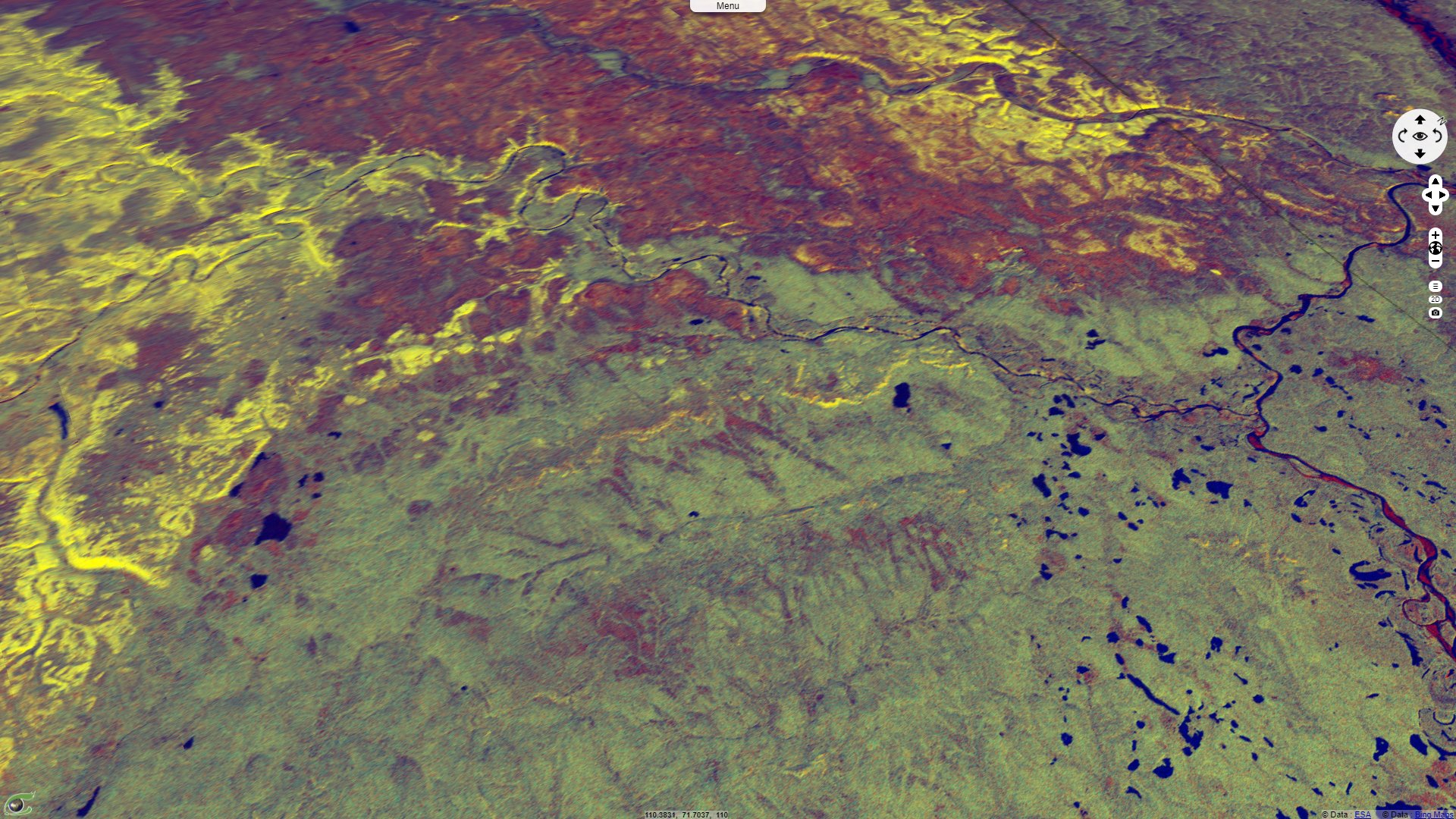
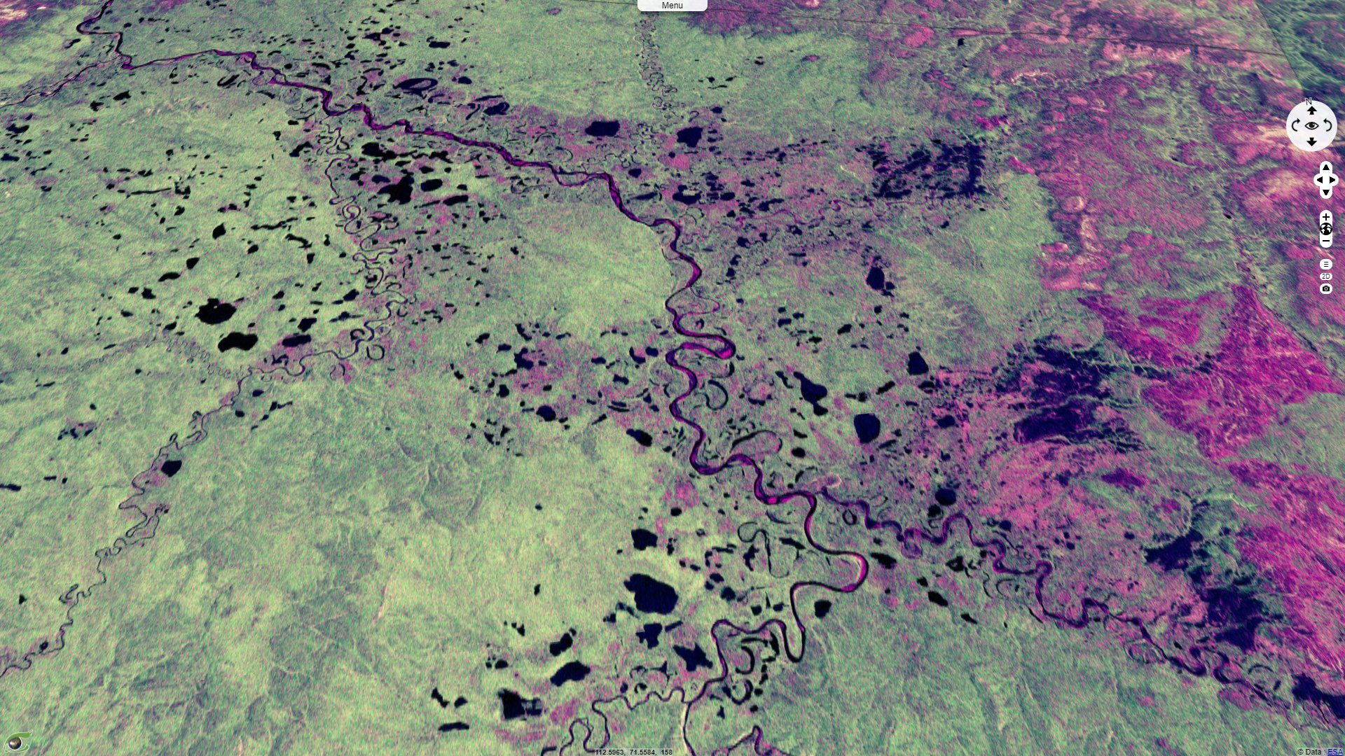
Sentinel-1 CSAR IW acquired on 04 August 2020
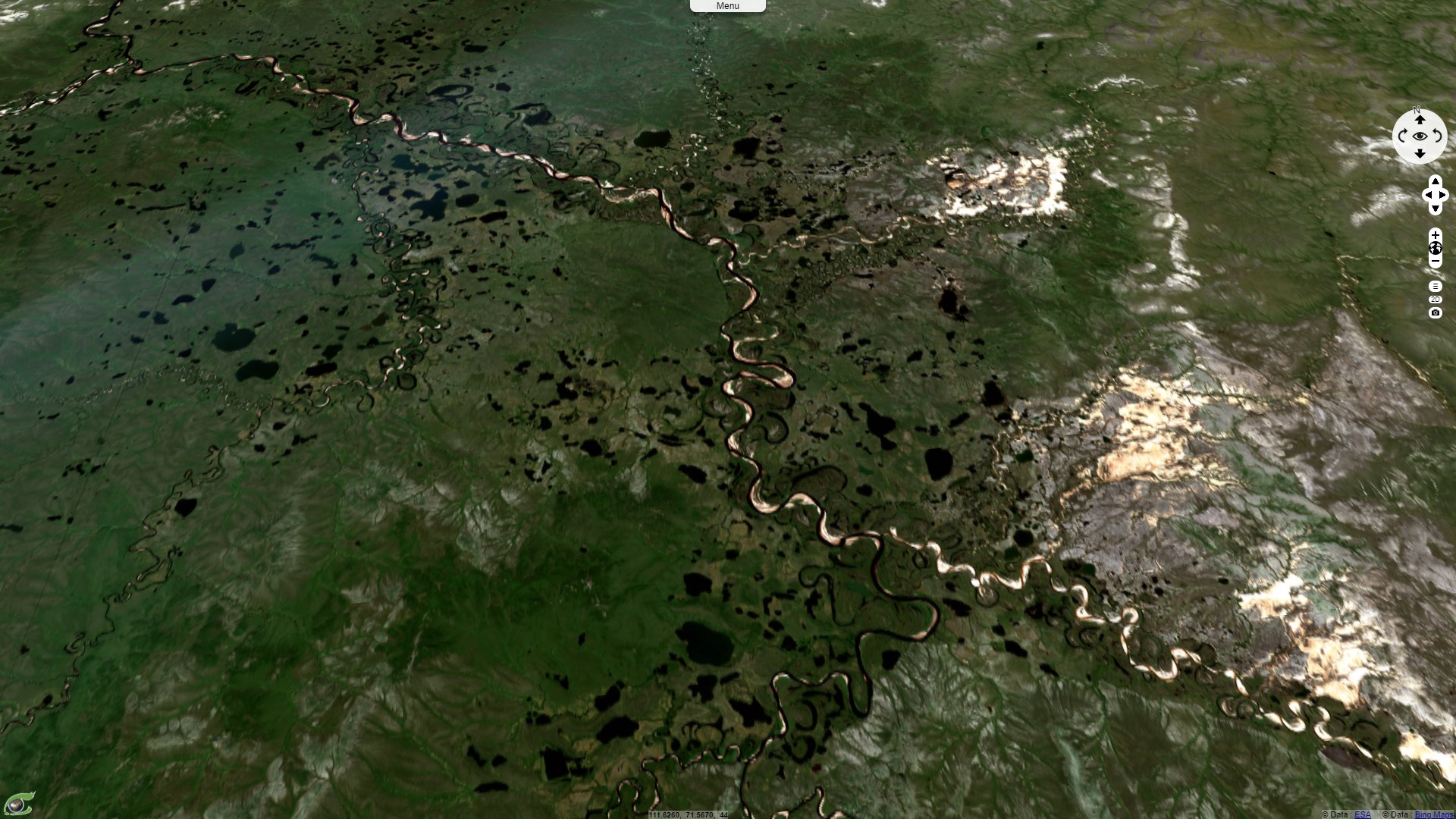
Sentinel-2 MSI acquired on 09 September 2020
Keyword(s): Crater, geology, hydrology, UNESCO, Siberia, Russia.
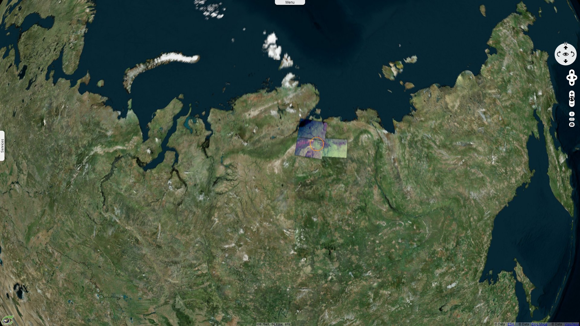
Popigai crater is one of the the best preserved of the large craters on Earth. It has the distinction of being a UNESCO World geological heritage. Alexander Deutsch dedicated an article to this structure, published in March 2000: "Popigai in Russia (N 71˚28’ E 110˚11’), fulfills all aspects for an ideal crater model. It is a large, nearly uneroded complex impact structure which has been extensively drilled. The only setback is that Popigai is situated in a very remote, sub-polar part of Siberia, inhabited only by a small group of the Dolgan tribe."
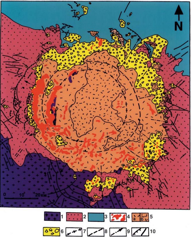
"Geological sketch map of the Popigai impact structure, modified after Masaitis et al. (1980). (1) Archean gneisses and schists; (2) Upper Proterozoic and Cambrian quartzites, dolomites, and limestones; (3) Permian sandstones and argillites with sills and dikes of Triassic dolerites; (4) tagamites; (5) suevites with lenses of fine-grained allogenic breccia (coptoclastites); (6) allogenic breccia; (7) center line of annular uplift; (8) center line of annular trough; (9) axes of radial troughs; (10) thrusts, faults." - Source: Alexander Deutsch
"Geological studies, and especially petrographic observations on the various breccias yielded a new, and totally different picture of the structure. It was considered for the first time as an impact crater, about 40 Ma old (Masaitis et al., 1975). Contemporaneously, the “volcanics” were recognized as impact melt rocks, and later as the host rocks for a quite specific class of diamonds, which had been previously found in placers close to the impact structure. Popigai turned out to be the first terrestrial location containing “impact diamonds” (Masaitis et al., 1972). The discovery of this high pressure carbon polymorph in Popigai impact rocks initiated in the 70–80's largescale exploration programs, including geophysical surveys, and extensive drilling."
"Exploration work revealed not only Popigai as tremendously rich deposit of impact diamonds (Masaitis, 1998), but unveiled the sub-surface structure of the crater, as well as the composition and distribution of impact-related rock formations (Masaitis et al., 1975; 1998). Popigai was shown to represent an extremely well preserved complex structure (Masaitis et al., 1998), forming a three-dimensional textbook for the geology of large complex impact craters, and an ideal object for general studies on the cratering process."
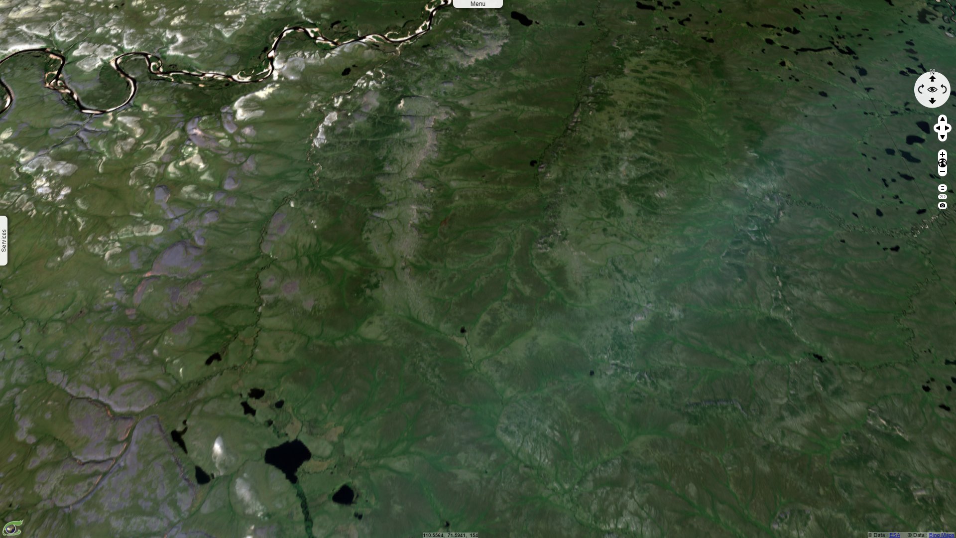
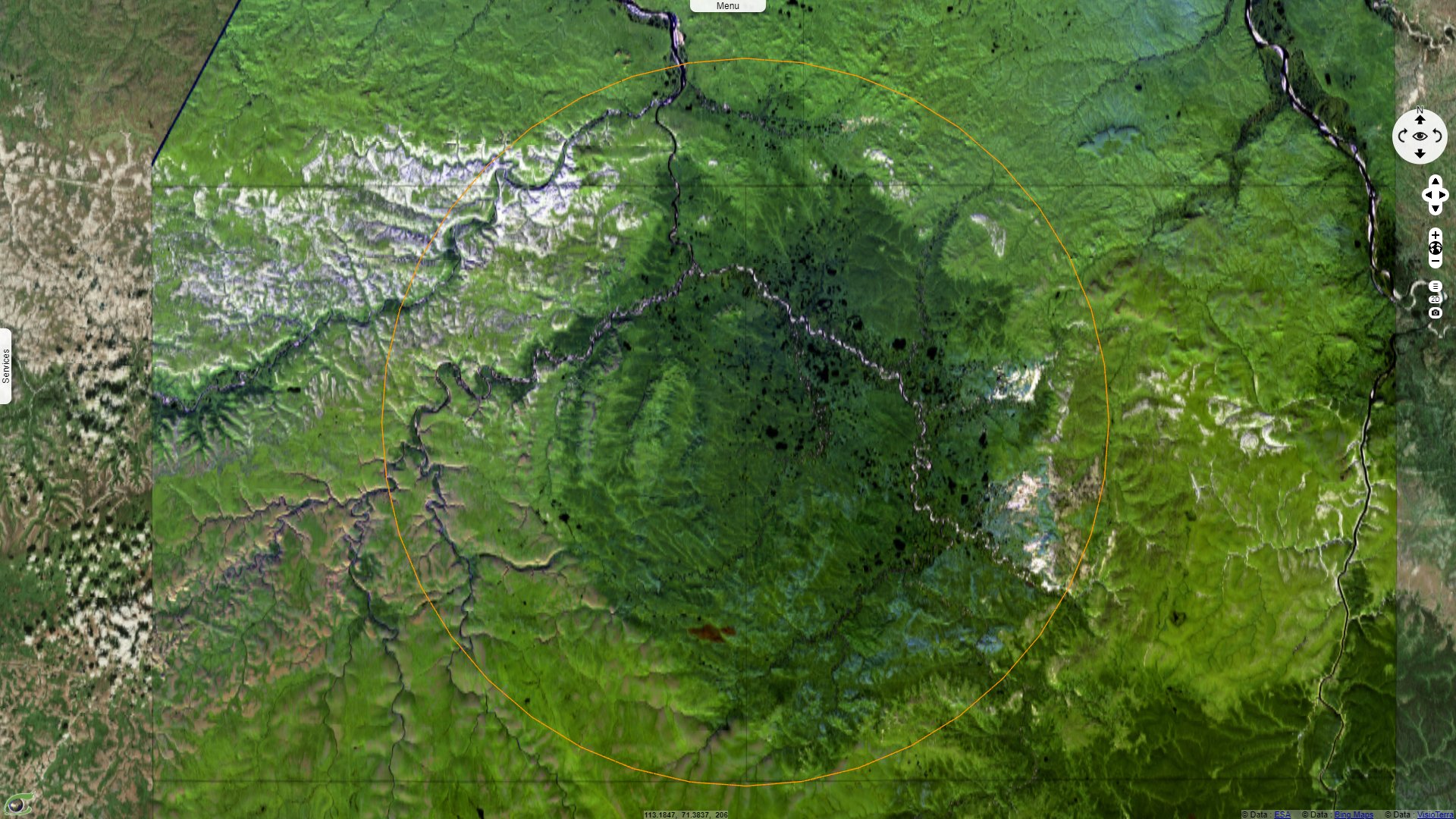
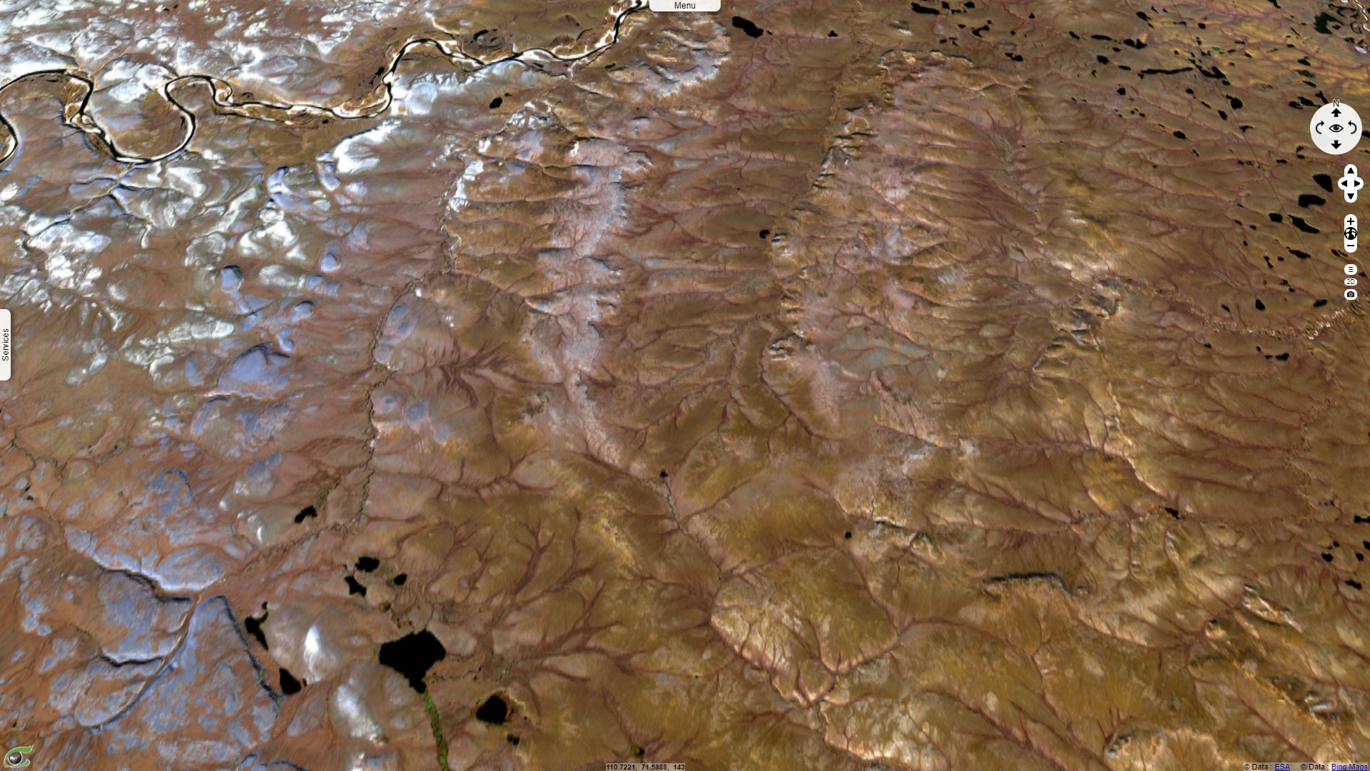
"During the flight from Khatanga to Popigai, the monotonous tundra, covered by debris of light-colored limestone and dolomite, dominates the vista. Suddenly the landscape changes to swampy areas spotted with numerous lakes; brownish table-shaped uplands and hills appear, and steep, dark-colored cliffs form prominent landmarks. The drainage system — blue rivers with light-yellow gravel and sandy beaches — mirrors the concentric structural features of the crater area. Along the valleys, groves of low larch trees and bushes of dwarf birches occur."
"About 30 km upstream of the estuary of the Rassokha in the Popigai river, there are breath-taking outcrops of the rock series which fill the crater. The up-to-150 m high rocky slopes continue for about 10 km, and similar outcrops occur along the tributaries of the Rassokha river for additional 10 to 15 km southward and northward. The helicopter of the IPEX 1997 team landed on the riverbank opposite to such a huge cliff, which displays a broad spectrum of variously colored rocks that are mixed together in a seemingly quite chaotic arrangement. In the light of the lowering sun, this cliff resembles a giant mural."
"This apparent chaos originated in the cratering process, and represents an allogenic or allochthonous polymict breccia. The spectrum of the clasts reflects the geological situation at the impact site, 35 Ma ago. The rocks range from dark brown and grey Archean gneiss; black diabase and pinkish quartzites of Proterozoic age; light-green, yellow and dark red Cambrian claystone, white and light brown limestone and dolomite of the same age, banded Permian sandstones of grey color, over bluish Jurassic clays to black fragments of Cretaceous coal. Here and there bombs or shards of dark green vesicular impact melt glass occur, as well as black dykes of injected impact debris."
"This giant accumulation of variously crushed and mixed rocks is cemented by a greyish, sandy matrix which, in turn, includes abundant small angular fragments of the already mentioned rock types, impressive impact-melt coated “gneiss bombs”, and a few shards and particles of partly weathered impact glass. This polymict breccia is a typical impact formation, occurring in similar form at other terrestrial craters such as the Ries (von Engelhardt et al., 1995), Haughton (Canada; e.g., Grieve, 1988), or Sudbury (Canada; e.g., Deutsch et al., 1995). Polymict impact breccias have been identified in the lunar sample collection, as well as amongst meteorites."
"At Popigai, the polymict breccia is capped by the erosional remnant of a sheet of chilled impact melt rocks. These so-called tagamites are named after the Tagamy ridge at Popigai. The tagamites form for several km along the Rassokha riverbed a spectacular brown wall with abundant, irregularly dispersed white patches—inclusions of rock fragments. Most of the inclusions in the melt sheet are brecciated and shocked gneiss clasts. The largest ones, up to 20 m across, are concentrated at the base of the sheet yet all parts of the tagamite layer carry abundant rock and lithic fragments down to a size of 1 mm. At dawn, the melt sheet appears as impressive dark wall, explaining the native name Khara Khaia or 'Black Mountain'."
"In general, this north-western sector of the Popigai crater forms to the outer edge of the annular trough, which is filled with allogenic breccia and melt rocks. These impact formations are widely distributed within the crater depression but thin out, and finally disappear at the crater’s edge. Further outwards, parauthochthonous sediments form an up to 15 km wide ring zone, which display numerous upthrusts, irregular folds and other dislocations; all these features attenuate outward. Up to a distance of 70 km from the crater center, small patches of allogenic breccia occur as remnants of the once coherent ejecta blanket."
"According to geological mapping and drilling, the inner part of the crater consists of an about 1–2 km deep annular through that surrounds, in turn, the ring uplift of brecciated and shocked crystalline rocks. The central depression inside this annular uplift is partly buried under a thick sequence of predominantly fine grained fall-back breccias and impactites. As shallow drilling failed to reach the bottom of the central depression, the thickness of the crater fill is estimated to reach 2.5 km. Geophysical data indicate the presence of a small, flat central uplift in the crater center, consisting of brecciated and partly melted crystalline rocks."
"According to this complex geological situation, the Popigai crater represent a smaller terrestrial analogue for the large multi-ring impact basins on the surfaces of other planets. Hence, Popigai exhibits an unique terrestrial geological feature, as the only other known terrestrial multi-ring structures are either eroded (Vredefort, South Africa, Therriault et al., 1997), tectonized and eroded (Sudbury; Deutsch and Grieve, 1994), or buried under a km thick post-impact sedimentary sequence (Chicxulub; Morgan et al., 1997)."
The views expressed herein can in no way be taken to reflect the official opinion of the European Space Agency or the European Union.
Contains modified Copernicus Sentinel data 2026, processed by VisioTerra.
Contains modified Copernicus Sentinel data 2026, processed by VisioTerra.
| More on European Commission space: |  |
 |
 |
||||
| More on ESA: | |
|
|
S-1 website | S-2 website | S-3 website | |
| More on Copernicus program: | |
|
|
Scihub portal | Cophub portal | Inthub portal | Colhub portal |
| More on VisioTerra: | |
|
|
Sentinel Vision Portal | Envisat+ERS portal | Swarm+GOCE portal | CryoSat portal |