Paroxysmal explosion at the Lighthouse of the Mediterranean
Sentinel-2 MSI acquired on 02 July 2019 at 09:50:39 UTC
Sentinel-3 SLSTR RBT acquired on 03 July 2019 at 08:50:04, 20:06:58 & 21:08:21 UTC
...
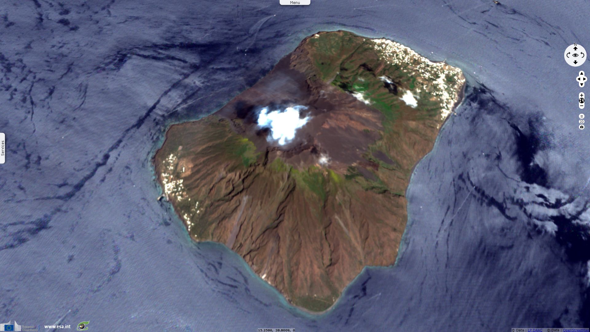
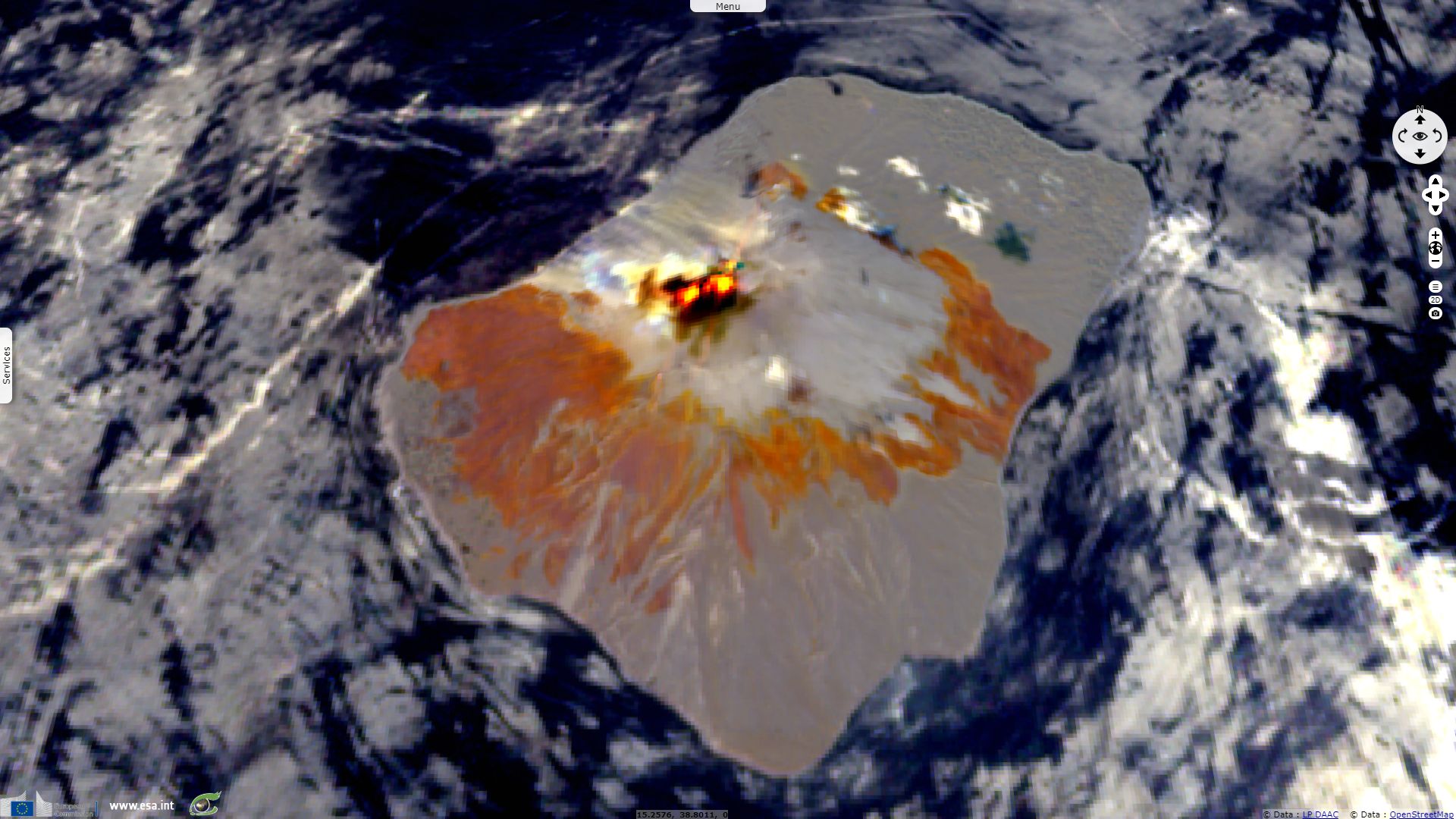
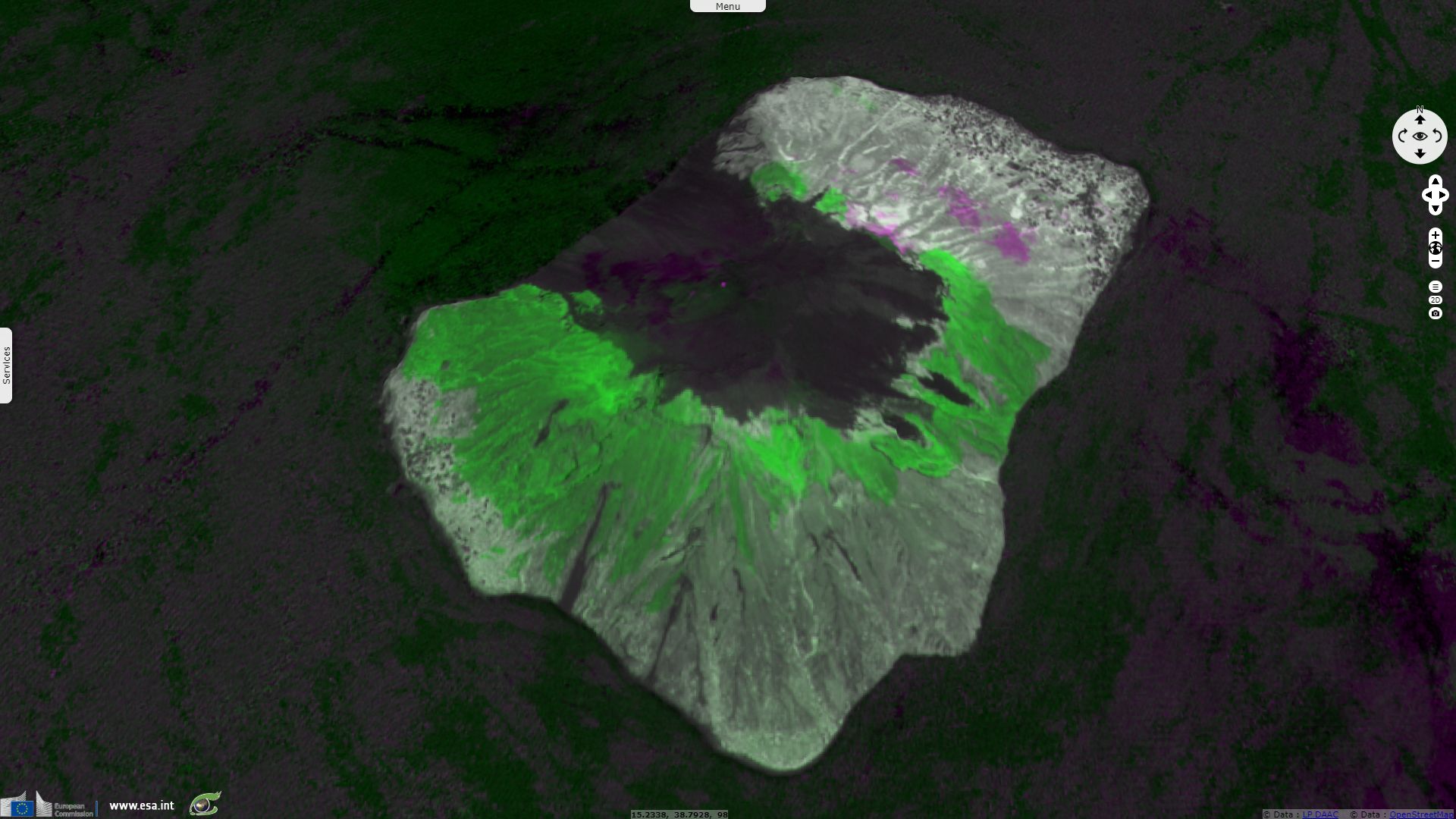
Sentinel-2 MSI acquired on 07 July 2019 at 09:50:31 UTC
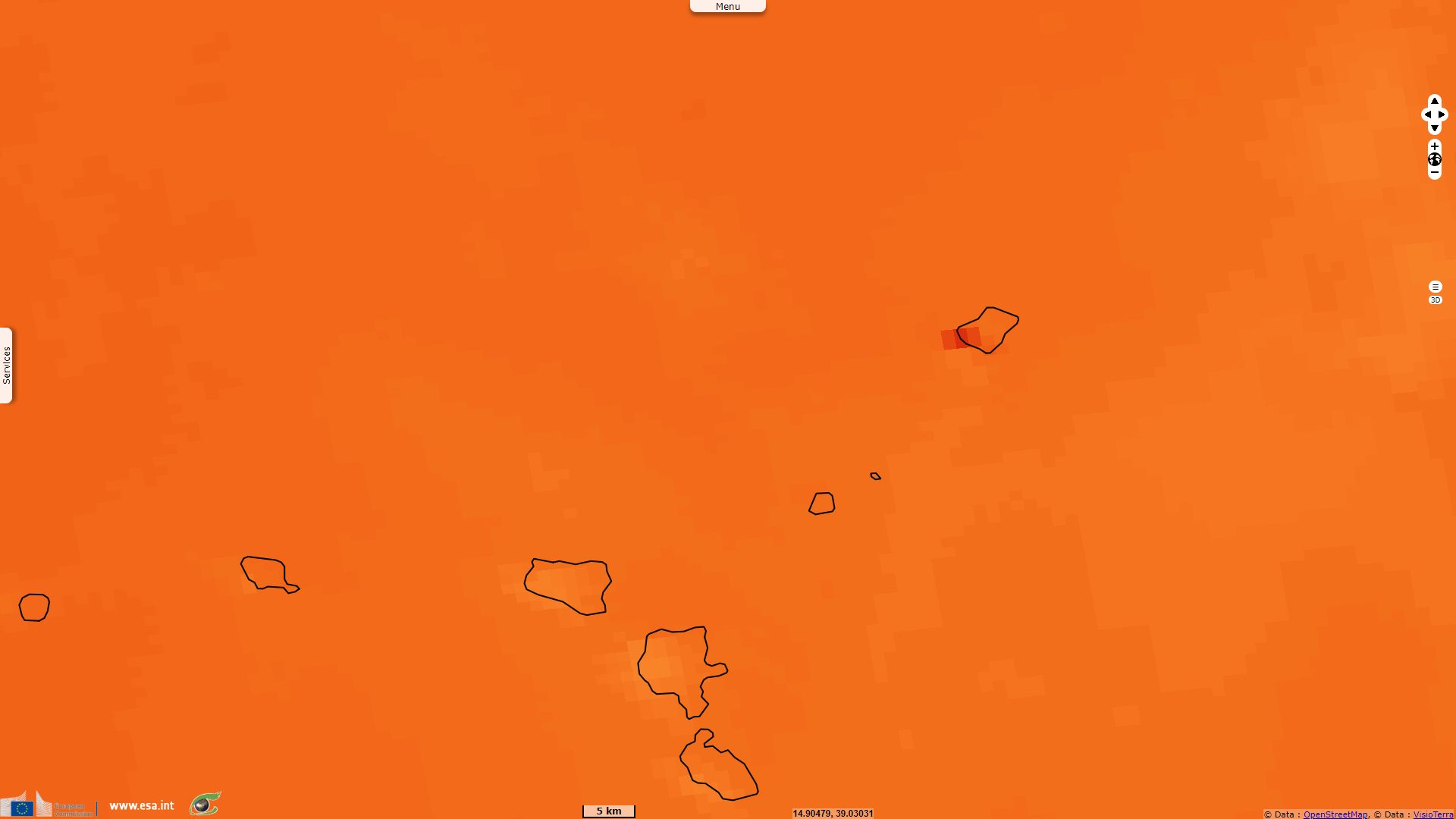
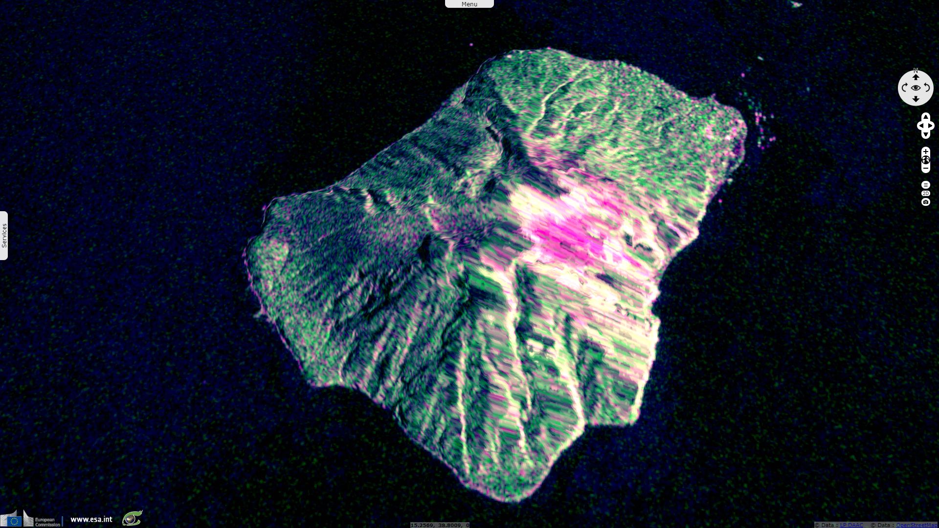
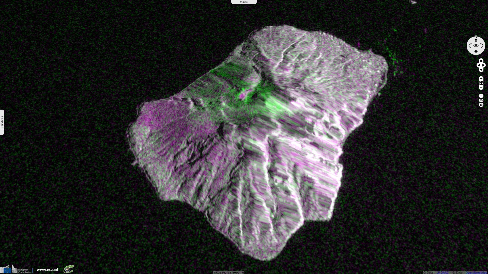
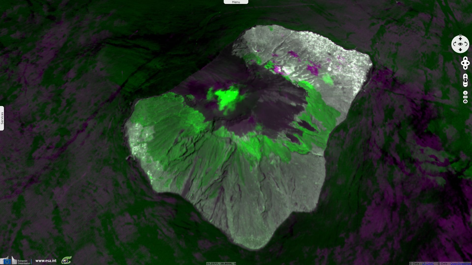
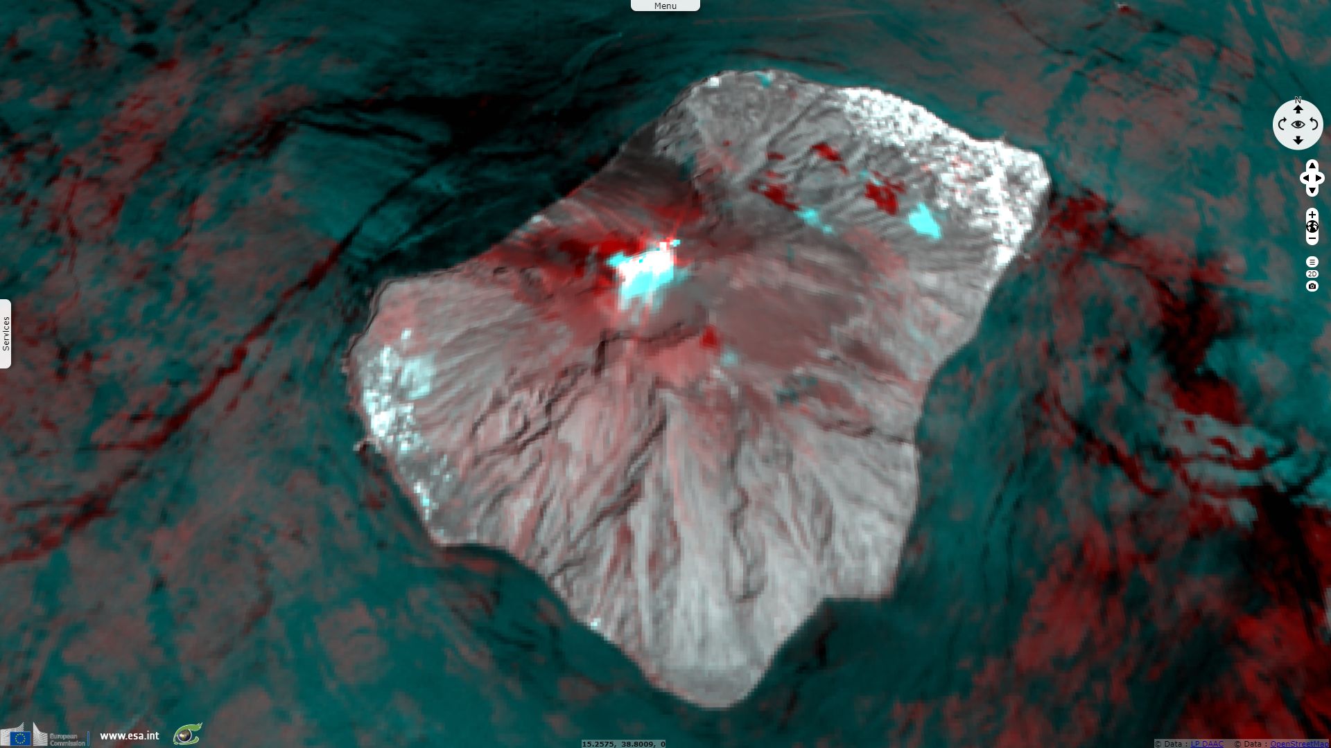
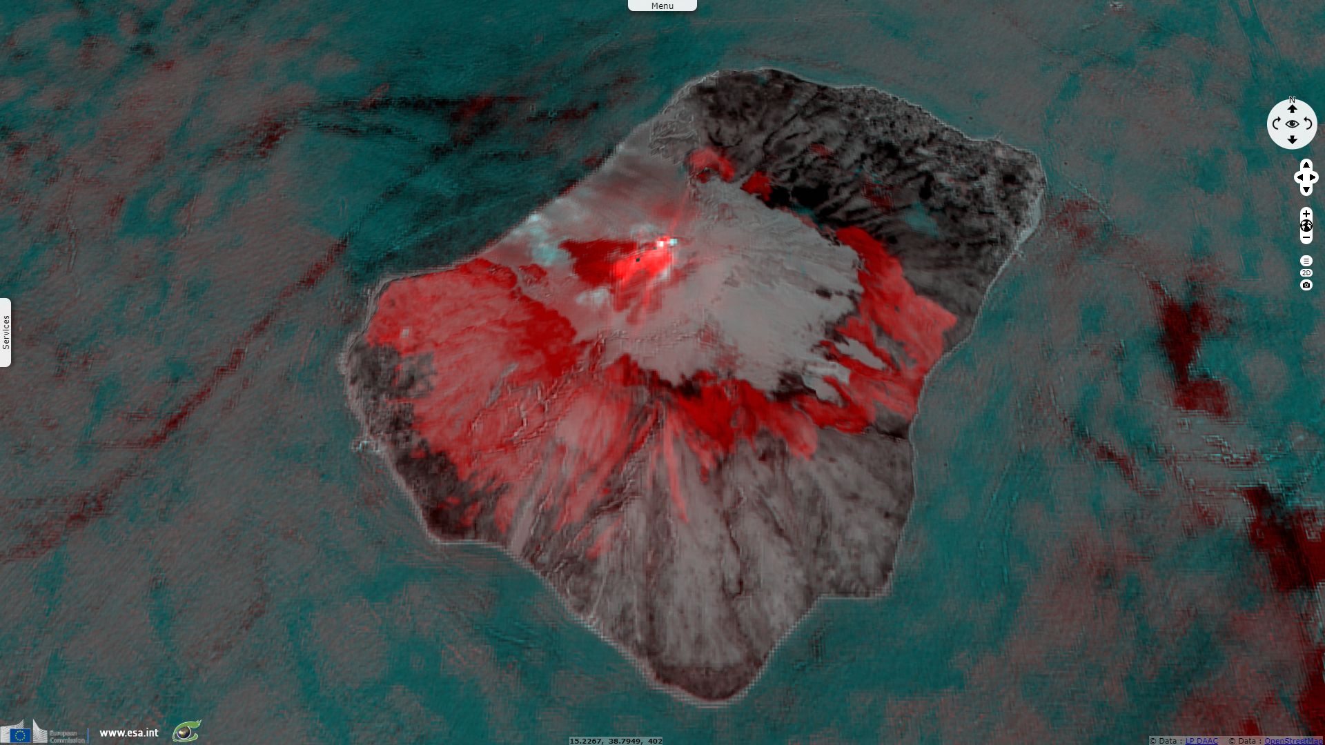
Sentinel-1 CSAR IW acquired on 08 July 2019 at 05:04:27 UTC
Sentinel-3 SLSTR RBT acquired on 03 July 2019 at 08:50:04, 20:06:58 & 21:08:21 UTC
...
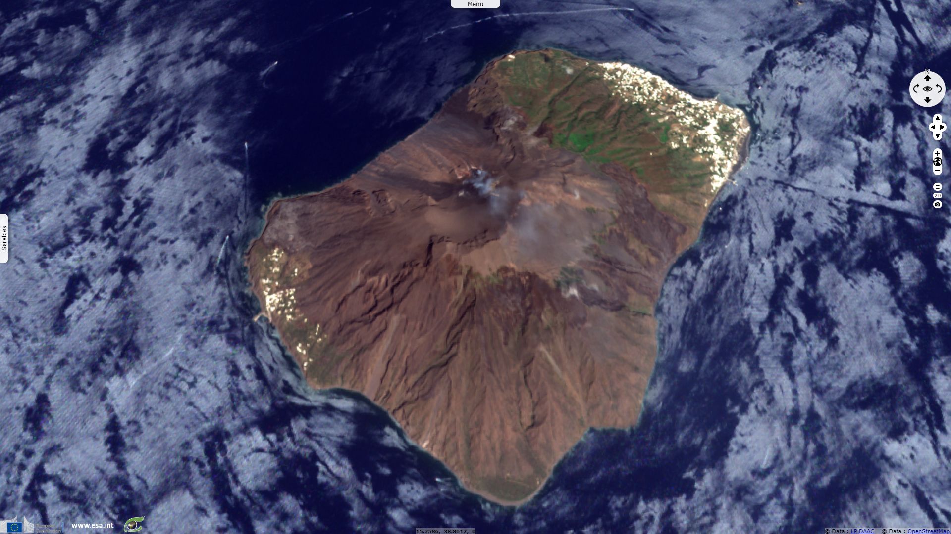
Sentinel-2 MSI acquired on 07 July 2019 at 09:50:31 UTC
Sentinel-1 CSAR IW acquired on 08 July 2019 at 05:04:27 UTC
Keyword(s): Emergency, geohazard, land, coastal, eruption, volcano, natural disaster, volcano, eruption, lava flow, wildfires, Stromboli, Aeolian Islands, archipelago, Italy, Tyrrhenian Sea, Mediterranean Sea
The Institute of Geological and Mining Engineering and Sciences of the Michigan Technological University describes the geographic location of the Stromboli: "Stromboli is the northeasternmost of the Aeolian Islands (Italian: Isole Eolie, or, more rarely, Isole Lipari) and lies about 50 km NE of Lipari. The island rises from a depth of about 17000 m, thus the entire edifice of Stromboli ranges in height next to Etna (about 3340 m). The highest point of the volcano ("I Vancori") lies at 924 m above sea-level whereas the place commonly described as "the summit", named Pizzo sopra la Fossa, reaches 918 m elevation.
The island has an area of 12.6 km², most of which is made of the volcano itself, with two more plain areas allowing the establishment of settlements. The larger of these is usually called Stromboli but in fact is a conglomerate of two communities, San Bartolo and San Vincenzo. Even smaller parts of the village have their own names like Ficogrande, Piscità, etc... The village extends from the northern part of the island to its northeastern tip. Stromboli village has about 350-400 inhabitants while Ginostra, on the SW side of the island, has only about 30, and there have been articles in the local press recently, reporting the imminent total abandonation of that place."
"Strombolicchio (right) and island of Stromboli (centre) from the Northeast. The lavas of the Strombolicchio volcanic neck were measured as 200 000 years old. Therefore they are older than any part of Stromboli, which emerged from the sea roughly 160 000 years ago" - Source: Stromboli online.
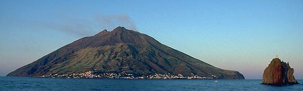
geology.com reminds its importance: "Stromboli is one of the most active volcanoes on Earth and has been erupting almost continuously since 1932. Because it has been active for much of the last 2000 years and its eruptions are visible for long distances at night, it is known as the 'Lighthouse of the Mediterranean'. Located off the coast of southern Italy, it is among the world's most visited volcanoes."
"Like Mount Etna on the island of Sicily, Stromboli is a part of the Calabrian volcanic arc. The volcanoes of the Calabrian arc are associated with the subduction of the African tectonic plate under the Eurasian plate. Stromboli is located on a NE-SW trending fault system, but the mechanisms which feed the volcano's magma chamber, and their relationship to the fault system, are poorly understood."
"The island of Stromboli was built by a series of eruptions of potassium-rich basalt and basaltic andesite lavas. The first eruptions began about 200 000 years ago, and formed the now-eroded Strombolicchio volcano. Starting around 160 000 years ago, the island of Stromboli proper began forming. For the next 150 000 years, lava flows and pyroclastic deposits built a stratovolcano, which was eventually covered by pyroclastic deposits, lahars and lava flows. The Neostromboli period saw the formation of the modern volcanic edifice, which involved numerous flank and summit caldera collapses."
The shape of the Stromboli is explained by the Istituto Nazionale Geofisica e Vulcanologia (INGV): "The structure of the island is controlled by NE-SO tectonic features, as evidenced by the predominant orientation of volcanic intrusions and fragile structures." "Its history is characterized by the growth and subsequent destruction of a series of volcanic buildings. The life of each of these buildings seems to end with a collapse of the sector, that is, a massive rock landslide, which leaves a huge niche (or amphitheater) of collapse. After the most recent collapse, around 5000 years ago, a new building began to be built inside the last collapse niche on the northwest flank, which is known as 'current Stromboli', whose active side constitutes a large talus scree, named Sciara del Fuoco."
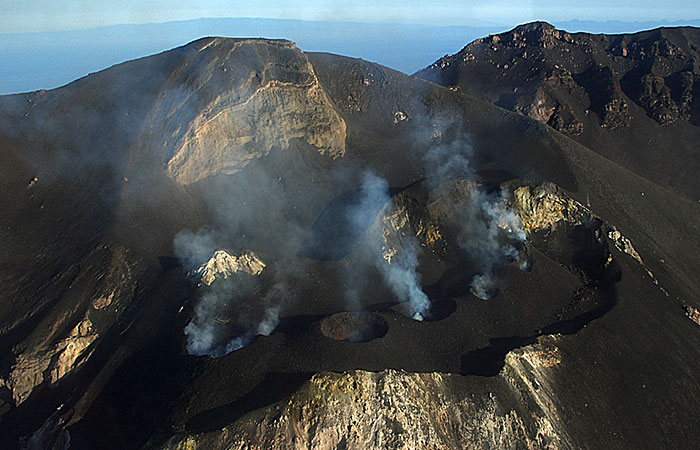
The institute of Geological and Mining Engineering and Sciences develops further: "The Sciara depression is bounded by two conspicious cliffs, or scarps. Both form immense natural barriers protecting the outer slopes of the volcano (beyond the Sciara depression) from lava flows and smaller pyroclastic flows as well as avalanches of material ejected from the craters. There are three craters presently at the crater area commonly called the 'crater terrace', a feature constatly changing and gradually growing upwards. Its longitudinal extension runs approximately NE-SW, but the craters are somewhat aligned in an en-echelon pattern."
The INGV describes the crater terrace: "For several decades, three main active craters have been distinguished, one in the north-eastern end of the crater area, one in the center, and the third in the south-west part. Each of these craters contains several eruptive vents, the quantity of which (and whose dimensions) vary according to the levels of the eruptive activity. In periods of more intense activity, the number of active mouths can be up to 10."
"The active craters do not lie, as one would suspect, at the summit, but they lie at an altitude of about 750 m some 100-150 m below in a large horseshoe-shaped depression open to the northwest. Immediately above the crater terrace stands Pizzo sopra la Fossa, a destination for many visitors that allows a spectacular view towards the inside of the craters." adds the Institute of Geological and Mining Engineering and Sciences.
"Left: The summit craters are clearly aligned along a linear fissure. The mountains of Calabria behind Pizzo, top left" - Source: Stromboli online.
"Right: The Grand Finale: this impressive eruption from the SW crater drops bombs all over the crater terrace" - Source: Stromboli online.
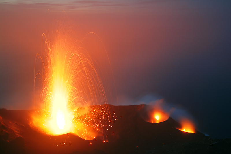
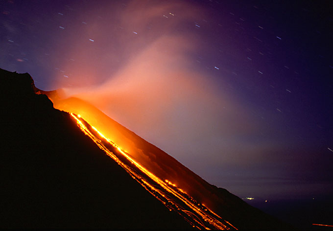
geology.com describes its typical behaviour: "Stromboli is the type location for the 'Strombolian' style of eruptions. Strombolian eruptions are mild explosive events where "slugs" of gas periodically rise through a magma-filled volcanic conduit, burst at the surface, and throw jet fountains of molten rock from its lava-filled central crater." The INGV completes: "It throws Incandescent lava fragments and variable quantities of ash up to a few tens or hundreds of meters above the mouths." The lava falls as bombs (larger than about 3 inches in size) and scoria (smaller fragments), and eventually builds into a steep-sided volcanic cone. "The explosions usually last a few seconds or ten seconds, and are well separated from each other, with intervals that can vary between one minute and several hours."
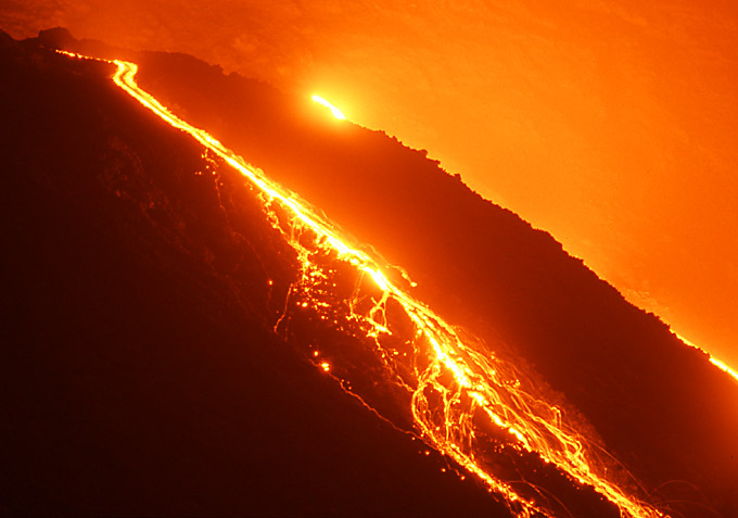
This persistent explosive activity is "interrupted only by occasional episodes of more intense activity, accompanied by lava flows, as recently occurred in 1975, in 1985, in 2003 and 2007. The current morphology is the result of numerous phases of activity articulated in different eruptive cycles that have occurred since over 100,000 years ago." "Eruptions with the emission of lava flows (overflow from craters or opening of new effusive mouths outside the craters) occur at irregular intervals (on average once or twice a decade) and lead to the temporary cessation of persistent Strombolian activity at the summit craters. The castings can reach the sea, where delta lava are formed which are usually quickly eroded by the action of the sea. These effusions can last between a few days and many months (2002-2003 eruption: 206 days). The beginning of a lava effusion is often accompanied by strong explosive activity at the summit craters."
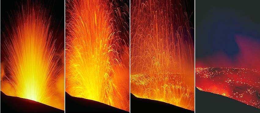
"Typical sequence of an eruption of crater 3. October 1986, camera position: Stromboli summit. Whereas most of the other pictures presented here were taken with a standard (50mm) camera lens, this series was recorded with a 135mm telefoto lens. The left image shows the first few tenths of a second of the eruption. Lava is violently thrown out. In the second image the eruption has reached its climax and in the third, most of the lava is already falling back into the crater. The final image shows tha lava cooling and its glow slowly fading." - Source: Stromboli online.
"A more dangerous phenomenon in Stromboli's activity are larger explosions than the usual Strombolian activity, so-called 'paroxysms'. Many of these events throw bombs and multi-dimensional blocks in the summit area (the Pizzo sopra la Fossa). During the strongest paroxysms, the fallout of incandescent pyroclastic material can cause fires in the vegetation on the outer slopes of the volcano. The strongest paroxysms in the last 100 years have been those of 1919, 1930, and 2003."
According to geology.com: "The Sciara del Fuoco poses the most serious volcanic hazard on Stromboli. A catastrophic sector collapse would not only displace large volumes of material and possibly expose dike systems on the volcano's NW slope; it could also create a tsunami, which could cause much damage if it reached any of the other islands in the Aeolian archipelago or the Sicilian coast."
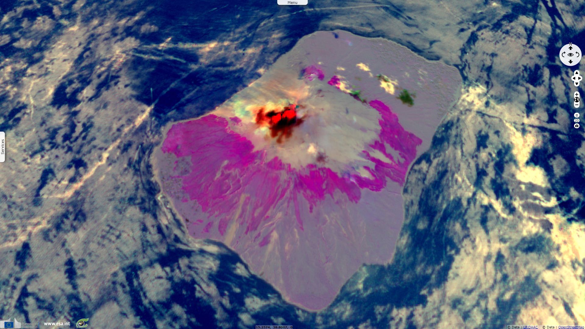
The recent paroxysmal explosion of the Stromboli is detailed by the Smithsonian Institution: "An intense paroxysmal explosive sequence at Stromboli on 3 July resulted in injuries to tourists climbing the volcano and one death. INGV surveillance cameras recorded intensification of Strombolian activity at the N1 and N2 vents in Area N (north crater area, NCA) and vent S2 in Area C-S (South Central crater area), and spattering at S1 and C in Area C-S. An explosion from Area C-S at 1459 was followed by lava effusion and a flow that traveled into the upper part of Sciara del Fuoco. At different times during 1543-1545 lava overflowed from all vents and a strong explosion occurred at N1 at 1545.
The paroxysmal phase began at 1546; two lateral blasts presumably from Area C-S were recorded at 1546:10 and 1546:20, just 10 seconds apart from each other. The main paroxysmal explosion, at 1546:40 ejected incandescent material that fell onto the flanks and generated an ash plume rose 4 km above the summit that drifted SW. Material from the lateral explosions and eruption column collapse generated two highly turbulent pyroclastic flows that reached the sea. Hot material set fire to vegetation on the W side of the island. Strombolian activity resumed at 1559, though the explosions were more intense than normal. Spattering from Area C-S continued on 4 July, feeding lava flows that continued to enter the ocean."
The INGV reports the frequency of explosions reached 5 events / day on 03 July to be compared with average values of 13 events / day on 07 July. Regarding seismic activity, the weekly bulletin indicates: "At 2.46 UTC on 3/07 a paroxysmal event was recorded, followed by an increase in the tremor on medium-high values, with some oscillation on high values. The data dilatometer presents a significant variation about eight minutes before this event, then returning to ordinary values. We also report the occurrence at 14:45 UTC on 3/07 of a small earthquake located at NW of Ginostra. The remaining seismological parameters do not show
significant changes."
Left: "23.4.2003, f=28mm. From 400m.a.s.l. Red Lagoon Nebula (M8) in constellation Saggitarius (above left horizon) and lights of Salina" - Source: Jürg Alean.
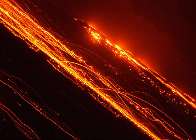
Centre: "22.4.2003, f=300mm. From 200m.a.s.l. During the one-minute exposure many blocks bounce through the telephoto lens' narrow field of view" - Source: Jürg Alean.
Right: "23.4.2003, f=300mm. From 400m.a.s.l. Two aa-lavaflows, one almost hidden by the middle horizon, the other plainly visible in the foreground" - Source: Jürg Alean.
The views expressed herein can in no way be taken to reflect the official opinion of the European Space Agency or the European Union.
Contains modified Copernicus Sentinel data 2026, processed by VisioTerra.
Contains modified Copernicus Sentinel data 2026, processed by VisioTerra.
| More on European Commission space: |  |
 |
 |
||||
| More on ESA: | |
|
|
S-1 website | S-2 website | S-3 website | |
| More on Copernicus program: | |
|
|
Scihub portal | Cophub portal | Inthub portal | Colhub portal |
| More on VisioTerra: | |
|
|
Sentinel Vision Portal | Envisat+ERS portal | Swarm+GOCE portal | CryoSat portal |