Christmas eruption of Mount Etna
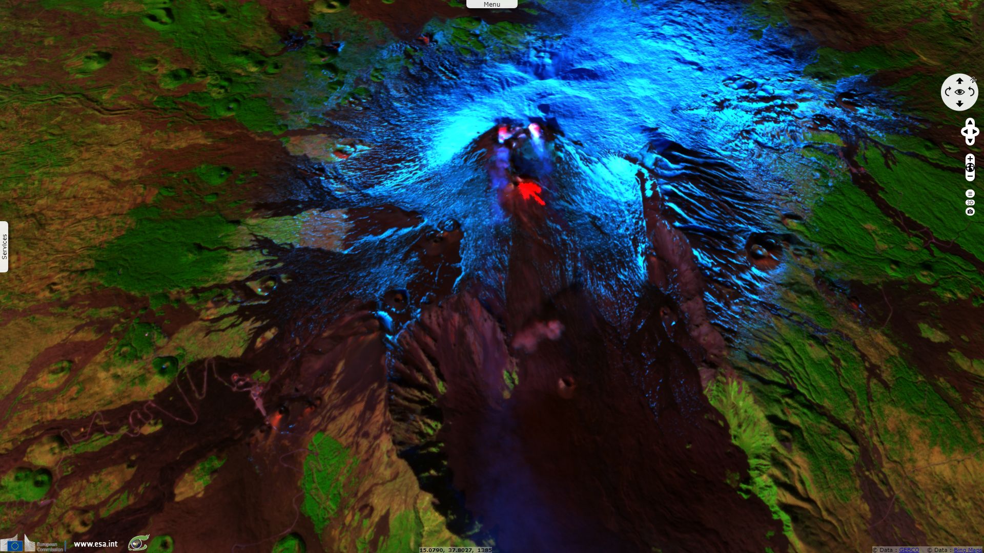
Sentinel-3 OLCI FR acquired on 24 December 2018 at 09:02:47 UTC
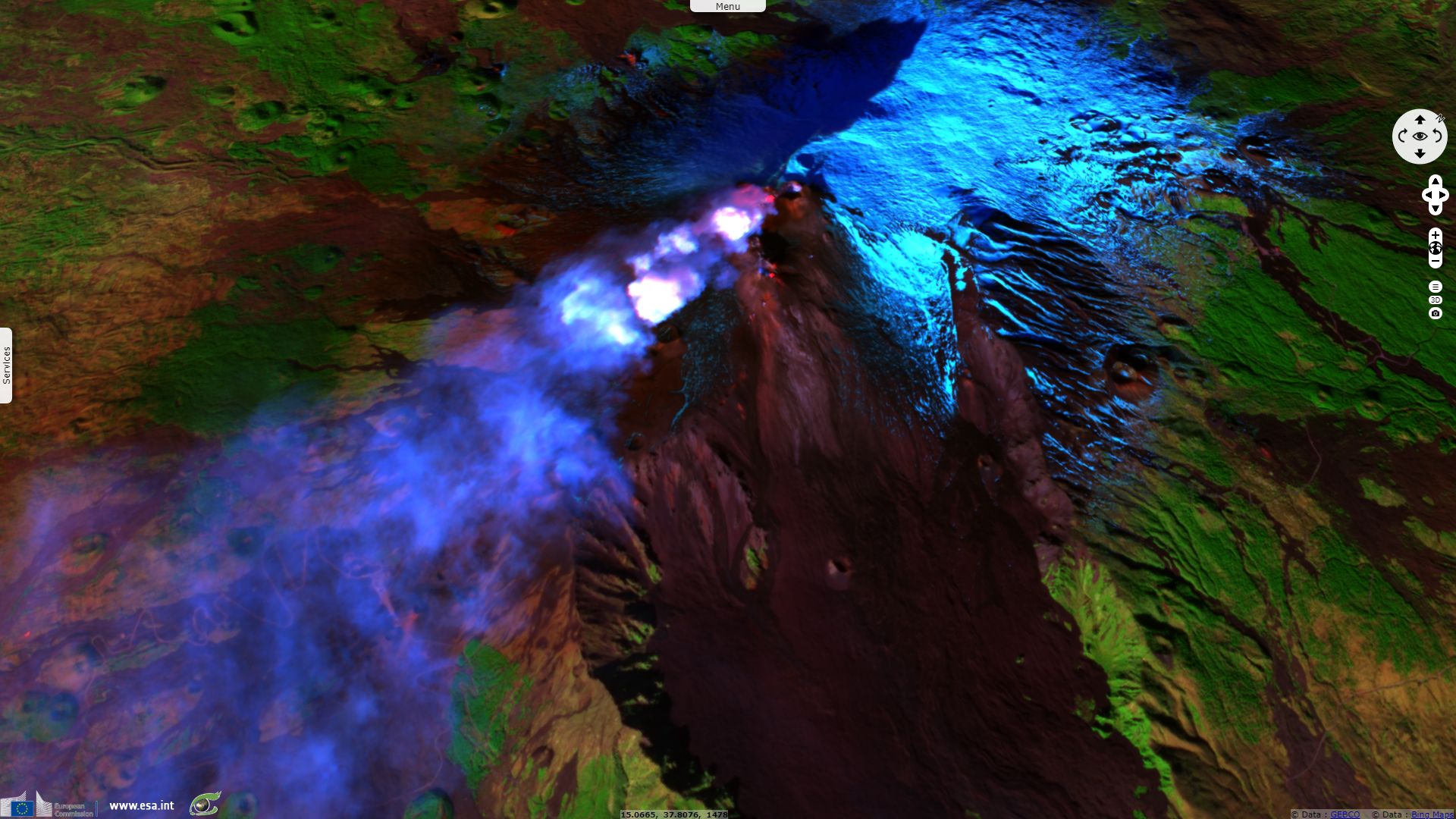
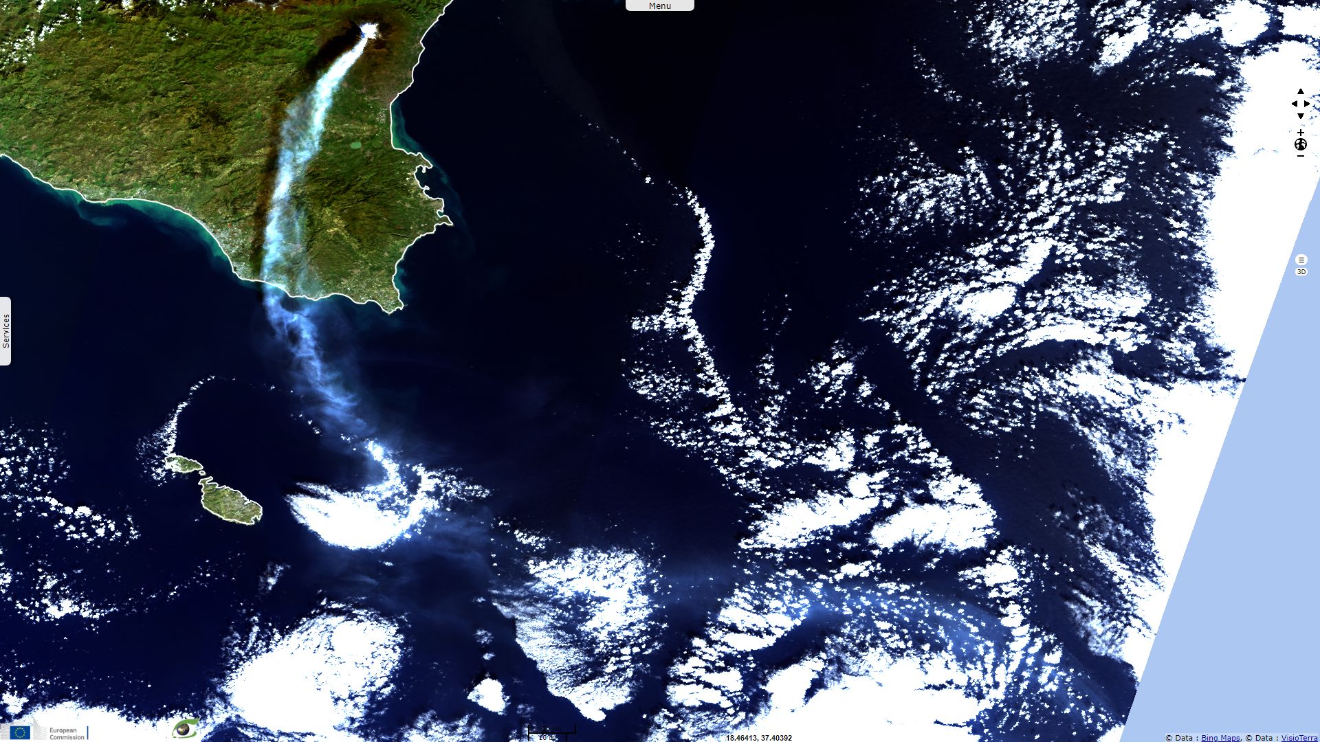
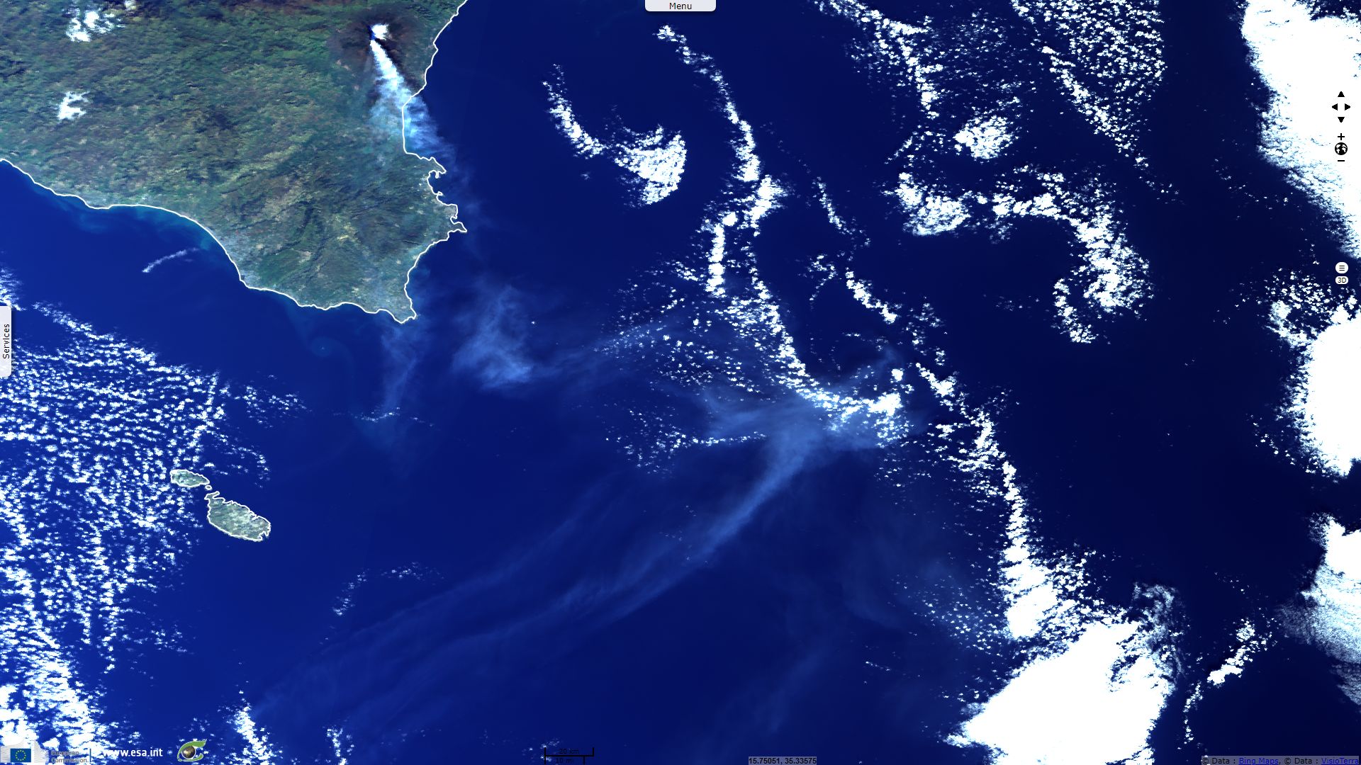
Sentinel-2 MSI acquired on 24 December 2018 at 09:54:19 UTC
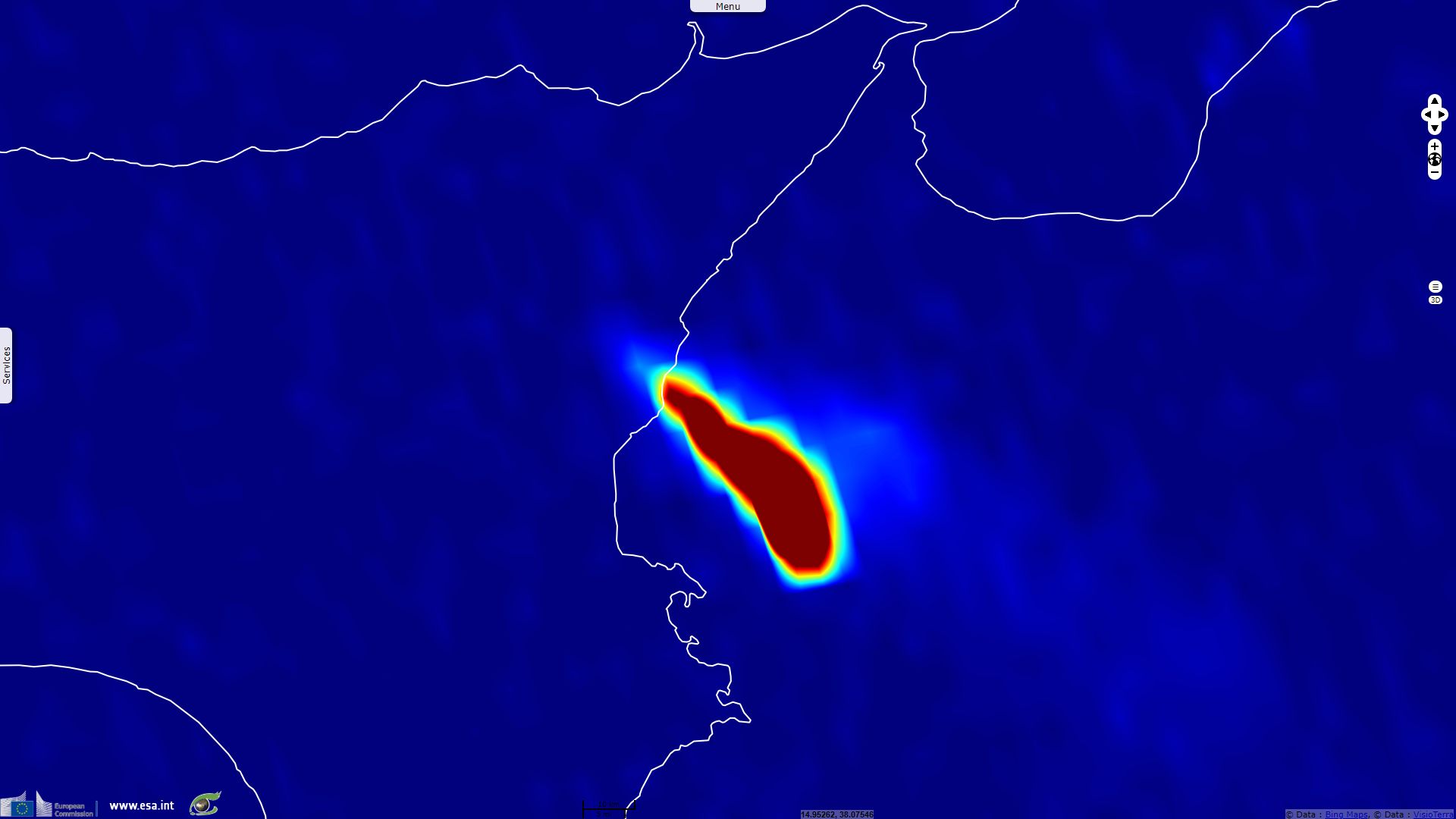
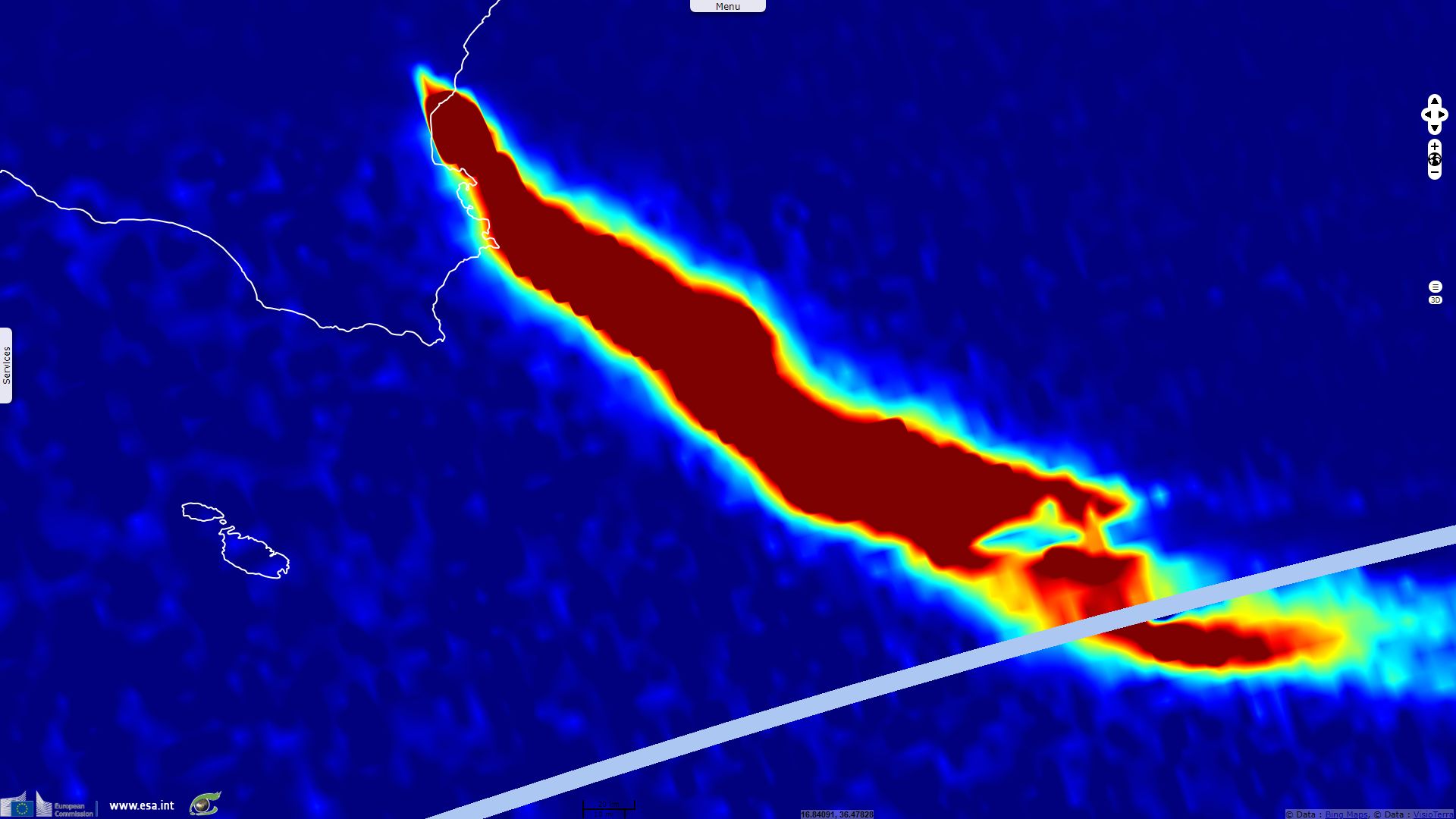
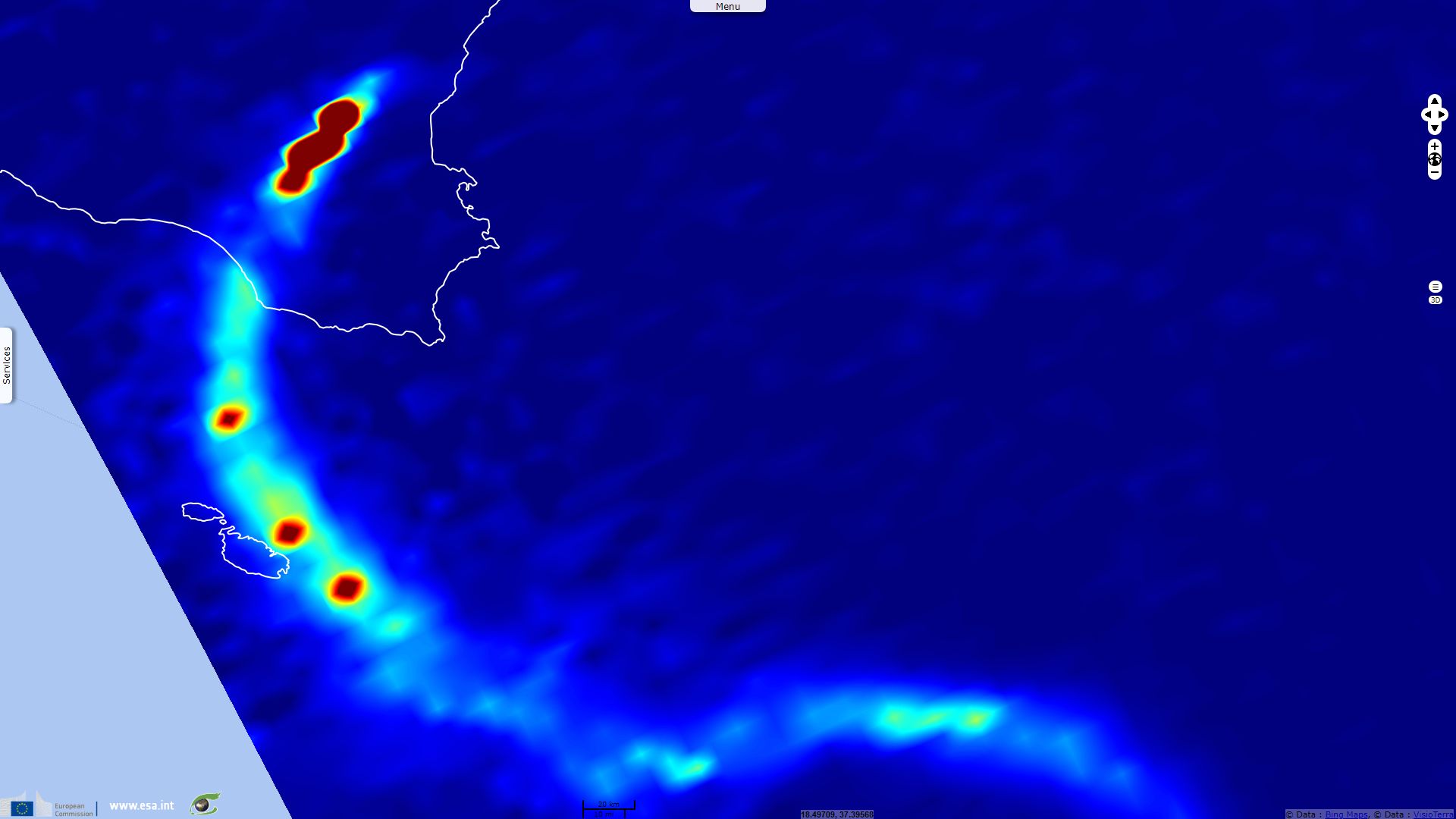
Sentinel-5P acquired on 24 December 2018 at 11:58:44 UTC
...
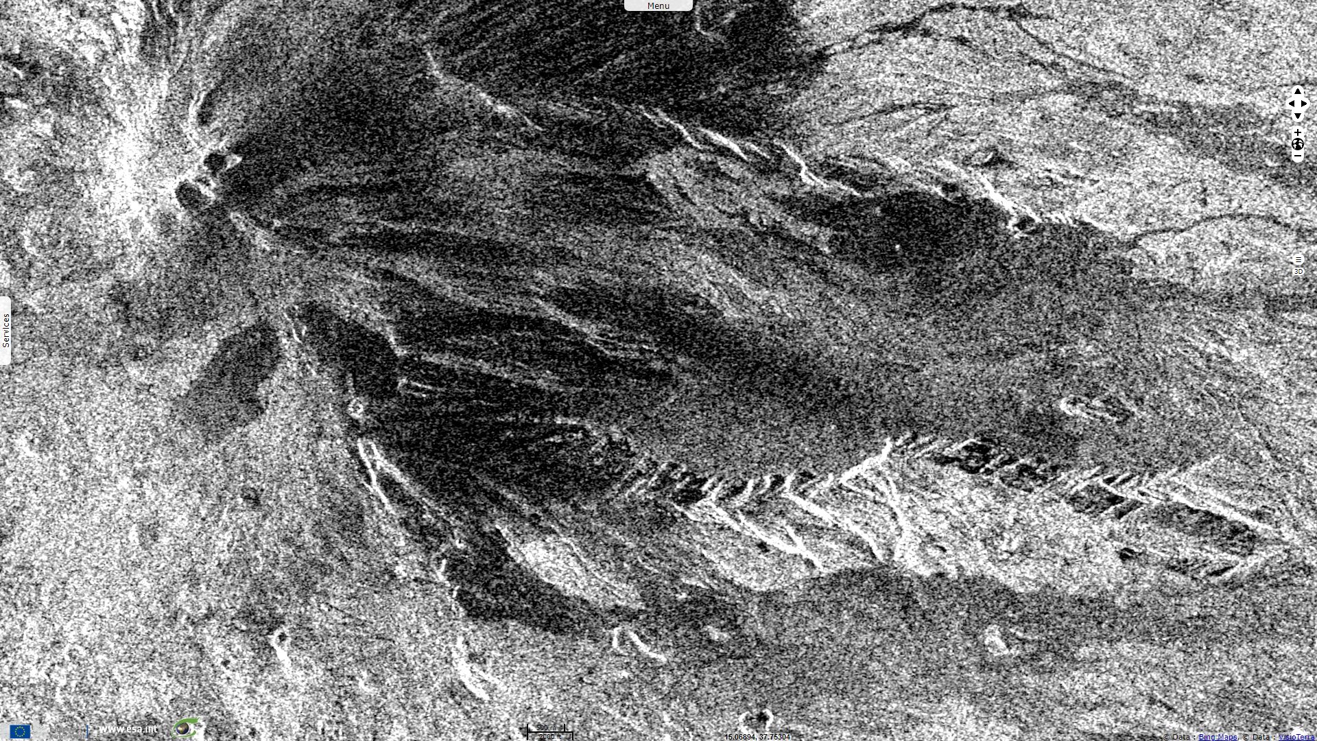
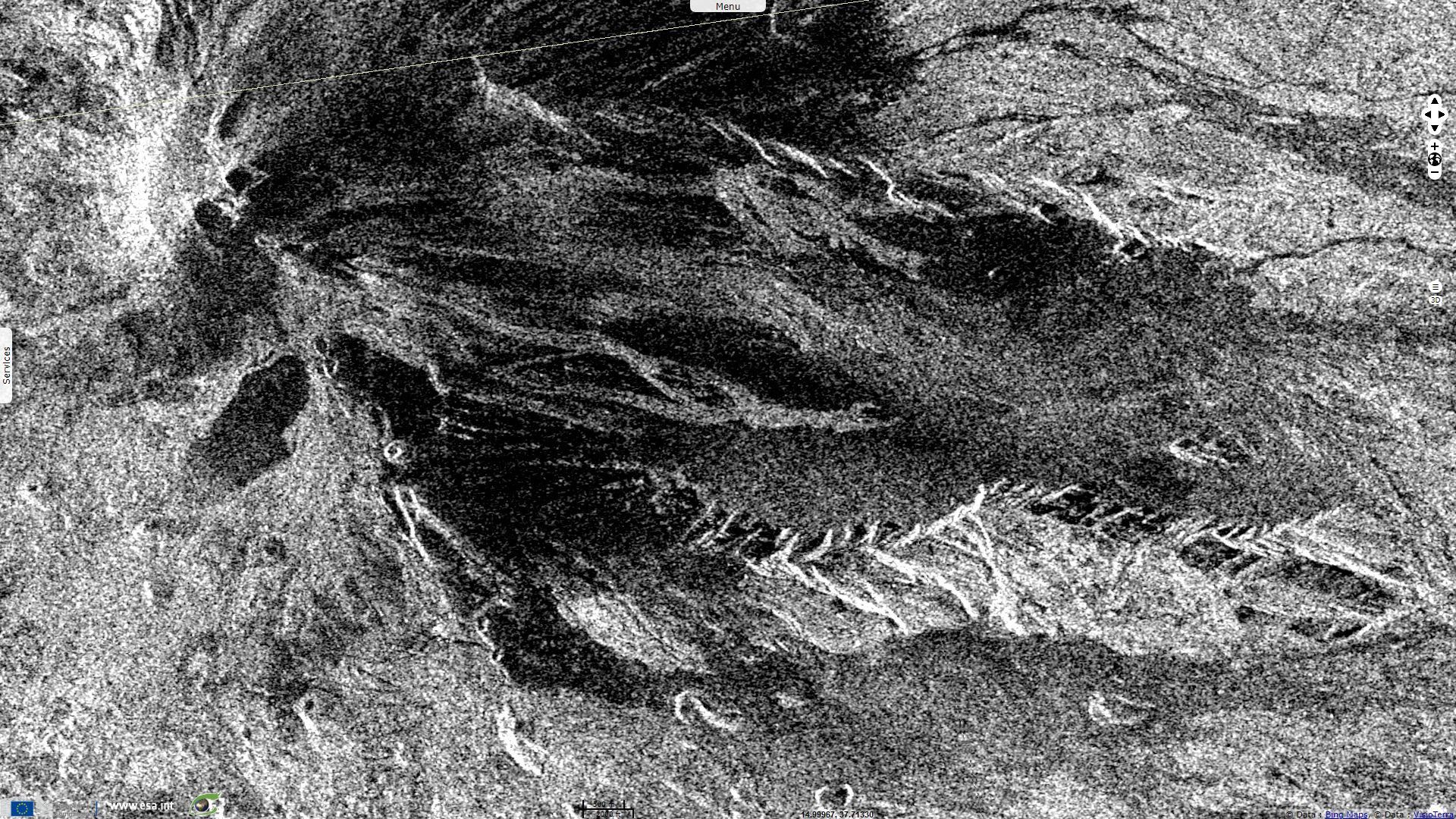
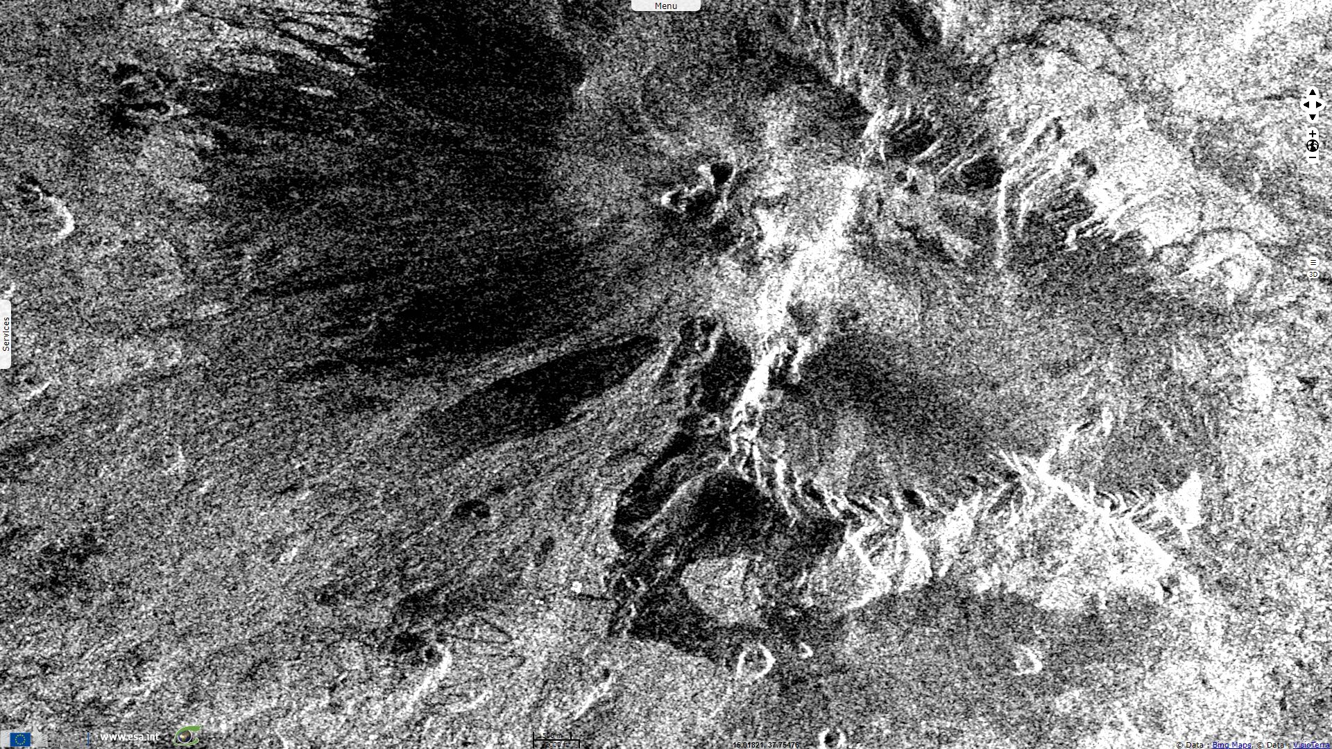
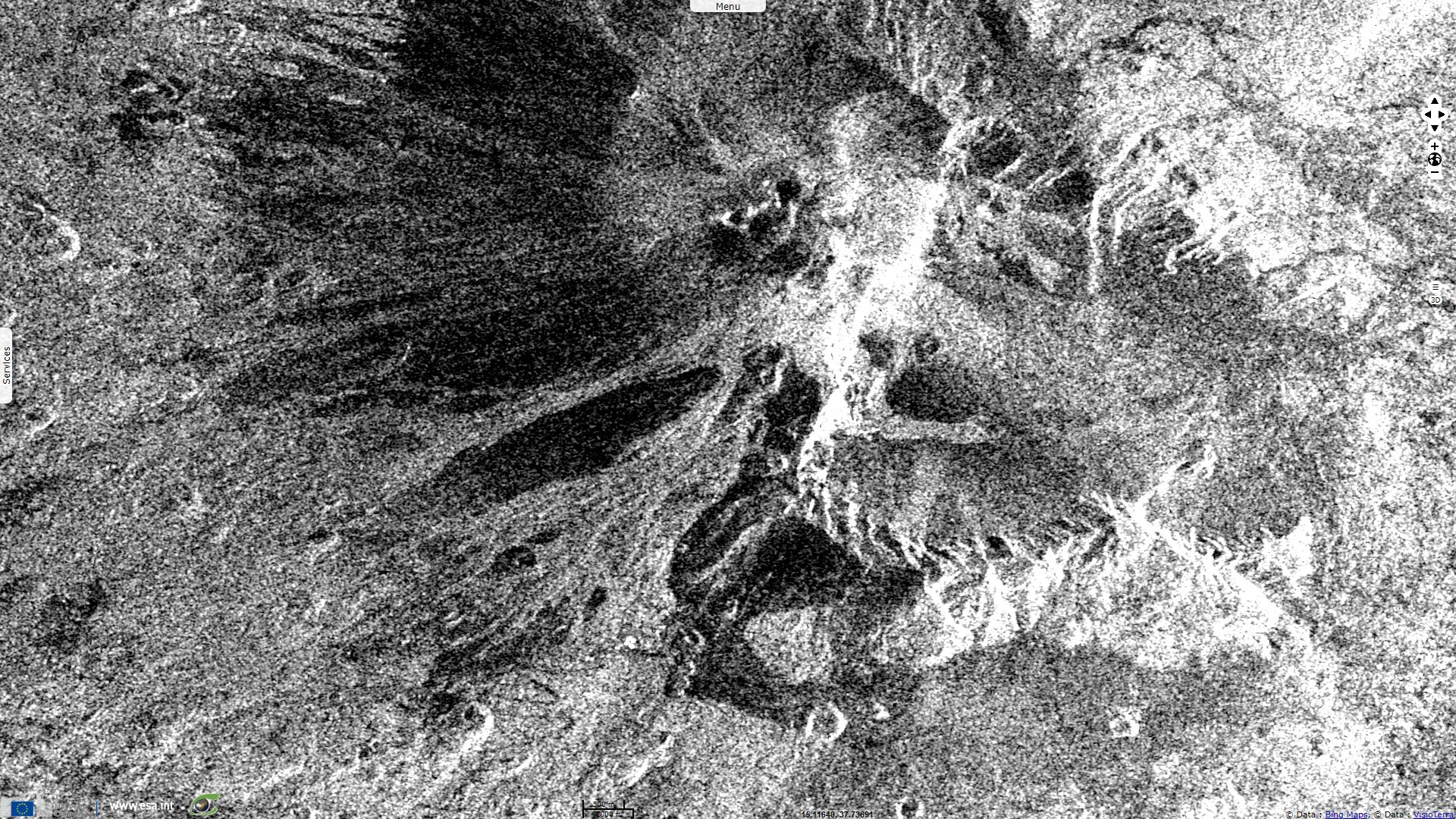
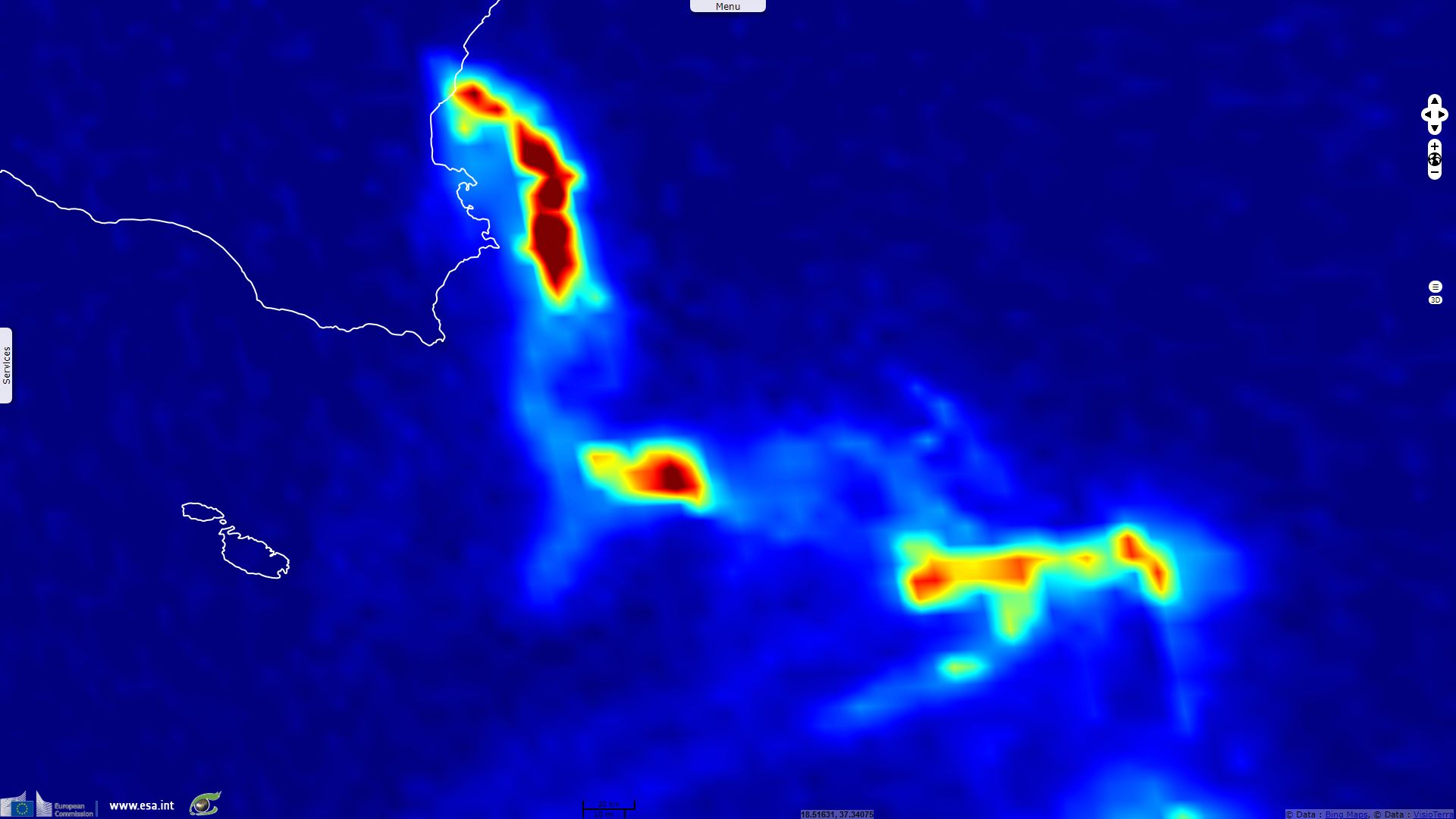
Sentinel-1 CSAR IW acquired on 28 December 2018 at 05:04:49 and from 16:55:24 to 16:55:49 UTC
Sentinel-2 MSI acquired on 24 December 2018 at 09:54:19 UTC
Sentinel-5P acquired on 24 December 2018 at 11:58:44 UTC
...
Sentinel-1 CSAR IW acquired on 28 December 2018 at 05:04:49 and from 16:55:24 to 16:55:49 UTC
Keyword(s): Volcano, eruption, natural disaster, geohazard, atmosphere, geology, lava flow, island, UNESCO World Heritage, crater, Sicily, Italy
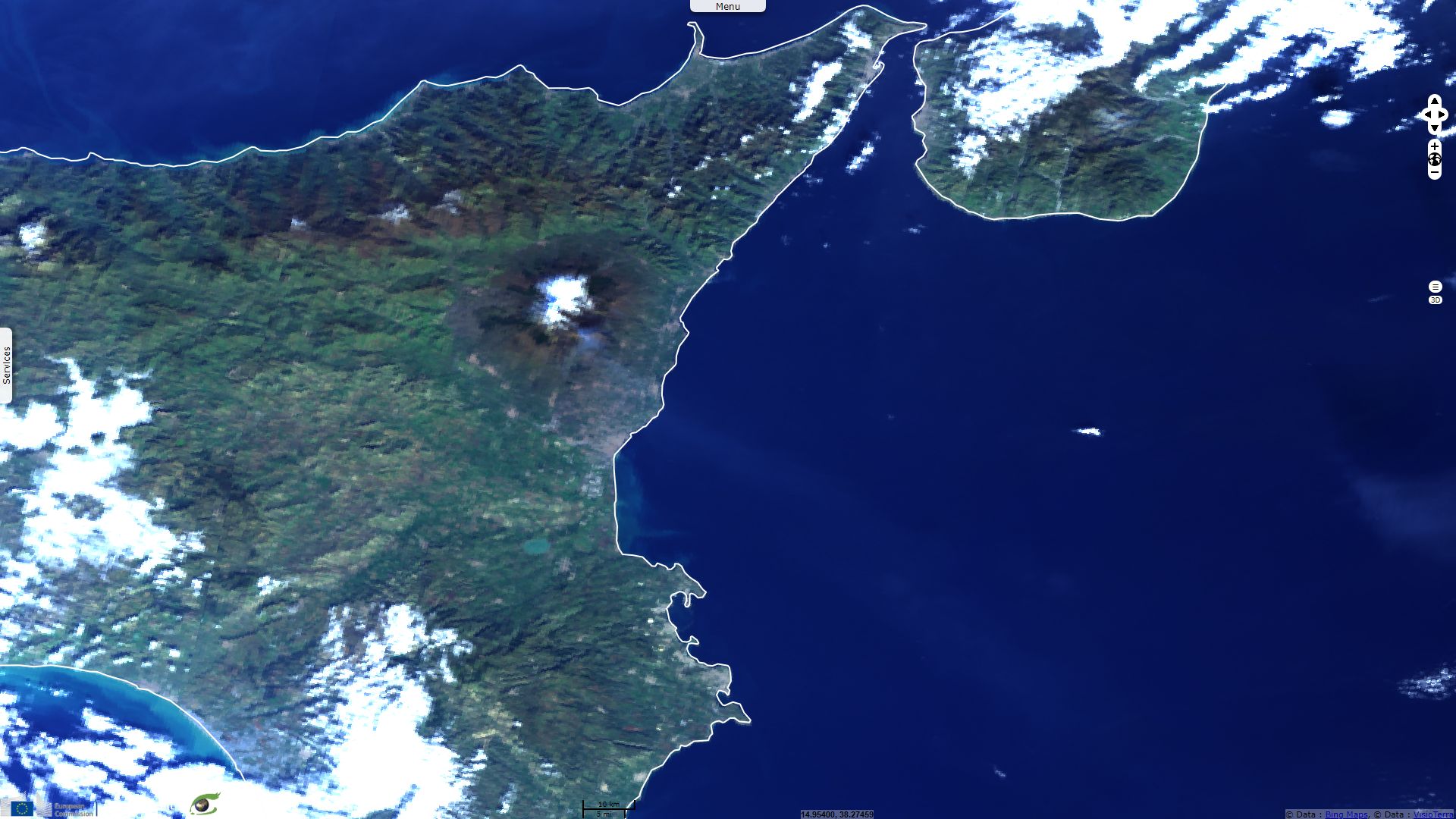
45km wide and 3300m high, Mount Etna in Sicily is the highest volcano in the European continent after Mount Elbrus. It is a decade volcano as well as a UNESCO World Heritage Site since 2013.
UNESCO describes it in the following terms: "Mount Etna is an iconic site encompassing 19,237 uninhabited hectares on the highest part of Mount Etna, on the eastern coast of Sicily. Mount Etna is the highest Mediterranean island mountain and the most active stratovolcano in the world. The eruptive history of the volcano can be traced back 500,000 years and at least 2700 years of this activity has been documented. The almost continuous eruptive activity of Mount Etna continues to influence volcanology, geophysics and other Earth science disciplines. The volcano also supports important terrestrial ecosystems including endemic flora and fauna and its activity makes it a natural laboratory for the study of ecological and biological processes. The diverse and accessible range of volcanic features such as summit craters, cinder cones, lava flows and the Valle de Bove depression have made the site a prime destination for research and education."
Towering above Catania, Sicily's second largest city, Mount Etna is a low but regular threat. The INGVterremoti blog of the National Institute of Geophysics and Volcanology (INGV) analyses the seism that happened in the early morning of the 26.12.2018, two days after a new eruptive sequence: "At 3:19 today, 26 December 2018, in the lower south-eastern flank of Etna, one of the most energetic earthquakes occurred on the volcano. The seismic event, of magnitude Ml equal to 4.8, Mw 4.9, was located 1km south of the town of Lavinaio, at a depth of about 1km below sea level. The earthquake was widely felt by the people living in almost the entire area of Catania, causing damage and some injured in areas closer to the epicenter. About a couple of hours before, at 1:09 am, the earthquake had been anticipated by another quake, of magnitude Ml 3.3, located a little further north-east and at the same depth."
"The earthquake at 03:19 is probably related to the activation of the Fiandaca fault and the Pennisi fault, two of the most southern structures of the Timpe tectonic system. The greatest damage is in fact distributed along these volcano-tectonic structures, together with the striking effects of superficial faulting associated with the seismic event. The distribution of damage and the extension of faulting are very similar to those reported by historical sources for the earthquake of 8 August 1894 (Int 899 max EMS, Mw 4.6), which broke the Fiandaca fault along its full lenght."
"The earthquake of this night occurred on the third day since the beginning of the volcanic eruption under way at Etna, which is affecting the top portions of the volcano and the Valle del Bove. In particular, an eruptive fissure opened at the base of the New Southeast Crater on the morning of 24 December produced an ash cloud mainly falling in the surroundings of Zafferana Etnea and a lava flow that flows into Valle del Bove after having crossed its western wall."
"This volcanic phenomenon was preceded by some hours and is accompanied until today by an important deformation and seismic activity, which has generated about 1100 earthquakes, of which about 60 exceed magnitude of 2,5 m; moreover, a significant increase in the average amplitude of volcanic tremor was recorded during the day of 24 December and currently, although decreasing, the values remain above the norm."

Epicentral map of the most energetic earthquakes recorded from 24 December 2018. The earthquake recorded at 3:19 today, with magnitude of 4.8 mL, is reported with the blue rhombus - Source: INGV.
"During the last three days the recorded seismicity involved several sectors of the volcano: in particular, in the early hours of December 24th it was shown in the summit area coinciding with the eruptive theater, from the surface up to 2km below sea level. Subsequently, it is positioned along the western and southern walls of Valle del Bove, up to a depth of 4-5km below sea level."


The new eruptive fissure and the mouths that have fed, and still feed weakly, lava flows - Source: INGV.
Progressive lava flows within the Valle del Bove - Source: INGV.
"It should be noted that the earthquake of today is not generated by movements of magma masses present in the epicentral area, but is probably the fragile response of the eastern flank of the volcano to a stress induced by the magmatic system that at this time is the source of eruption. In fact, it often happens that the intrusion of a magmatic dicochus transfers stress to the surrounding tectonic structures, causing earthquakes, even of high magnitude.
The current eruptive situation does not deviate much from the most recognized cases for the eruptive ethnical eruptions, during which a transfer of stress from the intruded masses towards the more superficial portions of the volcano flanks can generate the trigger of earthquakes even several kilometers away from eruptive centers."
"On the basis of the current manifestations of eruptive activity, problems are currently excluded from the populations and the main infrastructures: in fact, the lava effusion produced flows from the base of the New South-East Crater into the wide desert environment Valle del Bove. However, although the more superficial volcanological evidences indicate a decrease in the general eruptive activity, the information obtained from the geophysical signals does not allow to exclude a possible feeding, still in progress, of the information that has been intruded. Based on the distribution of current seismicity, this dictation could affect a sector other than the current eruptive theater, with the opening of new eruptive fractures at altitudes lower than 2400 meters, coinciding with the western wall and the southern wall of Valle del Bove."
The views expressed herein can in no way be taken to reflect the official opinion of the European Space Agency or the European Union.
Contains modified Copernicus Sentinel data 2026, processed by VisioTerra.
Contains modified Copernicus Sentinel data 2026, processed by VisioTerra.
| More on European Commission space: |  |
 |
 |
||||
| More on ESA: | |
|
|
S-1 website | S-2 website | S-3 website | |
| More on Copernicus program: | |
|
|
Scihub portal | Cophub portal | Inthub portal | Colhub portal |
| More on VisioTerra: | |
|
|
Sentinel Vision Portal | Envisat+ERS portal | Swarm+GOCE portal | CryoSat portal |