Two cities evacuated as Tulare Lake reappears, USA
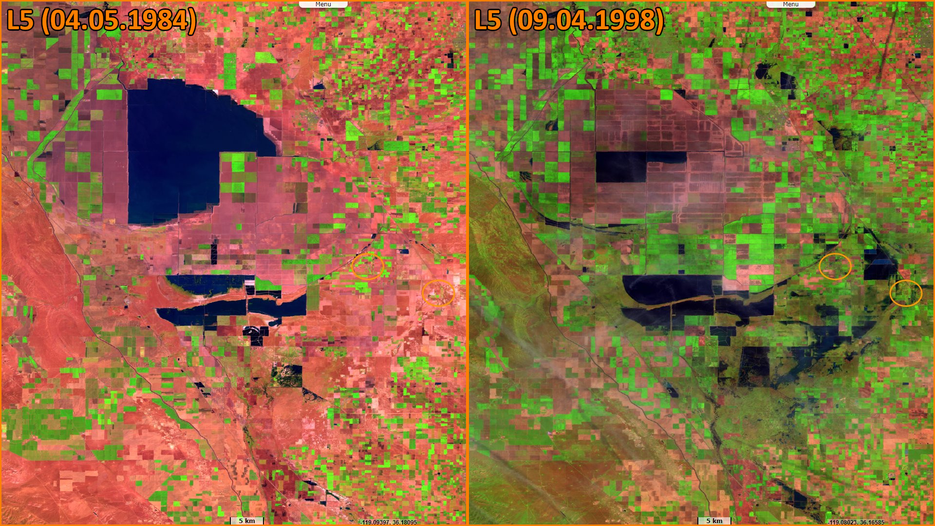
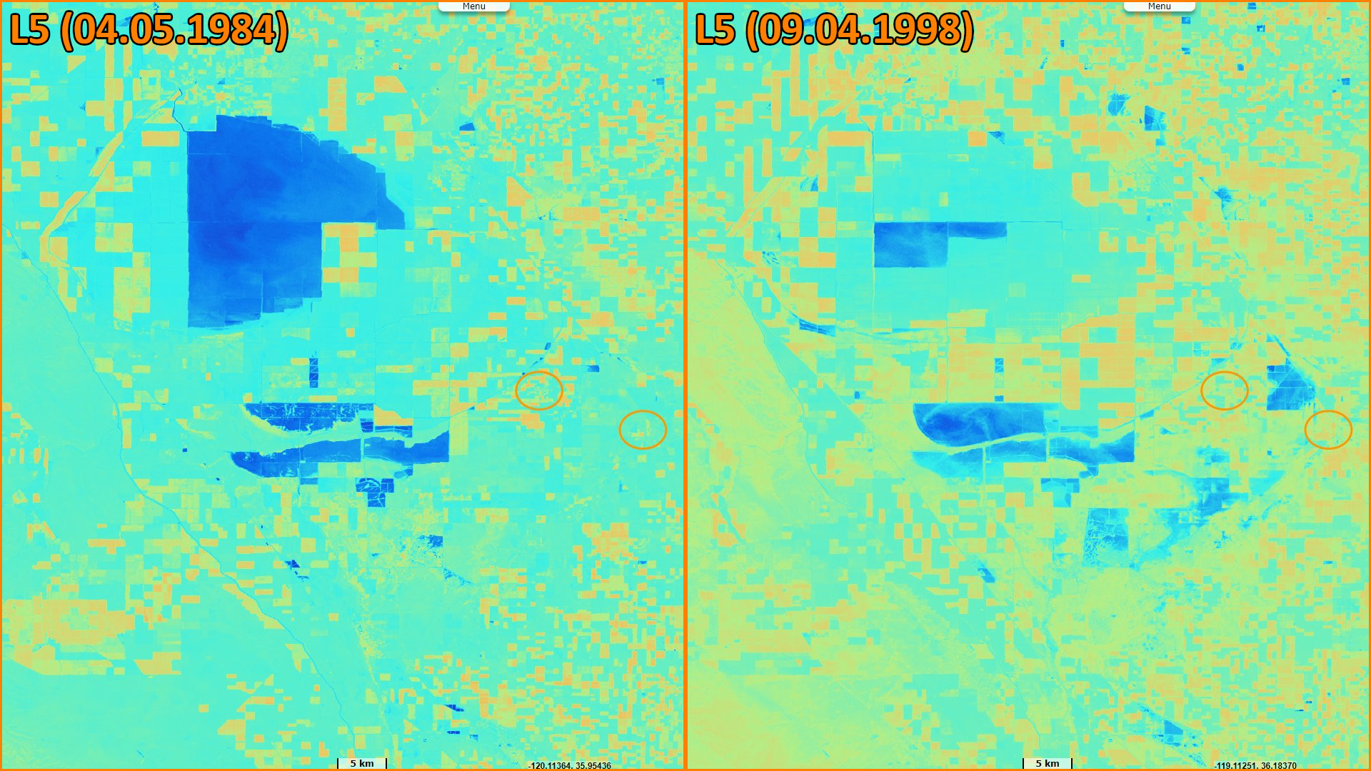
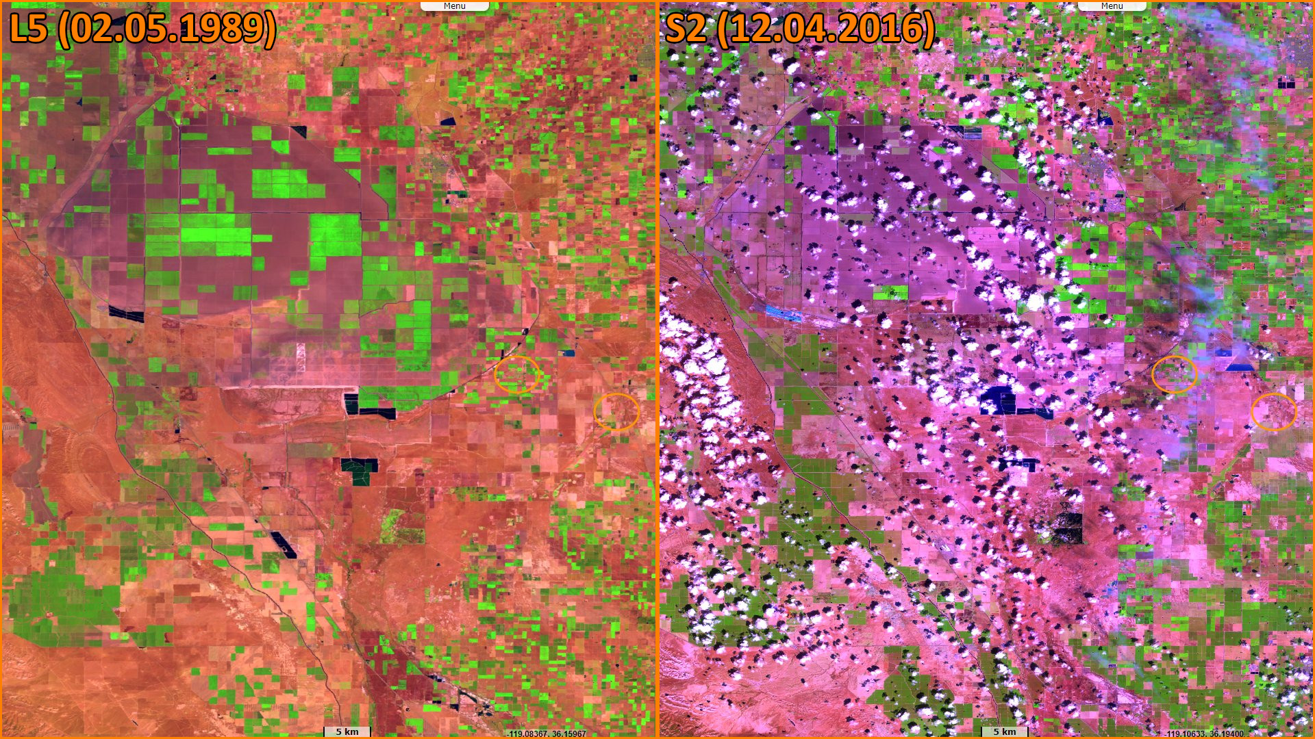
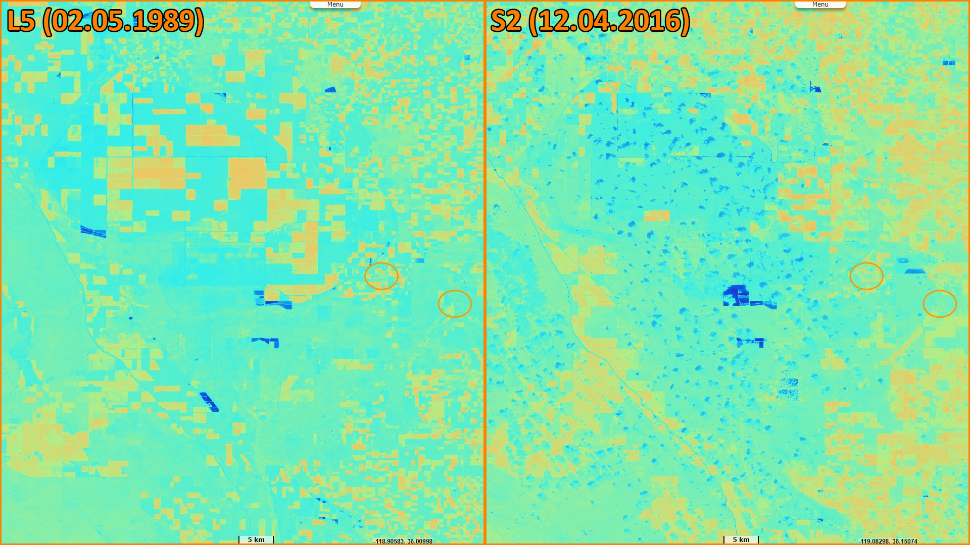
Landsat TM acquired on 04 May 1984 at 18:01:08 UTC
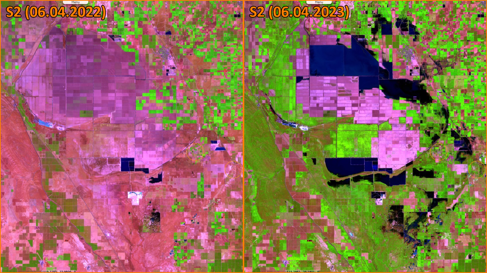
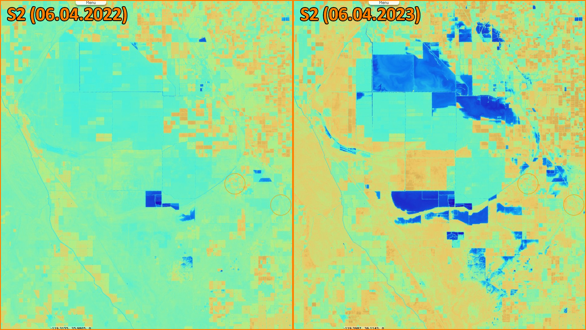
Sentinel-2 MSI acquired on 06 April 2022 at 18:39:19 UTC
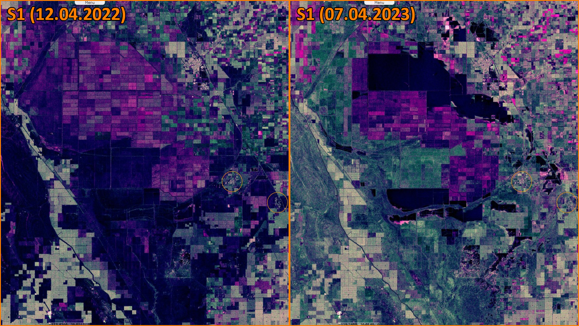
Sentinel-1 CSAR IW acquired on 12 April 2022 at 14:00:14 UTC
Sentinel-2 MSI acquired on 06 April 2023 at 18:39:21 UTC
Sentinel-1 CSAR IW acquired on 07 April 2023 at 14:00:19 UTC
Sentinel-2 MSI acquired on 06 April 2022 at 18:39:19 UTC
Sentinel-1 CSAR IW acquired on 12 April 2022 at 14:00:14 UTC
Sentinel-2 MSI acquired on 06 April 2023 at 18:39:21 UTC
Sentinel-1 CSAR IW acquired on 07 April 2023 at 14:00:19 UTC
Keyword(s): Flooding, emergency, hydrology, endorheic basin, agriculture, United States, USA
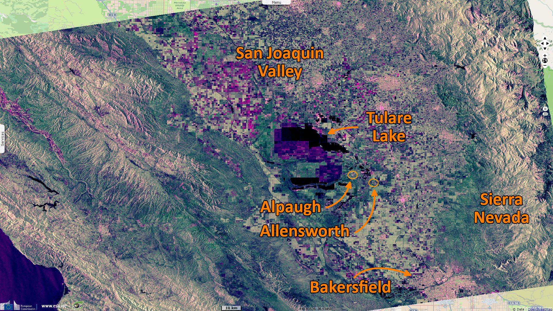
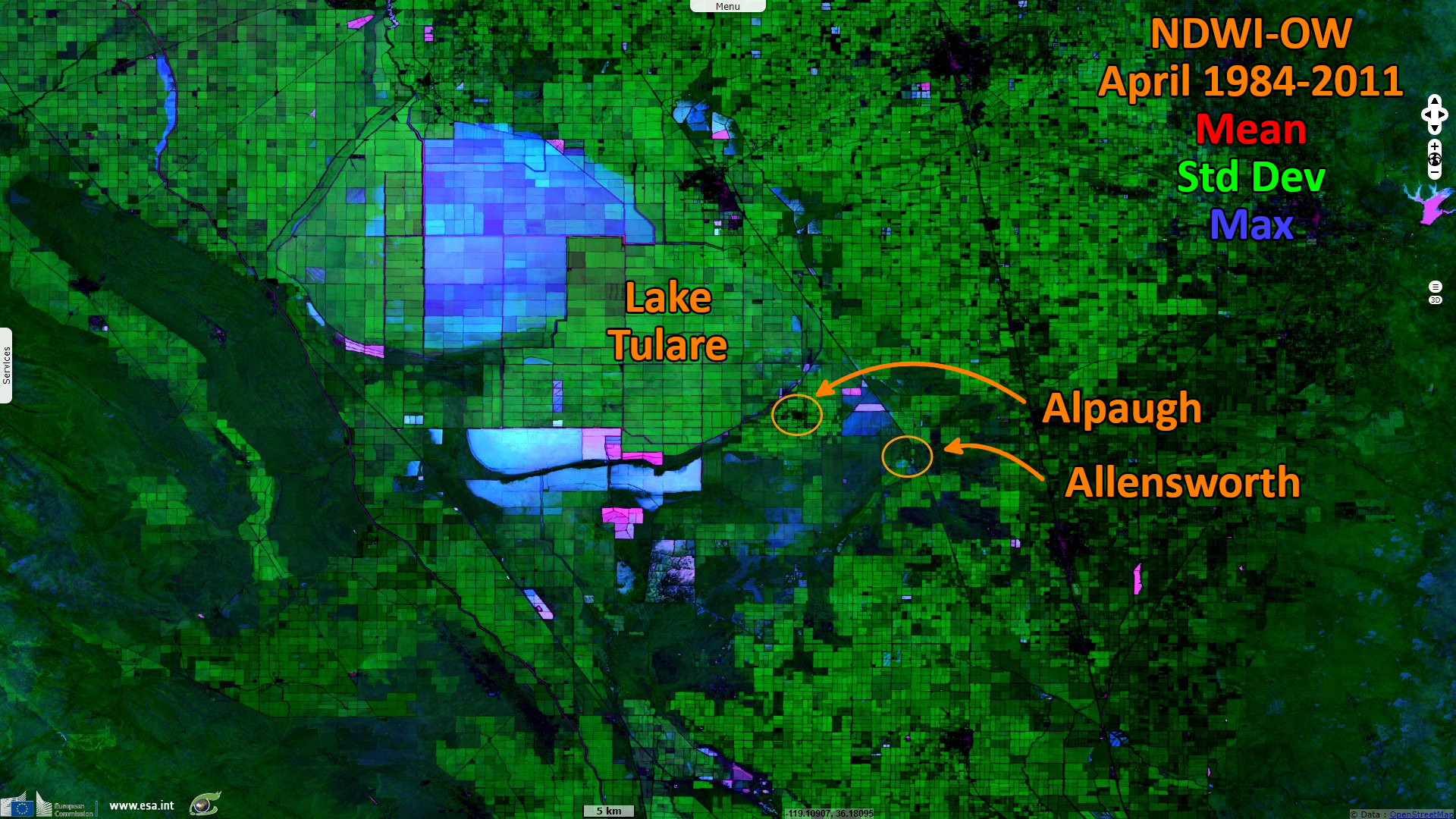
Adam Beam of ABC News wrote: "This year, Tulare lake started to fill again after the state was hit with a more than a dozen strong storms known as atmospheric rivers packed with massive amounts of rain and snow. What had been a dry lake bed filled with crops and crisscrossed by powerlines began to go underwater. Now, water covers more than 410 square kilometers. Most of that flooding is farmland. But a month ago, computer models showed rising waters threatened homes in the communities of Corcoran, Stratford, Alpaugh and Allensworth."
Thaddeus Miller reminds in the The Fresno Bee: It brought "much of the state out of the drought but also damaging infrastructure and homes with flooding. The Tulare Lake basin has had the roughest time from the pooling of a body of water that last was seen in 1983."
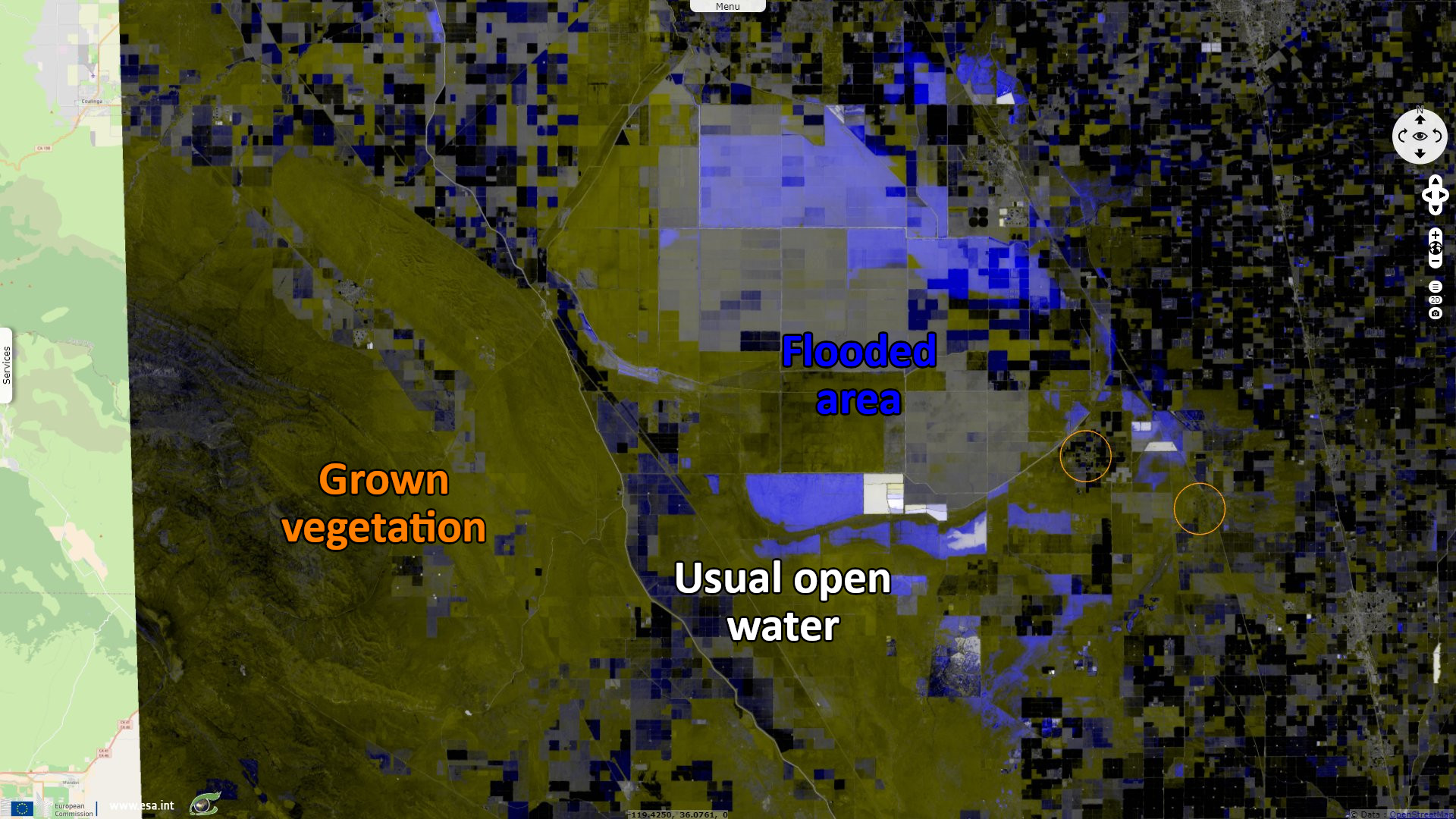
"While the historic lake was large, it was also shallow, about 11 m deep in high-water years. Some have speculated the lake flooding will be around for a significant time. The 1983 flooding took about two years to dry out, according to John T. Austin, a now-retired scientist with the National Park Service and author of 'Floods and Droughts in the Tulare Lake Basin.' The Corcoran clay layer and other factors slow the water from seeping. 'Only about 4% of the water goes through the ground; an enormous amount just evaporates,' he added."
The past size of Tulare Lake is detailed by Ellen Gorelick, Executive Director-Chief Curator of the Tulare Historical Museum: In 1868, the lake covered almost 2600 km². The first band of white settlers into the San Joaquin Valley found the lake more than 64 km long and 32 km wide. In flood season, it has measured as much as 120 km in length.
"The end result of thousands of years of rain and mountain runoff settling in the lowest part of the basin created the 'largest fresh water lake west of the Mississippi.' The last discharge into the San Joaquin River was in 1878. The depiction in 1879 shows the start of many years of decline in the Lake’s volume."
The views expressed herein can in no way be taken to reflect the official opinion of the European Space Agency or the European Union.
Contains modified Copernicus Sentinel data 2026, processed by VisioTerra.
Contains modified Copernicus Sentinel data 2026, processed by VisioTerra.
| More on European Commission space: |  |
 |
 |
||||
| More on ESA: | |
|
|
S-1 website | S-2 website | S-3 website | |
| More on Copernicus program: | |
|
|
Scihub portal | Cophub portal | Inthub portal | Colhub portal |
| More on VisioTerra: | |
|
|
Sentinel Vision Portal | Envisat+ERS portal | Swarm+GOCE portal | CryoSat portal |