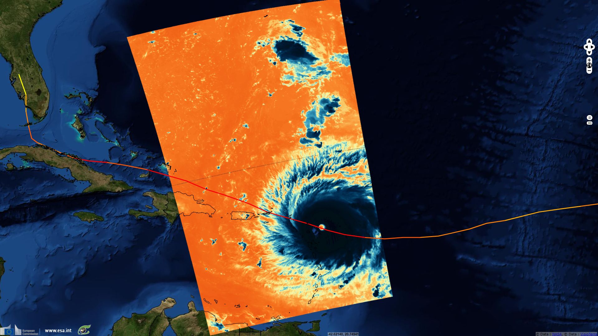
Two weeks of Sentinel-3 tracking hurricane Irma
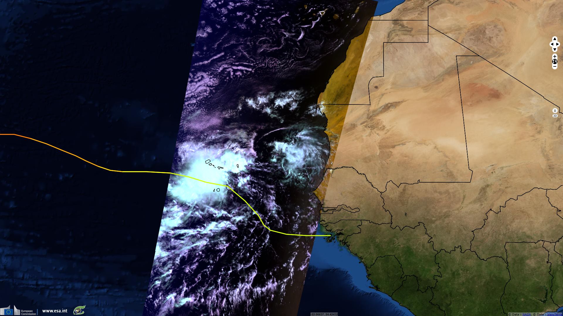
Sentinel-3 SLSTR RBT acquired on 27 August 2017 at 23:19:44 UTC
...
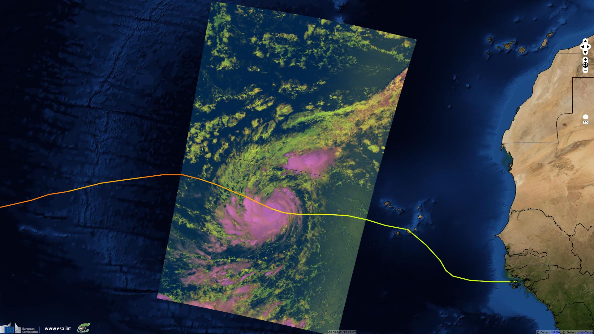
Sentinel-3 OLCI FR acquired on 11 September 2017 at 15:48:01 UTC
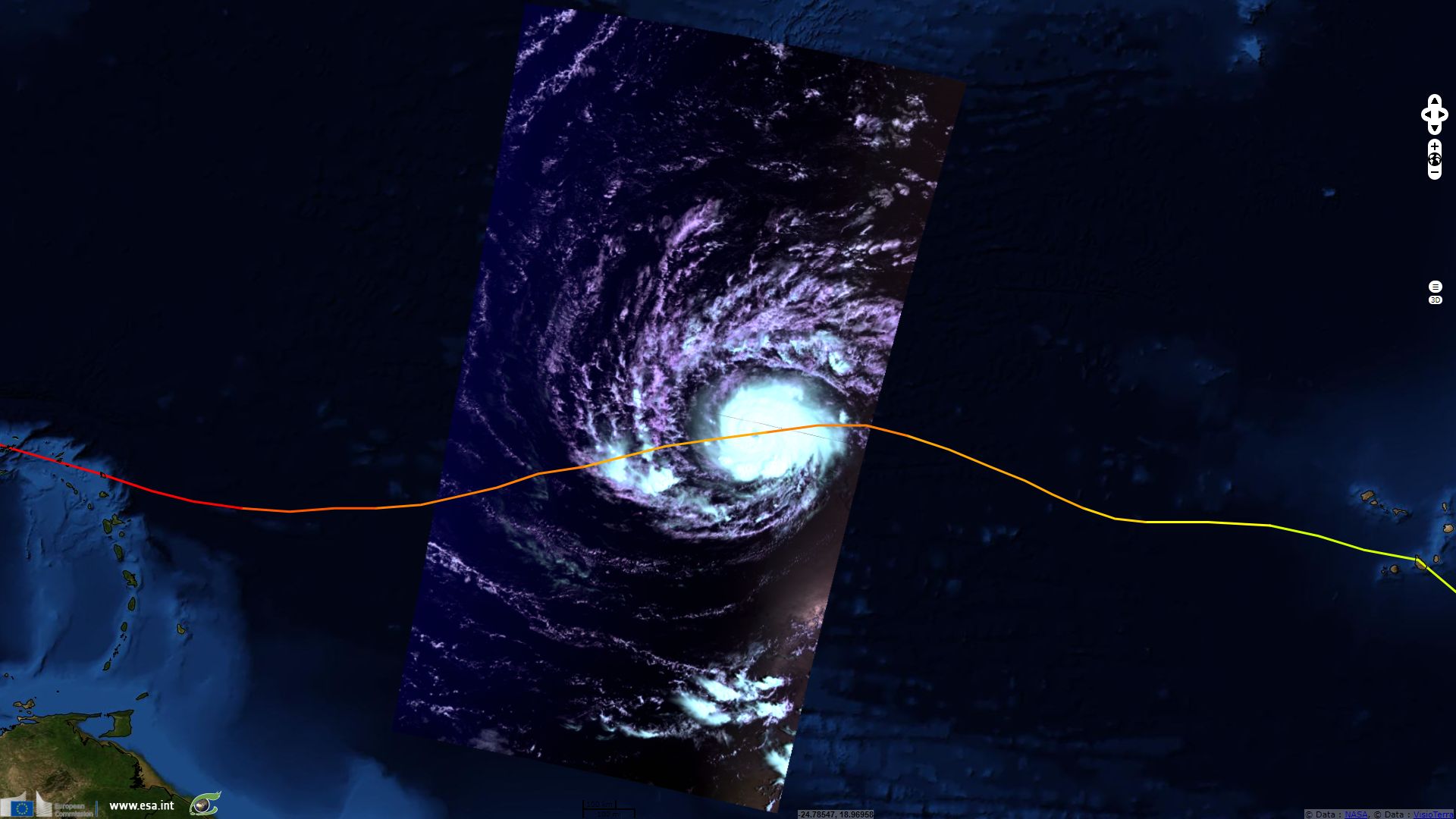
Sentinel-3 SLSTR RBT acquired on 12 September 2017 at 03:04:55 UTC
...
Sentinel-3 OLCI FR acquired on 11 September 2017 at 15:48:01 UTC
Sentinel-3 SLSTR RBT acquired on 12 September 2017 at 03:04:55 UTC
Keyword(s): Natural disaster, climate change, cyclone, atmosphere, hurricane, SST, wind, rain, surge, flooding, Caribbean, Antilles, Barbuda, Antigua, St Barthélemy, St Martin, Anguilla, Virgin Islands, Puerto Rico, Dominican Republic, Haiti, Turks & Caicos, Cuba, Florida
One week after Harvey hit Texas, a series of three hurricanes (Irma, Jose and Katia) approached land simultaneously the West Atlantic Basin. Irma was the most threatening as it remained a category-5 hurricane for almost three days and hit or bordered several countries, inflicting devastating damage while doing so.
Irma was first detected as a storm west of Guinea Bissau by the end the august 2017. It strenghened after reaching Cap Verde, Eumetsat wrote: Irma "was classified as a Tropical Storm at 15:00 UTC on 30 August and with warm sea surface temperatures and low wind shear, strengthening was anticipated. According to the National Hurricane Center early on 31 August, shortly after the development of a central dense overcast (CDO) and an eye feature, Irma rapidly intensified, with winds increasing from 110 km/h to 185 km/h in just 12 hours.".
Warm waters in west Atlantic fueled Irma which headed westward as a category-3 hurricane, altering its trajectory several times during its crossing of the Atlantic Ocean.
According to EUMETSAT: "By 21:00 UTC on 4 September Hurricane Irma had strengthened into a Category 4 hurricane, with winds of 215 km/h.
Favourable conditions helped deepen Irma and by 11:45 UTC on 5 September it was a Category 5 hurricane, with winds of 280 km/h, making Irma the easternmost Atlantic hurricane of this strength on record, surpassing Hurricane David in 1979.
Within a few hours Hurricane Irma had maximum sustained winds of 285 km/h (180 mph). By 00:15 UTC on 6 September, they'd reached 295 km/h and with a minimum pressure of 916 hPa — making Irma the strongest Atlantic hurricane since Hurricane Wilma (2005) in terms of sustained wind speed, and the most intense Atlantic hurricane since Hurricane Dean (2007). In addition, Irma was the strongest hurricane in the Atlantic basin outside of the Caribbean Sea and Gulf of Mexico in recorded history."
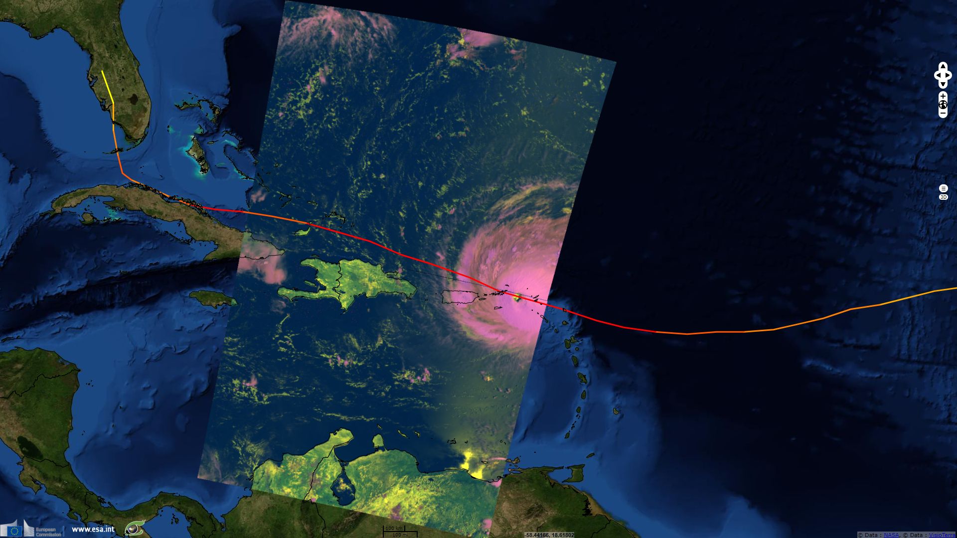
Météo-France stated Irma was the first category-5 hurricane to hit Lesser Antilles in recorded history. Accompanied by a change of direction, its fast intensification left populations little time to react. As it made its first landfall in Barbuda, Météo-France recorded storm surge exceeding 3m and waves 5 to 9m high in the region. EUMETSAT evaluates "Irma damaged or destroyed 95% of the structures on Barbuda, including its hospital, schools and both of its hotels." After similarly devastating French territories of Saint Barthelemy and Saint Martin as well as the Dutch Sint Maarten, Irma hit UK and US Virgin Islands.
While the human toll is much lower than that of the smaller and weaker Matthew in 2016, combination of wind strength, heavy rainfalls and storm surge damaged or destroyed most buildings, even some made of concrete, of some of these islands.
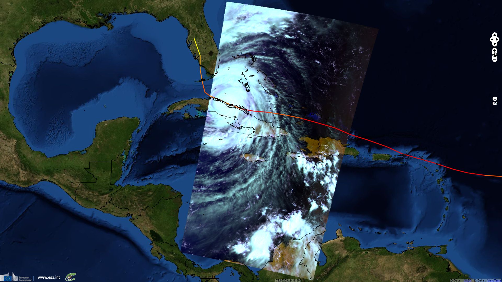
While the eye of Irma passed closer to Turks & Caicos and southernmost Bahamas islands than to Porto Rico and Hispaniola island, Irma was wide enough to cover wholly these islands. As noted by WMO (World Meteorological Organization), Irma then "made landfall in Cuba as the first category 5 hurricane since 1924" and followed its northern coastline for over a day which weakened it down to a category-3 hurricane.
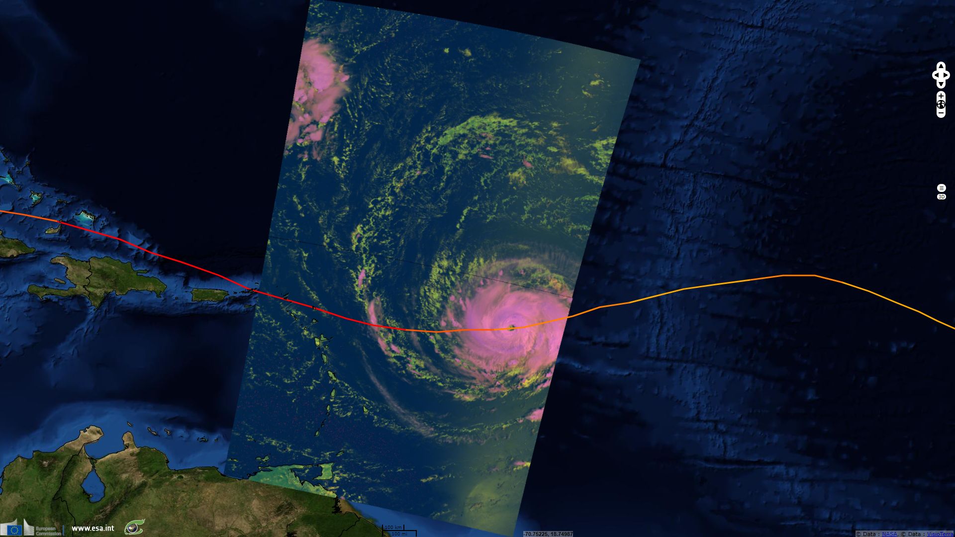
It strengthened one last time to category-4. "Irma made landfall Sunday morning in the Florida Keys – a string of tropical islands just off the Florida"; "with maximum sustained winds of 215 km/h and a central pressure of 929 hPa, bringing severe floods and large storm surges", EUMETSAT commented.
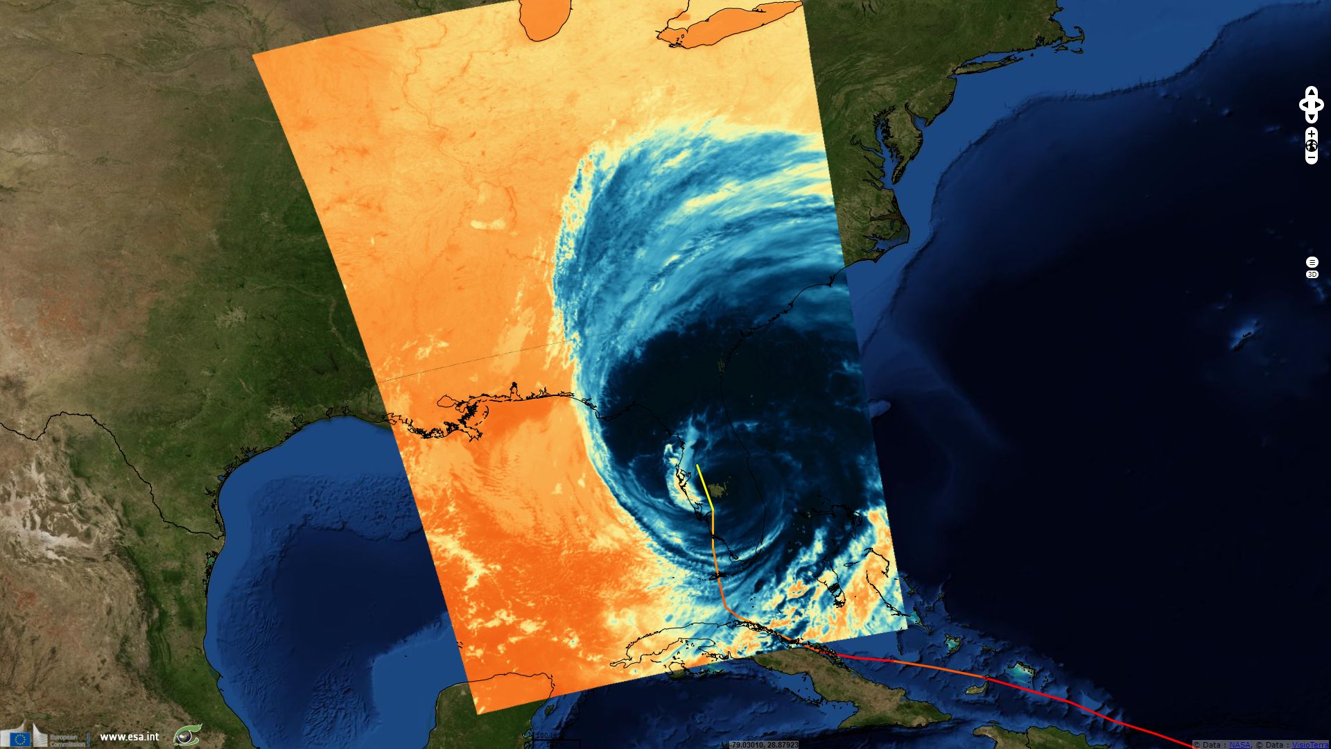
Finally, after crossing the Keys, WMO stated it "made landfall again in Florida, USA, on 10 September as a very dangerous category 4 hurricane on the Saffir-Simpson windscale" where "by Monday 11 September it had weakened to a tropical storm, though life-threatening hazards continued".
The Department of Atmospheric Science of the Colorado State University attributed Irma the following records:
- "Irma has now generated enough Accumulated Cyclone Energy (ACE) by itself to meet the NOAA ACE definition of an average full Atlantic hurricane season."
- "Generated the most Accumulated Cyclone Energy by a tropical cyclone on record in the tropical Atlantic (7.5-20°N, 60-20°W)."
- "Maximum winds of 185 mph (300 km/h) for 37 hours – the longest any cyclone around the globe has maintained that intensity on record. The previous record was Haiyan which caused devastation in the Philippines in the Northwest Pacific at 24 hours in November 2013."
- "Three consecutive days as a Category 5 hurricane – the longest in the satellite era (since 1966)."
The views expressed herein can in no way be taken to reflect the official opinion of the European Space Agency or the European Union.
Contains modified Copernicus Sentinel data 2026, processed by VisioTerra.
Contains modified Copernicus Sentinel data 2026, processed by VisioTerra.
| More on European Commission space: |  |
 |
 |
||||
| More on ESA: | |
|
|
S-1 website | S-2 website | S-3 website | |
| More on Copernicus program: | |
|
|
Scihub portal | Cophub portal | Inthub portal | Colhub portal |
| More on VisioTerra: | |
|
|
Sentinel Vision Portal | Envisat+ERS portal | Swarm+GOCE portal | CryoSat portal |