Vauban's iron belt stars, protection of the hexagon
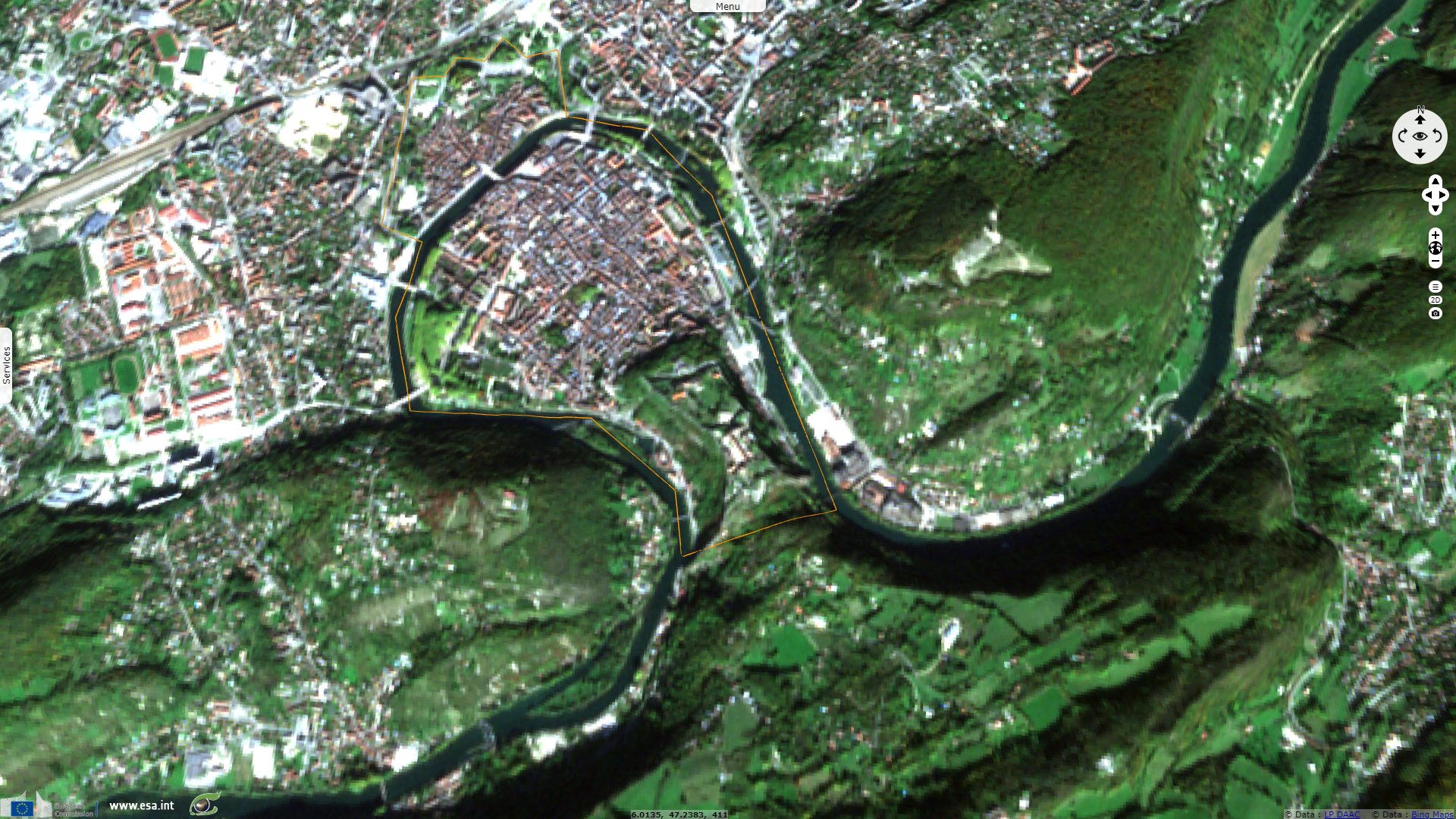
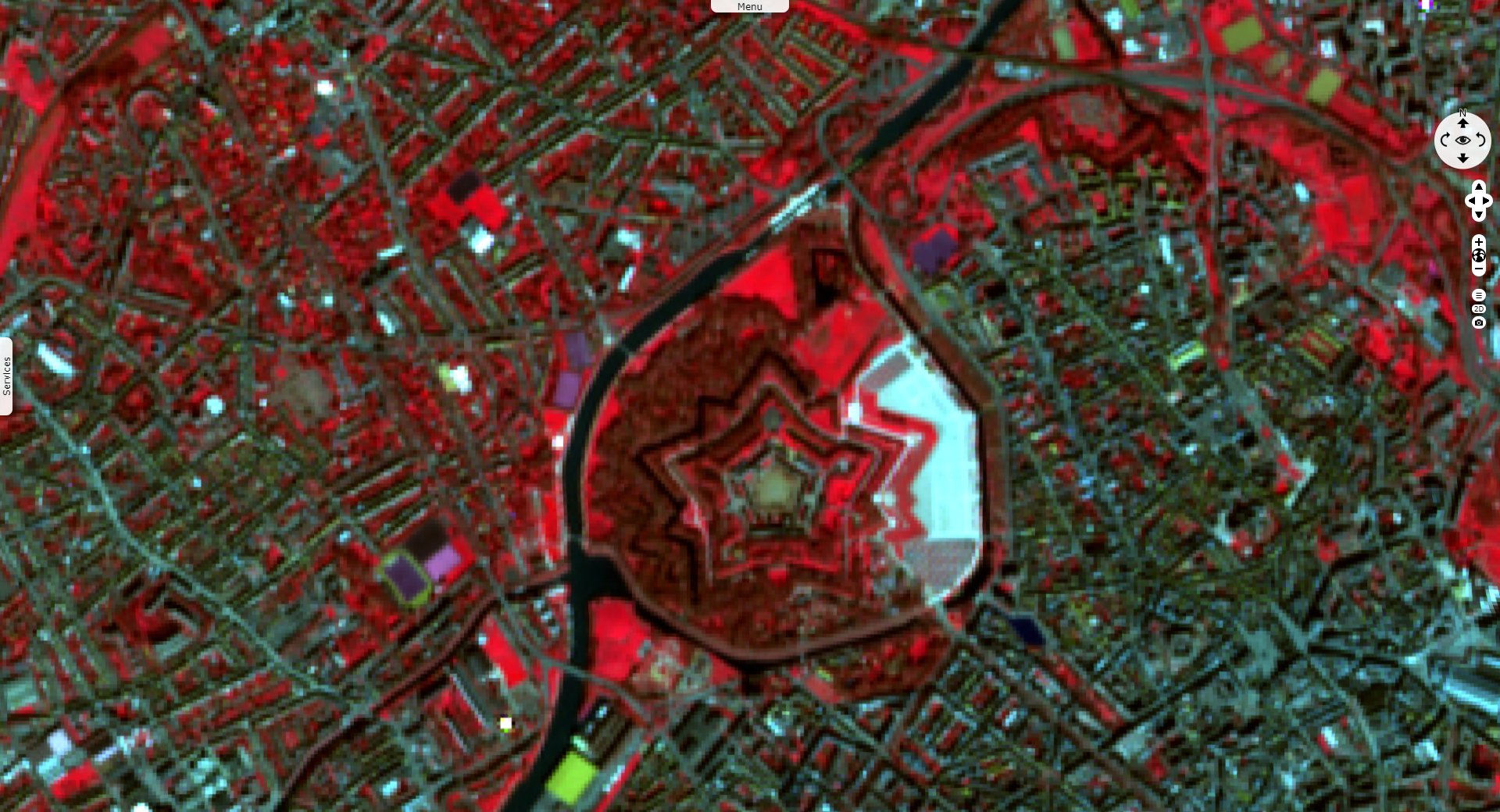
Sentinel-2 MSI acquired on 15 October 2017 at 10:40:09 UTC
...
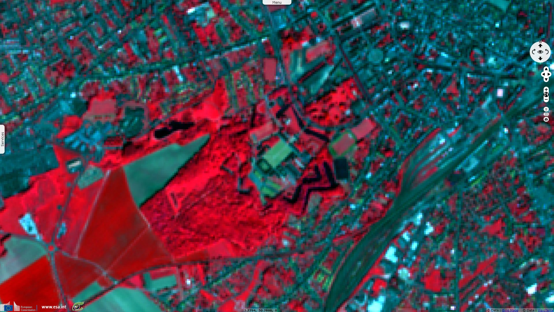
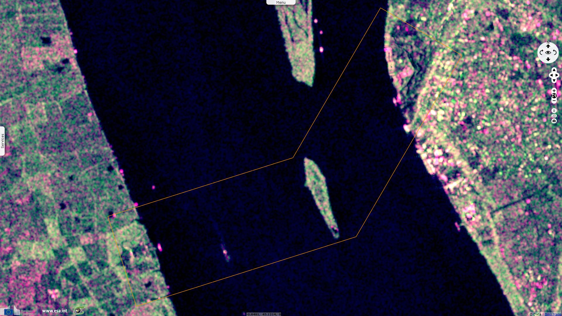
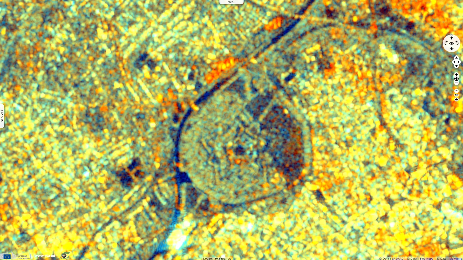
Sentinel-1 CSAR IW acquired on 04 April 2020 at 17:40:55 UTC
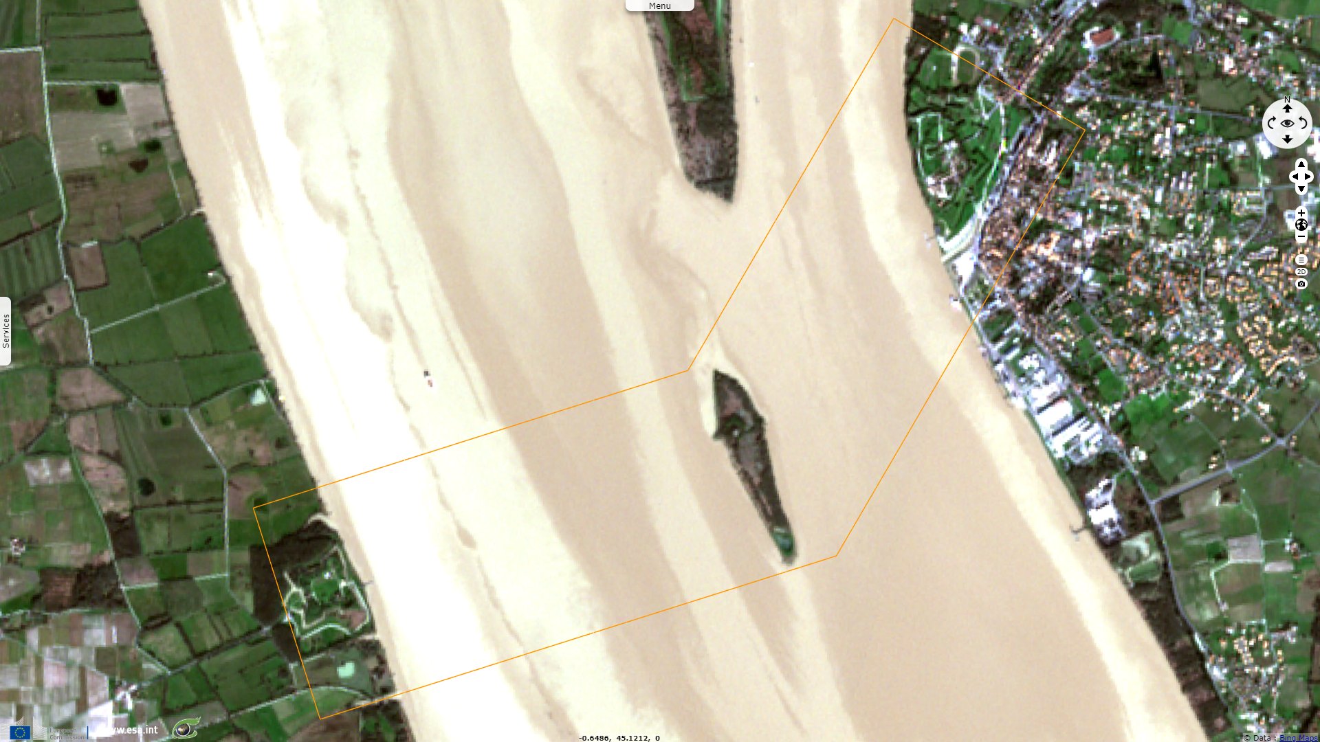
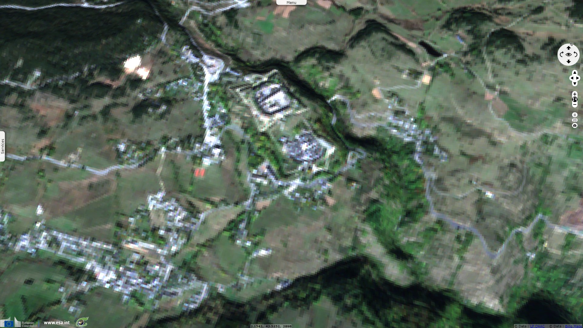
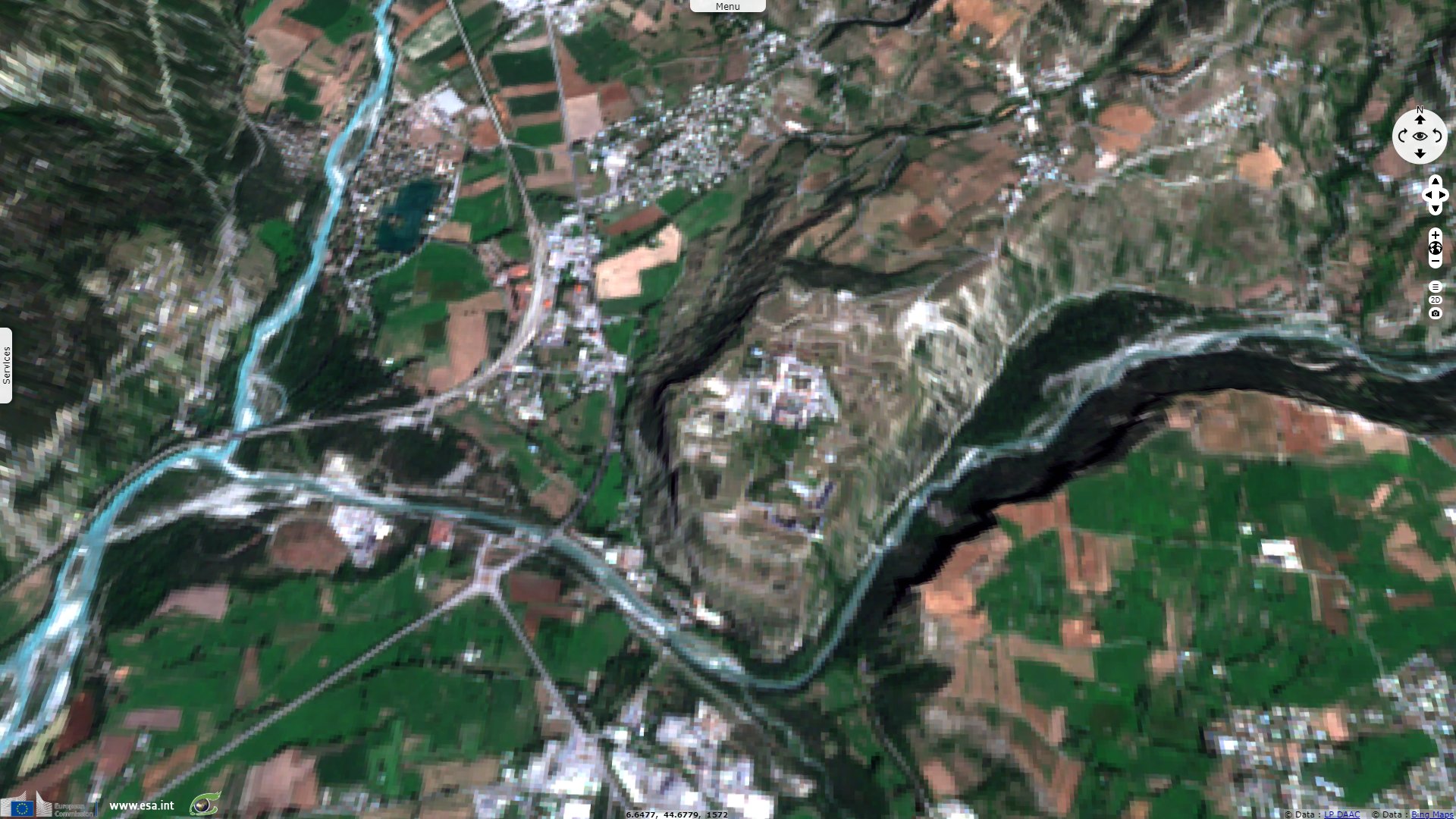
Sentinel-2 MSI acquired on 18 May 2020 at 10:56:19 UTC
...
Sentinel-1 CSAR IW acquired on 04 April 2020 at 17:40:55 UTC
Sentinel-2 MSI acquired on 18 May 2020 at 10:56:19 UTC
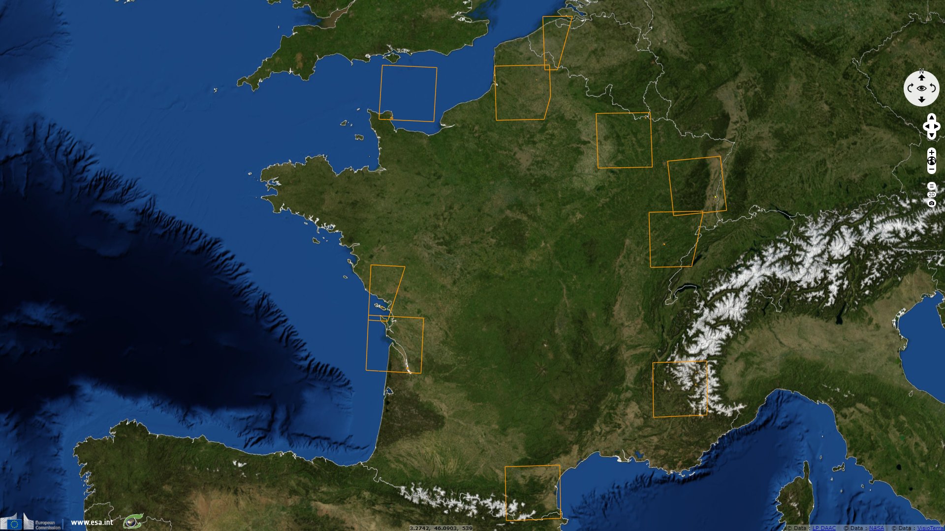
Keyword(s): Urban planning, security, river, sea, island, hill, mountain, plain, France
The official website sites-vauban.org dedicated to the promotion of this UNESCO World Heritage site explains: "During each of his visits, Vauban described the harbour of Saint-Vaast as the 'best and most secure in the kingdom' with natural protection from the Isle of Tatihou. However, the Cotentin coast remained vulnerable because of its prominent position facing England. The need to protect it turned out to be crucial after the battle of the Hougue, in June 1692, when Louis XIV‘s ships were defeated by the Anglo-Dutch fleet.
Therefore, in 1694, Vauban called for the urgent construction of two towers which would protect the anchorage of ships by means of cross fire. Work started under the orders of the engineer de Combes. These tapered towers, 20 metres high, are distinguished by their many different functions: for observation, firing out to sea and communication by signals and are a fine example of Vauban’s military engineering."
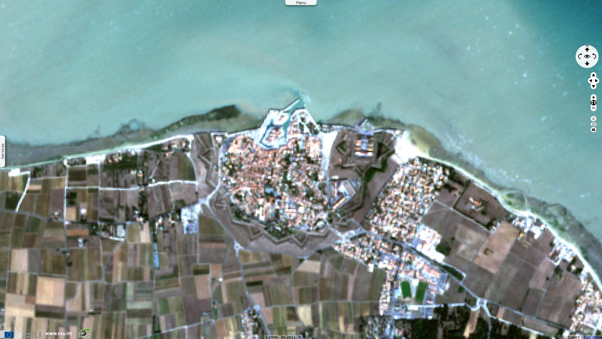
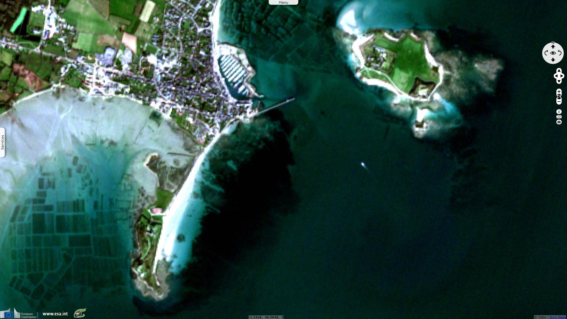
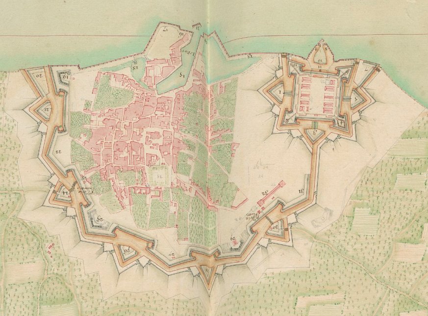
"In 1681, Vauban planned to build a central reduit at Saint-Martin, which could shelter the whole population of the island if the enemy landed at an other point. The town wall is unique because of its size: a semi-circle with a radius of 1.5 kilometres and ramparts 14 kilometres long. The geography of the site posed no constraints and the wall was built in record time.
The citadel, a perfect square, can only be accessed via one monumental entrance gate, opening onto a small fortified port. Inside, the buildings were planned to accommodate 1200 men and consist of a barracks, chapel, arsenal, the basements of the bastions and an officers’ pavilion. Saint-Martin-de-Ré is still in a good state of conservation today, sitting on the glacis which has never been built-up. It is surely the finest preserved example both of Vauban’s first system and of an island reduit."
"The barricade of the estuary is an imposing triptych guarding the River Gironde and was built by Vauban and his engineer, Ferry, between 1685 and 1692.
At Blaye, Vauban planned a new town wall with four bastions, three demi-lunes and two gates. He thereby transformed the medieval wall, systematically adapting the existing structures but leaving no visible outer signs of his work. From the other side of the bank, the engineer had a square fort, Fort Médoc, built from scratch on marshy land, meaning that he could only build barriers of earth for defence. Finally, Vauban erected Fort Pâté on an unstable sandbank in the middle of the river to close off the estuary. This oval canon tower was a remarkable technical feat and the prototype of a compact sea fort. It enabled cross fire with both banks, located 1600 metres from the island."
"Vauban’s great talent lies in optimizing bastioned fortifications, the defence system introduced and developed by first Italian and then Dutch engineers from the 16th century onwards. As opposed to medieval defence systems made up of high, thick walls, it is a system which drives defensive works into the ground thus rendering them less fragile. Vauban used what already existed to complete the natural defences of towns and strategic communication routes: namely, he used the morphology of the terrain, the ground’s resources and the earth’s layers."
Considered the expert in his field, rivaled only by his Dutch contemporary Menno van Coehoorn, Vauban's design principles served as the dominant model of fortification for nearly 100 years. Ironically, a small minority of French engineers continued to be innovators in the field, most notably the Marquis de Montalembert, rejecting then obsolete principles advocated by Vauban and his successors; his ideas were dismissed in France but became prevailing orthodoxy in much of Europe.
Mount-Louis guarded the Col de la Quillane, east of the Pyrenees then recently acquired in 1659. Mont-Louis is the highest fortified village in France, and one of the nine towns created ex nihilo by Vauban (six of which still are in France).
"Located in the eastern Pyrenees at an altitude of 1600 metres, the stronghold of Mont-Louis was built from scratch by Vauban on granite terrain and is perfectly adapted to the geography of the site. Work started in 1679 and was completed in two years. The fortified ensemble was added as a complement to Villefranche-de-Conflent in securing the route from the Pyrenees. This ensemble consists of two square structures, in tiers on the slope: a citadel with orillon bastions and demi-lunes (ravelins) and a new town enclosed in the enceinte. Although it is rare, all the watch towers and drawbridge gates as well as both churches and wells have been preserved intact since the 17th century. The citadel is still used for military purposes today."
"This remarkable construction was set on a bleak plateau, at a height of 1050 metres, dominating the confluence of the Rivers Guil and Durance. Mont-Dauphin, at that time considered as a modern garrison town, was planned to accommodate 2000 soldiers and as many civilians. Mont-Dauphin is an outstanding ensemble of buildings, still well-preserved today. It is the archetype of the mountain stronghold with an arsenal, the two powder magazines, the barracks on the ramparts and the church which was never completed."
Secured by french troops in 1668, Besançon was further fortified by Vauban to keep the city within the kingdom. "Besançon lies in an exceptional strategic position, which Julius Caesar had already noticed: the River Doubs encloses the city in a loop closed off by a hill. Here Vauban was to find a town that had been fortified since ancient times. Forever striving to adapt to the terrain, he improved some buildings and designed new ones, thereby totally reshaping the defence system of the town.
Vauban built the citadel on a rocky spur that he made higher to protect it from the Chaudanne and Brégille hills." The whole is surrounded by walls covered by circular paths and punctuated by watchtowers and sentry posts. The walls are up to 15 to 20 metres high with a thickness between 5 and 6 metres. On the other side of the Doubs river, "he transformed Battant’s medieval town wall with bastions, curtain walls and demi-lunes dominated by Fort Griffon, a second citadel facing the first one. Vauban optimised the defence of the heart of Besançon by inventing a new model of canon tower: the bastioned tower. He built six of them firmly anchored into the river and facing the hills which dominated the town."
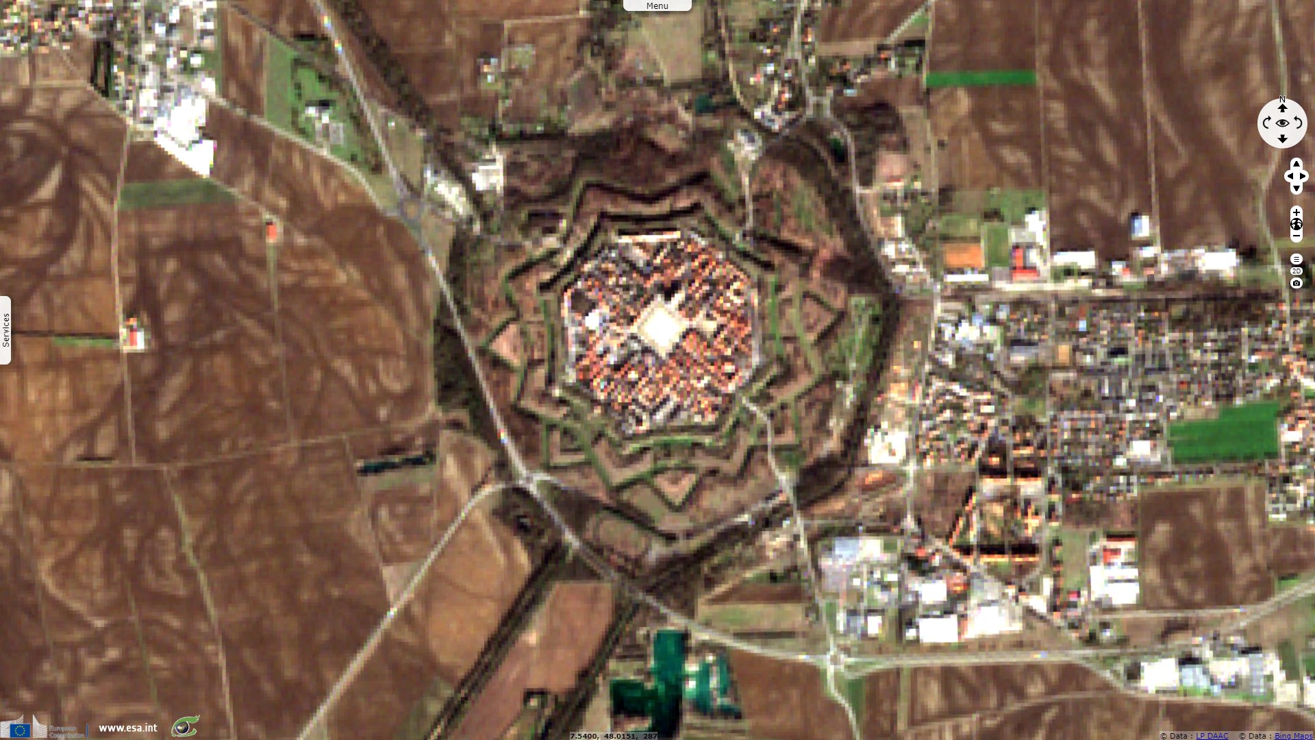
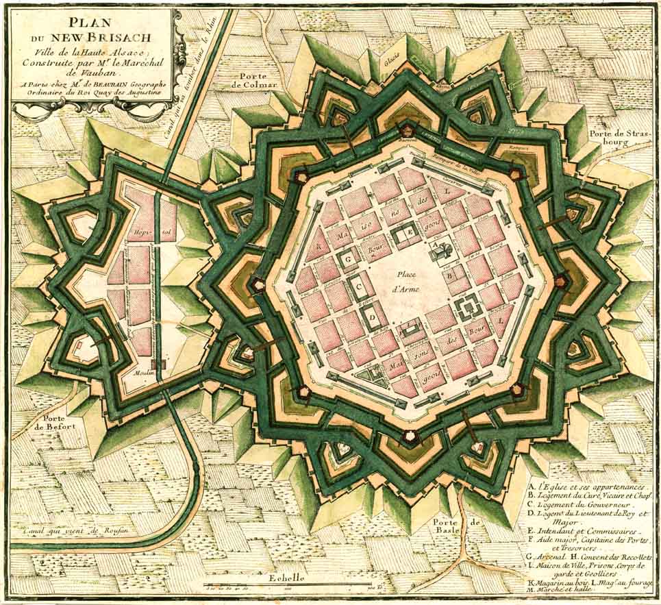
Annexed during the reign of Louis XIV, Neuf-Brisach was built in 1697. It is located 3km away from Vieux-Brisach on the other side of the Rhine border, which had been given back to its previous ruler. The city's layout was that of an 'ideal city', as was popular at the time, with a regular square grid street pattern inside an octagonal fortification.
"Neuf-Brisach is the sole example of Vauban’s third system and is his most successful urban planning project. A simple principle determines the internal organization of this octagonal layout namely to provide practical internal thoroughfares so that different areas, for commanding, fighting or civilian activity could exist in harmony without getting in each others way. The town was divided into 48 blocks, set around the central parade ground which grouped together the most important buildings. 34 of the blocks were reserved for use by the 4000 inhabitants of the town. The barracks were constructed up against the ramparts to best protect the civilians.
A perfect star on the Alsace plain, Neuf-Brisach can be seen as the culmination of all of Vauban’s fortified work."

Exemples of plain fortifications:
Left, extract of the map of Lille, 1693 - Bibliothèque nationale de France, Encyclopedia Gallica
Right, map of Neuf-Brisach city and fortifications, 1697 - Source: Theudericus
"When Longwy-Haut became French under the 1679 Nimeque Treaty, Louis XIV decided to destroy the old medieval town and replace it with a «new town» to form a major defensive link on the north-eastern border. Vauban skilfully adapted the layout of this stronghold to the steep terrain, on the edge of a cliff and dominating the Chiers valley and low town.
The fortress forms a hexagon with six bastions and is well-equipped with all the facilities required by a place of war; a church, arsenal, well and barracks, laid out perpendicularly. Over and above these military features, Longwy also reflects Vauban’s conception of the ideal town. A monumental gate and four bastions are still well-preserved. Two of them house cross-shaped magazines, an exception in the engineer’s work, and the two others have modified powder stores."

Left, exemple of relief-backed fortifications: map of Longwy, 1745 - Bibliothèque nationale de France, Encyclopedia Gallica
Right, exemple of coastal fortifications: map of Saint Martin de Ré, 1693 - Bibliothèque nationale de France, Encyclopedia Gallica
Lille was taken by French troops in August 1667 and the citadel works were started in 1668. The citadel was constructed to the west of the city on marshland at the junction of the rivers Deûle and Bucquet. This allowed the use of swamp water and mud as a natural defense to make conditions more difficult for any possible enemy besieging the citadel. Through a system of locks and water gates, 17 km² around the citadel could be flooded to a depth of 55 cm. A wide esplanade interrupted the plans, connecting the fort to the city.
The citadel was taken at a staggering cost in 1708 after a siege long enough to prevent further warfare until the end of winter. It was given back to the French kingdom in 1713. In 1750, a canal along the esplanade was drilled according to the plans drawn up by Vauban. The citadel resisted 35 000 besiegers in 1792.
Regarding his life: "From 1653 to 1703, Vauban took part in 48 sieges, restructured 130 strongholds, built about thirty strongholds from scratch and left behind him about thirty plans which were used after his death. As well as fortifying towns, Vauban also captured them. He knew only too well that no fortress was impregnable. Its role was to act as a deterrent, therefore serving as little as possible." By developing new tactics, he showed his ability in taking strongholds much faster than expected while largely decreasing human losses, his main preoccupation. Vauban's offensive tactics remained relevant for centuries; many of his principles were used by the Việt Minh at Dien Bien Phu in 1954.
"After the sieges at Tournai, Douai and Lille, which confirmed the engineer’s renown, Louis XIV entrusted him with the task of building the citadel at Lille, known as 'the Queen of Citadels'. With the Dutch War in 1673, the engineer convinced Louis XIV to set up his 'pré carré' or duelling field on the north-eastern border, reducing the number of his strongholds to retain only the strongest and thereby creating a double line of fortified towns."
Vauban advocated giving up territory as part of establishing a more coherent and defensible border. He was very preoccupied by public utility, advocated shaping the landscape and defending the territory with the construction of the 'iron belt' enclosing France in its "natural boundaries, not beyond the Rhine, the Alps, the Pyrenees, the two seas". The boundaries established in the north, east and south-west as a result have changed very little since then. According to Napoleon, the iron belt built by Vauban saved France from invasion on two occasions: under Louis XIV at the Battle of Denain, then during the Revolution.
Beyond his military feats, he was also an urban planner, statistician, economist, agronomist, political thinker, but also infantryman, artilleryman, mason, powder and saltpetre engineer, mine and road engineer, hydrographer, topographer, cartographer, army reformer. It is estimated he spent an average 150 days a year on the roads and travelled more than 180 000 km during his 57 years of service, acquiring a deep knowledge of the kingdom and its population.
Vauban worked on improving many of France's major ports and harbours, as well as civilian infrastructure projects. Shortly before his death in 1707 he produced an economic tract entitled La Dîme royale contained radicing proposals for a more even distribution of the tax burden; his use of statistics to support his arguments makes the paper a precursor of modern economics. His application of rational and scientific methods to problem-solving, whether engineering or social, anticipated an approach that became common in the Age of Enlightenment.
The views expressed herein can in no way be taken to reflect the official opinion of the European Space Agency or the European Union.
Contains modified Copernicus Sentinel data 2026, processed by VisioTerra.
Contains modified Copernicus Sentinel data 2026, processed by VisioTerra.
| More on European Commission space: |  |
 |
 |
||||
| More on ESA: | |
|
|
S-1 website | S-2 website | S-3 website | |
| More on Copernicus program: | |
|
|
Scihub portal | Cophub portal | Inthub portal | Colhub portal |
| More on VisioTerra: | |
|
|
Sentinel Vision Portal | Envisat+ERS portal | Swarm+GOCE portal | CryoSat portal |
- Vauban’s work bears witness to the peak of classic bastioned fortification, typical of western military architecture of modern times.
- Vauban played a major role in the history of fortification. The imitation of his standard-models of military buildings in Europe and on the American continent, the dissemination in Russian and Turkish of his theoretical thinking along with the use of the forms of his fortification as a model for fortresses in the Far East, bear witness to the universality of his work.
- Vauban’s work illustrates a significant period of human history. It is a work of the mind applied to military strategy, architecture and construction, civil engineering, and economic and social organisation.
"