Relationships between Mangrove Marine Park and surrounding populations, Democratic Republic of Congo
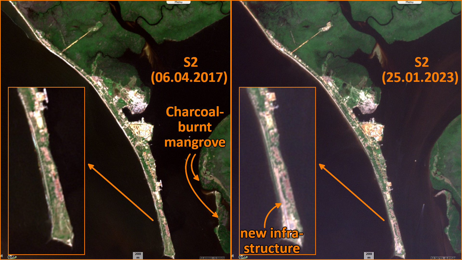
Sentinel-2 MSI acquired on 06 April 2017 at 09:10:21 UTC
...
Sentinel-1 CSAR IW acquired on 03 January 2019 at 17:32:48 UTC
Sentinel-1 CSAR IW acquired on 17 December 2019 at 17:32:55 UTC
Sentinel-2 MSI acquired on 25 January 2023 at 09:12:41 UTC
...
Sentinel-1 CSAR IW acquired on 03 January 2019 at 17:32:48 UTC
Sentinel-1 CSAR IW acquired on 17 December 2019 at 17:32:55 UTC
Sentinel-2 MSI acquired on 25 January 2023 at 09:12:41 UTC
Keyword(s): Coastal, mangrove, river, biodiversity, deforestation, oil and gas, National Park, DRC, Democratic Republic of Congo, Angola
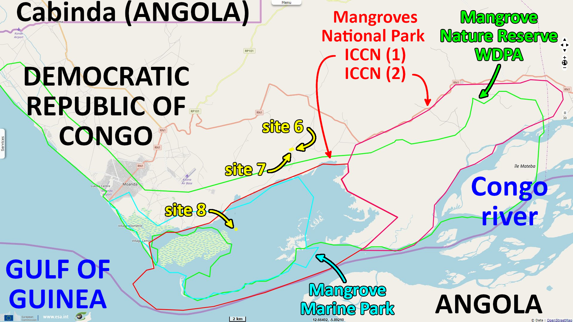
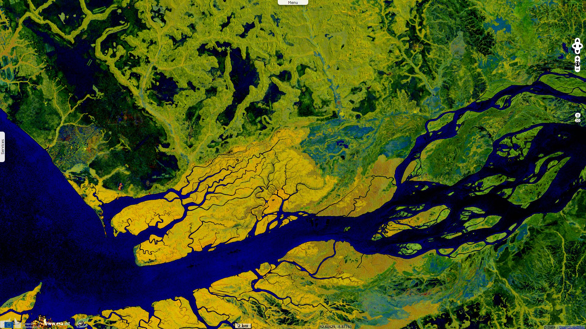
The Mangrove Marine Park is located in the Democratic Republic of Congo at the mouth of the Congo River bordering Angola to the north and south
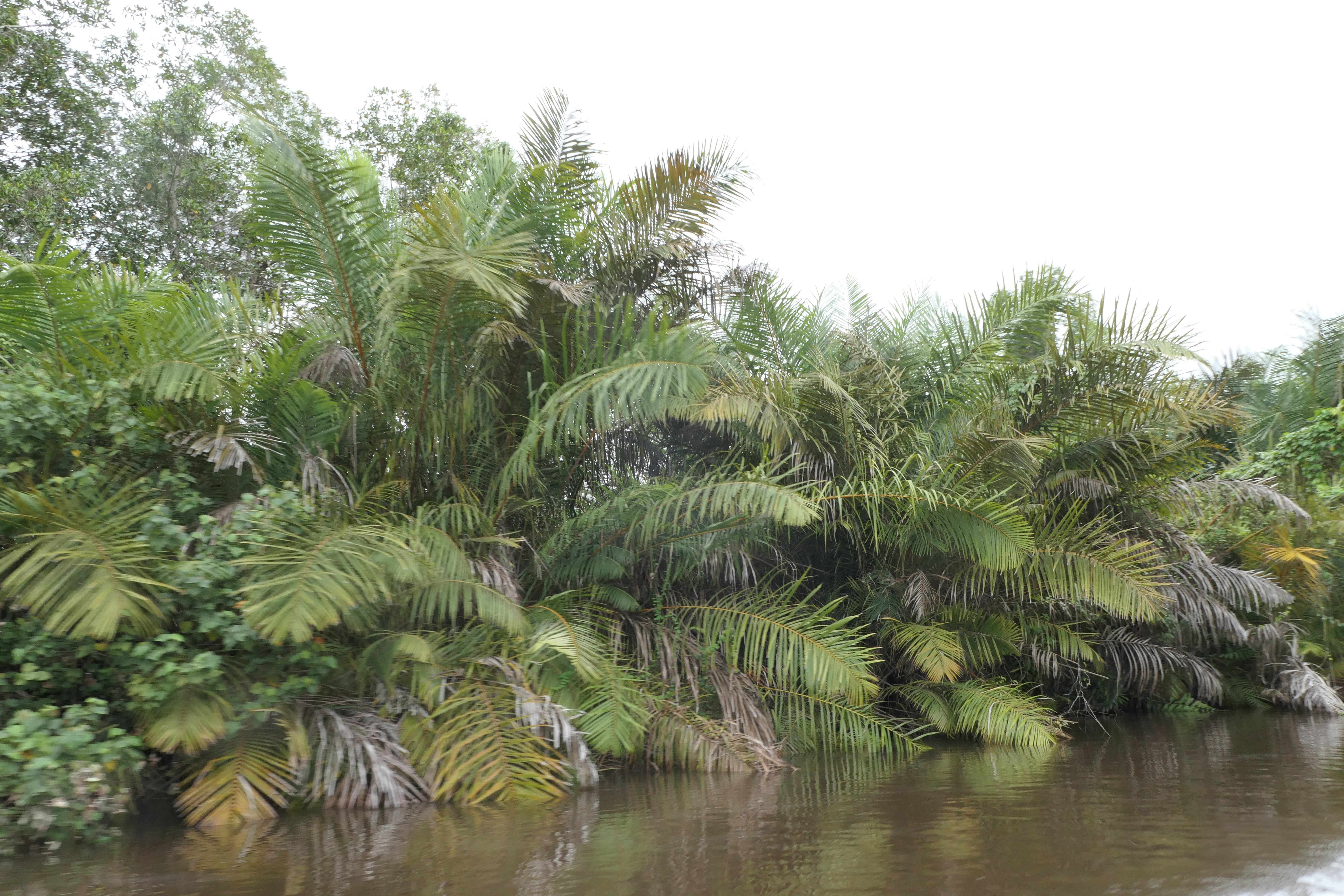
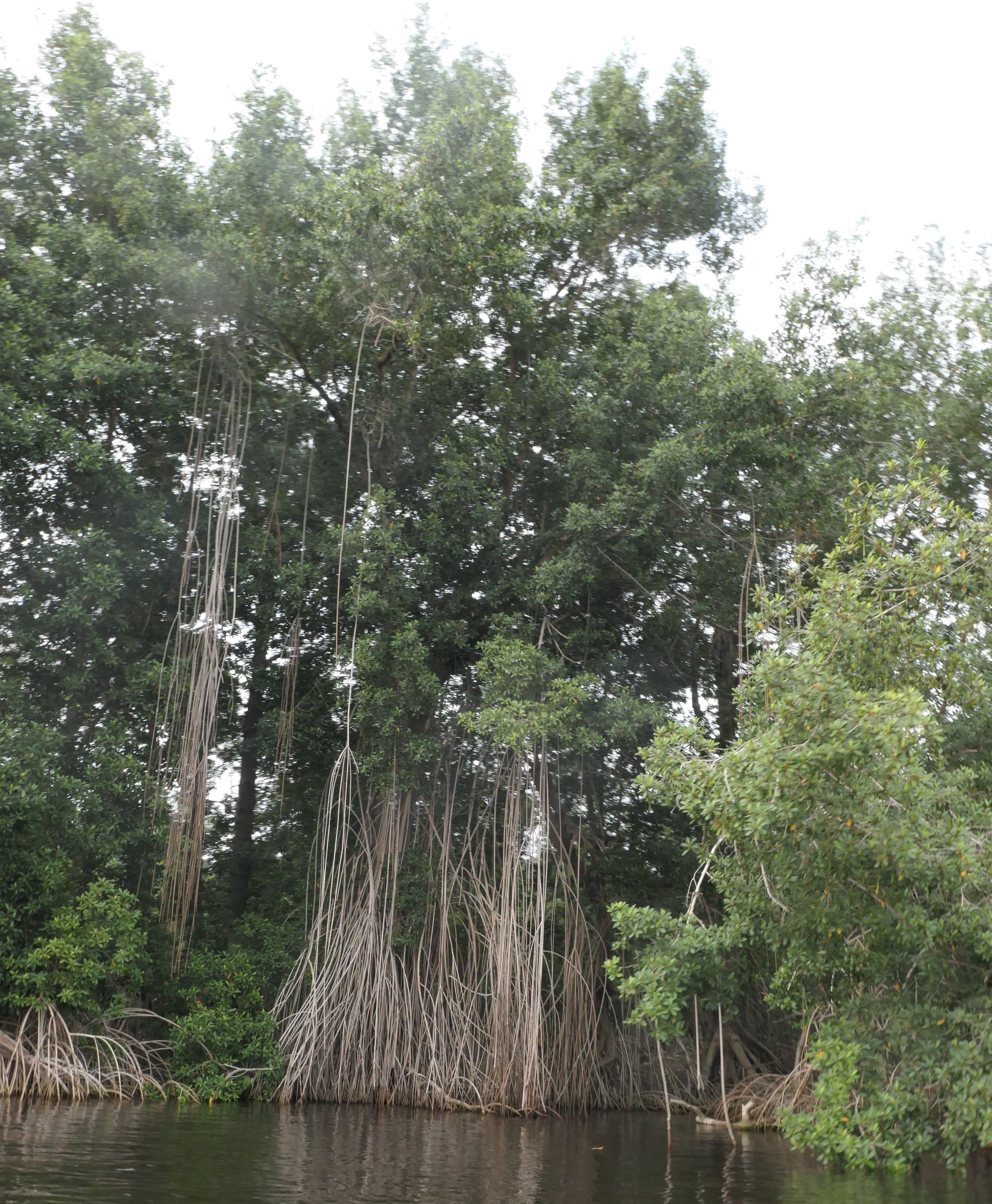
Raphia trees along the bank - Source: Bernard Riera and the Mangrove Marine Parc team
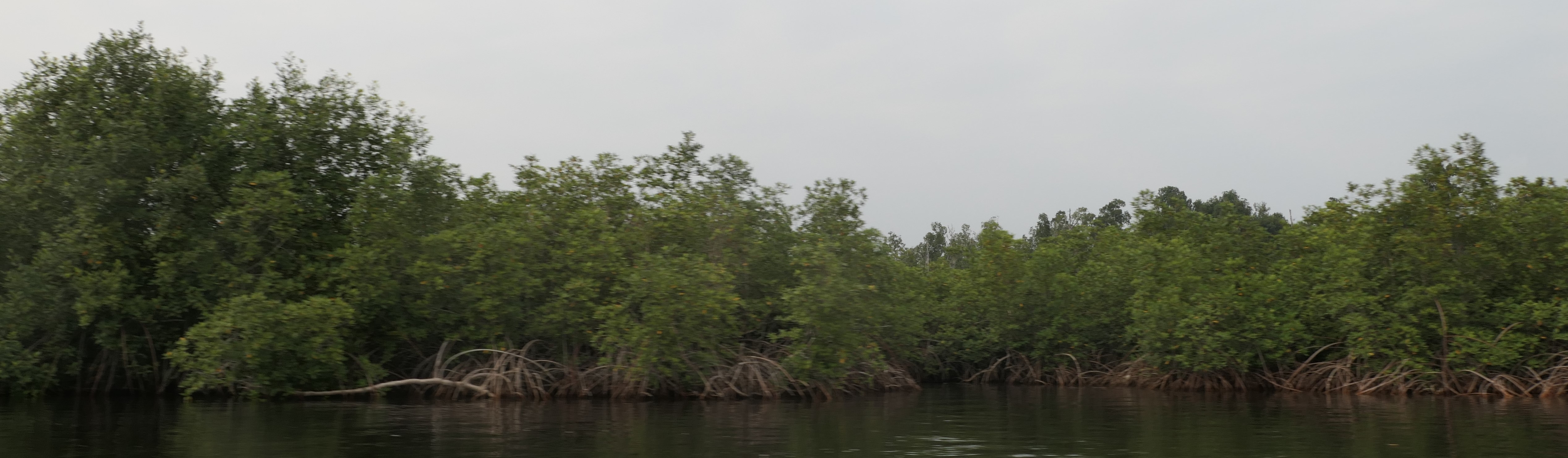
Paletuvier Rhizophora along the shore - Source: Bernard Riera and the Mangrove Marine Parc team
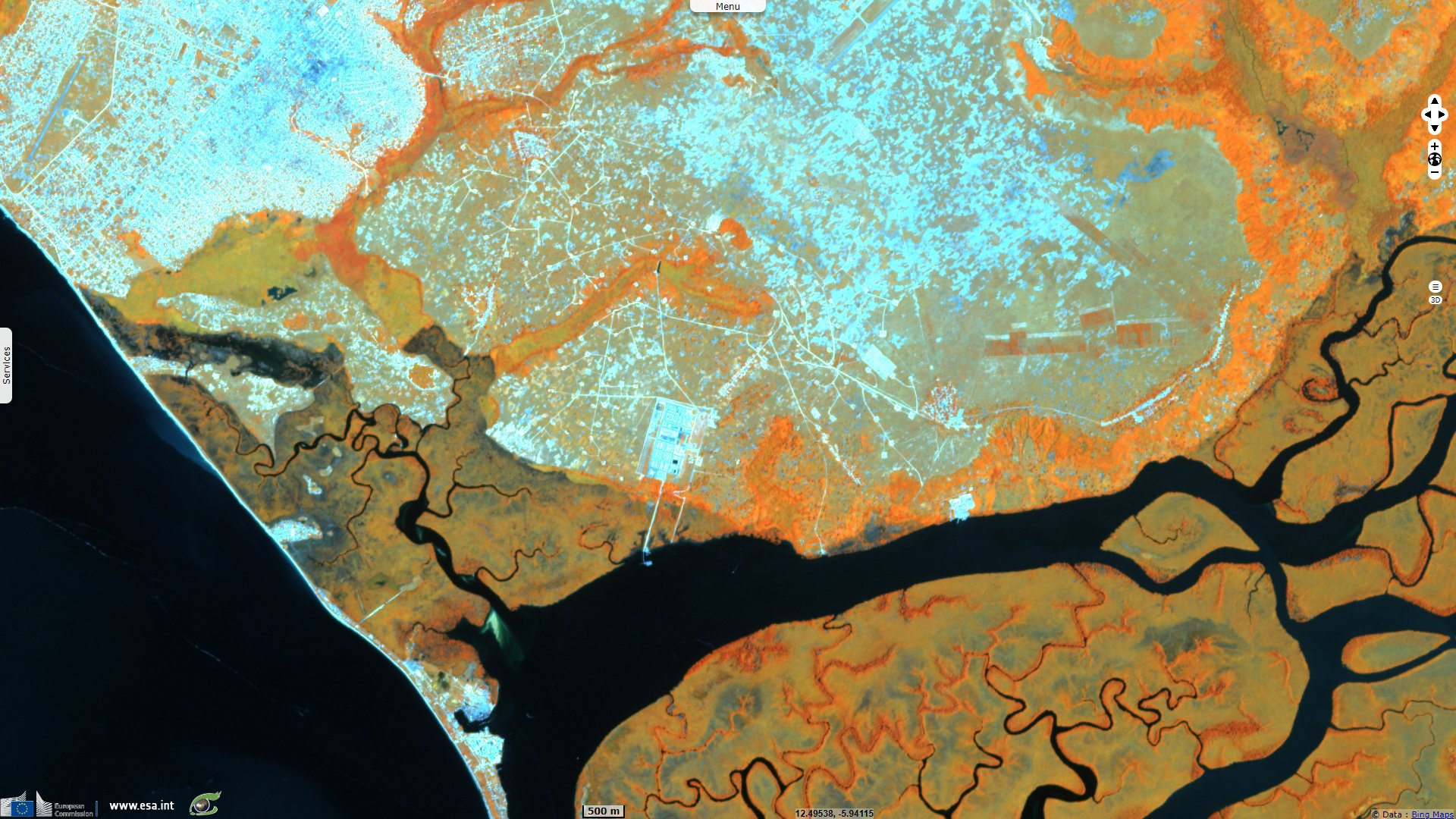
Pointe Banana, a port area in the Mangrove Marine Park on the Congo River estuary. New developments have been completed at the tip of the peninsula. Flooding episodes have become more frequent along time in this area.
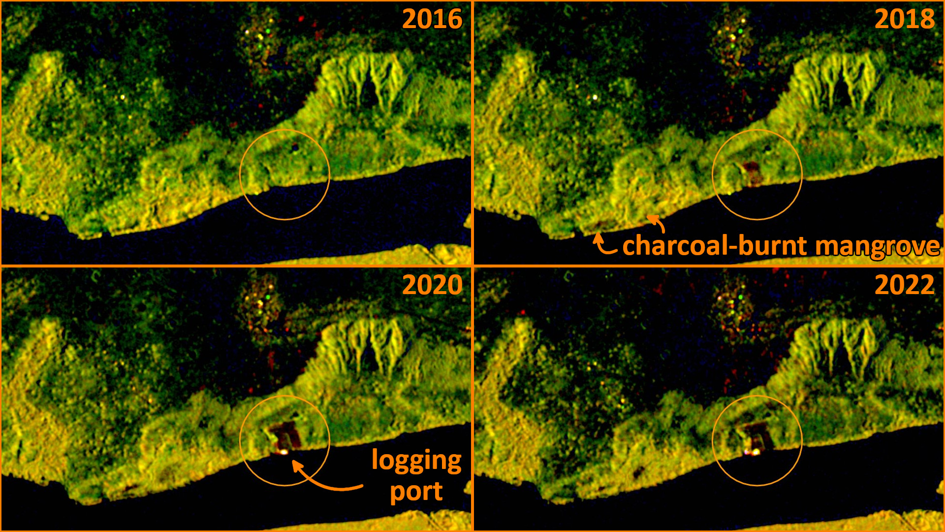
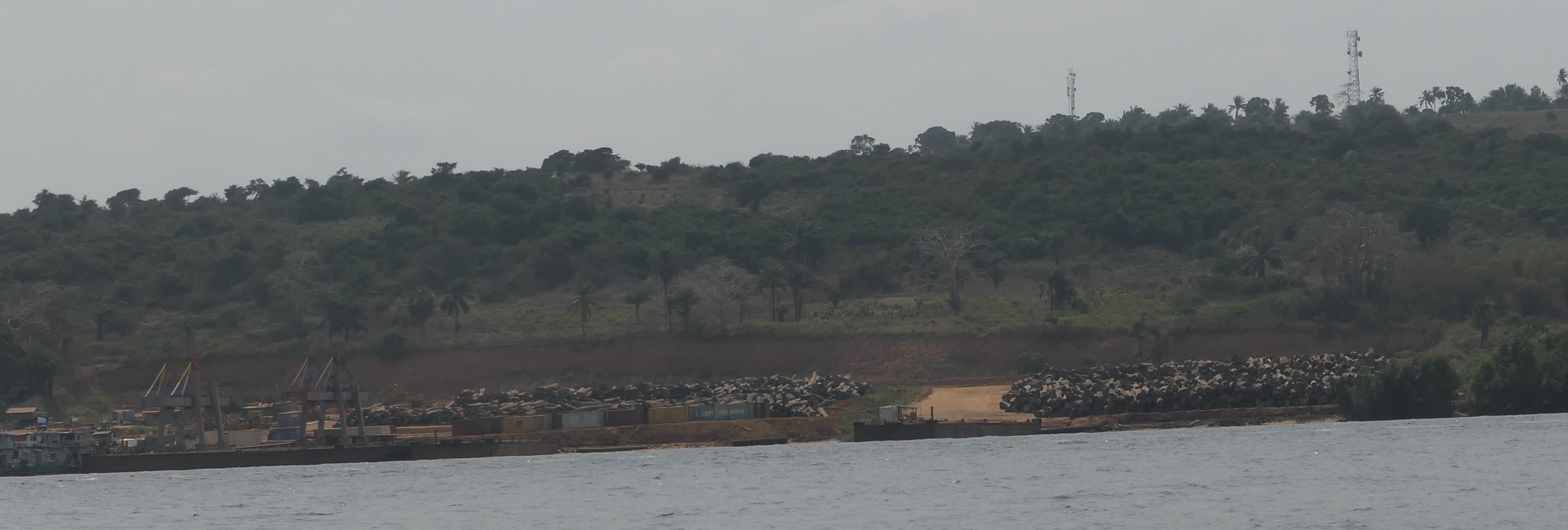
The logging port in 2022 - Source: Bernard Riera and the Mangrove Marine Parc team
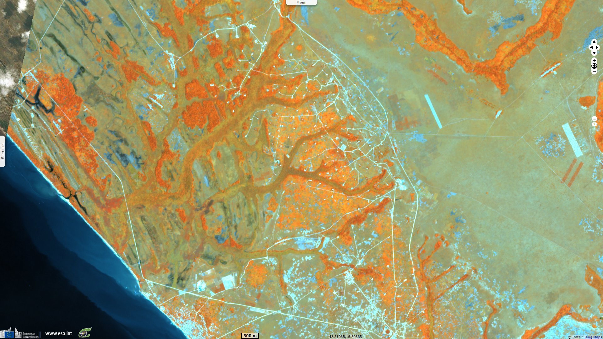
North bank of the Congo River, near the river mouth and Perenco infrastructure. In 2018, the Chinese concessionaire has begun work on the logging port near Muanda. This port stores logs illegally cut from the Congolese forest inland. Widely expanded, this Chinese-run port allows to export these logs to China according to Bernard Riera, co-leader of the Biodiversity Environment Tropical Vegetation at Paris National Museum of Natural History.
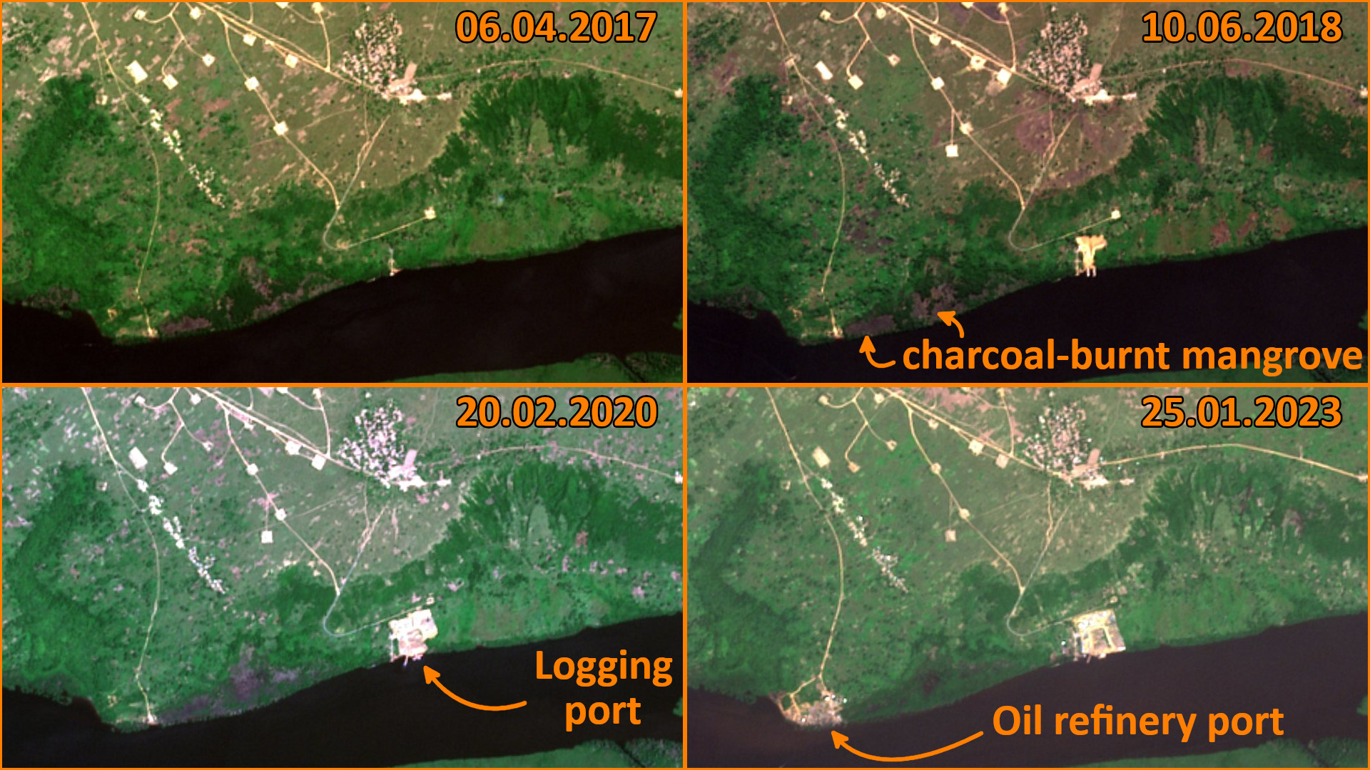
Along the river, the mangrove forest to the west of the port has been burnt to produce charcoal. The small port has been extended, the eastern part of it is hidden by the forest on the bank, hiding it from observers in canoe. Two years later, the illegal port has grown again, the portion at east is still hidden. In 2023, the forest on the shoreline was cleared to expand the port. At west, the team of the Marine Park replanted the area degraded by charcoal burning commented Bernard Riera.
The construction of a road on a dike has isolated this mangrove from the salt water. The mangrove vegetation is degrading since the construction of a road embankment, replaced by fern Acrostichum aureum.
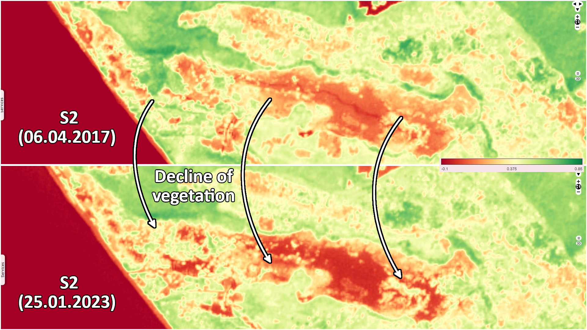
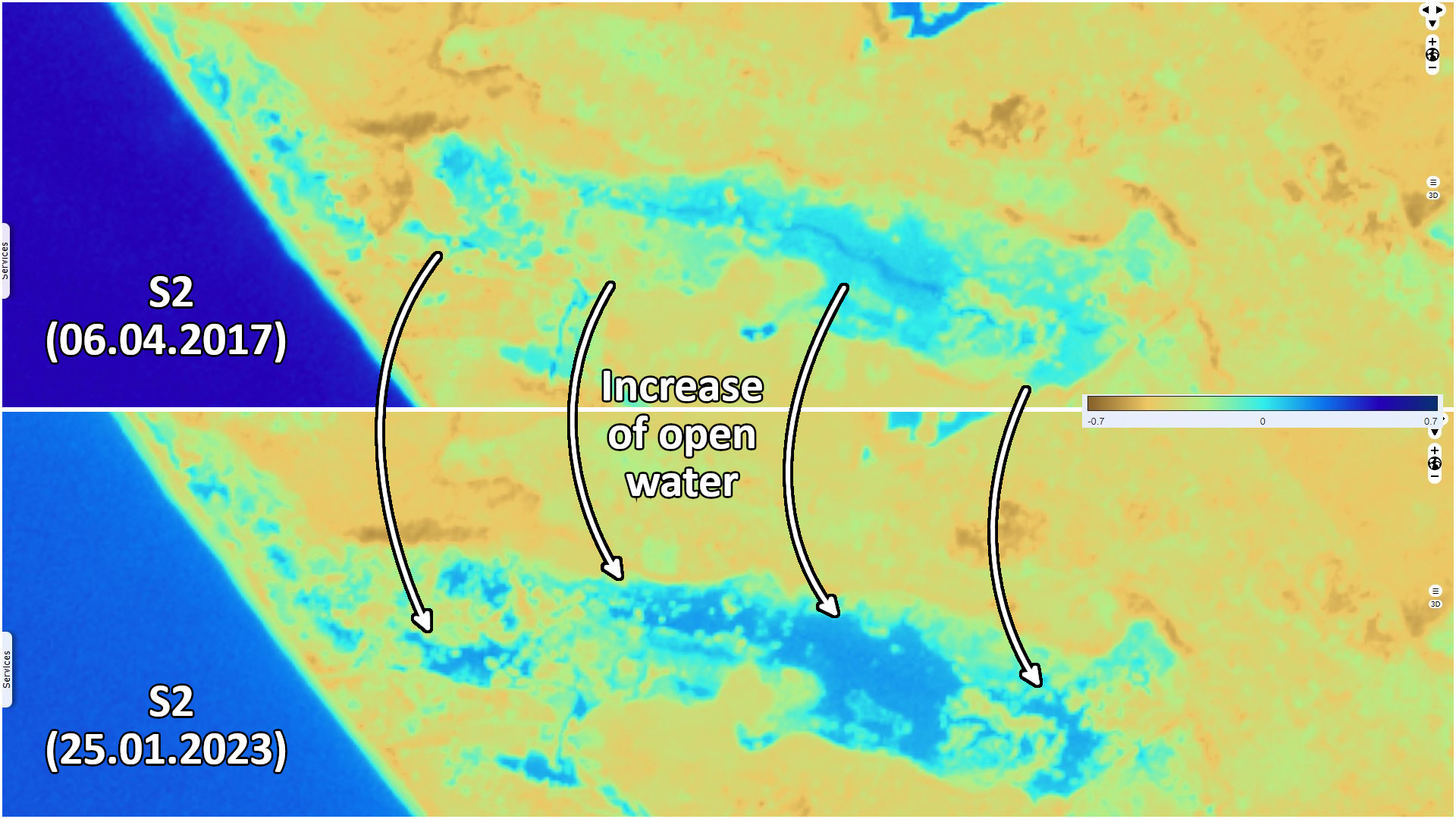
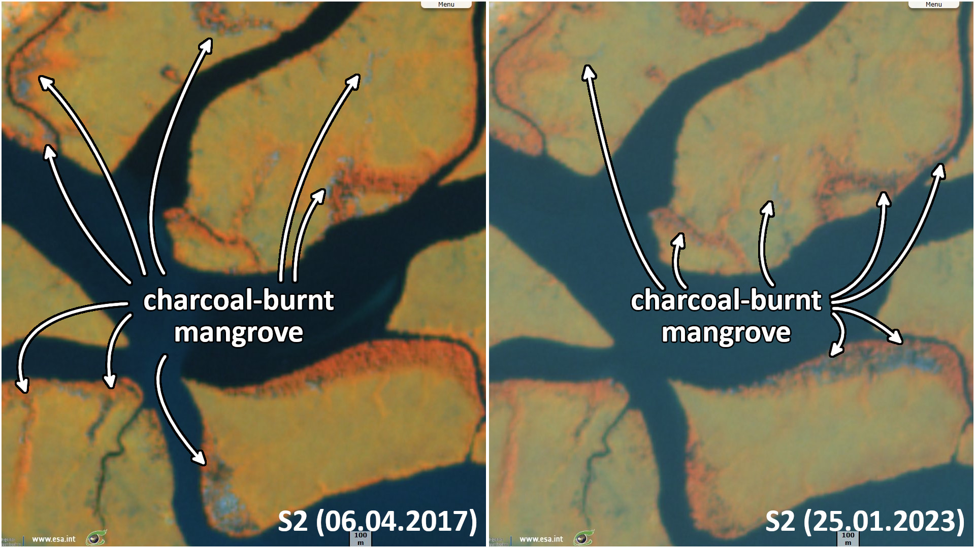
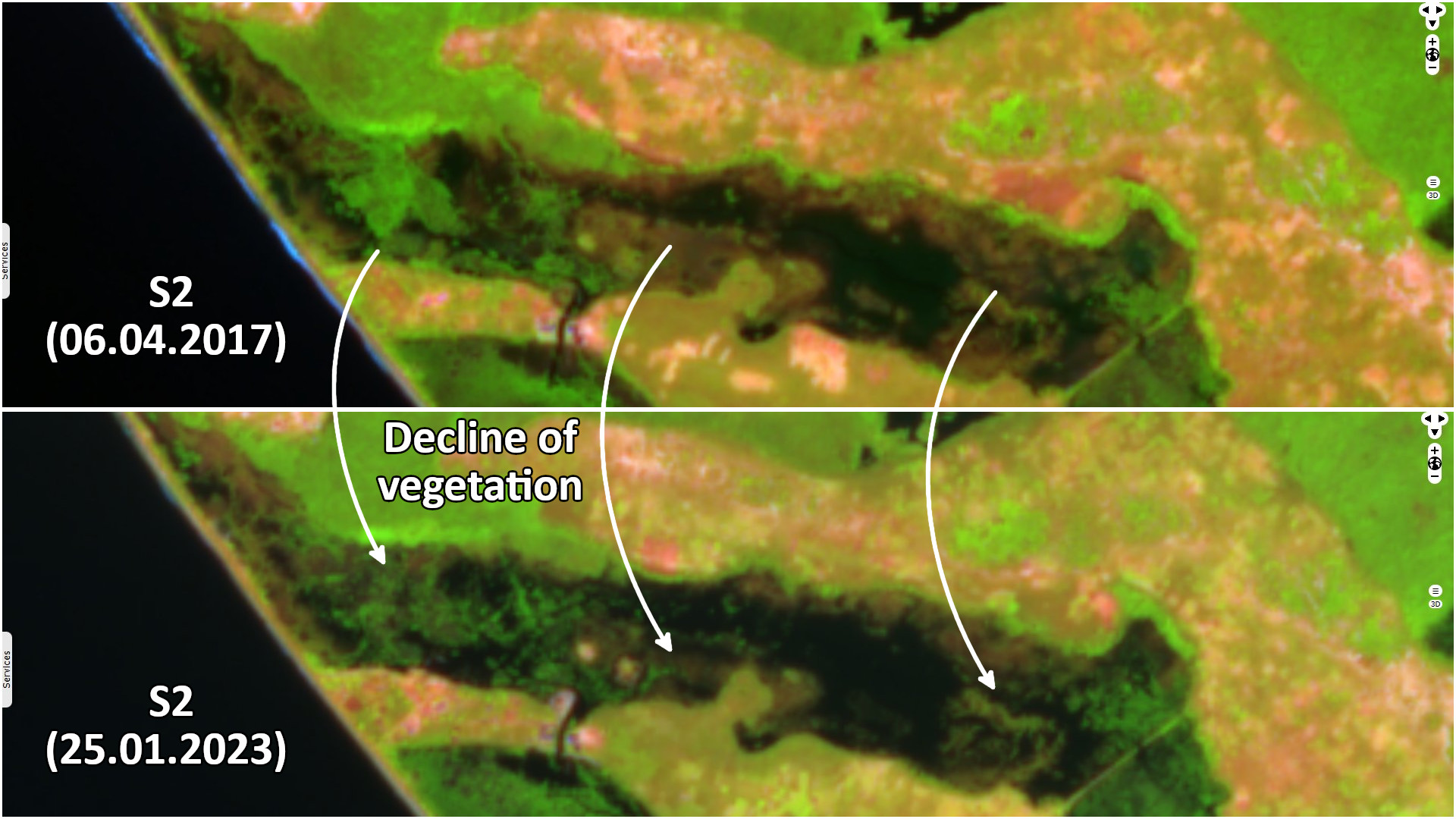
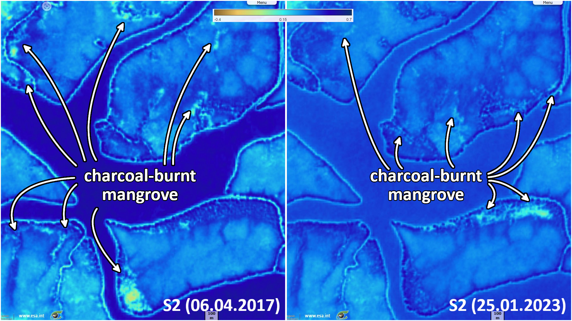
Part of the shores of the islands of the Mangrove Marine Park is bordered by mangrove, visible in orange. Areas degraded in 2017 to make charcoal are recovering, other areas have been degraded in the meanwhile.
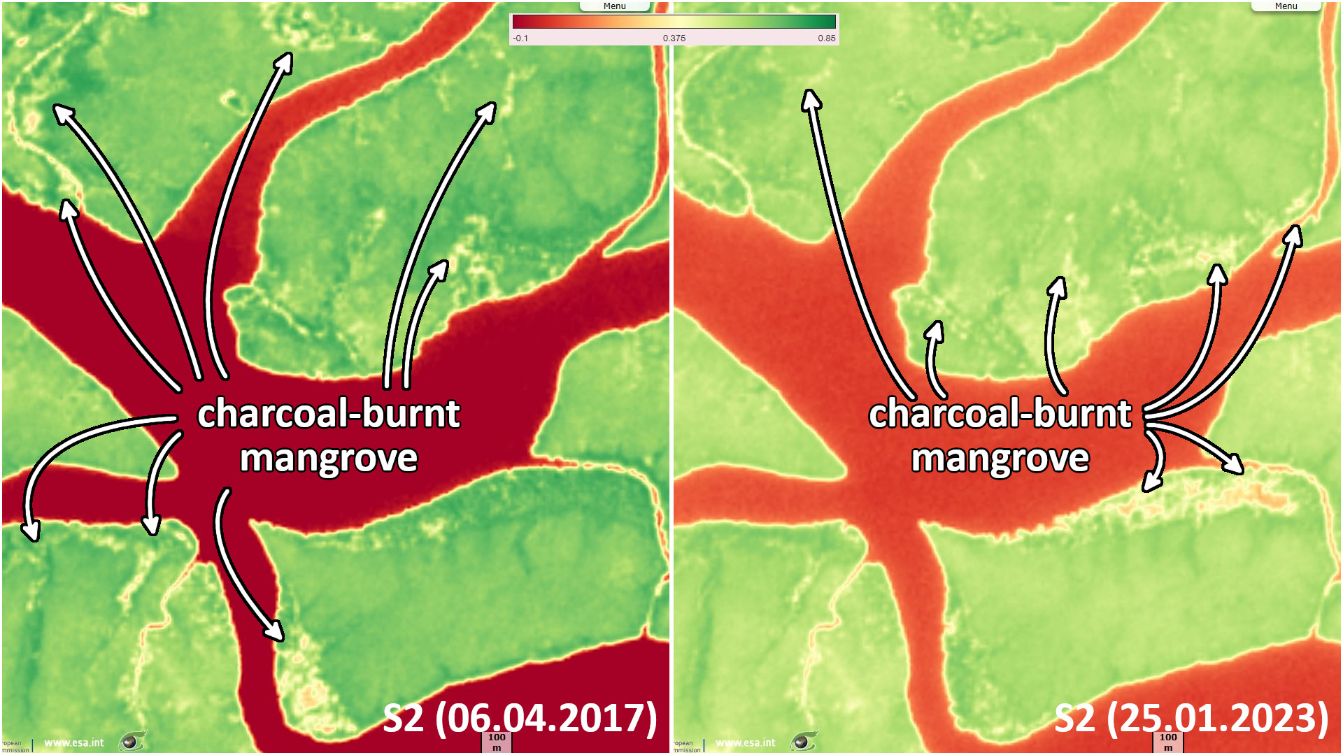
Land areas with degraded vegetation cover are shown in yellow and orange. Recovering areas have become greener, shrinking areas have turned yellow.
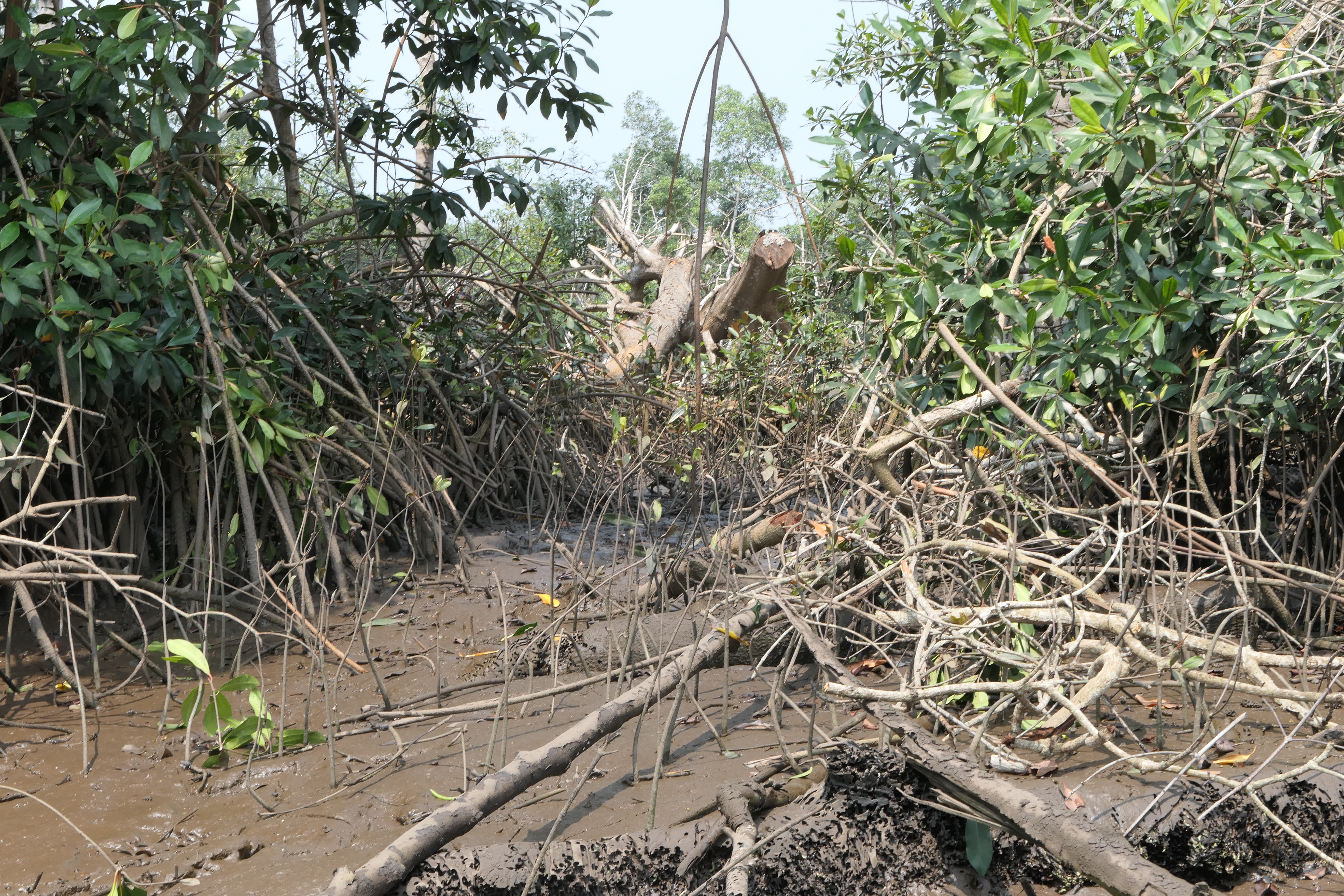
Degraded mangrove area - Source: Bernard Riera and the Mangrove Marine Parc team
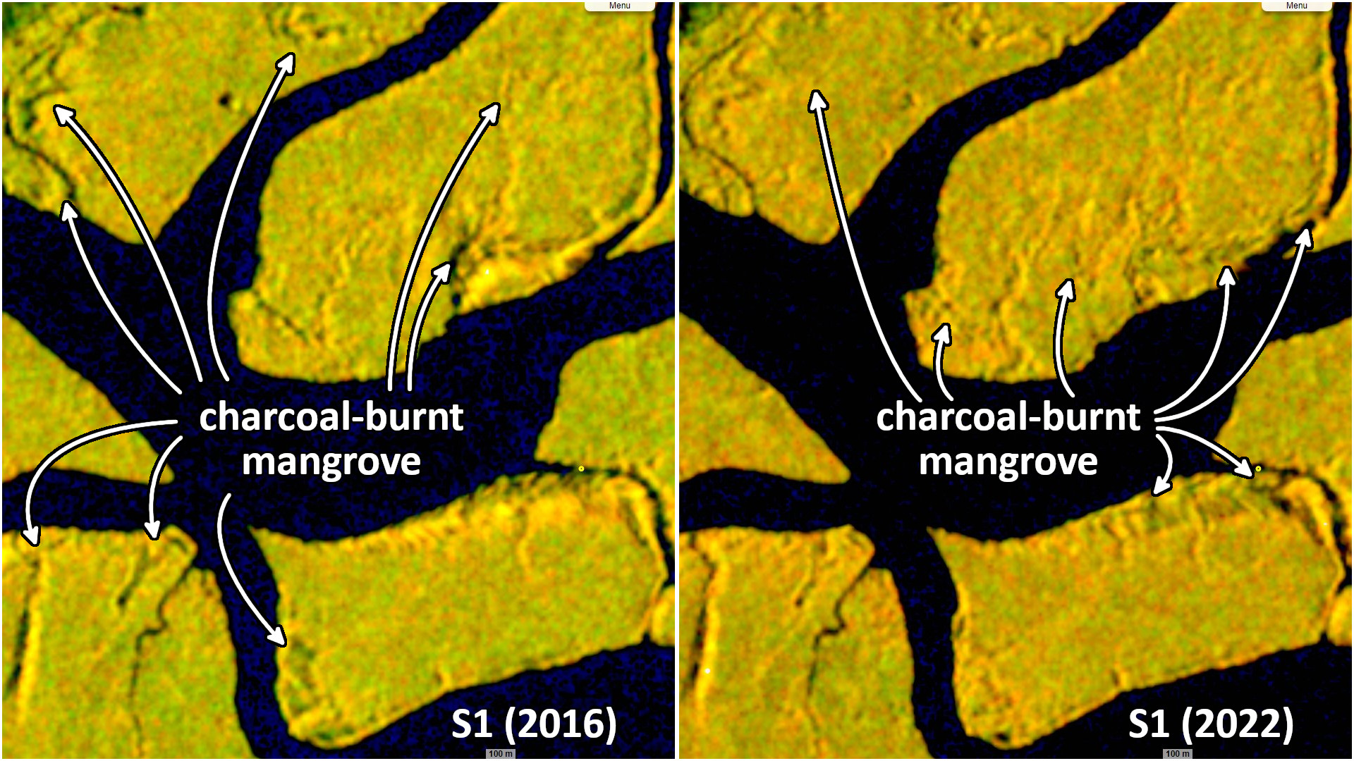
The holes are partially reabsorbed in these areas, new ones have appeared in areas recently burnt for charcoal.
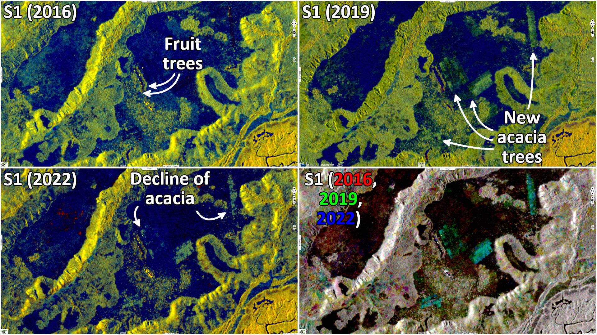
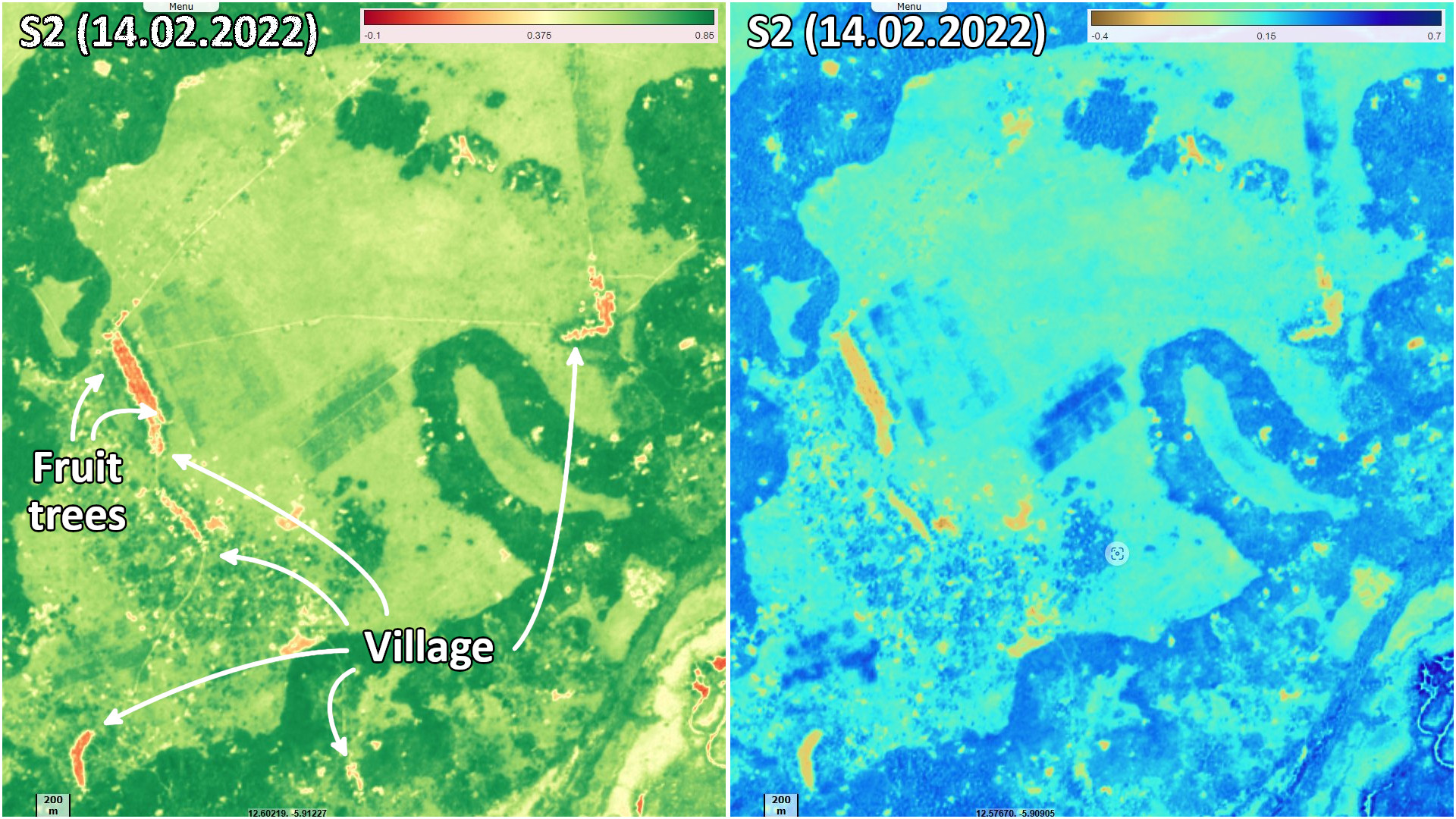
Village on the edge of the Mangrove Marine Park, an orchard is visible on both sides of the village. Four agricultural zones have been developed since 2016, shown in green on the 2019 image. Acacia Mangium has been used for its fast growth and ability to fix nitrogen, said Bernard Riera. Since 2019, part of the Acacia Mangium plots has regressed, the low density of plants in part of the plots has limited shade and increased the sensitivity of the plants to intense sunlight. The areas of tree crops visible in 2019 are green, those visible in 2022 are blue. There is more green than blue in the cyan areas, indicating a decline in the number of trees from 2019 to 2022.
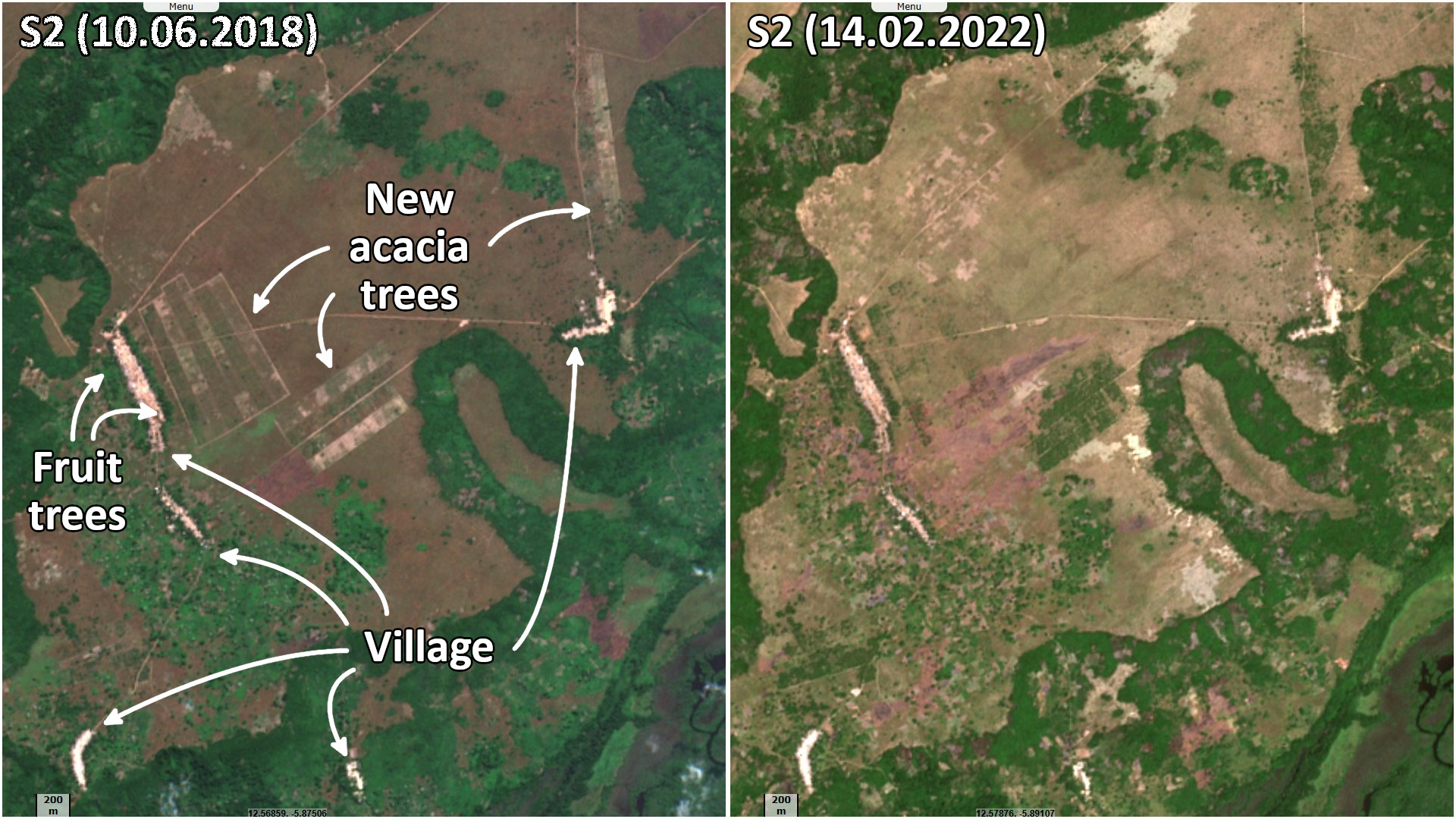
In 2018, the newly created plots are well demarcated after clearing the low vegetation. In 2022, the vegetation has grown in the plots. The boundaries, fresh in 2018 due to the cutting of the low vegetation, have disappeared.
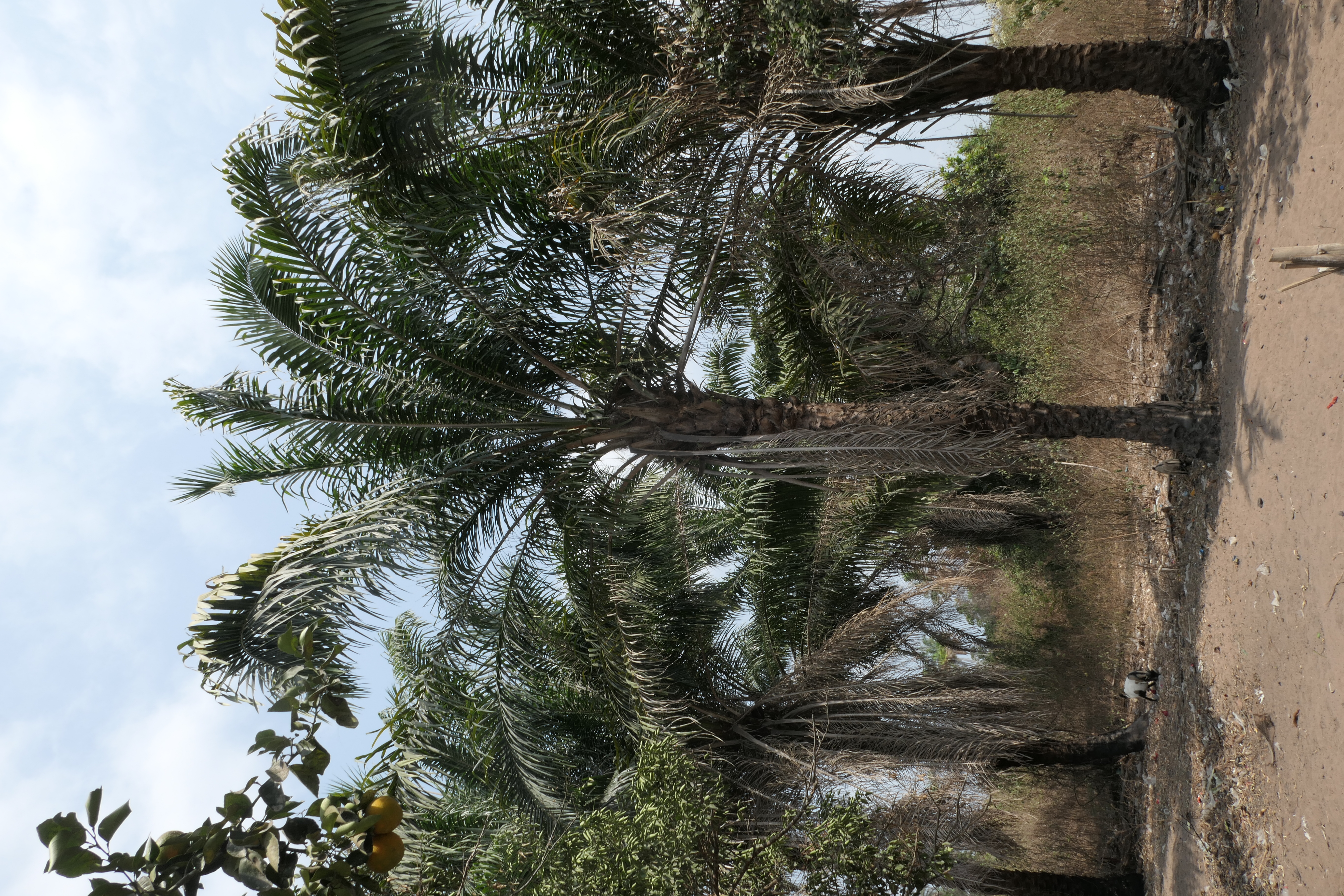
Date palm trees in an orchad - Source: Bernard Riera and the Mangrove Marine Parc team
The vegetation index shows the crops in deeper green. The soil moisture also shows these cultivated areas in a deeper blue than the lower vegetation.
The views expressed herein can in no way be taken to reflect the official opinion of the European Space Agency or the European Union.
Contains modified Copernicus Sentinel data 2026, processed by VisioTerra.
Contains modified Copernicus Sentinel data 2026, processed by VisioTerra.
| More on European Commission space: |  |
 |
 |
||||
| More on ESA: | |
|
|
S-1 website | S-2 website | S-3 website | |
| More on Copernicus program: | |
|
|
Scihub portal | Cophub portal | Inthub portal | Colhub portal |
| More on VisioTerra: | |
|
|
Sentinel Vision Portal | Envisat+ERS portal | Swarm+GOCE portal | CryoSat portal |