Two-stage avalanche at Lamplugh Glacier, Alaska, USA
Sentinel-1 CSAR IW acquired on 06 June 2016 at 15:32:06 UTC
Sentinel-1 CSAR IW acquired on 30 June 2016 at 15:32:08 UTC
...
Sentinel-2 MSI acquired on 12 August 2022 at 20:29:01 UTC
Sentinel-2 MSI acquired on 18 September 2022 at 20:21:21 UTC
Sentinel-1 CSAR IW acquired on 30 June 2016 at 15:32:08 UTC
...
Sentinel-2 MSI acquired on 12 August 2022 at 20:29:01 UTC
Sentinel-2 MSI acquired on 18 September 2022 at 20:21:21 UTC
Keyword(s): Geohazard, ice, avalanche, glacier, National Park, UNESCO World Heritage Site, USA, United States
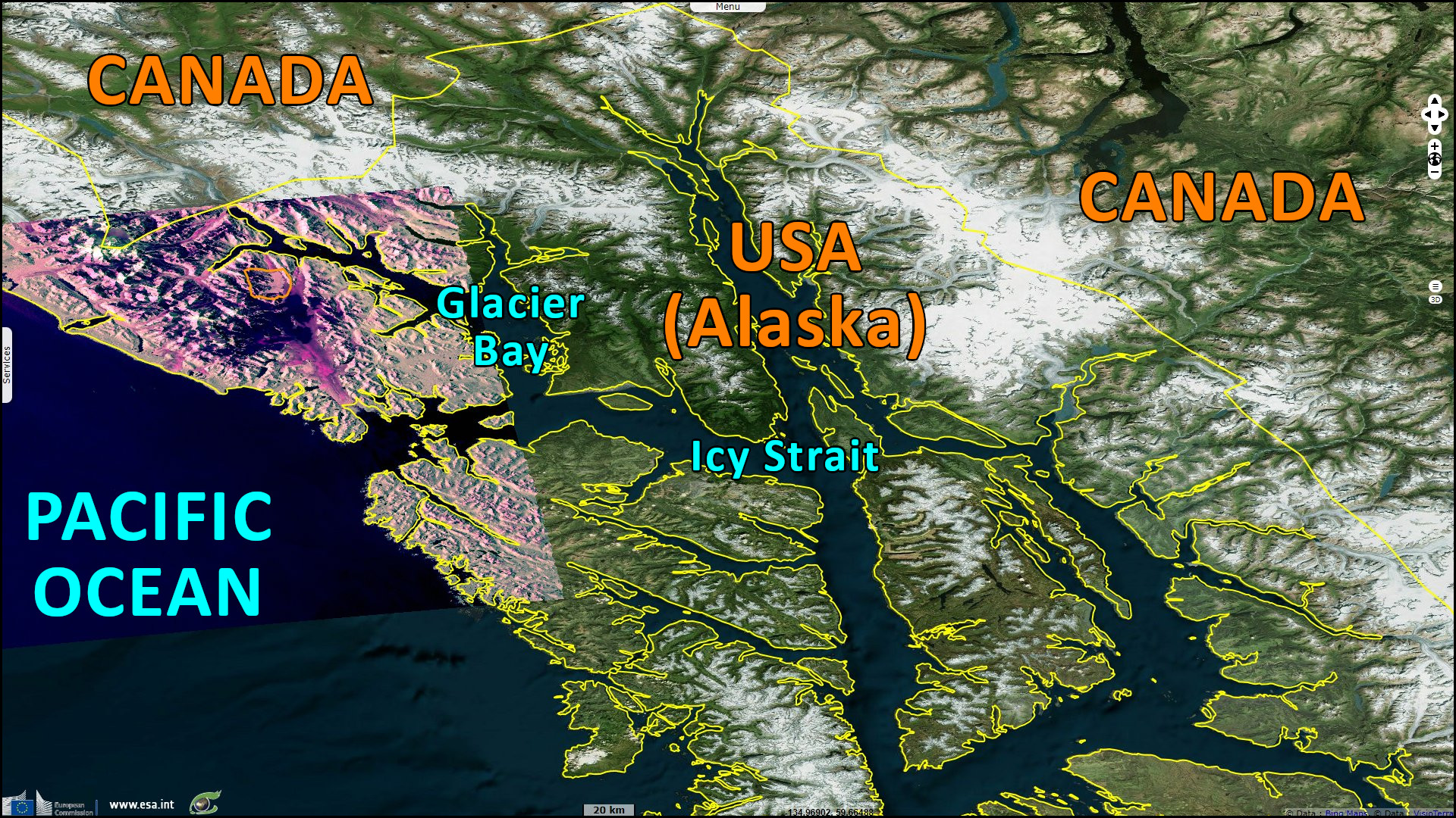
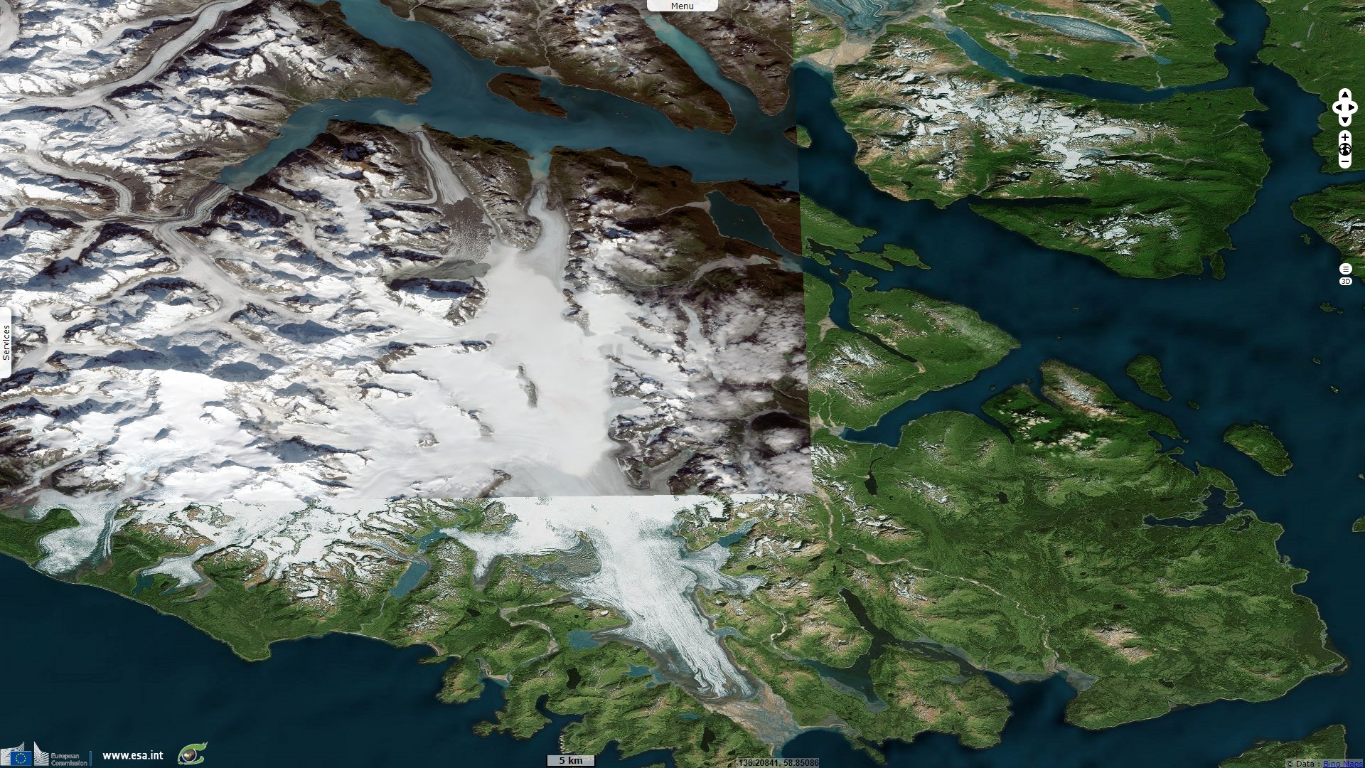
A national park located in south-east Alaska, near the border with Canada, "The boundaries of Glacier Bay National Park and Preserve encompass an extensive and diverse North Pacific coastal ecological community or 'biome.' Ice fields, expansive river and stream systems, and tidewater glaciers are significant natural features that influence what plants and animals are able to survive in any given location. Steep, sculpted peaks and scoured, rock-strewn valleys show scars of glacial activity and mark the advances and retreats of glaciers dating back over 115 000 years to before the Wisconsin Ice Age. Bedrock outcroppings expose the complex geology of southeast Alaska."
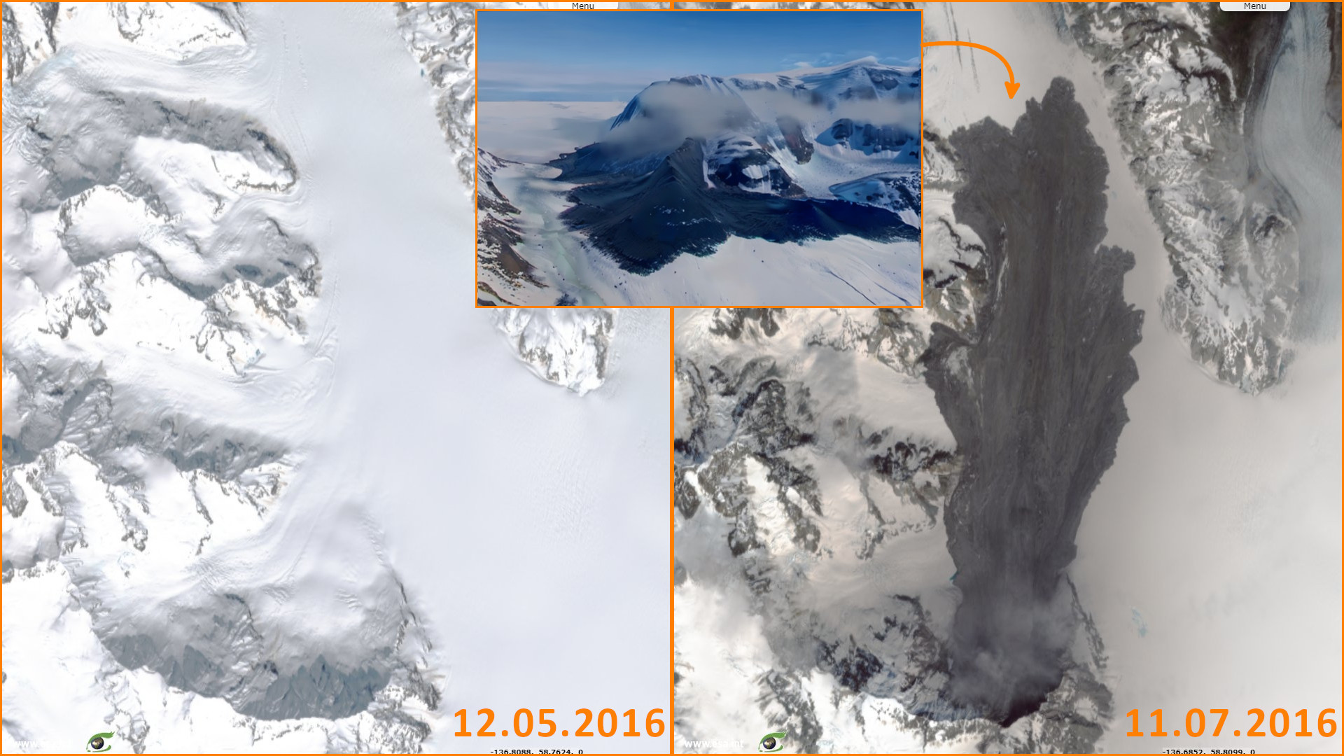
Professor Dave Petley, Vice-Chancellor of the University of Hull in the United Kingdom, is a researcher whose work focuses on natural and environmental hazards. His blog describes this impressive event: "The landslide appears to be a very deep-seated, ridge crest to slope toe failure of unusually large proportions. The landslide appears to have generated a highly mobile, broad and long landslide deposit on a comparatively low angled slope, probably consistent with flow of debris over an ice bed. The landslide has developed complex structures at the toe, probably associated with the final creeping stage of movement."
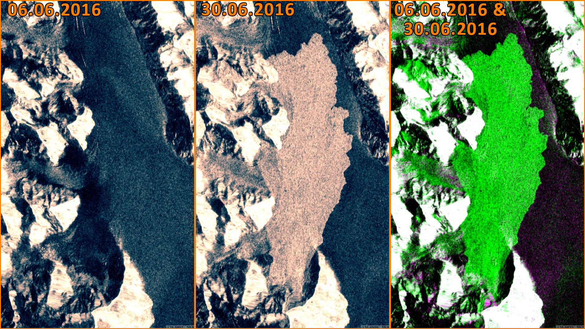
"The crest of the slope appears to be at about 2030 metres elevation, and the break at the foot of the slope at about 875 m, giving a vertical extent of about 1155 metres. The toe of the deposit is at about 550 metres elevation, which means that the runout lost about 225 metres elevation over 10 000 metres, giving a travel angle of about 1.3 degrees. This is exceptionally low. This part of Alaska is now firmly established as the global hotspot for rock avalanche activity."
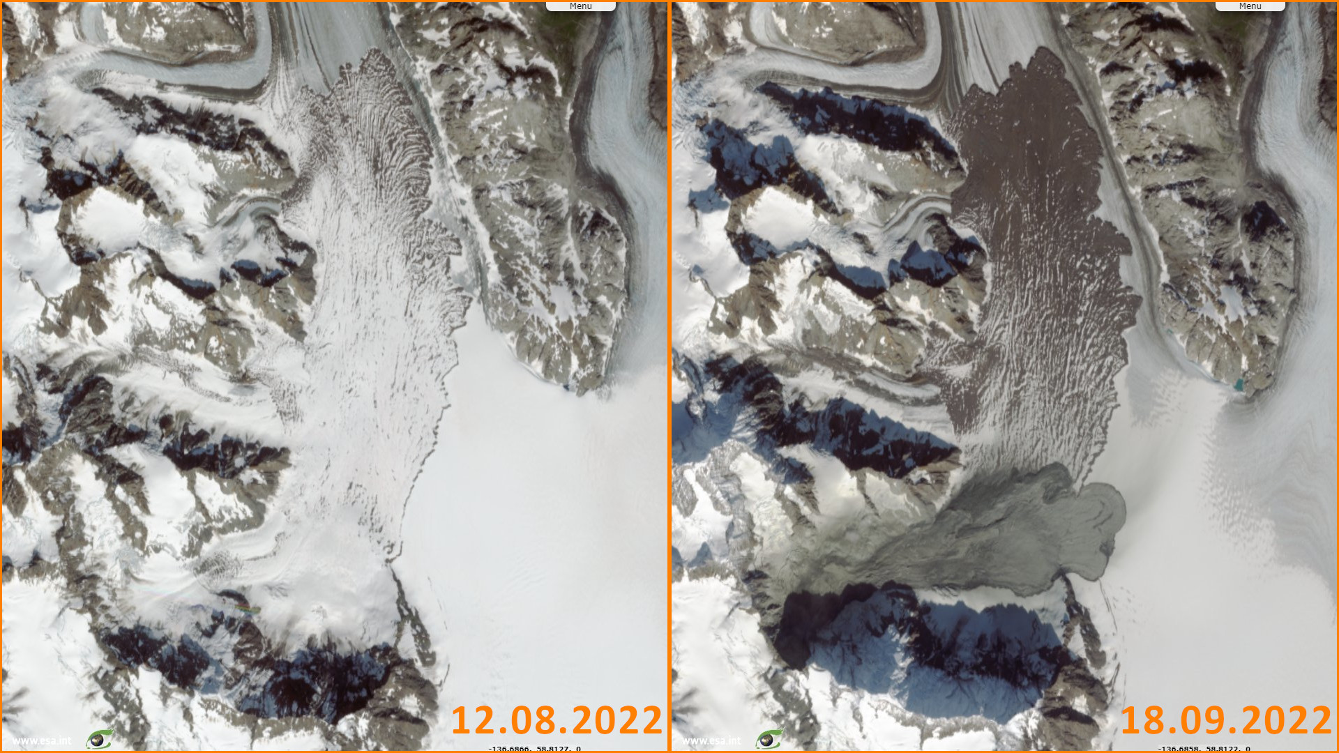
In another post, Professor Petley highlights a second large avalanche that happened in 2022: "The rock avalanche has a runout distance of about 6 km by my initial calculation. It has not been channelised, and in this case it has run out across ice. Thus, the deposit has a very different morphology. The flow structures at the tow are beautiful, illustrating the spreading of the landslide in the late (low velocity) stage of movement."
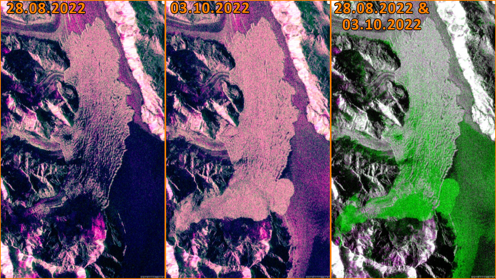
"This rock avalanche has in part travelled across the deposit of the even larger 23 June 2016 rock avalanche at the same site (although a different section of the slope collapsed to generate that one)".
The views expressed herein can in no way be taken to reflect the official opinion of the European Space Agency or the European Union.
Contains modified Copernicus Sentinel data 2026, processed by VisioTerra.
Contains modified Copernicus Sentinel data 2026, processed by VisioTerra.
| More on European Commission space: |  |
 |
 |
||||
| More on ESA: | |
|
|
S-1 website | S-2 website | S-3 website | |
| More on Copernicus program: | |
|
|
Scihub portal | Cophub portal | Inthub portal | Colhub portal |
| More on VisioTerra: | |
|
|
Sentinel Vision Portal | Envisat+ERS portal | Swarm+GOCE portal | CryoSat portal |